I got a day off on Wednesday, and with my crampons and axe finally arriving and a great forecast for MSH area (60F, partly cloudy) it was no question where to go. Coldwater Peak, just north of Mt. St. Helens, evaded me at least 5 times over the last 3 years, and now it was a chance to make it and also test my new gear on some steep terrain.
Long story short, when I arrived at almost empty Johnston Ridge parking lot it was gray, windy day with low clouds & brief sunbreaks, and it even tried to snow! It felt more like November than June. New snow didn't stick to bare ground - the first 2 miles of the hike were mostly snow-free, with only a few snowdrifts left from the winter. Good news is that the trail is now legally open - red tape at the trailhead is gone and I saw two rangers doing tread work at Devils Elbow, about 45 minutes into the hike.
The view of Coldwater Peak from the beginning of the hike at Johnston Ridge
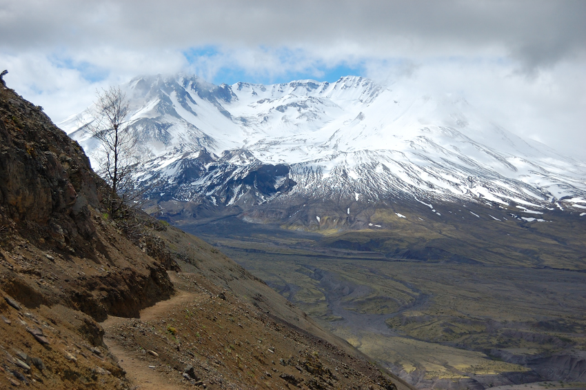
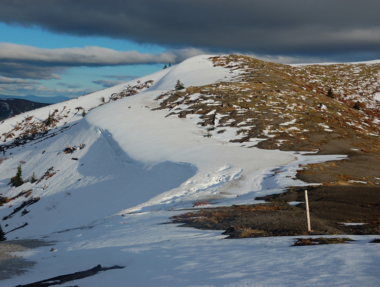
St. Helens from Devils Elbow
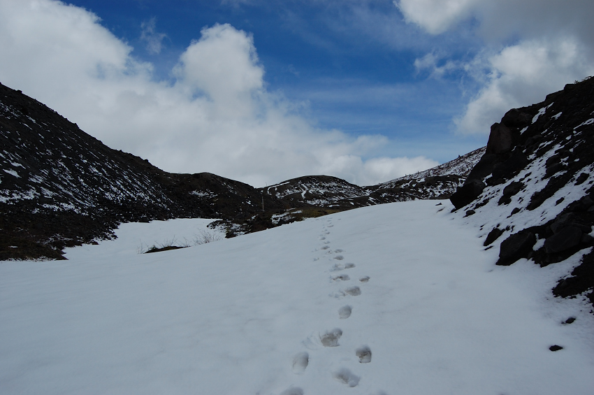
Past Devils Elbow, it was on and off snow hiking. Followed the tracks of two hikers to Harry's Ridge saddle (met them near the saddle); they were the last people I saw all day.
There's something eerie in the eruption blast zone... even 30 years later
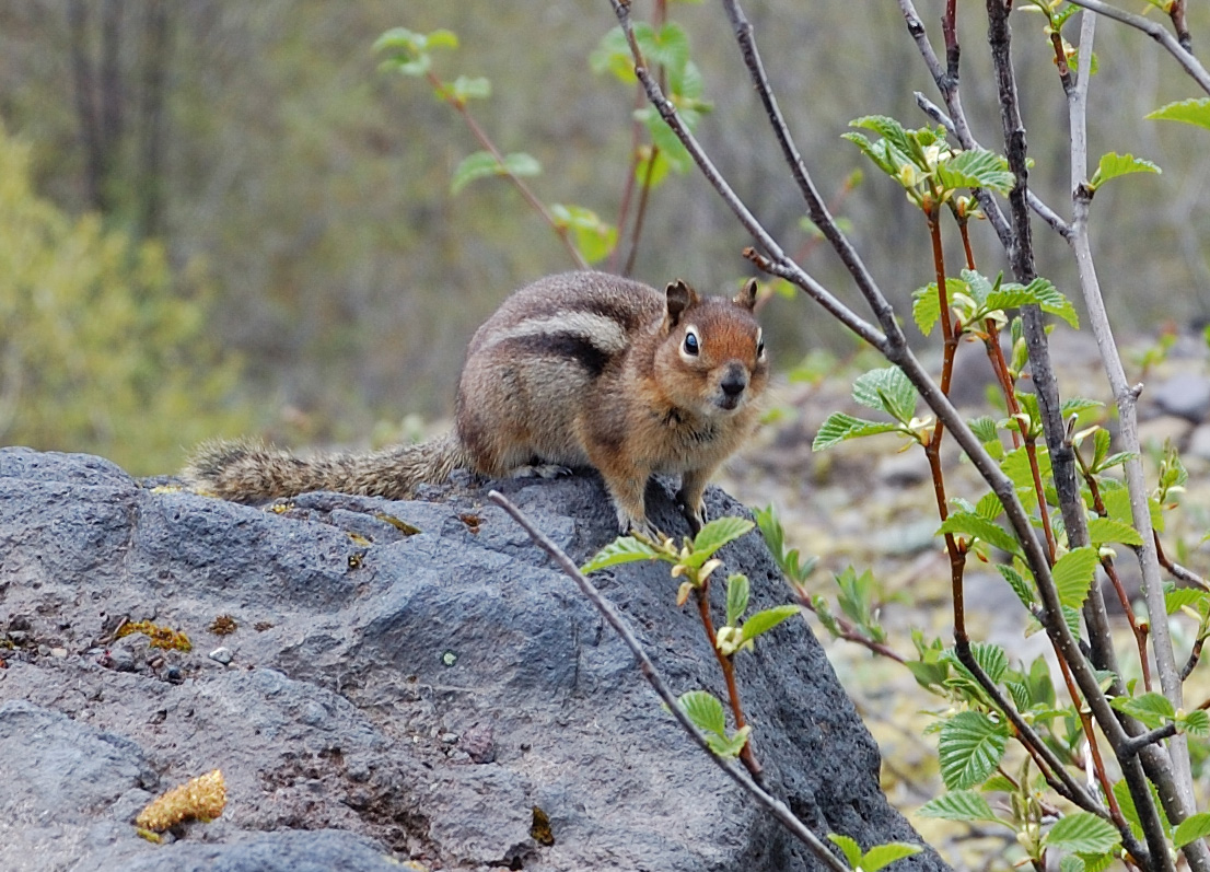
Wildlife
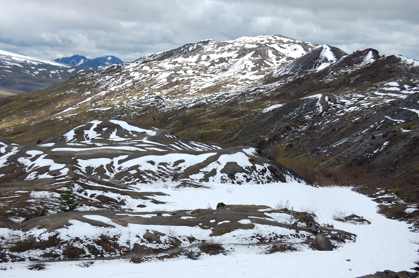
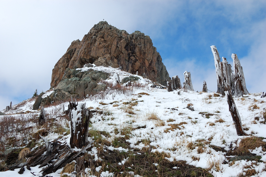
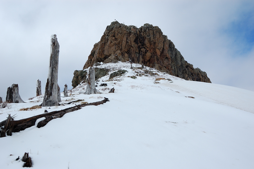
Once past Harry's Saddle, all tracks ended and I was on my own. Getting to Coldwater requires going over the summit of smaller, unnamed mountain (steep terrain doesn't allow to go around). It was referred as Godgwater Peak, I sometimes call it "Stump Hill" for the amount of stumps left from the eruption
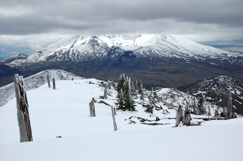
Looking up Stump Hill - still a while to go (Coldwater Peak just shows from behind it on the left)
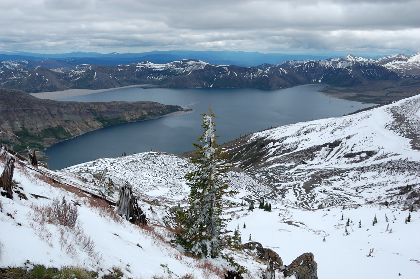
Had great views of Spirit Lake almost the entire time
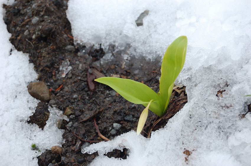
In a couple of weeks there'll be lots of glacier lilies in bloom
The amount of fresh snow quickly increased and by 5000' it was about 6-8 inches of fresh, wet stuff over hard snowpack left from the winter. This really got me concerned, because on the steep terrain ahead this fresh upper layer won't allow my crampons to anchor to harder snow below, and it may easily slip off under my weight. I decided to go ahead and see if there's any alternative route.
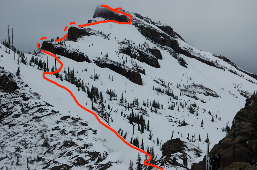
Once past this small summit, great views of Coldwater Peak and St. Helens Lake open up. Red line shows the route I took in the end - rather than taking a long sidehill slog on the east side that roughly follows the trail (and risk slipping down or running out of time), I kept closer to SW side which has mostly melted off and, aside from some snodrifts, mostly had fresh snow, well anchored by huckleberry brush.
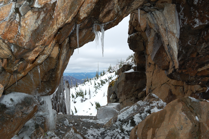
I changed to crampons and went down and past icy Rock Arch. Going along arch ridge was steep and pretty exposed, so I took it slow
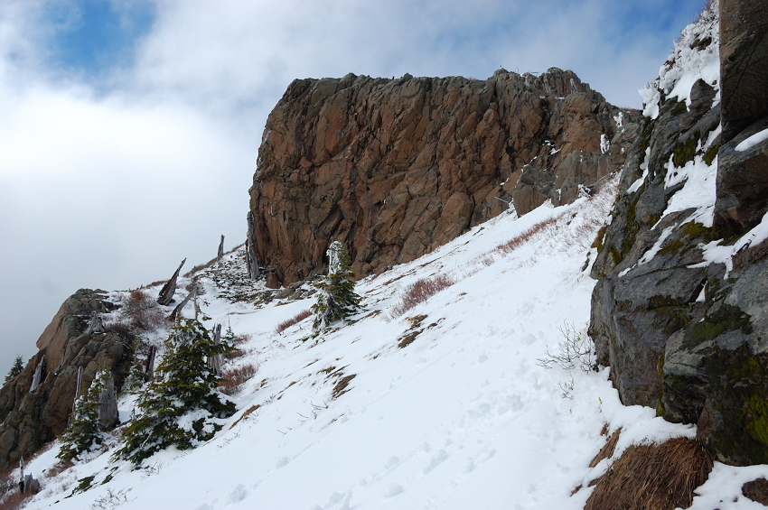
Past the Arch Ridge (my toponym, for reference purpose only), I went steep up to a saddle between Coldwater Peak and "Snag Peak", and then went around rock outcrops on the left, without knowing if there's any passage at all.
Here is second rock wall from just past first wall (you may already see antennas on top). Other than a few snowdrifts, this part turned out pretty straightforward. It was interesting how the wind changed due terrain - on the saddles it was really cold because of strong gusts, but on mountain sides it became dead calm and pretty warm.
Summit block comes into view (the 3rd rock wall on my ascent) - that's where the things get interesting again. The only way to go around it was on snow-laden and steep east side
The slope below third rock wall was steep, it almost stopped me. Had to get into "snow well" (at one point, it was about 7 feet deep) and was able to get around the bad spot
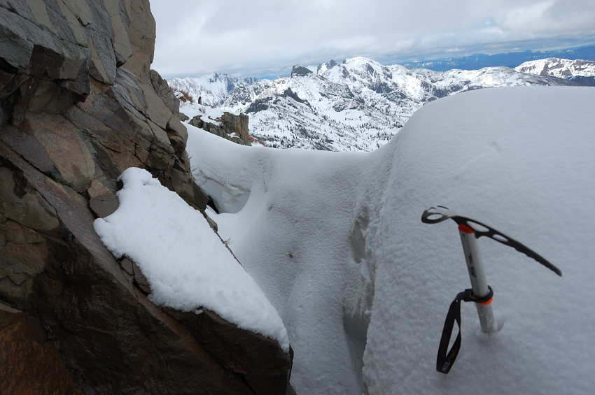
Frozen St Helens Lake and Spirit Lake (upper right corner) from my snow balcony
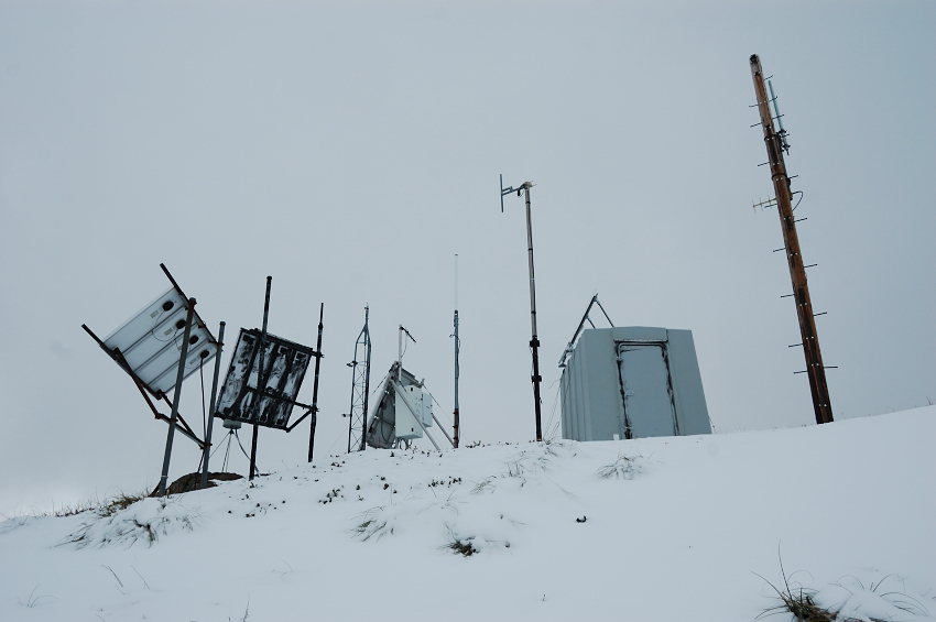
Just before the top, I connected to an actual trail. Antennas has been a welcome sight - they meant I just did it the hard way!
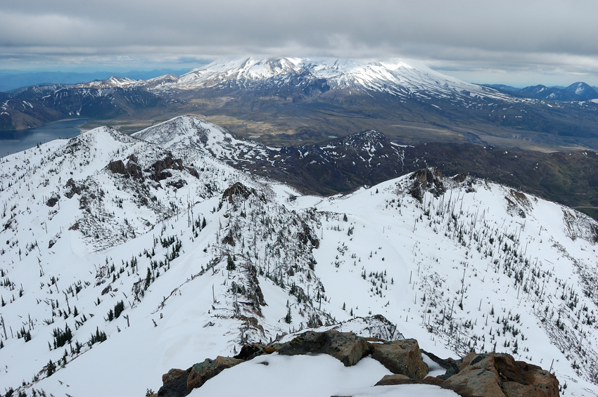
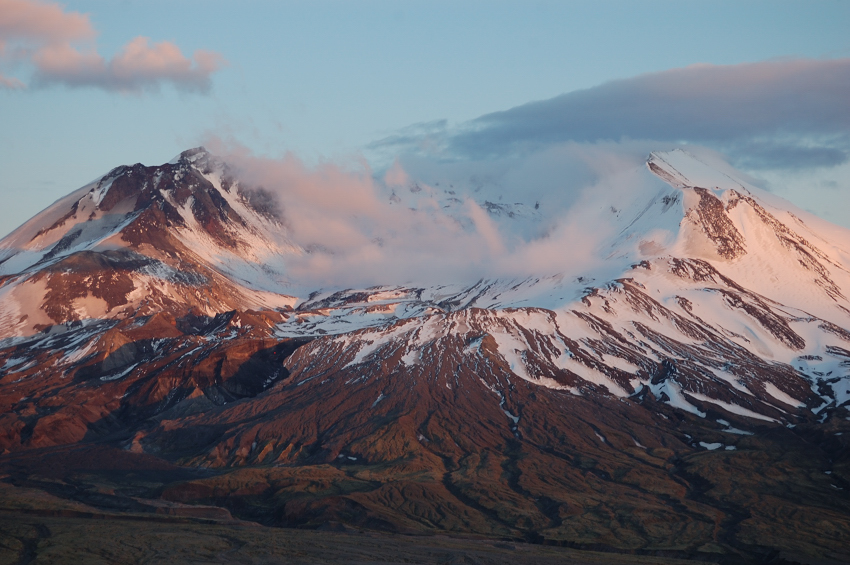
It wasn't as clear day as promised, but got nice view of Mt. St Helens
There wasn't much time left to rest, so I just hiked to actual summit and the N tip of the summit to take the pictures of surrounding landscape.
Mt. Whittier (the ridge at left background) and Margaret (extreme right)
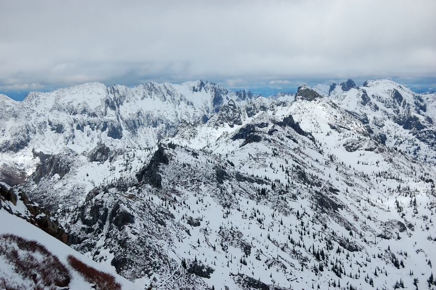
View to NW
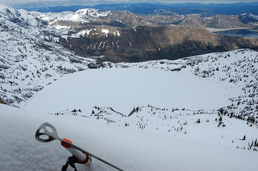
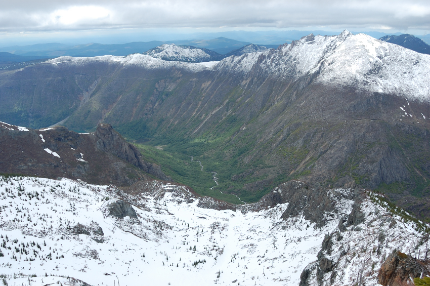
Coldwater Lake valley (only the small portion of the lake is visible)
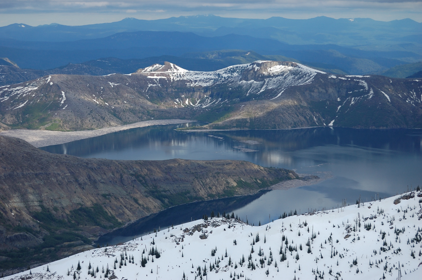
Spirit Lake
Mt Whittier zoom-in
Mt. Margaret zoomed in (rounded summit on the right)
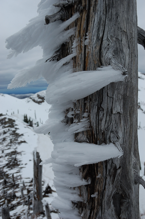
On the way back: rime frost on the trees
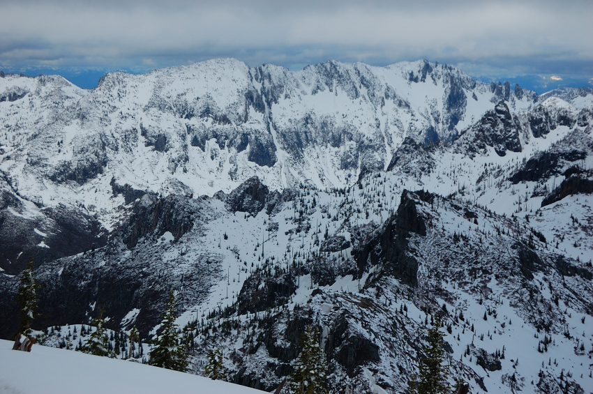
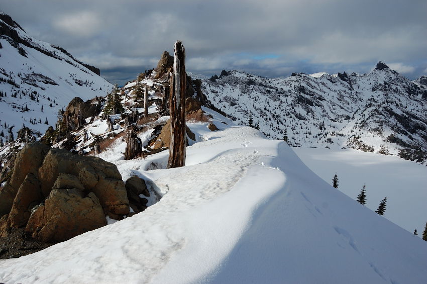
Arch Ridge and my tracks
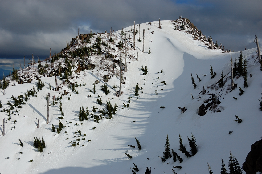
Back side of "Stump Hill", as seen from Arch RIdge. Note a huge snowdrift at the saddle
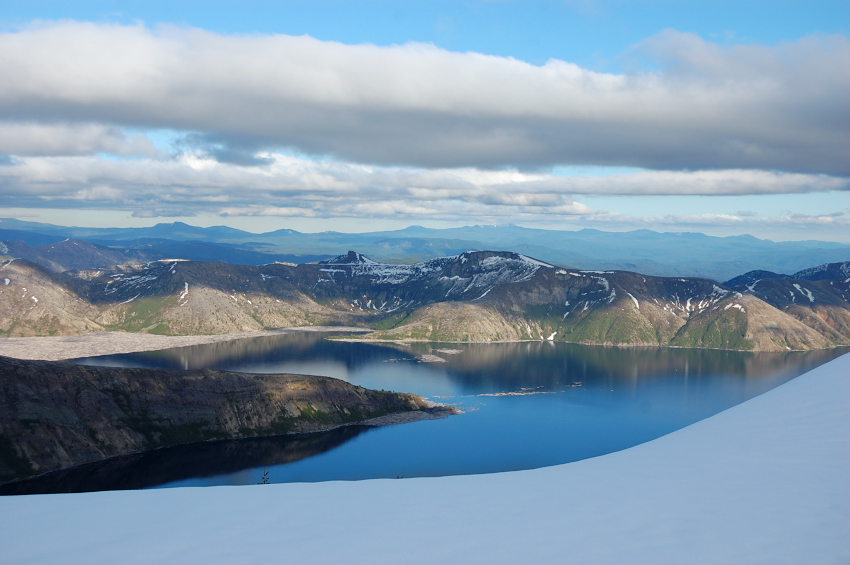
The lake finally turns blue, as the skies started to clear by the evening
Down at Harry's Ridge junction
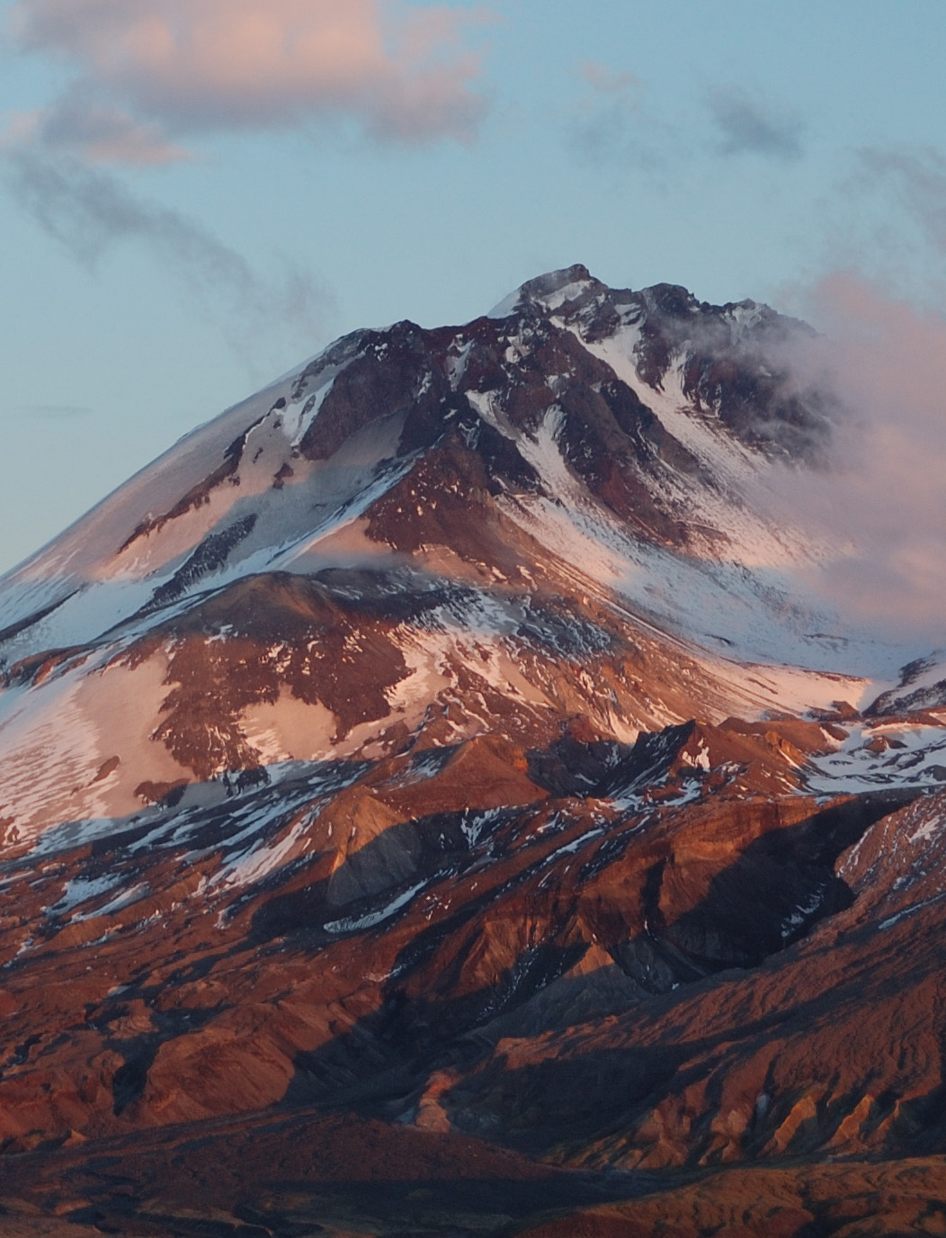
Got treated to a great sunset light on St Helens, and returned to my car just before the dark
It was a difficult but fun day for sure. Cannot wait to go back on a bluebird day!
Coldwater Peak 6/6/12 - success!
Re: Coldwater Peak 6/6/12 - success!
awesome photos and TR!
I would love to give this a go, I have not explored much on the north side of MSH.
Those photos make me want to go NOW
Thanks for the great TR!
I would love to give this a go, I have not explored much on the north side of MSH.
Those photos make me want to go NOW
Thanks for the great TR!
Re: Coldwater Peak 6/6/12 - success!
Thanks Pyrogen,
There's a trail all the way to the top, but with the snow I think it's much more interesting! And it's sure got better views than MSH (since you can see all those views plus MSH).
Roman
There's a trail all the way to the top, but with the snow I think it's much more interesting! And it's sure got better views than MSH (since you can see all those views plus MSH).
Roman
Re: Coldwater Peak 6/6/12 - success!
Well done Roman! That should be under "mountaineering" rather than trip reports. It sure looks like a beautiful day out with some exciting route finding. I'm glad that the trail is already fixed. What would you have done if you had ignored the "trail closed" signs and then met two rangers working on the repairs? "Hi Guys! I just came out to see if I can give you a hand with fixing the trail? I even brought this nice pick along."
Some people are really fit at eighty; thankfully I still have many years to get into shape…
Re: Coldwater Peak 6/6/12 - success!
Roman YOU DID It and with style to way to go my friend.
I have had my run ins with that hike its so much harder IMO than the 12 or so miles and 2500 ft gain.,
always fly up mt maragrete similar distance and eg in half the time,
enough about me it was your day .
the photo of the arch wow.
take care Tom -roy -troy call ,me what you want,
I have had my run ins with that hike its so much harder IMO than the 12 or so miles and 2500 ft gain.,
always fly up mt maragrete similar distance and eg in half the time,
enough about me it was your day .
the photo of the arch wow.
take care Tom -roy -troy call ,me what you want,
Re: Coldwater Peak 6/6/12 - success!
Thanks Peder and Tom! Yes I thought about posting it in off-trail reports, but it was on or close to the trail most of the way (except for the last part) and those views are familiar to people who did Coldwater on trail. It's been fun route; I had to work on my vertigo for sure.
Maybe would ask them where does this trail go . Then hope they forget to say me this trail is closed.Peder wrote:What would you have done if you had ignored the "trail closed" signs and then met two rangers working on the repairs?
Re: Coldwater Peak 6/6/12 - success!
Nice work, Roman! Really stellar pictures, too.
Now that you've ticked off Coldwater, you should get out there and do the Whittier ridge - it's a blast.
#pnw #bestlife #bitingflies #favoriteyellowcap #neverdispleased
Re: Coldwater Peak 6/6/12 - success!
It's great suggestion, Bosterson - I may try it later in the summer, most likely with an overnighter or two. I remember Peder's and your reports from Whittier - the terrain is so rugged, with open views, just fantastic to explore!Bosterson wrote:Now that you've ticked off Coldwater, you should get out there and do the Whittier ridge - it's a blast.
Re: Coldwater Peak 6/6/12 - success!
you not the only that has ingnored the signs up there you just take off running they never chase youromann wrote:Thanks Peder and Tom! Yes I thought about posting it in off-trail reports, but it was on or close to the trail most of the way (except for the last part) and those views are familiar to people who did Coldwater on trail. It's been fun route; I had to work on my vertigo for sure.
Maybe would ask them where does this trail go . Then hope they forget to say me this trail is closed.Peder wrote:What would you have done if you had ignored the "trail closed" signs and then met two rangers working on the repairs?
mods will have to delete this for ileagle conversation
-
- Posts: 267
- Joined: October 5th, 2010, 10:43 pm
Re: Coldwater Peak 6/6/12 - success!
Congratulations, Romann!
Your summit approach qualifies this TR as an "Off-Trail" Report as well (I would think). Pretty ballsy route, too...
Any sign of trail disturbances on the Devil's Elbow?
I trust images from your expedition will also appear in one of your Picasa galleries in the future?
Your summit approach qualifies this TR as an "Off-Trail" Report as well (I would think). Pretty ballsy route, too...
Any sign of trail disturbances on the Devil's Elbow?
I trust images from your expedition will also appear in one of your Picasa galleries in the future?