Augspurger and Dog redux - 7/2/11

This forum is used to share your experiences out on the trails.
User avatar
Bosterson
Posts: 2320
Joined: May 18th, 2009, 3:17 pm
Location: Portland

Augspurger and Dog redux - 7/2/11

Post by Bosterson » July 3rd, 2011, 12:06 pm

I went back to Augspurger because it was such a sunny day that the Washington Gorge seemed in order, and I wanted to go up to the actual summit since last time I was denied by snow.

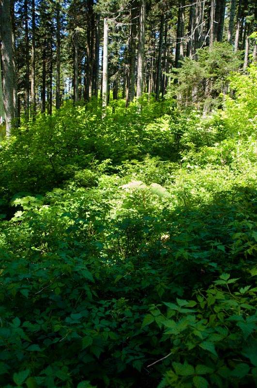
The good news is that all the snow is gone. The bad news is that it's been replaced by brush. A lot of brush.

There were 40 cars in the Dog parking lot when we left at 9:30am. We went up the Augspurger trail to the junction on the NW side of Dog.

Image
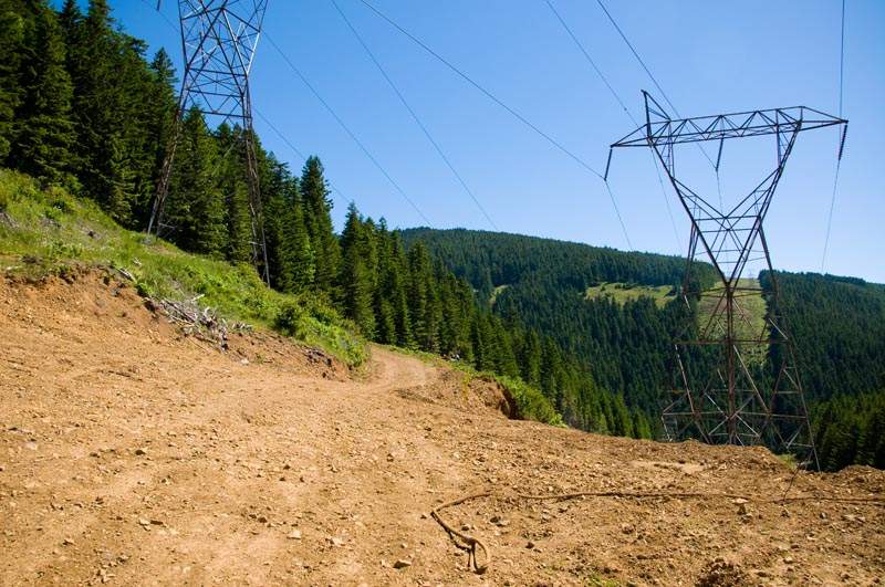
View of the powerline road up to the first Augspurger ridge, seen from the Augspurger junction.

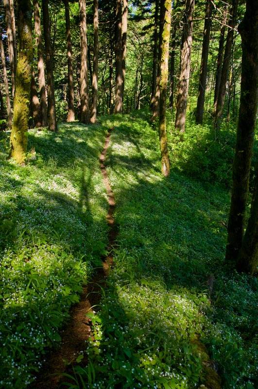
We turned left and immmediately the trail became over grown. We popped out onto a little hill with some small wildflowers.

Image

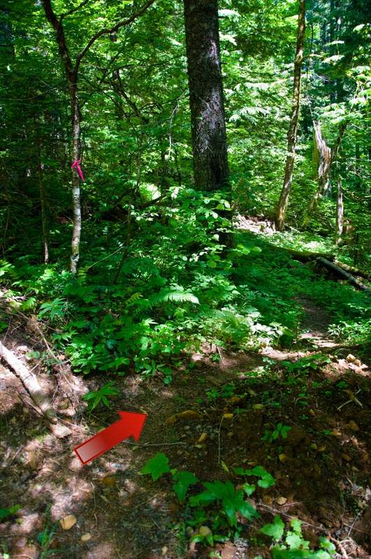
The trail goes down into a gully and then uphill slightly to intersect with a powerline road. We turned right at the (fading) pink ribbons and headed uphill.

Image
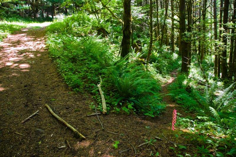
(Picture taken to show the junction - you're coming from the trail, and you turn right on this road and head in the direction the sticks are pointing, up the hill.)

Soon we came to a big multi-junction in a clearing. Our road continued straight through.

Image

After this, the road goes straight uphill for a bit, then jacknifes sharp left. There are some pink ribbons in the right-hand corner of the road, and a very faint trail. This was all desolate and easy to see two months ago when I was last here.

Image

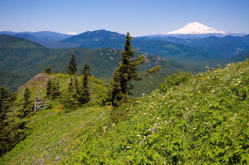
After some steepness, we popped out on the powerline ridge. This is an excellent snack spot and the views are fantastic.

Image
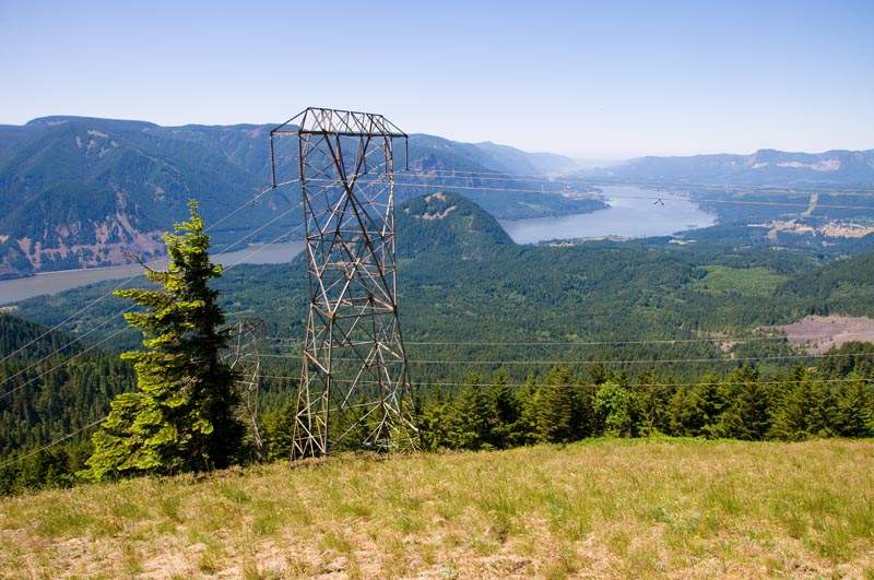
Looking down the Gorge.

Image
Hood, Defiance, and an Indian pit? (Or maybe just a fire pit.)

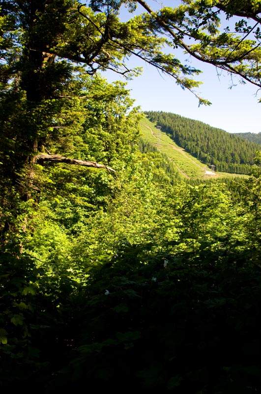
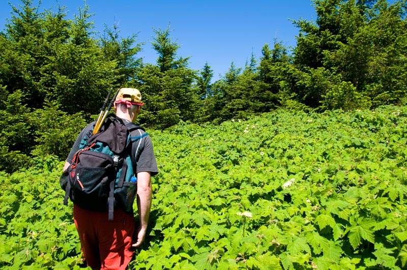
We continued along the ridge and into some open areas. The foliage went from a nice backdrop...

Image

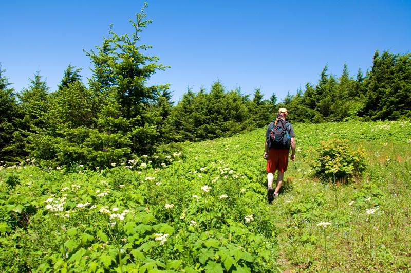
...to a sea we had to wade through.

Image

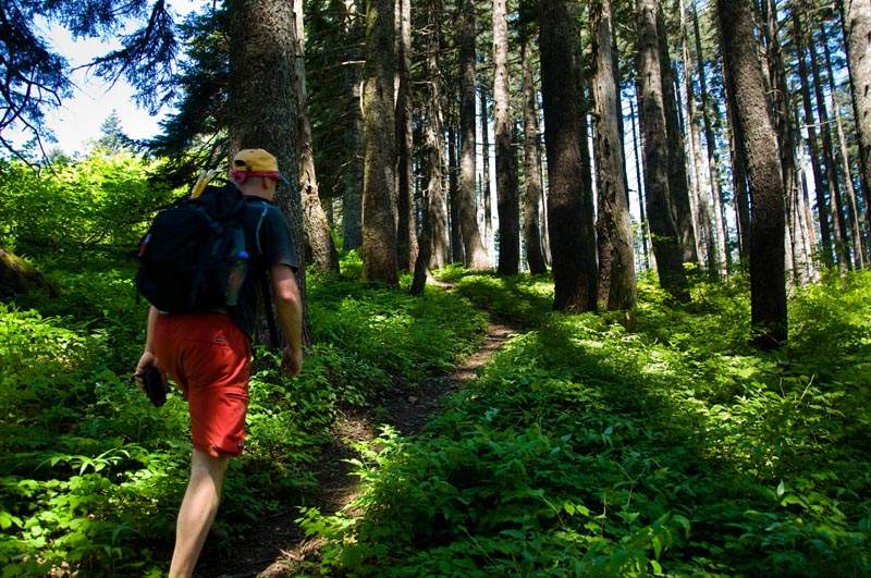
After this we were on the blunted ridge that leads up to the shoulder to the west of Augspurger. Around this spot last time I hit snow and followed a bunch of tracks straight uphill in the open part of the ridge. It turns out the trail goes to the right through the forest. This whole section was much shorter this time than I recalled, maybe because of the lack of snow.

Image
Going up to the shoulder.

I'd turned around on the shoulder last time, but the summit is only about 1/4 mile away and we were there in a flash. Unfortunately, Augspurger's summit is like Devil's Rest - just a high point in the trees. However, the trail continues off to the left downhill and after descending a little, you pop out onto a ridge with great views.

Image

We decided to continue down the ridge to the highpoint visible at the end. This involved the most brushwhacking of the hike. This time it was of the scratchy variety.

Image
There's a trail in here somewhere...

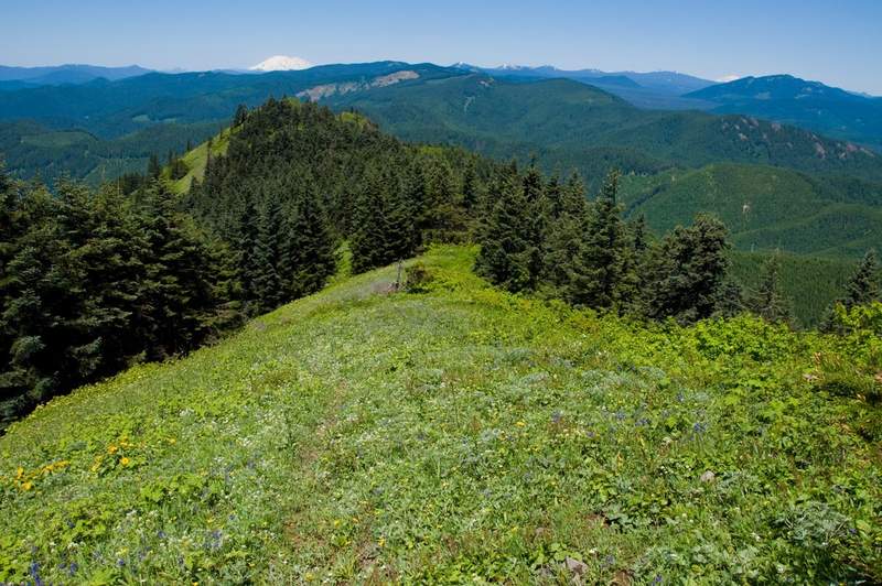
The high point was a little brushy, but right after it we popped out into the open. It doesn't seem to be named on any map, and I guess it's really just the NW ridge of Augspurger, but I started calling it Consolation Point.

Image
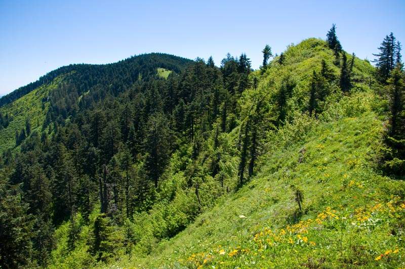
Looking back to the summit with Consolation Point in the foreground.

Image
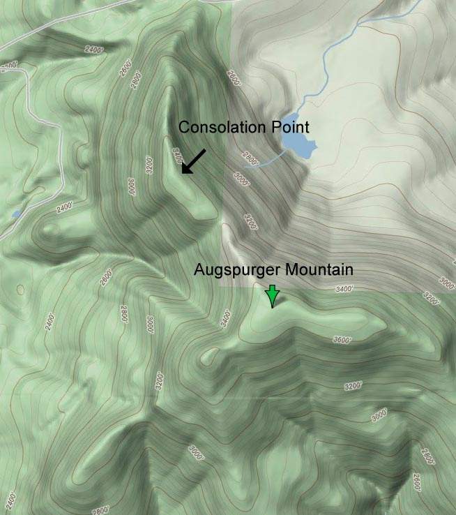
Map of Augspurger. The trail goes up to the little shoulder to the left of Augspurger, then up to the summit and down the northwest ridge. Dog Mountain is off the map to the south. Note that Augspurger is mis-labeled on USGS maps (and on Google). The green arrow above is the actual summit.

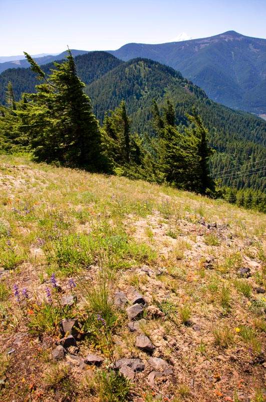
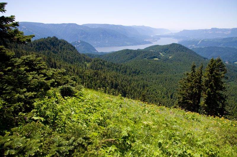
There were excellent views down the Gorge.

Image

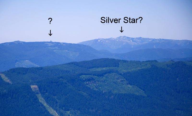
To the west, I could see what I think is Silver Star, with some odd point to its left. Any ideas?

Image

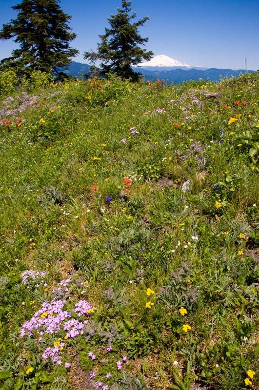
There's a nice lunch spot at the end...

Image

...and little flowers everywhere.

Image

We retraced our steps and back at the junction with Dog, I turned left and ran up to the summit and went down the normal Dog trail. Plenty of people still up there - there had been nary a soul on Augspurger. It was a nice hot day and both David and I managed to run out of water before we got back to the car - and we each started with 3L!

Augspurger is a great hike for solitude and a little more adventure than you normally get in the Gorge, but it may not be really hikeable due to brush after this (unless you bring a machete? I'm not kidding), at least until fall or whenever all that foliage dies off. Our hike was around 17.5 miles and 5500 ft gain including Dog at the end.
Last edited by Bosterson on July 3rd, 2011, 3:03 pm, edited 1 time in total.
#pnw #bestlife #bitingflies #favoriteyellowcap #neverdispleased

User avatar
Crusak
Posts: 3617
Joined: August 6th, 2009, 7:33 pm
Location: Oregon

Re: Augspurger and Dog redux - 7/2/11

Post by Crusak » July 3rd, 2011, 2:02 pm

Great report and great hike! I have been curious about Augspurger since Roy and I did Dog Mtn in the snow back in January.

The brush on that trail looked just like what I encountered on the Angel's Rest trail yesterday (between the Foxglove Trail and Wahkeena Spring). Eight feet or more in height, and lots of devil's club - made me glad I was wearing long pants.

Did you see any poison oak up there where you were yesterday? I heard that Dog Mtn has patches of it to contend with, or at least I recall mention of it.

That's a lot of mileage and elevation gain for one day - no wonder you drank so much. I knocked off more than 100oz myself yesterday, hiking less. :)
Jim's Hikes

Solvitur Ambulando

joerunner
Posts: 799
Joined: May 28th, 2008, 10:03 pm

Re: Augspurger and Dog redux - 7/2/11

Post by joerunner » July 3rd, 2011, 2:14 pm

I wish your report had been available a few years back when I took a right at that junction where the Trail meets the road. We ended up doing an extra 4 miles on logging roads before finding our way to the actual Augspurger trail. Any idea what the name Augspurger stands for?

cfm
Posts: 1097
Joined: June 18th, 2008, 6:49 am

Re: Augspurger and Dog redux - 7/2/11

Post by cfm » July 3rd, 2011, 2:22 pm

Your question mark is Three Corner Rock- where all the cool kids go.

User avatar
Bosterson
Posts: 2320
Joined: May 18th, 2009, 3:17 pm
Location: Portland

Re: Augspurger and Dog redux - 7/2/11

Post by Bosterson » July 3rd, 2011, 3:16 pm

joerunner wrote:I wish your report had been available a few years back when I took a right at that junction where the Trail meets the road. We ended up doing an extra 4 miles on logging roads before finding our way to the actual Augspurger trail. Any idea what the name Augspurger stands for?
I realized this was unclear because of the angle of my photo: when you're coming up the trail and hit the powerline road, you do turn right and go up the hill. I had walked a little ways back from the junction to take the picture so that it'd be easy to see both the road and the trail. I added a little note to the TR that should make this a bit clearer.

To that end, I'm not really quite sure where you turned right and got stuck on some roads, but I can see how that'd be easy to do. (The first time I hiked it, when I came back to that junction on my way down, I ran into a trail runner who'd veered off and thought he was on his way down Dog Mountain to his car...) None of the guides aside from NWHiker.com seem to cover this hike - Sullivan has a little side note about extending the Dog Mountain hike (but doesn't include a detailed trail description) and Curious Gorge doesn't even mention it.

I also have no idea where the name Augspurger comes from. Even Google doesn't seem to know...


Crusak - there was some poison oak on the Augspurger Trail segment that goes up from the Dog parking lot, but after we continued on at that first junction (leaving Dog Mountain behind), I didn't see any more of it. There was a little bit on the way down the main Dog Mountain trail, but the trail is so wide that it's not really a problem.
#pnw #bestlife #bitingflies #favoriteyellowcap #neverdispleased

joerunner
Posts: 799
Joined: May 28th, 2008, 10:03 pm

Re: Augspurger and Dog redux - 7/2/11

Post by joerunner » July 3rd, 2011, 3:41 pm

I meant I incorrectly took a left turn on the road where the trail comes out, sorry. Your picture is very clear.

HJG0989
Posts: 62
Joined: June 30th, 2008, 5:35 pm

Re: Augspurger and Dog redux - 7/2/11

Post by HJG0989 » July 3rd, 2011, 8:02 pm

Thank you, I love this trip report!!!! Even I could follow these directions :D

User avatar
wraithevolution
Posts: 127
Joined: May 28th, 2008, 10:03 pm
Location: Hood River, OR

Re: Augspurger and Dog redux - 7/2/11

Post by wraithevolution » July 4th, 2011, 6:05 am

I just hiked Augspurger last Sunday myself and I can attest to the overgrown part towards the end. All dense thicket, just ripped apart my shins. I've never seen it that thick, bringing my gaiters next time. There was also a LOT of bear poop on the trail, had me a little nervous.
A man is defined by his actions in life and by the well being of those directly effected by these actions.

User avatar
VanMarmot
Posts: 1924
Joined: May 28th, 2008, 10:03 pm
Contact:

Re: Augspurger and Dog redux - 7/2/11

Post by VanMarmot » July 4th, 2011, 9:46 am

Others probably already know this, but I was interested to find (in the 1976 edition of Spring & Manning's 102 Hikes...) that the alignment of the PCT (then called the Cascade Crest Trail) on the Washington side pre-1975 started at Dog Mtn, went over Augspurger Mtn, past Grassy Knoll and Big Lava Bed, to Big Huckleberry Mtn, and then down to Forest Road 60. Now, after starting at Cascade Locks, the PCT still passes by Big Huckleberry and crosses 60 at Crest Camp. I'd be interested if anyone has a map of the old alignment from Dog Mtn to Crest Camp, as it would make for an interesting "hike through history."

User avatar
Bosterson
Posts: 2320
Joined: May 18th, 2009, 3:17 pm
Location: Portland

Re: Augspurger and Dog redux - 7/2/11

Post by Bosterson » July 4th, 2011, 10:19 am

wraithevolution wrote:I've never seen it that thick, bringing my gaiters next time. There was also a LOT of bear poop on the trail, had me a little nervous.
We saw a bunch of bear poop as well, and some indentations in the soft parts of the trail that might have been footprints...?
#pnw #bestlife #bitingflies #favoriteyellowcap #neverdispleased

Post Reply