Neither of these trails get many visitors although certainly a lot of effort went into construction and maintenance in the past. Likely the better maintained PCT segment that goes between the two to basically the same destinations will kill these 2 off in a few years.
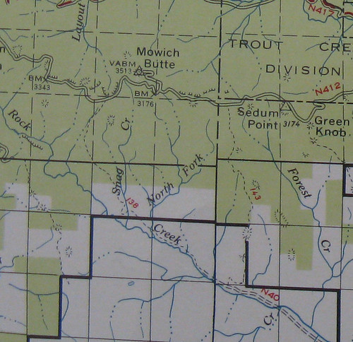
Here is a map from a 1963 GPNF map showing the placement of the trails - no PCT here which was likely built in the 70-80s. Snag Creek is #138 and Sedum Ridge is #143.
Snag Creek Trail, PCT loop
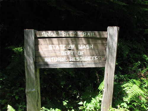
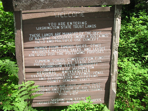
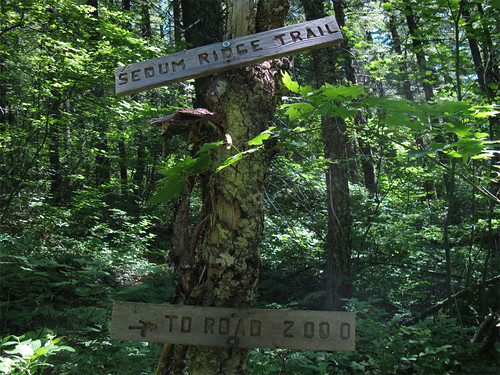
Snag Creek Trail takes off from the PCT at a junction marked by the following sign and heads up the hill towards Mowich Camp on Sedum Ridge. The sign gives a bit of history for the trail.

At the beginning, for a couple of hundred feet, the trail is broad easy to follow then before you know it, disappears into a decommissioned logged road, what? After wandering around a bit, another sign pops up. BTW, all this is well described in the Lorain book.
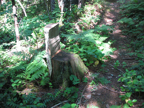
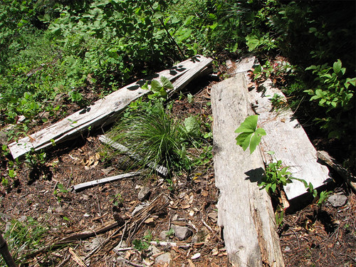
From here the trail resumes looking like a nice woodsy trail, not much for views, one spot gives a look to a old logging deck and Sedum Ridge. There's an accumulation of blowdown here and there and branches on the trail. Most of the interesting sights are trail side like this chainsawed chair.
The trail switchbacks up the side of the hill to a spot where the Lorain description sez:
Here's one of the benches, the other is in similar shape:Two wooden benches here allow you to enjoy the view in comfort
Although described in the text as fairly full, the 'view' you would enjoy from these benches is somewhat limited and it made me wonder when Doug last visited this trail - the first edition is 2003, the book I have is 2nd edition 2008. These benches look like they have been toast for quite some time. Taking a larger view of these kinds of trail guides in general and not that it is a big deal, but an interesting bit of information that any field guide entry could provide would be the date when the trail was last visited by the author. One of the obvious advantages of the PH Field Guide over hardcopy is the ability to add this little piece of useful data and links to relevant trip reports.
The maintained part of the trail ends just beyond the bench remnants at this sign:
I had to laugh when I saw this - the sign is on the DNR and Nat'l Forest boundary and faces north. The only problem is there is hardly any trace of a trail going on to Mowich Camp, all maintenance ends at this sign - extremely unlikely that anyone except adventure hikers would be coming south from Mowich Camp - so what's the point of the sign? The Lorain entry sez turn around at this point and go back the way you came, just an out and back, as the rest of the way to FR41 is too brushy. Undaunted, I pushed on to Mowich Camp and FR41 anyway. Not bad for a bushwhack, level ground, some over-your-head bracken, huckleberries, and vine maple.
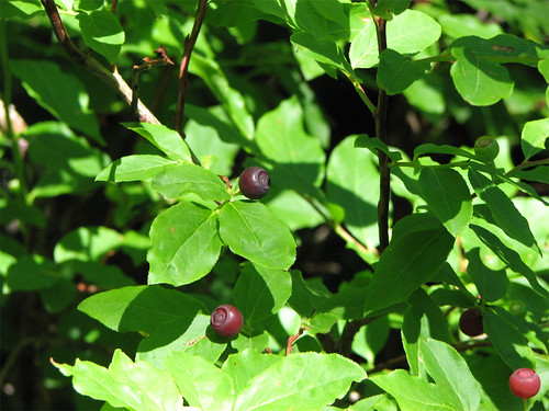
Huckleberries, yum. Huge, huge amounts of huckleberry bushes on the way to Mowich camp, not many had berries, though, maybe later.
I hit FR41 and went on to Mowich Butte to catch the view from this former lookout site. A bit overgrown now - here's looking south.
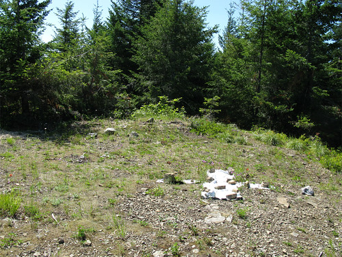
Not much to look at but I have a point to make - isn't a 'view' a resource that can and should be managed for recreational purposes? In the interest of preserving the view of a former lookout site isn't there some value and little cost in cutting down a few trees that block that view? It's just a matter of time before old lookout sites like Devils Peak, parts of Salmon Butte, and others vanish under the trees. If fires are to be suppressed then maybe a few trees can be cut down to give people a worthwhile destination and a another reason to use some of our trails.
To the north the view is a little better - three volcanoes, Soda Peaks, a pretty little pond in the valley below.

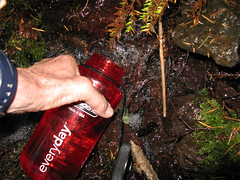
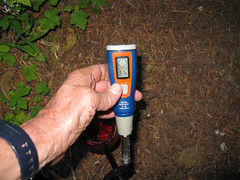
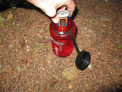
I went east on FR41 but saw the connector from FR41 to the PCT was a ways away from where the trail heads back down to Rock Creek so I did a little bushwhack to intersect the PCT. The PCT is clear of blowdown on the section I traveled, well graded, and had some welcome water as I was out by this time. Got to try my new Steripen - I know this was panned recently on this site on a report from Granny Hiker but when I was in REI the other day I obviously had more money than common sense so I bought one anyway - top of the line Journey model with a Smiley face and Mr. Yuck capable lcd.
Ya get your water, Ya set yer Steripen for the container size, ya stir, ya drink yer fill, and ya wait 2 weeks for results.
That's it for Snag Creek Trail, on to Sedum Ridge.
Old Sedum Ridge Trail
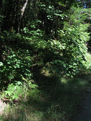
I had a hard time finding the trail head for Sedum Ridge Trail, took a couple of tries and a too-long bushwhack to finally find the trail. First try I went up some logging road and up on a ridge before I realized that I couldn't possibly be on a trail. My apologies to Doug Lorain for all the things I said about him, his book, and ancestors 5 generations back, my mistake. I came back the next day and still couldn't find the trailhead so I just took off up the hill to where I knew I'd run into the trail. I did and what a find, this is a great trail. The problem is the trailhead is essentially unsigned and the the start of the trail looks the same as the surrounding forest floor. Here is the trailhead marker and the start of the trail - parking is a wide spot on the Rock Creek side of the road just opposite the trailhead - GPS coordinates at the end of this report:
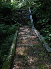
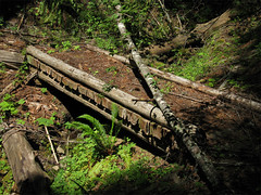
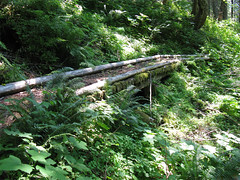
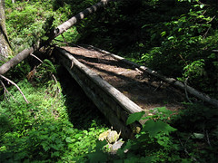
The trail is broad, graded-for-horses and travels through mostly older second growth forest. Lots of accumulated blowdown and branches to negotiate. There are 4 bridges along the way, unfortunately, the first bridge seen shortly after the start of the trail has collapsed - the length of the span may have been its undoing.
The other 3 are in good shape.
Eventually the trail intersects at a signed junction with the PCT and continues past the intersection a hundred feet or so to end at the decommissioned FR41.
A fun pair of little used trails. In ten years time if nothing more is done on them the reports on these trails will be found in the lost trails forum - should PH still be around.
The Sedum Ridge Trailhead GPS coordinates:
45 45.101' N 121 59.960'W
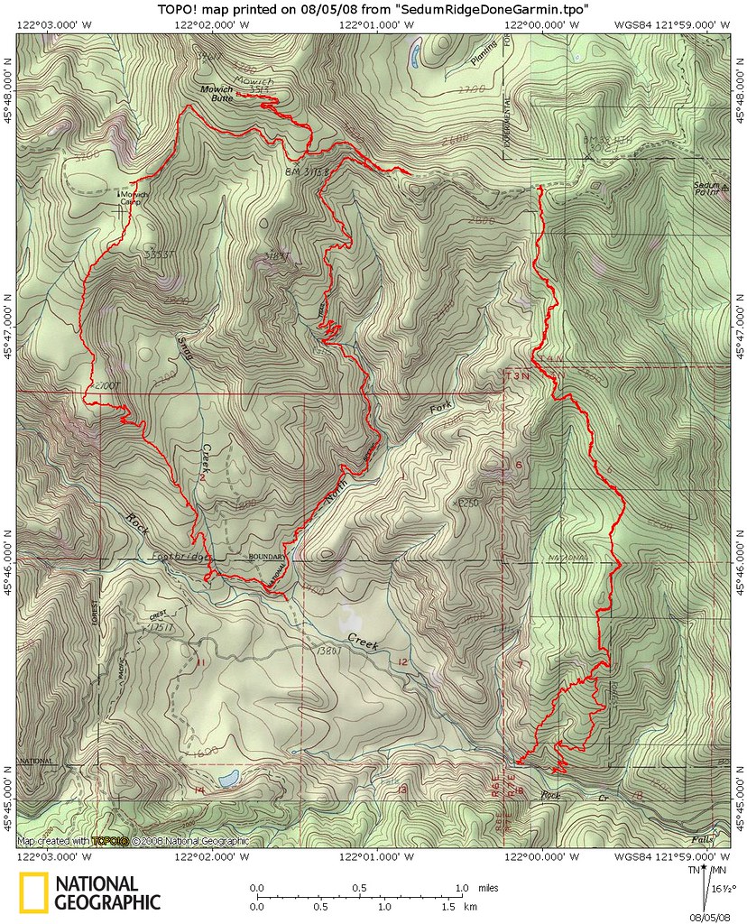
Map for both hikes: