Eagle Cap Wilderness (7/30 - 8/3)

This forum is used to share your experiences out on the trails.
User avatar
pdxflowergirl
Posts: 589
Joined: March 6th, 2009, 12:47 pm
Location: Portland, Oregon
Contact:

Eagle Cap Wilderness (7/30 - 8/3)

Post by pdxflowergirl » August 9th, 2010, 10:10 am

Day One: Drove seven hours to Wallowa Lake in Joseph, OR. Arrived just before nightfall and hiked in the dark for about two miles to undesignated campsite (aka - only flat area we could find).

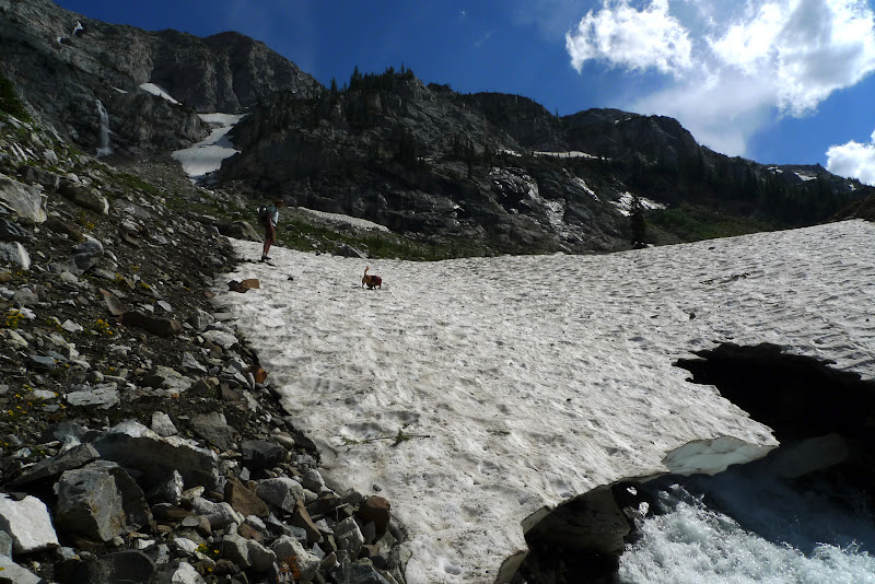
Day Two: Sunshine and more sunshine! Too late in the day for a safe river crossing, so we scrambled up the talus slope side and made it across the snow bridge. Continued the hike up to Frazier Lake and were the only people there. Lots and lots of blood-thirsty mosquitoes. But they couldn't compete with the views.

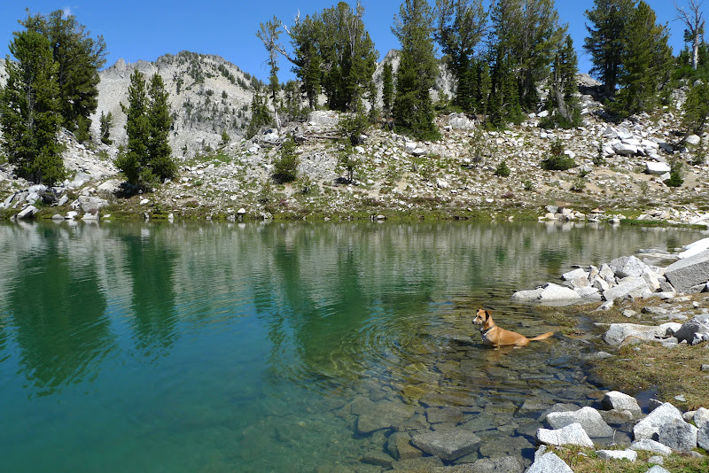
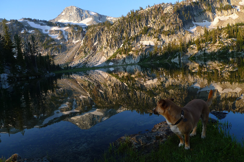
Day Three: Lunched at Glacier Lake. Greg napped while Max and I skirted the lakeshore, soaking up the views of Eagle Cap. Set up camp down at Mirror Lake and enjoyed more Eagle Cap vistas.

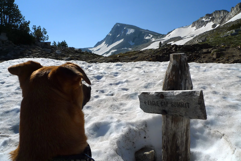
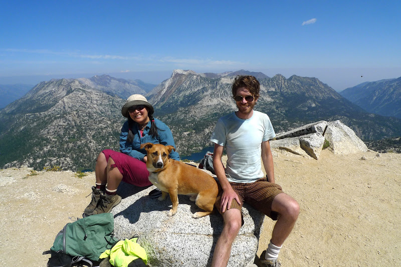
Day Four: Up early to summit Eagle Cap. Had it all to ourselves for about an hour. The we joined forces with a group of five folks to loop back down to Glacier Pass. After a well-earned siesta back at Mirror Lake, we packed up and headed down to Horseshoe Lake for our last night. An appropriate namesake as there were several horse camps with cute cowboys :)

Day Five: After a leisurely breakfast, we packed up to make the final trek back to Wallowa Lake and complete the 35-mile loop. Saw several hummingbirds, wildflowers, and stunningly beautiful vistas.

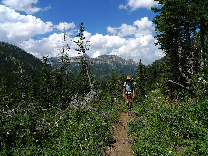
hiking in along the West Fork of the Wallowa River
Image

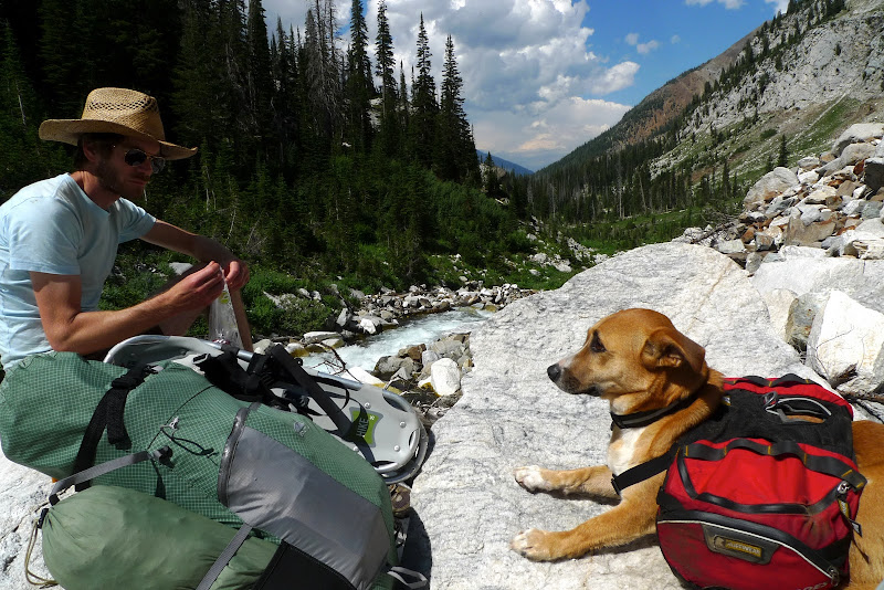
taking a snack break along the Wallowa River
Image

snow bridge crossing
Image

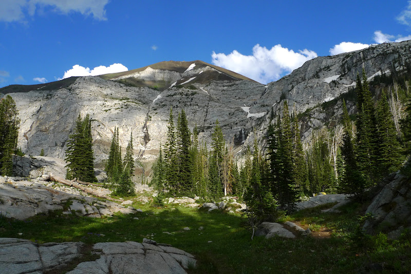
view from Frazier Lake
Image

Max relaxing in Glacier Lake
Image

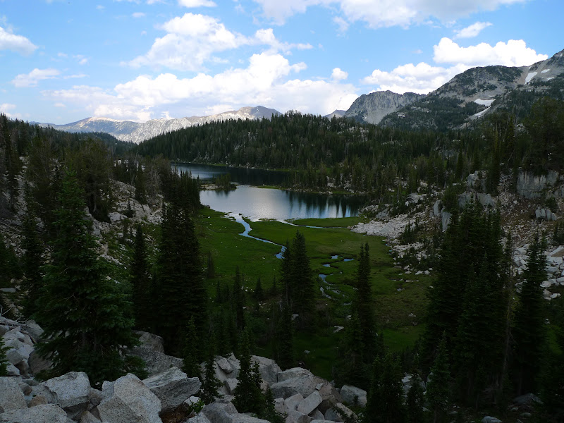
aptly named Mirror Lake
Image

focusing on our goal
Image

at the summit of Eagle Cap
Image

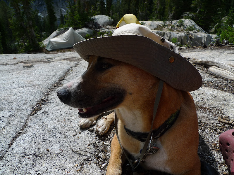
Max chillin' back at base camp
Image

leaving Moccasin Lake
Image

click here to see video
Kam

User avatar
drm
Posts: 6152
Joined: May 28th, 2008, 10:03 pm
Location: The Dalles, OR
Contact:

Re: Eagle Cap Wilderness (7/30 - 8/3)

Post by drm » August 9th, 2010, 10:57 am

So the video is sliding down to Glacier Lake from Eagle Cap?

Looks like the snow melt is just as late there as everywhere else in the region.

User avatar
Excursionista
Posts: 425
Joined: May 28th, 2008, 10:03 pm

Re: Eagle Cap Wilderness (7/30 - 8/3)

Post by Excursionista » August 9th, 2010, 11:15 am

I love that place! Sounds like you had a great time. I like the pic of Max at the Eagle Cap sign; obviously a late melt-out. That snow-bridge looks sketchy as heck - I'd definitely have second thoughts before crossing it, and I'd be nervous the whole time. :shock:

User avatar
Bosterson
Posts: 2317
Joined: May 18th, 2009, 3:17 pm
Location: Portland

Re: Eagle Cap Wilderness (7/30 - 8/3)

Post by Bosterson » August 9th, 2010, 11:58 am

Excursionista wrote:That snow-bridge looks sketchy as heck
Where was that, btw? I'm guessing somewhere between Six Mile Meadow and Frazier Lake, maybe when the river bends around to the right before you get to the lake? We were there last year about a month later than this and there was no snow anywhere!
#pnw #bestlife #bitingflies #favoriteyellowcap #neverdispleased

User avatar
pdxflowergirl
Posts: 589
Joined: March 6th, 2009, 12:47 pm
Location: Portland, Oregon
Contact:

Re: Eagle Cap Wilderness (7/30 - 8/3)

Post by pdxflowergirl » August 9th, 2010, 7:20 pm

drm wrote:So the video is sliding down to Glacier Lake from Eagle Cap?

Looks like the snow melt is just as late there as everywhere else in the region.
Dean - I am standing at the top of a snowfield that starts near the "armpit" of a switchback near the summit of Eagle Cap. The bottom of the snowfield is where we "switchbacked" to tie into the ridgeline that goes over to Glacier Pass. So we didn't actually go all the way down to Glacier Lake since we'd been there the day before.

Re: snow melt - the Wallowa Ranger Station folks told me that there was lotsa snow and to bring my snowshoes. So we packed the extra four pounds and didn't need them once! My friends who grew up in Lostine and were hospitable enough to share their cabin on Wallowa Lake for the night told us that snow can melt in a few days up on the peaks and passes. Live and learn :P

Excursionista wrote:That snow-bridge looks sketchy as heck - I'd definitely have second thoughts before crossing it, and I'd be nervous the whole time. :shock:
Jason - It wasn't nearly as sketchy as one that I crossed on the Timberline Trail several years ago. This one was pretty thick, though I was still very cautious. Max kept running back and forth across it - puppies have no fear! And, the snow bridge was our only option since the river was so high and the current looked too swift to cross safely.

Bosterson wrote:Where was that, btw? I'm guessing somewhere between Six Mile Meadow and Frazier Lake, maybe when the river bends around to the right before you get to the lake? We were there last year about a month later than this and there was no snow anywhere!
Nat - It was about 1/4 mile from Frazier Lake, just below the meadow area. I think that most of the snow melted a few days prior, judging from the voracious appetite of the mosquitoes!
Kam

User avatar
sparklehorse
Posts: 828
Joined: May 28th, 2008, 10:03 pm
Location: over the hill
Contact:

Re: Eagle Cap Wilderness (7/30 - 8/3)

Post by sparklehorse » August 9th, 2010, 8:52 pm

Nice report and pics, thanks for posting! Looks like you had a great trip. Max looks happy as a clam too. I love Eagle Cap, prettiest corner of the state in my book. OK, I don't have a book, but it would be if I did.

G
.
You have to milk the cow a lot to make a bit of cheese.
~Henri Cartier-Bresson

Smugmug / Facebook

User avatar
Water
Posts: 1355
Joined: May 28th, 2008, 10:03 pm

Re: Eagle Cap Wilderness (7/30 - 8/3)

Post by Water » August 9th, 2010, 11:36 pm

thanks for the pictures and update.. it is impressive how the snow has hung around so long.. I guess getting 4-10 foot of snow into the middle of june up in the high elevations was true even out in the wallowas.

neato to have gone down to the ridgeline that connects with glacier pass to make a loop of it! I've wanted to explore off that south ridgeline that runs to glacier peak, tho i think that snow makes it a lot more conducive than when it is all rocky.

food for thought, sketchy snowbridge, you always have the option of not going on it or not fording. we ran into that ford being pretty decent in august of 08, but fortunately it was very narrow it was over quick.. but i could see with all this snow even early morning it might be tough to feasibly do.

sorry to hear the ranger station told you to bring snowshoes? was that an actual ranger or one of the people they have to staff the phones? unfortunately i have found the face people (non-rangers) to be absolutely worthless at nearly every national forest. they can read off the website, and nothing more, but by god don't have the capability to update it when they get feedback on present conditions. and half the time they've never really hiked in a lot of the areas they are giving generic 'information' on. i don't understand why avid outdoor 20-30 somethings who know the trails awesome aren't in those jobs../end rant
Feel Free to Feel Free

User avatar
drm
Posts: 6152
Joined: May 28th, 2008, 10:03 pm
Location: The Dalles, OR
Contact:

Re: Eagle Cap Wilderness (7/30 - 8/3)

Post by drm » August 10th, 2010, 7:15 am

Water wrote: i don't understand why avid outdoor 20-30 somethings who know the trails awesome aren't in those jobs../end rant
The avid outdoor 20-30 somethings are in the outdoors, not answering the phones. They probably avoid the phone jobs like the plague. Wouldn't you? What ranger wants to be staffing the phones when summer arrives?

On a few rare occasions I've had ranger offices connect me with the "field ranger" or some such, but it is the exception. There are a few places where the two actually communicate regularly.

User avatar
pdxflowergirl
Posts: 589
Joined: March 6th, 2009, 12:47 pm
Location: Portland, Oregon
Contact:

Re: Eagle Cap Wilderness (7/30 - 8/3)

Post by pdxflowergirl » August 10th, 2010, 8:04 am

sparklehorse wrote:Max looks happy as a clam too.
Max was happy most of the trip. The granite tore up his paw pads and he was not too happy about this part. But like most dogs, he never wants to show he's in pain. And it was much warmer than I had anticipated. The sun exposure was quite intense. Fortunately there was lots of water everywhere with the snow melting. So Max was able to take creek breaks whenever he needed to cool off.

Water wrote:neato to have gone down to the ridgeline that connects with glacier pass to make a loop of it! I've wanted to explore off that south ridgeline that runs to glacier peak, tho i think that snow makes it a lot more conducive than when it is all rocky.
This was my third trip up to the EC summit, and I had scoped out that route each time. We almost opted not to do it this year, but then we saw a clear path to the snow field and then there is an established trail along the ridge that we had scouted out the day before when coming up from Glacier Lake. Saw some folks coming up the ridge, but I think sliding down the snowfield was way more fun than climbing up it would've been!

drm wrote:On a few rare occasions I've had ranger offices connect me with the "field ranger" or some such, but it is the exception. There are a few places where the two actually communicate regularly.
My best example of these "phone rangers" being useless was when I was relatively new to backpacking in Oregon (about six years ago). Greg and I wanted to hike the Timberline Trail. So we drove up to the lodge and parked, but couldn't find the Trail #600. So we went inside the lodge and saw the FS info desk and asked the ranger where the trail begins. She asked us, "What is the Timberline Trail?". We walked out a different door of the lodge while shaking our heads and laughing, and ran smack into the trail sign...like almost right outside the door! We totally busted out laughing at that point. Actually, thinking back, it wasn't funny at all because we encountered lots of snow that July and the rivers were raging from the snowmelt. This type of info is vital for completing this loop, and it would've been nice if the ranger had provided it. But it was an excellent adventure, one of my best backpacking memories. And - most importantly - I learned some fundamental backpacking skills.
Kam

User avatar
romann
Posts: 2417
Joined: May 28th, 2008, 10:03 pm
Location: Vancouver, WA

Re: Eagle Cap Wilderness (7/30 - 8/3)

Post by romann » August 10th, 2010, 9:33 am

Nice report! Those granite mountains are beautiful. The video of glissade looks cool, some people slide very fast and don't seem to have ice axes in their hands, but that slope seems safe.

I never been in Wallowas yet (and still a newbie to backpacking), so I have a few basic questions about that area:
1) There's a lot of thunderstorms in Wallowas, but how intense do they get? Would you go backpacking in Wallowas at all if you see thunderstorms in the forecast?
2) How cold does it get at night?
3) Are the trails there easy to follow?

Post Reply