Spent the night near Trillium Lake, so decided to hike the Eurkea Peak trail. I started on Sherar Burn Road, which was rough, rocky, and narrow, but passable in 2WD. Not sure why I chose this road other than my map showing the trailhead on is Sherar Burn Road. Starting at the bottom of the trail on Still Creek Road would be a better choice.
There was sufficient space for a few vehicles to park and turn around near the trailhead.
 Viewed 981 times")
- Trailhead on Sherar Burn Road
The trail is no-nonsense, dropping/rising nearly 1000' in 1.3 miles with no switchbacks along the way, but a fairly consistent grade. The forest consists of a mix of conifers, pacific silver fir, Douglas fir, western white pine, western hemlock, cedar and even lodgepole pine with an understory of rhododendrons, bear grass, huckleberry and bunchberry, which might be pictureesque in the right seasons. There were a few fall colors, including yellowed bracken fern and a large variety of mushrooms, although wooly chanterelles were most common.
 Viewed 981 times")
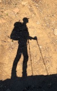
- Eureka Peak Trail
 Viewed 981 times")
- Eureka Peak Trail
 Viewed 981 times")
- Trailhead on Still Creek Road
Eureka Peak trail doesn't go to the top of Eureka Peak, it just connects the two forest roads. Back at the trailhead, I looked around for a possible footpath to the top but didn't see anything obvious. I considered bushwacking up the ridge, but the vegetation was dense with a lot of fallen trees and it was starting to rain, so turned back. Had I known there was an old crumbling shelter at the top, as mentioned in this
trip report, I might have gone for it.
I'd love to know the history of the trail, it seems so odd to just connect roads. The trail is on the 1962 Government Camp Topo. Currently, it is a connector for mountain bikers according to the
forest service, who I assume bomb down the trail.