McIntyre Ridge Trail and Sheepshead Rock 6/16/09

This forum is used to share your experiences out on the trails.
Post Reply
User avatar
Swede
Posts: 90
Joined: May 28th, 2008, 10:03 pm

McIntyre Ridge Trail and Sheepshead Rock 6/16/09

Post by Swede » June 18th, 2009, 5:11 pm

The last time that I hiked the McIntyre Ridge trail was back in 2002, when it was still accessible from Hwy 26. Splintercat's recent comments about an alternative trailhead caught my interest, so I decided to give it a try. I found the trailhead easily, following Tom's precise directions. The road gets pretty brushy towards the end, but it's still wide enough for vehicles.

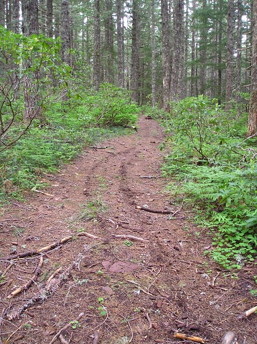
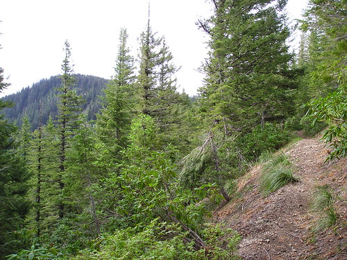
Tom's post included pictures of the vehicle access barriers at the trailhead (boulders and pit), but they weren't enough to keep a recent dirt bike rider out. I followed dirt bike tracks all the way to the top of the ridge and through several meadows.

Image

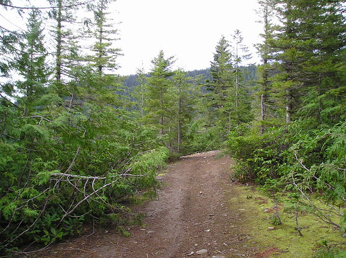
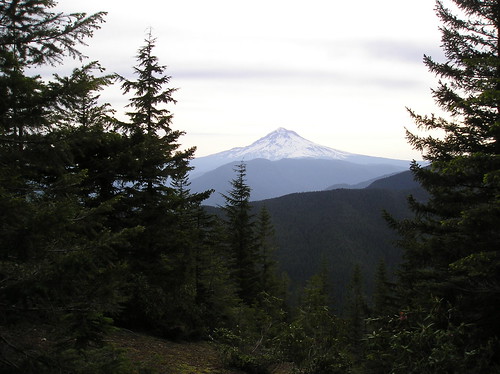
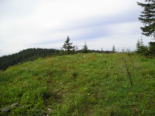
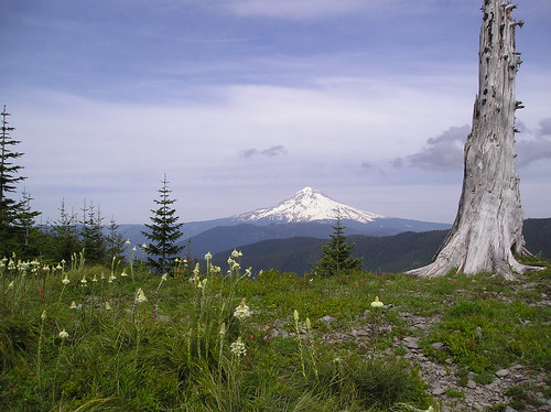
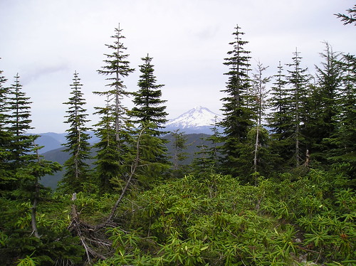
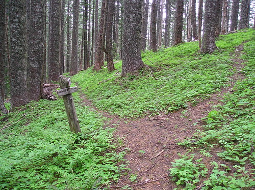
The trail climbs through the forest for a good mile or mile and a half until it finally breaks out into the open here, where you get your first view of Mt. Hood.

Image

Image

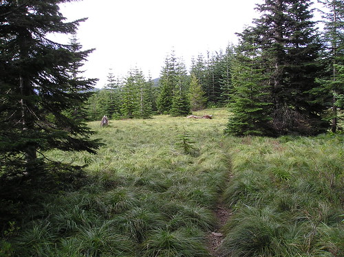
The trail continues along the ridge top, alternating between beargrass meadows, wildflower meadows, and forest.

Image

Image

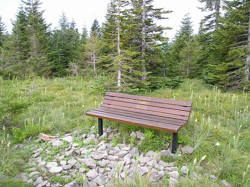
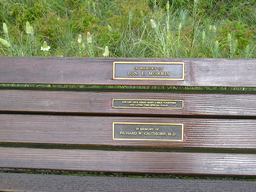
After about 2 1/2 miles there's a viewpoint with a bench, a memorial to two hikers who particularly enjoyed this spot. If you take a moment to rest on the bench and check out the view, you'll understand why!

Image

Image

Image

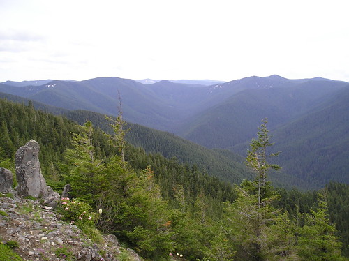
From here the trail enters the forest and heads on down to it's junction with the Douglas Trail. There's a view of Wildcat Mountain along the way.

Image

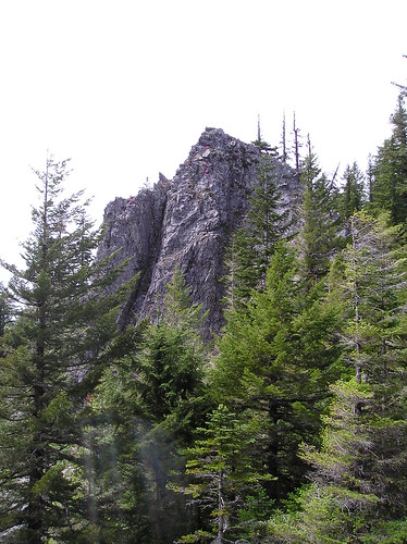
From here I followed the Douglas Trail past Wildcat Mountain and the rock garden mentioned in awildman's recent post. I checked out the view from the old lookout site on Wildcat Mountain. It was probably spectacular when the lookout was there, but there are trees obscuring the view these days.

Image

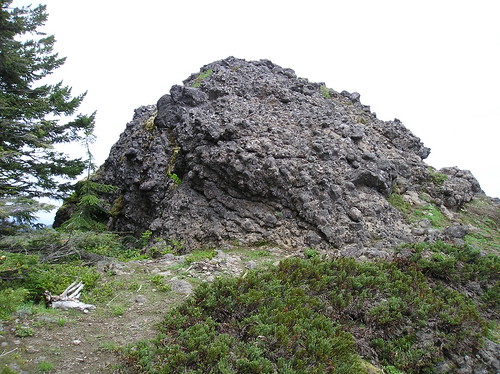
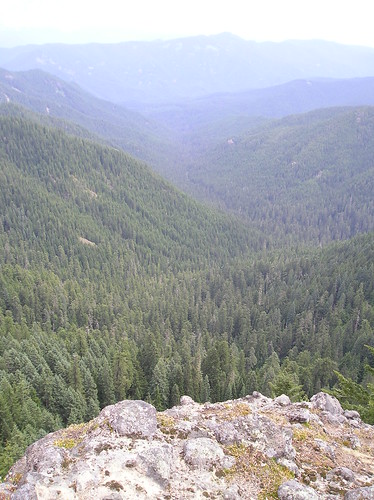
A nice view of the Eagle Creek drainage from the rock garden.

Image

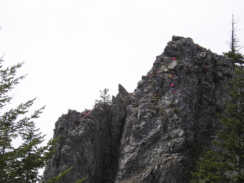
I passed a large rock outcrop with flowers growing near the top.

Image

I zoomed my little point-and-shoot to the max for a closer look.

Image

I continued on to the junction with Plaza Trail 783 and followed that past Coffman Camp south to its junction with the spur trail to Salmon Mountain, another former lookout site.

Image

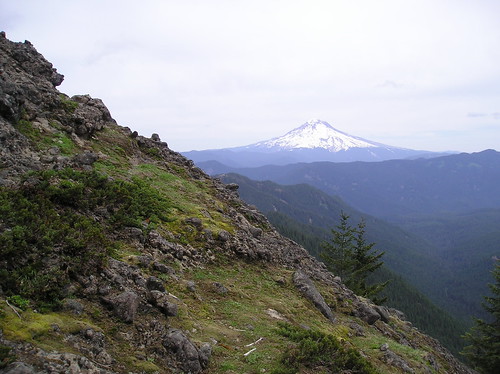
From there it was on to Sheepshead Rock, a total distance of about 9 miles from the trailhead. The rock doesn't look so imposing until you see the 100-foot drop on the other side.

Image

Mt. Hood from the slope approaching the rock.

Image

The South Fork Salmon River.

Image

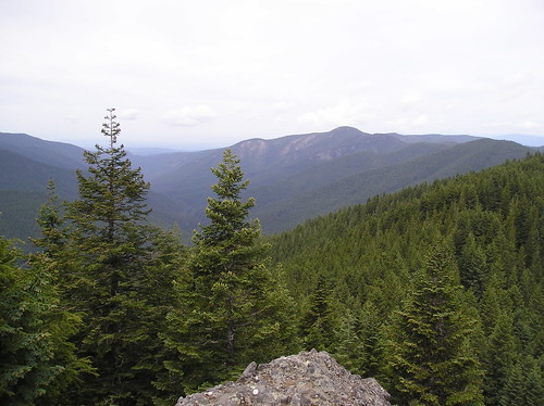
Looking NW towards Wildcat Mountain (the high spot to right of center).

Image

I had hoped to make it as far as the 4610 road, but ran out of time and had to turn back. I did stop on the way back at a couple of the saddles south of Coffman Camp and poked around in the woods hoping to find some evidence of an abandoned trail coming up from Eagle Creek. Pablo, Splintercat and others have discussed this before. Of course I found nothing, and didn't want to venture too far downhill with the limited time I had. But if there is such a trail, or a feasible route through the open forest in that area, it would make a really good loop for a day trip to be able to hike up Eagle Creek and climb up to the Plaza Trail and return by that route. Two nice trails, it would be good to be able to connect them.

More photos here: http://www.flickr.com/photos/19191522@N ... 889039560/
Last edited by Swede on June 29th, 2009, 10:14 am, edited 3 times in total.

User avatar
anna in boots
Posts: 2122
Joined: May 28th, 2008, 10:02 pm
Location: In the moment

Re: McIntyre Ridge Trail and Sheepshead Rock 6/16/09

Post by anna in boots » June 18th, 2009, 5:57 pm

Oh, man, all that lovely space just makes me want to go hike it right now! Thanks for the report and the great idea, Swede. Looks like you had a really good day.

anna in boots
Current trip reports at All Thoughts Work™ Outdoors
http://allthoughtsworkoutdoors.wordpress.com/

User avatar
Guy
Posts: 3333
Joined: May 10th, 2009, 4:42 pm
Location: The Foothills of Mt Hood
Contact:

Re: McIntyre Ridge Trail and Sheepshead Rock 6/16/09

Post by Guy » June 18th, 2009, 6:03 pm

Thanks for the great post & pics, I haven't hiked the area since the late 80's - You have inspired me to return! The last time I hiked Wildcat was in July 1987, 10 days after the due date of my now oldest daughter's birth. Tired of sitting around & waiting we hiked up wildcat. It did the trick & my daughter was born the next day :D
hiking log & photos.
Ad monte summa aut mors

User avatar
awildman
Posts: 918
Joined: June 6th, 2009, 5:20 pm
Location: Portland

Re: McIntyre Ridge Trail and Sheepshead Rock 6/16/09

Post by awildman » June 18th, 2009, 7:15 pm

Very cool, Swede! It's too bad that there isn't a loop option (yet). Another good trail in the area is the Bonaza Trail, which starts low just outside of Welches and climbs to the Plaza Trail and Huckleberry Mountain. It would be a fun two-day trip (or one long one) up Bonanza to Coffman Camp and down the Cheeney Creek drainage to look for the elusive trail.

AW
Rambling on at Allison Outside

User avatar
Splintercat
Posts: 8334
Joined: May 28th, 2008, 10:03 pm
Location: Portland
Contact:

Re: McIntyre Ridge Trail and Sheepshead Rock 6/16/09

Post by Splintercat » June 18th, 2009, 10:39 pm

Great report, Swede..! I was grinding my teeth a bit at the sight of those dirt bike tracks INSIDE the new wilderness boundary (which extended down to the road). Signage is clearly in order, at least to deter the law-abiding OHVers.

It looks like the beargrass is just recovering from the snowpack in the lower meadow, but blooming at the bench viewpoint - odd! Nice to see the blooms, though. I'm ready for summer in the mountains! How was the trail condition on McIntire from the new trailhead to the Douglas junction..? Any logs down or problematic brush?

Allison, you mentioned a loop, and it reminded me that I ran into a young couple on McIntire Ridge last year who were on an overnight backpack that began at the Eagle Creek trailhead. They had hiked down to Eagle Creek, then up the cutoff and to a campsite somewhere near the Plaza Traihead (possibly Plaza Lake). They were just wrapping up their second day by taking the Plaza Trail to the Douglas Trail, and back down to their car. It surprised me a bit, since I'm mostly used to seeing horses doing this loop.

The only downside for them was having to cope with OHVs and shooters at Wildcat Quarry -- I warned them what to expect. I'm increasingly convinced that the quarry just needs to be closed, and the lower Douglas trailheads used for hiker access. Despite "no shooting" signs, it's a free-for-all up there.

-Tom

User avatar
Swede
Posts: 90
Joined: May 28th, 2008, 10:03 pm

Re: McIntyre Ridge Trail and Sheepshead Rock 6/16/09

Post by Swede » June 19th, 2009, 5:41 pm

Tom,

I hadn't realized that some of the McIntyre Ridge area was included in the new wilderness designation. There were so many bits and pieces added all over the place that it's hard to keep track of it all. My map shows the previous alignment of the wilderness boundary coinciding more or less with the trail. So before the recent expansion, was the trail considered to be within the wilderness or outside of it? It's a moot point now, of course, but I'm curious about that memorial bench. Surely that wouldn't be allowed within the wilderness.

Anyway, to answer your question, the trail is in very good shape all the way to the Douglas Trail, with only a couple of down trees in the first couple of miles. They're easy to step over, or to ride around if you're on your dirt bike. The trail is not overly brushy for the most part.

User avatar
Splintercat
Posts: 8334
Joined: May 28th, 2008, 10:03 pm
Location: Portland
Contact:

Re: McIntyre Ridge Trail and Sheepshead Rock 6/16/09

Post by Splintercat » June 19th, 2009, 10:54 pm

Howdy Swede,
Thanks for the trail report - very helpful! I was worried that the brush was going to be working against us on getting a new trailhead recognized. As far as the new boundary, here's a link to the adopted map, courtesy Oregon Wild (note: this is a PDF):

http://www.oregonwild.org/oregon_forest ... %2040k.pdf

As you can see, the new boundary hugs the paved road, then the spur road to the unofficial/alternative McIntire trailhead, where the boundary then heads straight for the ridgeline. So the jeep track that you followed to the McIntire Trail looks to be outside the wilderness, but the main trail heads into the expanded wilderness just a short distance south of the junction with the jeep trail.

Nice photos on your Flickr account, too!

Tom :)

Post Reply