Pilot Rock is readily visible from I-5 and is one of the classic hikes in S Oregon. It's possible to drive within a mile of it (which hoards apparently do in the summer) so you can get right to the 3rd class scramble to the top with its views. But we wanted to combine that scramble with a decent hike, so we started toward the Rock from the lower PCT TH on old Hwy 99 near Siskiyou Pass. This is Hike #3 in Paul Gerald's Day & Section Hikes, Pacific Crest Trail, Oregon (now don't you wish you'd gotten an autographed copy at the last Meet-n-Deet?). The TH is just a wide spot along Hwy 99 but now there's a nice new PCT sign to guide you.
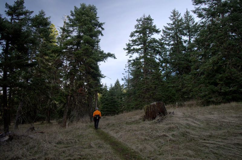
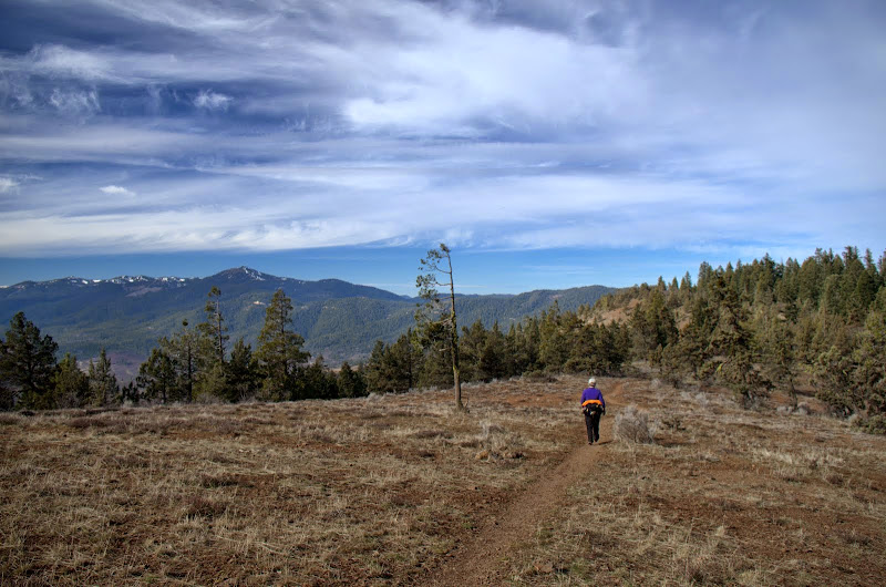
The trail climbed gently and pleasantly through forest and open meadow,
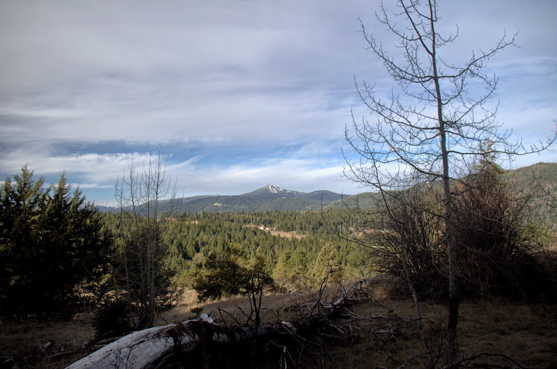
with an occasional view W toward Mt. Ashland,
then along an open ridge for our first close view of our objective,
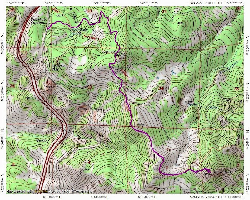
until we reached the junction with the "short" trail after about 4 mi.
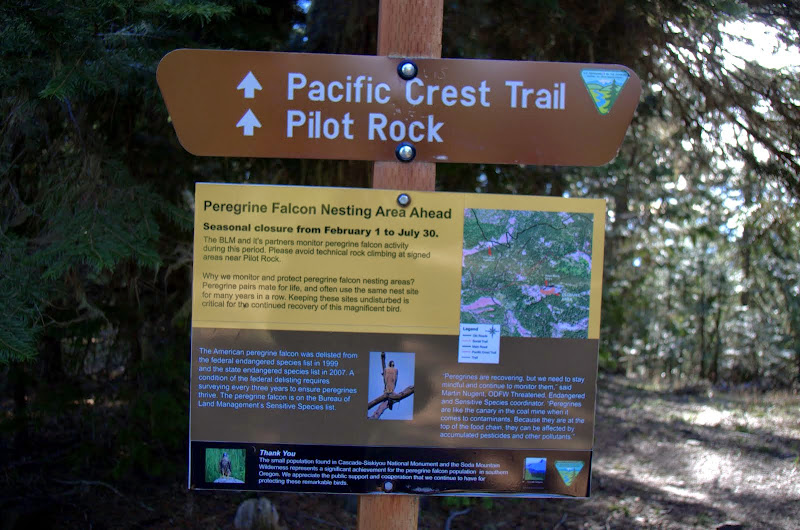
The trail (what the BLM calls a "social trail") to the Rock starts shortly after this sign. It's a very good trail (social or otherwise) - being wider than the PCT at the beginning and having it's upper reaches well graded and buttressed with little rock walls. A very easy way to gain a few hundred feet!
The social trail took us to the base of the summit chute, which looks intimidating but is pretty straightforward - just hug the left wall and don't get seduced into following the big ledge to the right, as it leads to a cliff.
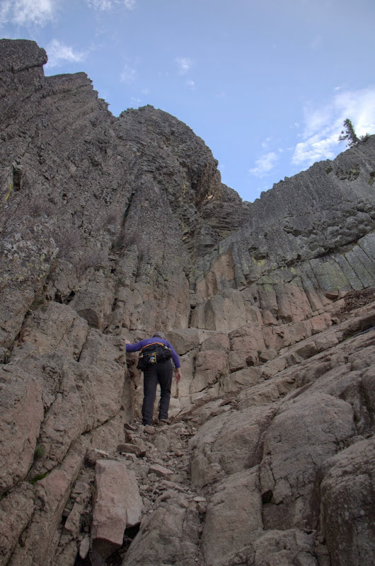
The slightly tricky parts were a chimney and a chockstone right at the start of the chute.
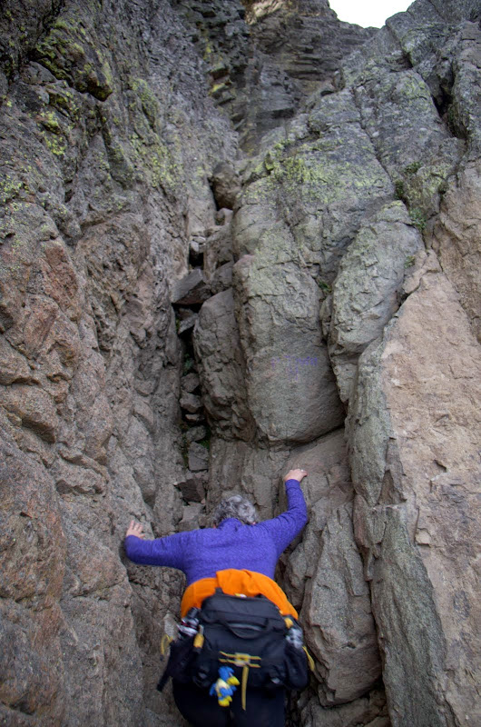
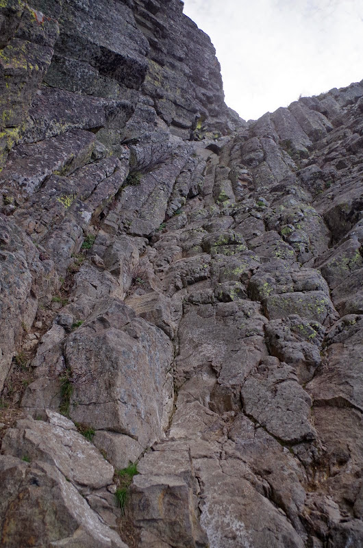
But after some moves over good handholds and footholds, we were past these obstacles,
and on our way along the sweeping basalt columns to the summit (which reminded us of Devil's Tower).
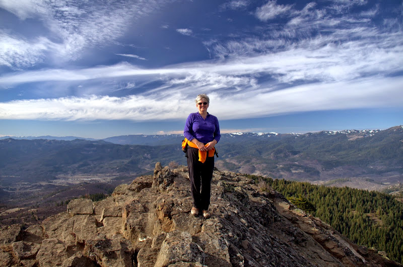
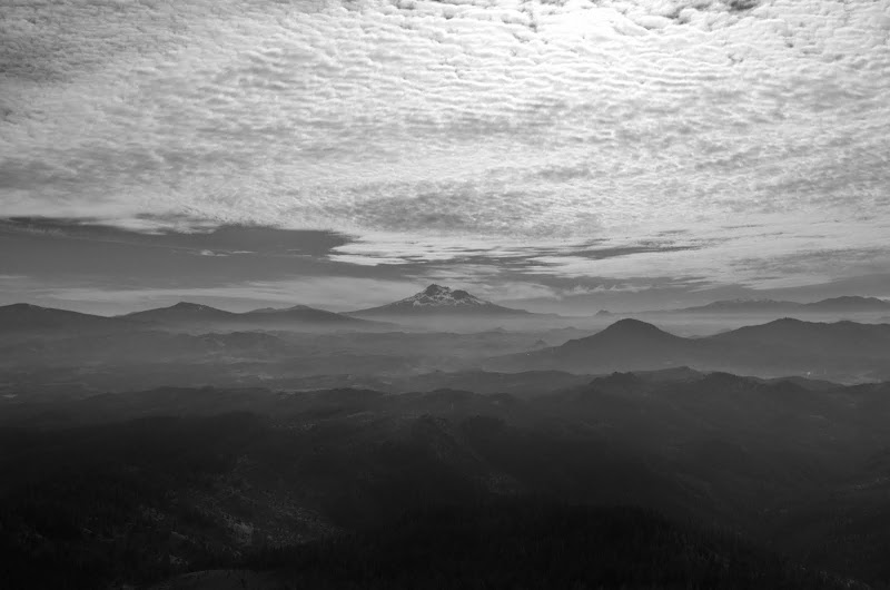
We popped on to the top on what was a gorgeous, bluebird day - with Mt. McLoughlin on the horizon -
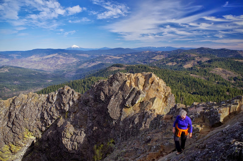
and with big views all around (sadly, the snow of the peaks in the background is a fraction of what it's supposed to be and we'd be willing to trade a bluebird day or two for a good blizzard).
To the W, Mt. Ashland (a) and Wagner Butte (wb),
to the E, Soda Mtn (s) and Boccard Point (bp),
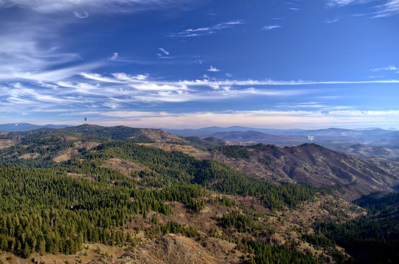
and to the S, Mt. Shasta.
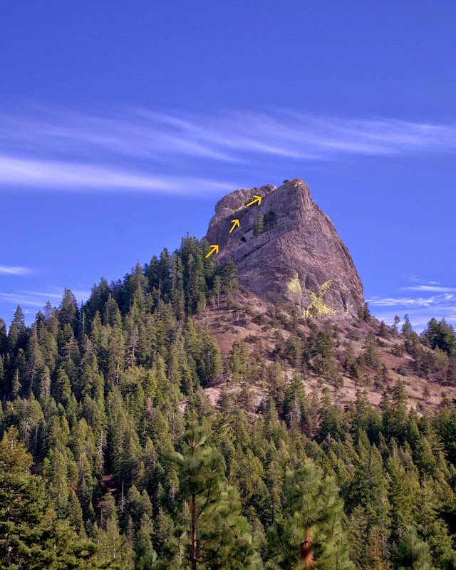
After soaking in the views and some sun, we scrambled down to the PCT, had a quick snack, and headed back to the TH. Along the way, there was one spot where we could look back and see our route up the Rock (arrows).
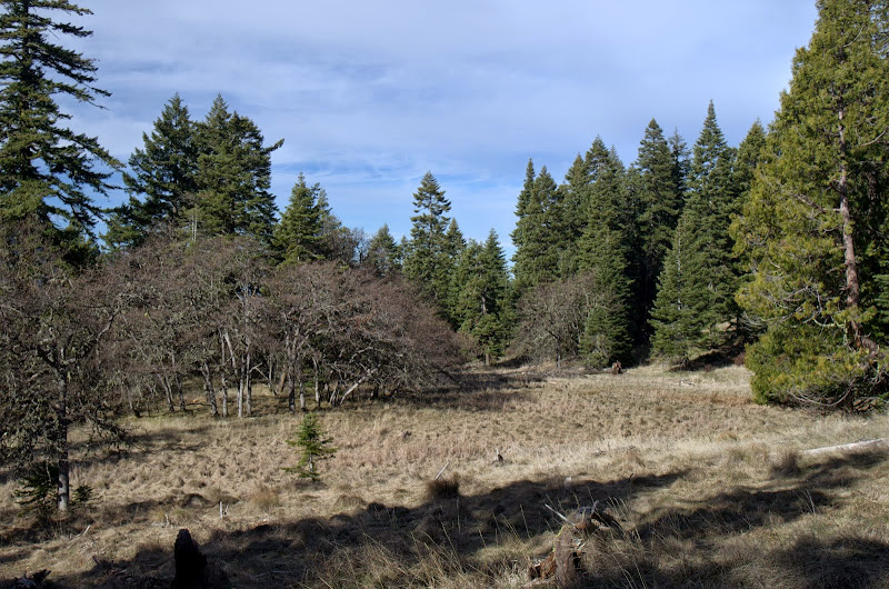
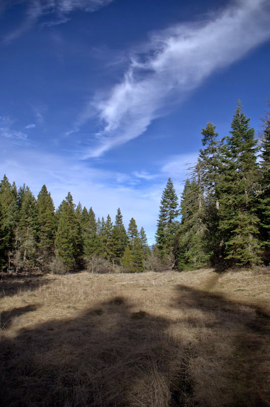
After that, we ambled back to the TH along open ridges
and through forested meadows.
A really nice little hike (9.5 mi RT, 1500' EG) combined with a fun 3rd class scramble and huge views!
OK, we're good on sunshine for the moment so feel free to start the snow machine. Yep, no worries, just bring on a blizzard (or two). Why should New England have all the fun?
Pilot Rock via the PCT (S Oregon) 29-Jan-2015
Last edited by VanMarmot on July 23rd, 2015, 11:59 am, edited 2 times in total.
Re: Pilot Rock via the PCT (S Oregon) 29-Jan-2015
Great job and great pictures. I think I saw Mt McLaughlin in there too? I hiked SoBo on the PCT past there this summer and went up to the chute. But I had no clue/info on how hikeable/climbable it was from there or the suggested route so I turned around. Wish I knew what I know now. That "social trail" has now been formalized as you might have guessed. It used to go straight up from the base. Those beautiful and well constructed switchbacks were just being installed this summer as I went by there.
-GoalTech
-GoalTech
Re: Pilot Rock via the PCT (S Oregon) 29-Jan-2015
Yay! I've been enjoying your posts from the south
Such a glorious hike!
Pitt/McLaughlin is also visible from points along the trail, as I remember. A wander and a scramble onto a nice rock of a farseein' place. There's also a great Shasta-and-Pilot-Rock viewpoint a bit further along if you keep going past Pilot Rock.mjirving wrote: I think I saw Mt McLaughlin in there too?
Such a glorious hike!
- Sean Thomas
- Posts: 1647
- Joined: February 25th, 2012, 11:33 pm
Re: Pilot Rock via the PCT (S Oregon) 29-Jan-2015
Another great TR and pics, VM! You're on a DN like roll down there
Re: Pilot Rock via the PCT (S Oregon) 29-Jan-2015
Thanks, Sean! Being retired (just like DN) makes it easier to be a (mostly) full-time hiker - as does having a whole new area to explore!Sean Thomas wrote:Another great TR and pics, VM! You're on a DN like roll down there
Re: Pilot Rock via the PCT (S Oregon) 29-Jan-2015
Thanks! I added a mention of Mt. McLoughlin to my TR.walrus wrote:Yay! I've been enjoying your posts from the south
Pitt/McLaughlin is also visible from points along the trail, as I remember. A wander and a scramble onto a nice rock of a farseein' place. There's also a great Shasta-and-Pilot-Rock viewpoint a bit further along if you keep going past Pilot Rock.mjirving wrote: I think I saw Mt McLaughlin in there too?
Such a glorious hike!
- mileagemike25000
- Posts: 475
- Joined: February 8th, 2012, 7:40 pm
- Location: Vancouver, WA
Re: Pilot Rock via the PCT (S Oregon) 29-Jan-2015
Van Marmot - Very nice TR and excellent photos! My wife and I visited the Ashland area early last summer and thoroughly enjoyed hiking on the PCT past Pilot Rock. One thing that struck a chord is that this area is designated as Soda Mountain Wilderness, but it appears you can drive right into it. What's more is we didn't see any wilderness signs. The only place we saw any indication that this was a wilderness was on the very bottom text of the "Peregrine Falcon Nesting Area Ahead" sign (we also have the same picture of this sign ). It appears that this beautiful place is quite popular, but a Wilderness designation typically indicates that they shutdown all motorized access in order to keep it pristine. Have you heard anything about any BLM plans, or is this the new paradigm for wilderness, since it was designated in 2009? Perhaps the BLM is just out of funds for executing the Wilderness designation? Thanks for posting!
Mike
Mike
Re: Pilot Rock via the PCT (S Oregon) 29-Jan-2015
That chute up Pilot Rock looks like straight-up climb! Great views, and looks like a fun hike.
I really like that close-up shot of Mount of Happiness
Re: Pilot Rock via the PCT (S Oregon) 29-Jan-2015
Mike,mileagemike25000 wrote:Van Marmot - Very nice TR and excellent photos! My wife and I visited the Ashland area early last summer and thoroughly enjoyed hiking on the PCT past Pilot Rock. One thing that struck a chord is that this area is designated as Soda Mountain Wilderness, but it appears you can drive right into it. What's more is we didn't see any wilderness signs. The only place we saw any indication that this was a wilderness was on the very bottom text of the "Peregrine Falcon Nesting Area Ahead" sign (we also have the same picture of this sign ). It appears that this beautiful place is quite popular, but a Wilderness designation typically indicates that they shutdown all motorized access in order to keep it pristine. Have you heard anything about any BLM plans, or is this the new paradigm for wilderness, since it was designated in 2009? Perhaps the BLM is just out of funds for executing the Wilderness designation? Thanks for posting!
Mike
When wilderness designation comes along after 100+ years of prior uses, it's not unusual to find some "accomodations" having been made. One of my favorite examples of this is the Golden Trout Wilderness in the California Sierras - where an air strip ( ) was grandfathered into the wilderness to support fishermen and horse packers.
Here (BLM Soda Mtn), the wilderness is squeezed in E of I-5, N of the CA border, S of the PCT, and is bisected to the E by powerlines (through what is now a national monument). The road that allows service of the considerable array of electronic gizmos stuck on the summit of Soda Mtn is only open to specific users. Elsewhere there is private land served by roads that come right up to (and in one case into) the wilderness - one of these takes you to the Pilot Rock short hike alternative. This hodge-podge of conflicting and interwoven land uses was tossed on the BLM and I like to think they're doing their best with this - but it can't be easy.
- Bruce
Re: Pilot Rock via the PCT (S Oregon) 29-Jan-2015
Sort of like how Badger Creek Wilderness is penetrated by the road to Badger Lake!
"The top...is not the top" - Mile...Mile & a Half
Instagram @pdxstrider