
Karl and Eric,
Many thanks for the link to the GPS track. I've never seen this section of the WRT mapped and, without a GPS myself, was kind of curious about exactly where I had gotten to at Tailgate Point!
Wilson River Trail: the road to Idiotville
Re: Wilson River Trail: the road to Idiotville
I was in the area around 1pm, but I did not try to cross. 

Re: Wilson River Trail: the road to Idiotville
Excellent! You are among a rare group of people who have done that section, I think. Mayhem, EP, Sean Thomas and a couple of others that I know have done that section of the WRT. I've never been over there.
Well done! Thanks for your perseverance in finishing the hike and also for documenting your trip so well.
Well done! Thanks for your perseverance in finishing the hike and also for documenting your trip so well.
Re: Wilson River Trail: the road to Idiotville
@Crusak: Except that all those luminaries you mentioned probably just tacked it on as a relatively insignificant divergence from some 30 - 50 mile mega-jaunt.
I took the trouble to drive up and find the Idiot Creek Loop Road trailhead (no easy task), so here are directions for anyone wanting to do the "whole" WRT as it currently exists (car shuttle version):
Drive 21.7 miles on Highway 6 from where it peels off of Highway 26, and turn right onto gravel Drift Creek Road for Larch Mountain. Drive 0.2 miles and, after crossing the Devil’s Lake Fork on a bridge, turn left at a junction. Drive 0.5 miles, crossing Idiot Creek, and come to a four-way junction. Keep straight here on the main track; after 0.7 miles, stay right. In 0.1 miles, keep left at another junction. In 0.3 miles, keep left again. In another 0.2 miles, go left to cross Game Hog Creek and drive 1.2 miles on the main track. Keep left at this junction, and head up 0.9 miles: you will pass the trail sign on your right and can continue to the top of Idiot Creek Loop Road and park in a wide, muddy area at the bend.
Note: Idiot Creek Loop Road is NOT a loop any more, so you will have to return the way you came to get back to Highway 6.
-
Splintercat

- Posts: 8334
- Joined: May 28th, 2008, 10:03 pm
- Location: Portland
- Contact:
Re: Wilson River Trail: the road to Idiotville
Bobcat, when I saw Idiot Creek in your post, I initially thought the WRT had been extended to the actual Idiot Creek -- that would be nice, someday, as it's just a short traverse upstream to Stafford Falls. I've had to ford the river in the past to get to the falls -- and it's a bit sketchy when the falls are at their best..!  But gotta get that ultra-green spring shot, after all..!
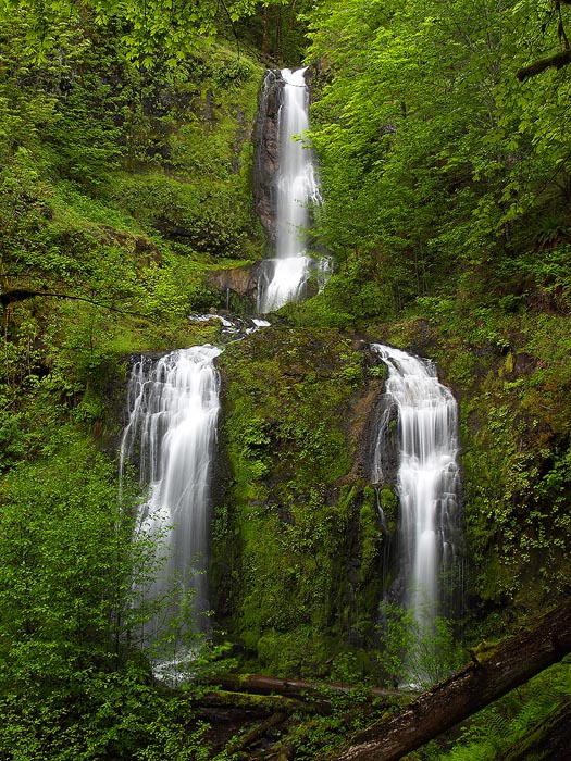
Stafford Falls:
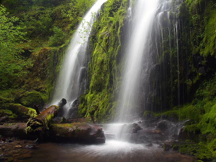
Lower Tier up-close:
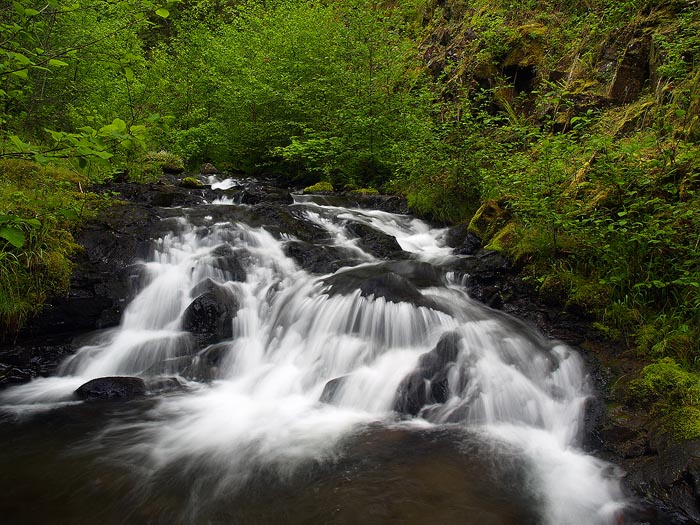
Stafford Creek en route to the falls:
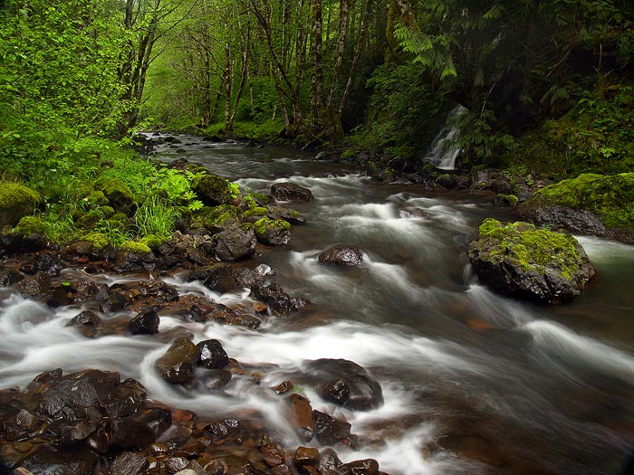
Where Stafford Creek meets the Wilson:
Beautiful area in there, if you can dodge the logging show!
Tom
Stafford Falls:
Lower Tier up-close:
Stafford Creek en route to the falls:
Where Stafford Creek meets the Wilson:
Beautiful area in there, if you can dodge the logging show!
Tom
Re: Wilson River Trail: the road to Idiotville
@Splintercat: Stafford Falls is beautiful - at least your photos make it so! I had never heard of them and looked them up on the NW Waterfall Survey: I guess you are the one with the proposal to name them after OR's greatest poet - great choice!
I can't imagine trying to ford the Devil's Fork at this time of year, though . . .
General plans for the WRT have it connecting with the Storey Burn Trail on the east end (which means you'll then be able to hike the entire Gales Creek Trail as an extension - as far as Reeher's Camp) and the Vanderzanden boat launch on the west end. It's inching along, but slowly because of state budget issues. Probably the next thing is to get a footbridge over Elk Creek. Then I imagine the route will go from Tailgate Point down the ridge between the Idiot Creek Loop Road and the Devil's Fork (too many clear cuts farther from the river) to cross Idiot Creek at the road bridge.