Gnarl Ridge from Cloud Cap (Sep 7)

This forum is used to share your experiences out on the trails.
User avatar
Splintercat
Posts: 8334
Joined: May 28th, 2008, 10:03 pm
Location: Portland
Contact:

Gnarl Ridge from Cloud Cap (Sep 7)

Post by Splintercat » September 11th, 2014, 7:40 pm

Had a great day with the legendary (and Portland Hikers founder) Jeff Statt and friends on the east side of Mount Hood on Sunday. The skies were pretty smokey, and there were even a few late season flies biting, but that didn't take the shine off what is always a really unique hike. If you haven't done it, the route circles south around the base of Cooper Spur, with the mountain almost disappearing at one point -- but then reappearing in what seems to be a completely different form than the horn-shaped Cloud Cap view, with the awesome, broad east face unfolding as you reach Gnarl Ridge. It's quite dramatic!

The Timberline Trail was in great shape, and we passed a few hikers -- though a fraction of the hordes that we could see climbing Cooper Spur (like tiny ants). Very much a solitude option on a busy Sunday on Mount Hood.

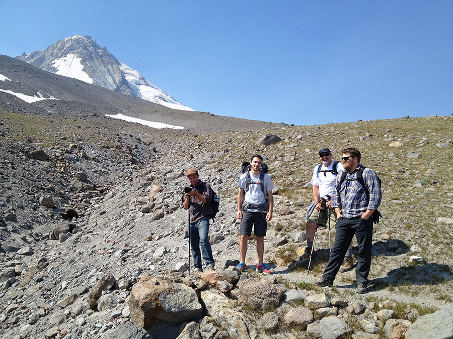
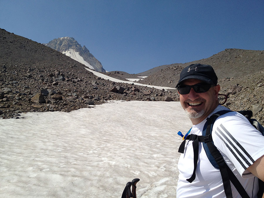
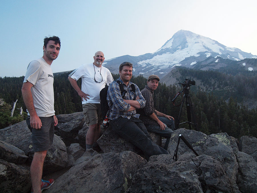
Some pics from the trip, starting with the crew (Eric, Tony, Jeff & Chris) on the traverse around Cooper Spur:

Image

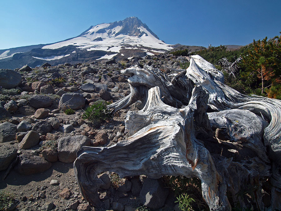
Note the mountain is disappearing behind the spur -- a bit further on, beyond the high point of the TT at 7,000+ feet, the mountain fully disappears as you cross a series of permanent snowfields -- one last glimpse of the "Cloud Cap" profile:

Image

Whitebark alley on Gnarl Ridge, looking toward smoke and Lamberson Butte:

Image

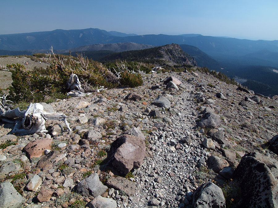
Looking the other way from Gnarl Ridge:

Image

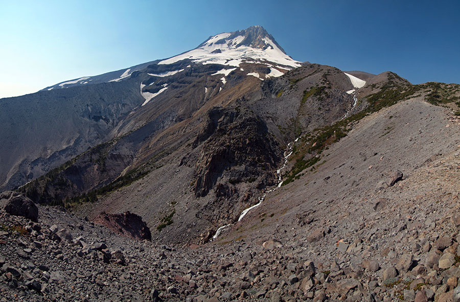
This is a 3-image photo merge using an 11mm wide angle lens -- always an awesome view from the top of Gnarl Ridge!

Image

The crew back at Cloud Cap -- we were a day early for the Super Moon, but did stay to capture the sunset from the overlook near the inn:

Image

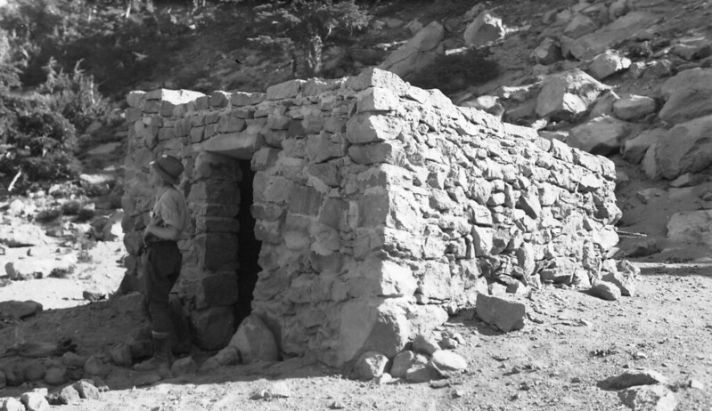
...and a bit of trivia from Cloud Cap Inn: this rock has a carved 6000' elevation marker on it, but has anyone deciphered the carved letters below? I see a "PAP" an "8" and a "4", but can't make out much more:

Image

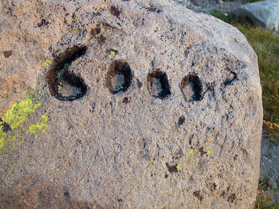
With the Cloud Cap Inn dating to 1889, these could be years from the early history of the lodge, perhaps..?

Great day on the mountain, as always!

Tom :)

User avatar
Rustygoat
Posts: 507
Joined: August 27th, 2012, 2:28 pm
Location: SE Portland

Re: Gnarl Ridge from Cloud Cap (Sep 7)

Post by Rustygoat » September 12th, 2014, 4:02 pm

Nice Tom, this is one of the few parts of the Timberline Trail that I have yet to do this summer. I wasn't sure If I was going to hike up from below or take the route you did. I read that there is the remains of an old shelter up on the ridge. Did you run across it or do you know if it is further down the ridge? I like the Newton creek picture giving perspective of the upper portion of the creek as well as the Newton-Clark Moraine. Someone would have to be crazy to climb that thing! ;) :lol: Thanks for sharing Tom! :)
Tim

Chasing waterfalls can be addictive.
NW Off-trail Waterfalls -Facebook Group

User avatar
Splintercat
Posts: 8334
Joined: May 28th, 2008, 10:03 pm
Location: Portland
Contact:

Re: Gnarl Ridge from Cloud Cap (Sep 7)

Post by Splintercat » September 12th, 2014, 8:01 pm

Tim, my hiking partners got the full story about the GONZO waterfall hunters who had visited both the Gnarl and Lamberson Branch waterfalls -- since we passed above all of that terrain! :)
I read that there is the remains of an old shelter up on the ridge. Did you run across it or do you know if it is further down the ridge?
It is -- just below the ridge line on the north shoulder of Lamberson Butte. It's plainly visible from the trail, if you look. I posted this awhile back, but there's an old map tacked on the wall inside Cloud Cap Inn that shows an intriguing "grave" near the ruins -- check it out:

Image

Kinda on my checklist, but I'll save that for next time I approach Gnarl Ridge from the Elk Meadows side.

Tom :)

User avatar
Jane
Posts: 3639
Joined: May 28th, 2008, 10:03 pm

Re: Gnarl Ridge from Cloud Cap (Sep 7)

Post by Jane » September 14th, 2014, 8:05 am

hi guys:) I did the Gnarl Ridge hike Wednesday with the Mazamas, we added in meandering around Elk Meadows on the way down. There isn't much left of the old shelter, but yes it is on the left side of the trail a short ways before you get to "whitebark alley" as Tom called it ;)
Gnarl Ridge 9-10-14 stone shelter remains.jpg
Gnarl Ridge 9-10-14 JG view of Mt. Hood.jpg
Elk Meadows 9-10-14 group view from shelter.jpg

User avatar
Splintercat
Posts: 8334
Joined: May 28th, 2008, 10:03 pm
Location: Portland
Contact:

Re: Gnarl Ridge from Cloud Cap (Sep 7)

Post by Splintercat » September 14th, 2014, 9:01 am

Nice, Jane! Good to hear from you, too -- glad you've found time to be out on the trail this summer!

Tom :)

User avatar
mjuliana
Posts: 397
Joined: July 23rd, 2012, 2:32 pm

Re: Gnarl Ridge from Cloud Cap (Sep 7)

Post by mjuliana » September 14th, 2014, 7:45 pm

Gnarl Ridge is such a great place up on the mountain. It's just magical to sit up there. Thanks for sharing the pictures.
Thanks,
Mike J

justpeachy
Posts: 3069
Joined: May 28th, 2008, 10:03 pm
Location: Portland, OR
Contact:

Re: Gnarl Ridge from Cloud Cap (Sep 7)

Post by justpeachy » September 14th, 2014, 9:36 pm

Nice report! I didn't make it up to that area of the mountain this summer and not sure I will before winter. Sigh, maybe next year.

BTW, this undated photo from the Forest Service shows what the Gnarl Ridge shelter used to look like:

Image

User avatar
Splintercat
Posts: 8334
Joined: May 28th, 2008, 10:03 pm
Location: Portland
Contact:

Re: Gnarl Ridge from Cloud Cap (Sep 7)

Post by Splintercat » September 16th, 2014, 7:37 pm

Nice photo, Cheryl! I'm gonna guess 1930s based on the USFS ranger uniform -- and possibly a photo documenting a brand new shelter, as constructed by the CCC..? Thanks for sharing!

Tom :)

User avatar
retired jerry
Posts: 14426
Joined: May 28th, 2008, 10:03 pm

Re: Gnarl Ridge from Cloud Cap (Sep 7)

Post by retired jerry » September 17th, 2014, 6:10 am

I was there Sept 11

Looked for that spring but it was dry

I saw a nearby stream but it was just barely wet

User avatar
Splintercat
Posts: 8334
Joined: May 28th, 2008, 10:03 pm
Location: Portland
Contact:

Re: Gnarl Ridge from Cloud Cap (Sep 7)

Post by Splintercat » September 17th, 2014, 6:21 am

I noticed that, Jerry - the entire snowfield in that draw was gone! There are a couple reliable snowmelt streams about 1/2 mile north (and uphill) on the TT, but not as convenient for camping at Gnarl Rdge.

Tom

Post Reply