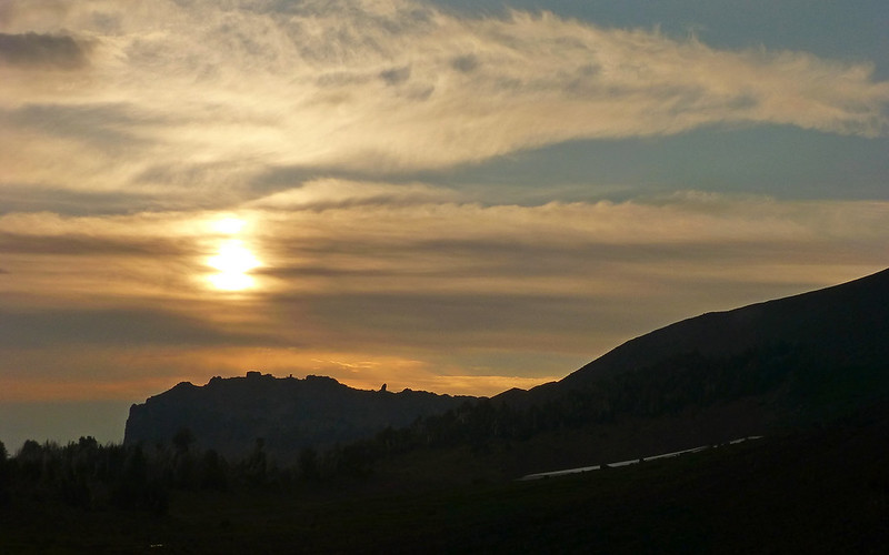
So, buckle in. Here's what's turning out to be the real shocker in all this. Even I find it really difficult to imagine, but... It's been fully Thirty-One Years (31!) since I'd done any real backpacking! Obviously, way past the point of needing to correct that omission. And I owe Jim a lot for not only coming up with the rough plan, but also for putting up with all my newb issues.

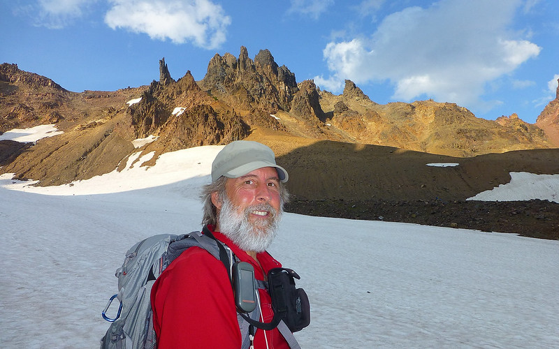
The ravages of age. My last backpacking trip (left), prior to this week (right).
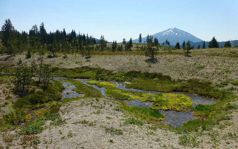
I picked Jim up in Beaverton at 6:00am on Sunday morning, and we arrived at the Tam McArthur Rim trailhead about 9:30am. It's a long haul! The weather was perfect, though there was a slight wafting of smoke in the air. Seemed to be mainly from the fires around Mount Jefferson, though some surely drifted in from farther afield. There were a dozen+ cars at the trailhead, and a bit of a clustering around the Wilderness registration kiosk. Mostly local dayhikers. We were off and climbing a bit before 10:00am.
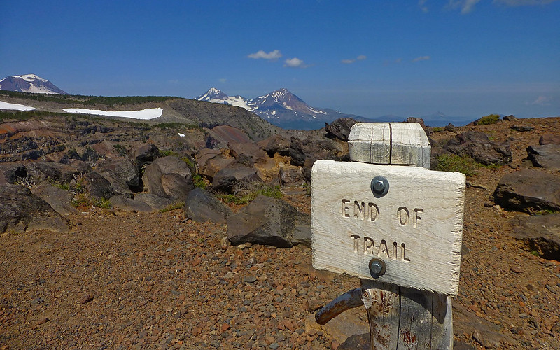
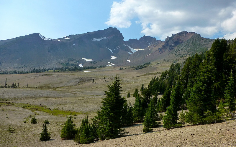
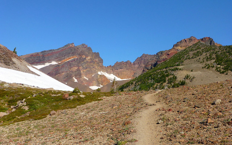
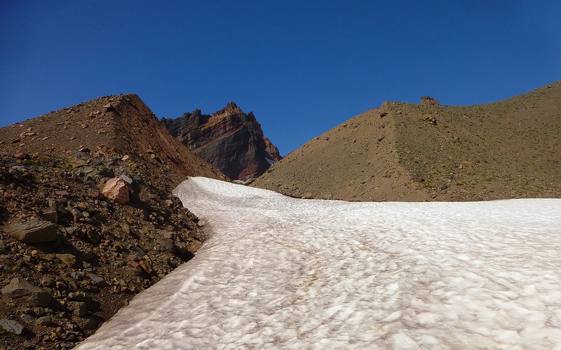
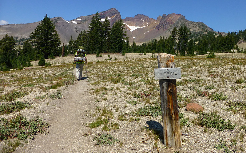
The trail begins at nearly 6600', and climbs gradually to about 7800' in the first few miles. The views open up almost immediately, and soon enough you're above timberline. The trail is quite nice, even after the point at which they say it "ends." Not too far after that, we just traversed cross-country, finding out own way to a nice campspot Jim had used previously at the foot of Ball Butte.
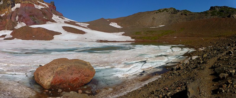
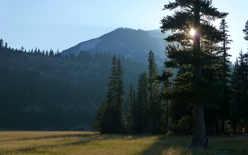
Trailhead on the right, Tam McArthur Rim on the left. Beach in foreground was a treat at end of loop!
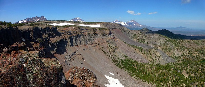
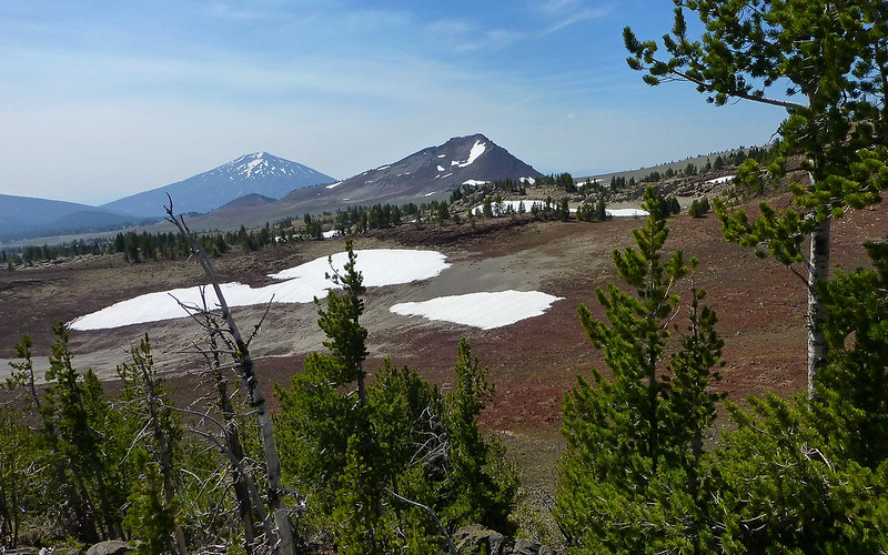
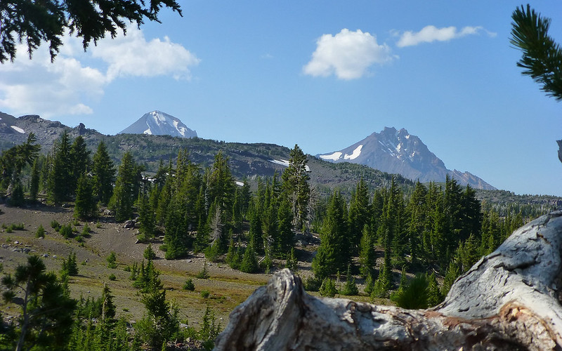
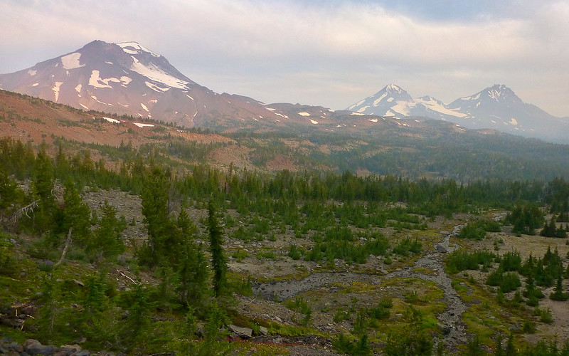
The first views of Broken Top appear quickly. As other reports mention, it is far too easy to take way too many photos of this volcano!
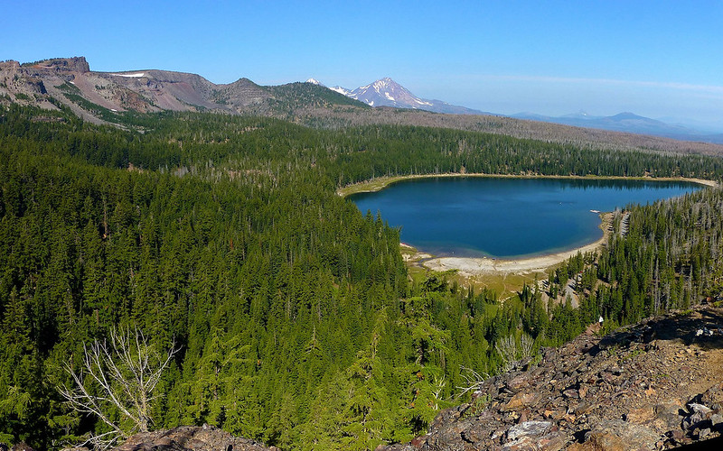
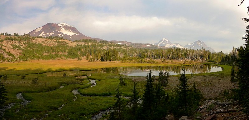
Looking over the Rim towards Little Three Creeks Lake and the 2012 Pole Creek Burn. We'll return through that area in a couple days.
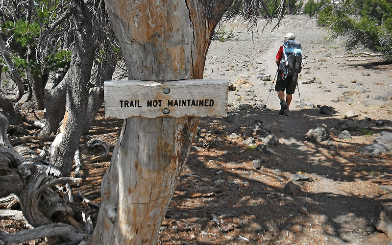
The first of numerous silly signs we saw. Don't believe everything you read.
At what seems to be the official viewpoint, the views are indeed nice. And there are plenty of people to view them!
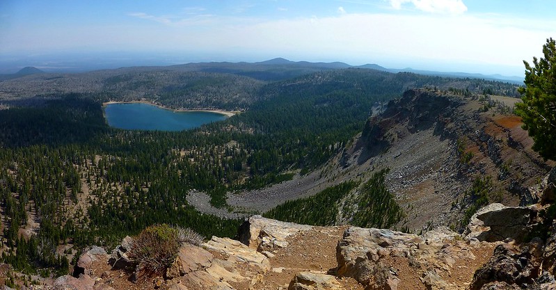
Looking back down the Rim towards our starting point at Three Creeks Lake.
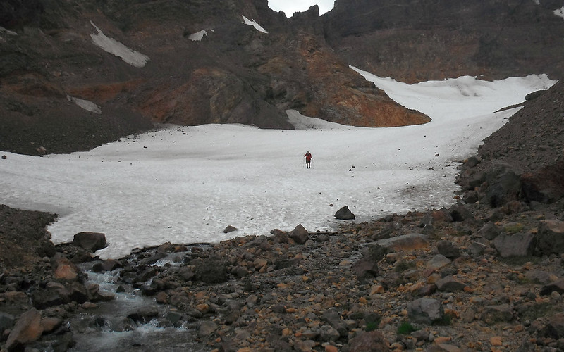
Moving on... No real need for a trail at this point. It's wide-open country!
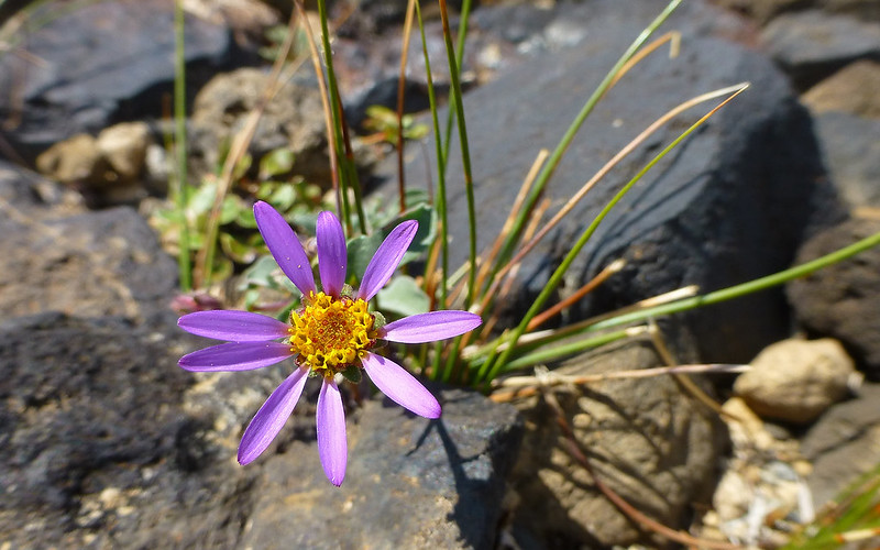
Not much in the way of flowers, but occasional eye-candy.

Dare ya to take just one (shot of Broken Top!). Impossible.
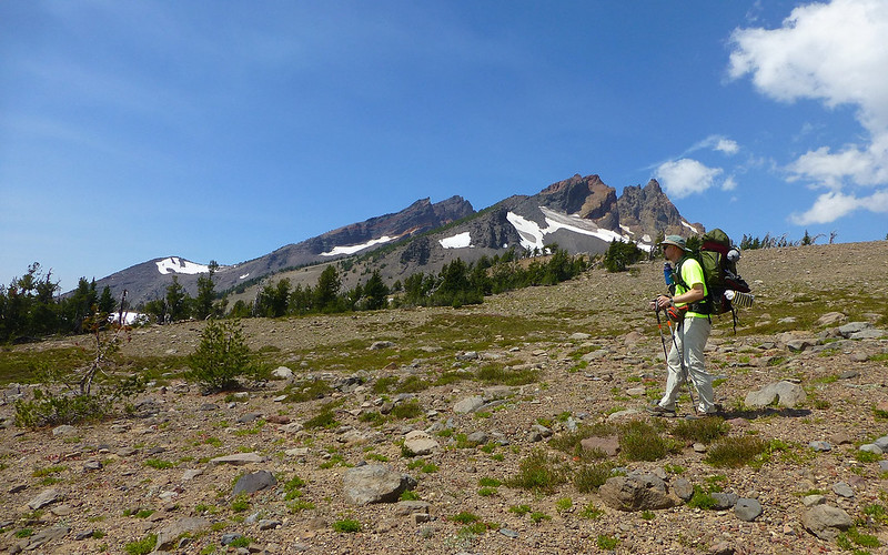
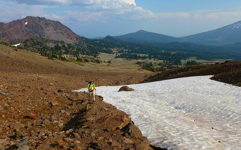
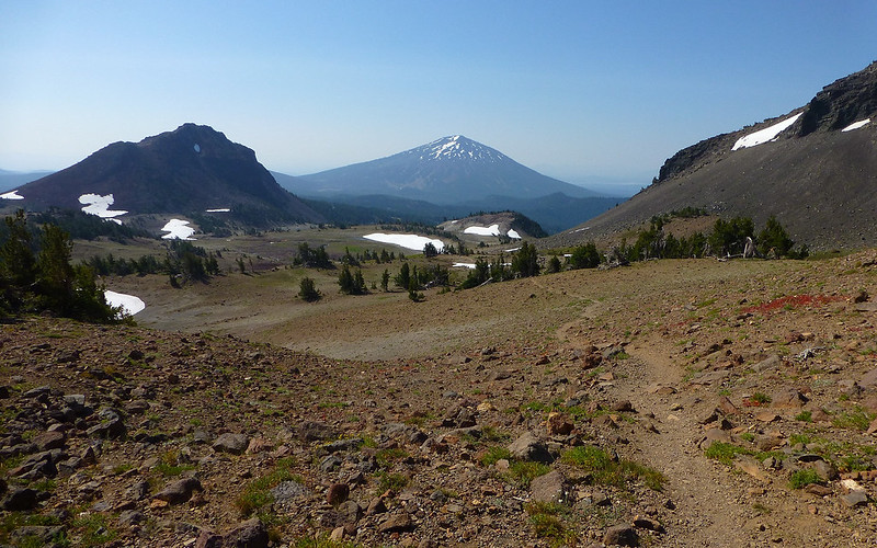
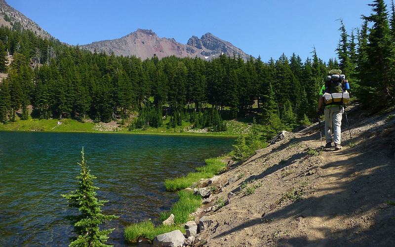
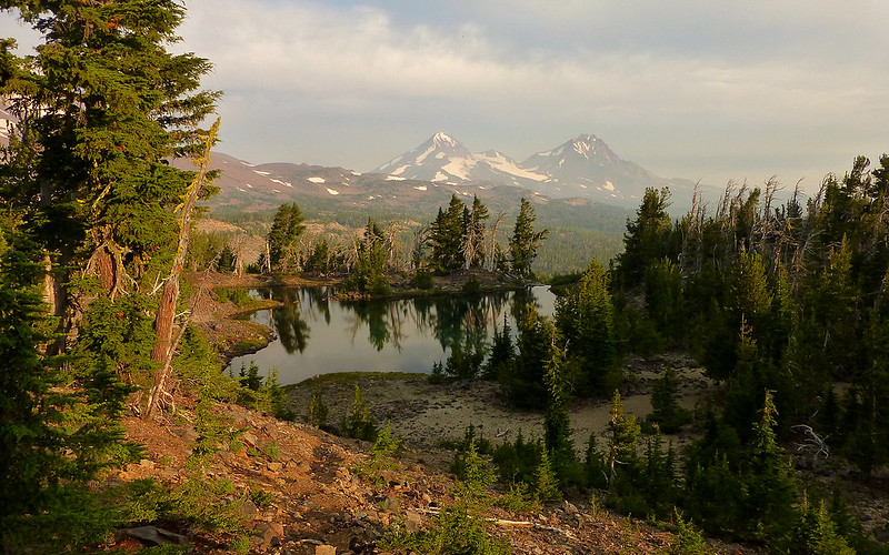
Soon enough, we could see Ball Butte (and Mt. Bachelor) ahead. We just contoured in that general direction.
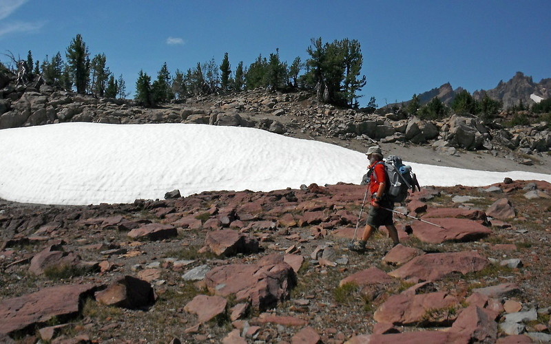
The goin' was easy.
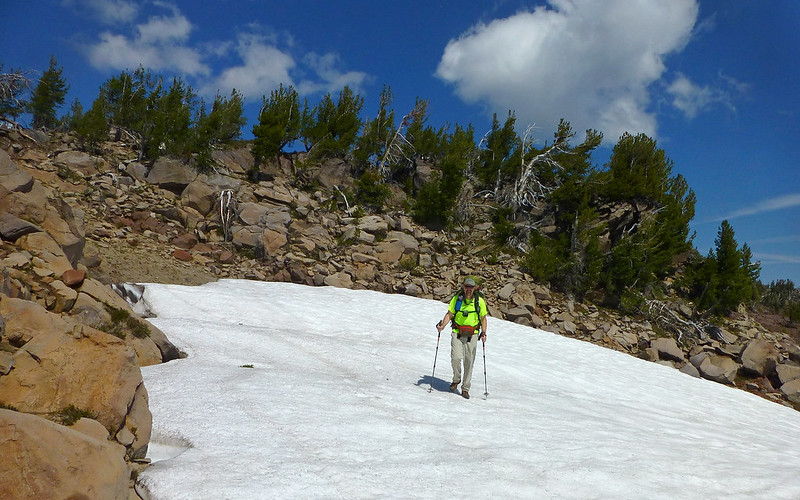
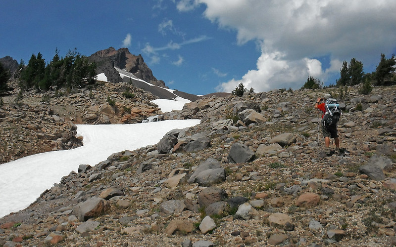
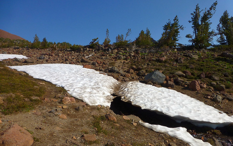
There were still a few snowfields and rocky jumbles to navigate, but nothing at all tricky.
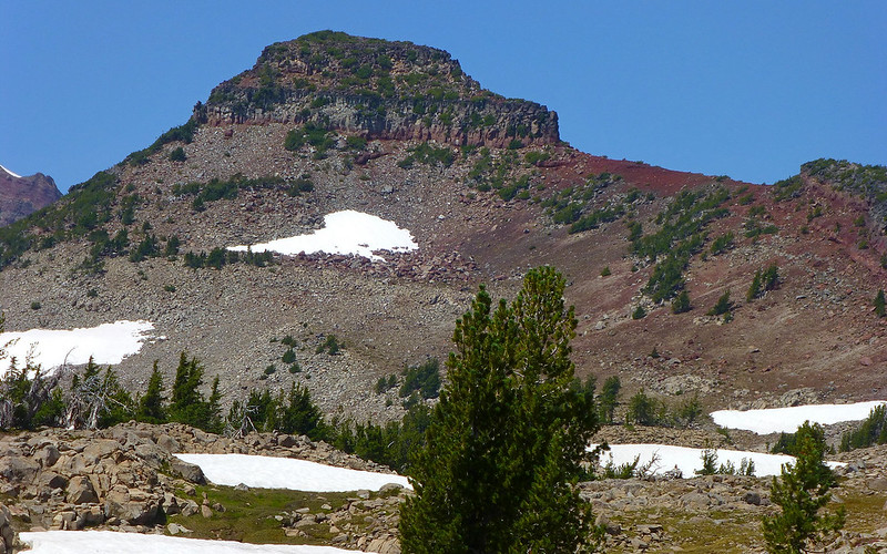
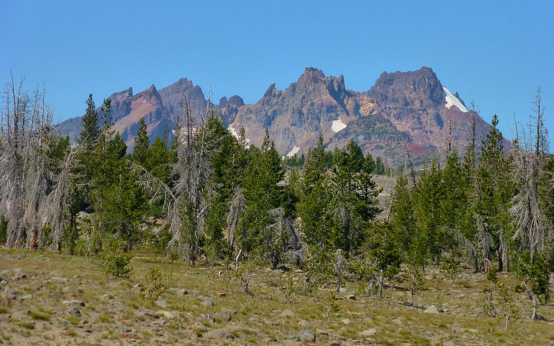
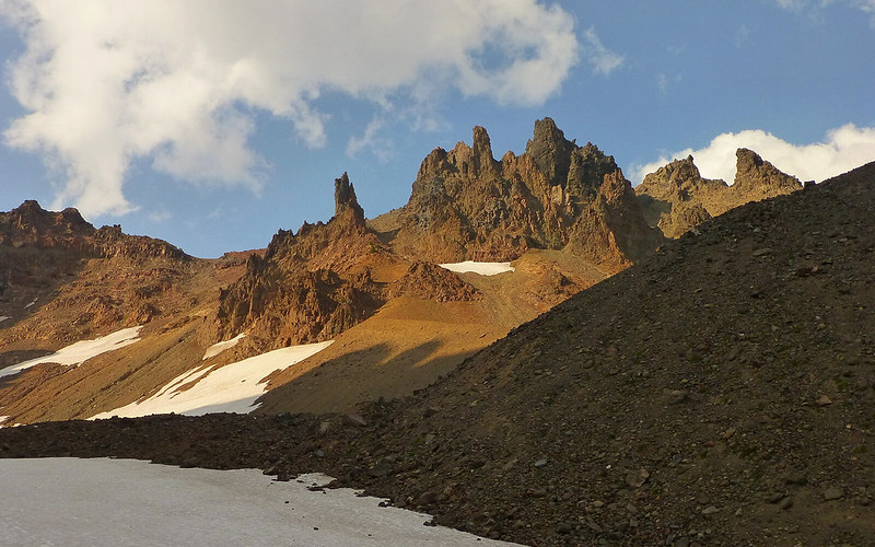
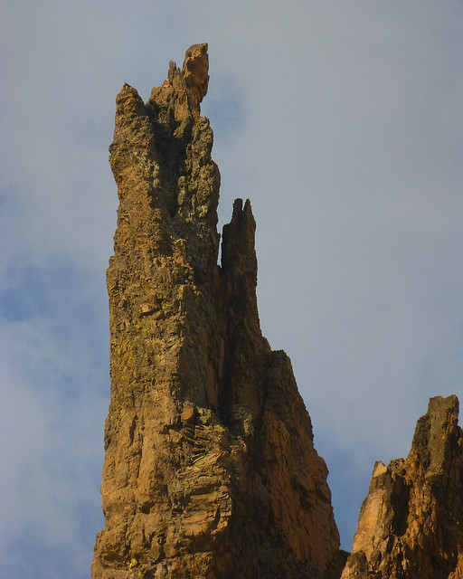
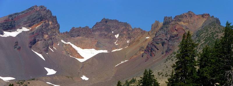
Broken Hand (what's with that name?) arose prominently to one side of us.
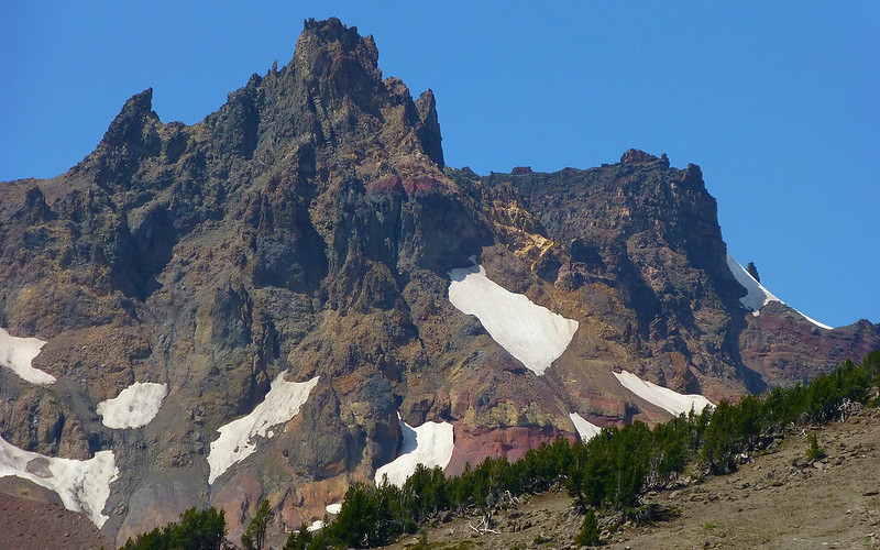
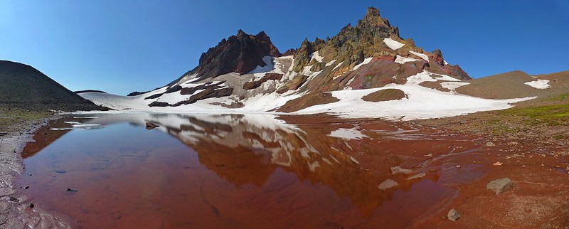
The views of Broken Top were always mesmerizing.
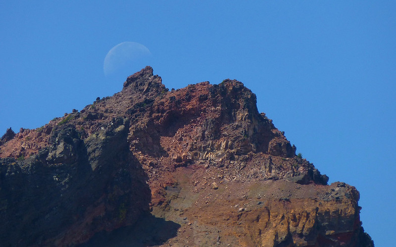
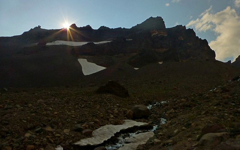
Moonset on the mountain.
"Truckin', got my chips cashed in... Keep truckin', like the do-dah man..."
Hey now! Three days on the trail, and only 750 photos! Wassamatter with that?
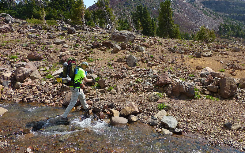
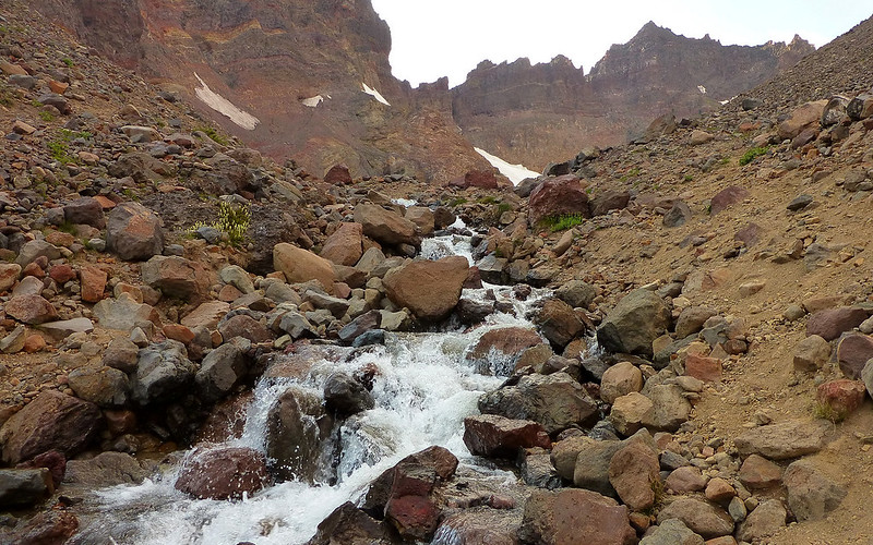
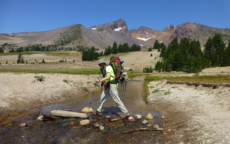
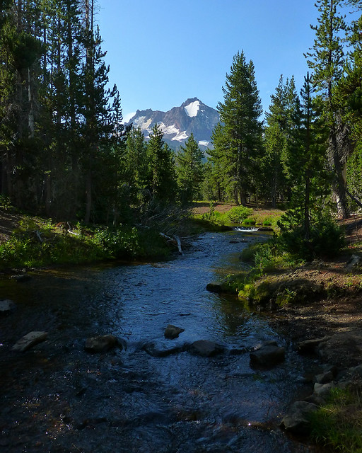
All along the loop, there were random stream crossings. None proved challenging at all.
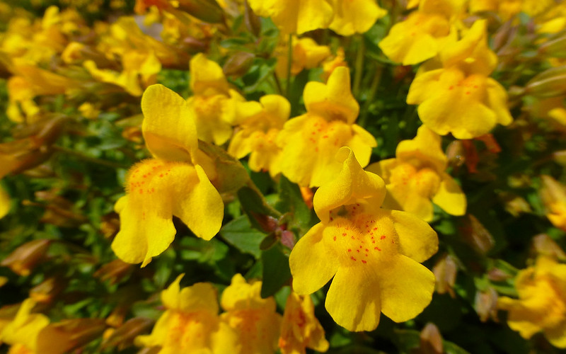
More eye-candy. Some sort of orchid, maybe? EDIT: Monkey Flower, (Mimulus spp.), src: cfm
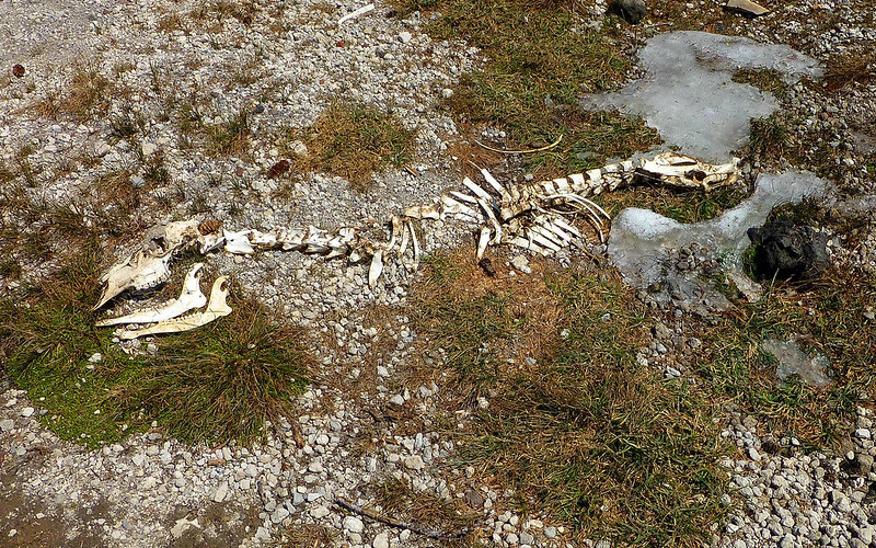
This poor guy seemed to have only just melted-out. Surprising the bones weren't more scattered!
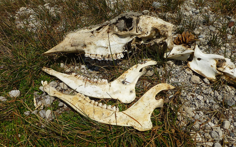
Deer or Elk? We saw tracks of both.
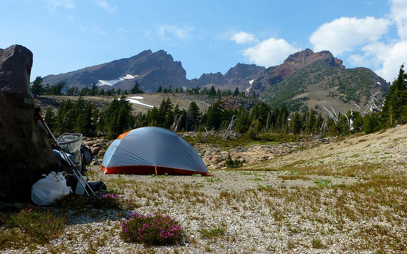
Camp I
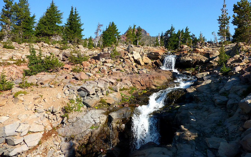
Some years ago, Jim and some buddies had camped right at the base of Ball Butte for a few nights, and he remembered it as a superb site. We pulled right up to it just a bit before 4:00pm, and I had to agree almost immediately. We had a view right up at Broken Top. There was a ripping little stream, with a very scenic waterfall, about 100 yards away. And even closer, a smaller stream with a drop-dead beautiful water feature - a rock bench right were it finished tumbling down a series of stairsteps and over a perch. We were perhaps 200 yards (and two stream crossings) from the main trail up to No Name Lake. The ground was a soft, forgiving pumice. Wow! I was jazzed.
Room with a view!
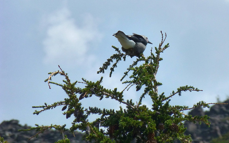
These jays and tons of hummingbirds kept us constant company.
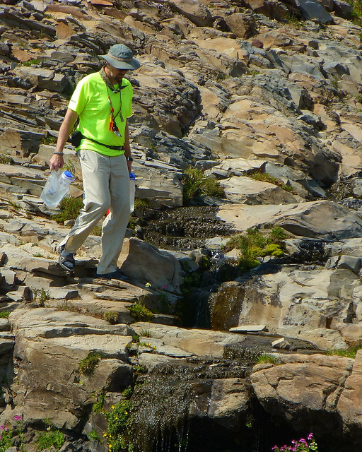
Jim crossing the smaller water feature, with six liters of fresh water from the larger stream.
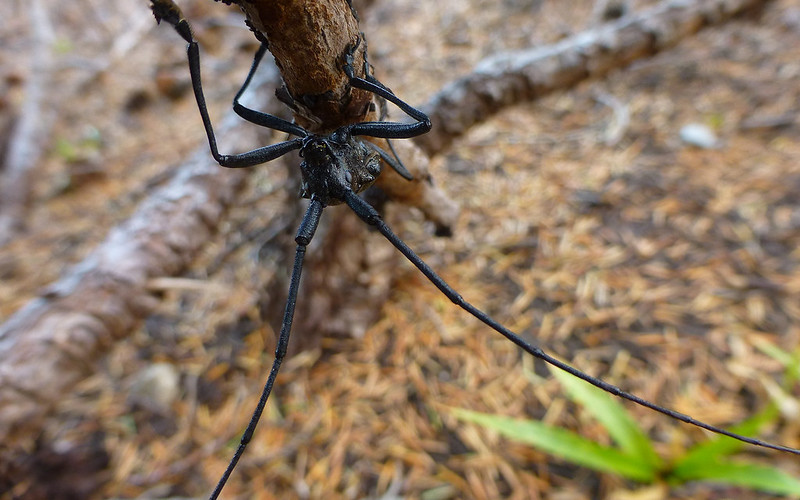
Desert life is always interesting. There were also lots of giant ants in the woody areas around our site.
As we established camp, we chewed over all the possibilities to explore in our immediate area. The decision was to take a quick run up into the crater of Broken Top before dinner, as Jim recalled that being one that took a bit more time than others. Then, in the morning, going for another quick jaunt up to No Name Lake.
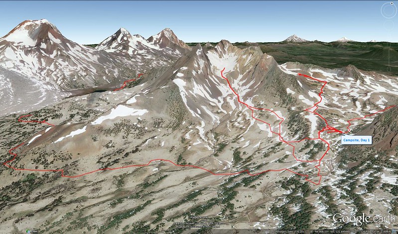
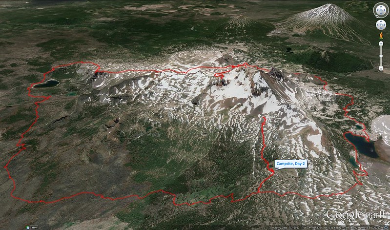
Aerial perspective on our campsite and explorations thereabouts.
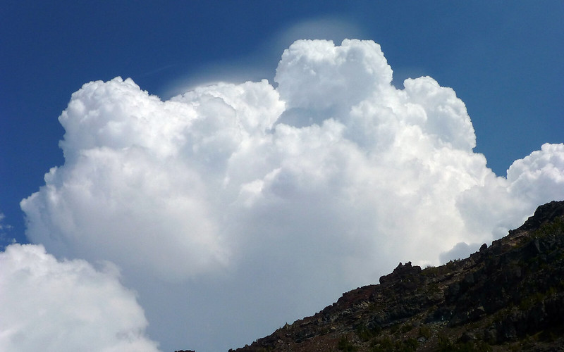
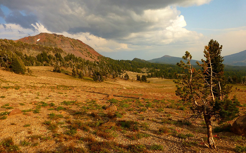
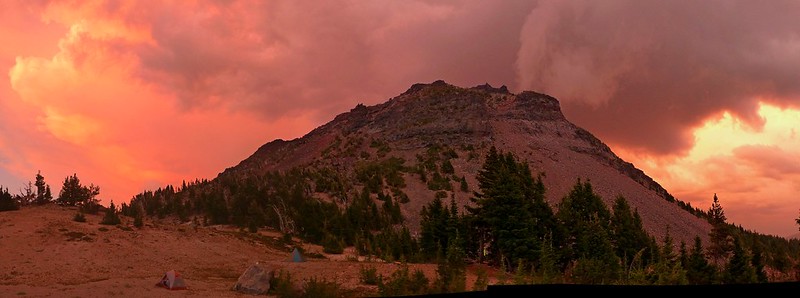
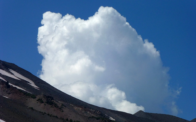
I noticed, but didn't think much of, this rapidly growing cloud over Ball Butte.
Crossing a little ridge 1/4-mile from our site, we hit this broad plain leading directly to the volcano's crater.
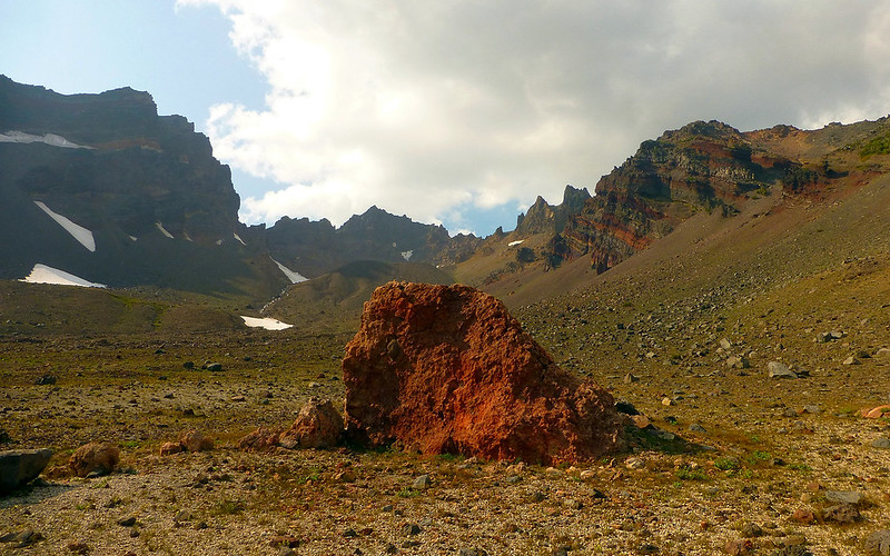
Distances were deceiving, but progress was swift. This lavabomb was huge!
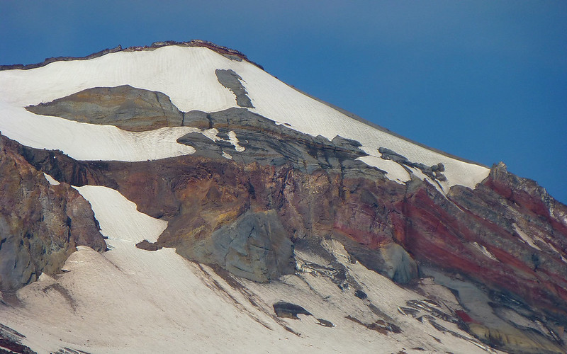
The low-angled, smoke-filtered sunlight on the crater walls provided stunning visuals!
In probably under 1/2-hour, we were at the snowfield right below the outflow waterfall.
The sun was sinking behind the high crater walls fast!
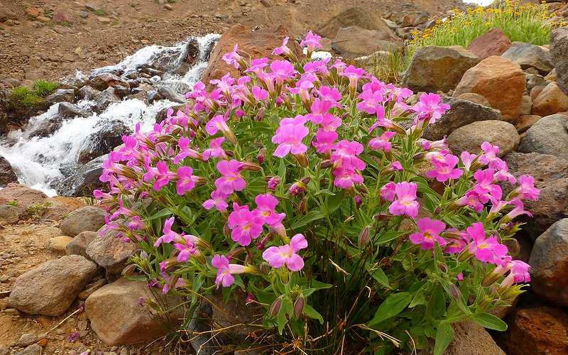
Where there was water, there were flowers.
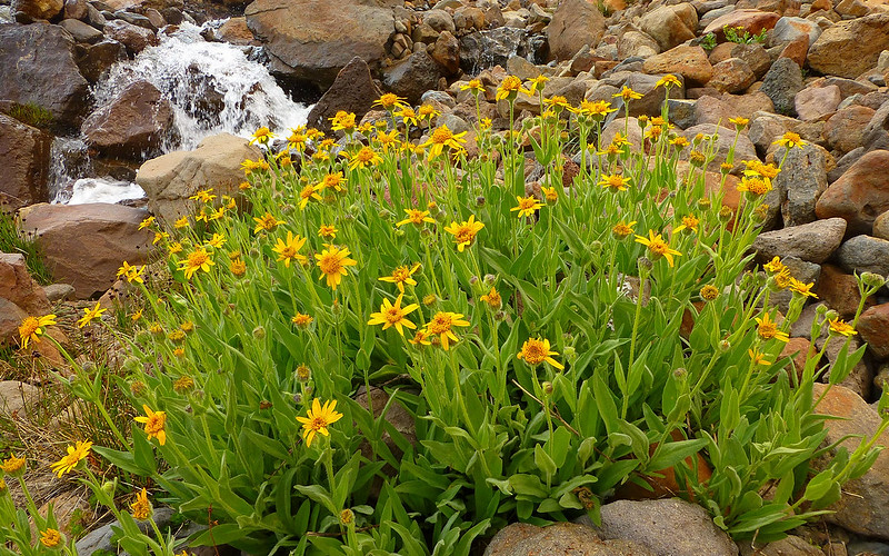
Some of the larger clumps were right along streams near Camp I.
It was a bit of a scramble up alongside the waterfall. Fun, with the goal always in sight.
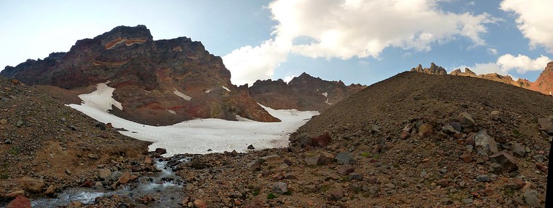
Finally, we reached the foot of the Crook Glacier within the crater.
Far too many pictures were taken.
And why not?!?
I continued on up nearly 2/3 of the way to the far rim. Rockfalls were near constant in numerous directions.
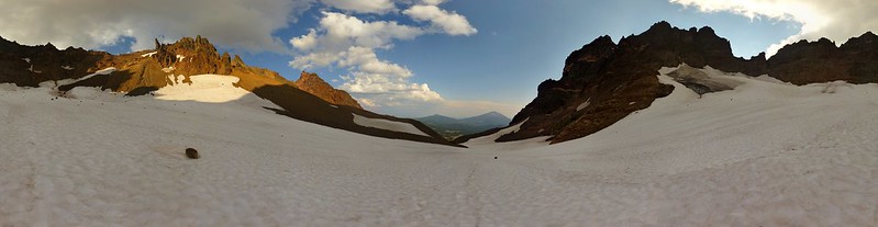
46-image 360° panorama inside the Broken Top crater. 100-megapixel interactive Photosynth of same view.
A mountain with attitude!
Jogging back down off the glacier.
As we made our way back to camp, the clouds behind Ball Butte took on a bit more ominous look.
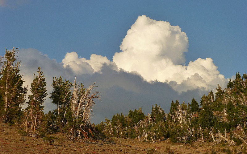
For that matter, cumulo-activity seemed to be all around right about now.
We got back to camp, settled in, and fired up the stove to "cook" some water for our dinners. As we did, the rumbling behind Ball Butte began. Then random flashes of light! Life was getting very interesting about now!
Our dinner view of Ball Butte.
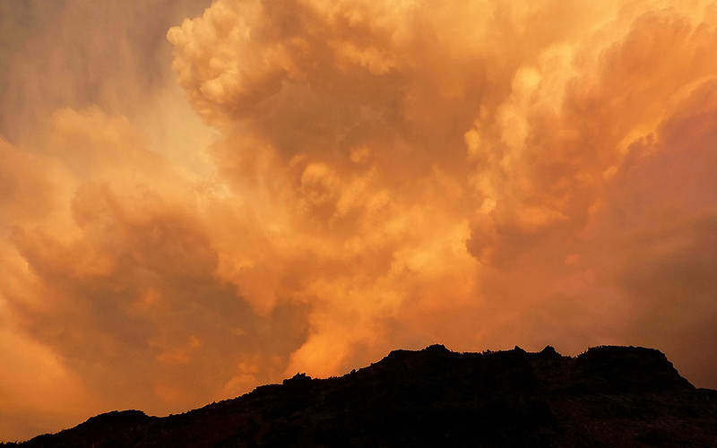
Red sky at night, backpacker's delight? The sky had turned scarlet red 15 minutes later. See our tents?
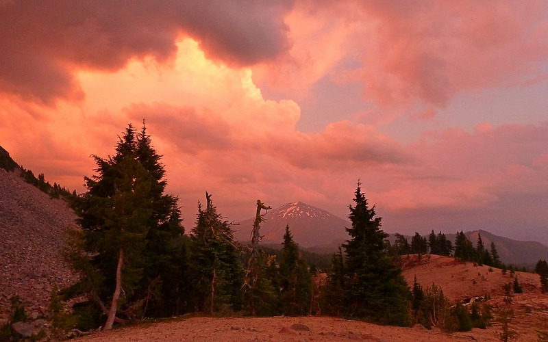
Looking over at Mount Bachelor. (Which, fwiw, offered us 4G service while in camp!)
It began raining a bit, and the thunder and lightning became much more frequent as darkness fell. We decided to call it a night. As it turned out, the rain never got out of hand. I actually wished for more, to really test the new tent. Some of the lightning was very close though, at times being followed in less than two seconds by its thunder. By 2:00am, the skies were crystal clear again, and the stars seemingly infinite in number.
Day 2
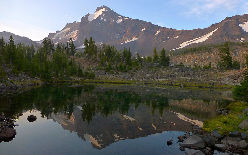
Being as this was Jim's second trip here, he decided to stay in camp this morning and just relax a bit, while I had an overwhelming urge to get on up to No Name Lake. I'm not sure, if I only had to pick one, whether I'd go with the lake or the crater. They're both stunning!
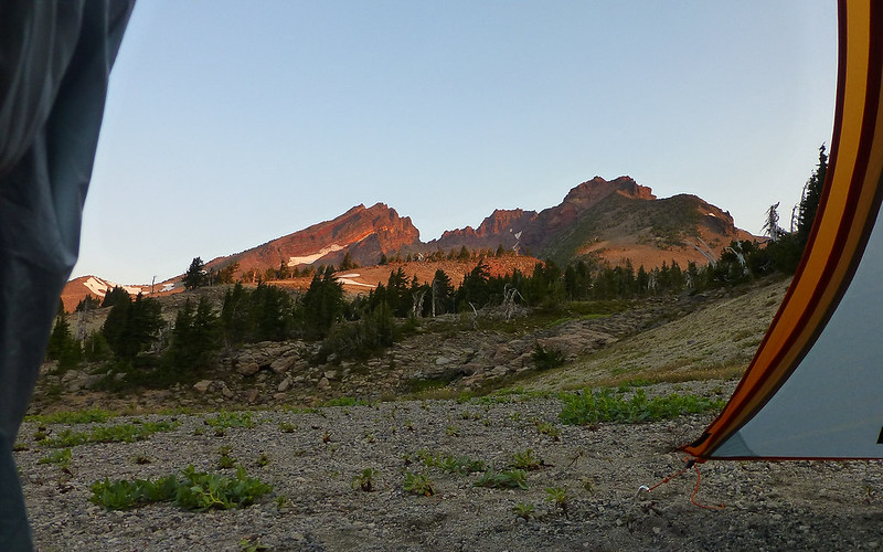
Good morning, Broken Top!
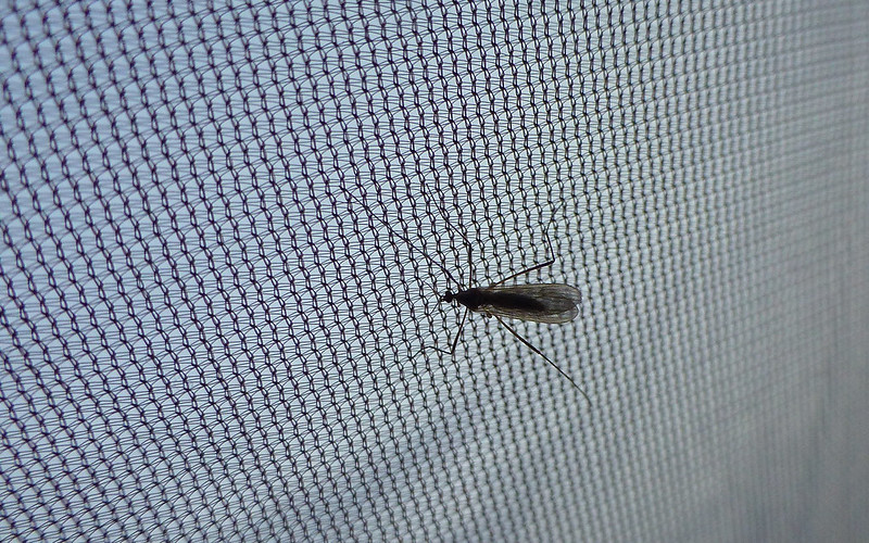
Darn near the only skeeter seen on the entire trip. Easily dispatched.
The morning colors on Broken Top were every bit as lovely as last night's evening shades.
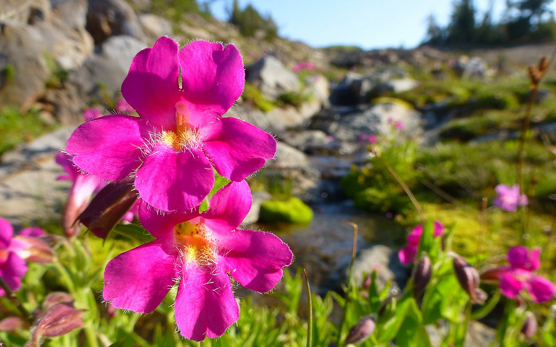
The little creek beside our campsite provided for numerous wildflower clusters. EDIT: Monkey Flower, (Mimulus spp.), src: cfm
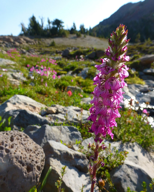
No idea what this is? EDIT: Lousewort (Pedicularis), src: cfm
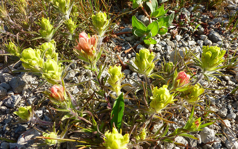
Interesting multi-colored cluster of dwarf paintbrush.
The larger waterfalls just beyond offered all our fresh drinking water.
We'd seen dozens of folks using the trail back and forth to No Name Lake. Crossing the saddle to left led to the crater.
Bad idea to just blindly follow the footsteps here!
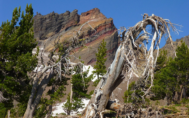
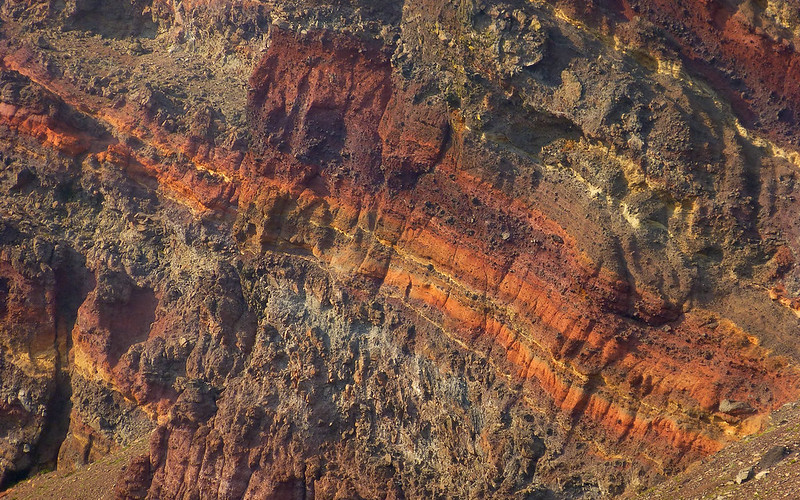
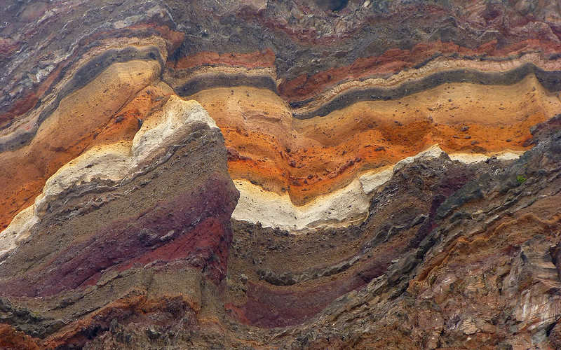
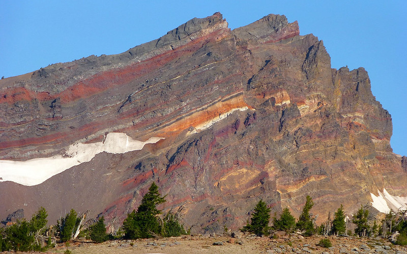
Those layers! Oooh la la!
Eventually the trail became a large snowfield, under which flowed the outlet stream.
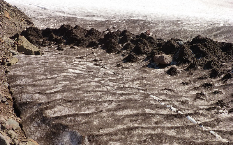
Wasn't at all sure what to make of these molehill-like sand formations on the snowfield. Can anyone enlighten me?
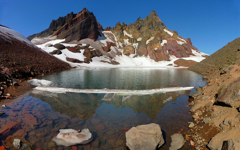
And then... There it was! Wow...
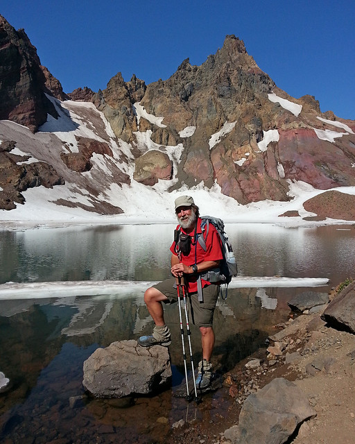
Met a woman there who insisted on taking my picture, "So you can post it to Facebook!" Okay, wth?
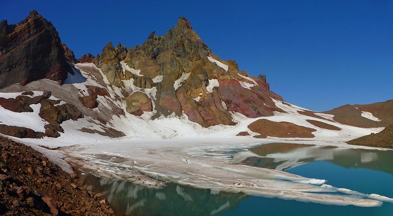
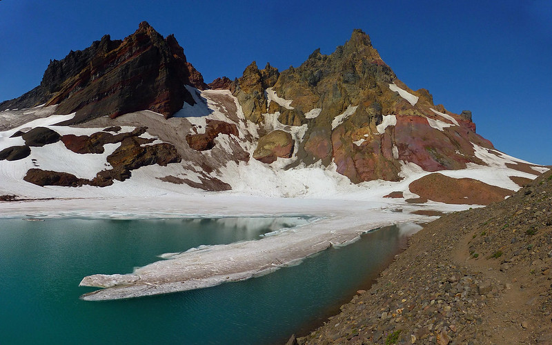
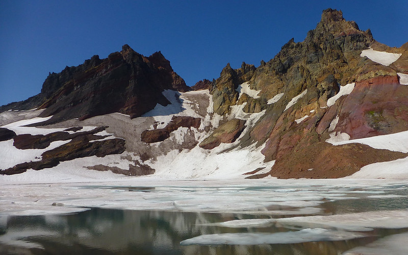
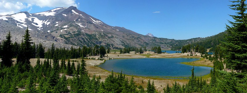
No Name Lake
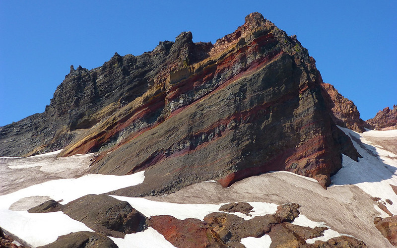
Incredible layering on Broken Top.
The trail continued along the right shore for quite a ways.
In fact, it went right up that saddle in the middle. Wish I'd have gone that extra 1/4-mile now for the Sisters view.
Darn good thing film is so cheap nowadays!
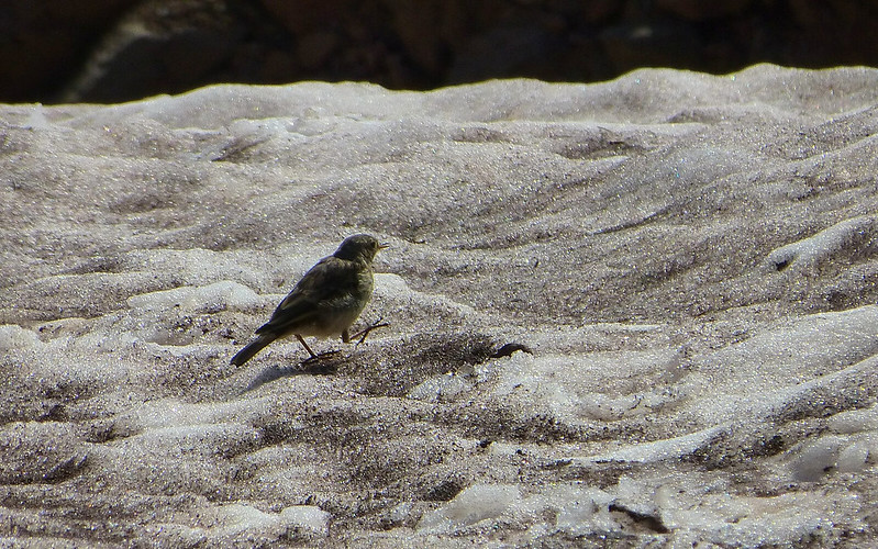
There were bunches of these guys somehow making a living on the snowfields.
Time to hustle back to camp, pack up, and move on along!
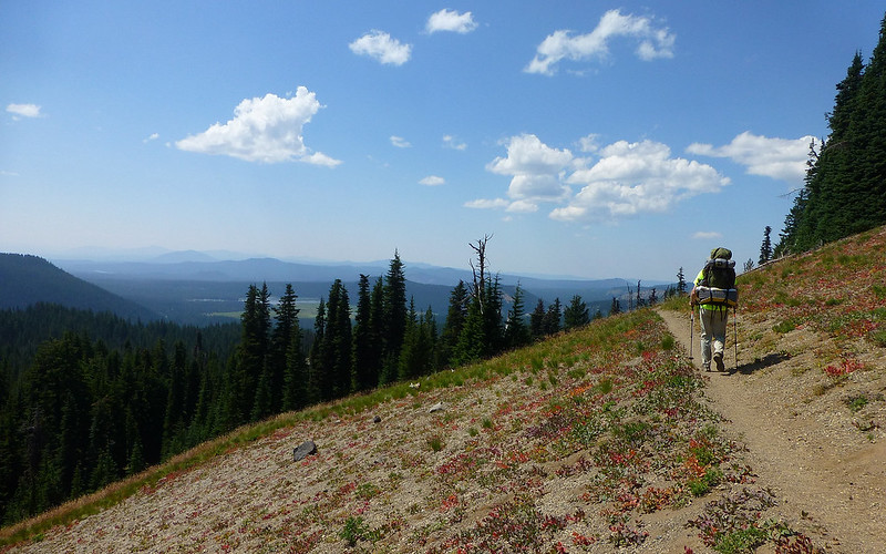
Once back in camp, I quickly broke down my tent, and stuffed my pack, and we were off. We planned to be in the Green Lakes area around lunch time, and settling into a new campsite at Golden Lake a few hours later. Being as the hiking was now entirely on-trail, there wasn't the feeling of serendipity we'd had the day before, as we traveled clockwise around our loop more on auto-pilot mode.
Looking directly into the crater of Broken Top.
Yep, that settles it! We're back on the trail, again!
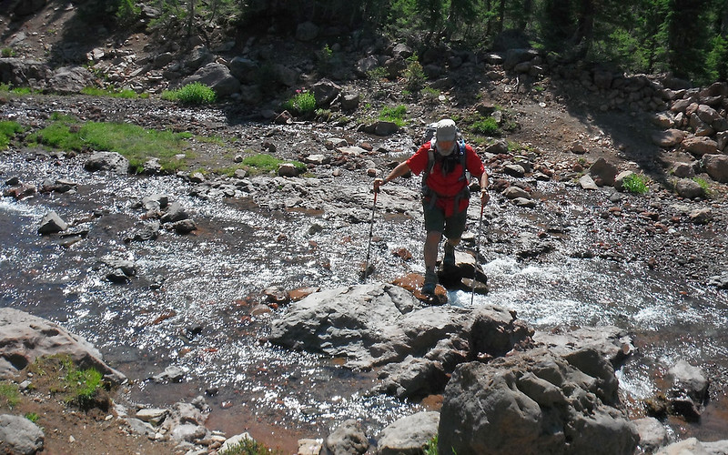
We encountered numerous little non-consequential crossings.
Including this manufactured Crater Creek Ditch, for which an alley had been carved out of the Wilderness Area.
Little springs popped from the ground every here and there.
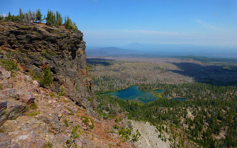
Views to the south were somewhat obscured by haze, but included Sparks Lake and Diamond Peak.
Then a most amazing wildlife sighting was soon to be had! As we crested a small hill, there, lying in wait for us, in the shade, was that most elusive creature of all - a backcountry ranger! I kid you not. First things first, he wanted to see our Wilderness Permit, if you can imagine. Later on, I'd sorely wished I'd asked him, "What if I don't have one?" Instead, I told Jim where he could dig it from my pack. Ranger John was quite pleased that it was actually signed, and urged us to both read it as well.
The good ranger then went on, for probably no less than twenty minutes, about the glories of LNT, and proper human waste disposal, and where fires were not allowed, and how close to the water tents were allowed at various locations throughout the Wilderness, ad nauseum.
He asked about our itinerary. "Where did you learn about that loop?" "Portland Hikers!" "Oh." No apparent recognition. He couldn't believe we were doing it in "only three days!" He was concerned about us traveling through the burn. We told him about our single-day loop around Three Finger Jack. "Where did you learn about that?" (again.)
Some deep sighs later, "Well, it's a free country! That's what freedom of the press gets ya." Clearly, he was not a fan of off-trail travel! Nice enough guy, but perhaps had spent too much time alone in the woods, and feeling more than bit possessive of the glory that surrounded him.
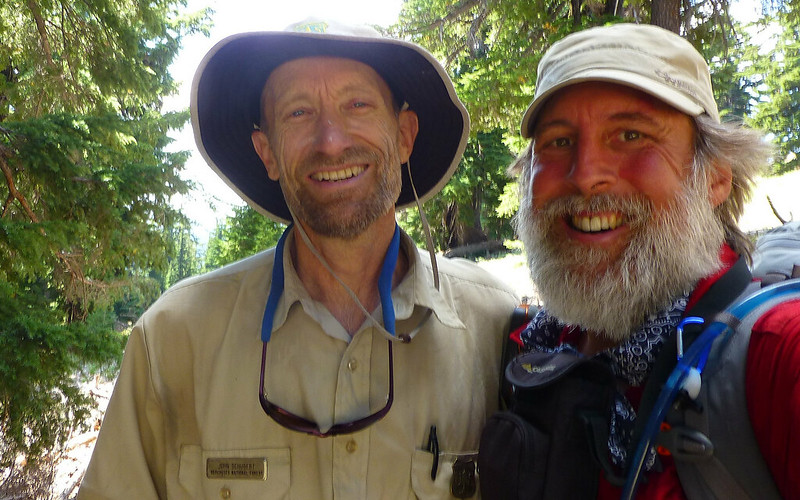
My new bud, Ranger John.
Shortly after our "wildlife" encounter, about 2:00pm, we came upon Green Lakes. Beautiful!
Found a most excellent lunchspot, looking right up at South Sister, and probably spent 45 minutes here just relaxing.
As we lunched, we noted the growing cumulo-clouds popping up on every side of South Sister.
All too soon, it was time to get moving again. I admit, I wanted to make camp before more thunderboomers hit.
Rapidly, the clouds grew over South Sister, and thunder started echoing off the hillsides.
Getting up out of Green Lakes basin required a bit of a climb, after which Middle and North Sisters came into view.
Camp II
Our choices seemed to be to camp at either Golden Lake or Park Meadow. I was rooting for the lake, and Jim graciously agreed. Been in lots of meadows, but there's something more special about a lake, at least to me. There's a junction off the main trail that's both easily missed and easily mistaken as the main trail itself! We met parties who'd done both. One other guy did come setup camp later this evening, and asked us, "What lake is this?" He had no idea he was off the main trail. Kinda crazy. Anyway, this spot was just gorgeous. (I lack for words, sorry.)
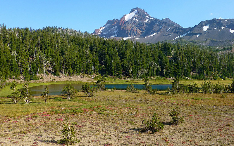
A little before 5:00pm, we pulled up to Golden Lake. No one else was there.
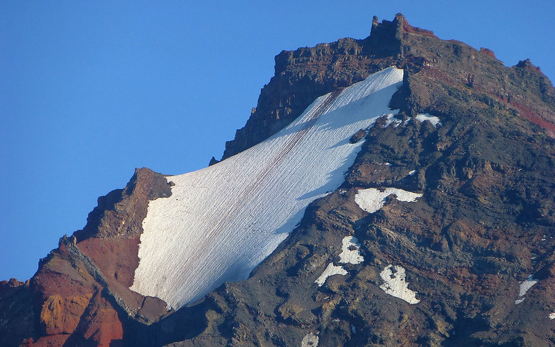
Magnificent snowfield high atop Broken Top.
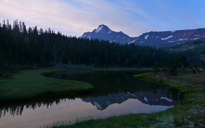
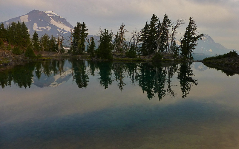
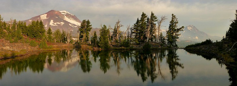
Broken Top reflecting in the sinewy outlet of Golden Lake.
The sun traced the northern slope of South Sister as it descended towards the horizon.
The area around Camp II.
We were both a little bit beat, to be honest. The thunderstorms that had threatened had somehow vanished without a trace. A nice, warm meal really hit the spot. Afterwards, we just sat around and watched the stars come out. There were a lot of them.
Day 3
The morning was a bit hazy. I awoke before sunrise. Jim's tent was still closed up. So I crawled out in my longjohns and slipped on my flipflops. Thought I'd go take a few shots of sunrise on the mountains all around us. As I wandered around the lake, I saw a trail heading uphill following a little waterfall that's offered us a nice background rumble all night. Miah66 had told me about some tarns up there. How far could they be?
Good morning, Broken Top!
Our campsite is directly up from the lake, below the gap between Middle and North Sisters.
As the sun slowly rose in the east, the landscape to the west took on the quality of a painting.
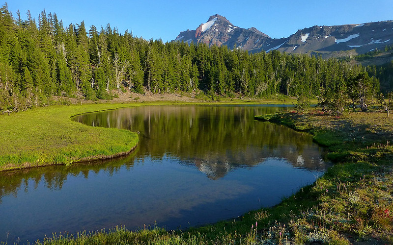
Broken Top reflecting off the first tarn I found. I've lost all track of time and distance already.
Wrapping around the lower tarn, to get a nice view of the Sisters.
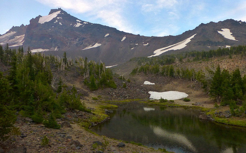
Flipflopping higher and farther, I find another beautiful tarn a bit closer to Broken Top.
Sunrise over Broken Hand. About 1.5 miles and 800' up from camp.
To be sure, "flipflopping" was not a metaphor this morning!

The orange cast of smoke and a low sun offered a surreal feeling to the views as I descended.
I really didn't want to go down. But by now, I was sure Jim was wondering.
Uff-da!
Shuffle-jogging down the mountain in flipflops allowed a few stops for moments like this view of our campsite.
Back at camp, Jim was already half packed up, and a little eager to hit the road. I knew we had a long drive ahead, and didn't want to feel rushed later on. So I had a quickie breakfast and hustled all my gear together as quickly as I could, and we were hitting the trail again by about 9:00am.
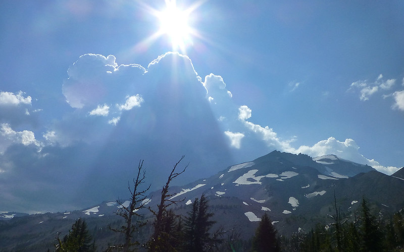
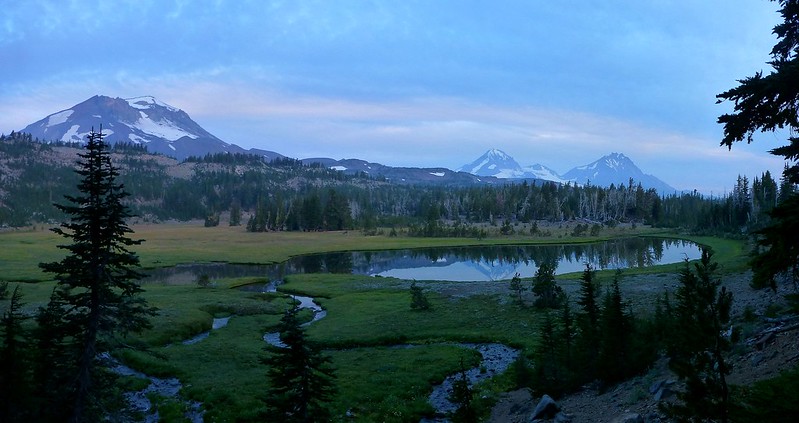
The colors in these volcanoes are just stunning, compared to the grayness that so typifies those closer to home.
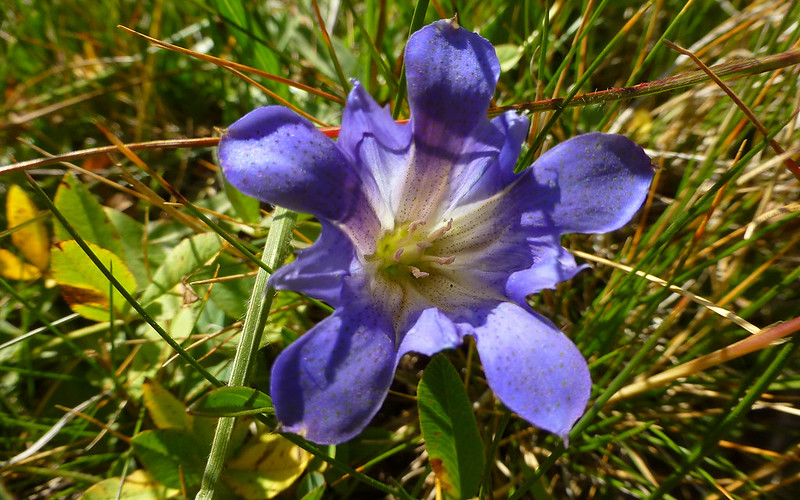
Someone told me last summer that gentians signaled the last days of summer.
Park Meadow turned out nice enough, but both of us were mighty pleased we'd stayed at Golden Lake instead.
East Fork Park Creek
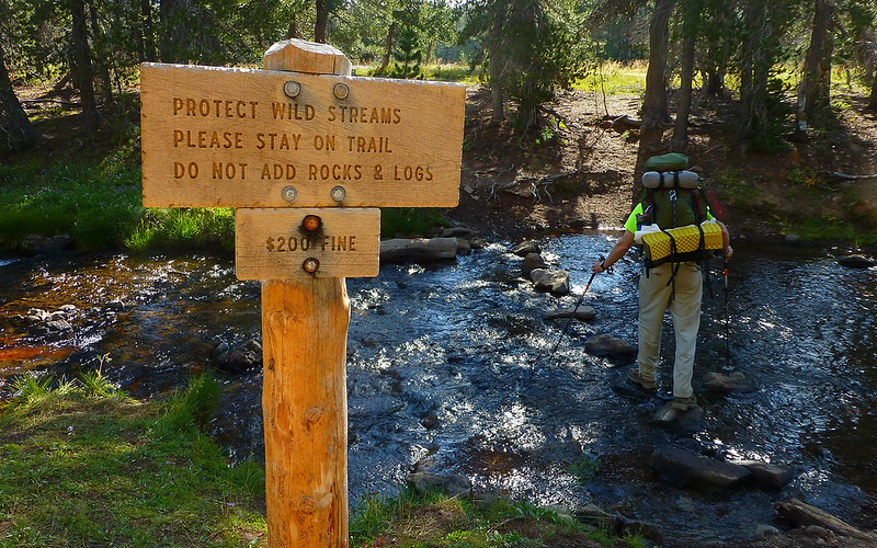
My nomination for Dumbest Sign Ever.
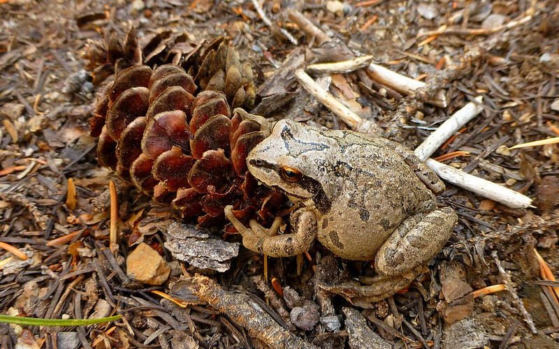
A toad with no fear at all.
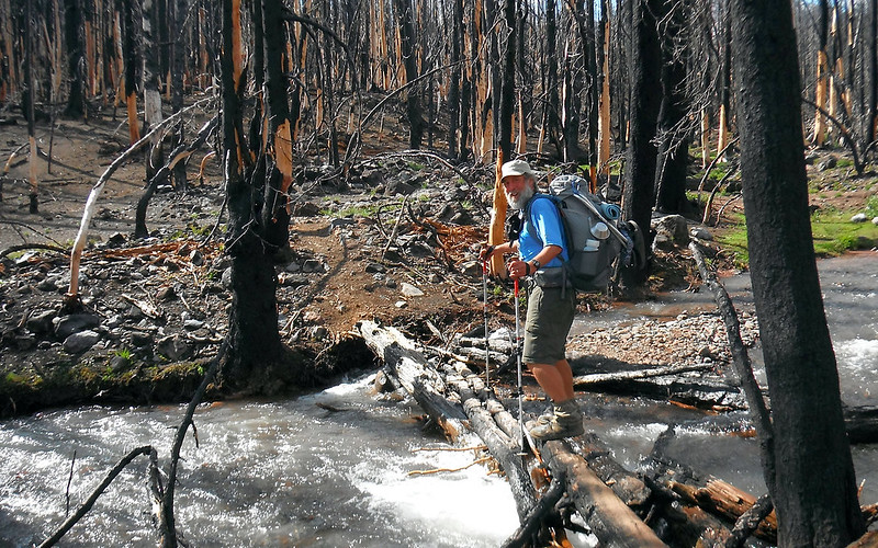
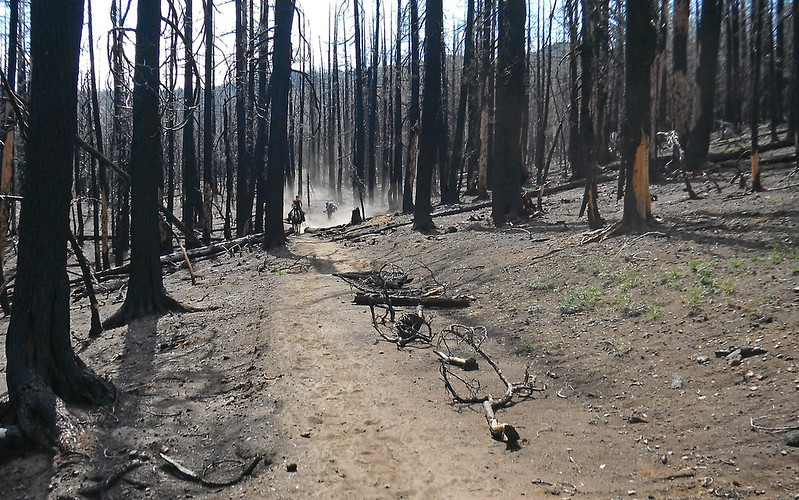
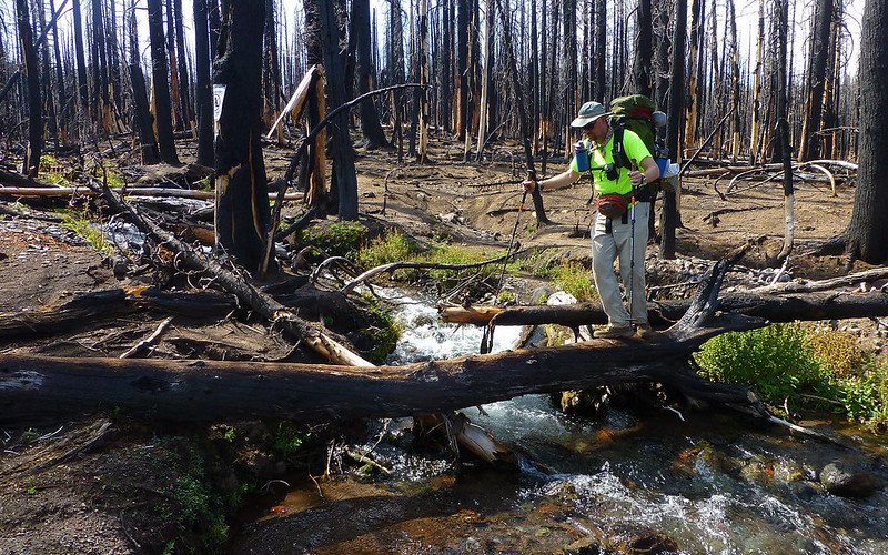
The Pole Creek Burn area had lots of crossings, and lots of logs.
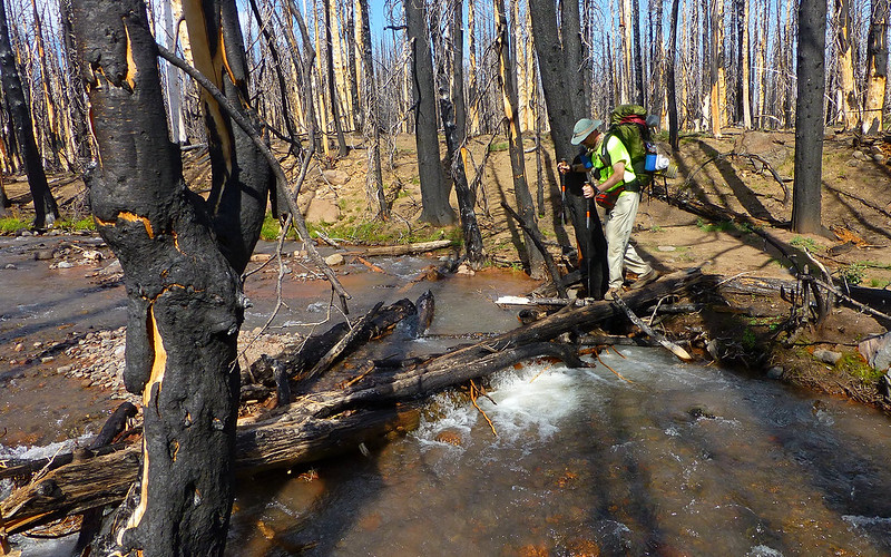
We saw a couple wade this one, rather than just clamber across these logs.
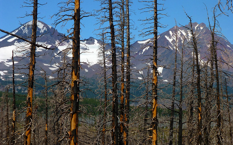
This 2012 fire certainly opened up some views!
We had seen lots of evidence of horses all day. And then this.
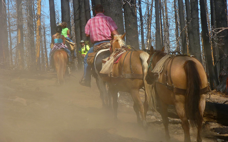
Wow, did they ever kick up the dust!
Another non-complicated crossing.
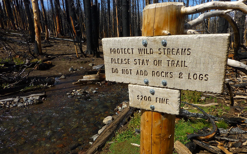
Another. Dumb. Sign.
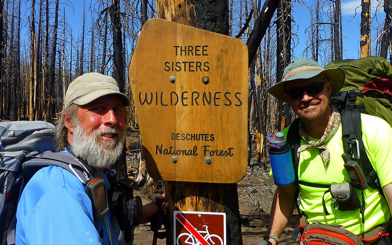
Had to sneak in a good buddy shot here, given this glorious background. Feel the burn?
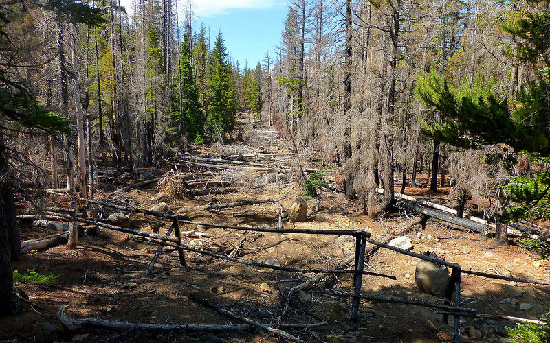
The remaining few miles were non-remarkable. Lots of uphill. Passed this fire line.
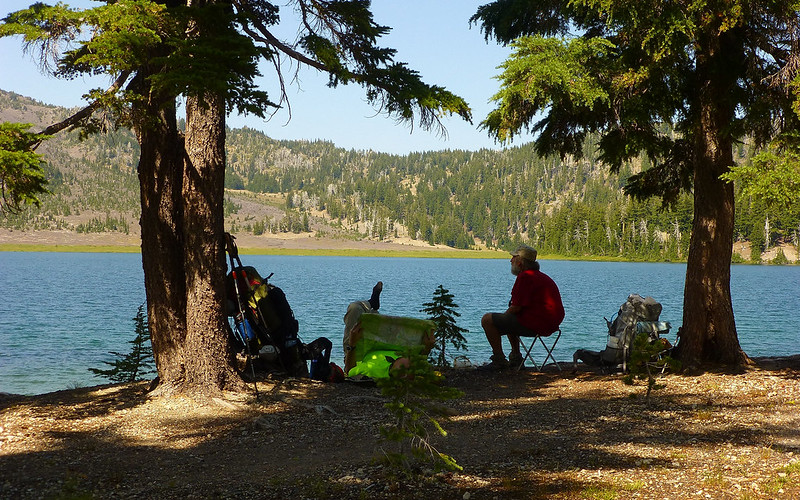
Upon return to the trailhead, all I wanted to do was go jump in the lake! That's not at all like me. We threw our gear in the jeep, and I wheeled it down to a nice beach there. IT WAS COLD!!!
Our stats varied, as I did a bit more wandering. Best guestimate (with sidetrips) would put the total distance at around 35 miles, and about 6500' of elevation gain.
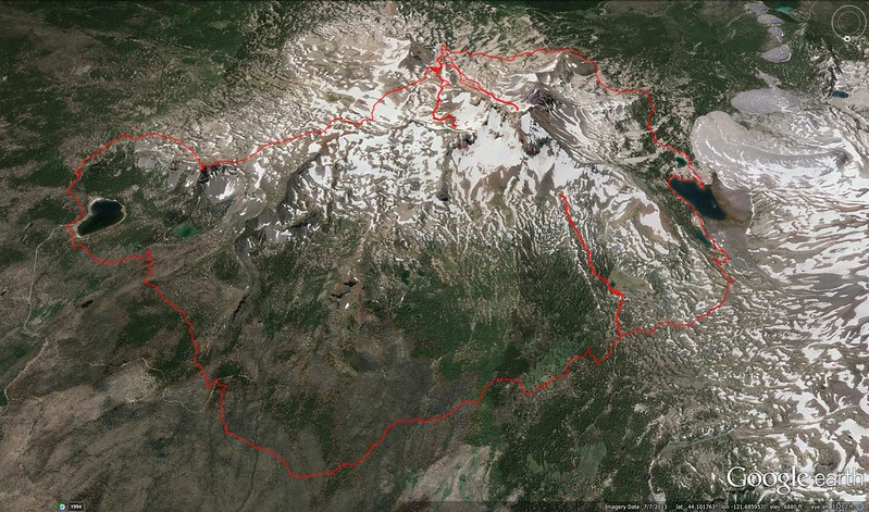
The full loop. Portland perspective. (Looking south.)
http://gpsfly.org/gps_map.php?gps_id=3568&w=645&h=440
After my quickie bath (and, I tell ya, it was quick!), we hit the road for Sisters, and a little lunch at Bronco Billy's. For some reason, the pulled pork jumped right off the menu for both of us!
All in all, probably one of the best possible re-immersions into backpacking a guy could hope for! I think I'll do it some more.