140819 Tatoosh Range:Unicorn Peak, The Castle, Pinnacle Peak
- TheOtherBob
- Posts: 161
- Joined: March 22nd, 2014, 4:59 pm
140819 Tatoosh Range:Unicorn Peak, The Castle, Pinnacle Peak
EG: 5200' The keyframes are shown here in case anyone else finds them useful (note that we skipped Boundary Peak). The first mile functions as a pleasant warmup before rising gradually to Snow Lake. The trail then continues south and terminates at the talus. Full disclosure: if you do not like walking on talus or scree, this trip is not for you. We climbed up out of the bowl at the south end where Unicorn Creek descends to Snow Lake. From there, things open up a bit and one gets a good look at Unicorn Peak. This next image shows a panoram of the area. The opening image was taken from one of the shallow hills in the center of the panoram. From there, there are several ways to get up to Unicorn Peak. As shown on the map, we looped around and ascended from the south side... ... and then later decided to descend more directly to the west.
From the top of the ridge, we got our first good look at Unicorn. The center south face (center of the image) is doable, but since we were climbing free, we inspected other options and eventually ascended from the east (right side of the image). The view was spectacular (and would be even more so when Rainier isn't wrapped in clouds). We both ascended all three peaks during this trip. Here is a compilation (L->R) showing her coming up onto Unicorn Peak(Stevens Peak in the background), much later in the day after climbing up Pinnacle Peak, and in the middle of the afternoon up on The Castle. From Unicorn Peak, we descended back down to cross over onto the ridge and out to point 6524...
- TheOtherBob
- Posts: 161
- Joined: March 22nd, 2014, 4:59 pm
Re: 140819 Tatoosh Range:Unicorn Peak, The Castle, Pinnacle
... while looking toward our next goals.
Pinnacle Peak was by far the longest of the three climbs, and we ascended it from the west. It was getting close to sunset, so the wind was starting to pick up, which made the climb less pleasant. However, the views and cloud play visible from the top were worth it. The downclimb was peaceful, cathartic, pleasant. We took a long food break before putting on head lamps and descending the Pinnacle Peak trail in the dark. By the time we started walking back to our TH along the road, the traffic had cleared out for the night: we walked down the middle of the road and marveled at stars between the intermittent clouds... which was a fantastic way to end a very satisfying trip.
Note that the peaks don't need to be climbed to enjoy the scene out there--it's a great hike in its own right. Additionally, there are 6 other peaks on the west end that are class 1-3.
Happy Hiking!
-Bob
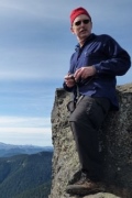
Most of the photos I take while I'm out are of scenes that are relatively static, nearly frozen in time. In those cases, considerations of time are subjugated to considerations of space--but the presence of another person completely inverted the photographic dynamic on many occasions during this trip. This image, in particular, exemplifies many of the amazing but fleeting moments that this trip provided in abundance. During the time it took me to tap off the first half of the pictures that comprise this panoram, I nearly missed it.
Here are The Castle and Plummer Peak from point 6524...
... and a smiling panoram.
After turning down onto the next portion of the ridge, we stopped for some water and admired the afternoon lighting.
Then it was on to The Castle. There were several options there, but we were only really happy with the one that has the slot at the top (has red rappel gear stationed at the top right now).
Mount Rainier was being coy all day, so this is the best we could do in the late afternoon light.
We could also see our next destination quite clearly now.
We dropped around the south end of the Castle and side-hilled over to the base of Pinnacle Peak.
While doing that, we did notice a user path that appears to go up and into The Castle from the west and agreed that we need to look into that the next time we're out there.Pinnacle Peak was by far the longest of the three climbs, and we ascended it from the west. It was getting close to sunset, so the wind was starting to pick up, which made the climb less pleasant. However, the views and cloud play visible from the top were worth it. The downclimb was peaceful, cathartic, pleasant. We took a long food break before putting on head lamps and descending the Pinnacle Peak trail in the dark. By the time we started walking back to our TH along the road, the traffic had cleared out for the night: we walked down the middle of the road and marveled at stars between the intermittent clouds... which was a fantastic way to end a very satisfying trip.
Note that the peaks don't need to be climbed to enjoy the scene out there--it's a great hike in its own right. Additionally, there are 6 other peaks on the west end that are class 1-3.
Happy Hiking!
-Bob
Re: 140819 Tatoosh Range:Unicorn Peak, The Castle, Pinnacle
I am so jealous of this trip you two got to make! Made plans to be up there two years with my friend Jon from Snohomish, but something happened at the last minute and it fell apart. Seeing your pictures makes me even more determined get there!
Kelly
There is no shortcut to anyplace worth going to.
PM me about the soon to be released:
Skamania 231
"How to really get off the beaten path in Skamania County"
There is no shortcut to anyplace worth going to.
PM me about the soon to be released:
Skamania 231
"How to really get off the beaten path in Skamania County"
- jointhedance
- Posts: 112
- Joined: July 16th, 2012, 8:21 am
- Location: Portland
- Contact:
Re: 140819 Tatoosh Range:Unicorn Peak, The Castle, Pinnacle
Yes, ditto, envious of you all doing this stretch of the Tatoosh Range. What a blast!