Burnt Granite and Tarzan Springs (Clackamas area)

This forum is used to share your experiences out on the trails.
Post Reply
User avatar
bobcat
Posts: 2768
Joined: August 1st, 2011, 7:51 am
Location: SW Portland

Burnt Granite and Tarzan Springs (Clackamas area)

Post by bobcat » August 19th, 2014, 2:53 pm

The old Skyline Trail was a precursor to the Pacific Crest Trail, but was often routed through country that became accessible to loggers and was eventually abandoned. In the good ol’ days, before WWII, trails were used more by livestock, especially sheep going to the high meadows, than recreational hikers. The Burnt Granite Trail #595 follows the route of the Skyline Trail; the southern section, below the Tarzan Springs Trail, then became part of the Rho Ridge Trail #564.

The Trail Advocates site lists the Burnt Granite Trail as one of the routes now maintained by volunteers. Indeed, it is still shown on several maps, including National Geographic’s Mount Hood map. Access to the trailhead has changed recently as the 4650 road has been blocked at its lower end, and it’s necessary to travel farther along the Clackamas River Road (FR 46) to 4670, drive up that road 4.2 miles, and then turn right on gravel 4650 to go 4.0 miles to the unmarked trailhead.
BurntGraniteMap.png
Trail Advocates warns, however, the following:

"This is big time cougar country. Watch your back. Seriously. Not advisable to hike this trail alone. The cougars are in the thick rhododendrons.”

Well, I decided to hike the trail alone, but I began at a rather late hour. In fact, I never was very worried about cougars, understanding well their distaste for all things human, although I did glance back a few times to ensure that there was no teenager with more curiosity than sense on my trail. I saw signs of bear on the outing but no definitive kitty presence announced itself.

Indeed, I was in an area renowned in certain circles for larger and more elusive creatures.

Tarzan Springs, one of my goals, was supposedly named after a gold prospector who was reputed to cohabit there with a family of “ape-like” creatures. It is unknown whether this zoophile conceived a hybrid race that even today may reside in our midst.

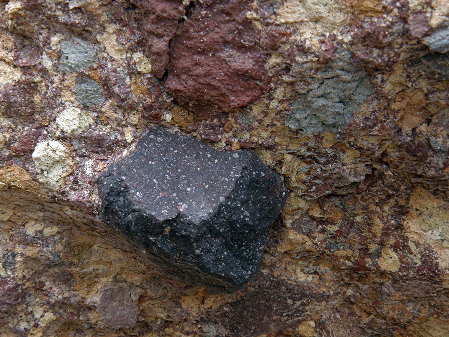
Burnt Granite Peak, of course, was named after a burn – as one can discern from the open lodgepole pine bench on its east side. Also, it’s not granite, but andesite. However, Burnt Granite, or at least a rock pile on the southern end of its ridge, is also the site of one of the best-known sasquatch encounters: the Glen Thomas sighting, an event much cited in the lore surrounding this cryptozoological beast. In October 1967, Thomas observed a family of bigfoot grabbing rocks out of the pile, in essence burrowing down to find hibernating rodents, which they then popped into their mouths. The whole activity gives new import to the idea of “vision quest pit.”

The Burnt Granite Trailhead is about half a mile up FR 4650 from the Skyline Trail’s original crossing: the intervening tread has been obliterated by a clearcut. There is flagging here, and you hike up an abandoned road bed past an old trail board. The trail resumes the original tread and begins a series of slow traverses and switchbacks through montane forest and an encroaching understory of rhododendrons. There is timber down on the trail, and I used my saw to get rid of the most impedimental branches and trunks. I did not bring pruners, however, and the whole way up I endured multiple proverbial face slaps from rhododendron whorls.
Trailhead, Burnt Granite Trail.jpg
Old trail sign, Burnt Granite Trail.jpg
Rhododendron passage, Burnt Granite Trail.jpg
Chinquapin galls, Burnt Granite Trail.jpg
Mossy tread, Burnt Granite Trail.jpg
Pine drops (Pterospora andromedea), Burnt Granite Trail.jpg
On the lodgepole pine bench, with Burnt Granite looming up to the right, I found the junction with the Tarzan Springs Trail, marked by an old campfire circle with a rusty tin can. I headed down this trail into a forested bowl: the path, also with quite a bit of blowdown, follows part of the route of the abandoned Trail #568, which joined the now-abandoned Rho Creek Trail below Fadeaway Spring. Near the end of this trail, there is some decent old growth, particularly Douglas-fir. The trail reaches a spur to FR 4670. I walked 230 yards along the road to my right and then bushwhacked through a perimeter of forest and spiraea bushes to the sedge expanse of Tarzan Springs Meadow. The main spring forms a good-sized pool, which must have been a boon, I imagine, to the shepherds of yore. Nevertheless, I found no tracks in the mud of any feet, little or big.
Junction with Tarzan Springs Trail, Burnt Granite Trail.jpg
Old growth, Tarzan Springs Trail.jpg
Tarzan Springs, Tarzan Springs Meadow.jpg
I hiked back up to the Burnt Granite Trail and took a left. The trail is much more distinct as it traverses talus slopes with views to Sisi Butte, Olallie Butte, and Mt. Jefferson. Up on the south crest of Burnt Granite, there is a lot of blowdown and the track becomes harder to find. It soon drops over to the north side of the ridge in a bear-grass meadow and reaches the Glen Thomas rock pile. Here, I took in the views of the northern end of Rho Ridge, from the Granite Peaks to Peak 5017 and over to the central Cascades. There is a very well-defined five-foot deep pit here, much more substantial than any “vision quest” pit I’ve seen. A series of rough little cairns, nothing that would have been fashioned by any self-respecting Homo sapiens, are set along the crest of the rock pile – Does Bigfoot possess rudimentary artistic tendencies? Below the rock pile, the rusting wire that led to Burnt Granite’s lookout had been twisted by forces crude and ignorant.
Granite Peaks from the Burnt Granite Trail.jpg
Sasquatch pit and Peak 5017, Burnt Granite Trail.jpg
Lookout wire, Burnt Granite Trail.jpg
Mt. Jefferson from Glen Thomas sasquatch site, Burnt Granite Trail.jpg
In thinking of this hike, the original plan had been to extend it to Mt. Lowe and then return to bushwhack along Burnt Granite’s ridge to the lookout site, but my sawing activities and the late start had used up my time (must get home by the dinner curfew), so I sniffed around the rock pile for more evidence, and finding none, took advantage of the fruits of my labors to breeze back to the trailhead without major obstacle.

User avatar
BrianEdwards
Posts: 2405
Joined: February 2nd, 2010, 1:32 am
Location: Oregon City, OR
Contact:

Re: Burnt Granite and Tarzan Springs (Clackamas area)

Post by BrianEdwards » August 19th, 2014, 4:56 pm

Nice outing on one of the more obscure Clackamas district trails. The trail looks in relatively descent shape for being abandoned.
Clackamas River Waterfall Project - 95 Documented, 18 to go.

User avatar
RobFromRedland
Posts: 1095
Joined: May 28th, 2008, 10:03 pm

Re: Burnt Granite and Tarzan Springs (Clackamas area)

Post by RobFromRedland » August 19th, 2014, 6:31 pm

When I was there a few years ago, the trail was in pretty good shape, and you could still get to it via 4650. (and it was still considered an "active" trail). Since then, it has been officially abandoned (for at least the second time), and the road to it was decommissioned, so you have to take a long way around now. I had heard that it was getting rather overgrown with the rhodies.

One thing - I don't think there was ever a lookout building on Burnt Granite - I think it was just a tent with a phone at the peak. We actually bushwhacked up to the peak and found where the old phone had been. It was rather interesting to see.

Nice to see someone exploring these seldom used trails. They have their own charm.
Life is not a journey to the grave with the intention of arriving safely in a pretty and well-preserved body, but rather to skid in broadside, thoroughly used up, totally worn out, and loudly proclaiming: WOW! What a ride! - Hunter S. Thompson

User avatar
Splintercat
Posts: 8333
Joined: May 28th, 2008, 10:03 pm
Location: Portland
Contact:

Re: Burnt Granite and Tarzan Springs (Clackamas area)

Post by Splintercat » August 19th, 2014, 8:45 pm

Very nice report, John! That's a fascinating area -- if somewhat tattered from the logging heyday. I've explored the Granite Peaks area and have come across some outcrops that I think explain why the name "granite" was attached to this little range. Here's a sample:

Image

This is really just a volcanic conglomerate, but there's enough going on here that a casual glance suggests granite. I brought a chunk of this home, and over the course of two years in the yard, it has completely come apart into the conglomerate components, so that also helps explain the steepness and rugged nature of the Granite Peaks, in particular -- highly unstable rock.

I have not seen bigfoot sign in that area, but clearly I wasn't paying enough attention... ;)

Thanks for posting!

Tom :)

User avatar
miah66
Posts: 2039
Joined: July 6th, 2009, 8:00 pm

Re: Burnt Granite and Tarzan Springs (Clackamas area)

Post by miah66 » August 20th, 2014, 9:45 am

That is an interesting (and kind of disturbing) account from Glen Thomas. I'd never heard about that. No Sasquatch sightings on ph.org yet, right? :o
"The top...is not the top" - Mile...Mile & a Half

Instagram @pdxstrider

forestkeeper
Posts: 1291
Joined: July 23rd, 2011, 8:31 pm
Location: Canby, Oregon
Contact:

Re: Burnt Granite and Tarzan Springs (Clackamas area)

Post by forestkeeper » August 20th, 2014, 11:49 pm

:D Nice TR bobcat! I was there about 7 years ago, doing some sasquatch hunting. Beautiful area. I actually camped in an old quarry. Never did see one but there were constant tree rappings. Also, lot's of movement above the quarry, while I was sitting near the fire. Something was walking back and forth, for pebbles were coming down the quarry walls.

User avatar
bobcat
Posts: 2768
Joined: August 1st, 2011, 7:51 am
Location: SW Portland

Re: Burnt Granite and Tarzan Springs (Clackamas area)

Post by bobcat » August 21st, 2014, 6:50 am

@Brian: The trail tread is in marvelous shape: built to last the ages - but it was a first-class trail at one time of course. If the three or four people who go up there every year could take a little saw and some pruners and just nibble away as they hike, the route should be perfectly navigable for some time to come.

@Rob: Yes, I read your trail diary on the outing before I went - it gave me the notion of also going to Tarzan Springs.

This site says there was a cabin atop Burnt Granite. The 1934 photo on Trail Advocates shows just a telephone pole . . .

@Tom: Burnt Granite itself is definitely your everyday ridge of basaltic andesite, but Granite Peaks are probably composed of the "unsorted glacial deposits" from the Pleistocene shown on my geological map. That explains how the rock just fell apart in your yard! I suspect they are a moraine from one of the Cascades ice sheets.

@forestkeeper: Yes, I think that quarry must be the standard base camp for sasquatch hunters. It seems to come up in a lot of the reports!

User avatar
RobFromRedland
Posts: 1095
Joined: May 28th, 2008, 10:03 pm

Re: Burnt Granite and Tarzan Springs (Clackamas area)

Post by RobFromRedland » August 24th, 2014, 5:57 am

bobcat wrote:
This site says there was a cabin atop Burnt Granite. The 1934 photo on Trail Advocates shows just a telephone pole . . .
Thanks for the info! I had not seen that before. I was basing my info on that photo (and some other accounts). Very cool.
Life is not a journey to the grave with the intention of arriving safely in a pretty and well-preserved body, but rather to skid in broadside, thoroughly used up, totally worn out, and loudly proclaiming: WOW! What a ride! - Hunter S. Thompson

Post Reply