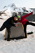
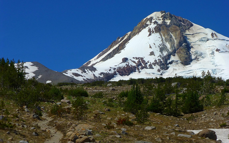
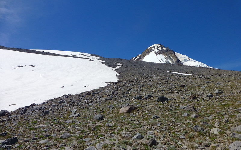
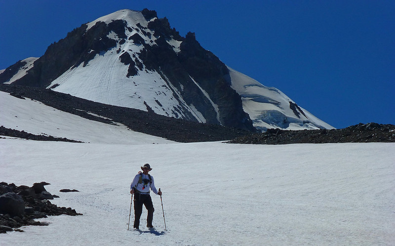
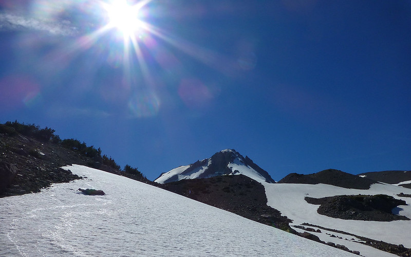
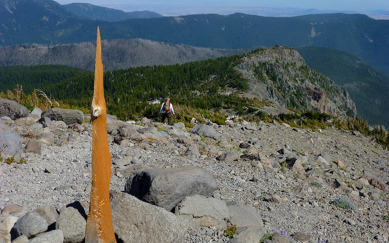
Opening pic: Our primary goal was this ridge at about 8500'.
Saturday started out very gloomy. But passing through Government Camp, the sky began to lighten considerably. Within a few more miles, crystal clear blueness that would stick with us the rest of the day was all around. We met at Elk Meadows TH just after 8:00, shifted gear between rigs, got over to the gated Cloud Cap road by about 8:40 and were on the trail shortly after. About 3/4 of a mile in, we had a choice of following the (traditional?) Tilly Jane ski trail up, or the (less traditional?) Polallie Ridge trail. A few shrugs, and WTHs later, we went with the latter. It seemed like a good choice in retrospect, but with nothing to compare it to, um, "it was nice."
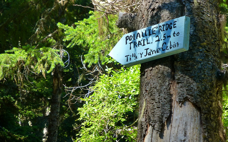
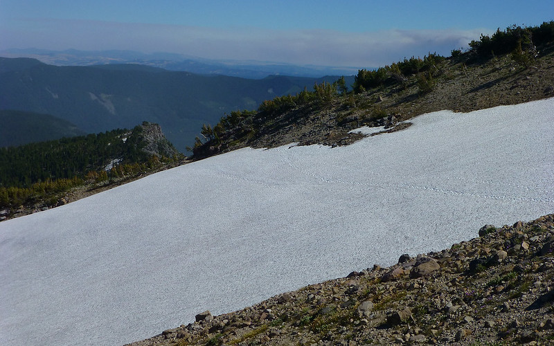
The trails were exceedingly well marked down below.
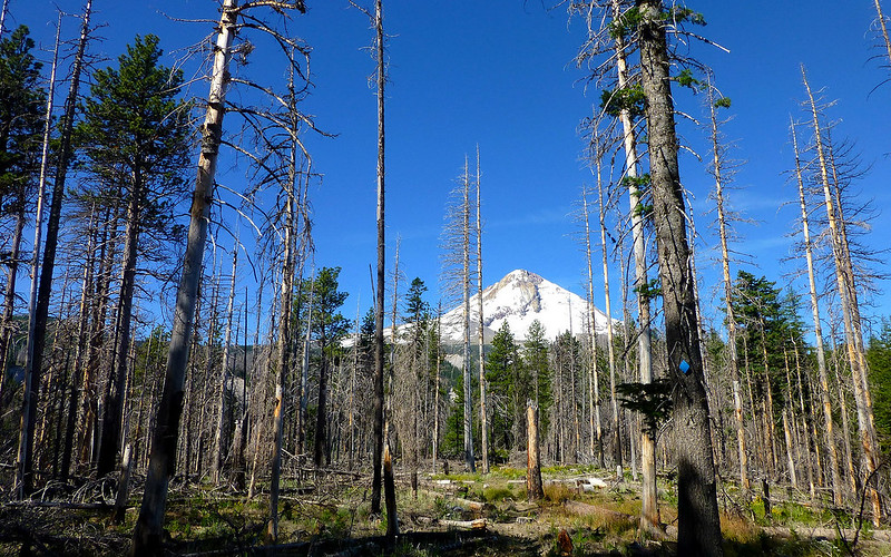
Almost right away, we entered the 2008 Tilly Jane fire scarred area. The views opened right up, too!
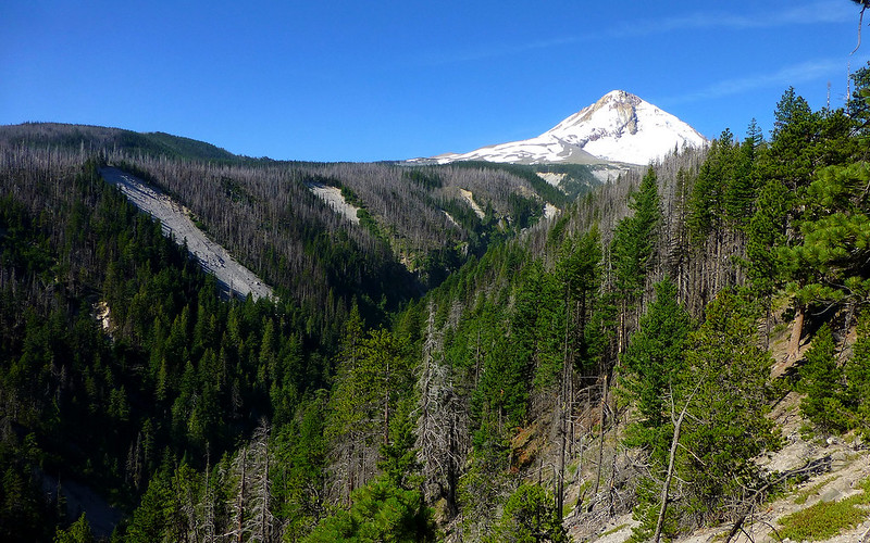
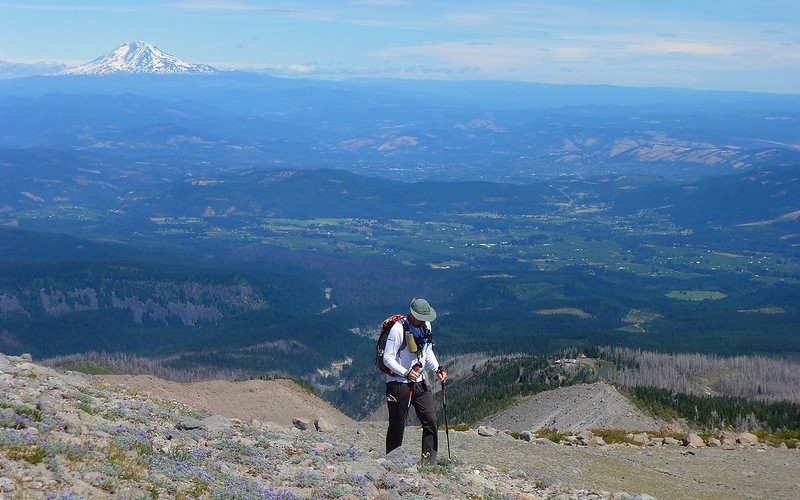
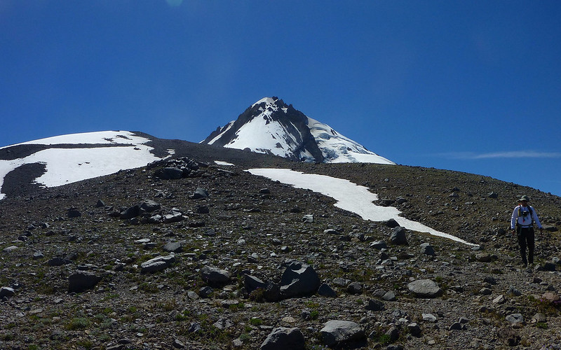
It was Jim's first trip to this side of the mountain, so it was cool pointing out our destination from way down here.
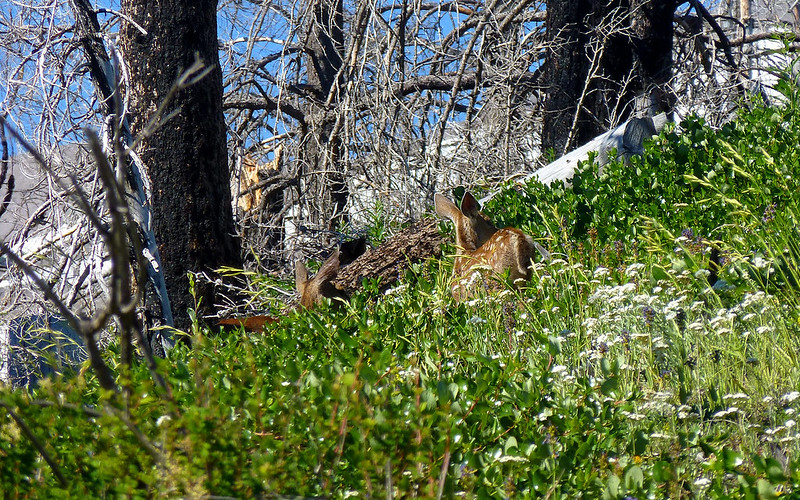
A brisk wind was with us all day. It was loud enough, these deer weren't aware of us until we were quite close. Two does, two fawns.
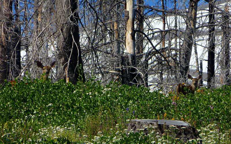
After watching them for a bit, we let 'em know we were there, so we could all go our separate ways.
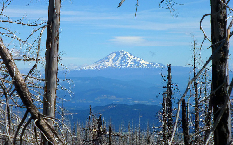
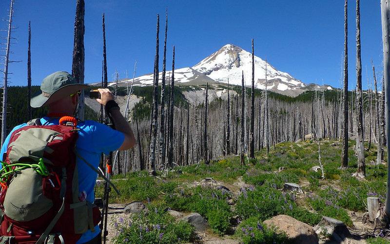
Started catching glimpses of the Washington volcanoes pretty early, too. Adams was the only one not wearing a skirt of clouds.
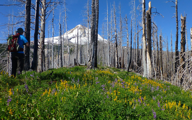
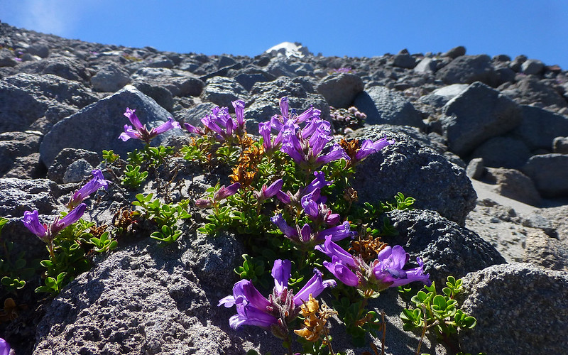
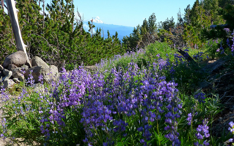
The ridge was carpeted in fields of purple and gold.
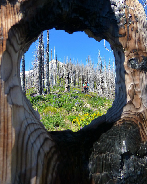
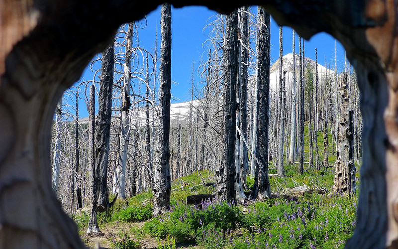
Couldn't resist the frame job this burnt out knothole offered!
It's photo ops like this that keep me at the back of the pack on most hikes.
Two shots, same position. As Jim was shooting this, I was telling him I thought I could see the shelter. (I lied, but I knew about where it was.)
Blind, super-zoom, from same spot as shot above. See the shelter? It's there.
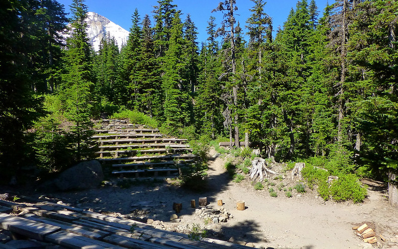
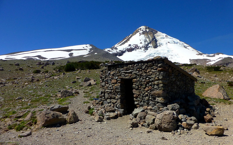
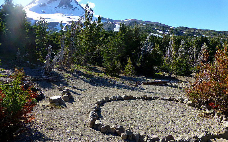
Soon enough, almost by surprise, we found ourselves at Tilly Jane. The CCC probably built this amphitheater in 1938.
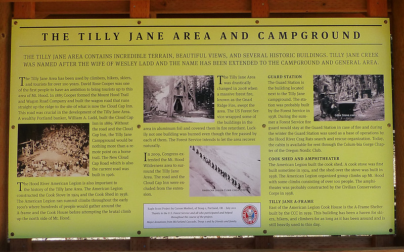
Very nice info sign, put up as an Eagle project in 2011, telling all about this little wayside.
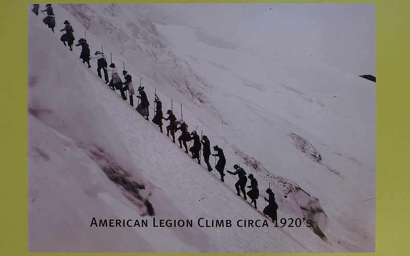
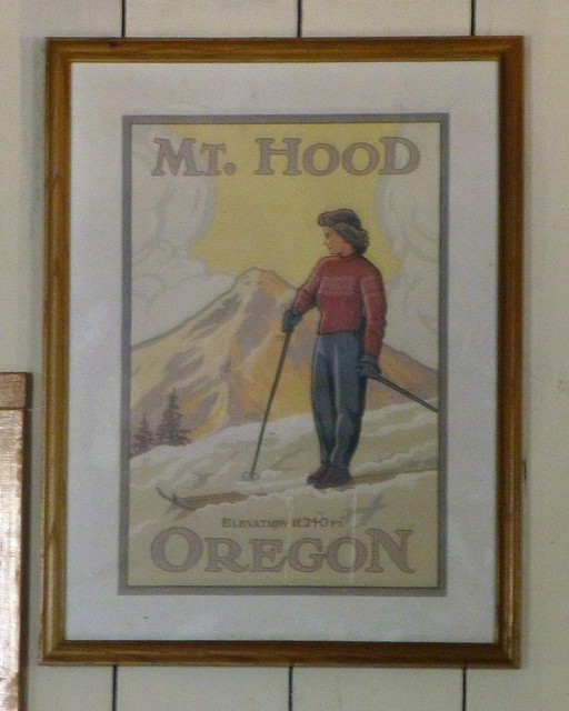
Love this photo! This was the standard climbing route up Hood before Timberline Lodge was built.
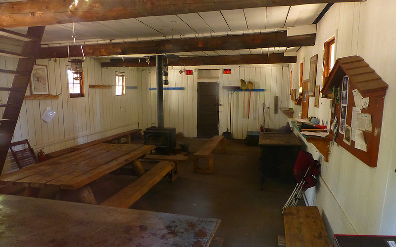
The a-frame was locked up, but we peeked and poked around a bit to have a looksee.
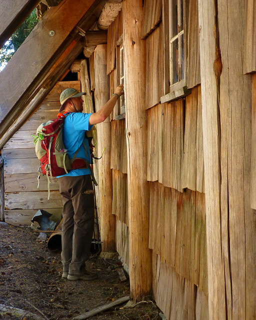
"We have our ways..."
A-frame artwork.
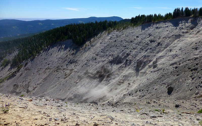
The wind was picking up as we climbed, and the Polallie Creek valley was a constant dust cloud of activity.
A little after 11:00, we were breaking through timberline.
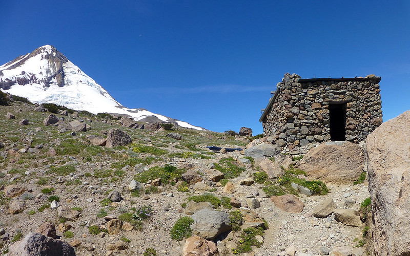
Stopped for the obligatory photos of the CCC constructed shelter. This one seems to be in the best shape of all still standing!
Met a really nice gal here, who was setting up camp before exploring the area more.
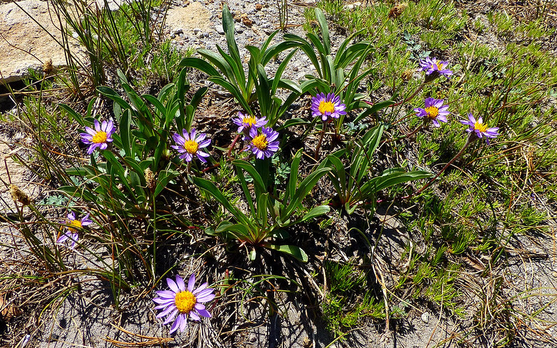
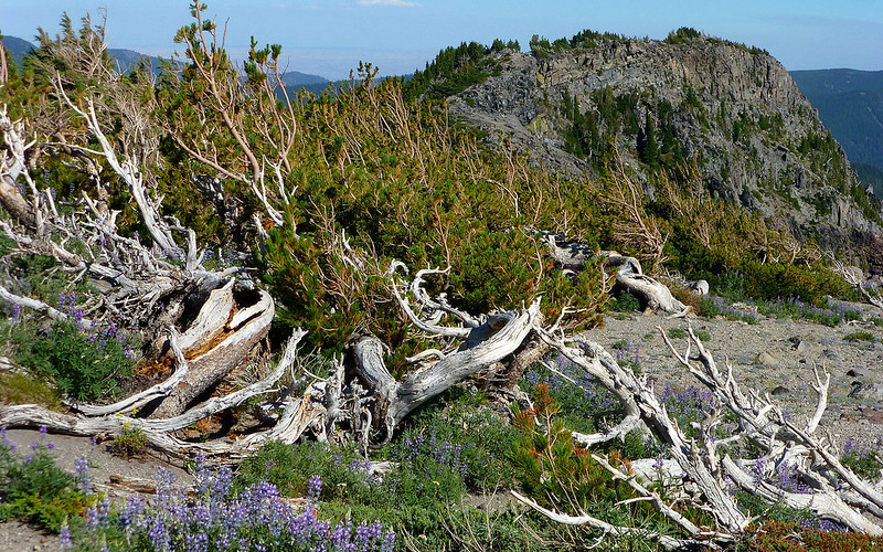
The first signs of spring were only just now hitting up here, as random asters and penstemon clung to the rock.
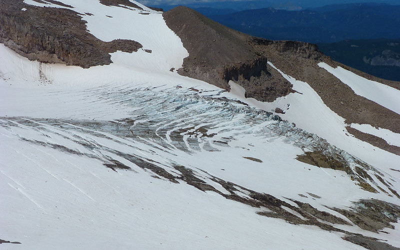
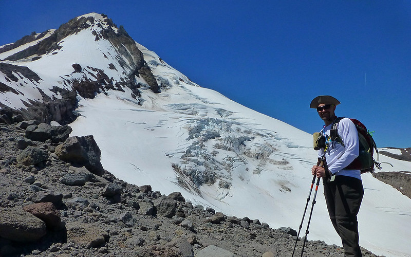
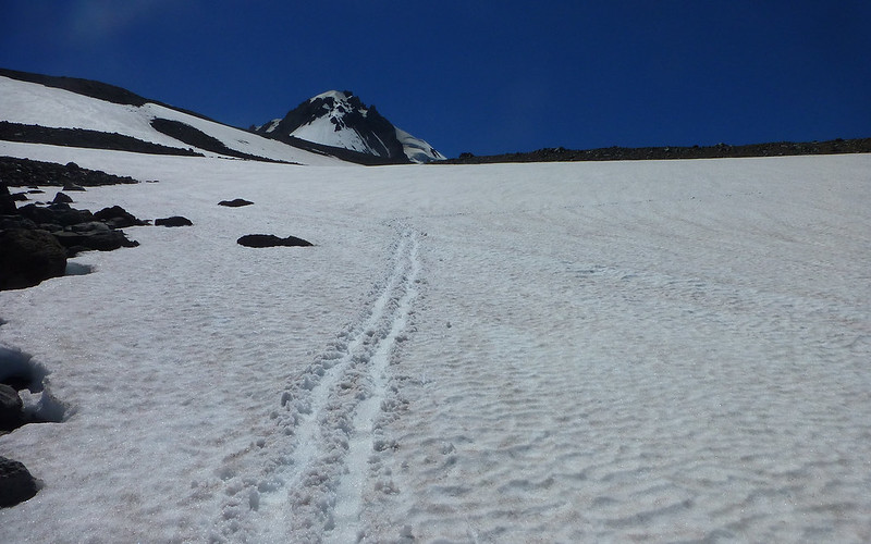
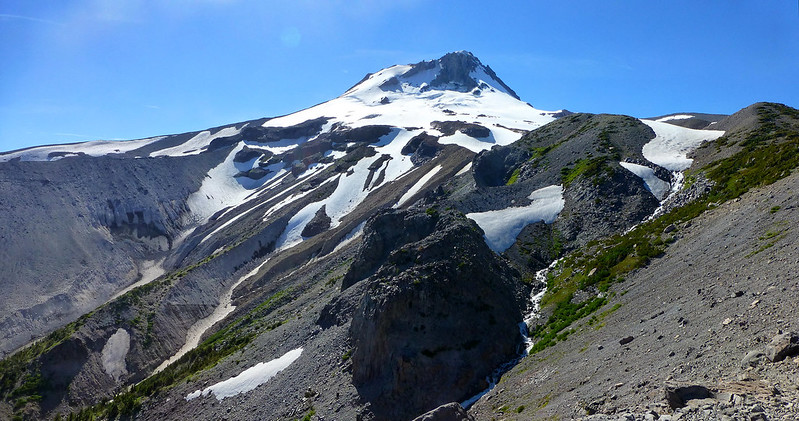
Crossing the glacier appeared to be far less difficult that getting in or out of that valley! (St. Helens and Rainier on horizon.)
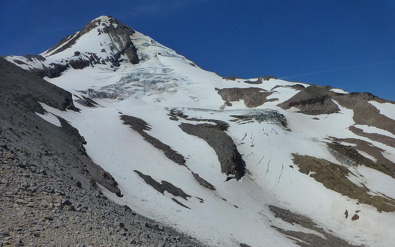
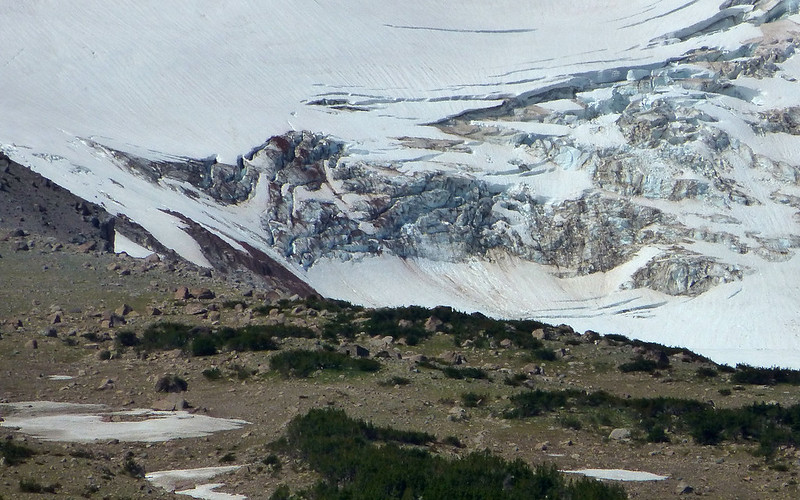
I suppose we pulled over at nearly every overlook to admire that beautiful glacier!
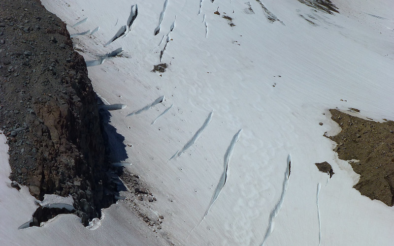
Check out the ski tracks between crevasses.
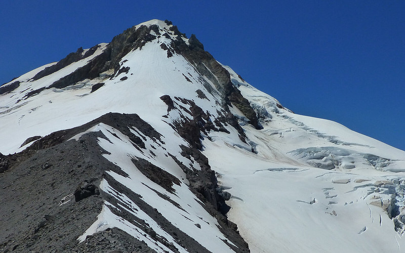
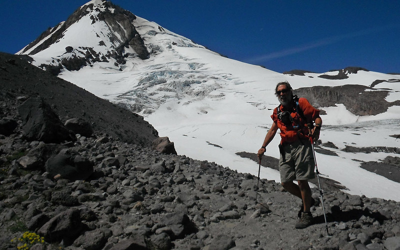
Really almost requires a pano to take in the whole mountain at this close range.
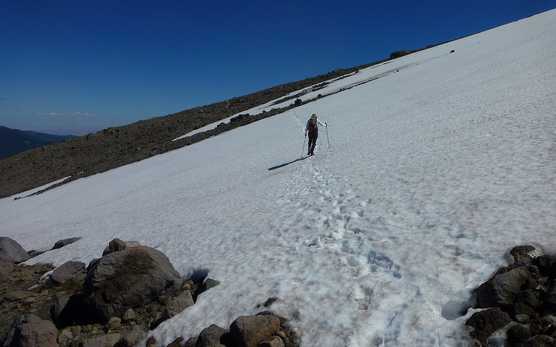
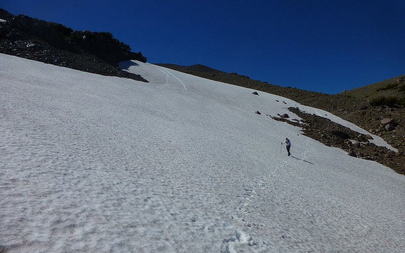
Most of the trail is melted out, but there are still significant portions where the only choice is to bomb up the rubble.
Jim took this moments after my hat whizzed 200' in half a second. Didn't put it back on until we dropped down to Lamberson Butte.
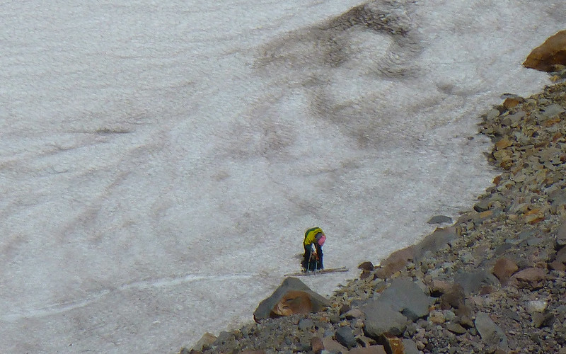
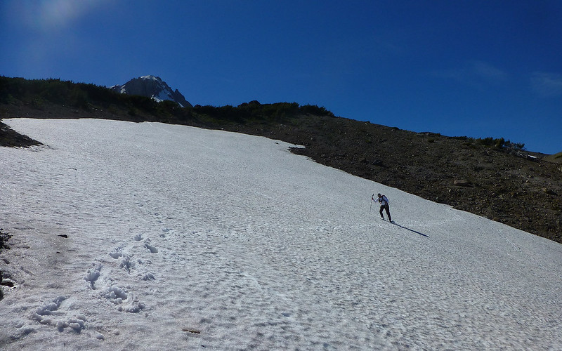
Spotted a skier, but didn't get the camera out until s/he was pretty much done with the run.
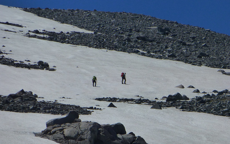
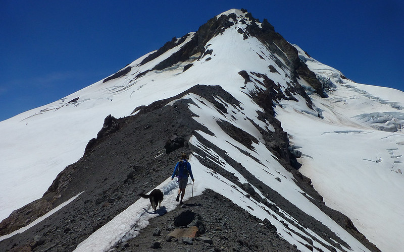
Above, two hikers with ice axes chose to climb the snowfield rather than the rubble.
Same photo as above, without the zoom. See the hikers? Yeah, we still got a ways to go!
Now I see an exit strategy on the west side of the valley, and three hikers using it. Still no clear way out on the east side.
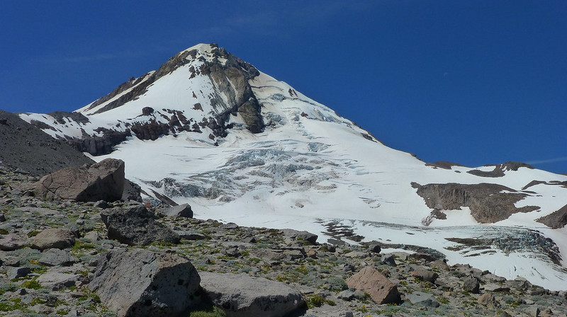
The ice patterns on Elliot are endlessly fascinating.
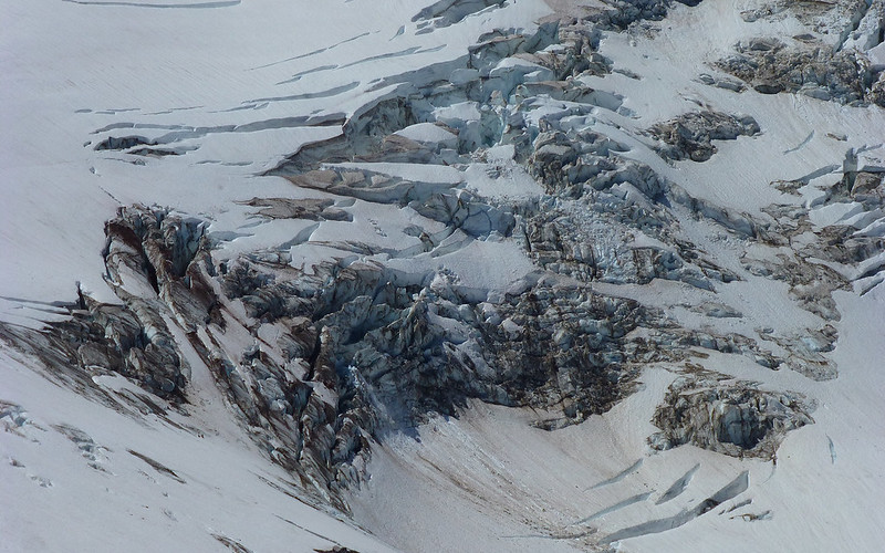
Wow.
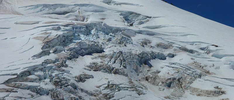
The scale is simply incomprehensible.
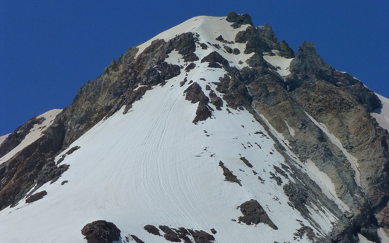
The traditional climbing route. Not overly littered with rocks yet?
The classic backdrop shot.
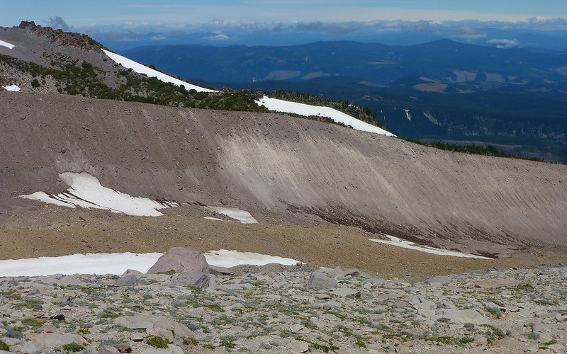
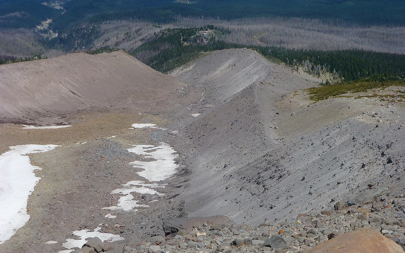
Above about 8000', there really is no more trail. Just a lunar-like rubble scramble.
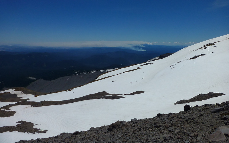
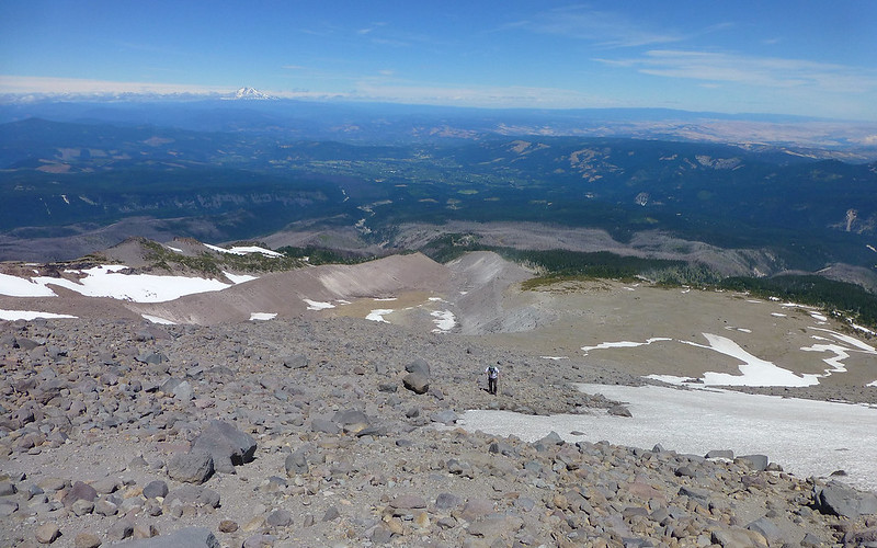
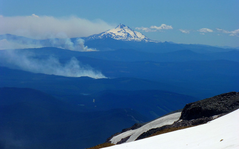
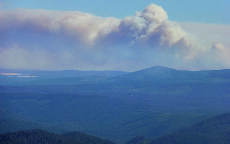
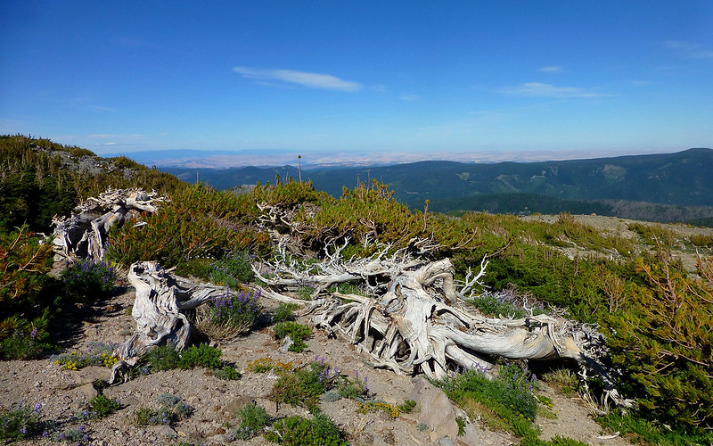
The first thing that hits you, after cresting the spur at 8500', is the realization that Oregon is on fire.
* shudder *
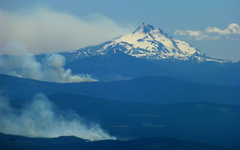
Prelude to the worst fire season so far?
Another iconic/obligatory shot. Hard to miss this one, just above the 8500' windbreak.
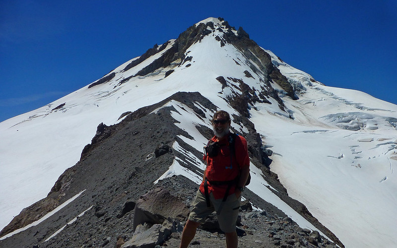
Such a poser. (Not technically a selfie, if someone else took it, right?)
New trail friend Laura was just soaking up the radiant heat from a lava bomb lizard rock, and offered to share the superb vantage point.
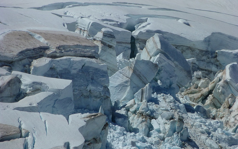
That ice!
After a quick snack, we wandered out to Tie-In Rock.
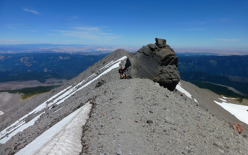
And this became the end-of-the-trail, for today. The ridge was clear a bit higher, but the winds were well over 70mph now.
Best lava bomb lizard rock you'll find up here!
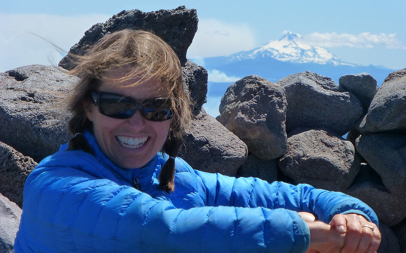
We said goodbye here, as she was in no hurry to get back down but we had many miles to go. Her infectious smile really summed up the wonder of this place.
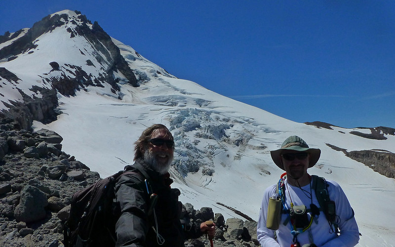
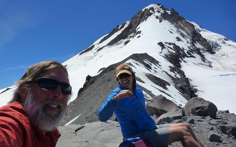
Finally, on our way back down, Jim and I remember to take the traditional TFF buddy shot!
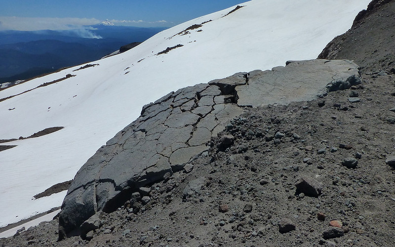
Penstemon on the moon.
Descending the rubble wasn't a lot of fun...
So we quickly switched gears when the slope and runout seemed reasonable.
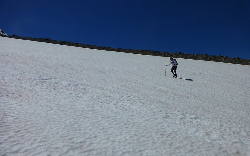
Testing the snow legs.
Yeeee-haw!
In no time, we were back on the Timberline Trail, where we met a couple of guys running a 360°.
The next mile and a half was probably 50-60% pitched snow field. That got a bit old.
Every time we'd crest a little ridge, another hugeass snowfield lay ahead.
Temps were in the low-70s, as was the wind. One word: Extreme Exposure. (OKay, I lied, two.)
"No, really, Jim. I promise. This is the last snowfield before Gnarl Ridge."
"Yeah, I've heard that before!" Heh...
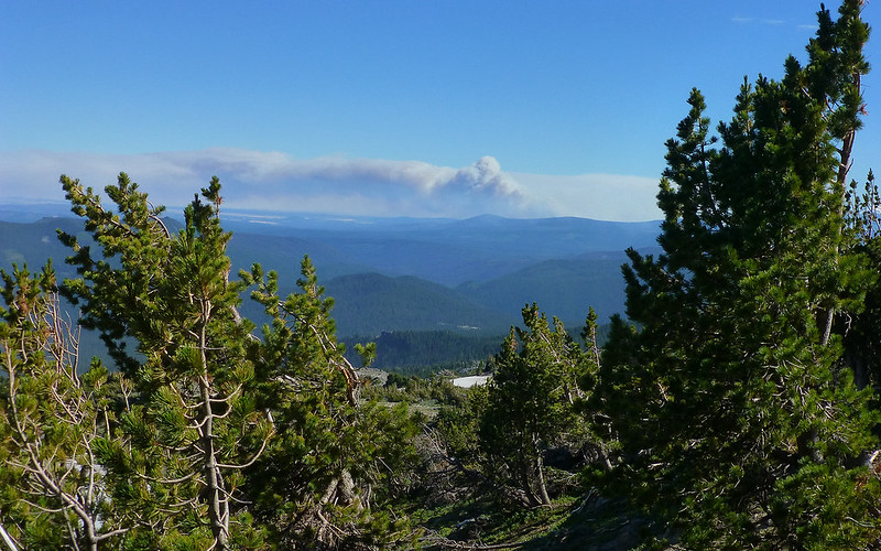
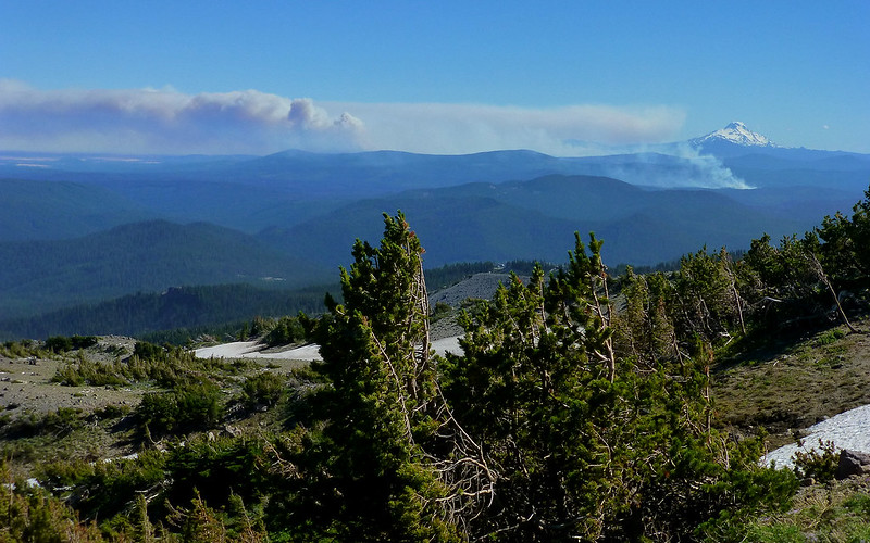
Once again, the conflagration to our south came slamming back into view!
BOOM!!!
The lupine was really kicking back into gear, though.
How many ways can you say, "Yikes!"?
As we rounded a bend, I heard water! An ice-cold spring, coming right out of the mountain. (N45.36822° W121.65713°)
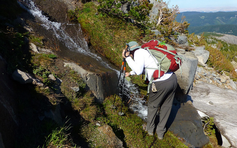
Mmmmmmmmmmmmmmmm-mmm!
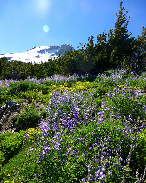
Again, more blankets of purple and gold.
We'd finally arrived on Gnarl Ridge, proper. It was about 4:30.
I'd looked forward to sitting and soaking up this view. But we were still being sand-blasted, so it was not to be.
So instead we rambled on down towards Lamberson Butte where, mercifully, the wind finally subsided.
And when I say "sand-blasted", I'm really not kidding.
Lamberson Butte looks so different from above than it does from below.
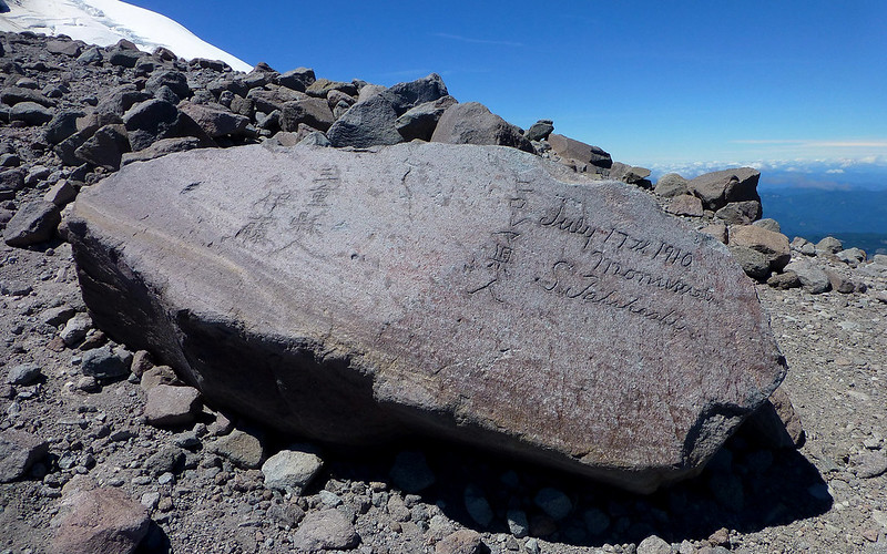
We dropped packs here to take twenty. Marvelous!!! Found that half of the mystery "47" had migrated, too!
Near the shelter ruins beside Lamberson, I spotted what might make a pretty nice little campsite.
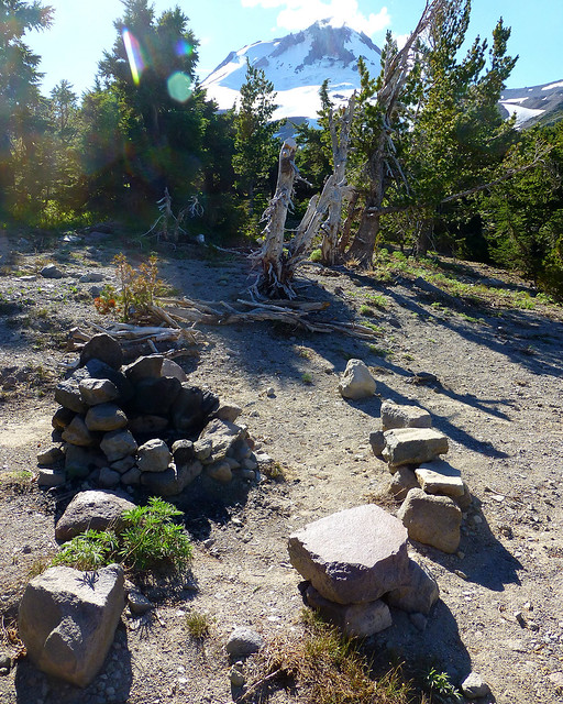
But I really wondered what folks were burning in this elaborate fire pit! Grizzled old whitebark pine???
The remainder of the descent was rather uneventful, given how awesome everything up high was.
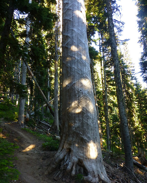
Got to show Jim the bizarre mystery tree on the Elk Meadows trail.
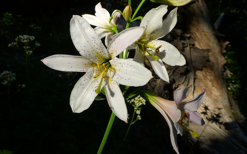
Enjoyed a mini-explosion of Cascade Lilies along the switchbacks.
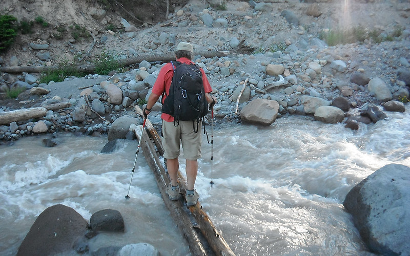
Displayed perfectly horrible form crossing Newton Creek.
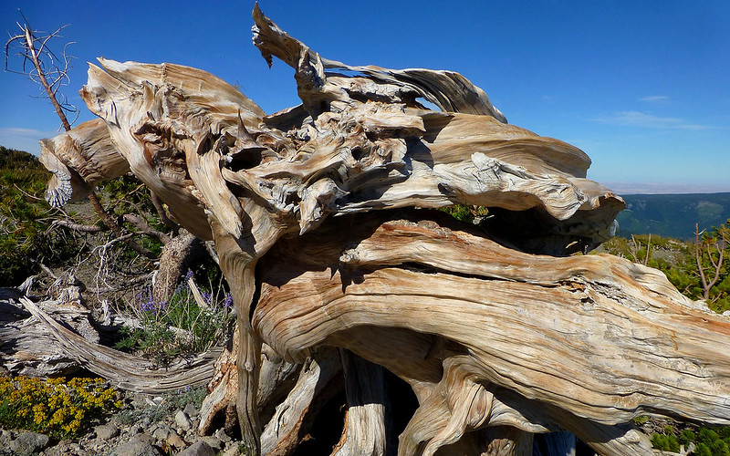
And finally noted that Splintercat's got his fingers in just about everything up here.
At the end of the day, the numbers were all over the place. The GPS seems to have been blown *waaaay* off course by the high winds messing up the barometer within.

See all those spikes?
So I don't put a whole lot of stock in these numbers...
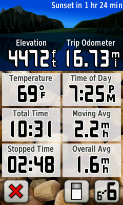
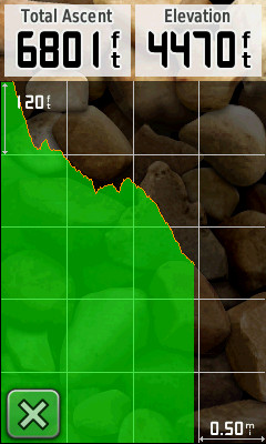
Would a GPS lie?
But I would heartily recommend doing this hike as a shuttle with two vehicles, if you possibly can! The added variety just adds spectacularly to the standard in/out.
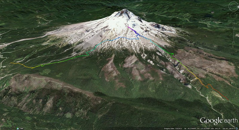
Look at how much ground we could cover with two rigs! GPSfly track.
Truly, another fabulous day on the mountain!