Grassy Knoll Direttissima

This forum is used to share your experiences out on the trails.
Post Reply
User avatar
K.Wagner
Posts: 652
Joined: June 2nd, 2013, 1:25 pm
Location: Vancouver, WA

Grassy Knoll Direttissima

Post by K.Wagner » July 12th, 2014, 8:38 pm

Grassy Knoll Dirittessima???? Come on Kelly, everyone knows that the way up to the Grassy Knoll is a trail!

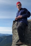
Ah, but anyone who has done that trail to the old lookout on the Grassy Knoll has looked down that slope to the south and marveled at those open slopes. And I bet most of the guys and some of the gals thought “That would be such a kick come up that open ridge!!” Well, it was a kick!
14-Route-S.jpg
GrassyKnollDirittissima.jpg
Grassy Knoll Map
So, after one false start (about ½ mile too far west), I was on my way by about 9:15, and it was already starting to feel hot. The climb up the ridge was a piece of cake (albeit a steep one!). The elk & deer had done a pretty good job of route finding for me.
06-Dirittissima-S.jpg
The few cliffs there were easily bypassed on the east side.
09-S.jpg
The knoll was slowly getting closer, which was good, because the heat was really starting to work on me. There weren't many wild flowers out on the slope, would have been better 3 weeks ago. This little lavender guy and a few paintbrushes were really the only color.
44-S.jpg
The crux of the whole route, which I didn't anticipate, was the last 75 feet or so. Bare of any vegetation, loose fine gravel on top of small bands of rock, and steep! (from the top of the vegetation up) If I had not had my poles with me, I don't think I would have even tried it. With the poles, it wasn't that tough.
12-Grassy Knoll-S.jpg
The climb up was about 900 feet in 8/10 mile, 1 hour.

So, the plan was to continue on to the summit of Big Huckleberry, another 7 ¾ miles and 1,600 feet. Just as soon as I entered the forest, started seeing my favorite wildflower, the Tiger Lily. I think I saw more on this trail than I have ever seen on another trail. I actually got tired of taking pictures of them!
21-Tiger Lily & Adams-S.jpg
Then this beautiful butterfly came along, but the darn thing just refused to pose for me. This was the best I could do.
24-Butterfly-S.jpg
The first 2 miles or so of the trail were a delight. So many flowers and such views from the open ridge! According to Peakfnder.org I was seeing Stacker Butte off to the east, but I could see another ridge way out beyond that wasn't identified, but I think was Haystack Butte, about 45 miles away. This picture was across the Columbia River, showing Wind Mtn, Mt Defiance, Mt Hood.
42-Wind Defiance Hood-S.jpg
The heat was really slowing me down. My moving average was 2.2 MPH, but my overall average was down to 1.1, and my heart rate was pretty consistently up around 135 – 140, and I know it hit 150 (my max rate) many times, because I would have to stop and drink more water just to get it calmed down.

Once the trail leaves the ridge, it is in heavy forest, and you don't get any more views until the summit. There is a user trail that goes out on the open ridge to the east, where you do get some better views than the actual summit. I didn't take any pictures, the sun was just too hot to be out of the shade. So, I ate my lunch, finished off with a brownie and some blue berries. (My wife takes good care of me!)

On the way down, met a young couple on the PCT headed north. I didn't think to ask, but I have to assume from the timing that they started at the Columbia (has to be too early for the through hikers to be here, and they certainly didn't look like they had been on the trail that long.) He was planning on bailing at White Pass, and she was hoping for Canada. I brought up to them that they were pretty early and would certainly be having heavy snow issues on Adams and Goat Rocks and to expect clouds of mosquitoes the next day in Indian Heaven. They seemed somewhat surprised by this news! Hope they do OK.

In an attempt to beat the heat somewhat, stopped at Cold Springs. The springs ARE COLD! Dumped my old warm water and refilled with spring water. Then started splashing water all over my head. What a shock, but felt so good! Then I took my long sleeve cotton shirt out and soaked it good. Then put it under the pack flap to protect it. Once back down to Grassy Knoll, put the shirt on for the final push down the open slope. Made it down in about 20 minutes!

The couple on the PCT were the only people I saw the entire trip.
Final numbers 9 1/3 miles, 2,490 feet, and boy, did I stink!
Kelly
There is no shortcut to anyplace worth going to.

PM me about the soon to be released:
Skamania 231
"How to really get off the beaten path in Skamania County"

User avatar
Roy
Posts: 2824
Joined: January 25th, 2010, 6:35 pm

Re: Grassy Knoll Direttissima

Post by Roy » July 14th, 2014, 7:26 am

You make me sweat just reading this tr. :lol: That is very ambitious for a hot afternoon thanks for sharing.
The downhill of the mind is harder than the uphill of the body. - Yuichiro Miura

User avatar
K.Wagner
Posts: 652
Joined: June 2nd, 2013, 1:25 pm
Location: Vancouver, WA

Re: Grassy Knoll Direttissima

Post by K.Wagner » July 14th, 2014, 5:56 pm

There probably was a reason I didn't see anyone else on that trip, maybe they're a little smarter than I am??

That was a really fun route up that open ridge; am planning on doing it with the wife next spring. I am certain that open ridge is snow free weeks before the trail is.
Kelly
There is no shortcut to anyplace worth going to.

PM me about the soon to be released:
Skamania 231
"How to really get off the beaten path in Skamania County"

Post Reply