This is my first trip report!
Today we embarked on quite the journey. I thought the McIntyre Ridge to Wildcat mountain hike looked really neat. I wanted to views and a little challenge. We ended up having to go later in the day. I was working at my daughter's homeschool co-op until 1pm. Then I picked my husband and 2 dogs up at the dog park and we went home to drop them off (I am SO glad we did not bring the dogs, you will see why later).
15 minutes into the drive there I realized my husband didn't grab my camera (he picked up the bag but set it back down). We turned around to go back home and get it. A bit of an inconvenience. I put in the GPS coordinates and we headed towards Sandy. We ended up going the wrong way after awhile. I should have just read the directions on the information on this site.
When we got to the one lane road though it said you go 8.9 miles. At around mile 4 we hit this horrible dirt road. We could only go 5mph on it and we were afraid the car was going to get damaged (Chrysler Sebring). We were only on it about .5 miles and we said we couldn't drive on it much longer. I was about to suggest to just turn around at the next turn around spot. This is when we hit the dead end. We were very confused at first because according to the information on this site we had at least another 7-8 miles to go. I compared pictures of the trailhead to where we were at. They matched perfectly.
After posting pictures I realized that they are posting in reverse order and I can't figure out how to fix it. So when you look through them just go from the bottom up to see how the trail progressed.
We ended up having to stop when we got to the second viewpoint. It was 6pm by then and we didn't want to get stuck in the woods at night. They snow was really slowing us down. Near the end of our descent most of the trail was covered in snow. Some of it was very deep and hard to walk through. I am not sure how far we ended up hiking though. We had no GPS signal or phone reception. We hiked for about 4 hours though.
Enjoy!
I think we will go back sometime after the snow melts and a few hours earlier.
Should have brought snowshoes. McIntyre Ridge 4-14-14
Should have brought snowshoes. McIntyre Ridge 4-14-14
- Attachments
-
- This snow was over my knees, and we kept sinking in.
-
- Great view
-
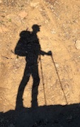
- Another goofy picture
-
- My little hiker, having her first (and only) sit down break.
-
- A snow covered meadow.
-
- I just liked this.
-
- Snow was quite deep in some areas. We kept sinking down to at least our knees of we weren't careful.
-
- This spot was particularly slick.
-
- This was a long, VERY steep hill.
-
- This was the trail on the way up. You can tell it is not traveled as often as others.
-
- I thought the snow was cool...turns out I would come to hate it later.
-
- Our 5 year old standing in a small patch of snow. Turns out we would see a lot more later....
-
- Beautiful View!
-
- If you see this rock...you know you are in the right place.
-
- The trailhead area. Plus my husband and 5 year old daughter.
Re: Should have brought snowshoes. McIntyre Ridge 4-14-14
Welcome!
How about all that snow, huh? Even in a "low snow" year like this one, there's enough up there to slow one down. Wilcat Mtn is a great destination in the fall, too. Just wear orange.
How about all that snow, huh? Even in a "low snow" year like this one, there's enough up there to slow one down. Wilcat Mtn is a great destination in the fall, too. Just wear orange.
Believe it or not, I barely ever ride a mountain bike.
-
CampinCarl

- Posts: 573
- Joined: June 17th, 2011, 7:41 am
- Location: Salem
Re: Should have brought snowshoes. McIntyre Ridge 4-14-14
Nice first trip report! Way to go getting your daughter to hike through the snow Looks like a hike for me to bookmark for a future family hiking trip.
Re: Should have brought snowshoes. McIntyre Ridge 4-14-14
[Wh"CampinCarl"]Nice first trip report! Way to go getting your daughter to hike through the snow Loocouldike for me to bookmark for a future family hiking trip.[/quote]
She did great all the way up, no complaining at all. Out want until the way down that she started getting a little whiney. She kept slipping in the snow and was getting cold. I guess going Downhill is harder than going up! I think we will definitely go back after the snow melts though. I wish we could have done the whole hike...but time and snow prevented us from doing that.
The view is worth the drive! And once the flowers start blooming I bet it's just incredible!
-
Splintercat

- Posts: 8334
- Joined: May 28th, 2008, 10:03 pm
- Location: Portland
- Contact:
Re: Should have brought snowshoes. McIntyre Ridge 4-14-14
Nice first report, Lamar! That's a confusing trailhead to find, but here's where I think you might have misread the directions:
Nice photos! I've never been up there this early, so I'm impressed that you got to the trailhead without snow..!
Tom
You were at the right trailhead, and the short (increasingly rough) spur you described is 9.4 miles from the 4-way stop where you turned on to Wildcat Mountain Road (and about 1/4 mile long). Glad you found it! There are other spurs up there that are easy to get sidetracked on, but you did great in finding the right spur.From the Firwood Road junction, turn left onto Wildcat Mountain Road (Forest Road 36) and follow this paved, two-lane road for 8.9 miles to the Mount Hood National Forest Boundary, where the road narrows to one lane with turnouts, and becomes Road 3626. Drive carefully here - sight distances are poor due to overgrown shoulders in many sections. Stay straight (uphill) at 9.4 miles, where the paved spur to the Wildcat Quarry and the Douglas Trail head to downhill and to the right.
Nice photos! I've never been up there this early, so I'm impressed that you got to the trailhead without snow..!
Tom