Ok, this is NOT the Eagle Creek in the Gorge but the one down towards Estacada way in the HuckleSalmonberry Wilderness.. It's also one of the closest Mt Hood NF trailheads to town. Matt, Jim, Merle, Larry and I met this morning at the Clackamas Fred Meyer to cram into one vehicle for the short drive to the trailhead. We got there about 9ish, finished up about 430 without ever seeing another soul. Matt came up with just over 15 miles total with 1,700' of cumulative elevation gain (what happened to my 3mile lake loops ). The only real 'hill' is the one you walk down to start and back up to finish the hike with. If you like the color green in multiple shades, this is your hike. Here's a taste of what we saw...
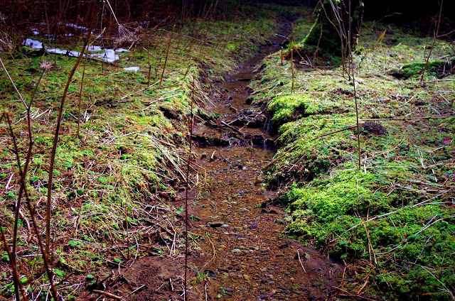
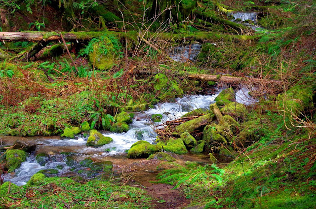
One of many side creeks that cross the trail, some of which took some creativity to cross. Or like me, just walk thru the stupid water and bring xtra socks
There's just one after another of them right now..
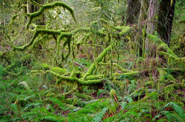
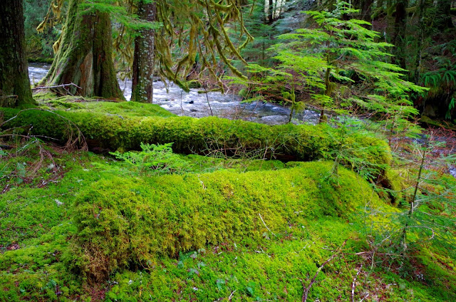
The moss is as thick as it gets around here..
Jim and Larry up ahead on the trail..
Another side creek to cross..
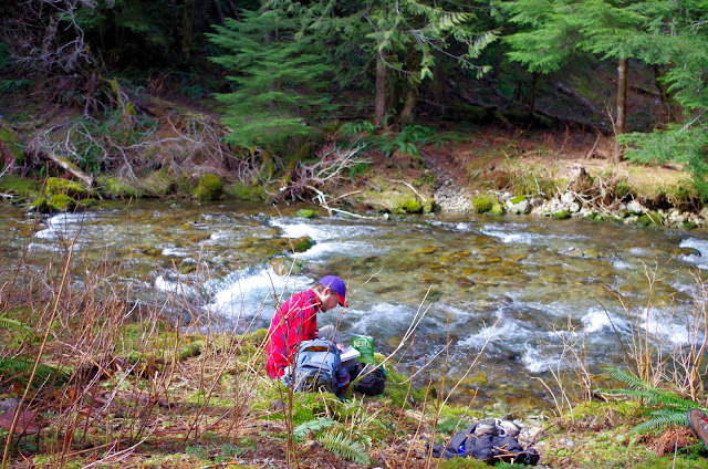
And Matt getting in the way again..
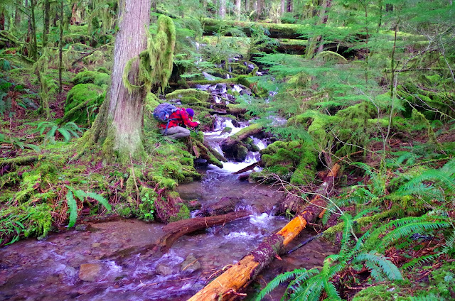
And another little side creek..
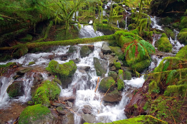
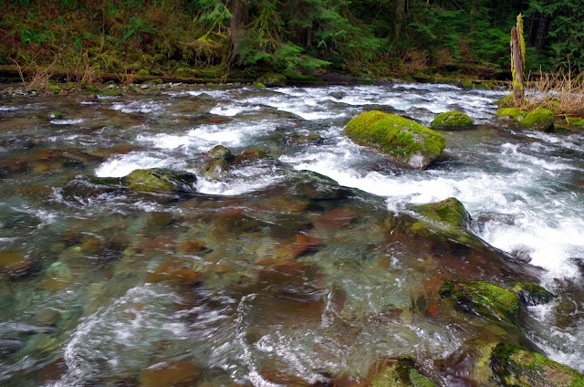
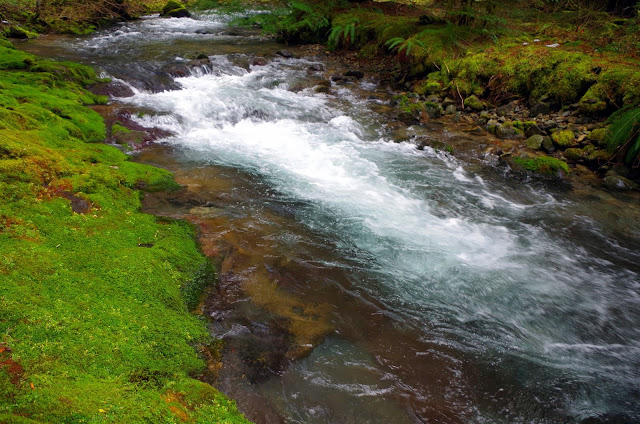
The crystal clear waters of Eagle Creek..
Some hardy berries that made it thru winter..
And the deep deep red of the cedar bark..
Another thick bed of moss..
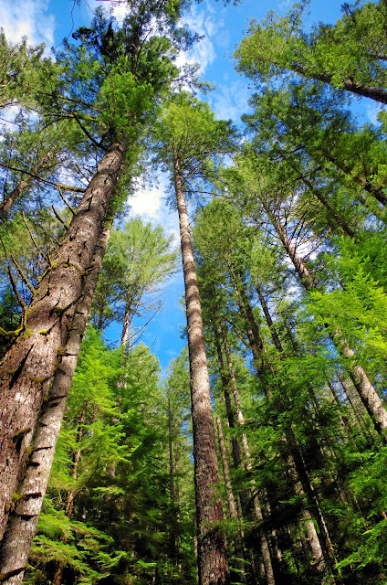
Blue sky above the tall trees..
Another look at Eagle Creek..
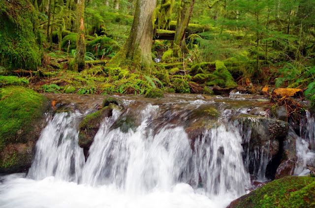
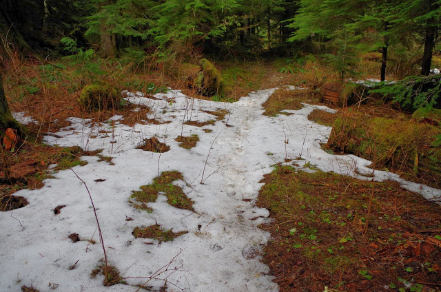
One of the stretches of trail approaching the end where the last of the snow was melting and the water finds the path of least resistance.. the trail.
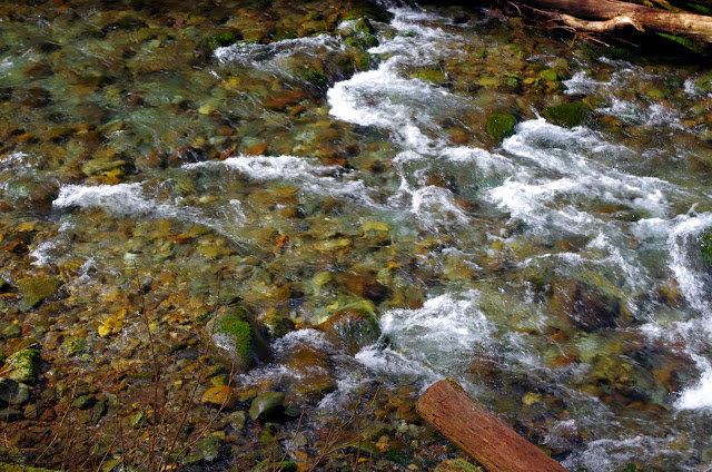
More of Eagle Creek..
Last of the snow at approx. 2,400'..
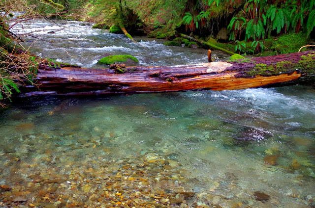
Merging forks of Eagle Creek.
The trail stretch right alongside the creek during the last mile or so is one of the nicest sections..
Matt at trails end where we had lunch. Directly across Eagle Creek is the Eagle Creek Cutoff Trail which goes up, up, up..
Sun highlighting the red of the huckleberry bushes..
A couple more of Eagle Creek as the trail passes alongside it..
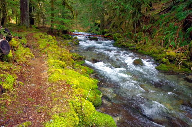
The carpet of moss is your companion for almost the entire hike..
Even the tree bark is colorful down here...
One last creek crossing to look at..
Backlit moss on the trees..
More tall tall trees and blue blue sky
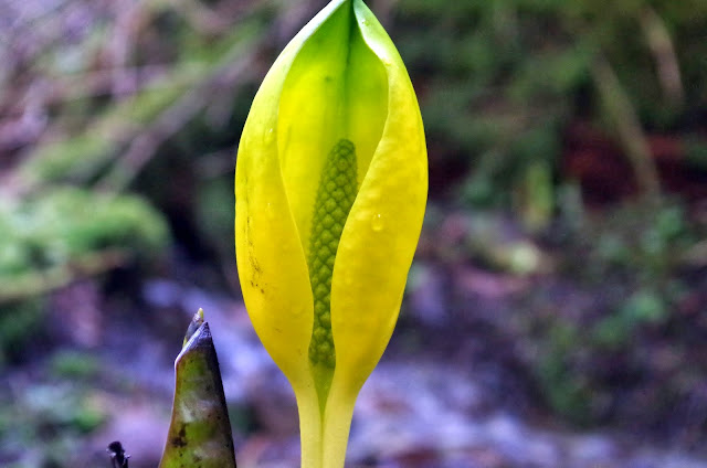
The first skunk cabbage flower I've seen in the Cascades so far this year..
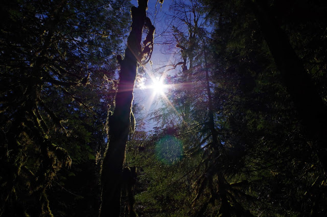
The sparkling sun thru the forest..
Finishing up with one last look at the forest canopy and the blue skies above..
What a great day! Album here http://picasaweb.google.com/pdxgene/EagleCreek2
One really nice thing is the trail is mostly all pine needly and couldn't be easier on your feet.
And oh yeah, I know it's not really the HuckleSalmonberry
Eagle Creek Trail #501 3/13
Last edited by pdxgene on March 14th, 2014, 4:50 am, edited 1 time in total.
- mattisnotfrench
- Posts: 1318
- Joined: May 28th, 2008, 10:03 pm
- Location: SE Portland
- Contact:
Re: Eagle Creek Trail #501
It was a great day! The hike was certainly easy but long - my stats on my GPS came out to almost exactly 15 miles with about 2,600 feet of elevation gain. That surprises me - I thought it would be less.
Here's my attempt at linking to a map:
Overall I did not have the best photo day, as I think my camera's light settings were too low, causing a lot of grainy photos. Here are some of the ones I like:
It was a great day and a great hike! I strongly recommend the "other" Eagle Creek.
Here's my attempt at linking to a map:
Overall I did not have the best photo day, as I think my camera's light settings were too low, causing a lot of grainy photos. Here are some of the ones I like:
It was a great day and a great hike! I strongly recommend the "other" Eagle Creek.
Author of Extraordinary Oregon!, PDX Hiking 365, 101 Hikes in the Majestic Mount Jefferson Region, and Off the Beaten Trail. Website: www.offthebeatentrailpdx.com
-
- Posts: 10
- Joined: December 3rd, 2013, 9:39 am
- Location: Austin, TX
Re: Eagle Creek Trail #501 3/13
wow. added to my list.
Re: Eagle Creek Trail #501
Hey guys,
Looks amazing - definitely one of my favorites.
How was the road to the trailhead?
Looks amazing - definitely one of my favorites.
How was the road to the trailhead?
mattisnotfrench wrote:It was a great day! The hike was certainly easy but long - my stats on my GPS came out to almost exactly 15 miles with about 2,600 feet of elevation gain. That surprises me - I thought it would be less.
Here's my attempt at linking to a map:
Overall I did not have the best photo day, as I think my camera's light settings were too low, causing a lot of grainy photos. Here are some of the ones I like:
It was a great day and a great hike! I strongly recommend the "other" Eagle Creek.
- BrianEdwards
- Posts: 2405
- Joined: February 2nd, 2010, 1:32 am
- Location: Oregon City, OR
- Contact:
Re: Eagle Creek Trail #501 3/13
Such a great hike, thanks for sharin
Clackamas River Waterfall Project - 95 Documented, 18 to go.
- mattisnotfrench
- Posts: 1318
- Joined: May 28th, 2008, 10:03 pm
- Location: SE Portland
- Contact:
Re: Eagle Creek Trail #501
Awful the first 200 yards and pretty decent after that. Go really slow over the first 200 yards or so and after that keep an eye on the potholes, but it's way better than it used to be other than the first stretch.ghosting wrote:Hey guys,
Looks amazing - definitely one of my favorites.
How was the road to the trailhead?
Author of Extraordinary Oregon!, PDX Hiking 365, 101 Hikes in the Majestic Mount Jefferson Region, and Off the Beaten Trail. Website: www.offthebeatentrailpdx.com
-
- Posts: 1
- Joined: March 17th, 2014, 6:57 pm
Re: Eagle Creek Trail #501 3/13
I'm planning on exploring this trail next weekend. I have to ask if there are any bridges or dangerously narrow parts to the trail? I have an older dog who has limitations, so it's nice to know what we're in for.
Thank you so much for posting this!
- Exkursionist
Thank you so much for posting this!
- Exkursionist
-
- Posts: 1291
- Joined: July 23rd, 2011, 8:31 pm
- Location: Canby, Oregon
- Contact:
Re: Eagle Creek Trail #501 3/13
Nice TR and photos! In driving to TH, do I need to drive past Eagle Fern Park on SE George Rd for about 5 miles, turn right on SE Harvey and drive until road ends? Thinking about going there in a couple of days.
Will
Will
- mattisnotfrench
- Posts: 1318
- Joined: May 28th, 2008, 10:03 pm
- Location: SE Portland
- Contact:
Re: Eagle Creek Trail #501 3/13
The only thing resembling a bridge was what I posted in the photo above. The trail is in general pretty narrow but overall is about the furthest thing from dangerous. The only difficult parts are the side creek crossings, but they won't be difficult for a dog - only for humans who want to keep their feet dry.exkursionist wrote:I'm planning on exploring this trail next weekend. I have to ask if there are any bridges or dangerously narrow parts to the trail? I have an older dog who has limitations, so it's nice to know what we're in for.
Thank you so much for posting this!
- Exkursionist
That's basically it. A couple of the turns on Harvey Road aren't 100% obvious but you should follow the largest road that is open. I have a GPS track of the drive if you need it. The road doesn't end at the trailhead but it's obvious where the trailhead is. There's a small parking lot, with a road on your right blocked off by wood. Here's a photo:forestkeeper wrote: Nice TR and photos! In driving to TH, do I need to drive past Eagle Fern Park on SE George Rd for about 5 miles, turn right on SE Harvey and drive until road ends? Thinking about going there in a couple of days.
Will
Ignore everything else and look for that woodpile. That's the trail behind it, dropping down into Eagle Creek's canyon.
Author of Extraordinary Oregon!, PDX Hiking 365, 101 Hikes in the Majestic Mount Jefferson Region, and Off the Beaten Trail. Website: www.offthebeatentrailpdx.com
Re: Eagle Creek Trail #501 3/13
No bridges that I recall, and very easy (especially on the feet) trail. Lots of little rock hop crossings, though. The dog with us managed pretty well. More info.exkursionist wrote:I'm planning on exploring this trail next weekend. I have to ask if there are any bridges or dangerously narrow parts to the trail? I have an older dog who has limitations, so it's nice to know what we're in for.
We actually saved a track on the drive out, anticipating people might wonder. I don't remember the road names, but take a look at the report referenced above, towards the end.forestkeeper wrote: Nice TR and photos! In driving to TH, do I need to drive past Eagle Fern Park on SE George Rd for about 5 miles, turn right on SE Harvey and drive until road ends? Thinking about going there in a couple of days.
Karl
Back on the trail, again...