Tanner Butte summit 19-Jan-2014

This forum is used to share your experiences out on the trails.
User avatar
CraigG
Posts: 368
Joined: April 29th, 2013, 8:06 pm

Tanner Butte summit 19-Jan-2014

Post by CraigG » January 19th, 2014, 9:49 pm

Just when I thought I would need to shift into "winter hiking mode", Karl had to go ahead and post his fantastic Tanner Butte viewpoint hike http://www.portlandhikers.org/forum/vie ... =8&t=17883. ;) Well, that does it. Tanner Butte viewpoint was on my to-do list for 2014, so let's get started right away. I had never been up Tanner Butte and I was curious how much snow was retained at it's high point after the storms from last weekend. Seemed like a good reason to go check it out.
I took a group of three follow hikers on this adventure from Wahclella parking lot to Tanner Butte viewpoint. I required each person to bring snowshoes in case (gasp!) we actually hit enough snow.
We started from Wahclella parking lot at about 7:25am. Clouds were already clearing as we headed up the #400 trail past the powerlines to the #777 road. Our only "bouldering" of the day:
Image
I guess this trip report will seem a lot like Karl's, because we took his lead on ascending via the Wauna cutoff trail (is that the correct name? Edited the offtrail name to be more "correct" and/or less "incorrect"). The trail actually started as an old access road:
Image
..and continued as switchbacks up to powerlines above:
Image
There was a defined path that continued up the ridge:
Image
Image
Image
With a view off to the left (north):
Image
In fact, there were a number of nice views on this ascent up the ridge as the fog continued to lift:
Image
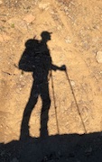
Almost to the point where we started flattening out:
Image
Image
The path was a little header to follow in sections as the terrain began to flatten out, but it wasn't too hard to get the general idea of where to go. Ah, a campsite and the intersection with the #401 Tanner trail:
Image
Thus began our long stroll south, passing the Dublin lake junction - still no snow:
Image
As we continued south towards the Tanner Butte viewpoint, I heard rumblings from my colleagues about the merits of bringing snowshoes along. More like, "Hey Craig, it is possible we will be carrying snowshoes along almost 20 miles for nothing?". I respond with the standard/safe response, "It's better to be prepared". :) I couldn't think of anything else better to say. ;)
Any snow yet? Hmmm, nope. In fact, it felt rather warm, like a clear autumn day:
Image
Snow? OK - a little bit as we continued on Beargrass Alley:
Image
A little more, but never more than a foot deep in very short sections uncovered by trees:
Image
Image
It was just easier to posthole through the short sections of packed ice/snow. No views until we were within a mile or so of the highpoint:
Image
Ah, the unsigned junction to the Tanner Butte viewpoint:
Image
The junction turned out to be a moderately steep hike through a foot of snow at points, but it was easy to see where the trail was. We came upon the lower viewpoint - 6 inches of packed snow on the ground - easy to walk on:
Image
The viewpoint was ahead 1/10 of a mile:
Image
We got to the viewpoint at 12:45pm and spent 40 minutes lunching at the Tanner Butte viewpoint - high 40s, light wind...in January? Really? Yes!!!
Image
Views? Of course!
Image
Image
My (very) amateur attempt at a panorama:
Image
More views:
Image
Image
Do we really have to go? Yes - it's 1:30pm, need to start heading back.
Image
OK - time to descend. I think I heard mumbles in this direction about carrying snowshoes almost 20 miles for nothing? ;)
Image
One more look at Hood from the first butte viewpoint as the afternoon slips away:
Image
We took the #401 trail all the way down to its trailhead:
Image
A neat cloud stream through the Gorge right before dark:
Image
Crossing Tanner creek as we get our headlamps out:
Image
We got back to the car at about 6:05pm in the dark.

Image

Raw hiking stats - track not cleaned up nor analyzed yet. Includes some wandering on my behalf, so distance is slightly longer:
Distance: 19.9 miles
Overall Time: 10:37:20
Moving Time: 8:53:28
Stopped Time: 1:43:52
Avg Overall Speed: 1.9 mph
Avg Moving Speed: 2.2mph
Total Ascent: 5338 ft
Max Elevation: 4496 ft

Thanks for putting this idea into my head Karl! :D
Last edited by CraigG on January 20th, 2014, 12:16 pm, edited 3 times in total.

User avatar
BrianEdwards
Posts: 2405
Joined: February 2nd, 2010, 1:32 am
Location: Oregon City, OR
Contact:

Re: Tanner Butte summit 19-Jan-2014

Post by BrianEdwards » January 19th, 2014, 9:58 pm

Crazy just how little snow there still is this year. Not much chance for any in the 10 day either
Clackamas River Waterfall Project - 95 Documented, 18 to go.

User avatar
Charley
Posts: 1838
Joined: May 28th, 2008, 10:03 pm
Location: Milwaukie

Re: Tanner Butte summit 19-Jan-2014

Post by Charley » January 20th, 2014, 7:53 am

The lack of snow up there is CRAZY. I hiked up Silver Star the other day and there was more snow there.
Believe it or not, I barely ever ride a mountain bike.

User avatar
Bosterson
Posts: 2317
Joined: May 18th, 2009, 3:17 pm
Location: Portland

Re: Tanner Butte summit 19-Jan-2014

Post by Bosterson » January 20th, 2014, 12:12 pm

CraigG wrote:we took his lead on ascending via the Wahclella cutoff trail (is that the correct name?).
Not entirley sure what we're calling it now ("shortcut?" "cutoff?") but it's Wauna, not Wahclella. Wauna Cutoff works fine for me.
"Hey Craig, it is possible we will be carrying snowshoes along almost 20 miles for nothing?"
Quite the slave driver, aren't you? ;)
#pnw #bestlife #bitingflies #favoriteyellowcap #neverdispleased

User avatar
CraigG
Posts: 368
Joined: April 29th, 2013, 8:06 pm

Re: Tanner Butte summit 19-Jan-2014

Post by CraigG » January 20th, 2014, 12:21 pm

> Not entirely sure what we're calling it now ("shortcut?" "cutoff?") but it's Wauna, not Wahclella. Wauna Cutoff works fine for me.

Greetings Nat - thanks for the reply. Works for me too.
Wauna cutoff/shortcut makes more sense. Edited my TR to be more correct (or less incorrect?)

>Quite the slave driver, aren't you? ;)

I certainly aspire to be ;) I consider hikes I lead to have a voting democracy of 1. ;)
I think one way to top this would be to require snowshoes for the Tanner-Eagle megaloop, already knowing there is no snow :lol:

User avatar
drm
Posts: 6152
Joined: May 28th, 2008, 10:03 pm
Location: The Dalles, OR
Contact:

Re: Tanner Butte summit 19-Jan-2014

Post by drm » January 20th, 2014, 5:05 pm

You realize of course that if you hadn't brought those snowshoes, the snow would have somehow appeared. You would have been wallowing in waste deep goop. There really are gremlins up there that look at approaching hikers and decide whether they are going to run into snow and somehow make it materialize instantly if they failed to bring snowshoes or skis. If they did bring snowshoes, then it disappears. (If they brought skis, they turn it into ice)

User avatar
Born2BBrad
Posts: 1086
Joined: May 1st, 2011, 7:26 pm
Location: The Dalles

Re: Tanner Butte summit 19-Jan-2014

Post by Born2BBrad » January 20th, 2014, 6:59 pm

Great recap Craig on a trip I just did that Karl TR'd.

It's interesting to see how little snow there still is, even after what we got last week.

BTW, love the stats! I'm an analyst and like to compare what kind of numbers other people get. Not for competition reasons, but for GPS accuracy reasons. Everyone's GPS seems to come up with different results - even if it's the same model on the same trip.

Also, bringing along the snowshoes should be thought of as additional conditioning for when you will need them on another trip.

Brad
Make now always the most precious time. Now will never come again.
- Jean Luc Picard

Link to GPX tracks
Link to Trip Reports

User avatar
kepPNW
Posts: 6411
Joined: June 21st, 2012, 9:55 am
Location: Salmon Creek

Re: Tanner Butte summit 19-Jan-2014

Post by kepPNW » January 20th, 2014, 7:12 pm

Born2BBrad wrote:Great recap Craig on a trip I just did that Karl TR'd.
Yeah, as I said in another thread, I was just tagging along on that one! It was you and Nat that did all the route-finding. Can't believe there's even less snow now than when we were up there! Nice TR, Craig! Glad we could offer a bit of inspiration. :)
Karl
Back on the trail, again...

User avatar
CraigG
Posts: 368
Joined: April 29th, 2013, 8:06 pm

Re: Tanner Butte summit 19-Jan-2014

Post by CraigG » January 20th, 2014, 7:17 pm

Greetings Brad -

I would say my hiking numbers are higher than they should be. I did start from Wahclella TH whereas Karl started from Eagle Creek. Eagle Creek seems further on the map "as the crow flies", but I think #400 to Wahclella TH has more switchbacks at the bottom making its distance longer. I also jumped up and down multiple times in excitement at the summit point like a 5 year old, which probably added to overall distance... ;)

I have noticed that my GPS odometer varies measurably from the track measurements when I analyze it from the computer. I guess that is some type of jitter in they way distance is calculated for each type of measurement? It could be I am holding the GPS a lot and swinging it, contributing to jitter.

@drm - I certainly believe there is magic in them 'thar hills! Gremlins, yard gnomes, magic fairies, elves, etc. I am glad they like snowshoes. ;) I would have broke down and cried (on-trail) if we hit snow and I had told the group to leave the snowshoes behind. It's all good...

User avatar
kepPNW
Posts: 6411
Joined: June 21st, 2012, 9:55 am
Location: Salmon Creek

Re: Tanner Butte summit 19-Jan-2014

Post by kepPNW » January 20th, 2014, 7:20 pm

CraigG wrote:I have noticed that my GPS odometer varies measurably from the track measurements when I analyze it from the computer. I guess that is some type of jitter in they way distance is calculated for each type of measurement? It could be I am holding the GPS a lot and swinging it, contributing to jitter.
Generalization, probably. The saved track is a lot more generalized (few points) than what's used by the Trip Computer as you're hiking. I've come around to feeling the latter is more often closer to the actual distance traveled.
Karl
Back on the trail, again...

Post Reply