The Other Eagle Creek, 10-Jan-2014

This forum is used to share your experiences out on the trails.
User avatar
kepPNW
Posts: 6411
Joined: June 21st, 2012, 9:55 am
Location: Salmon Creek

The Other Eagle Creek, 10-Jan-2014

Post by kepPNW » January 11th, 2014, 3:28 pm

The forecast on Friday was pretty miserable. Seemed like a nice day to take a long walk in the woods. Oh how wrong that was! It was actually a fantastic day for a long walk in the woods!

We headed towards "the other" Eagle Creek, down in Clackamas County sort of near Estacada, on the vaguest of directions. Basically, we followed the path more traveled after turning off the main road (OR-224). I'll try to offer some more details down below.

This trail winds through an ancient, moss-draped, old-growth wonder of a forest. We felt rain on us at the trailhead, and again hours later when we returned to the trailhead. But the rest of the day, not really at all. The forest just seemed to absorb the rain before it ever found us!

The day was dark, though, so photos were few. And those that turned out, even fewer. I'll try to offer a sense of what's there, but really there's no way to fully convey a rainforest in photos. It's just something you need to experience first hand.


Image
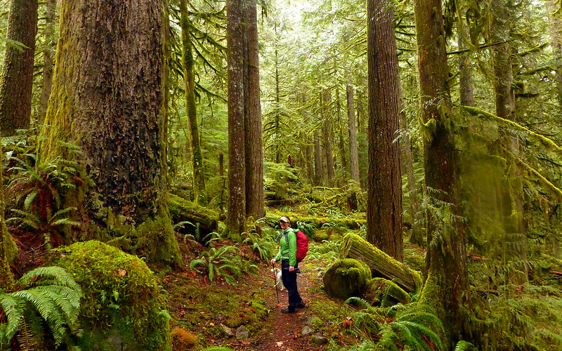
An absolutely exquisite forest. No words are adequate.


Image
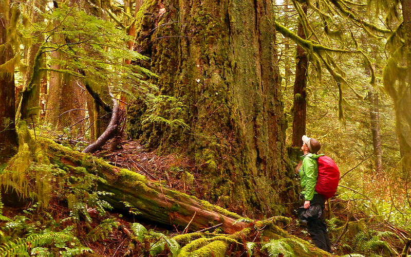
The trees just call to you. We wondered... 800 years old? 900?


Image
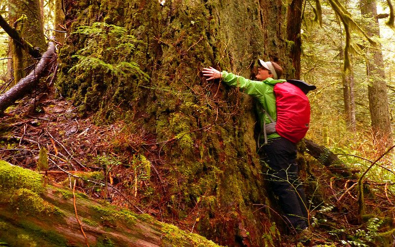
Whole lot of this going around these days, it seems!


Image
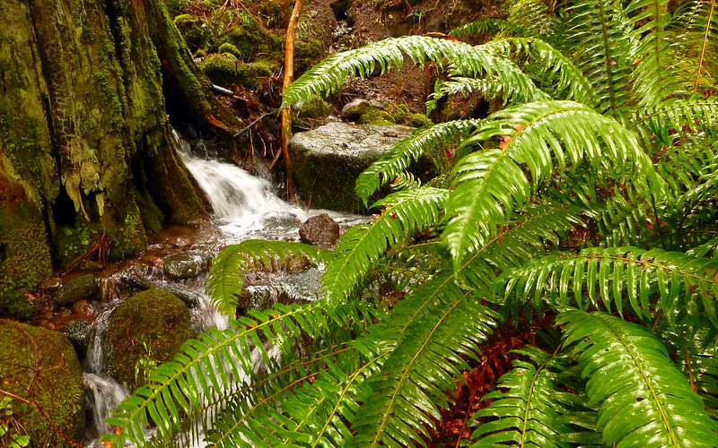
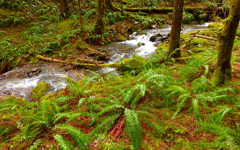
We crossed dozens of little tributaries to Eagle Creek. Some of them small.


Image
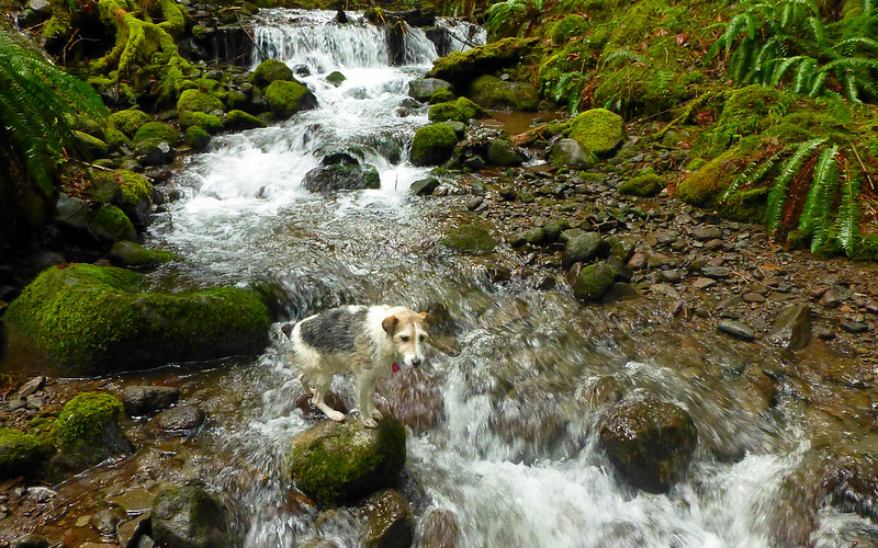
Some requiring a bit of thoughtful rock-hopping.


Image
And a few where the poles and a good sense of balance helped.


Image
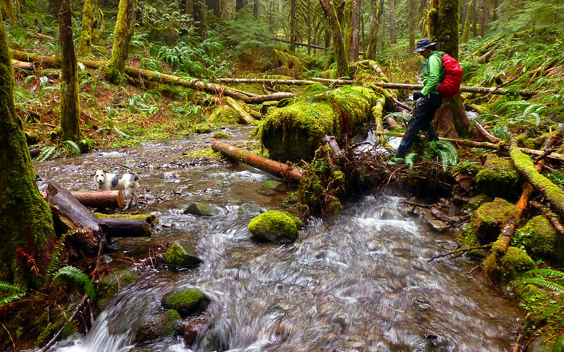
We made occasional forays down to the creek, whenever we saw something cool like this gigantic boulder.


Image
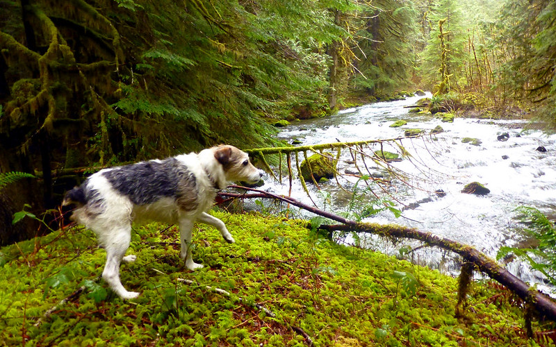
Oscar was all over that!


Image
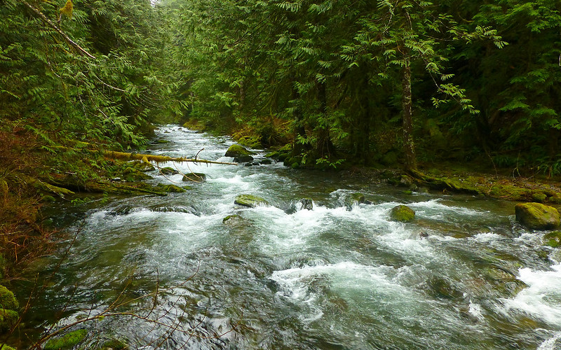
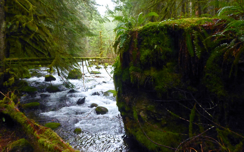
The view overlooking Eagle Creek was spell-binding.


Image
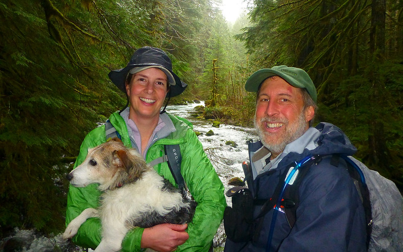
Turned out to be the perfect location for the TFF buddy shot, too!


Image
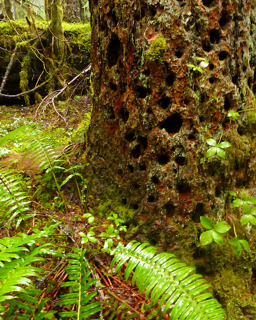
Evidence of woodpeckers existed, but we never saw any.


Image
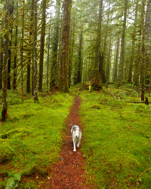
The trail was very soft on the feet. Boots only useful if they happen to be waterproof, I suppose.


Image
Perpetual whitenoise from one stream or another, completely masked my tinnitus. Lovin' that!


Image
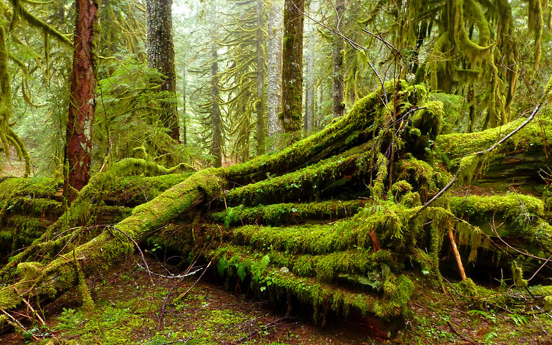
This end of that log was easily a couple feet taller than me!


Image
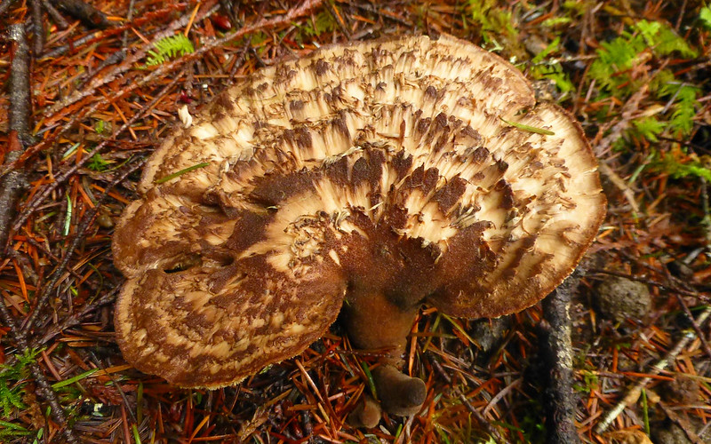
Really bizarre forest floor fungus thing.


Image
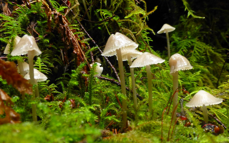
While most 'shrooms were pretty spent, there were still lots of these guys popping up from almost anything dead.


We ended up hiking about 13 miles, while almost imperceptibly climbing nearly 1500'. Our turn around point was at a crossing of Eagle Creek nearly 7 miles in, which we had a couple of options to get over, but it felt like pushing past there would've meant a TH return well after sunset. So, we had a little lunch, and retraced our steps. Never a boring moment, despite the in/out nature of it.

http://gpsfly.org/gps_map.php?gps_id=2972&w=645&h=440

Getting There
Finding the trailhead was a bit of an adventure. We sort of followed the directions offered by the Outdoor Project. After turning off the main road, it was mostly paved. The last couple miles, though, were a bit rough. Mostly mud, with more than a few fair-sized crater-lakes. Generally, at least one set of wheels could ride an edge, and it didn't end up being a problem at all with the jeep. Not entirely sure a small 2wd would be as successful, but, um, probably?

The trailhead coordinates offered by Outdoor Project are bogus, though. Do not use them! Instead, we created a new track when we left the trailhead, which shows the entire route back to the main road.

http://gpsfly.org/gps_map.php?gps_id=2971&w=645&h=440

I really wish I'd thought to take a photo of the trailhead, but didn't! So (I hope he won't mind!) instead I'll include a shot bobcat took and posted in another thread.

Image
I believe the little road marker reads "3-5E-13.4"? Wish I'd taken better note of it. Trail winds through those stumps.
(photo: bobcat)


It's a bit difficult to get to, but this is a real gem of a trail. We never saw another human all day long. To the people who laughed at the notion of hiking yesterday, I think we actually laughed last. Best possibly "crappy day" imaginable! :D
Last edited by kepPNW on January 11th, 2014, 3:47 pm, edited 1 time in total.
Karl
Back on the trail, again...

User avatar
BrianEdwards
Posts: 2405
Joined: February 2nd, 2010, 1:32 am
Location: Oregon City, OR
Contact:

Re: The Other Eagle Creek, 10-Jan-2014

Post by BrianEdwards » January 11th, 2014, 3:45 pm

The forest along that trail is so lush, lovely hike in any season
Clackamas River Waterfall Project - 95 Documented, 18 to go.

User avatar
RobFromRedland
Posts: 1095
Joined: May 28th, 2008, 10:03 pm

Re: The Other Eagle Creek, 10-Jan-2014

Post by RobFromRedland » January 11th, 2014, 4:18 pm

The first bit of the trail isn't all that great, travelling through old cut areas. But once you get down to the creek, it just becomes kind of magical. A great winter trail, but it is rather hard to find, and mostly unmarked. I haven't been there since the new cutting has started, though.

The point at which you turned around is really the end of that trail. After crossing the creek, you would be on the eagle creek cutoff trail (504 I believe) which heads back up the other side of the canyon and eventually intersects the Old Baldy trail. That trail isn't all that long but is very steep.
Life is not a journey to the grave with the intention of arriving safely in a pretty and well-preserved body, but rather to skid in broadside, thoroughly used up, totally worn out, and loudly proclaiming: WOW! What a ride! - Hunter S. Thompson

User avatar
Splintercat
Posts: 8333
Joined: May 28th, 2008, 10:03 pm
Location: Portland
Contact:

Re: The Other Eagle Creek, 10-Jan-2014

Post by Splintercat » January 11th, 2014, 5:43 pm

Thanks, Karl - great pick for a winter hike! Great photos, too..!

Couldn't agree more on the beauty along the way, too. The spur road used to be a lot uglier, but last time I hiked there (a few years ago now), the clearcuts had grown over quite a bit, and it wasn't really a big deal (though I've wondered if the renewed logging has undone that..?).

BTW, there's a large (and spectacular) falls on the stream flowing from Old Baldy on the south side of the canyon - you can see it from the Douglas Trail (in spots), and it's a fairly manageable bushwhack from the Eagle Creek trail... if you're looking for a somewhat longer trip. I've called it Chak Chak Falls and I don't think it gets many visitors. Hard to photograph, but really impressive!

Thanks for posting! :)

User avatar
Peder
Posts: 3401
Joined: May 28th, 2008, 10:02 pm
Location: Lake Oswego

Re: The Other Eagle Creek, 10-Jan-2014

Post by Peder » January 11th, 2014, 5:47 pm

After those pictures, I think we may have another kind of "Portland Hikers" influx on that trail! I sure wish to visit asap...
Some people are really fit at eighty; thankfully I still have many years to get into shape…

User avatar
K.Wagner
Posts: 652
Joined: June 2nd, 2013, 1:25 pm
Location: Vancouver, WA

Re: The Other Eagle Creek, 10-Jan-2014

Post by K.Wagner » January 11th, 2014, 5:58 pm

Karl,

You 2 picked another great day & great trip! I looked over the maps REALLY hard trying to come up with some way to make a loop with this trail, then up to Old Baldy with some sort of a OT connection back to the roads on the north side of Eagle Creek. Just couldn't find a way to avoid getting my feet wet. Maybe in the summer / fall it might be a reasonable thought. But, then there is that stiff climb out of the canyon at the very end....... :cry:
Kelly
There is no shortcut to anyplace worth going to.

PM me about the soon to be released:
Skamania 231
"How to really get off the beaten path in Skamania County"

User avatar
bobcat
Posts: 2768
Joined: August 1st, 2011, 7:51 am
Location: SW Portland

Re: The Other Eagle Creek, 10-Jan-2014

Post by bobcat » January 11th, 2014, 6:57 pm

As usual, your pictures do great justice to the trail. Looks like the three of you had a fine time.

Yes, the BLM road is 3-5E-15.4. Thanks for portraying my CR-V. I'll get this in the Field Guide soon enough, hopefully with precise directions . . .

The raggedy fungus is a scaly hedgehog (Sarcodon imbricatus).

User avatar
sprengers4jc
Posts: 1036
Joined: October 22nd, 2013, 11:35 am
Location: Vancouver, WA

Re: The Other Eagle Creek, 10-Jan-2014

Post by sprengers4jc » January 11th, 2014, 8:42 pm

Great TR! I had wondered if this trail was worth the hassle to get to it. From your pictures, I'd say it was. I'm glad that while the rest of us were shivering miserably in the rain, longing for some spring sun, you three were experiencing this place to share with the rest of us. Thanks for doing so :).

PS: I love the pic of Oscar doing the 'rock hopping.' We always let our dog pick the trail out for us in those situations. She seems to do much better than us at finding the trail with the least amount of wetness and difficulty ;).
'We travel not to escape life but for life to not escape us.'
-Unknown

User avatar
kepPNW
Posts: 6411
Joined: June 21st, 2012, 9:55 am
Location: Salmon Creek

Re: The Other Eagle Creek, 10-Jan-2014

Post by kepPNW » January 13th, 2014, 6:50 am

Thank you, for all the very nice comments!
RobFromRedland wrote:The first bit of the trail isn't all that great, travelling through old cut areas. But once you get down to the creek, it just becomes kind of magical. A great winter trail, but it is rather hard to find, and mostly unmarked. I haven't been there since the new cutting has started, though.
Yes, the first mile or so wasn't all that intriguing, as you drop down into the valley. Probably should've mentioned that. Nice enough, but nothing like what's to come.
RobFromRedland wrote:The point at which you turned around is really the end of that trail. After crossing the creek, you would be on the eagle creek cutoff trail (504 I believe) which heads back up the other side of the canyon and eventually intersects the Old Baldy trail. That trail isn't all that long but is very steep.
I think we were still about a half-mile or so from where it turned up. We wondered if there was "a point" in doing that extra bit, other than exercise? Assuming something called Old Baldy would have some views? That is, at any rate, on a day where the top wouldn't have been in clouds. :)
Splintercat wrote:Couldn't agree more on the beauty along the way, too. The spur road used to be a lot uglier, but last time I hiked there (a few years ago now), the clearcuts had grown over quite a bit, and it wasn't really a big deal (though I've wondered if the renewed logging has undone that..?).
Not sure I can answer that, having not seen it before. You do drive along the edge of a clearcut for awhile, not long before getting to the TH. Is that what you mean?
Peder wrote:After those pictures, I think we may have another kind of "Portland Hikers" influx on that trail! I sure wish to visit asap...
Not being in the Field Guide, and "a bit" difficult to find, I dunno...? :)
K.Wagner wrote:You 2 picked another great day & great trip! I looked over the maps REALLY hard trying to come up with some way to make a loop with this trail, then up to Old Baldy with some sort of a OT connection back to the roads on the north side of Eagle Creek. Just couldn't find a way to avoid getting my feet wet. Maybe in the summer / fall it might be a reasonable thought. But, then there is that stiff climb out of the canyon at the very end....... :cry:
We didn't spend much time with maps, but in just looking around were wondering what sorts of loop options might be possible, on either side of the trail. That Old Baldy loop you're looking at does appear pretty appealing! It'd be a heck of an effort, too, especially that "cliff diving" at the western end of the return route! :o

At least some of those O&C lands (I believe) shown on the map have been recently clearcut, too, fwiw.
bobcat wrote:Yes, the BLM road is 3-5E-15.4. Thanks for portraying my CR-V. I'll get this in the Field Guide soon enough, hopefully with precise directions . . .
I sure hope it's okay I used that photo! I linked directly to the one hosted here, which you put in your TR. Was really kicking myself for not taking one myself of the trailhead. Appreciate the confirmation on the road marker, too! We used that ourselves to positively ID the turnout!

I think one potentially confusing thing is, there's a road cut heading downhill approximately parallel to the trail. Folks could mistake that for the trail? Routing them through that thicket of stumps is the key to getting out the starting gate properly.
sprengers4jc wrote:Great TR! I had wondered if this trail was worth the hassle to get to it.
In a word... Yes! :D
Karl
Back on the trail, again...

User avatar
RobFromRedland
Posts: 1095
Joined: May 28th, 2008, 10:03 pm

Re: The Other Eagle Creek, 10-Jan-2014

Post by RobFromRedland » January 13th, 2014, 7:26 pm

I think we were still about a half-mile or so from where it turned up. We wondered if there was "a point" in doing that extra bit, other than exercise? Assuming something called Old Baldy would have some views? That is, at any rate, on a day where the top wouldn't have been in clouds. :)
Unfortunately, Old Baldy no longer has any views, even on a clear day. It used to have a lookout on it, but it has really grown in over the years. There is just a small open spot on the top now. There are a few spots on the way up with views, but nothing on top.
Life is not a journey to the grave with the intention of arriving safely in a pretty and well-preserved body, but rather to skid in broadside, thoroughly used up, totally worn out, and loudly proclaiming: WOW! What a ride! - Hunter S. Thompson

Post Reply