This shady trail climbs up the Mowich Ridge, moving from Washington’s Yacolt Burn State Forest into the Gifford Pinchot and connecting with the Pacific Crest Trail. The loop I did took in these two trails plus a segment of the CG 2000 (Red Bluff) Road – about 10 ½ miles.
The most difficult part of the hike for some has been locating the trailhead and the beginning of the trail. I have been here before, so found it easily enough – 0.9 miles west of Step Creek Falls (where CG 2000 first crosses Rock Creek). There’s an obvious parking pullout on the right. The trail is not so obvious for the first few yards, but becomes so about 25 yards in.
Note: The last time I hiked the Sedum Ridge Trail, nine years ago, there was a trailhead sign and a sign at the junction with the PCT. Neither exists today. The trail does not see systematic maintenance and the worst blowdown is in the first quarter mile. About a mile up the trail and until the PCT, there has been some log removal from the trail and a little pruning. The trail tread is becoming overgrown with Oregon grape, red huckleberry, thimbleberry, and vine maple. About a decade’s worth of debris covers the trail as well.
 Viewed 2287 times")
 Viewed 2287 times")
Heading in, you cross a broken footbridge (intact nine years ago) and then make your way up slopes and benches. This forest has not been logged and has been regenerating for 110 years, ever since the Yacolt Burn. Snags from the burn jut up in the understory, the largest one I saw being eight feet across. All the other footbridges on the trail are intact and, higher up, one crosses numerous small creeks and mossy seeps. The temperatures were just above freezing and ice had formed on the trail in places.
Just above the junction with the PCT is the ridgeline dominated by Mowich Butte. Abandoned FR 41 runs along here, but even though it was such a balmy day, and the views of the Washington volcanoes would have been splendid, I eschewed the temptation to go to the old lookout site: I had only begun hiking at 11:30 a.m. and needed to get back.
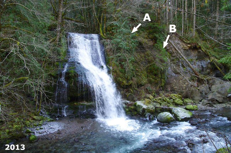
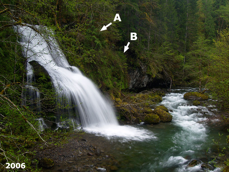
The PCT drops down along the valley of the North Fork Rock Creek. The trail passes right above one small waterfall, but there are several others more interesting down in the valley and better seen at this time of year when the leaves have dropped. Where the trail first gets close to the North Fork, you pass through a small grove of old growth hemlocks and Douglas-firs that somehow survived the 1902 conflagration. I reached the CG 2070 road and headed down to cross Rock Creek and follow CG 2000 for about ¾ mile back to the trailhead.