Larch Mountain from Multnomah Falls, 23-Nov-2013
Re: Larch Mountain from Multnomah Falls, 23-Nov-2013
Would that be the Sensitive Habitat that's lying under the giant collapsed concrete staircase that they built ?
Re: Larch Mountain from Multnomah Falls, 23-Nov-2013
That's a question that bears near-term investigation!Guy wrote:Would that be the Sensitive Habitat that's lying under the giant collapsed concrete staircase that they built ?
Karl
Back on the trail, again...
Re: Larch Mountain from Multnomah Falls, 23-Nov-2013
Very enjoyable tr. I have always found Larch Mountain to be a very good training hike, and particularly nice when foul weather cuts down on the crowds. I did a Wahkeena to Multnomah Falls loop last tuesday. Ran into some trail workers placing new signs. They asked us where we thought even more signs should go. They felt the signage frenzy was triggered by the youth group that was stranded overnight in late August.
Re: Larch Mountain from Multnomah Falls, 23-Nov-2013
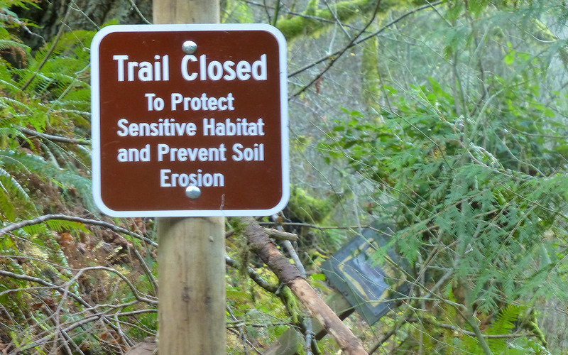
Yeah, the Wahkeena junction was crazy. See first attachment, and in addition there was at least one more "Wahkeena ->" sign on a tree about 50 feet down the trail!gene mc wrote:Very enjoyable tr. I have always found Larch Mountain to be a very good training hike, and particularly nice when foul weather cuts down on the crowds. I did a Wahkeena to Multnomah Falls loop last tuesday. Ran into some trail workers placing new signs. They asked us where we thought even more signs should go. They felt the signage frenzy was triggered by the youth group that was stranded overnight in late August.
Karl
Back on the trail, again...
Re: Larch Mountain from Multnomah Falls, 23-Nov-2013
Great pics, Kep! You had some luck there as they generally close access to the Multnomah bridge if it's icy in the slightest; likely concerned about lawsuits. Have heard of people getting severely fined for bypassing the gate. If it's closed, one can head east maybe a mile down the OCRH to a pullout where you can access via the Gorge trail. (Or go up via Wahkeena.)
Yes, the ice formations in Archer Valley are something to see. Was up there randomly one day during a warm spell and huge chunks of ice were calving off the valley walls. Very impressive.
Re: Larch Mountain from Multnomah Falls, 23-Nov-2013
Thanks, Mandrake! I guess I wasn't even aware of them gating it off. Jeez, good to be aware of that. Hopefully, they put a sign down low, so you don't have to get up near the bridge before finding out? Wahkeena was my fallback plan for coming back down, so I suppose I would've diverted there if it was blockaded. That access to the east is good to keep in mind, as well!mandrake wrote:Great pics, Kep! You had some luck there as they generally close access to the Multnomah bridge if it's icy in the slightest; likely concerned about lawsuits. Have heard of people getting severely fined for bypassing the gate. If it's closed, one can head east maybe a mile down the OCRH to a pullout where you can access via the Gorge trail. (Or go up via Wahkeena.)
Sounds excellent! Not sure why that area wasn't higher on my radar before now.mandrake wrote:Yes, the ice formations in Archer Valley are something to see. Was up there randomly one day during a warm spell and huge chunks of ice were calving off the valley walls. Very impressive.
Karl
Back on the trail, again...
- Sean Thomas
- Posts: 1647
- Joined: February 25th, 2012, 11:33 pm
Re: Larch Mountain from Multnomah Falls, 23-Nov-2013
Glad someone was able to NOT block the tallest mtn in the state But as Tom pointed out, you have to be a real pro to block out Hood and Jeff (although im sure i'll accomplish that someday
Yes, I've seen the closure a few times too and good call on that pullout to the east. Do you know what the fine was(just curious)
mandrake wrote:Great pics, Kep! You had some luck there as they generally close access to the Multnomah bridge if it's icy in the slightest; likely concerned about lawsuits. Have heard of people getting severely fined for bypassing the gate. If it's closed, one can head east maybe a mile down the OCRH to a pullout where you can access via the Gorge trail. (Or go up via Wahkeena.)
Yes, the ice formations in Archer Valley are something to see. Was up there randomly one day during a warm spell and huge chunks of ice were calving off the valley walls. Very impressive.
Yes, I've seen the closure a few times too and good call on that pullout to the east. Do you know what the fine was(just curious)
Re: Larch Mountain from Multnomah Falls, 23-Nov-2013
Karl, is there ever a day when you don't need to get out?
As for the GPS readings, they often undercount on switchbacks because they can set track points in mid switch, eliminating the corners and making it look as if you traveled in more of a straight line. Maybe that happened on the paved trail? Not so many switchbacks on LMT after that.
RE: Signage, they've also added new signage by the overlook on Whakeena Trail. For quite a while there were no signs at the junction of LMT and #420. (My guess is stoners like the 420 sign and keep stealing it.) Much earlier this year I ran into a guy heading up Larch Mountain at the Highwater Trail junction one night around 9 pm who thought he was on the Whakeena Loop. He had no light and no real map, just a page torn from Sullivan's book. I met another hiker who got lost in the same area and went all the way to the summit of Larch before realizing his mistake. Lost hikers frequently end up at Nesika and call the Trails Club - and we talk them down. The lost church group earlier this year was coming back on the basin road and turned onto the Cougar Rock Trail thinking it was the Larch Mountain Trail, then got cliffed out below Cougar Rock. SAR reports 90% of rescues take place between Angel's Rest and Horsetail Falls, and I believe they do around 165 a year. To you and I, it's hard to fathom getting lost in this area, but it happens all the time.
Re: Larch Mountain from Multnomah Falls, 23-Nov-2013
I'm glad you were able to get out this past weekend, Karl! I really wanted to go. But no.
I've had a few icy treks up and down the paved part at the bottom myself. One time I was crawling and clawing my way down the icy asphalt at the same time that a group of Asian tourists were crawling and pulling themselves up along the chain railings. As we passed each other we all burst out laughing, because we looked ridiculous. Fortunately all of us survived.
Re: Larch Mountain from Multnomah Falls, 23-Nov-2013
It did take two tries, of course!Sean Thomas wrote:Glad someone was able to NOT block the tallest mtn in the state
Pretty rare, when you put it that way!aircooled wrote:Karl, is there ever a day when you don't need to get out?
Boy, I dunno. If you zoom in on gpsfly, you'll see it getting pretty weird on the very lower part, just jumping off into space at times. I was suspecting that was satellite signals reflecting off cliffs, or something. Wasn't so much just truncating switchbacks as it was creating entirely new ones in totally non-sensical places.aircooled wrote:As for the GPS readings, they often undercount on switchbacks because they can set track points in mid switch, eliminating the corners and making it look as if you traveled in more of a straight line. Maybe that happened on the paved trail? Not so many switchbacks on LMT after that.
I've gotten disoriented before up in Multnomah Basin. I can see it a little. I guess I have trouble with those just wandering aimlessly, chattering away but not paying attention. Though I know that some group dynamics lead to that.aircooled wrote:To you and I, it's hard to fathom getting lost in this area, but it happens all the time.
Funny! I felt a little like that, but was thankfully all alone at that point.Crusak wrote:I'm glad you were able to get out this past weekend, Karl! I really wanted to go. But no.
I've had a few icy treks up and down the paved part at the bottom myself. One time I was crawling and clawing my way down the icy asphalt at the same time that a group of Asian tourists were crawling and pulling themselves up along the chain railings. As we passed each other we all burst out laughing, because we looked ridiculous. Fortunately all of us survived.
It felt good to stretch the legs, for sure!
Karl
Back on the trail, again...