Green Point Mtn via Nick Eaton Way, 11-Nov-2013

This forum is used to share your experiences out on the trails.
Post Reply
User avatar
kepPNW
Posts: 6411
Joined: June 21st, 2012, 9:55 am
Location: Salmon Creek

Green Point Mtn via Nick Eaton Way, 11-Nov-2013

Post by kepPNW » November 13th, 2013, 6:40 pm

Well, it was one of those days. Apparently fairly nice (beautiful, even?) back in the city, and downright crazy up the gorge. Jim (crusak) and I both had Monday free, and decided to do a loop up Nick Eaton Ridge, over to Green Point Mountain, then back down the Herman Creek valley. The day started out nice enough. Although the winds driving through gorge were pretty ferocious around 6:00am, blowing my jeep from lane to lane, the skies were generally pretty clear. That all changed as we climbed.

We left the trailhead around 7:00, following the Herman Creek trail to the Nick Eaton Way turn off, then up, up, up, up, up, up, and up some more, until we were finally in the clouds. We did have some warning. There's a clearing around 2400', that generally offers some views up the Herman Creek valley, across the valley to Bensen Plateau, and west through the Gorge. Well, the view to our south, up the valley, was rather foreboding.

Image
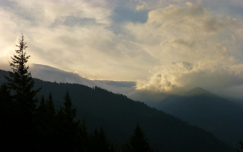
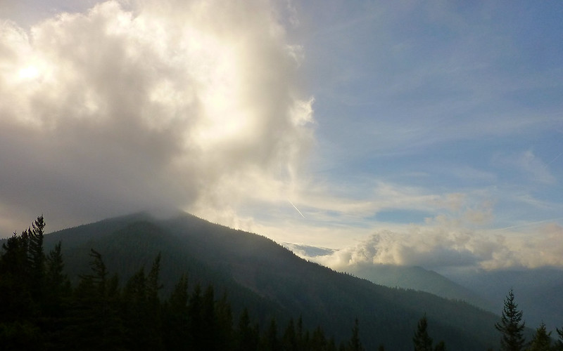
Yes, that's a really nasty wave of clouds spilling down over Nick Eaton Ridge and Green Point Mountain.


Image
It was a monster wave!


Image
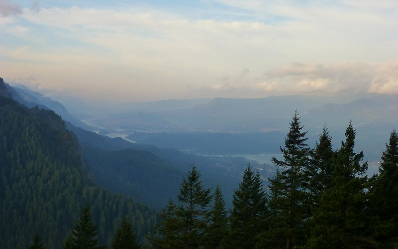
Looking across the Table Mountain landslide, about 8:30, west into the Gorge. Shaping up to be a nice day back there.


I had told Jim that the way up was mostly about the exercise. :) This (above) was one of two views we had before climbing right into that wave. Otherwise, it was just a really nice forest, and a pretty nice trail, we were climbing up through and along.

Image
The kind of sight that makes you wonder if mcds got bored. We counted no fewer than 17 cuts!


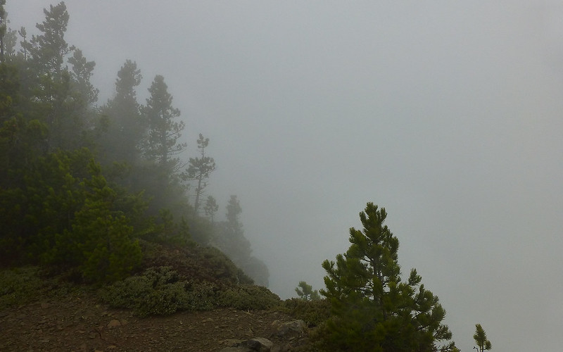
We veered off at about 3100' to a little point that I'd read offered some nice views. I really need to revisit those TRs to determine what the heck gave me that idea! What we did see, was the rest of our climb into the clouds, stretching out ahead of and above us.


Image
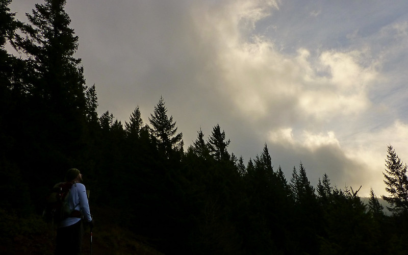
Jim surveying the sky from Pt 3159.


Image
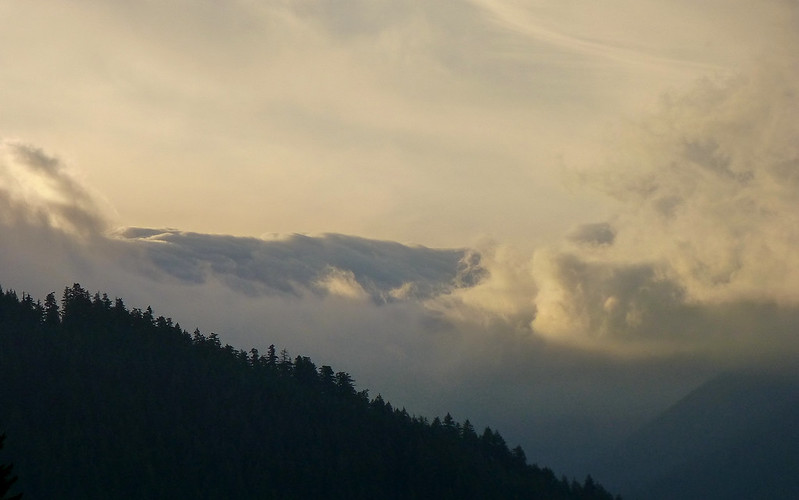
The last 1000' up Nick Eaton Ridge, with a little saddle to lend false hope about 2/3 of the way up. Note cloud wave hasn't moved.


Image
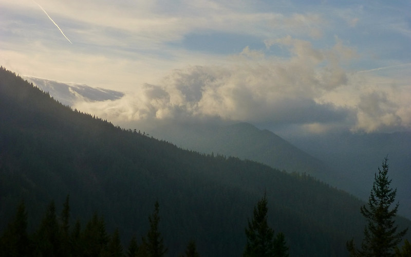
Cloud wave still spilling over Green Point, into the Herman Creek valley, about 9:00.


This next stretch was a good, fun test, though. I didn't think so, until I downloaded my track later that night, but after dropping back down off Pt 3159, the trail climbs 1000' in just about 0.8 miles. It then levels off for some ways all along Nick Eaton Ridge, until reconnecting with Gorton Creek Trail farther south.
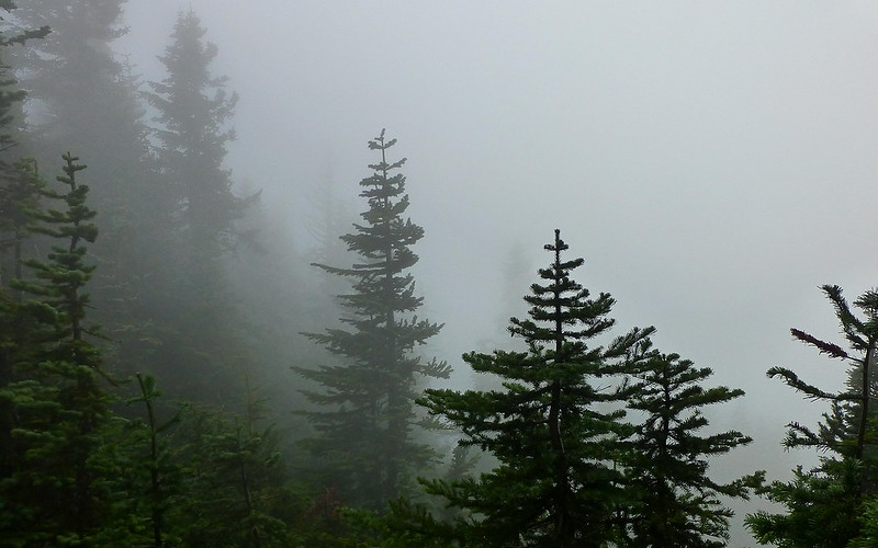
Image
Up, up, up...


Image
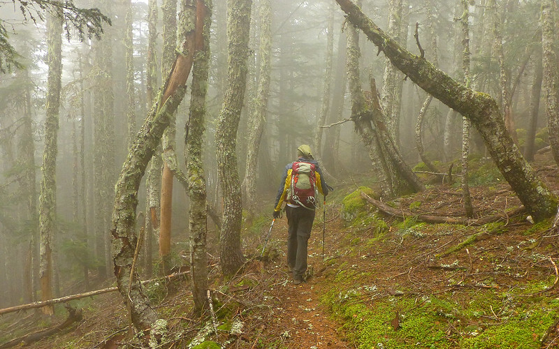
... into the clouds!


Image
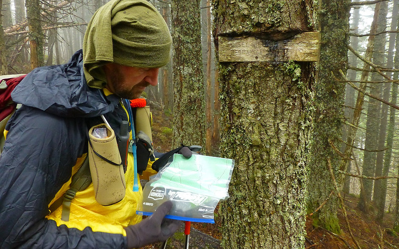
Pausing at the Casey Creek junction, as it was one of the few visible landmarks we could calibrate to.


Image
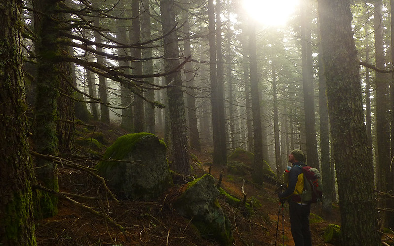
For all of 15 or 20 seconds, the sun poked tentatively through the clouds. SNAP!


Image
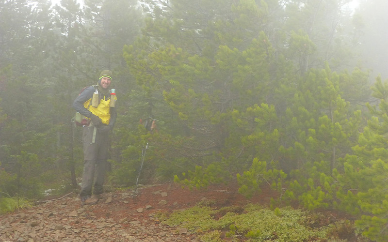
We paused in the forest, for me to don my windbreaker. No need to wait for this viewpoint at which we did not even linger!


Image
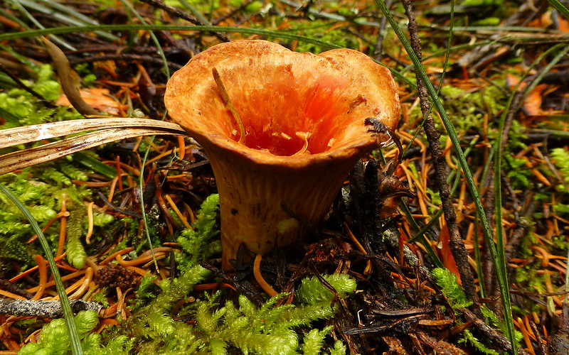
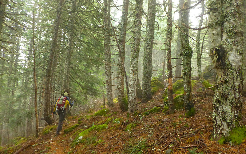
The forest floor was full of fungus, though, which livened things up a bit.


Continuing on to Green Point Mountain, we ran into virtually no snow at all compared to Craig's recent report of just two days prior. The thing that was just incredibly striking about this trail, however, was that it was almost impossibly straight for nearly 2.5 miles. Very weird! Like driving across corn fields in the midwest, when we did come to a bend in the trail it was almost startling.

Image
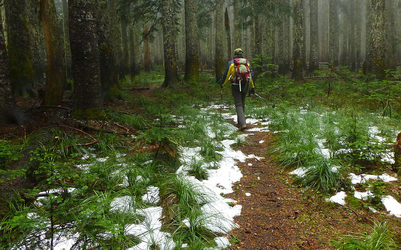
Largest patches of snow we encountered all day. These at about 4400'. (Watch that curve ahead!)


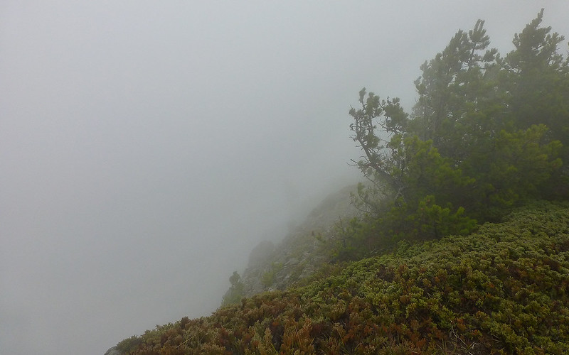
We knew we were getting close to the summit as the wind picked up and the sky thickened. Yeah, that's what I meant to say. The water content of the sky all around was got very dense. We hit two, what I can only assume on a clear day might be called, viewpoints. Each was entirely shrouded in wicked-fast moving clouds. Our thermometers registered 32-34°F. We were guessing the wind, not the gusts, but the steady wind to be blowing at around 50mph. The water in the air was mostly frozen, but what the weather people might call a "wintery mix" -- sort of like a Slurpee, but a little more dispersed and without the artificial coloring.

Image
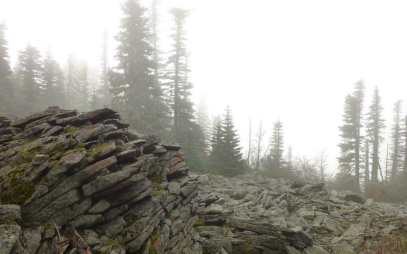
Gotta be a view there, right?


Image
At the actual summit plateau, there's a nice little flat gravel viewing platform. Looked like a cliff over the edge, but really couldn't tell.


Image
It was more than a little hard to stand up against the wind coming over the cliff face.


http://youtu.be/xggneOLvNUw
I think this captures it a bit better than the stills above.


Image
Here, Jim is about 30' away from me. The air is pretty thick!


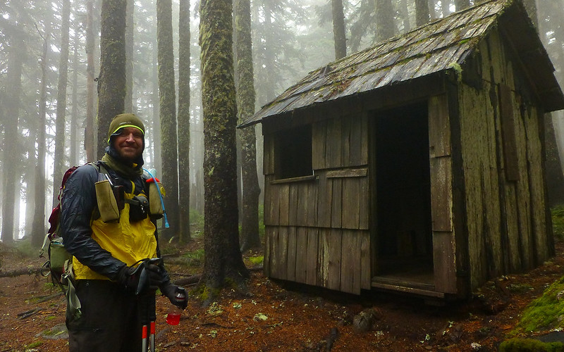
We didn't dally at the summit, either, of course. At this point, we were both marveling that neither of us had even begun to expect this sort of situation. However, we were both prepared with hats, gloves, pretty good wind/water protection. But still, the cold was pernicious. We high-tailed it for the Herman Creek Cut-off, still over a mile away, hoping that when we dropped down on the leeward side of the ridge the situation would improve considerably. The wind hadn't let up a bit, when we saw...


Image
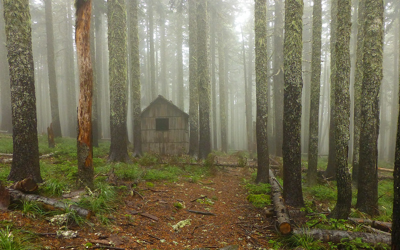
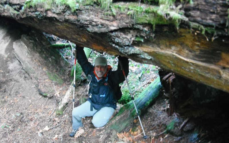
O.M.G...! Shelter from the storm! (About 12:15.)


Image
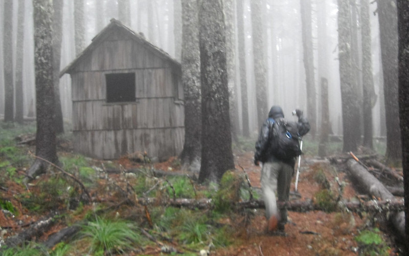
I was really moving at this point, shooting a couple photos of our refuge on the run. (photo: Jim)


Image
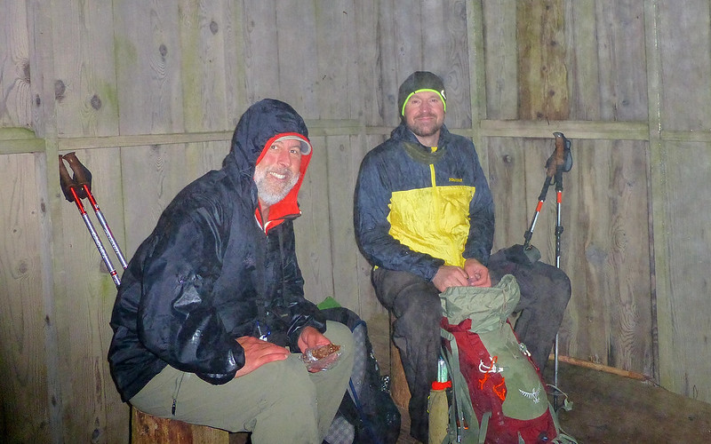
My fingers couldn't even undo the snaps on my pack. But finally, we were able to relax and eat a little lunch.


Image
Refreshed and rarin' to go again, maybe 15 minutes later, we took the plunge off the ridge down into the valley.


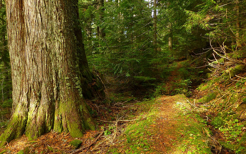
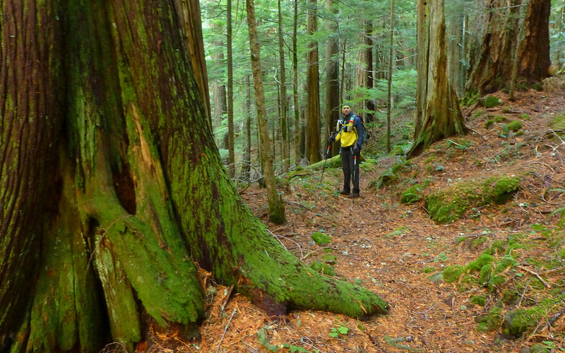
Needless to say(?), the situation changed immensely as we traveled downhill into the Herman Creek drainage. We entered a virgin old growth forest of magnificent grandeur! The lush greenness of it all was awe-inspiring. And it started warming almost immediately. Which was much welcome. Within a couple miles, we were above 40°F again. The sky no longer leaked down upon us.

Image
Long, long ago, someone worked awfully hard engineering great stretches of this trail to keep it high and dry.


Image
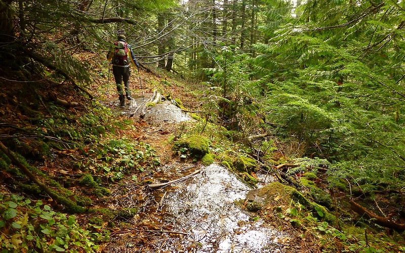
Although there were still numerous minor creek crossings, all were of the dry boot variety.


Image
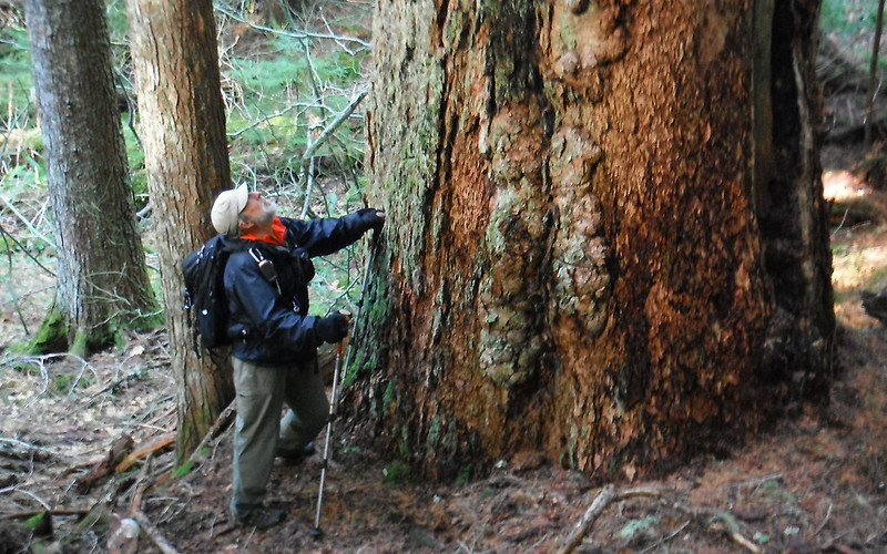
The trees were ginormous! (photo: Jim)


Image
Opportunities to pose beside them were countless. But there was no need. One just stood in awe.


Image
The forest was dark, so I hardly took any photos. And yet. Wow...


Image
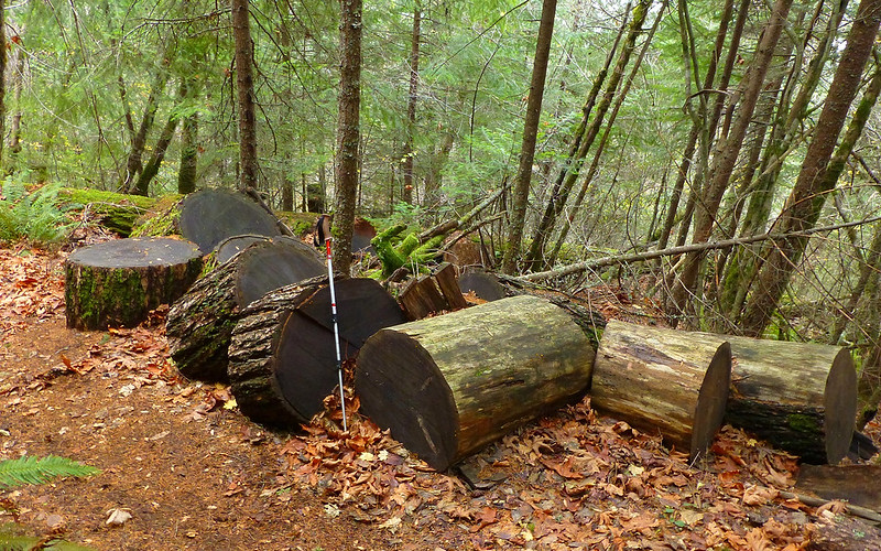
Just doin' my part, trying to keep up with Sean! Trail maintenance never ends. (photo: Jim)


Image
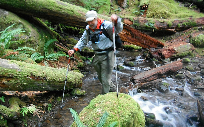
It was a glorious descent. Easiest vertical mile ever. (photo: Jim)


Image
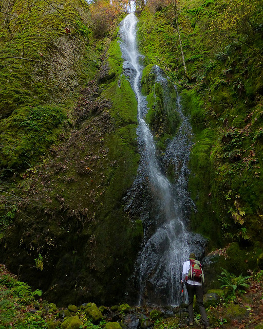
Some pretty nice scenery along the way, too.


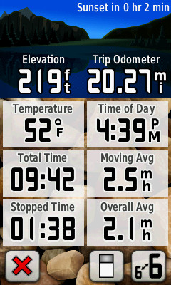
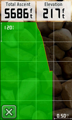
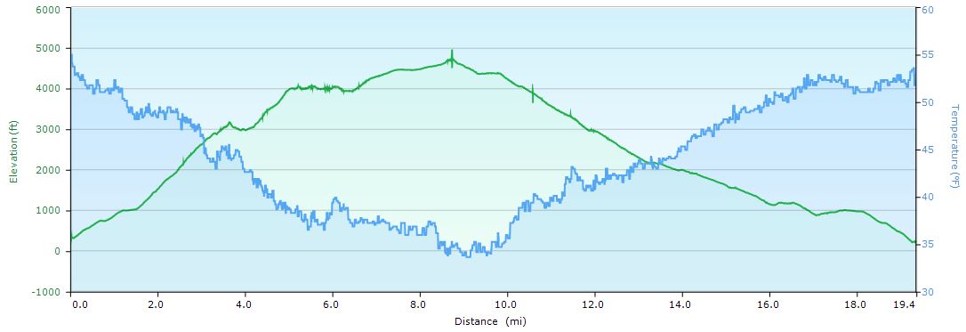
We got back to the trailhead just shortly before sunset. Probably 4:30 or so. The final GPS tally put the day at just over 20 miles, and about 5700' of EG. The more generalized, recorded track computed to a bit less than that.

Image . . . Image

Image

http://gpsfly.org/gps_map.php?gps_id=2874&w=645&h=440

I know it sounds cliché-ish, but... It was another really great day to be in the woods! :D
Karl
Back on the trail, again...

User avatar
Crusak
Posts: 3617
Joined: August 6th, 2009, 7:33 pm
Location: Oregon

Re: Green Point Mtn via Nick Eaton Way, 11-Nov-2013

Post by Crusak » November 13th, 2013, 7:18 pm

Two things surprised me about Monday's hike. First, it was more difficult that I expected. The total elevation gain on the route was probably the most I've done all year, but I felt really good throughout the hike. I think cold weather agrees with me (much more so than hot weather!)

And the second surprise was the weather. I'd checked forecasts for areas all over the region in the 5000-6000' range and didn't see anything approaching what we experienced on the summit. I ended up digging into my 'emergency clothing' that I've carried on over 100 other day hikes, but never touched. Good thing I had that Marmot windshirt with me. :)

The last 11 miles was pretty relaxing after that steep 5300' / 9 mile climb. And the trees! There are some whoppers along the Herman Creek Trail.

Thanks for the great suggestion on where to hike Karl. Like you said, another great day in the woods!
;)
Jim's Hikes

Solvitur Ambulando

User avatar
Get Out Backpacking
Posts: 115
Joined: July 24th, 2012, 12:49 pm

Re: Green Point Mtn via Nick Eaton Way, 11-Nov-2013

Post by Get Out Backpacking » November 13th, 2013, 7:52 pm

Thanks for the snow report. I was thinking about going out to Indian Mtn. this weekend, starting out from Nick Eaton ridge and then taking the PCT back. Hope the forecast starts looking a little better.

User avatar
kepPNW
Posts: 6411
Joined: June 21st, 2012, 9:55 am
Location: Salmon Creek

Re: Green Point Mtn via Nick Eaton Way, 11-Nov-2013

Post by kepPNW » November 14th, 2013, 6:16 am

Crusak wrote:Two things surprised me about Monday's hike. First, it was more difficult that I expected. The total elevation gain on the route was probably the most I've done all year, but I felt really good throughout the hike.
It's a doozy. I really liked the nice, soft trails, though. That makes such a pleasant difference on the feet.
Crusak wrote:And the second surprise was the weather. I'd checked forecasts for areas all over the region in the 5000-6000' range and didn't see anything approaching what we experienced on the summit. I ended up digging into my 'emergency clothing' that I've carried on over 100 other day hikes, but never touched. Good thing I had that Marmot windshirt with me. :)
Heh, ditto that! I still had one more layer I could've plundered, but it was nice to get some use of stuff I often wonder why I bother with. Having a second set of gloves was a godsend at the point my fingers were no longer operating. :)
Get Out Backpacking wrote:Thanks for the snow report. I was thinking about going out to Indian Mtn. this weekend, starting out from Nick Eaton ridge and then taking the PCT back. Hope the forecast starts looking a little better.
It'll be fun to hear what you run into! As you allude, the freezing levels have taken a plunge, and looks like some moisture on its way.
Karl
Back on the trail, again...

payslee

Re: Green Point Mtn via Nick Eaton Way, 11-Nov-2013

Post by payslee » November 14th, 2013, 11:02 am

Love those pictures!

My goal on Saturday had been to visit the big trees up at cedar swamp but my group opted for a hot sit-down lunch when we were just a mile short. It's a luxury to have too many good things to choose from but I am definitely going back up there soon. I love the Herman Creek Valley because no matter how wretchedly awful the weather seems to be everywhere else, that place is always so sheltered and lush.

Your videos of the Greenpoint summit on the other hand, Brrr!

Your fungus was a wooly chanterelle. Good to eat, although reportedly not quite as delicious as the yellow chanterelles we were finding lower down. It was a good year for shrooms this year, although it looks like the snow blanket is coming down quickly.

take care,
payslee

User avatar
kepPNW
Posts: 6411
Joined: June 21st, 2012, 9:55 am
Location: Salmon Creek

Re: Green Point Mtn via Nick Eaton Way, 11-Nov-2013

Post by kepPNW » November 14th, 2013, 1:43 pm

Thanks, payslee! Even a cold PB&H sandwich was incredibly welcome, once we found that little shack to get out of the weather in. I really was enchanted with the Herman Creek valley, though. I'm sure I'll be back, probably repeatedly. First time there. Back in the '70s, I knew a couple guys who spent most of the summer up there. Didn't "get it" then. Now, it makes (a little) more sense. :)
Karl
Back on the trail, again...

airoff
Posts: 422
Joined: March 15th, 2012, 8:35 am
Location: Portland, OR

Re: Green Point Mtn via Nick Eaton Way, 11-Nov-2013

Post by airoff » November 14th, 2013, 7:46 pm

kepPNW wrote:Thanks, payslee! Even a cold PB&H sandwich was incredibly welcome, once we found that little shack to get out of the weather in. I really was enchanted with the Herman Creek valley, though. I'm sure I'll be back, probably repeatedly. First time there. Back in the '70s, I knew a couple guys who spent most of the summer up there. Didn't "get it" then. Now, it makes (a little) more sense. :)
I'm just a lurker here so obviously I know none of you, but I'd like Sean, Don, justpeachy, or any other legend here to take this opportunity to tell us even more about "that little shack"!

I'd actually mostly love to know more about how to get to the other remaining WWII shelter without getting my feet soaked or stung by hornets. I've been on Tanner Cutoff heading west from Dublin Lake, but have never ventured South from what I assume to be Moffet Cr Trail...

User avatar
kepPNW
Posts: 6411
Joined: June 21st, 2012, 9:55 am
Location: Salmon Creek

Re: Green Point Mtn via Nick Eaton Way, 11-Nov-2013

Post by kepPNW » November 14th, 2013, 10:10 pm

I'd really enjoy hearing more about that shack (or others like it), as well. It came as a total surprise to me, and I've wondered what its story was!
Karl
Back on the trail, again...

User avatar
Crusak
Posts: 3617
Joined: August 6th, 2009, 7:33 pm
Location: Oregon

Re: Green Point Mtn via Nick Eaton Way, 11-Nov-2013

Post by Crusak » November 15th, 2013, 6:24 am

kepPNW wrote:I'd really enjoy hearing more about that shack (or others like it), as well. It came as a total surprise to me, and I've wondered what its story was!
Before this trip I checked out a couple of previous TRs and saw that the shack was along the route. But I'd forgotten about it until we came across it during the hike. A very welcome refuge it was!
Jim's Hikes

Solvitur Ambulando

Post Reply