The forecast called for a high right around 32°F at the summit, with clearing clouds as the day progressed. As it turned out, the day started out clear (away from the Columbia) and clouds slowly enveloped the volcano as it progressed. So we didn't enjoy the 200-mile views possible on some days, but there was "a lot of drama in the air!" as backup entertainment. (It also meant survival sans sunscreen - bonus!)
Story of the day, racing clouds to the summit. We won.
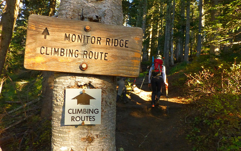
Four of us started from the Climber's Bivouac trailhead about 8:45am. The first couple miles climb gently through the forest, to timberline. Didn't see the abundance of mushrooms that were out just a week ago a few miles from here. We did get a few nice views along the way, though.
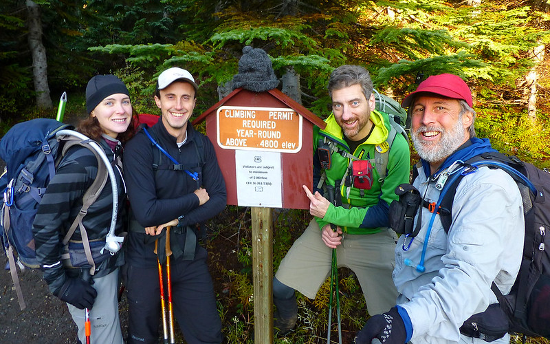
Elsie, Bosterson, EP, and me. Having slept in, we're all ready to rock!
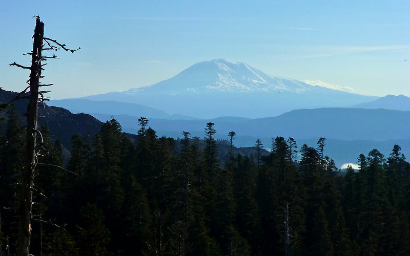
Clear start to the day. Mount Adams, 30-odd miles away.
This route seems harder in some ways, easier in other, than the Worm Flows route. Shorter, less climbing, but boulder-ier.
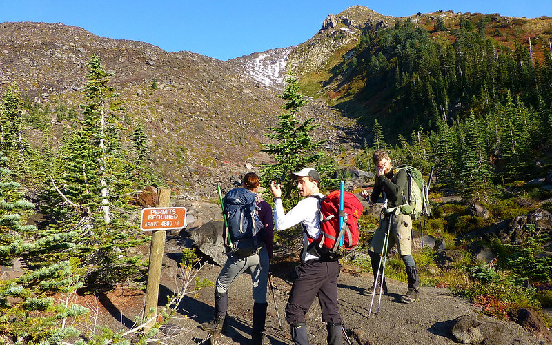
As we break out of the forest, we find more signs speaking directly to government inaction.
Eric seems to have something in his eye, and Bosterson's clearly looking the other way. Hmmmm...
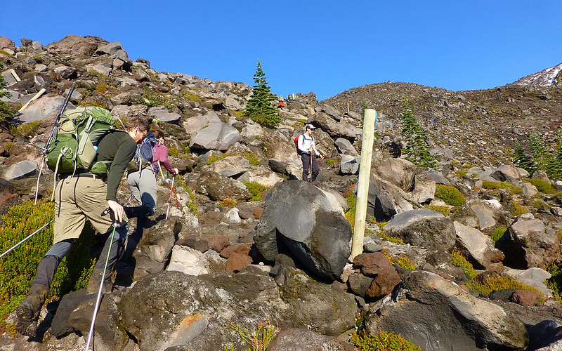
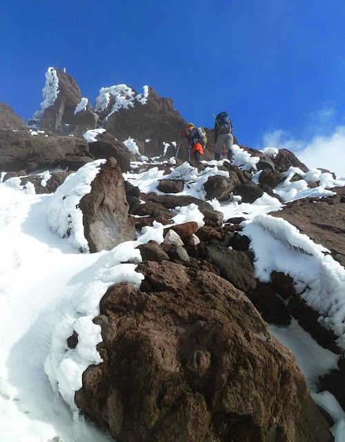
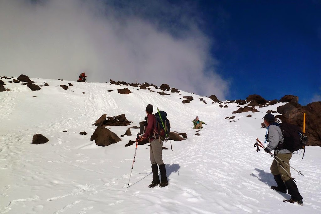
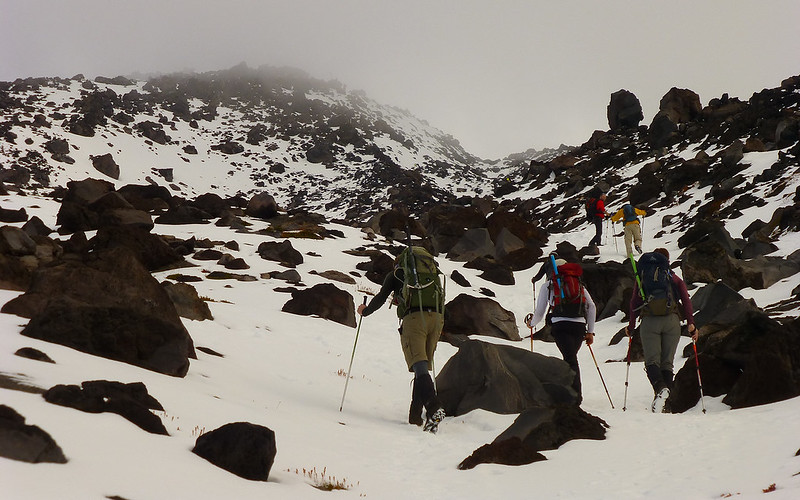
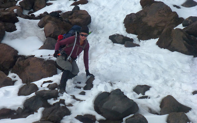
Scaling the boulders was a task; one I didn't relish repeating with a gravity assist.
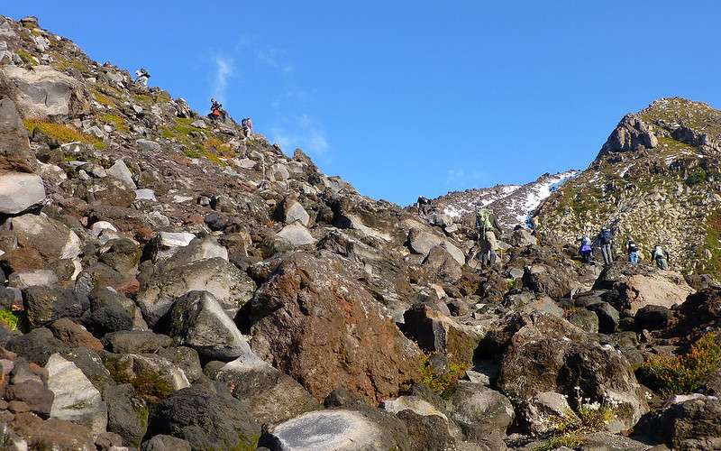
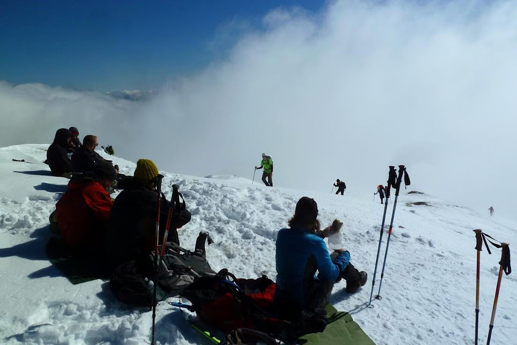
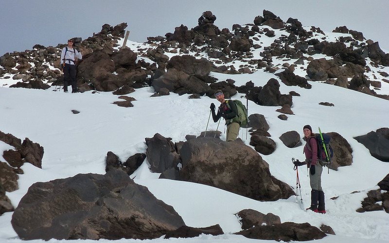
Although we were far from alone, the mountain never seemed crowded. Except right here, maybe.
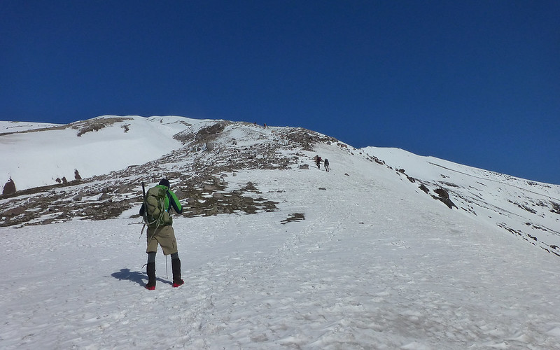
Somehow, perhaps following the herd, we got slightly off the "trail" for awhile. Didn't matter. Target was in sight, and it was simply a matter of going up. And up. And up.
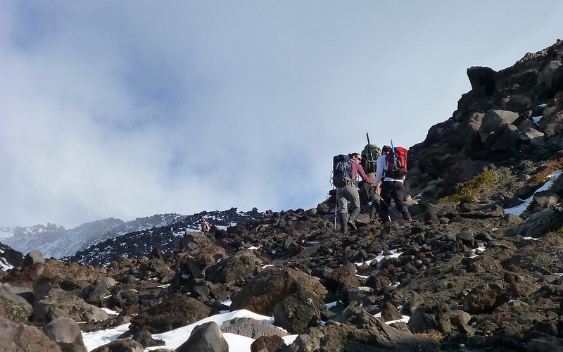
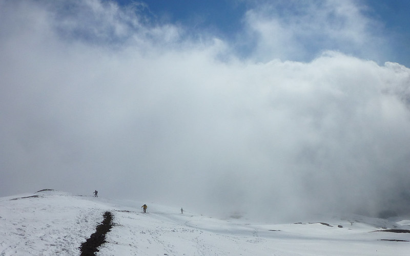
About 1.5 hours in, the clouds started making themselves a bit more known. It looked like we could climb out of them, though.
The race was on.
We didn't start running into appreciable snow until nearly 6000'.
At which point we got into a game of spikes-on/spikes-off, depending on terrain.
Bosterson never did use any traction at all, though. Dude sticks to mountains like velcro.
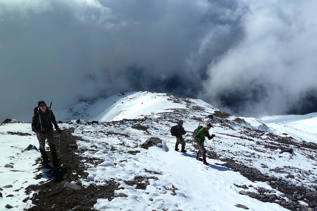
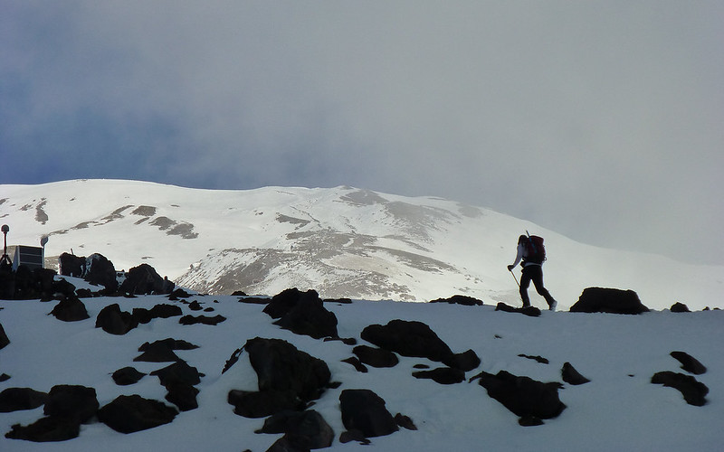
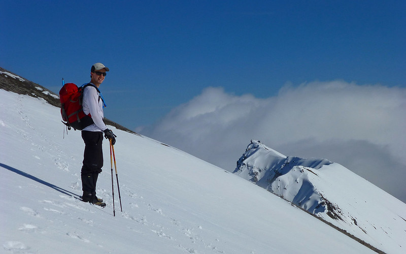
Climbing into the clouds. New trail friends from the parking lot below. (Orange skirt was visible at a distance!)
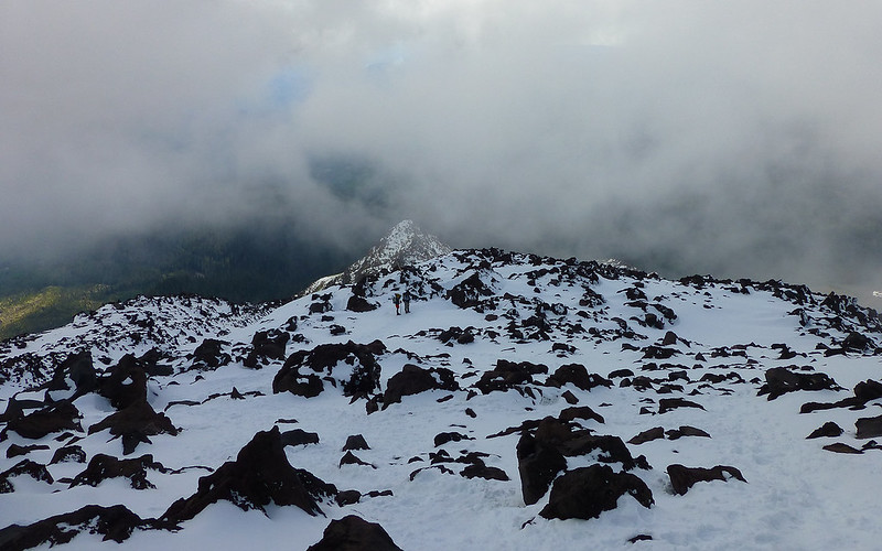
Just a nice shot. Summit in sight.
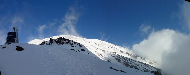
They said there were several of these monitoring stations, but this was the only one I noticed, here on Monitor Ridge.
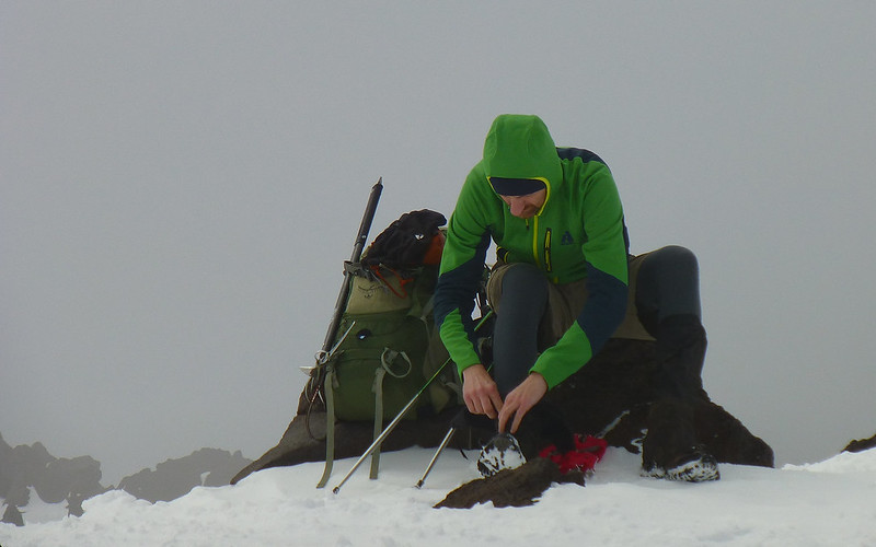
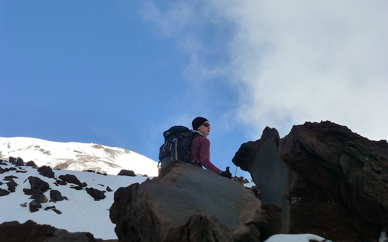
Equipment adjustment. It was getting pretty cold at this point. No sun; plenty of wind.
Whoops, I lied. There's smore monitors!
Same equipment, five minutes later. Mountain's playing peekaboo!
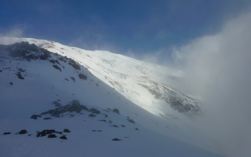
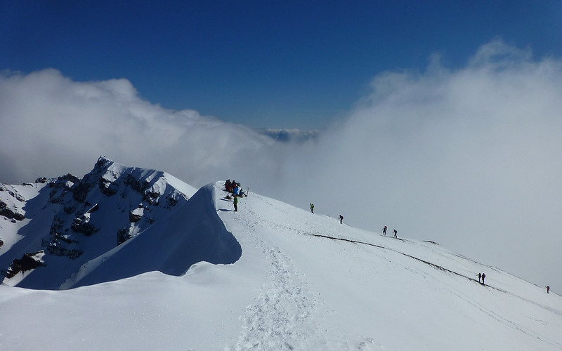
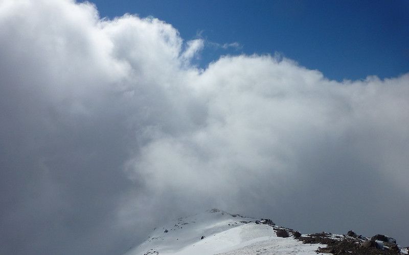
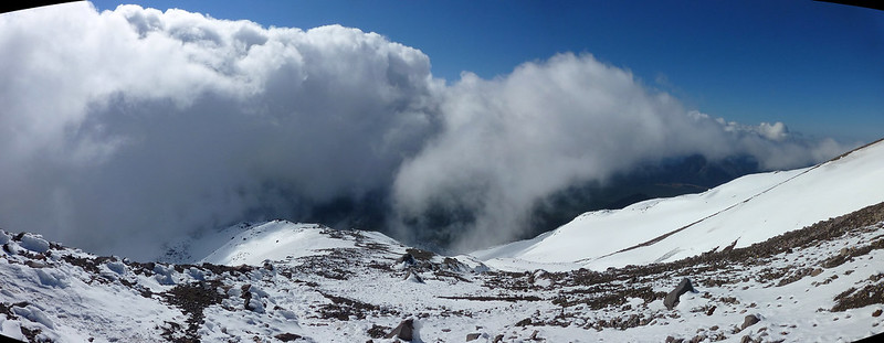
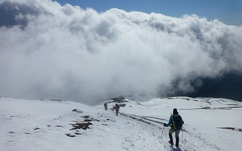
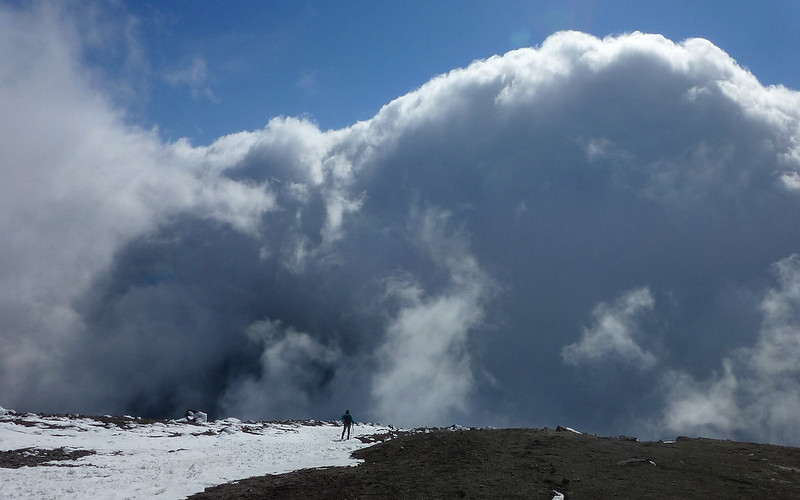
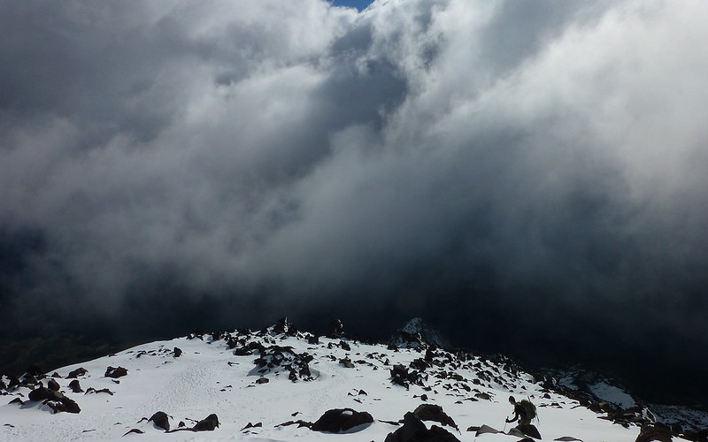
Wave after angry wave of clouds washed over the ridge.
Looking down (can you tell?) was often far more intriguing than looking up. Dynamic skies!
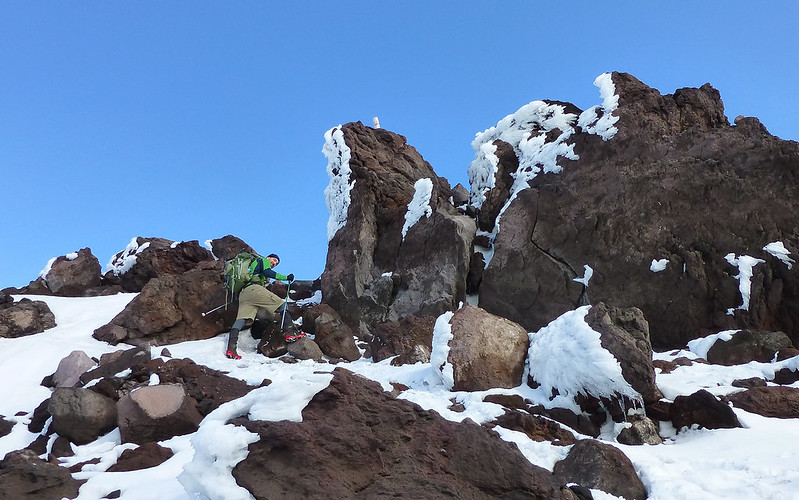
Really cool little rime-laden passage through some lava boulders.
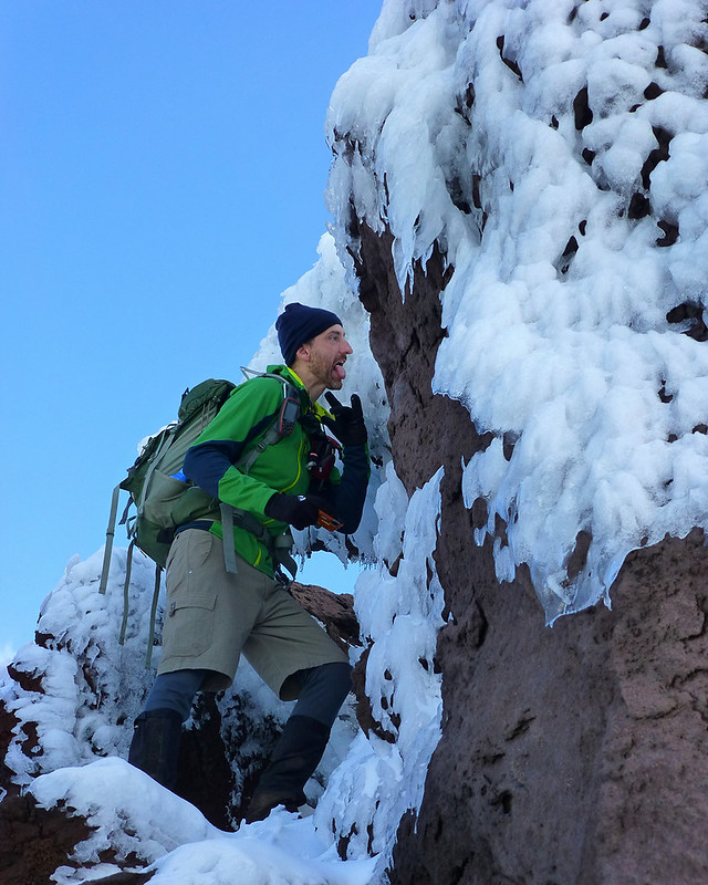
Oh! That's right! This is a Loonie Hike! Cue... Action!
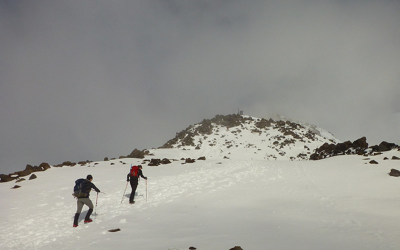
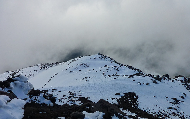
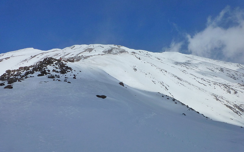
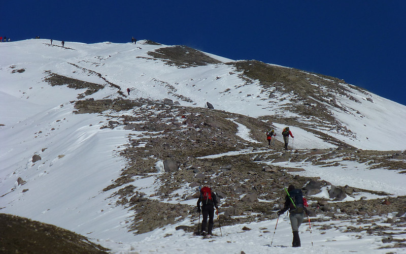
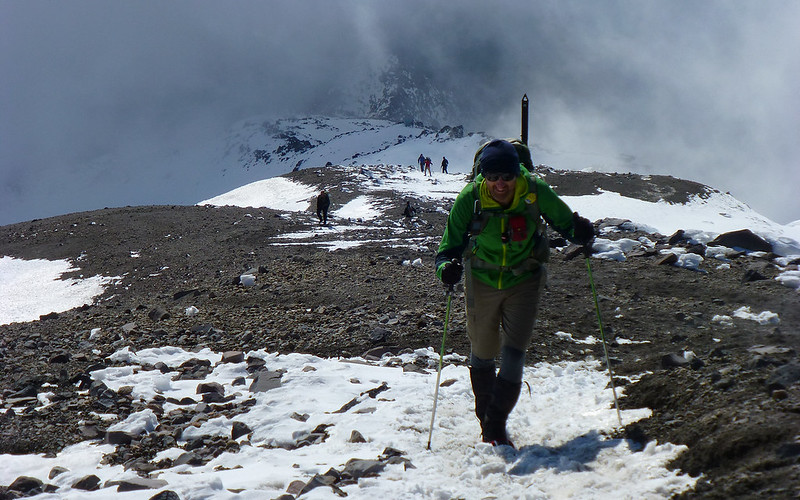
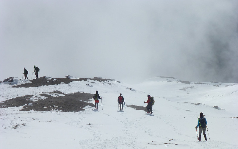
At about 7000', we could start making out individuals on the summit. None of that silly false summit stuff here. Just lock-on target, and keep moving.
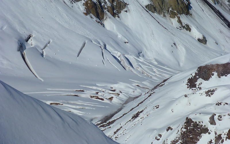
Snow was firm. Beware of deep holes between boulders, though!
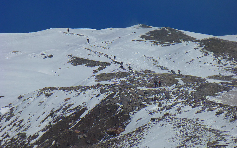
Zoom on the final summit procession. It never really felt as steep as Worm Flows.
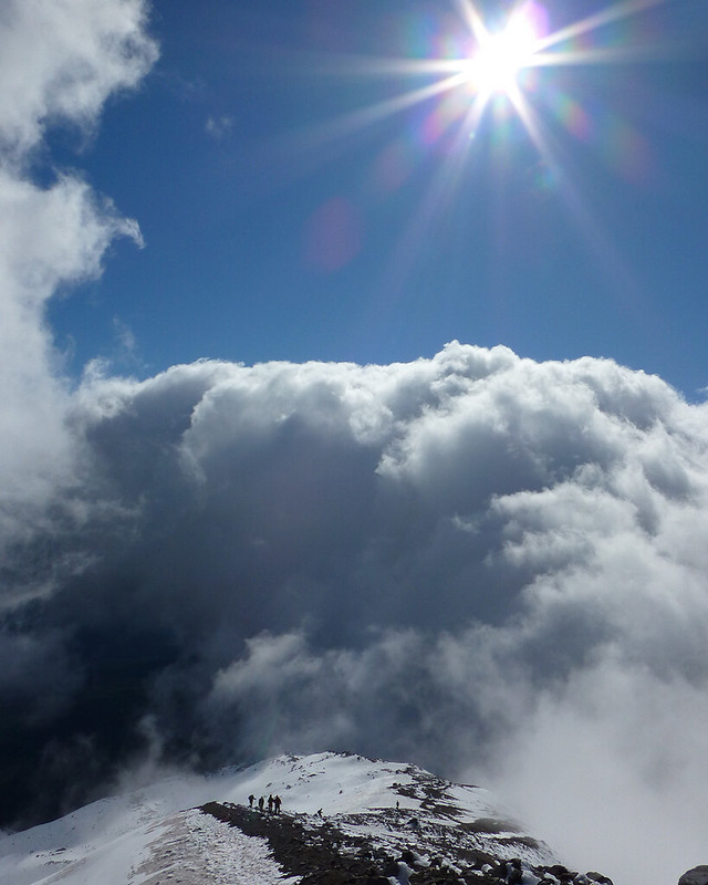
The sky show was non-stop!
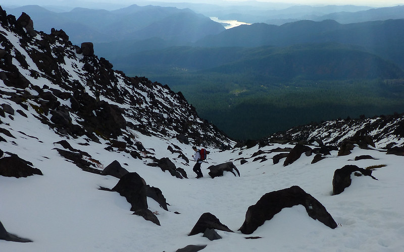
We followed more exposed ridge in middle on ascent, and descended in deeper (knee-saving!) snow to left.
Another gratuitous sky shot. I couldn't stop marveling at it.

The typhoon remnants of two weeks ago seem to be fading fast, even at elevation.
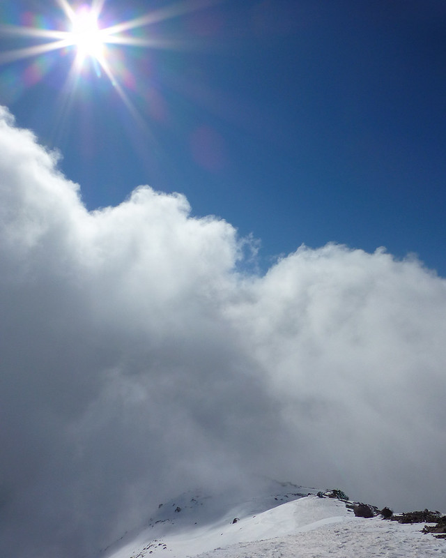
You tell me, does that look like a "friendly" cloud?
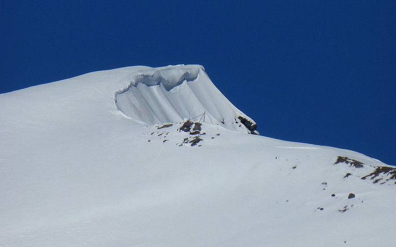
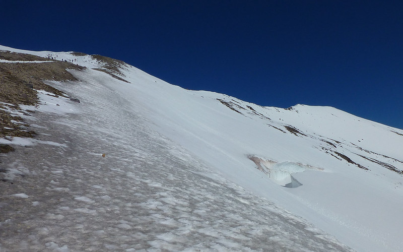
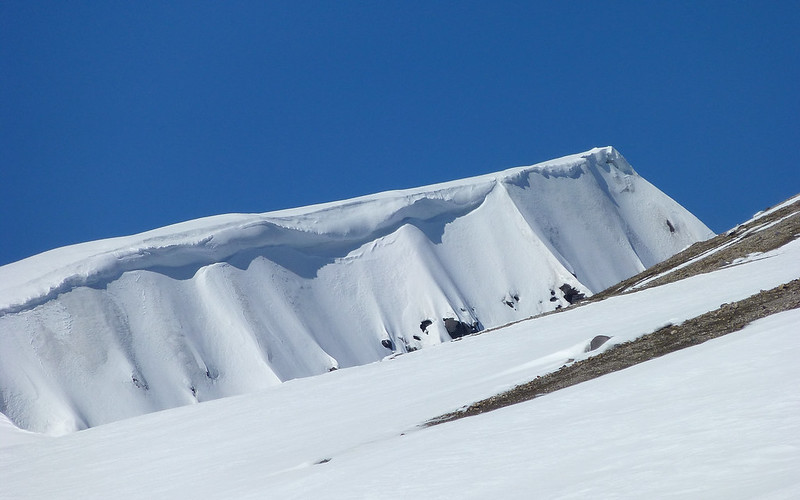
As we approached the rim, I was surprised to see cornices that large this early in the season! Turned out, most of the rim was cornice-free.
700' to go (up) still, though it looks much closer than that!
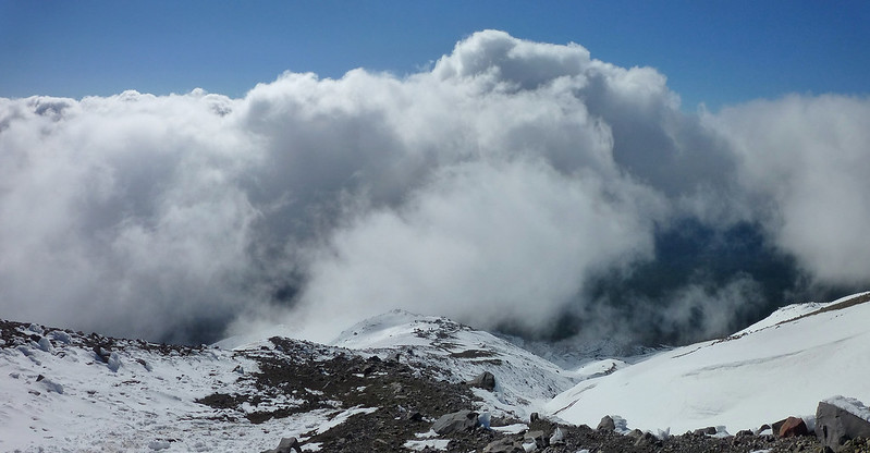
Angry cloud. (We're winning the race, still!) See the little people?
Spotted that same crevasse in Swift Glacier that Roman had photographed.
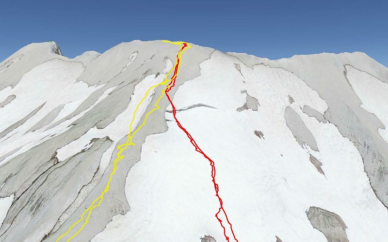
Then noticed it's right on the Worms Flow (red) route! (According to Google Earth.)
We took a quick (wind free) lunch break at 7900', so we could just relish the summit once there.
EP realizing the end is very much in sight!
Oh yeah...
That pesky cornice again! Kids, don't crawl out on those things at home.
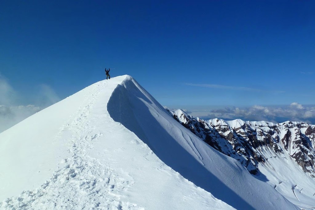
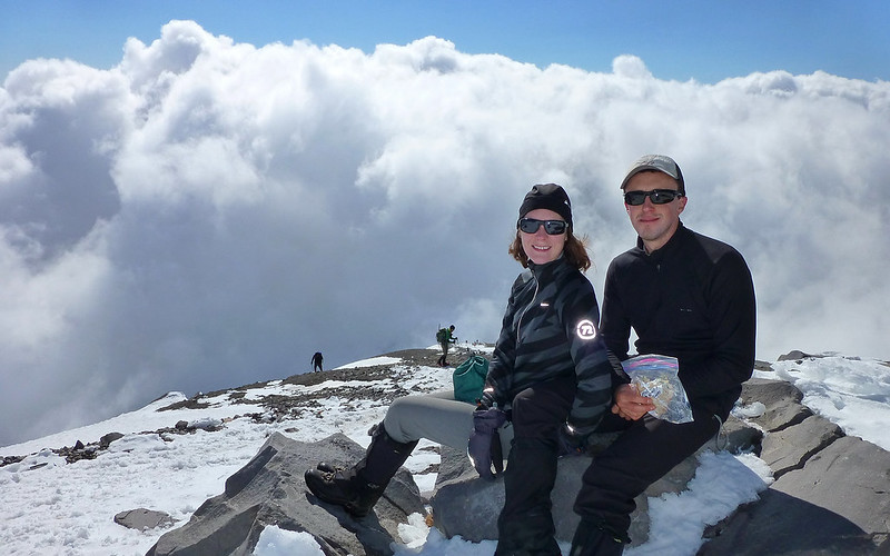
Mission accomplished! We'd beaten the clouds!
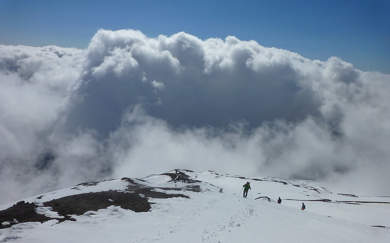
Try as they might, they simply couldn't catch up!
First to actually crest the summit!
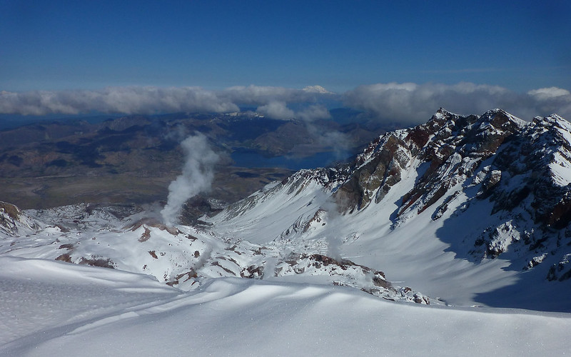
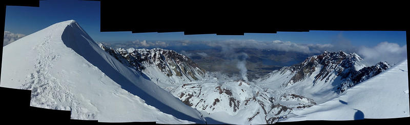
First view upon looking north towards the crater, Spirit Lake, and Mount Rainier.
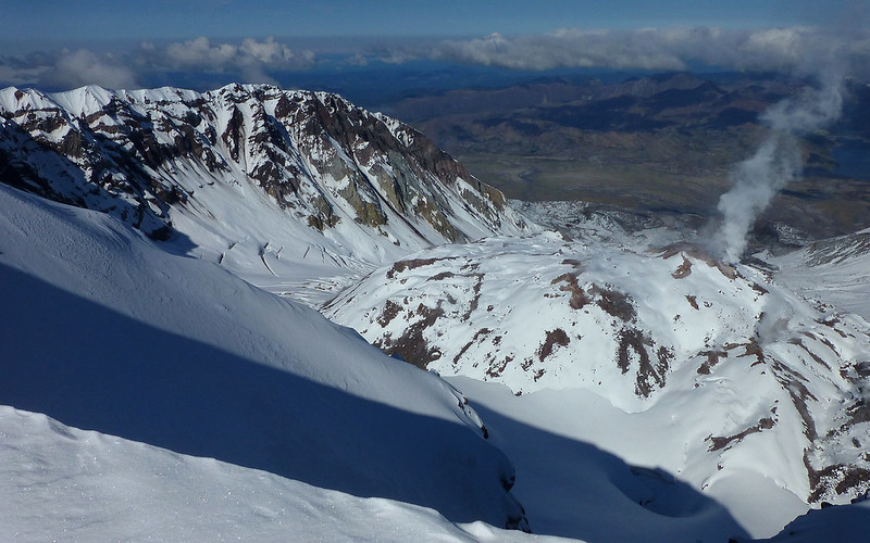
The lava dome was on fire yesterday! Holy cow, the steam was really spewing...
http://youtu.be/B2zsAMfYvHM
The jagged east wall of the crater is mesmerizing.
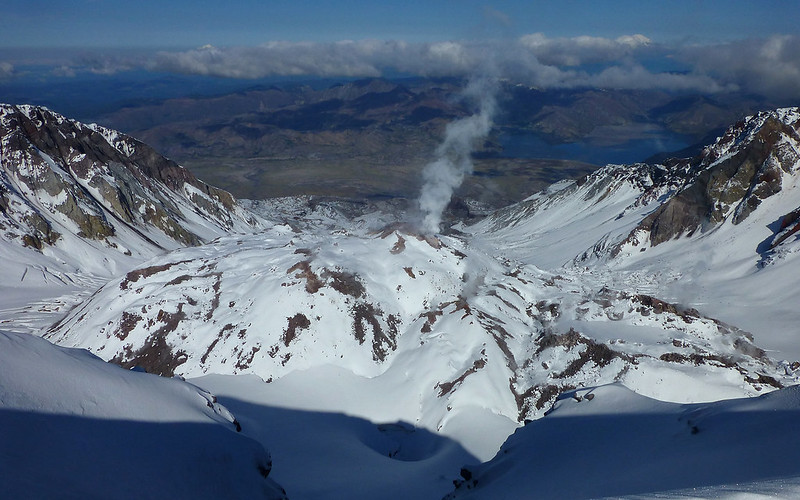
The scale of that lava dome is hard to comprehend, much less portray. It's taller than "Big Pink" in downtown Portland!
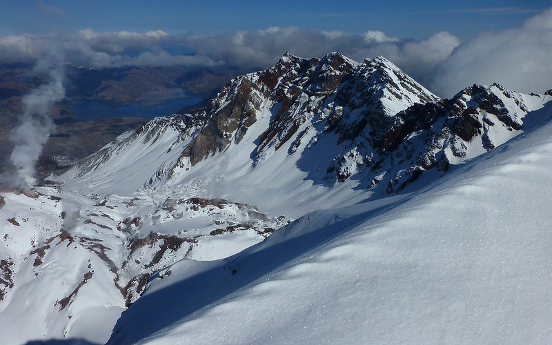
The shadow (from the rim) that encourages growth of Crater Glacier is quite obvious. As are its many crevasses.
Western edge of Crater Glacier which, once horseshoe-shaped, now completely encircles the lava dome.
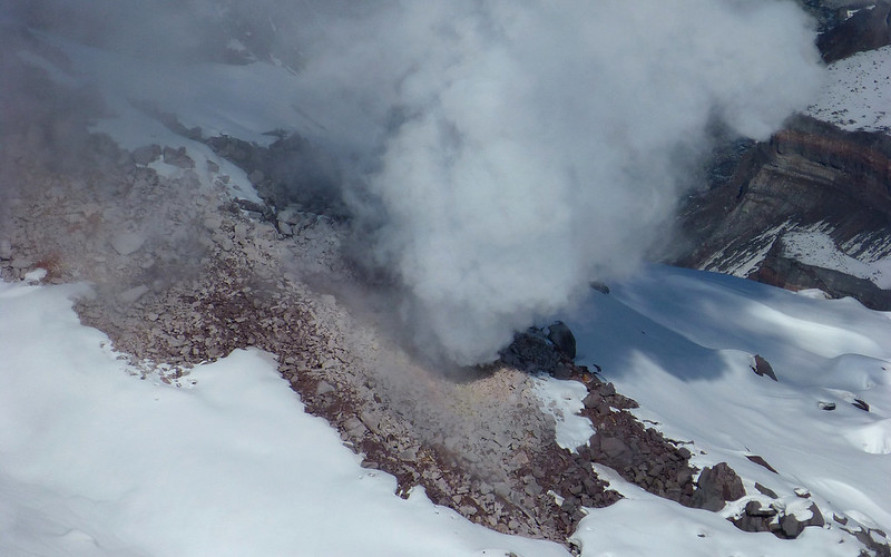
Billowing steam from the lava dome.
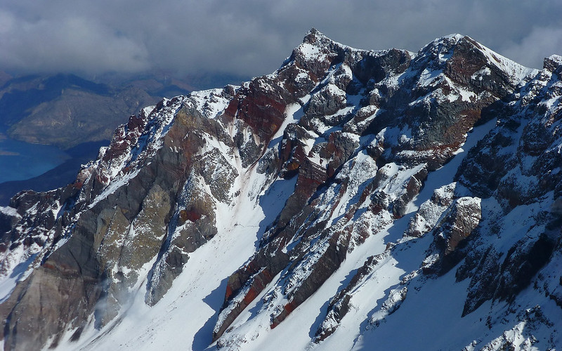
Words fail me. Breathtaking cross-section of a composite volcano interior!
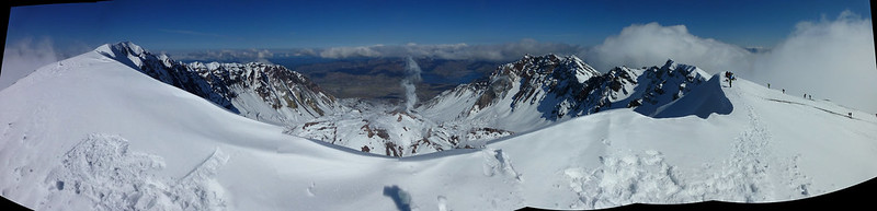
Pano from what I believe is the true summit. (GPS said 8285' here.) EDIT: It isn't actually the highest point, but close!
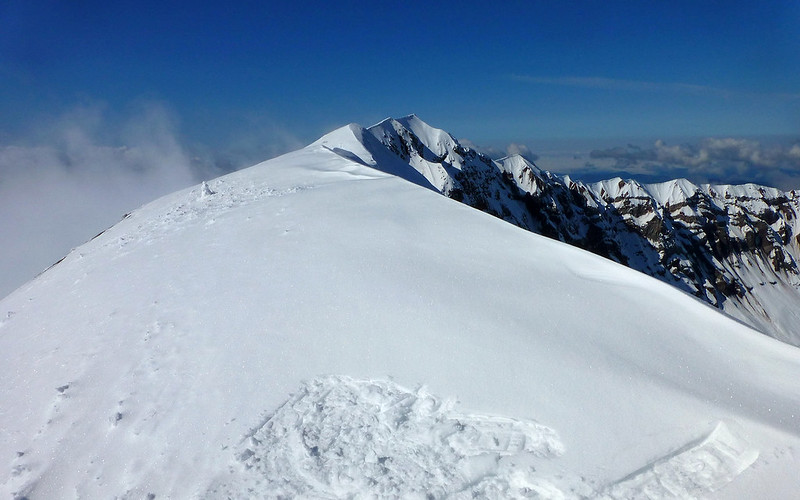
Zooming in on the pano above, here's the actual high point about 80' above me and a bit to my west.
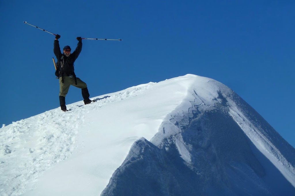
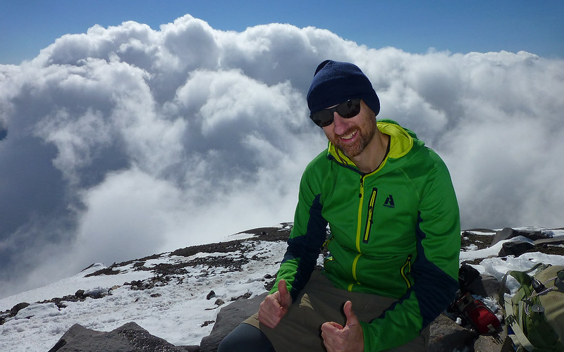
A moment of self-indulgent stickpic-ery.
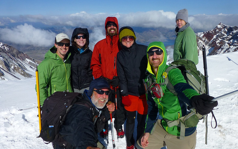
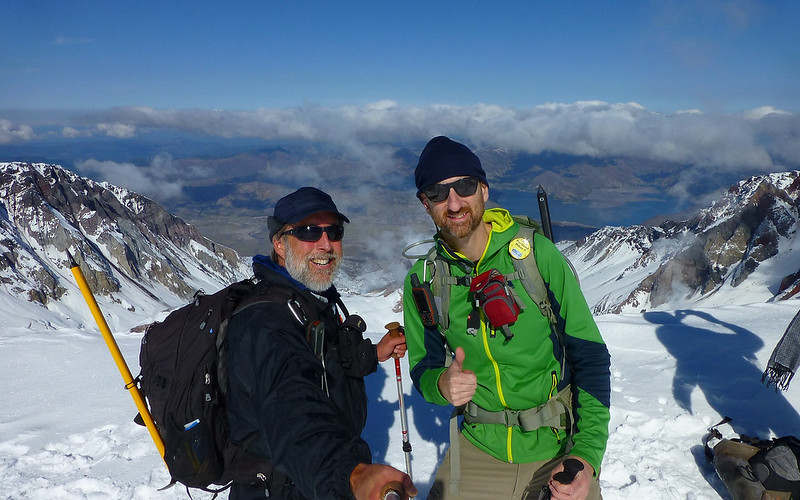
Major, enhanced by new (soon to de-lurk) trail friends, group shot!

Two new trail friends, Ted & Meg
Will these guys beat the clouds too? Dunno! It's time for us to head back down after 45 minutes up-top.
Those clouds! Again! Booo! Heh...
Into the abyss...
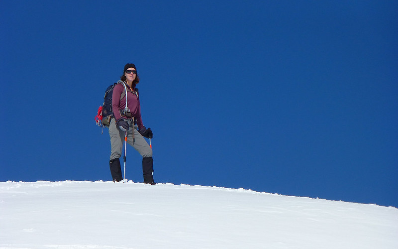
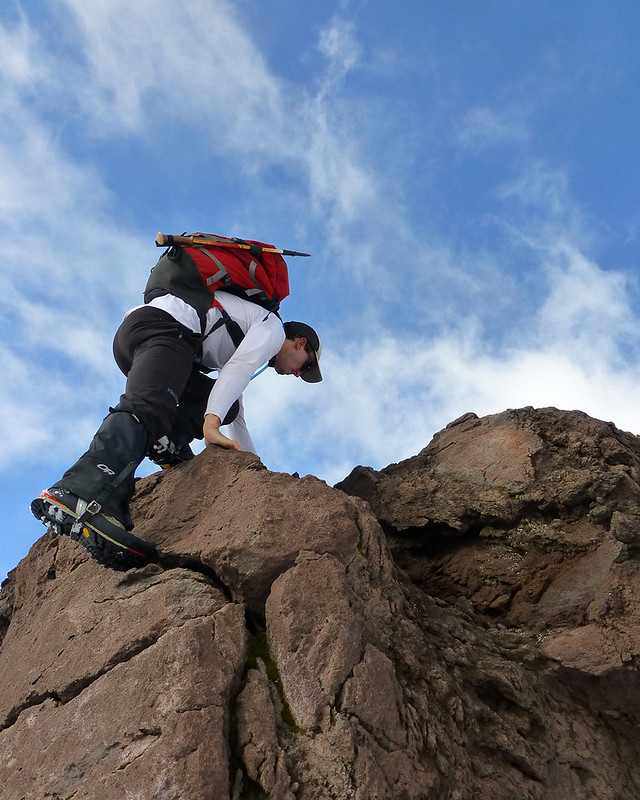
Halloween is upon us, but this climber shows no fear...
Wow...
At this point, the snow was getting pretty soft, and slipsliding was all too easy.
EP races ahead, hoping to get down in 2 hours. (Ended up taking nearly 3!)
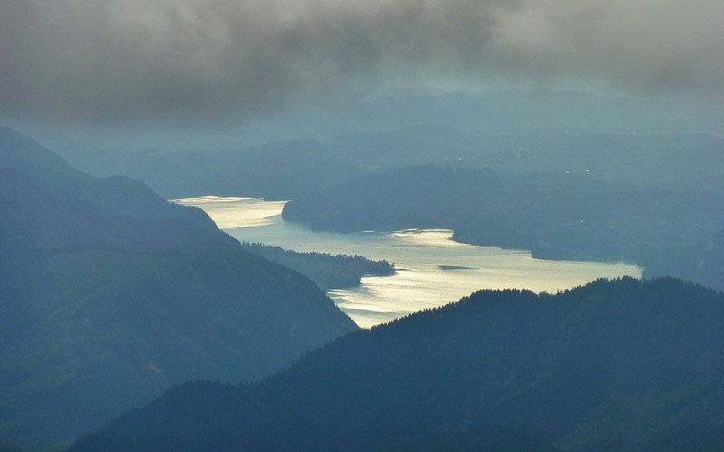
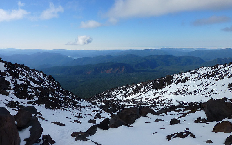
Below the clouds again, we see one of the reservoirs on the Clark-Cowlitz border.
Our route deviated on descent towards as much knee-saving snow as possible.
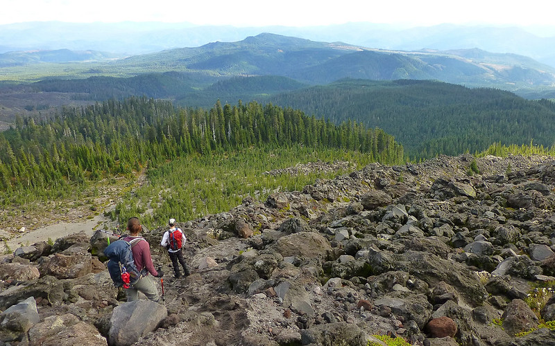
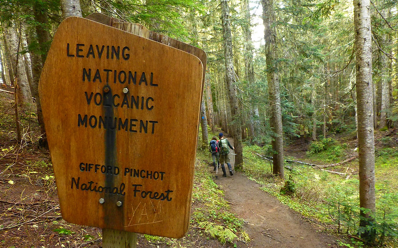
Finally, one last lava field, and we're back in the forest!
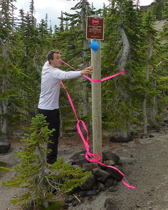
We found a USFS sign in disrepair. (I believe EP has more photos?) Bosterson kindly "stabilized" it.
The End.
Our tracks say we went nearly 9 miles, with about 4600' of EG. We considered doing a few laps around the parking lot to at least get in a respectable double-digit distance, but not for long.
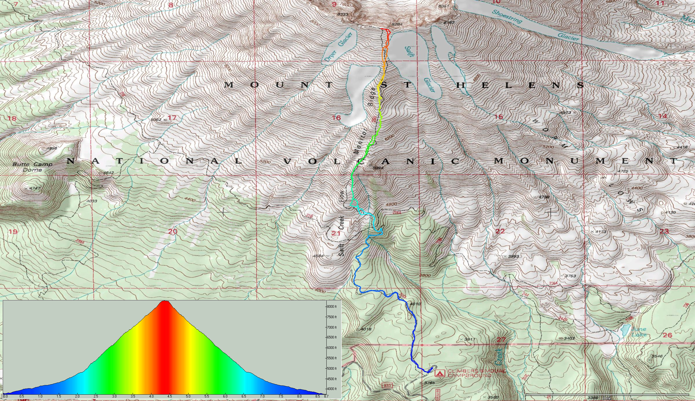
Click map for full-sized image.
http://gpsfly.org/gps_map.php?gps_id=2832&w=645&h=440
Absolutely fabulous day to be high on a mountain!