Peder and I tackled our third walk-up volcano, this summer, last Friday. It was a fine day indeed! We turned east on SR-14 out of Vancouver rather late Thursday, due to some really nasty traffic he got stuck in. But that worked out fine, as we stopped at Solstice Wood Fire Cafe in Bingen for a little bite to eat (Solstice Roast Chicken: w/cotija, yukon potato, roasted red pepper & pasilla pepper sauce) on our way to Trout Lake. Highly recommended! (Mmmm-mmmmmmmm!) Got to the Trout Lake Ranger Station well after it'd closed, but it's still a simple matter to fill out a Volcano Permit at their self-service kiosk. (Just be sure to have exact cash or check, for each individual, handy! $10 Mon-Thur, $15 Fri-Sun.)
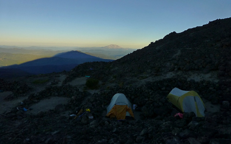
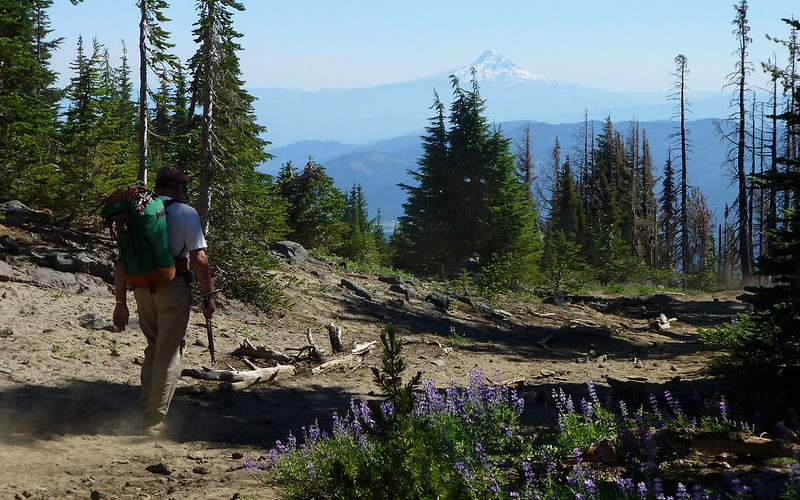
After getting our permits, we just drove the 12 or so miles from Trout Lake up to Cold Springs campground on the southern flanks of Mount Adams, and arrived there a bit after 9pm. The place was filling up fast and it was getting dark, so we snagged the first pull-out we could slide the Subaru into, and quickly setup a couple of tents then walked around a bit to find the trailhead.
When we returned to the site, the buttheads across from us had started a roaring bonfire. Totally unbelievable! These woods were already burnt up pretty well, and just tinder dry. There was some music wafting up from a few sites away. Total party atmosphere. We planned to set alarms for 3am, so decided to just make the best of it and try to crash. Amazingly, a "quiet hour" of sorts descended across the campground around, maybe, 10:30 or so. I think I slept maybe 2-3 hours? I dunno.
After stowing all our overnight gear away, and enjoying a quick breakfast, we were on the trail at 4am! It was a "brisk" 51°F out. Way too warm for a fleece, although the calm air in the woods made one feel good before we really started moving. The campground is at 5700'. The summit is 12,267'. A year ago, it would've been an impossible dream for me to even consider what we were about to undertake.
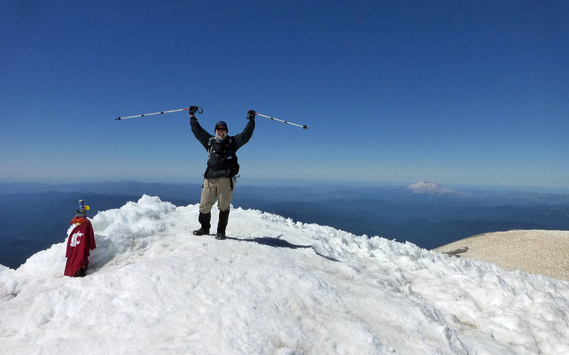
Roughly 11:30am. Highest I'd ever been, under my own power. Oh yeah!
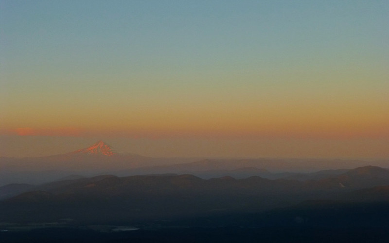
We walked the first couple miles in the dark, then experienced a multispectral, pastel-infused sunrise. I'm sure the colors were "enhanced" by the Mile Marker 28 fire over on US97. It was hard to keep moving forward, while the light show was going on behind us to the south.
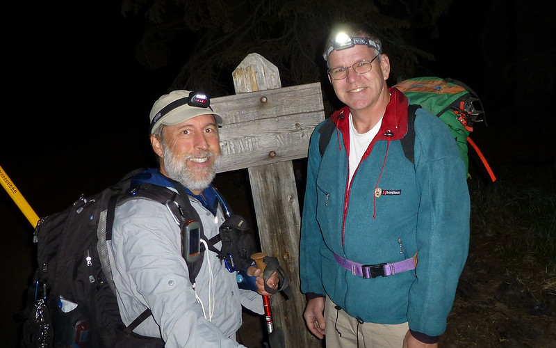
4:05am at the trailhead - obligatory TFF shot.
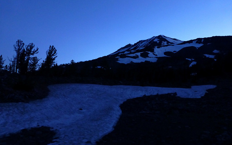
By 5:15am, we can see pretty well where we're going.
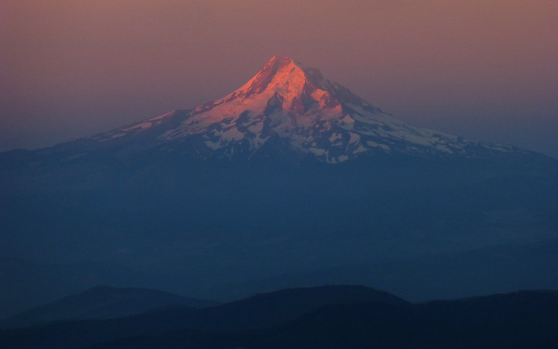
First direct light on Hood around 5:45am.
It quickly became clear that the air wasn't anymore. Fire season seems to be in full swing.
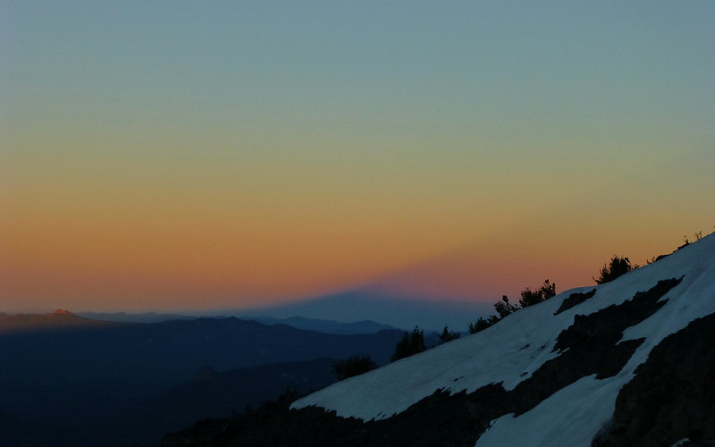
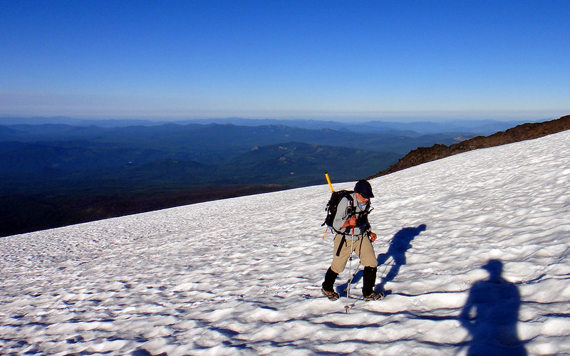
But the smoke certainly offered a bit more color to the classic shadow shots.
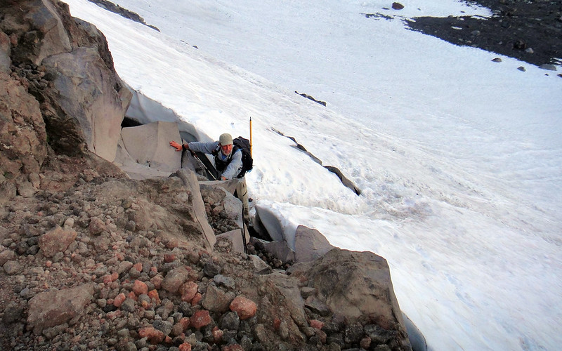
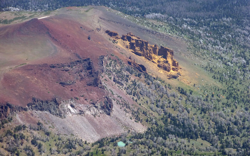
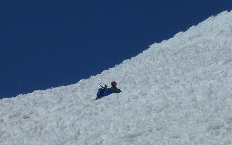
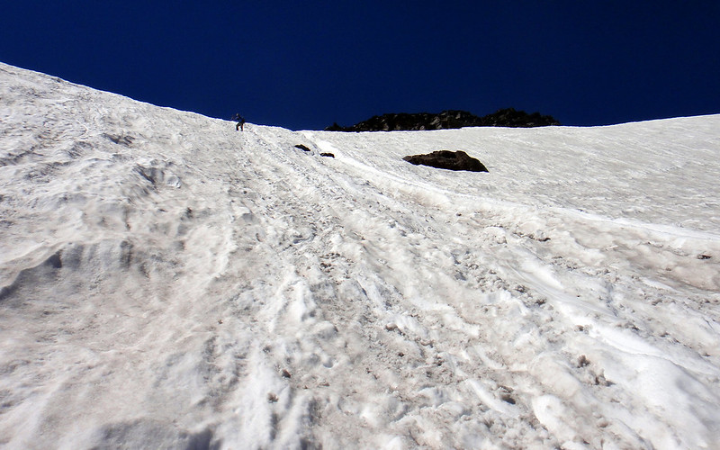
We ran into one rather steep snowfield early on, and this was the only place that actually required hands-on scrambling.
(photo: Peder)
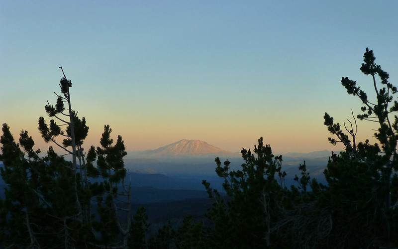
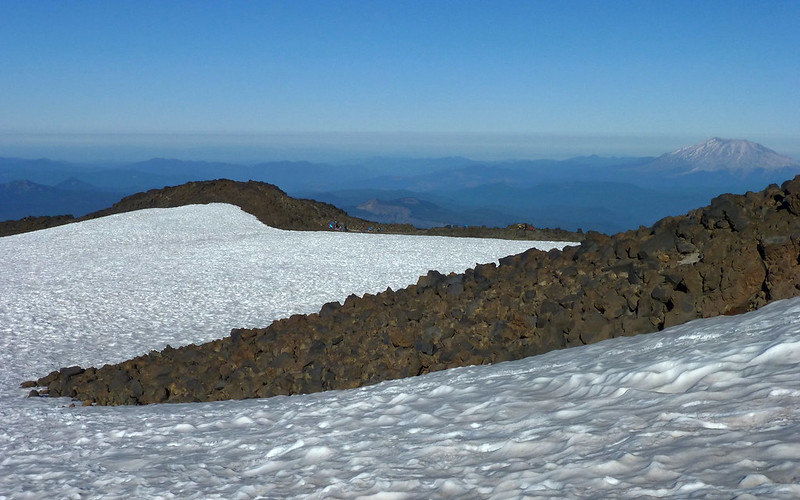
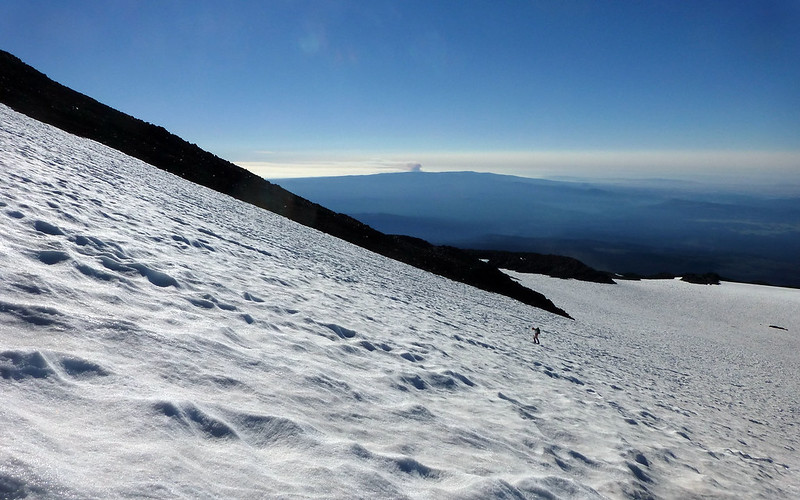
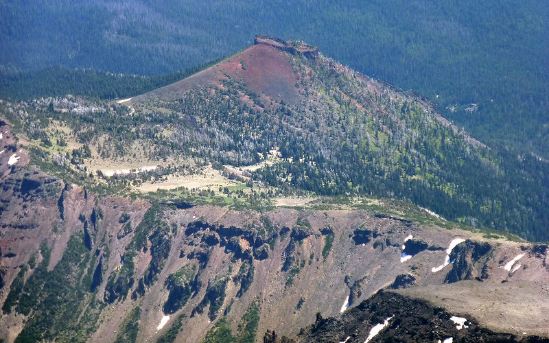
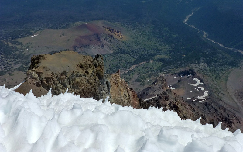
Rounding a corner at 7800', Mt St Helens came nicely into view!
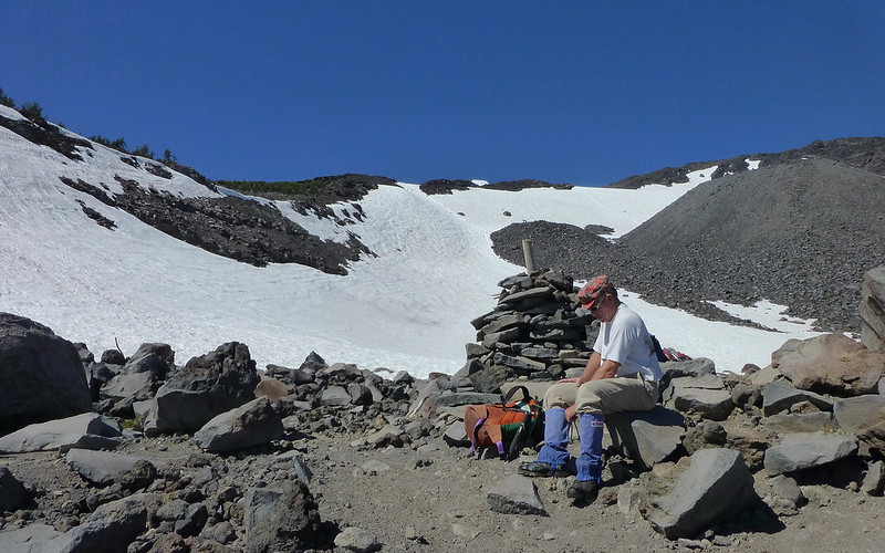
We passed a little tent-city at about 8000'. Seemed a lot of their occupants had already headed up!
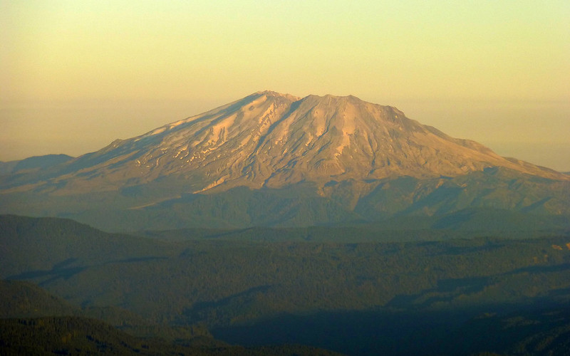
Did you know MSH and Adams are only 31 miles apart?
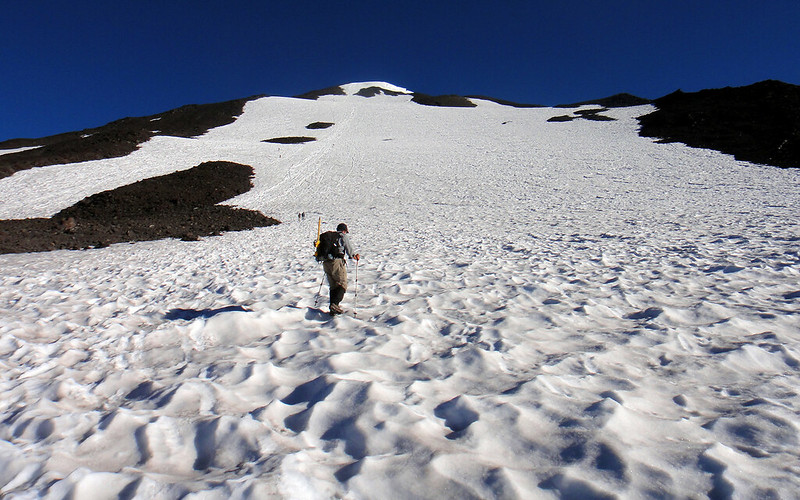
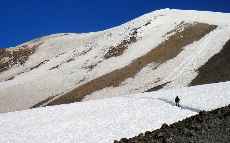
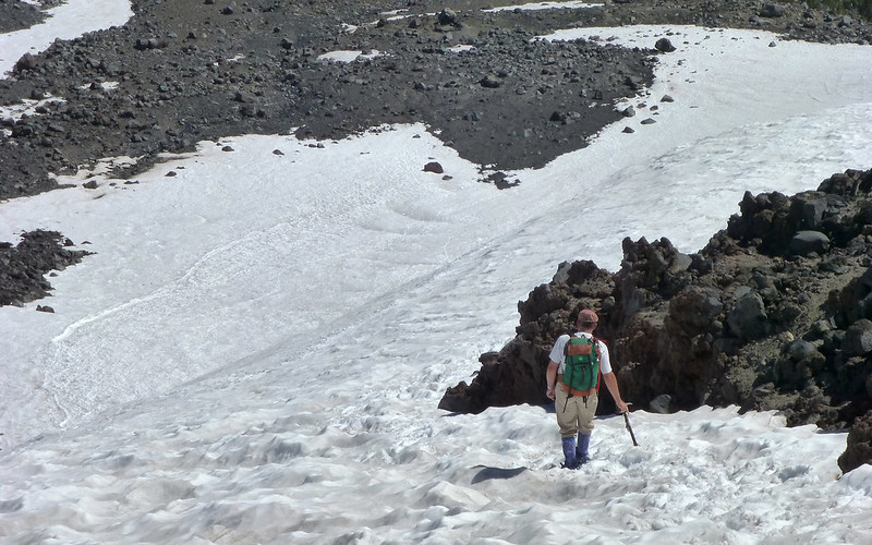
By 8300', we were on snow and would be for the rest of the climb. No traction needed yet.
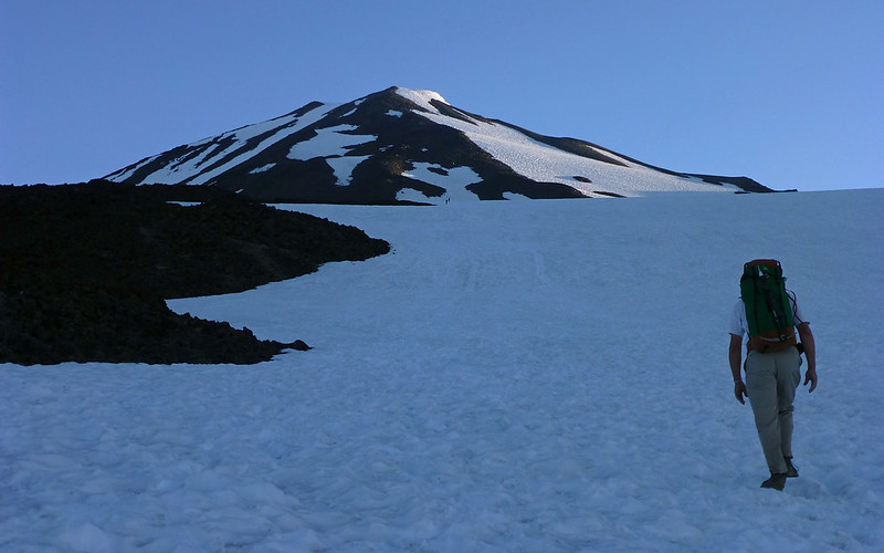
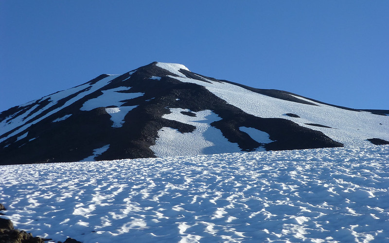
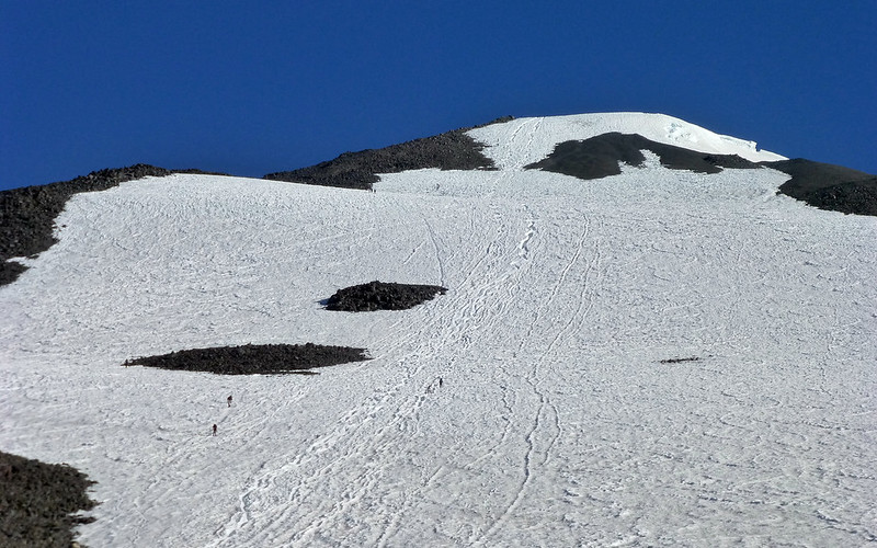
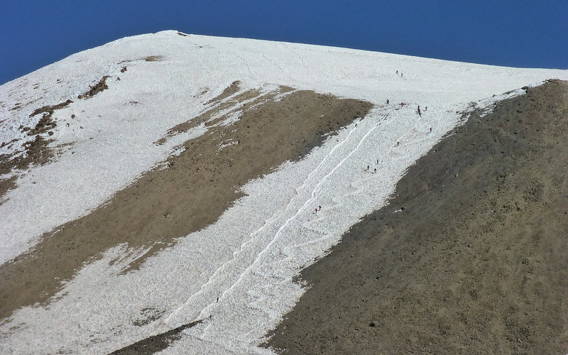
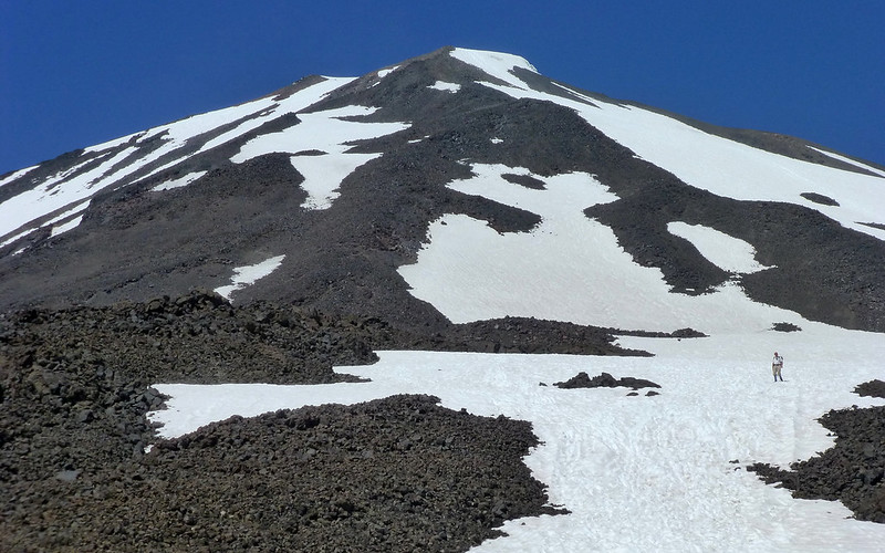
Distances on this mountain are impossibly deceptive. Peder was better at it than me, trying to gauge by the height of people that were barely visible. In the shot above, the bright point is known as Piker's Peak, and is falsely seen as the summit by many on their way up. As close as it always appeared, it just never seemed to get much closer. We were just below the lunch counter, and Piker's Peak is actually about 3500' higher than where we were. This is where we decided to traction up. I was going with microSpikes, and Peder had crampons. Certainly his choice was far more versatile, and would've worked in conditions which we, thankfully, didn't experience this day. The microspikes ended up working just fine, although as the snow softened I did have a few doubts along the way.
Does that look 3500' higher? If you download the Original, you might seem some tiny people up there.
I guess I just sorta put it into low gear, and motored up from this point onward. The lack of sleep didn't seem to be an issue.
(photo: Peder)
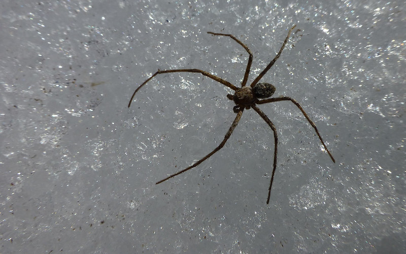
The bugs on the mountain were fascinating! Here's a little spider at 8900'! Lots of bees flying around, too.
Peder climbing through the Lunch Counter area at around 9000'.
Some campers with a killer view of Mount Saint Helens from the Lunch Counter.
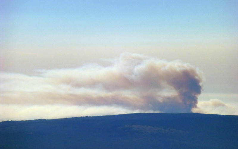
The "Mile Marker 28 Fire" over on Satus Pass was billowing to our east.
Some people, inexplicably, followed the glissade runs straight up the mountain. I tended to switchback and forth against the fallline.
(photo: Peder)
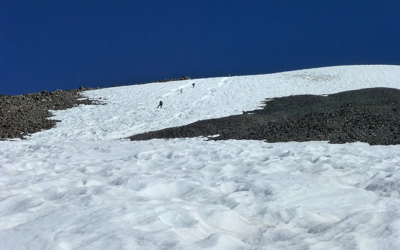
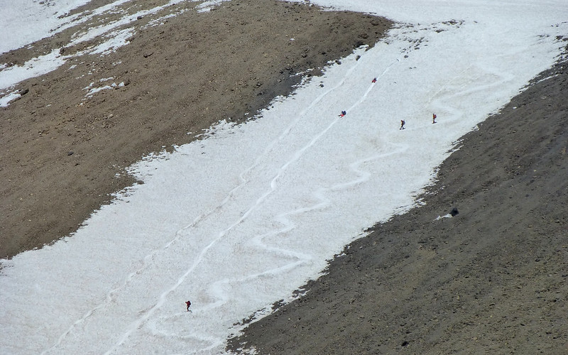
How many little people do you see? There are more. They are really little!
We each really set our own paces going up Piker's Peak. It's a workout! But it just takes persistence.
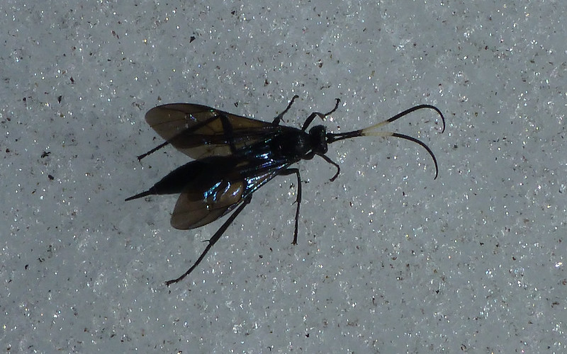
Another crazy bug at 10,200'!
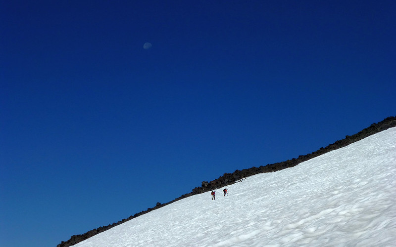
We seemed to parallel this father-daughter duo much of the day. I liked the nearly full moon over them, here.
At 9:30am, making the final push to the crest of Piker's Peak!
There was one poor guy waiting for his brother to come down from the summit. He'd rented the plastic "mountaineering" boots from REI, and they'd (of course?) been sheer hell on his feet, causing blisters bad enough he couldn't continue. I had been leery of their advice to do this, too, despite many folks saying the microspikes may not get me there. Just wasn't sure the plastic boots would, either! Anyway, that was a bummer to see.
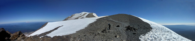
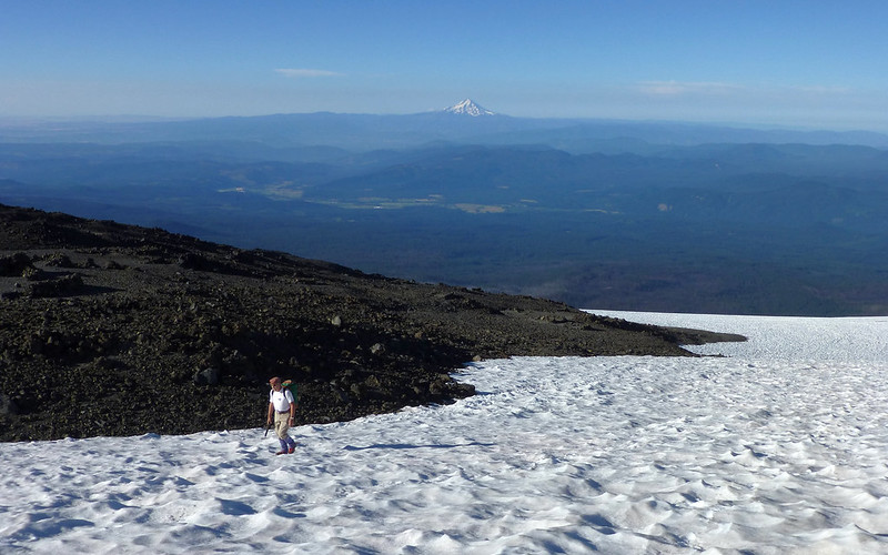
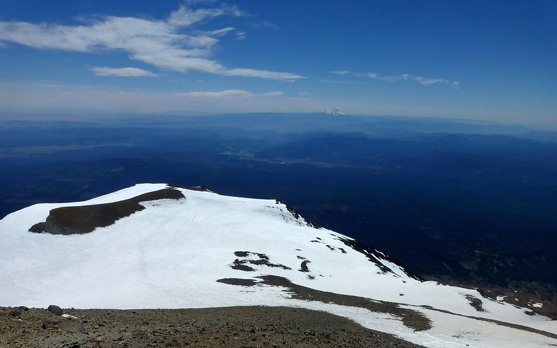
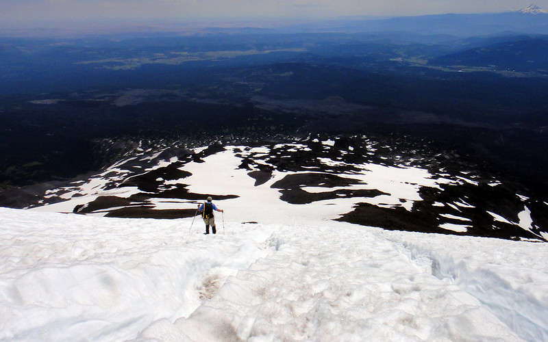
At 11,500', we're now looking down on Mt Hood, and getting our first good look at the actual summit.
There's a steady parade of folks heading up, and a few already coming down. They don't look as small, anymore!
I set off pretty quickly, as the snow had been softening below Piker's Peak. Up here, not so much!
(photo: Peder)
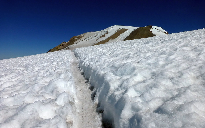
This trench was really bizarre. It didn't last long, but, well, ... , weird!
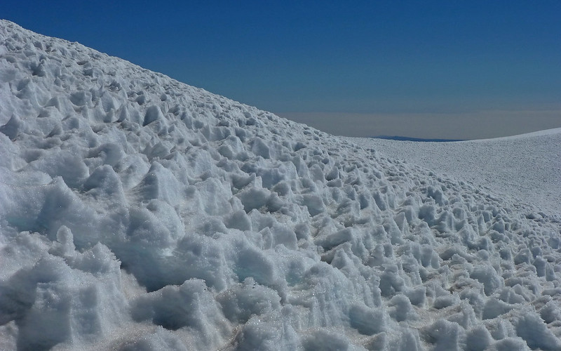
On the final climb to the summit, the snow became deeply etched in a most interesting way. I hadn't seen this, to this degree, before.
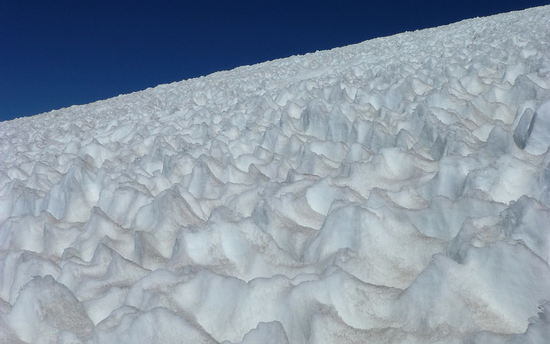
Those pits are 2-3' deep!
But there was something of a trail carved through them in many places.
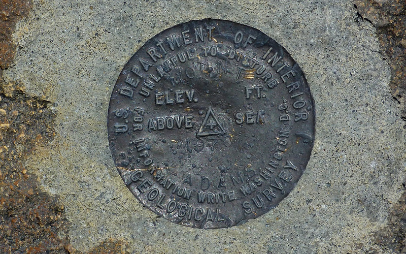
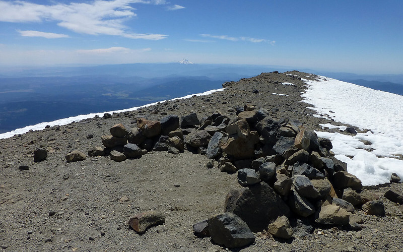
Summit!
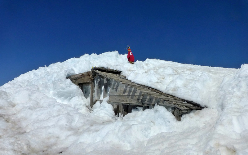
Finally! The summit! And what's left of an old fire lookout that was used only briefly in the 1920s.
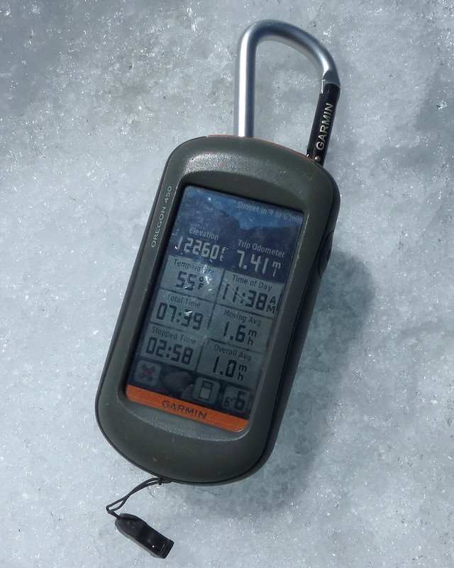
This is a "new world record" for my GPS, smashing the old one by nearly 2000'!
I thought someone had left their stuff here, but this turned out to be a memorial of some sort.
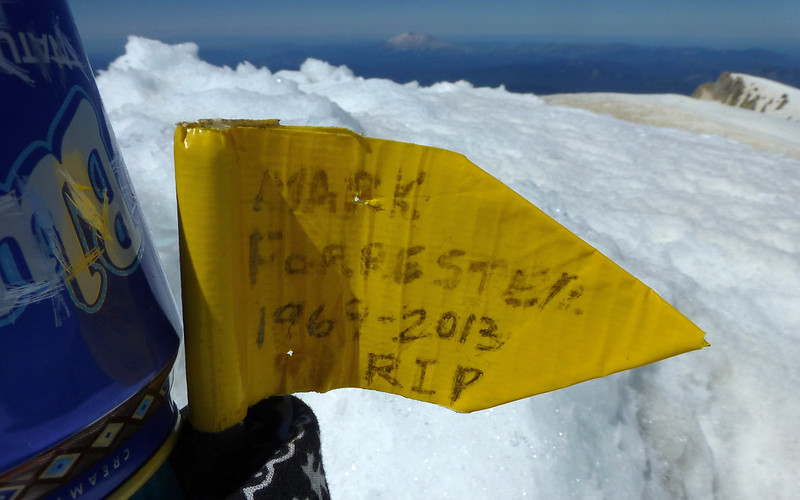
Googling didn't help shed any light on it, though. Is there a story here?
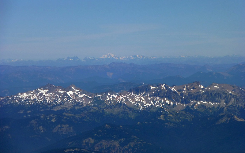
The views were pretty awesome. Here's Goat Rocks in the foreground, and Glacier Peak and the North Cascades behind.
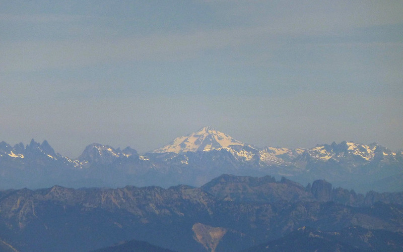
Glacier Peak
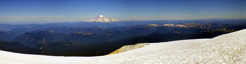
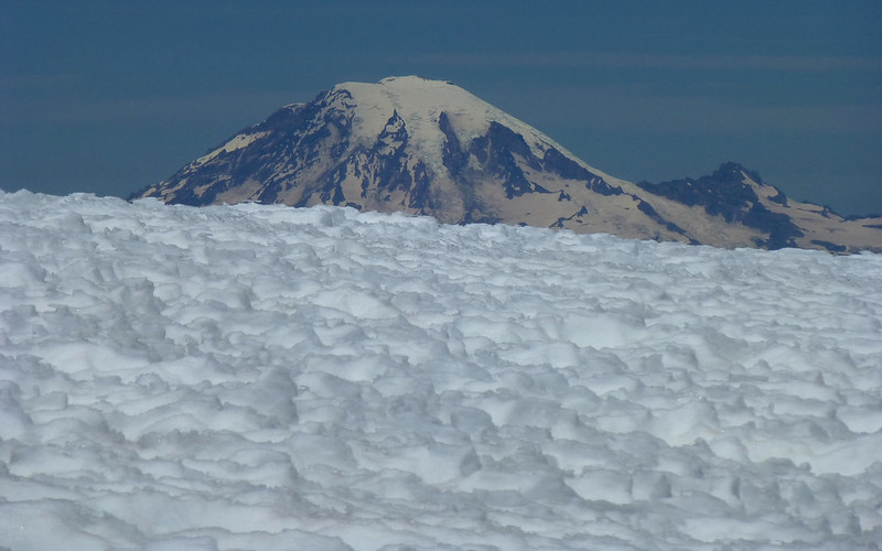
The Big Picture, with Mount Rainier in center.
(photo: Peder)
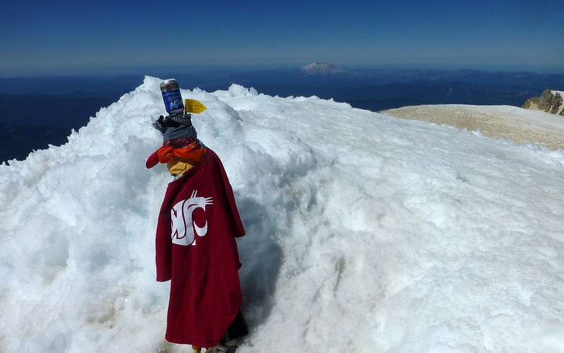
After awhile by the lookout, we wandered over to what we assumed to be the actual summit?
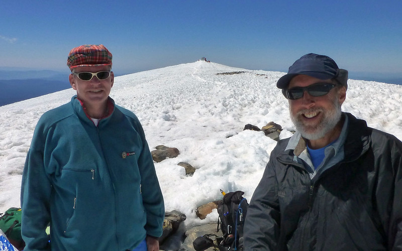
TFF victory shot. Not sure this spot is more than a foot higher than the other (in background).
We had a bit of lunch up there. The day was really nice! We'd been warned all the way up about how windy it was, but I'm pretty sure neither of us really felt that way about it. It was over 50°F, and really quite pleasant. I decided to wander east and loop the rim, before descending on what appeared to be an alternate way down. Peder was keen to try out his fancy new sled material on the glissade path.
Mount Rainier, poking over the summit as I start down the east side.
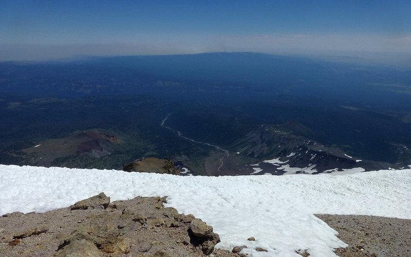
I think this is the Big Muddy Creek drainage? Raging forest fire in distance.
Little Mount Adams
Absolutely awesome pinnacle display! (Battlement Ridge? The Spearhead? Help!)
Yes, if you wanted to haul your gear up here, you too can bivy at over 12k'!
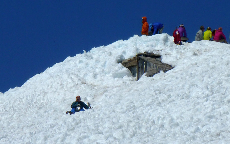
Peder, meanwhile, is pursuing the thrill of speed!
Yeeeeee-haw!
I was catching a very strong sulfur aroma as I peered over this edge!
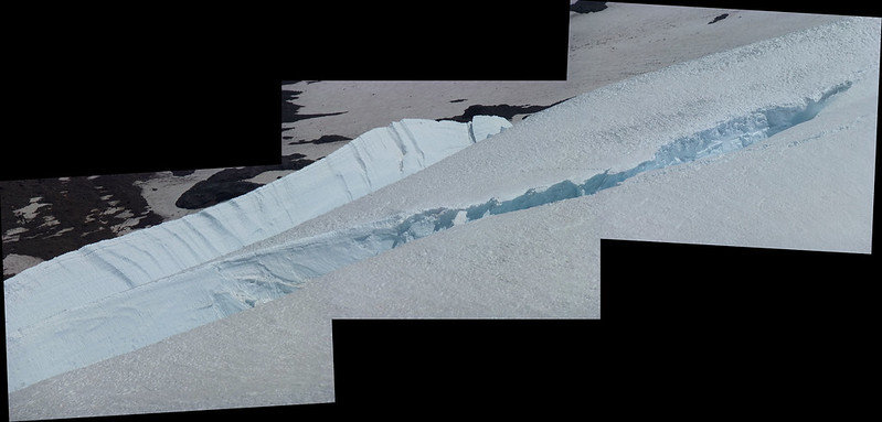
Yes, there are glaciers with crevasses on this mountain!
Heading back down towards Piker's Peak, where a crowd seems to be assembling.
Descending was a mix, some folks glissading, and others just plunge stepping on down.
Me, dropping down over the edge of Piker's Peak, to film...
(photo: Peder)
The rest of the descent was pretty uneventful. We just went down, down, down, sliding and boot-skiing.
We did hit one more somewhat steep section right before the end of the snow. Took some serious deep heels to stay upright here!
Me, happily following in Peder's footsteps! (photo: Peder)
Back down to 7500', nearly 12 hours after starting, it's time to strip down to summer clothes again! No more snow.
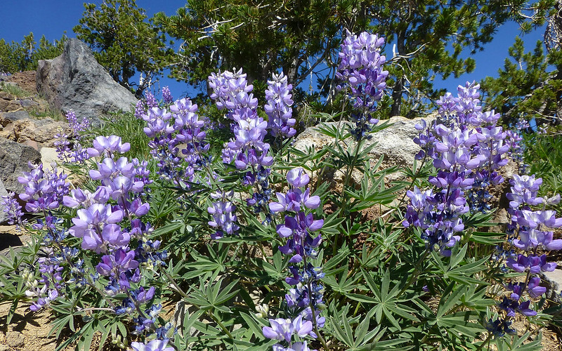
We're also back amongst the photosynthesizers, which are busy putting on a show!
Took me awhile to get my land legs back. I seemed to want to glissade down the rocks! Heh...
(photo: Peder)
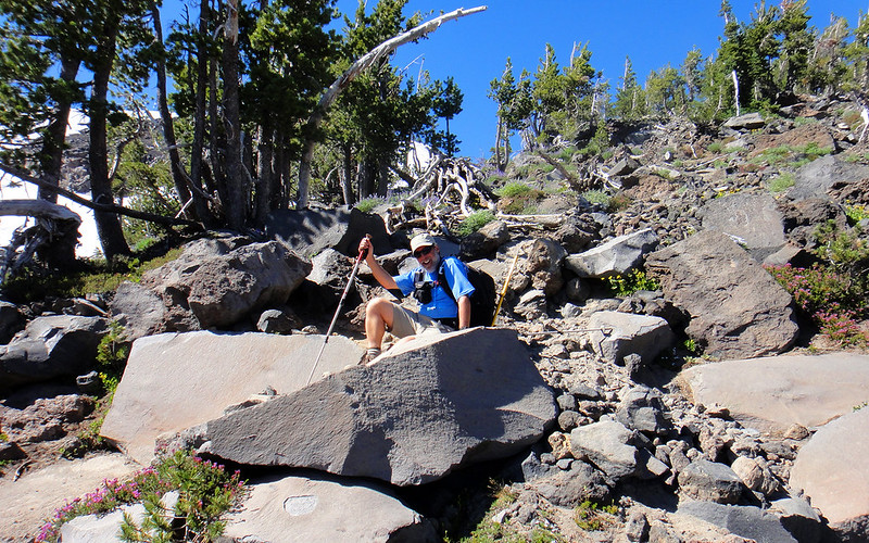
We still had 2.5 miles to go, through a mostly burnt forest, on sand and rocks. This part was just fine in the dark.
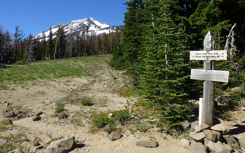
Truly weird thing is, we'd passed this sign exactly 12 hours - to the minute - ago!
And, well, that's about it. We got back down to the car about 6:00pm. Packed up pretty quick, and skedaddled on home. What a day! Just amazing.
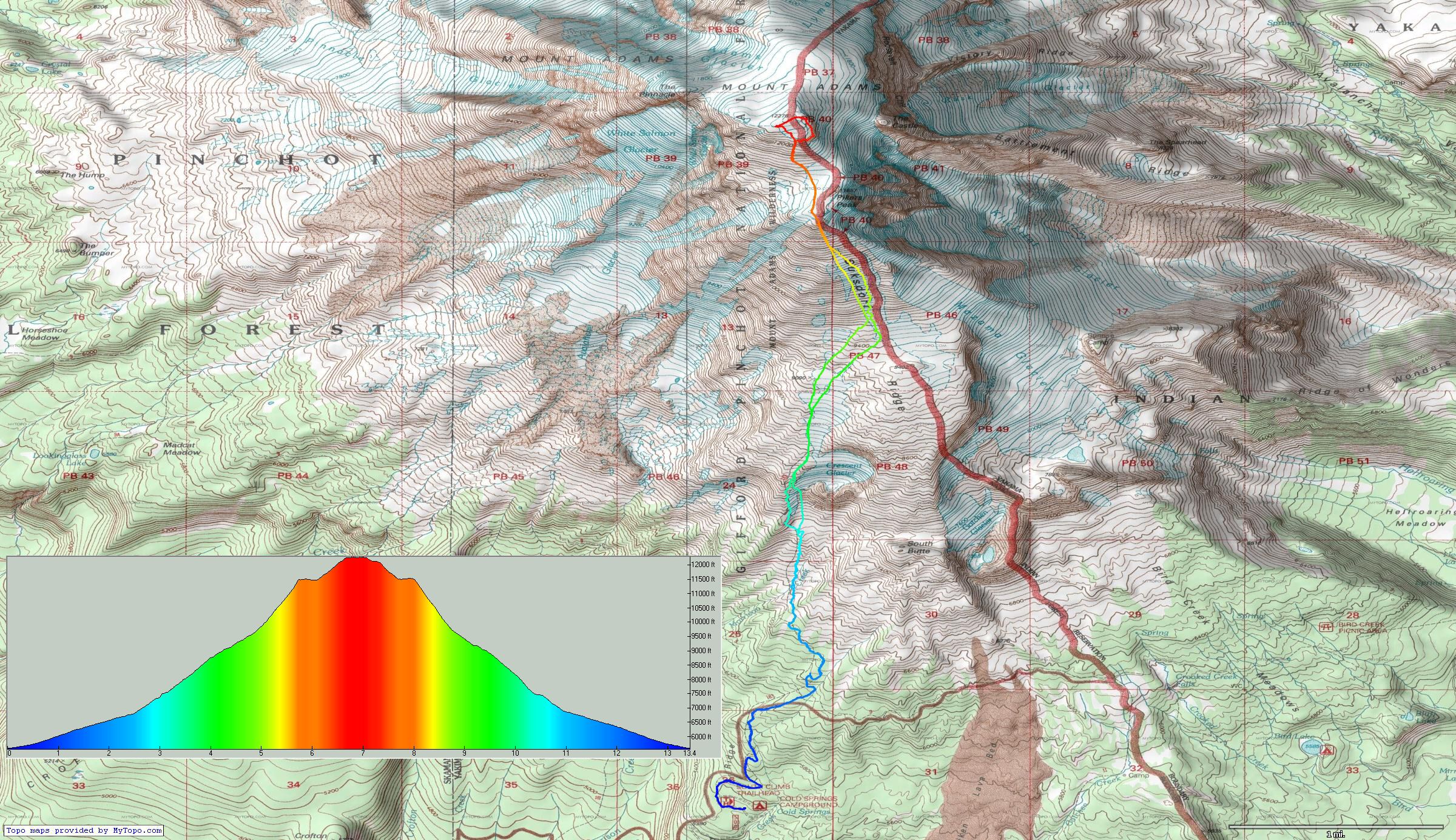
Right-click, view-image, for full-sized map.
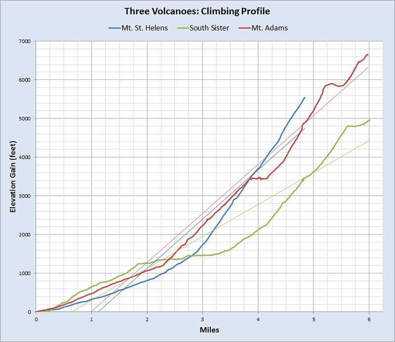
Something for the data-geeks in the crowd.
http://gpsfly.org/gps_map.php?gps_id=2669&w=645&h=440
A year ago, an impossible dream! Life is Good.
Mount Adams Dayhike, 26-July-2013
Last edited by kepPNW on August 6th, 2013, 3:47 pm, edited 1 time in total.
Karl
Back on the trail, again...
Re: Mount Adams Dayhike, 26-July-2013
Karl and Peder, Congrats!
That cool looking mountain N of Little Mt Adams is called Goat Butte. I was looking at it myself this weekend from the Ridge of Wonders. We could see trails in the cinder, likely made by goats, which we saw plenty of in the vicinity.
Someday I'd like to explore Avalanche Valley and Goat Butte, but it ain't easy to get there!
I've noticed that you have very ambitious and high mileage dayhikes, but you still seem to savor your locations, and take such fantastic pictures, I have trouble understanding how you do it all in a day. Have you ever considered backpacking?
Which volcano is next?
Re: Mount Adams Dayhike, 26-July-2013
The dynamic duo dose it again nice job guys, a nice shot of Galcier peak to.Speaking of sulfer did you know they had a sulfer mine on the summit till the 1930's? Hikers that got up early had coffee with the minners. There was a steady line mules hauling it down mid to late summer. Thats a miners shack still on top not a fire lookout contrary to popular belief.The miners had a rudamentry phone system and were also fire watchers.The mine never made money and went broke.
The thick wire still runs up to the summit peak from the lunch counter when the snow melts in Sept.
You can read about in the old moutaineers reprint --Tales of a Western Mountaineer by CE Rusk.
The thick wire still runs up to the summit peak from the lunch counter when the snow melts in Sept.
You can read about in the old moutaineers reprint --Tales of a Western Mountaineer by CE Rusk.
The downhill of the mind is harder than the uphill of the body. - Yuichiro Miura
Re: Mount Adams Dayhike, 26-July-2013
Hey, thanks, cfm! Good to have an ID on Goat Butte. That definitely seems to be a remote area to get to! And I haven't seen that name on any maps, either. But now I can try to find out more about it. We certainly had a loooong day of it, yep! I keep thinking about maybe getting back into backpacking, yeah, but that's the extent of it so far. (Mattresses are really heavy!!! ) We didn't come up with any solid ideas on the Next Big Thing on the way down, I hate to say. Some mysteries are good.cfm wrote:Karl and Peder, Congrats!
That cool looking mountain N of Little Mt Adams is called Goat Butte. I was looking at it myself this weekend from the Ridge of Wonders. We could see trails in the cinder, likely made by goats, which we saw plenty of in the vicinity.
Someday I'd like to explore Avalanche Valley and Goat Butte, but it ain't easy to get there!
I've noticed that you have very ambitious and high mileage dayhikes, but you still seem to savor your locations, and take such fantastic pictures, I have trouble understanding how you do it all in a day. Have you ever considered backpacking?
Which volcano is next?
Yeah, I'd read a bit about the sulfur mining - fascinating! Just amazing what folks used to think might be practical. But my understanding was the fire lookout was co-opted by the miners after it, too, was found to be impractical for its intended purpose. (Three years to build, then two years to fail?!) I was basing that off conversations citing things like this:Roy wrote:The dynamic duo dose it again nice job guys, a nice shot of Galcier peak to.Speaking of sulfer did you know they had a sulfer mine on the summit till the 1930's? Hikers that got up early had coffee with the minners. There was a steady line mules hauling it down mid to late summer. Thats a miners shack still on top not a fire lookout contrary to popular belief.The miners had a rudamentry phone system and were also fire watchers.The mine never made money and went broke.
The thick wire still runs up to the summit peak from the lunch counter when the snow melts in Sept.
You can read about in the old moutaineers reprint --Tales of a Western Mountaineer by CE Rusk.
- "The highest lookout site in Washington state, construction began on the D-6 cupola cabin in 1918, but continued for 3 years. The lookout was staffed from 1922-1924 then abandoned. Sulfur miners took over the cabin in the 1930's, adding a couple of additions and recycling the cupola in the process. The cabin is still there, encased in ice most of the time." ~ http://www.firelookout.com/wa/mtadams.html
You can see how they took off the top thingie, and added that bit to the side, eh? Some really good info here, but you'll need to search the page for "MOUNT ADAMS" to find it. (They should've had some internal jumps!)
I did see some wire on the mountain, and wondered about it. What was that for? Cool book! I might have to snag a copy of that, thanks!
Karl
Back on the trail, again...
- Eric Peterson
- Posts: 4097
- Joined: May 11th, 2009, 5:39 am
- Location: Oregon
- Contact:
Re: Mount Adams Dayhike, 26-July-2013
Nice job guys!
So did you just use micro spikes and it turned out reasonably doable, or do you think crampons
are still in order? I'm assuming Peder wore cramps?
So did you just use micro spikes and it turned out reasonably doable, or do you think crampons
are still in order? I'm assuming Peder wore cramps?
Re: Mount Adams Dayhike, 26-July-2013
Just as a note after reading your great trip report, OMC rents synthetic boots. Sarah got an ice axe, crampons, La Sportiva Mountaineering boots, and trekking poles for 25 dollars for the entire weekend. =) Totally worth it in my opinion.
Also, what software did you use to make this track?
http://www.flickr.com/photos/keppnw/9402236703/
Also, what software did you use to make this track?
http://www.flickr.com/photos/keppnw/9402236703/
Re: Mount Adams Dayhike, 26-July-2013
Nice, Karl. I've been wondering when you were finally going to get the TR up!
Pretty crazy meltout since I was up there. Those deep, spiky suncups are impressive, as is that bizarre trench across the top of Piker's. Glad you guys got some glissading in before the snow is gone!
And yeah, as Jhiggy said - if you rent boots, get synthetic. (OMC has Sportiva Trangos and Garmont Towers.) There is zero need for plastic boots pretty much in the Cascades period, but definitely not in summer conditions on mountains smaller than Rainier! All plastic boots will do is tear up your feet.
For your next peak: since you've done the easy three, it seems like you should step up to Hood. Whadaya say round about first snow, Novemberish? Plenty of time for you to find some crampons!
#pnw #bestlife #bitingflies #favoriteyellowcap #neverdispleased
Re: Mount Adams Dayhike, 26-July-2013
Well, actually Karl and I have both done Hood, but that is a summit one can do many times.... So, yes!Bosterson wrote:For your next peak: since you've done the easy three, it seems like you should step up to Hood. Whadaya say round about first snow, Novemberish?
cfm: Logistics make it much easier for me just to be out for one day. If I try to run off for two days, my wife complains and it is difficult to obtain my next "wife pass."cfm wrote:I've noticed that you have very ambitious and high mileage dayhikes, but you still seem to savor your locations, and take such fantastic pictures, I have trouble understanding how you do it all in a day. Have you ever considered backpacking?
Which volcano is next?
The only volcano on the radar is Middle Sister (my radar, not Karl's), so we may well go there next year. It is always wonderful to have something to look forward to!
Karl - Thank you for writing another great TR!
Some people are really fit at eighty; thankfully I still have many years to get into shape…
Re: Mount Adams Dayhike, 26-July-2013
Once again Great TR! Bammmmola to getin 'er done!
I always appreciate the great documentation with pics & or video with good writing to capture the moments
Shoe Shine Boy Has Left The Building!
Re: Mount Adams Dayhike, 26-July-2013
Thanks! Yeah, I just went with the microspikes, and Peder used crampons. Turned out, I was just fine. If we'd been later, and/or the snow had been much softer, the crampons would've been a better bet. But my footing was good enough the entire way. The couple spots I slid out (minor!) might've happened even with crampons - they were at nearly a 90° angle to the burning ball of gas. Simply being mindful with foot placement solved the issue quite nicely. And as I mentioned, that was just below the crest of Piker's Peak, which seemed to be both the steepest and softest. Beyond that, there were lots of good footing options.Eric Peterson wrote:Nice job guys!
So did you just use micro spikes and it turned out reasonably doable, or do you think crampons
are still in order? I'm assuming Peder wore cramps?
Thanks for the kind words! I'm just so picky about my feet... "Happiness Begins With Happy Feet!" If the feet aren't happy, nothing else is either. I suppose it might be worth giving them a look-see, but I'd really rather turn back than face tragically unhappy feet.jhiggy wrote:Just as a note after reading your great trip report, OMC rents synthetic boots. Sarah got an ice axe, crampons, La Sportiva Mountaineering boots, and trekking poles for 25 dollars for the entire weekend. =) Totally worth it in my opinion.
The base and profile were both generated with TopoFusion, then I combined them in a paint app.jhiggy wrote:Also, what software did you use to make this track?
Thanks, Nat! We've had houseguests, so I haven't had much time to put together a TR. (Actually, been on a few little hikes and up to a Mariners' game in the interim.) Yeah, it's melting fast up there, it seems. Although, not a lot of runoff, so maybe it's at/near equilibrium? (There was a rushing stream under one of the snowfields/glaciers just below the summit, though! Could hear it from above!)Bosterson wrote:Nice, Karl. I've been wondering when you were finally going to get the TR up!
Pretty crazy meltout since I was up there. Those deep, spiky suncups are impressive, as is that bizarre trench across the top of Piker's. Glad you guys got some glissading in before the snow is gone!
And yeah, as Jhiggy said - if you rent boots, get synthetic. (OMC has Sportiva Trangos and Garmont Towers.) There is zero need for plastic boots pretty much in the Cascades period, but definitely not in summer conditions on mountains smaller than Rainier! All plastic boots will do is tear up your feet.
For your next peak: since you've done the easy three, it seems like you should step up to Hood. Whadaya say round about first snow, Novemberish? Plenty of time for you to find some crampons!
I'll try OMC if I need to do this again, but yeah I think I'm ready to start watching for a decent pair of strap-ons like you and Peder have. Haven't done Hood since 1976! That'd be a lot of fun to do again!
Yes, exactly! Yes, I forgot!! Thank you!!!Peder wrote:cfm: Logistics make it much easier for me just to be out for one day. If I try to run off for two days, my wife complains and it is difficult to obtain my next "wife pass."cfm wrote:I've noticed that you have very ambitious and high mileage dayhikes, but you still seem to savor your locations, and take such fantastic pictures, I have trouble understanding how you do it all in a day. Have you ever considered backpacking?
Which volcano is next?
The only volcano on the radar is Middle Sister (my radar, not Karl's), so we may well go there next year. It is always wonderful to have something to look forward to!
Karl - Thank you for writing another great TR!
PS -- And thanks, too, for your ever-willingness to drive on these adventures!
PPS -- The music you chose to go along with that video was absolutely perfect!!
Another great trip! These things almost write themselves. Appreciate the appreciation, of course, but it is definitely a kick to "relive" the trip in the days that follow with the TR.mayhem wrote:Once again Great TR! Bammmmola to getin 'er done!
I always appreciate the great documentation with pics & or video with good writing to capture the moments
Karl
Back on the trail, again...