Opening picture:
What: Eagle Cap Wilderness (NE OR) backpacking trip
When: 7/18/13-7/20/13
Who: Me (Born2BBrad) and Chris (Hiker Chris)
Once again, I'm too tired to write a full-meal-deal trip report with all the history, geography and other narrative information. This TR is mainly to show conditions and what the views were on our route.
Here is the basic information on the route we took:
• Started out at the Wallowa Lake Trailhead (4645')
• Up the East Fork Wallowa River trail past Aneroid Lake (7560').
• Made camp at Jewett Lake (8270') after 9.56 miles and 3604' EG.
• Up and over Tenderfoot Pass (8540') and then up and over Polaris Pass (8900').
• Down to the West Fork Wallowa River at 6600'.
• Up the West Fork Wallowa River past Frazier Lake (7130') to Glacier Lake (8170').
• Up and over Glacier Pass (8530') and down to Moccasin Lake (7475').
• Up to Mirror Lake (7600'), then up the Horton Pass trail to a plateau (8183') below Eagle Cap (9572') to make camp for the night after 18.8 miles and 3411' EG.
• Tagged Eagle Cap early the next morning.
• All the way back to the trailhead after passing the lakes in the Lakes Basin and crossing the West Fork Wallowa River at 6040' and going through Sixmile Meadow after going 18.8 miles and 2059' EG.
• Total mileage 47.16 miles and 9074' EG (GPSFly says 43.8 miles and 9860' EG).
----------------------------
Other comments:
• I lost 5 pounds on this trip.
• Made it to the trailhead from my house in east Portland in 5 and a half hours. Same time for the way back.
• Mosquitoes were only bad near Moccasin Lake and Mirror Lake.
• We had budgeted for an extra day to bag the Matterhorn and Sacajawea Peak but were too tired and had too sore of feet to do that. Maybe next time.
• Talked to a USFS employee at Moccasin Lake who said he counted 80 switchbacks going down Polaris Pass to the West Fork Wallowa River. I think it was more.
• Not counting the last six miles, we only encountered 10 people along the trails, most of them within the first couple of hours before Aneroid Lake.
•
----------------------------
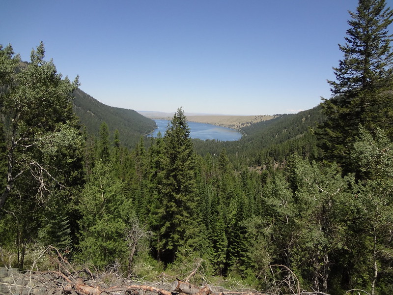
First good view of Wallowa Lake:
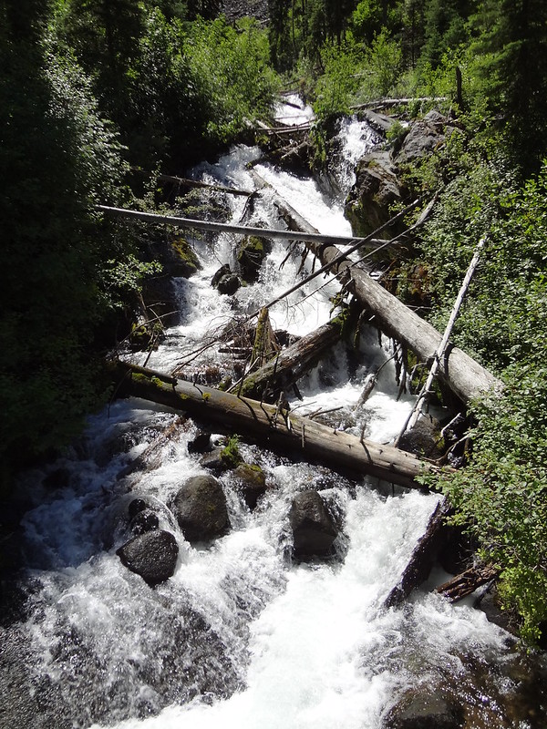
Waterfall along the East Fork Wallowa River Trail:
]
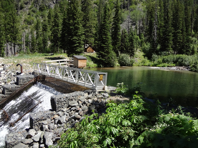
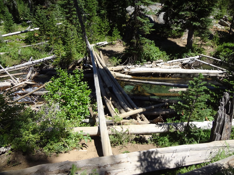
Diversion dam for electricity generation purposes:
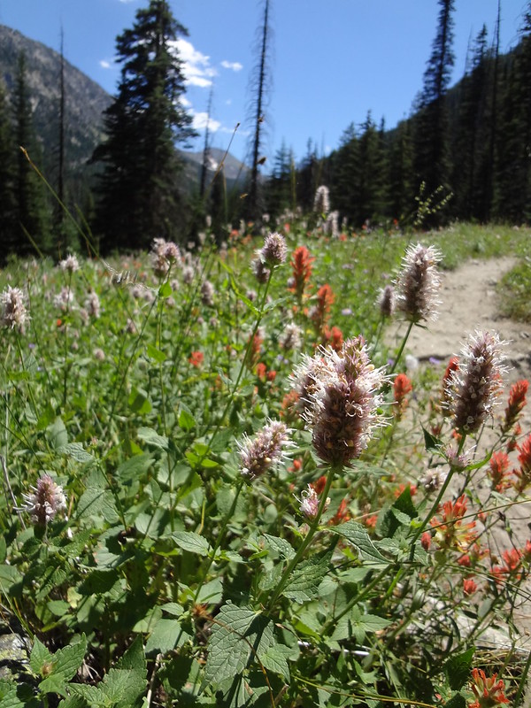
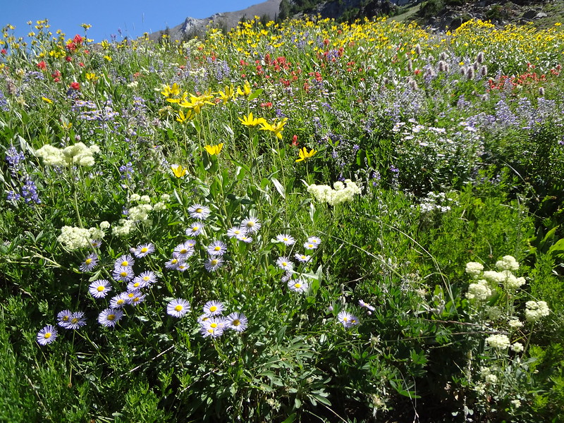
Flowers along the trail:
First view of Aneroid Mountain (9702'):
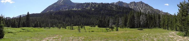
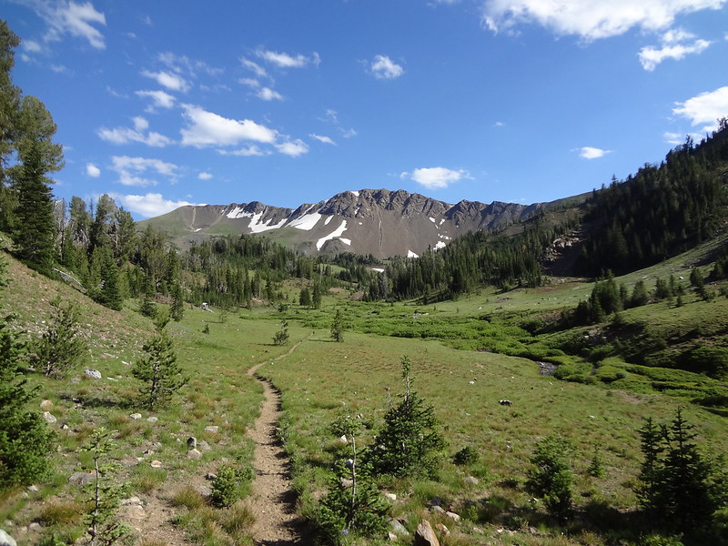
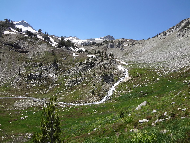
Cool pano shot of a meadow:
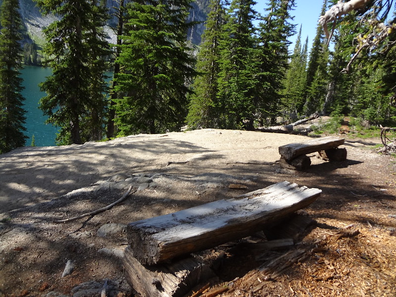
Wooden benches above Aneroid Lake:
The trail going up to Dollar Pass (to the left) or Tenderfoot Pass (to the right):
]
Aneroid Mountain from the trail going up to Tenderfoot Pass:
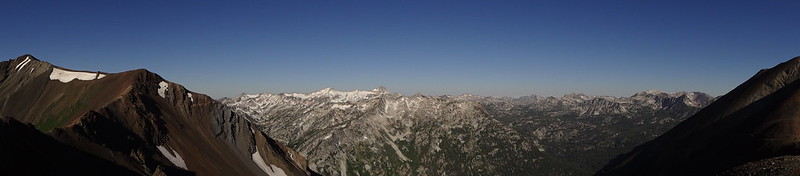
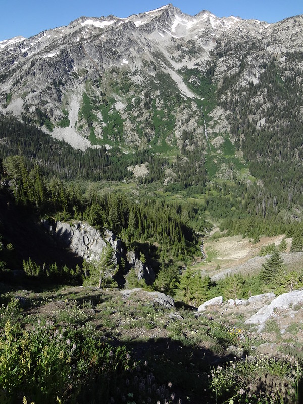
Pano of Aneroid Mountain and the area below it:
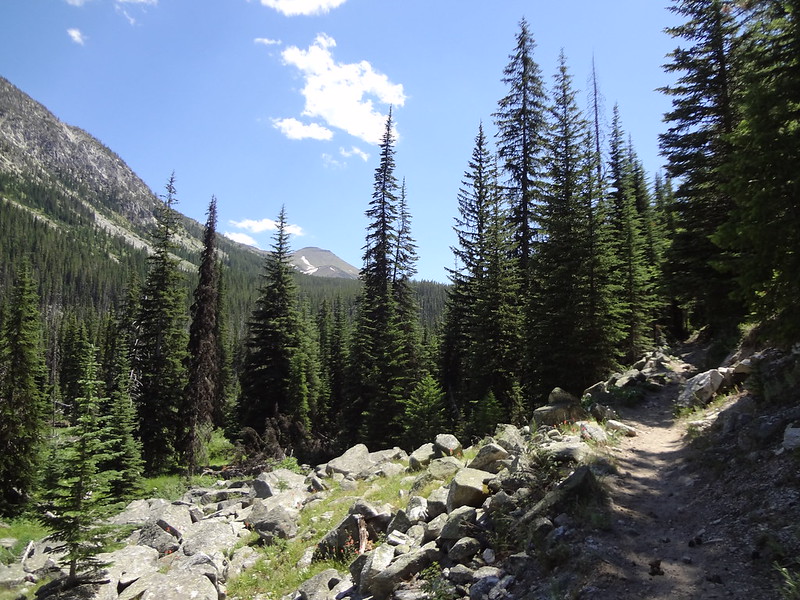
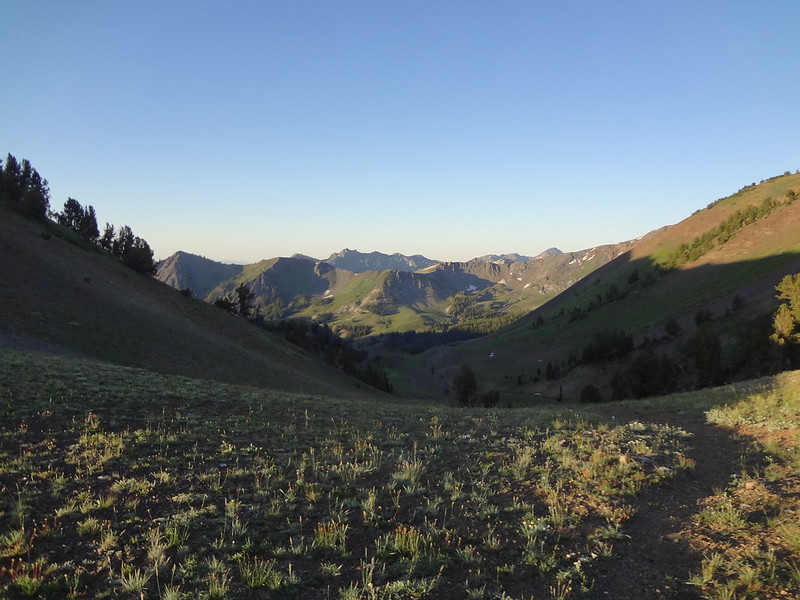
Heading over to Jewett Lake:
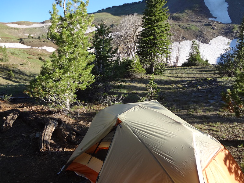
Campsite just above Jewett Lake:
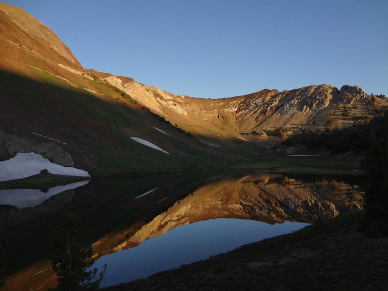
Sunrise at Jewett Lake:
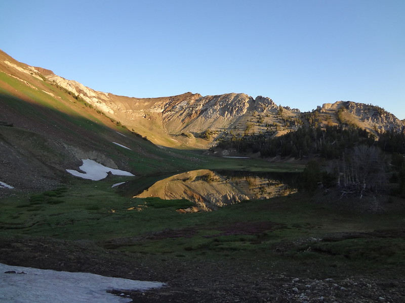
Jewett Lake from above:
Video below Tenderfoot Pass:
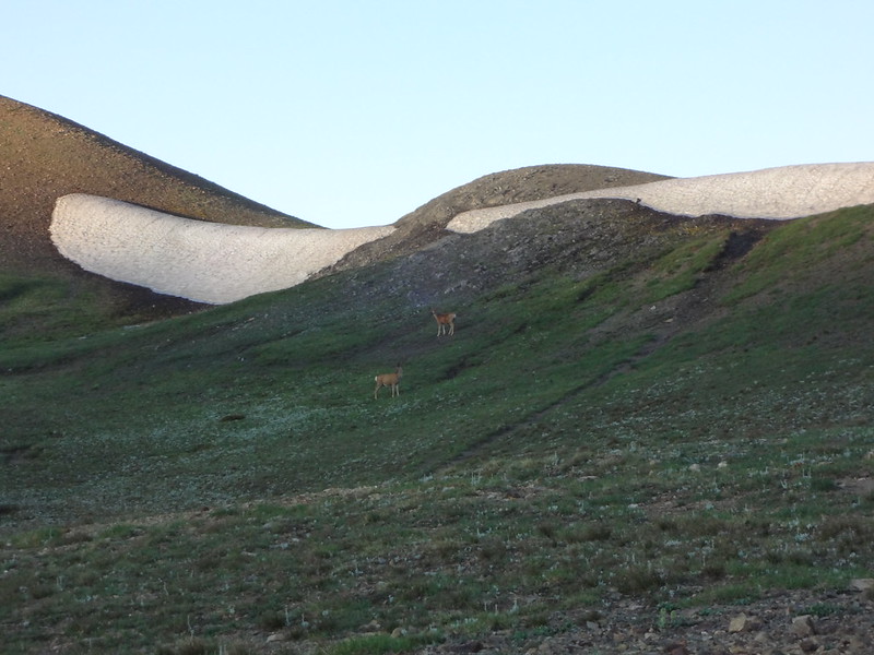
Deer below Tenderfoot Pass:
Looking down the other side of Tenderfoot Pass:
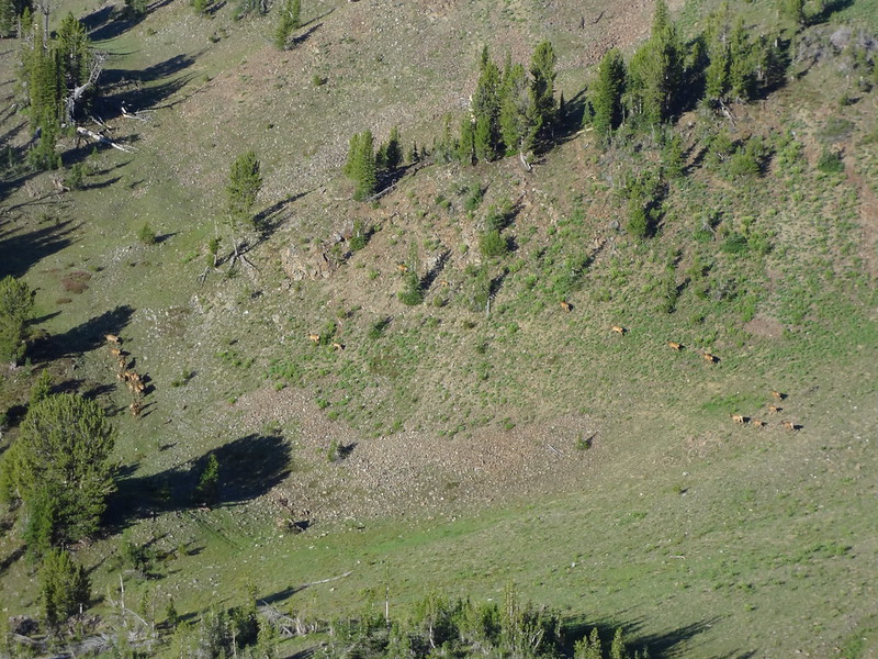
Herd of 30 elk on the way up Polaris Pass:
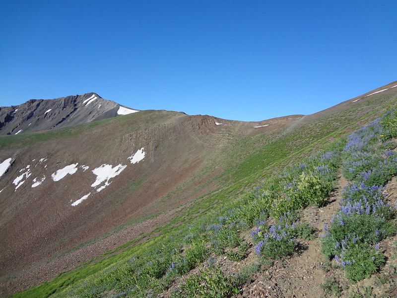
Looking up at Polaris Pass:
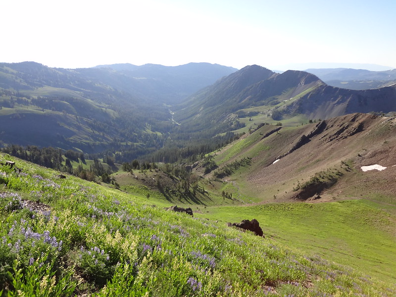
Looking down at the North Fork Imnaha River Valley:
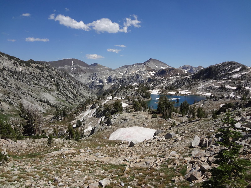
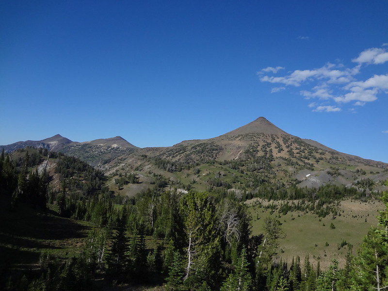
View from Polaris Pass looking west at Eagle Cap:
Zoomed in on Glacier Peak (L) and Eagle Cap (R):
Video of 360 from Point Above Polaris Pass:
Looking down at some of the 80 switchbacks down to the West Fork Wallowa River:
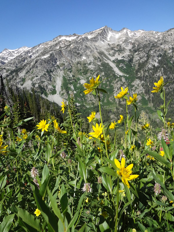
Lots of pretty flowers on the way down:
Can you see the river way down there?
More flowers:
Chris crossing the West Fork Wallowa River below Frazier Lake:
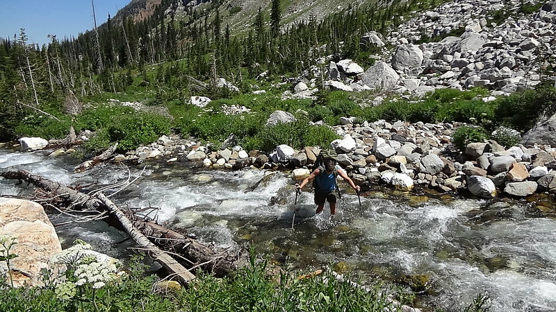
Video of crossing the ice-cold West Fork Wallowa River (below Frazier Lake):
Frazier Lake:
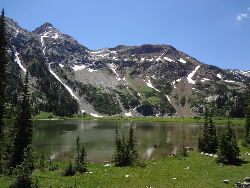
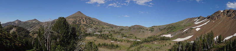
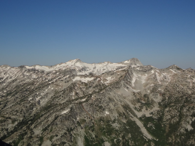
Almost to Glacier Lake/Glacier Peak (L) Eagle Cap (R):
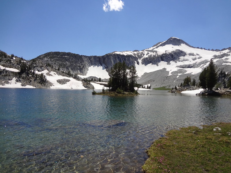
Glacier Lake and Glacier Peak:
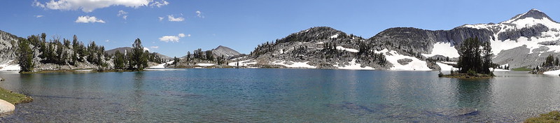
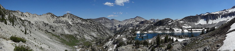
Glacier Lake pano:
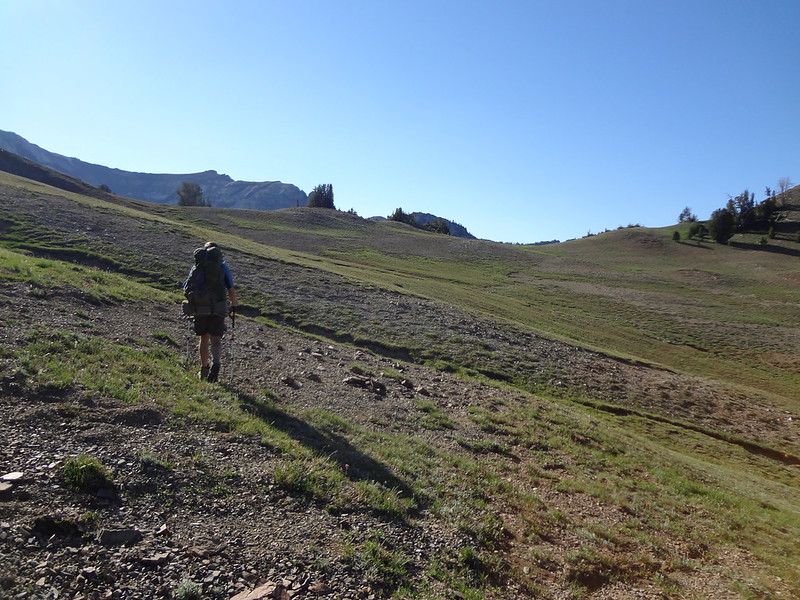
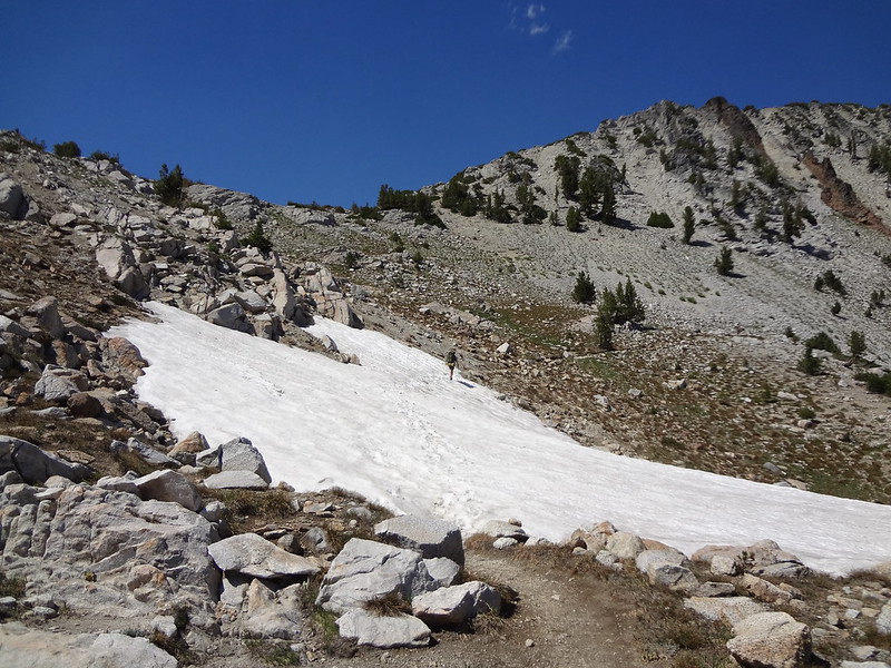
Climbing up to Glacier Pass:
Pano of Glacier Lake area from the trail up to Glacier Pass:
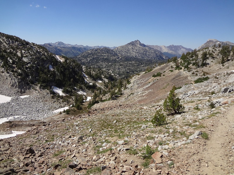
Looking down the other side of Glacier Pass:
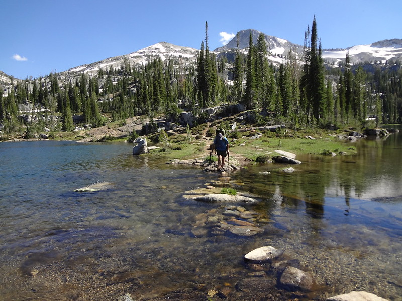
Crossing the isthmus of Moccasin Lake:
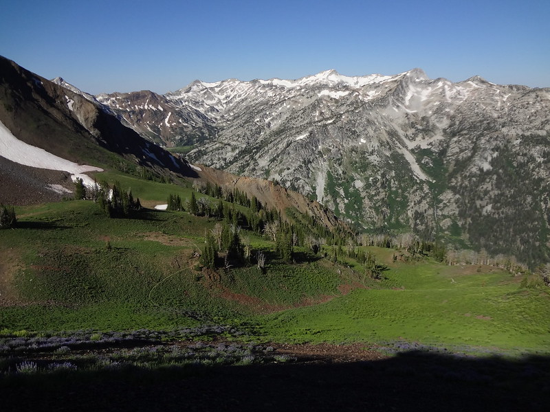
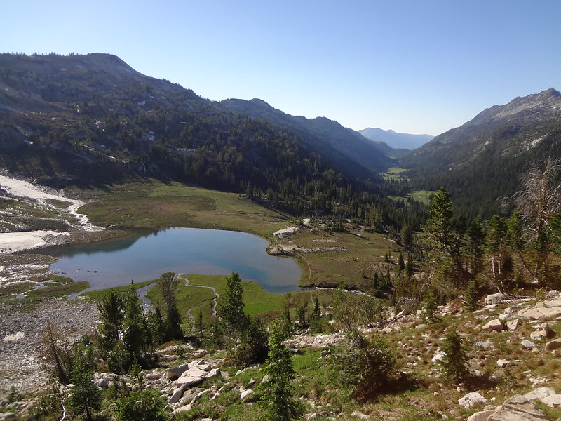
Upper Lake and the East Lostine River Valley from the Horton Pass trail:
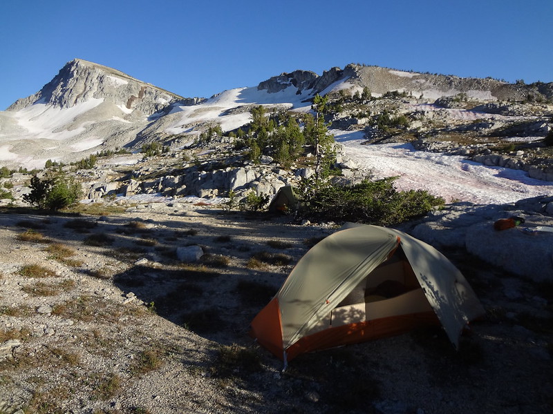
Campsite on the plateau below Eagle Cap:
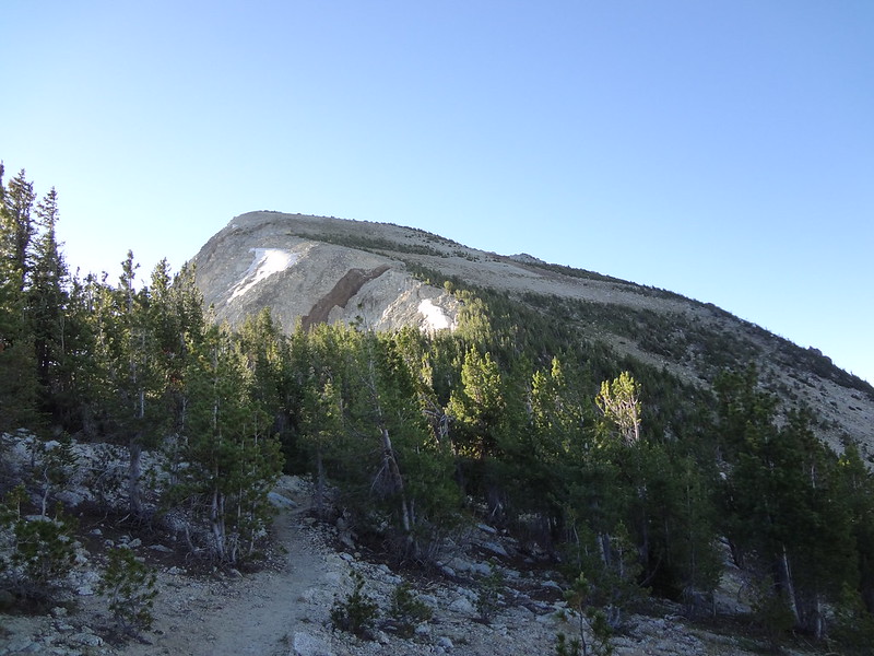
Looking up at Eagle Cap, our destination:
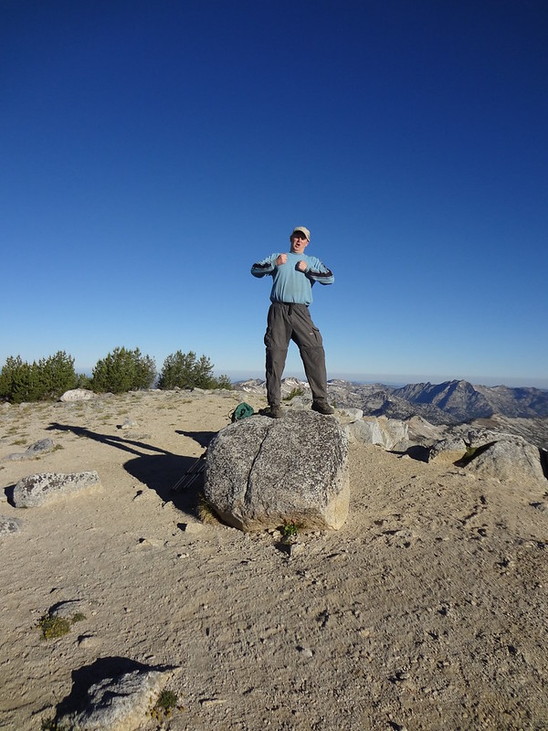
Me Brad. Make to top. Aaagghhh!!!
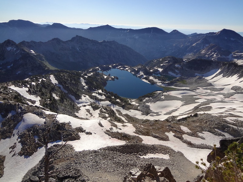
Glacier Lake from Eagle Cap:
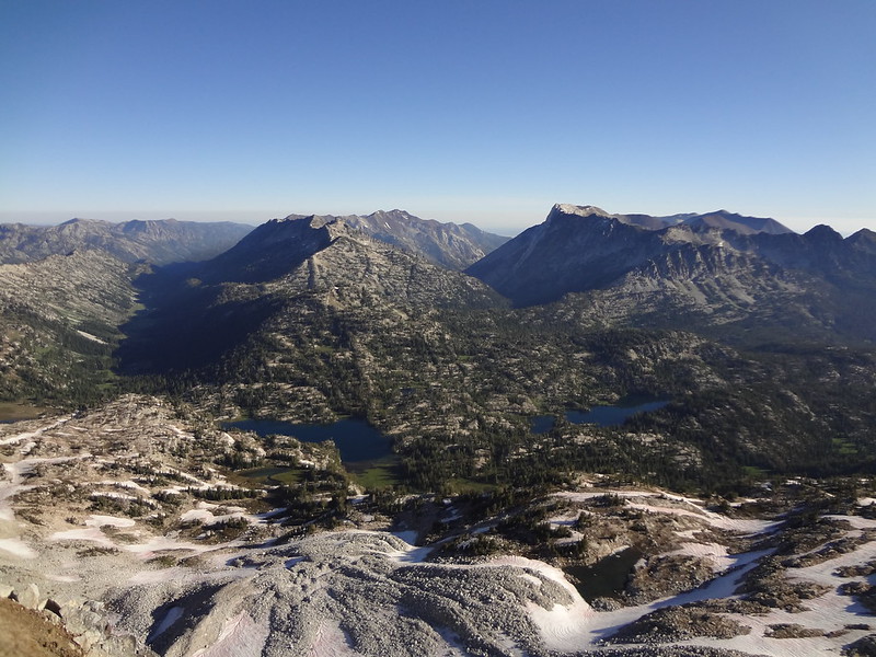
Too many geographical feature to name:
Video of Eagle Cap walkabout:
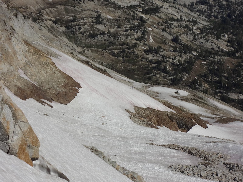
In the very center is a guy taking a shortcut to the top. He must have had crampons. I wouldn't go up that way.
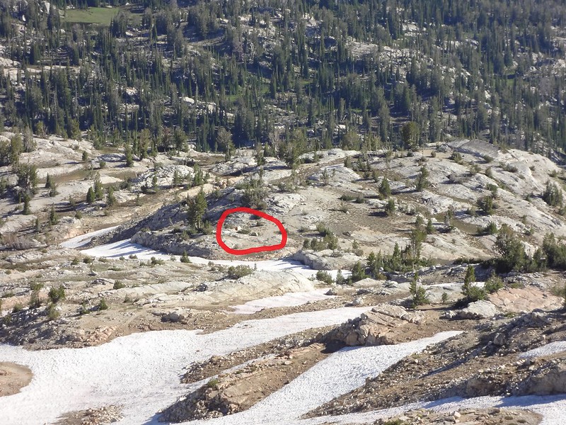
Zoomed in on our tents below:
No bridge over Lake Creek:
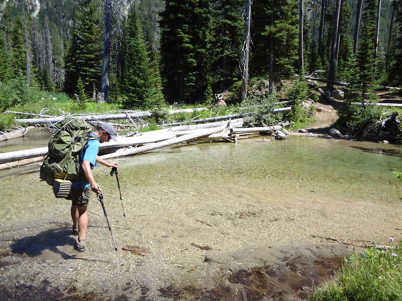
This is the crossing of the West Fork Wallowa River:
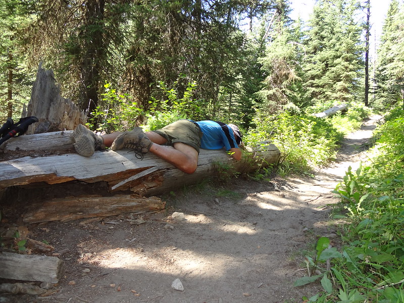
An exhausted Chris taking a break on the trail:
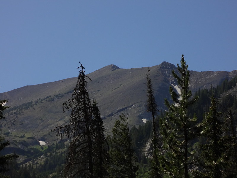
The Matterhorn and Sacajawea Peak. Not much snow way up there:
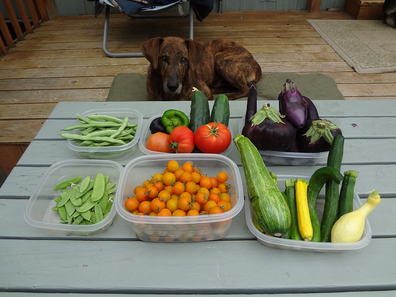
I came home to find that my garden had exploded:
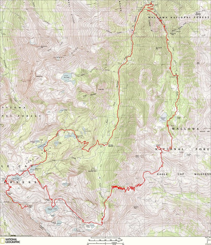
GPS tracks overlaid onto NatGeo:
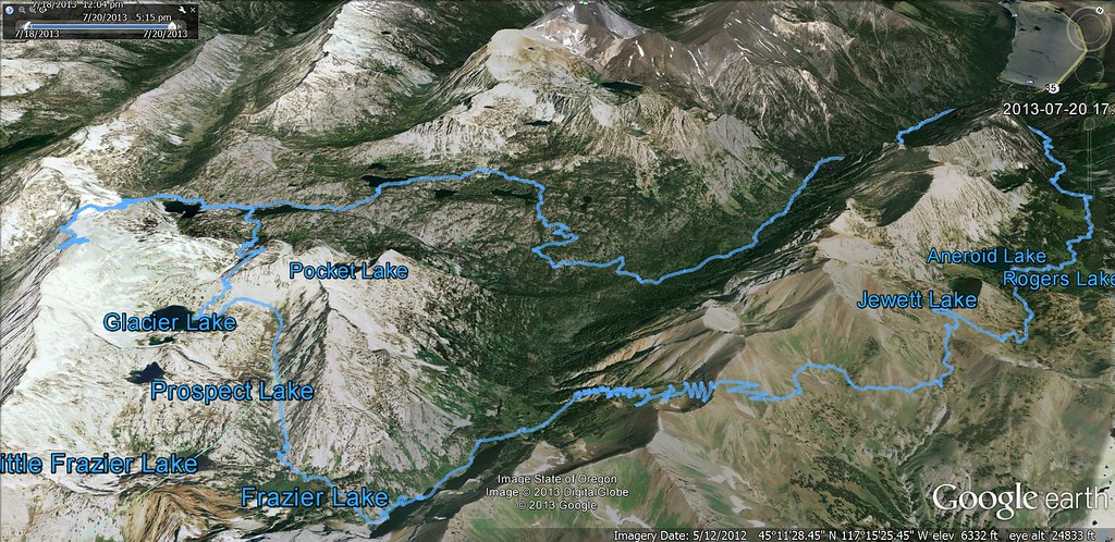
GPS tracks overlaid onto Google Earth:
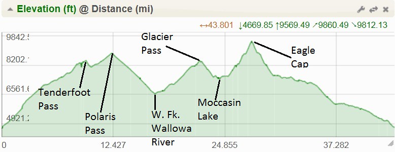
Elevation graph:
Google Doc link to the GPX tracks:
https://docs.google.com/file/d/0B7SKP52 ... sp=sharing
Not enough pictures for ya? Here's more:
http://www.flickr.com/photos/54959080@N ... 742486626/
Keep on hiking,
Brad
Eagle Cap Greatest Hits: 7/18/13-7/20/13
- Born2BBrad
- Posts: 1086
- Joined: May 1st, 2011, 7:26 pm
- Location: The Dalles
Eagle Cap Greatest Hits: 7/18/13-7/20/13
Make now always the most precious time. Now will never come again.
- Jean Luc Picard
Link to GPX tracks
Link to Trip Reports
- Jean Luc Picard
Link to GPX tracks
Link to Trip Reports
Re: Eagle Cap Greatest Hits: 7/18/13-7/20/13
Thanks for the TR! - Good to know that my feet will get wet at a few crossings
I am planning this same loop this upcoming weekend, the only difference is that we won't head to Eagle Cap and instead try to get up Matterhorn.
I had a quick question - How precarious is the descent from Polaris Pass? My partner is somewhat apprehensive of exposed areas without sure footing. I don't want to give her a 'surprise' midway through our journey.
- retired jerry
- Posts: 14426
- Joined: May 28th, 2008, 10:03 pm
Re: Eagle Cap Greatest Hits: 7/18/13-7/20/13
How'de you get those tomatoes and peppers to ripen. I have eaten one cherry tomatoe, which was quite good. Many green tomatoes that are thinking about ripening. Peppers thast are as big as a finger tip.
- Born2BBrad
- Posts: 1086
- Joined: May 1st, 2011, 7:26 pm
- Location: The Dalles
Re: Eagle Cap Greatest Hits: 7/18/13-7/20/13
Nebjamin,nebjamin wrote:I had a quick question - How precarious is the descent from Polaris Pass? My partner is somewhat apprehensive of exposed areas without sure footing. I don't want to give her a 'surprise' midway through our journey.
The trail down from Polaris Pass to the West Fork Wallowa River isn’t dangerously steep. If you look at the elevation chart, you can see, while steep, it is very consistent in the grade. There aren’t many – if any – cliff drop-offs right next to the trail. There are, however, some sections, especially higher up, where the trail is kind of loose rocky stuff. If your partner has hiked that kind of terrain before, they should have no problem. Hiking poles help tremendously and if your partner does not already use them, now might be a good time to start. Like I mentioned in the TR, be aware that there are at least 80 switchbacks.
That’s great you will be getting to the Matterhorn. We were too exhausted for that this time. Based on what I saw, it didn’t look like there was hardly any snow up there.
Have fun!
Brad
I built a 3’x’3’x6’ greenhouse a few years ago so I could buy starts early in the year and get a head start. Also, there are some tips to growing tomatoes. One is to limit the suckers and flowers, but not so much that you will not have any tomatoes. Another is to trim some leaves before they grow, again, not so much that the plant cannot collect sun energy. I don’t do those steps for cherry tomato plants. Of course, you have to have good, amended soil.retired jerry wrote:How'de you get those tomatoes and peppers to ripen. I have eaten one cherry tomatoe, which was quite good. Many green tomatoes that are thinking about ripening. Peppers thast are as big as a finger tip.
Make now always the most precious time. Now will never come again.
- Jean Luc Picard
Link to GPX tracks
Link to Trip Reports
- Jean Luc Picard
Link to GPX tracks
Link to Trip Reports
Re: Eagle Cap Greatest Hits: 7/18/13-7/20/13
I went down Polaris Pass a couple of years ago. It is exposed at the top and it is scree going down the switchbacks, so the footing isn't really secure. I don't really have a fear of heights, but my knees were a little weak for the first two switch backs going down. I was glad I had the trekking poles.nebjamin wrote:I had a quick question - How precarious is the descent from Polaris Pass? My partner is somewhat apprehensive of exposed areas without sure footing. I don't want to give her a 'surprise' midway through our journey.
Re: Eagle Cap Greatest Hits: 7/18/13-7/20/13
Wow - I forget the things can be that beautiful! Great pictures, and looks you had excellent weather. When I visited Lakes Basin a couple summers ago, there was T-storm every evening.
Thanks for trip report, and the map with GPX track.
-
- Posts: 51
- Joined: June 29th, 2009, 8:54 pm
Re: Eagle Cap Greatest Hits: 7/18/13-7/20/13
I am a bit afraid of heights and I was a bit apprehensive on the first 2-3 switchbacks. There are a 3-4 of spots where you would not want to lose your footing but they only last for 2-3 steps or so each. I tackled those spots slow and carefully. After that, it is gravy.nebjamin wrote:I had a quick question - How precarious is the descent from Polaris Pass? My partner is somewhat apprehensive of exposed areas without sure footing. I don't want to give her a 'surprise' midway through our journey.
Re: Eagle Cap Greatest Hits: 7/18/13-7/20/13
Nice job guys. I really enjoyed your TR. It's about as close as I'm gonna get to the Eagle Cap area in the foreseeable future.
The altitude, heat and exposure must really make hiking out there a challenge. But that scenery looks like it's worth the effort.
- Born2BBrad
- Posts: 1086
- Joined: May 1st, 2011, 7:26 pm
- Location: The Dalles
Re: Eagle Cap Greatest Hits: 7/18/13-7/20/13
You said it. I forgot to make mention of the difficulty of hiking in those conditions. There were hours at a time where there was no shade. It really wears a person out. But it was well worth it.Crusak wrote:The altitude, heat and exposure must really make hiking out there a challenge. But that scenery looks like it's worth the effort.
Make now always the most precious time. Now will never come again.
- Jean Luc Picard
Link to GPX tracks
Link to Trip Reports
- Jean Luc Picard
Link to GPX tracks
Link to Trip Reports