Eagle / PCT / Ruckel Ck loop
Posted: June 16th, 2013, 7:17 am
Lots of people have been doing some variation of this hike - dayhike or backpack though it may be. Sometimes I skip posting reports for popular trips, but I'm doing this one. The beargrass is in strong bloom on the PCT on the ridge between Chinidere and Smokey Camp, though nary a one in the ocean of beargrass on Benson Plateau. I can't conceive of what it would look like to see a strong bloom there. But the ones I saw were just coming into peak. Next weekend should be the peak.
Camp was at 2 Creek, the spot a couple miles below Wahtum Lake on the Eagle Creek trail. Temps were perfect - mid 60's in the shade, mid-70's to maybe 80 in the sun. I got some mosquito bites on top of Chinidere, but saw none at Wahtum.
One other postscript. Last year I did what I called the Fat Wahtum Loop and did it clickwise, which meant going up Ruckel Creek. This year I did a skinnier Wahtum Loop and went down Ruckel Creek. Normal thought says that the downhill is worse for the knees. But last year I injured my right knee going up it and it took half the summer for it get back to 100%. [For the uninitiated, Ruckel Creek has some really extended steep section. This year, going down, no real problems. I've always thought that for me, I am more likely to injure my knees on steep ascents. Maybe I'm just real diligent at using my poles on the downhill. I almost got a blister on one of my hands yesterday.
Entering the tunnel

Light at the end of the tunnel

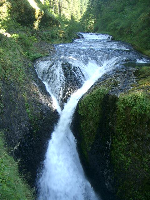
Twister Falls is at the perfect level now to emphasize the X crossing of the two streams of water. At higher levels, it gets washed out.
Burned out remnant of a tree in a small burn not far from the Indian Mtn junction on the Eagle Creek trail

First beargrass bloom - just above Two Creek

A lazy day at Wahtum Lake (for somebody)

Classic Hood from the top of Chinidere

Flowers were in bloom at Chindere's summit

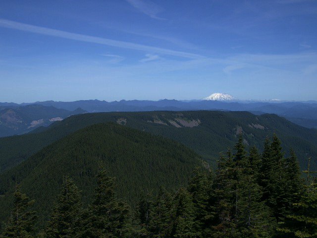
Mt. Saint Helens hangs out above the very flat Benson Plateau
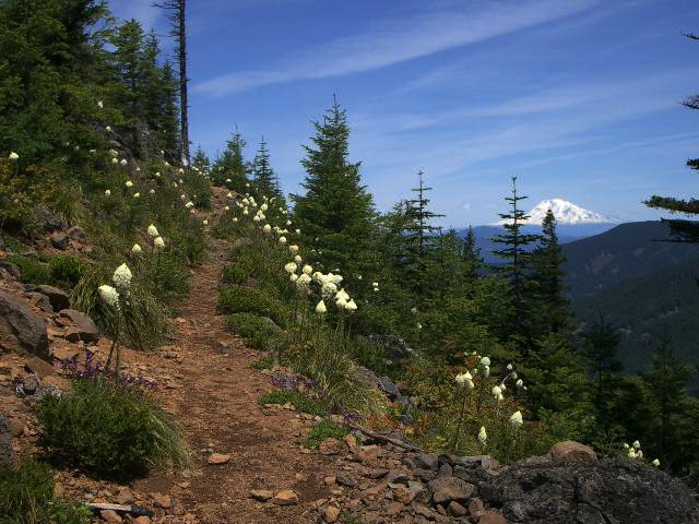
More beargrass blooms line the trail in profile of Mt Adams
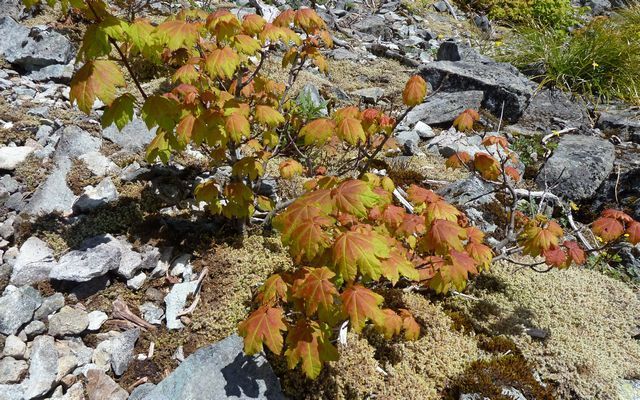
Here's an oddity: beargrass bloom in conjunction with vine maple that are turning red already. Is it typical for some of them to turn red now instead of in October like normal?

Camp was at 2 Creek, the spot a couple miles below Wahtum Lake on the Eagle Creek trail. Temps were perfect - mid 60's in the shade, mid-70's to maybe 80 in the sun. I got some mosquito bites on top of Chinidere, but saw none at Wahtum.
One other postscript. Last year I did what I called the Fat Wahtum Loop and did it clickwise, which meant going up Ruckel Creek. This year I did a skinnier Wahtum Loop and went down Ruckel Creek. Normal thought says that the downhill is worse for the knees. But last year I injured my right knee going up it and it took half the summer for it get back to 100%. [For the uninitiated, Ruckel Creek has some really extended steep section. This year, going down, no real problems. I've always thought that for me, I am more likely to injure my knees on steep ascents. Maybe I'm just real diligent at using my poles on the downhill. I almost got a blister on one of my hands yesterday.
Entering the tunnel
Light at the end of the tunnel
Twister Falls is at the perfect level now to emphasize the X crossing of the two streams of water. At higher levels, it gets washed out.
Burned out remnant of a tree in a small burn not far from the Indian Mtn junction on the Eagle Creek trail
First beargrass bloom - just above Two Creek
A lazy day at Wahtum Lake (for somebody)
Classic Hood from the top of Chinidere
Flowers were in bloom at Chindere's summit
Mt. Saint Helens hangs out above the very flat Benson Plateau
More beargrass blooms line the trail in profile of Mt Adams
Here's an oddity: beargrass bloom in conjunction with vine maple that are turning red already. Is it typical for some of them to turn red now instead of in October like normal?