When white men arrived in the late 1800s they plundered and pillaged the old Indian sites, and many of the artifacts they collected ended up in museums. Today it is illegal for visitors to take anything from the sites. But you CAN get up close to many of the ruins if you do this hike, which is why we chose this trail.
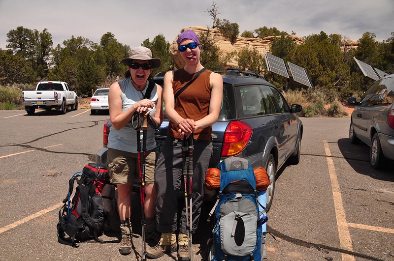
After the two-hour drive from Moab we arrived at the Kane Gulch Ranger Station, picked up the $15 permit we had reserved several months earlier, and got ready to hit the trail on what turned out to be a VERY windy day. (See those solar panels in the background? I was sure they were going to rip loose and fly away!)
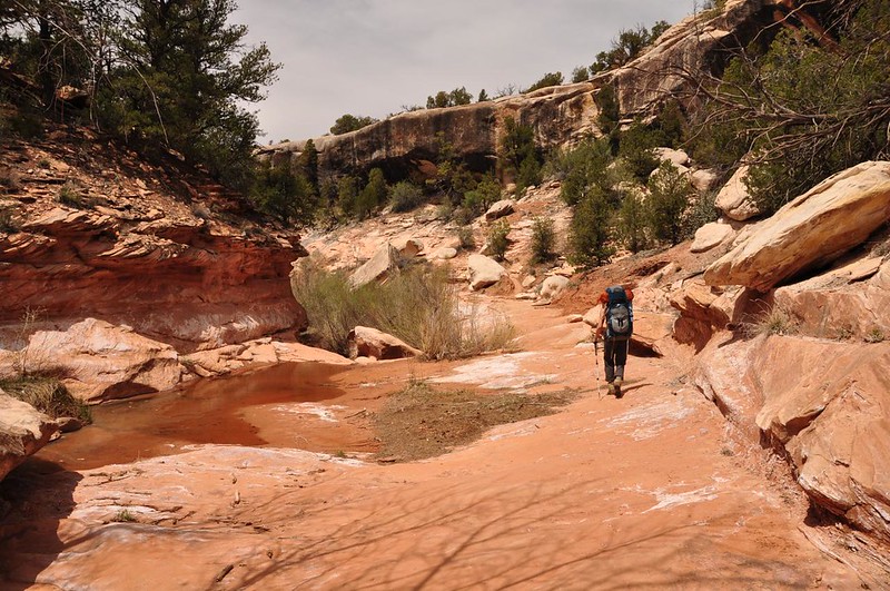
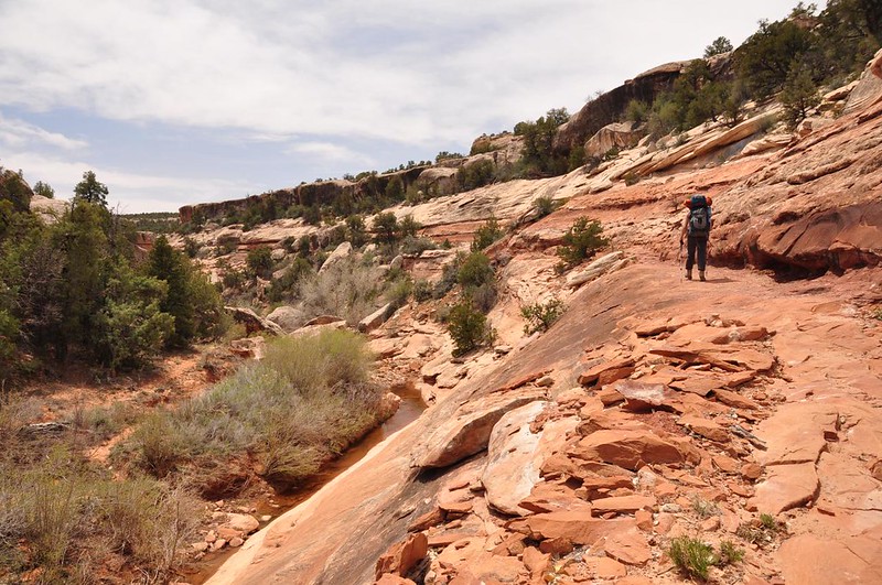
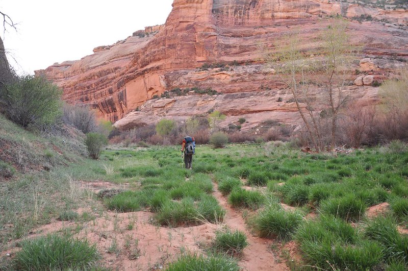
The first four miles of trail are through Kane Gulch.
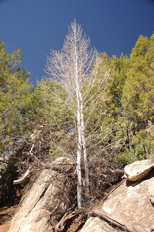
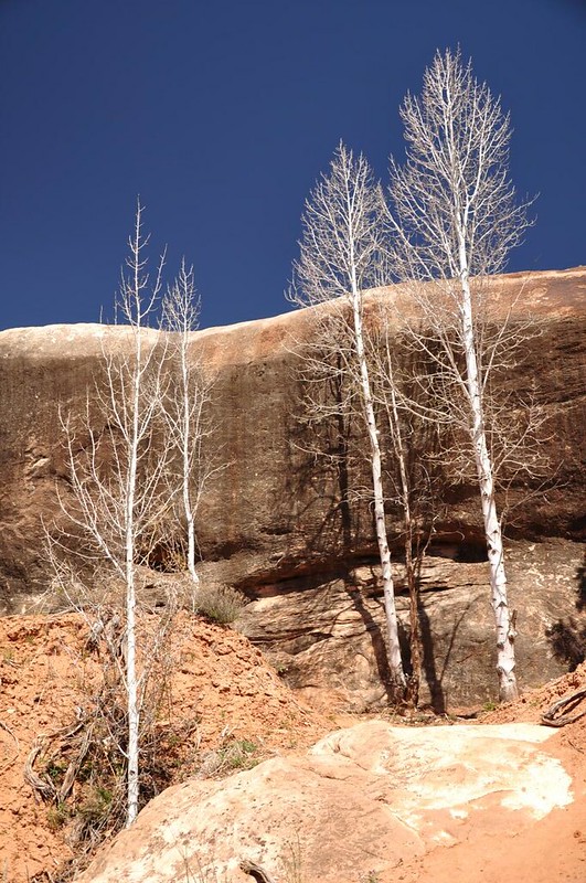
We spotted several dozen aspen trees along a stretch of trail about a mile in. According to the BLM glaciers deposited aspen seeds here during the last ice age. The seeds survived and grew into trees. The aspens that are here today are all of the same genetic makeup and they represent trees that have been growing here continuously for 11,000 years!
There are some ENORMOUS boulders at the bottom of Kane Gulch.

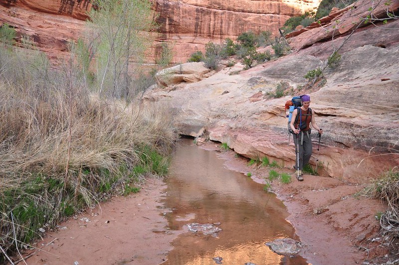
There were still some pools of water from the last time it rained, but other than that it was pretty dry.
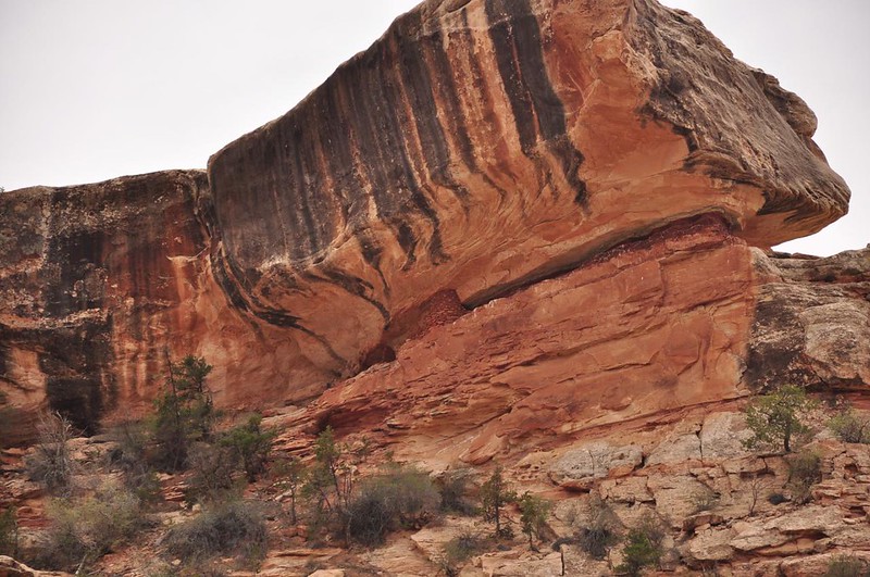
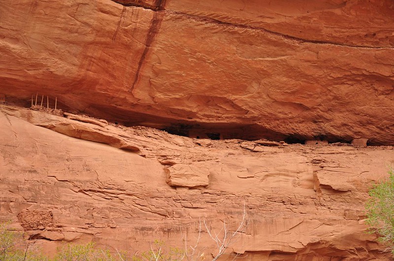
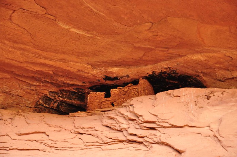
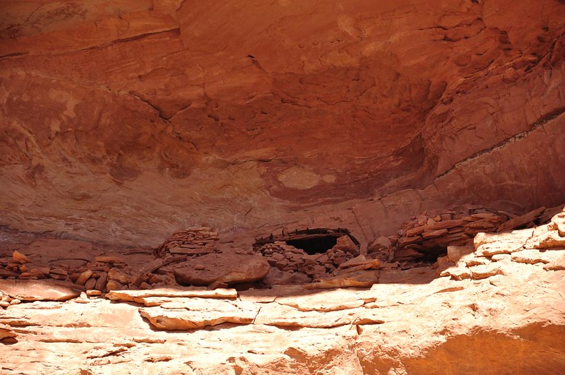
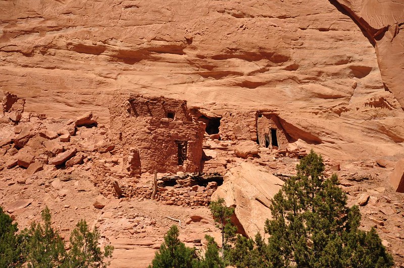
We spotted our first old Indian ruin way up high.
We saw a snake (not a rattlesnake) slowly crossing our path. He was pretty big, about four feet long. Since I know some people are afraid of snakes I won't embed the picture here. Click this link if you want to see it.
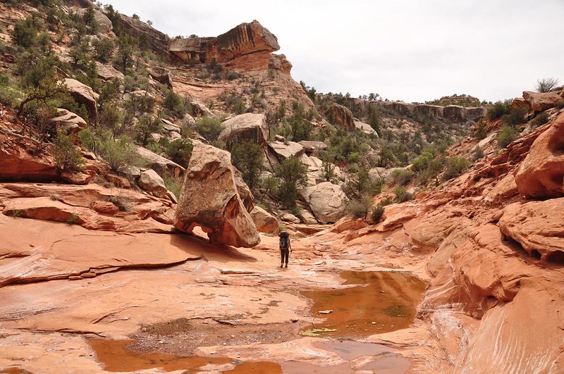
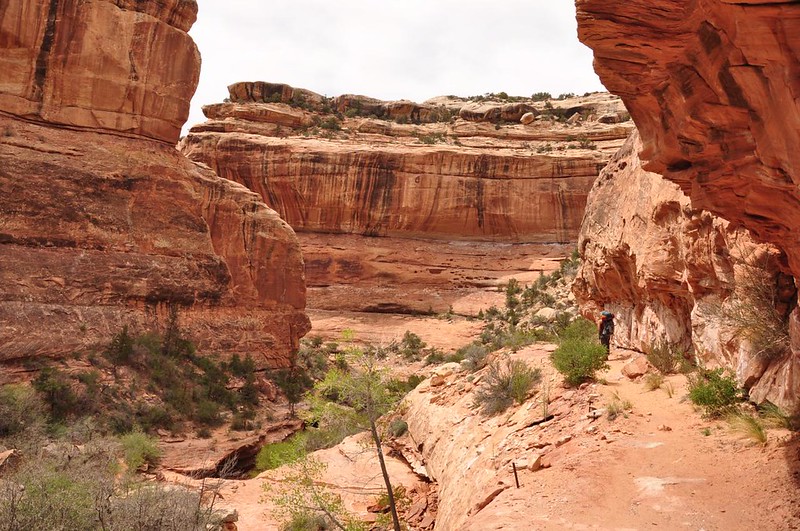
We followed the twists and turns of the canyon.
Sometimes we were hiking right in the bottom of the dry wash, and sometimes cottonwoods were growing right there in the channel. This one had lots of debris wrapped around its trunk from past flash floods.
A note about the "trail" in Grand Gulch. Sometimes we were on a real trail with dirt or sand. Sometimes we were hiking in the dry wash. And many times we were climbing in and out of the wash. Even though there wasn't really any elevation gain to speak of it still felt like there was. I lost count of how many times we were descending into a washing and climbing back out of it. Pretty tiring with a heavy pack!
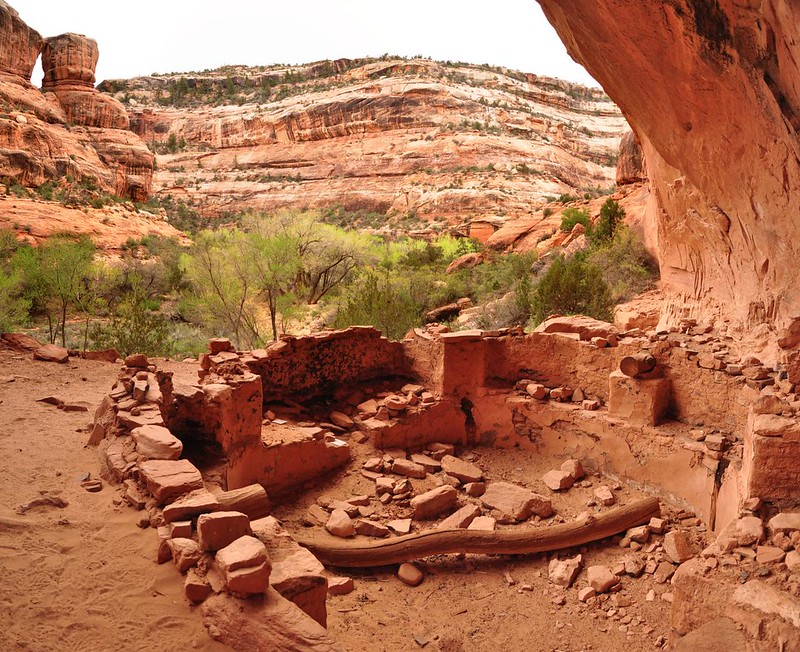
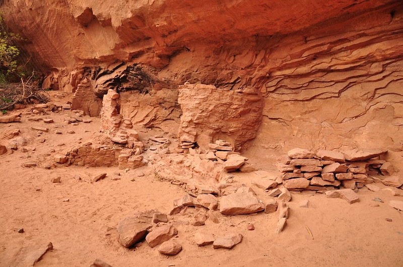
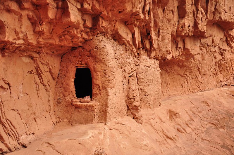
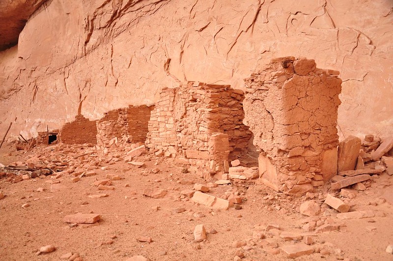
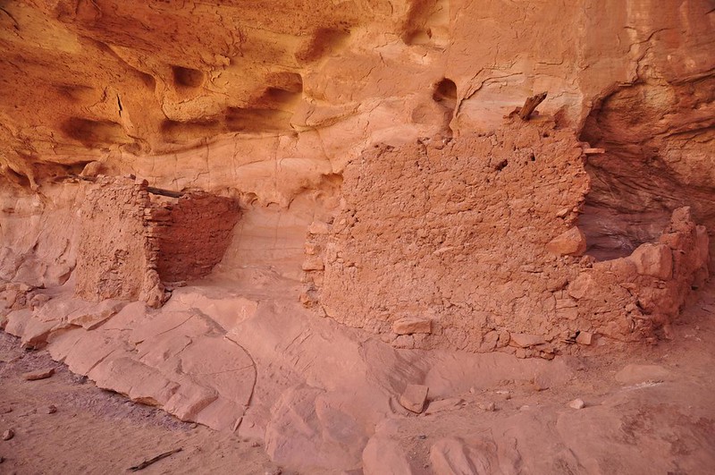
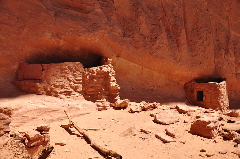
Where Kane Gulch meets up with Grand Gulch is a very cool site called Junction Ruin. The ruins consist of cists, storage rooms, habitation rooms, kivas, and defensive structures.

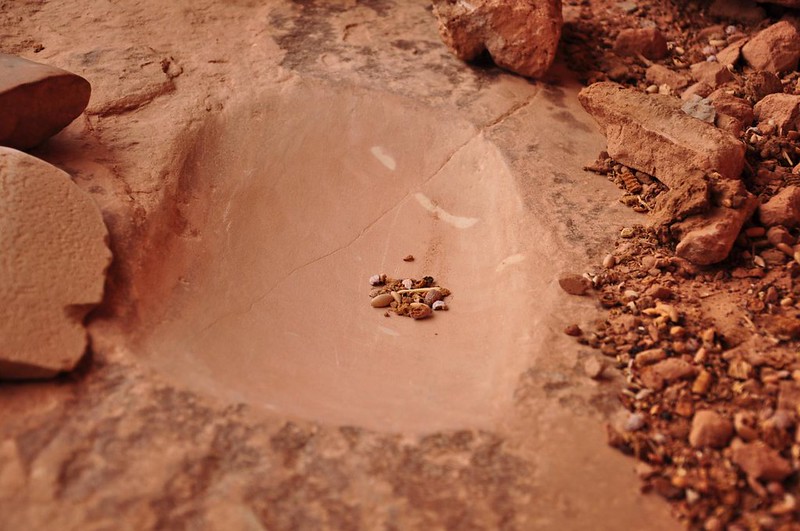
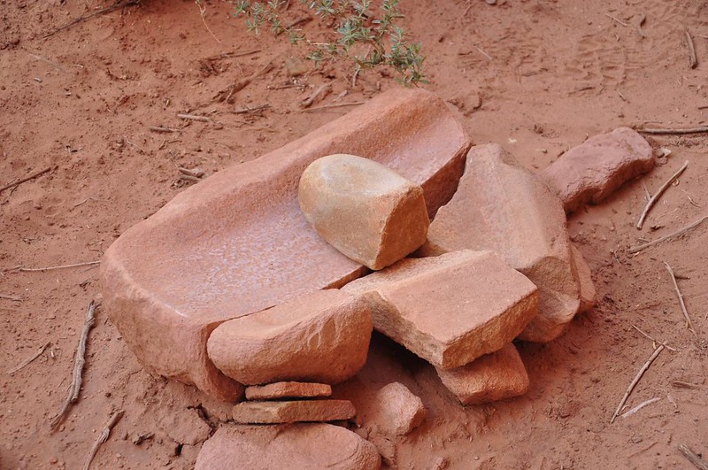
This smooth depression in the rock is where they would have ground their corn.
This high upper level would have been the defensive level and would have been accessed via a ladder.
Kivas were dug out of the ground and are assumed to have been used for ceremonial activities. Back when they were in use they would have had roof beams and a roof made of bark. An opening in the roof allowed the people to descend into the kiva via a ladder. One of the ruins many miles further along Grand Gulch has a kiva that's been stabilized enough to allow people to climb the ladder down into it.
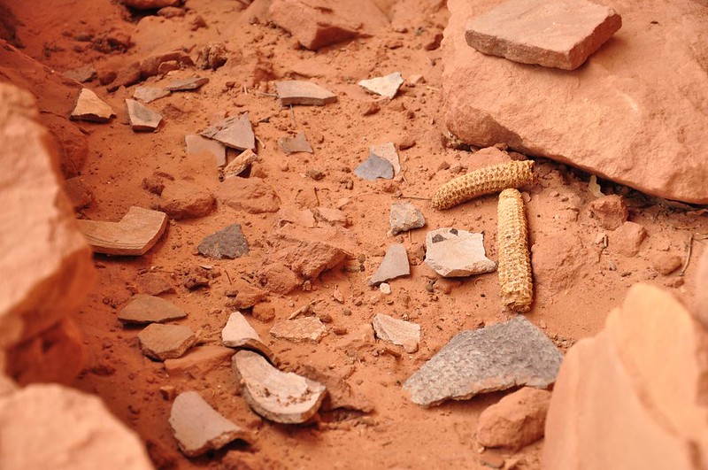
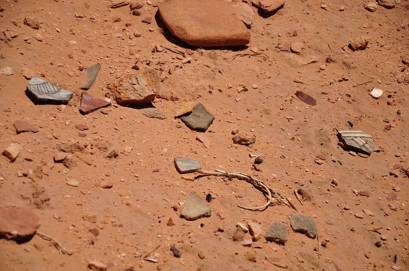
Archaeologists think that the Indians abandoned the Cedar Mesa area around AD 1260. Although the reason for abandoning the area is not known, several possibilities include depletion of resources, drought, disease, or warfare. Besides the ruins themselves, all that is left here are pieces of broken pottery and corn cobs.
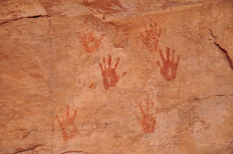
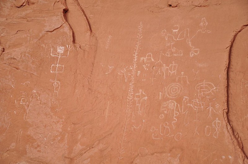
There were some handprints on the wall.
Pretty nice view from here!
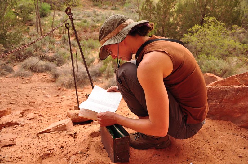
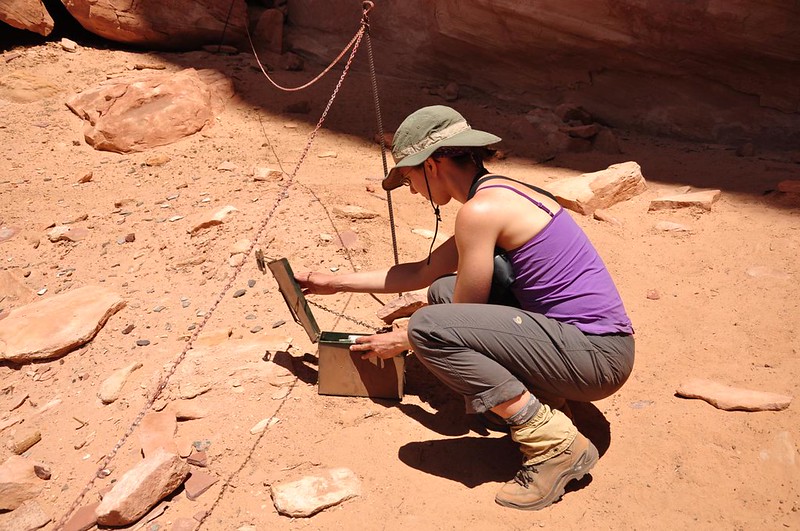
The BLM has an ammo can on site with a logbook (made for some interesting reading) and a packet of info about this site and the people who once lived here.
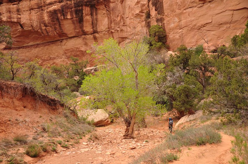
After spending time poking around the site we continued on. We passed quite a few cottonwoods, which were newly leafed out and lovely.
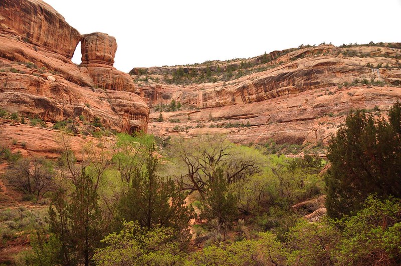
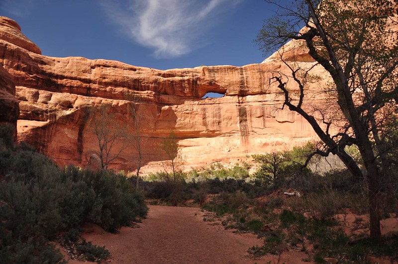
We passed Stimper Arch, high up on the canyon wall.
We came to Turkey Pen Ruin.
The final push before we reach our stopping place for the night.
Water is scarce around here but we knew there was a spring at Todie Canyon. We hiked up the canyon about a quarter mile, found the spring, and filled up all our containers. (The map showed several other springs we should have passed throughout our trek but we never saw them. They were either dried up already or we just missed them. Good thing we carried plenty of water!)
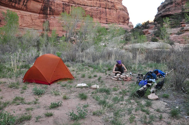
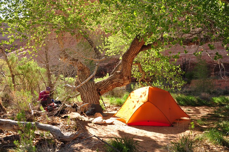
The only empty campsite we found was a bit exposed, but it would have to do, so we pitched the tent and started making dinner behind a makeshift wall of rocks to protect the stove from the wind.
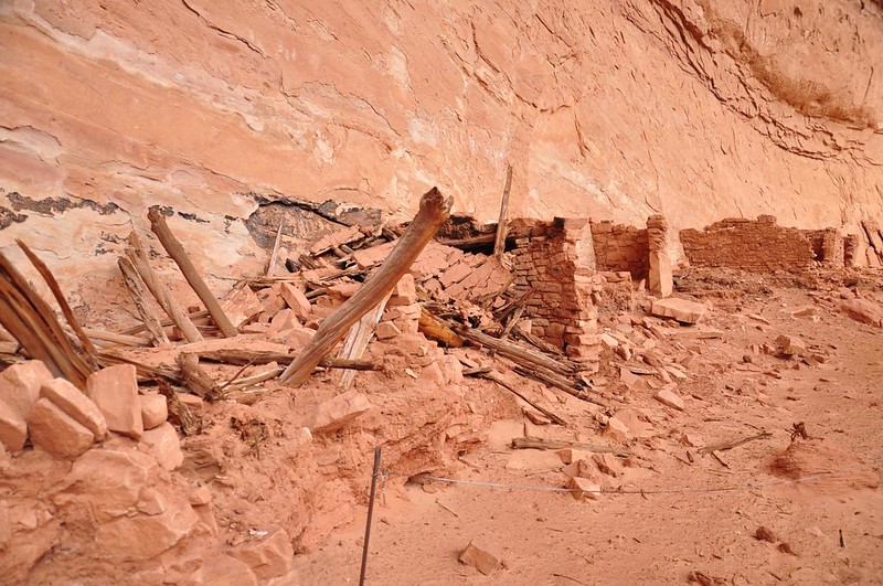
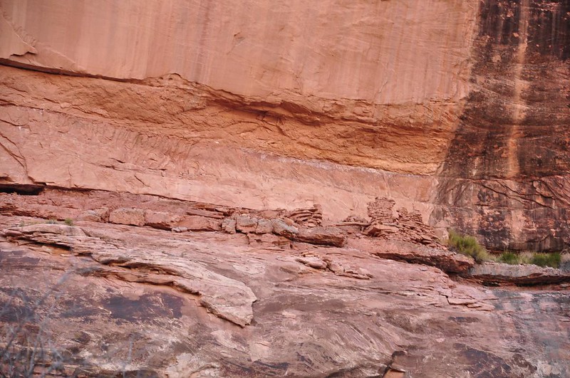
There were some ruins high above us.
With the sun gone and the wind blowing so hard it was pretty cold, so we went to bed right after dinner. Despite the seven miles of hiking we had done that day neither of us slept very well. The wind pummeled our tent all night long. If we hadn't been in it I think it would have blown away. The wind also blew dust up underneath the rain fly and through the mesh walls of the tent. In the morning everything was caked in dust: our faces, our hair, our sleeping bags, EVERYTHING.
As if that wasn't bad enough, the wind was STILL raging. It was hard to relax and enjoy the surroundings with the wind buffeting you and trying to blow your stuff away. After breakfast we moved the tent to a more protected campsite which was fortunately vacant after the previous night's occupants had packed up and left. Then we headed out for a day hike further along Grand Gulch.
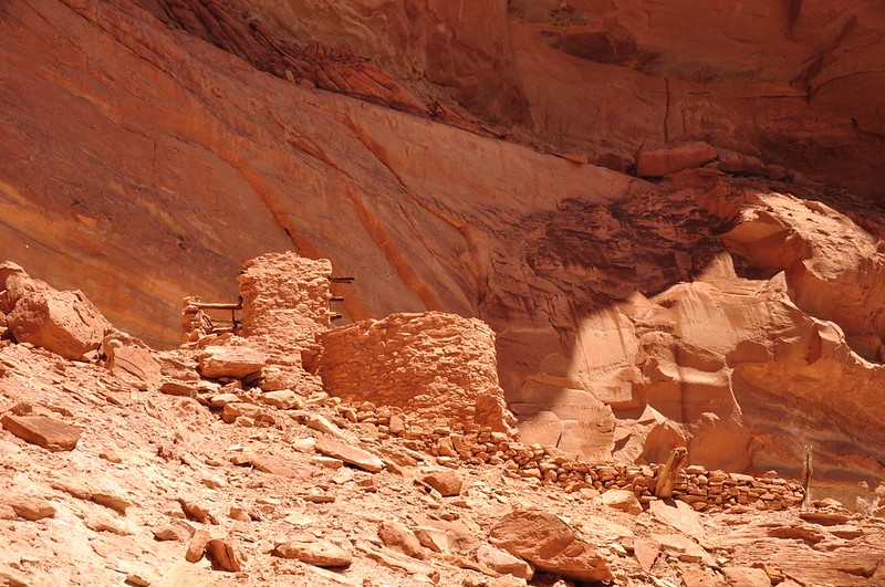
We came to another set of unnamed ruins.

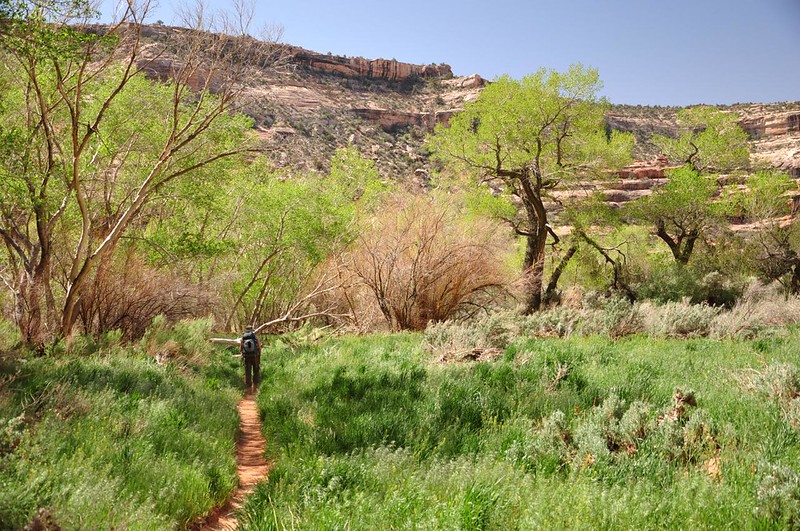
Some areas of Grand Gulch were surprisingly lush and green!
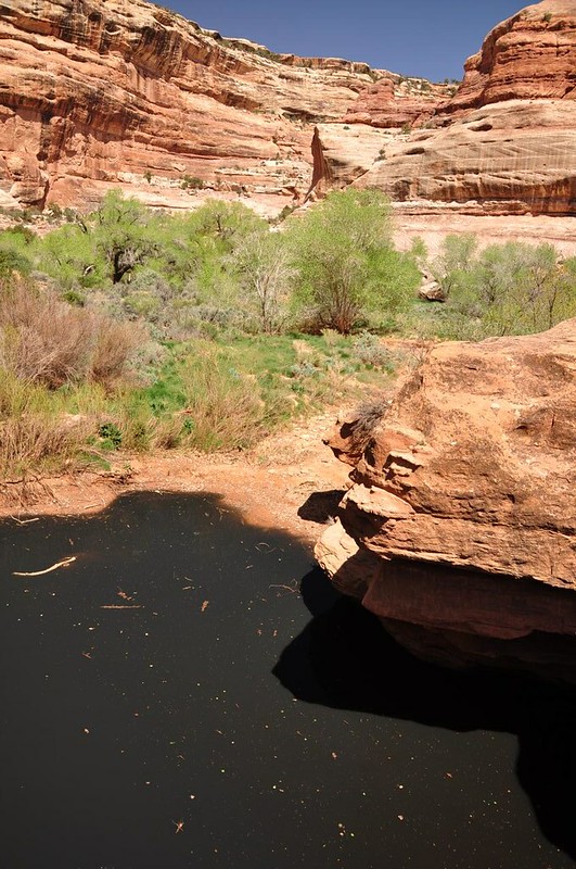
This is called Pour Off Pool, a pond of stagnant water. During flash floods a thundering waterfall would go crashing into this pool.
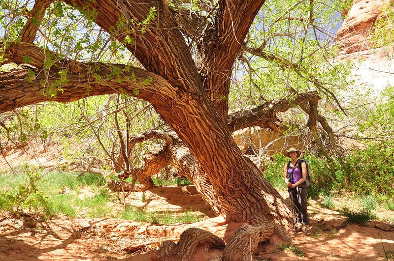
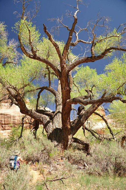
We came across this enormous old cottonwood tree. The picture, of course, doesn't convey just how big this thing was.
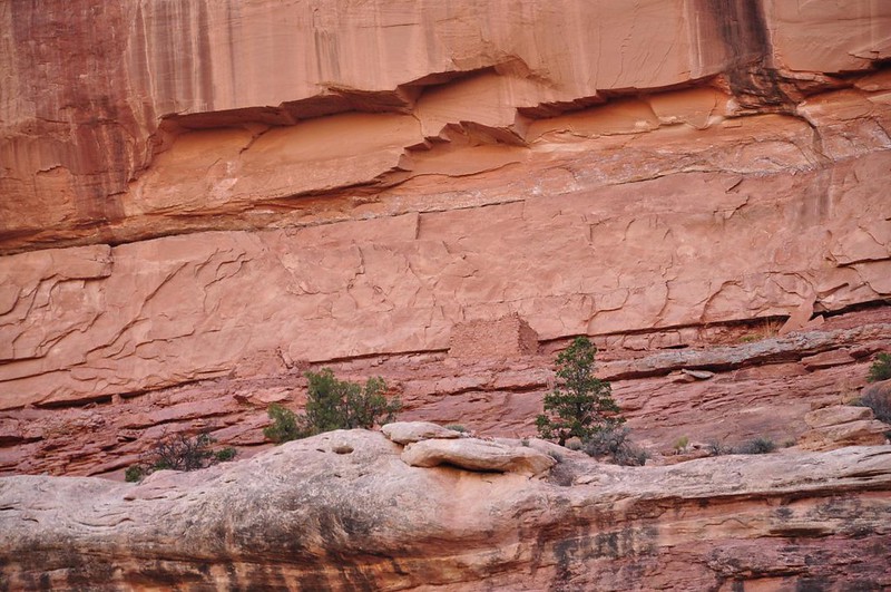
We spotted some distant ruins high up on the canyon wall.

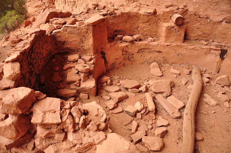
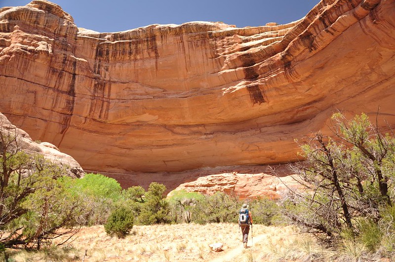
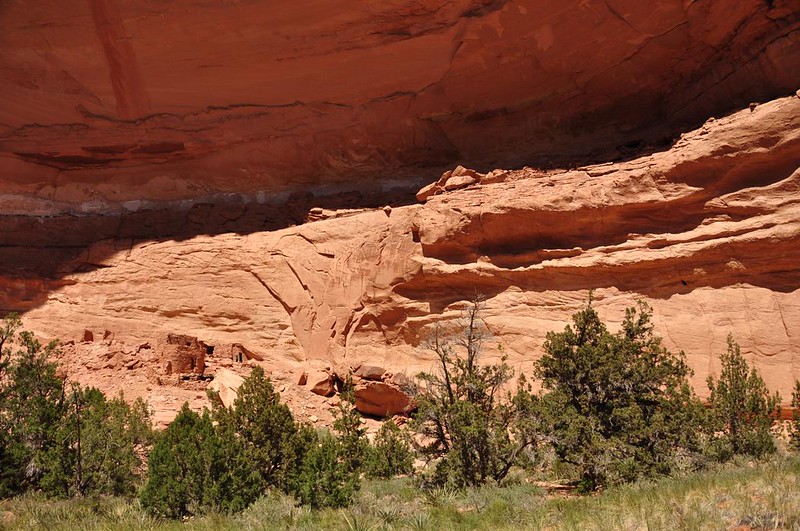
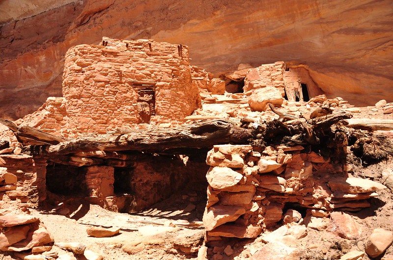
Then we were approaching Split Level Ruin, which is situated in a big impressive amphitheater of rock.
Same as Junction Ruin the BLM has an ammo can here with a logbook and info about the ruin.
This ruins here are believed to have been occupied during the Pueblo period (AD 750 - AD 1260).
The split level structure for which this ruin is named is believed to have been habitation rooms.
I found it kind of amazing that there are broken pieces of pottery just laying around at the ruins. People are told not to take them for souvenirs, and although I'm sure some people take them anyway, there are enough pieces still laying around that it seems most people are leaving them be.
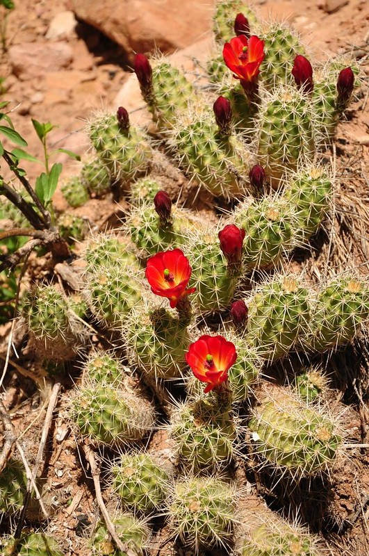
A cactus in bloom near the ruins.
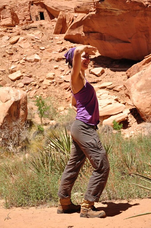
We rested in the shade for awhile since we had plenty of time. Deb did her best explorer imitation.
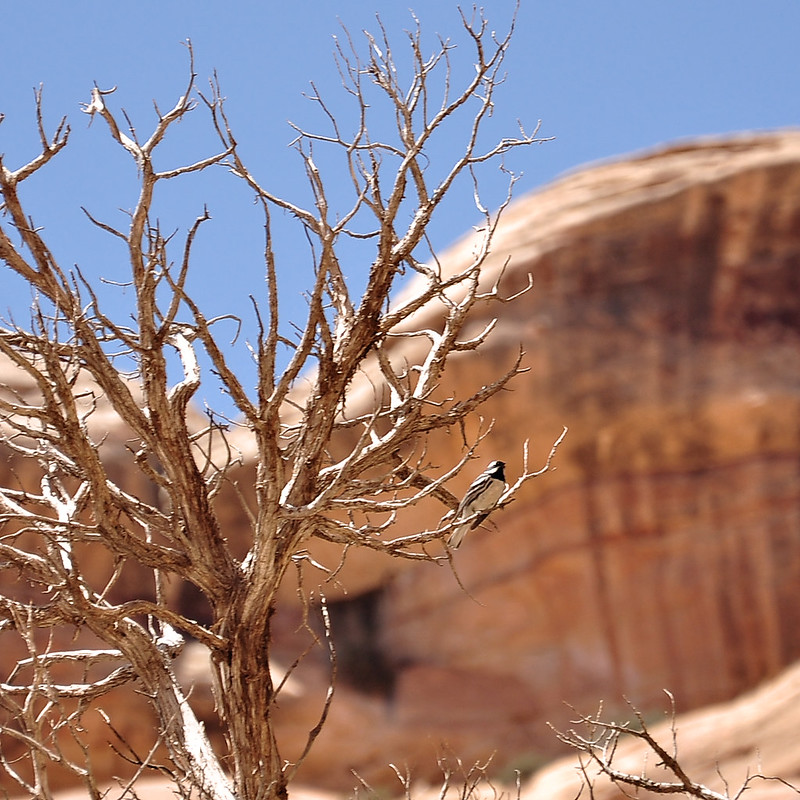
This is one of the many birds we heard. There were an astonishing number of them singing throughout the gulch.
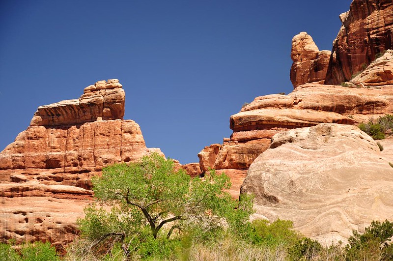
The colors here were so vivid. Red rock, blue sky, and green trees. Beautiful!
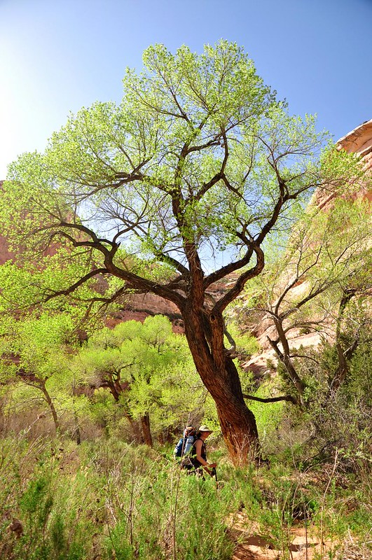
I loved the look of this cottonwood. (My wide angle lens would have been better for this, but even though I lugged it along for the whole backpacking trip I never dared to use because of all the blowing sand.)
Back at our campsite in Todie Canyon it was too early for dinner so we hung out and relaxed (or tried to, anyway; the wind was STILL blowing).
I forgot to bring my deck of tiny playing cards, so after dinner we played 20 Questions, which somehow ended in a fit of giggles. (That's the most fun I've ever had playing that game!) By the time we turned in for the night the wind had finally FINALLY died down and we were able to sleep soundly through the night.
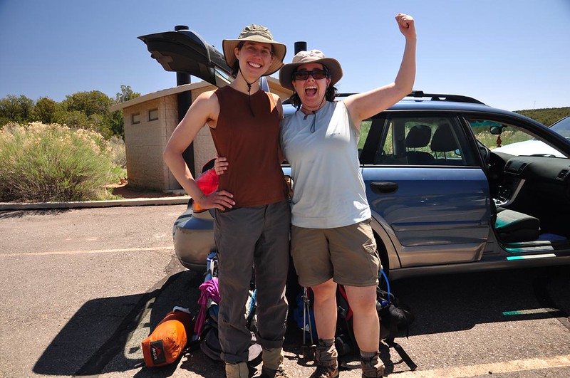
Nothing eventful on the hike out to the car. We were motivated by good food and drink waiting for us at the end of the day. Here is our post-backpacking photo. Yay, we did it!
Our total mileage for the hike was 20.5 miles over the course of three days. Many people do this trek as a 23-mile "loop" instead of an out-and-back. But if you do that the end of the hike has you exiting at the Bullet Canyon trailhead, which is 7.2 miles from the Kane Gulch Ranger Station. We weren't comfortable hitchiking back to our car, which is why we didn't do that.
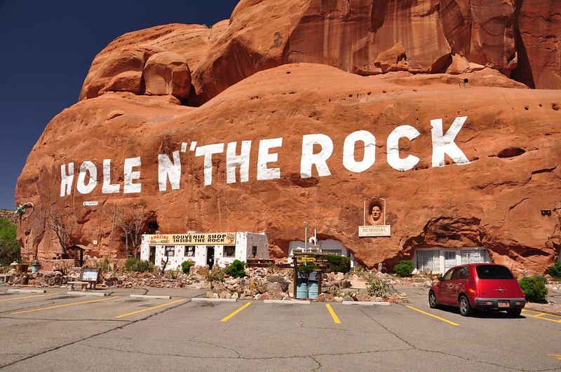
It was a two-hour drive back to Moab and even though we were hot and tired and dirty we had to stop at the Hole In The Rock. There's a 5,000-square-foot "home" carved out of the rock here. A guy and his wife lived here before it became a tourist attraction.
We set up our tent at Up The Creek Campground (a walk-in campground with showers in the middle of Moab).

Then we headed to the Moab Brewery for some nosh and cold beers. Excellent!
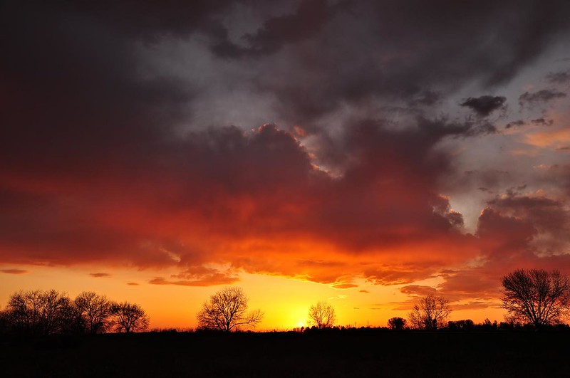
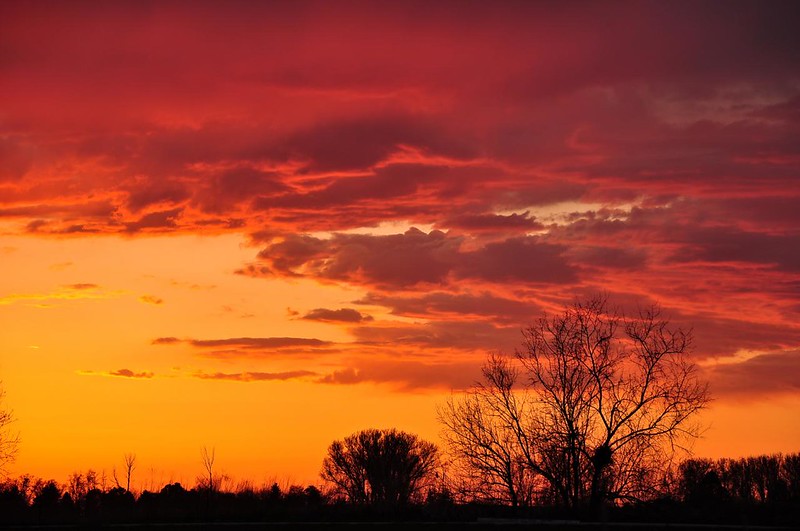
The next day we drove as far as Twin Falls, Idaho where we stayed at the KOA. From our campsite we had an excellent view of the amazing sunset. What a nice treat for the last night of our trip!
Utah is pretty amazing. I'm so glad I had the opportunity to see a little bit of it on this trip!