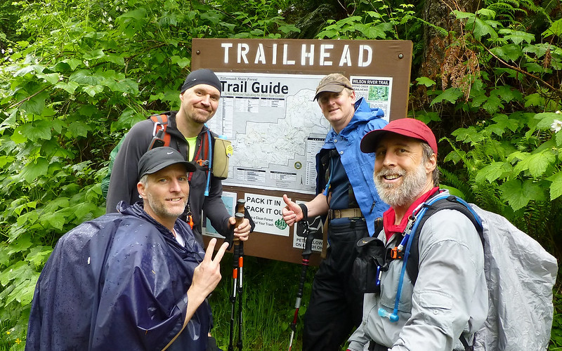
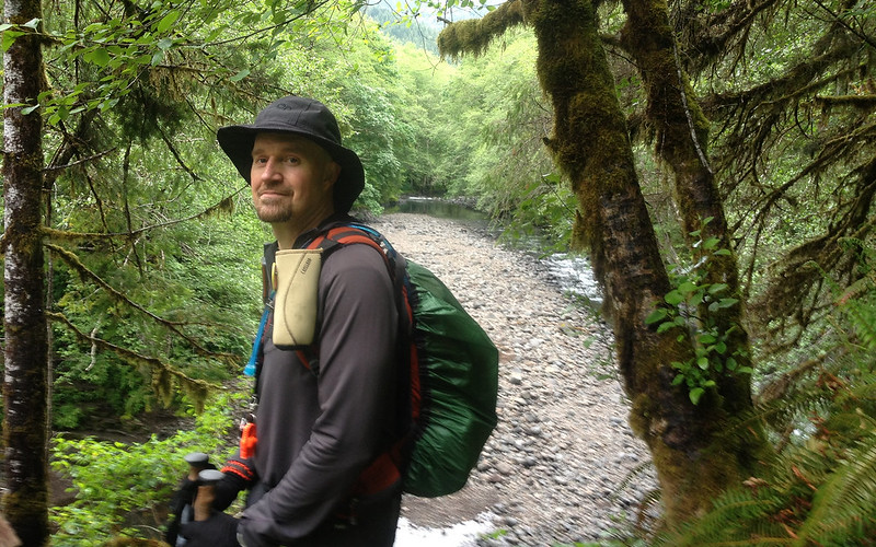
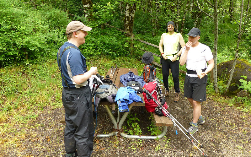
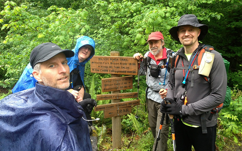
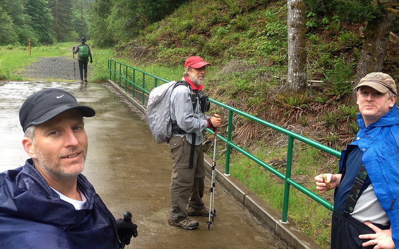
Four of us had agreed to meet around 7am here, Born2BBrad and I heading straight here, while mayhem and Crusak dropped the latter's truck off at Keenig Creek Trailhead 11 miles farther down the highway. Our trail would be more than 2x that long, before we'd see our rescue shuttle again. We took the group shot at the Elk Creek trailhead about 7:10am. Ten and a half hours later, at 5:35pm, we took the survivor's shot at Keenig Creek!
The thrill of victory; The agony of de feet! Any of these guys look like they just hiked 24 miles in the rain?
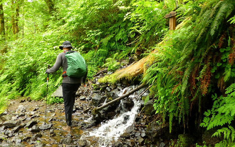
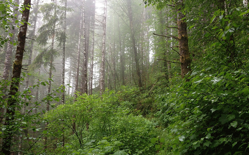
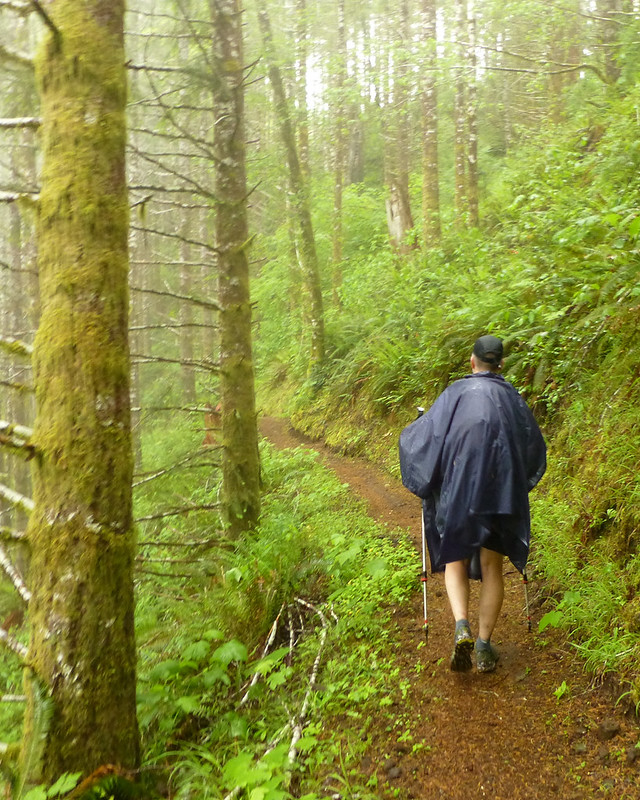
The hike was entirely through the drippingly lush Tillamook State Forest. About as green as green gets! While there were numerous opportunities to pause and enjoy our surroundings, I think everyone will remember much of it this way...
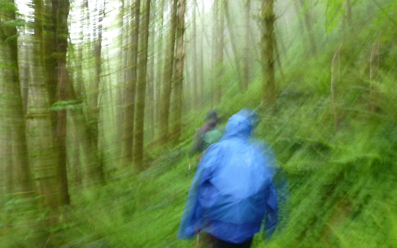
A bit of a blur.
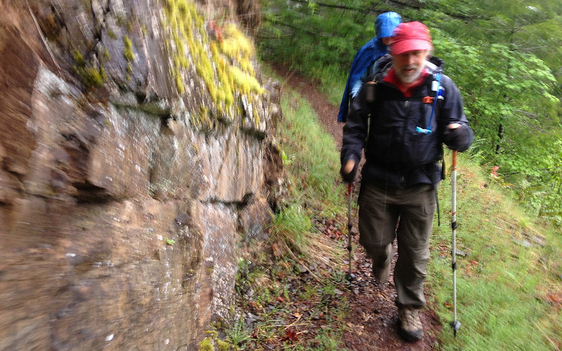
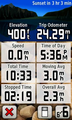
Zooming along for a 3.0mph average pace!
Our first scheduled detour, of many, for the day was to circle the mini-Stonehenge monument.
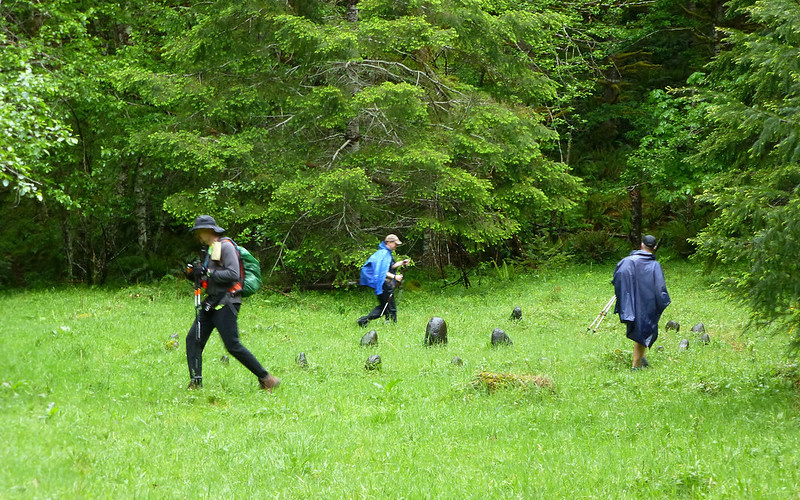
Around and round we go, where we stop, ...? A trail was beaten down around the outer circle.
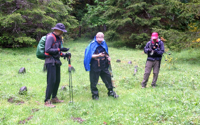
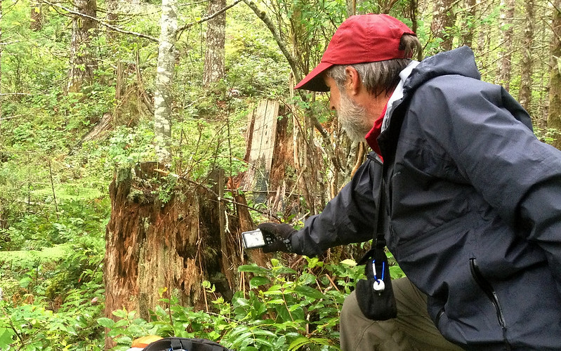
Three PHers studying their GPSes. (Mars, your cue!)
Enough with that, off we went towards the coast!
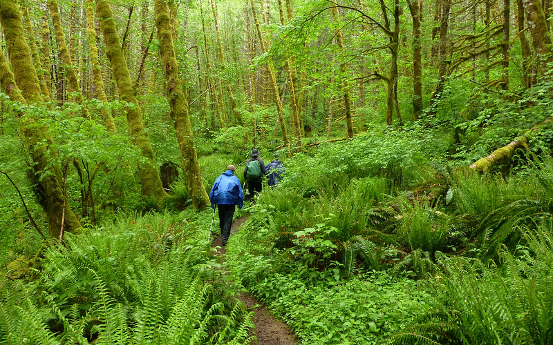
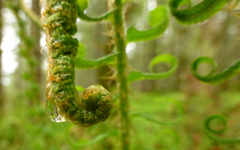
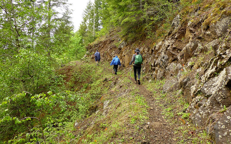
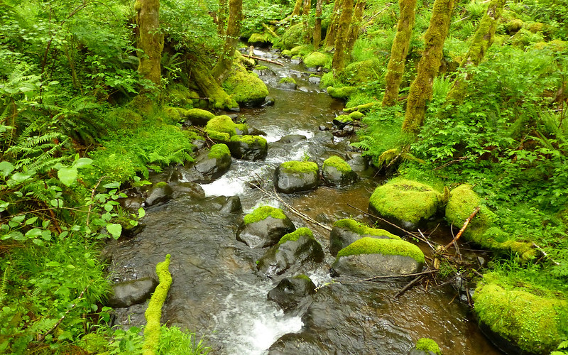
Dark and green, moss covering everything, ferns reaching for the sky.
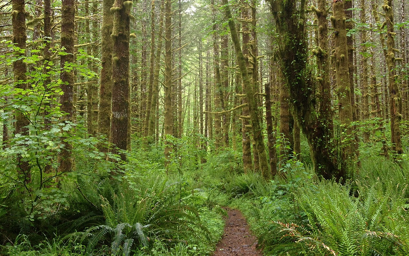
The forest is just incredibly beautiful. I now understand what draws people back here again and again.
Taking a photo for EP! That's all the explanation anyone gets for this one.
Drippiness on display.

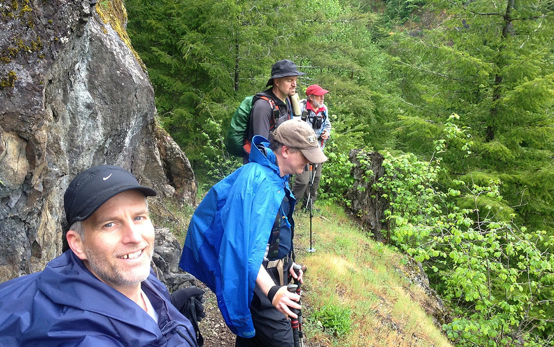
Coronary Ridge group shot! Why not? (Gotta come back and take this route someday!)
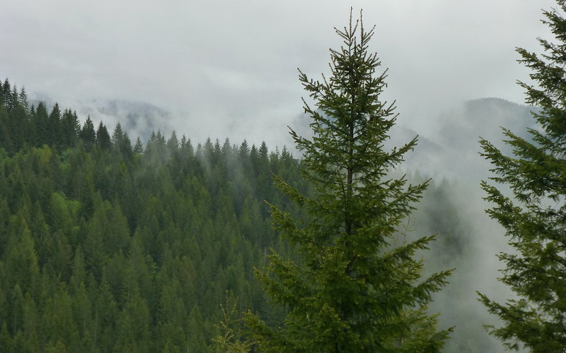
Occasionally, we'd hit an overlook, and see that there were low-flying clouds in nearly all directions. We never did see the peak of Kings Mountain, much less the ocean, despite many what you might think some would call opportunities.
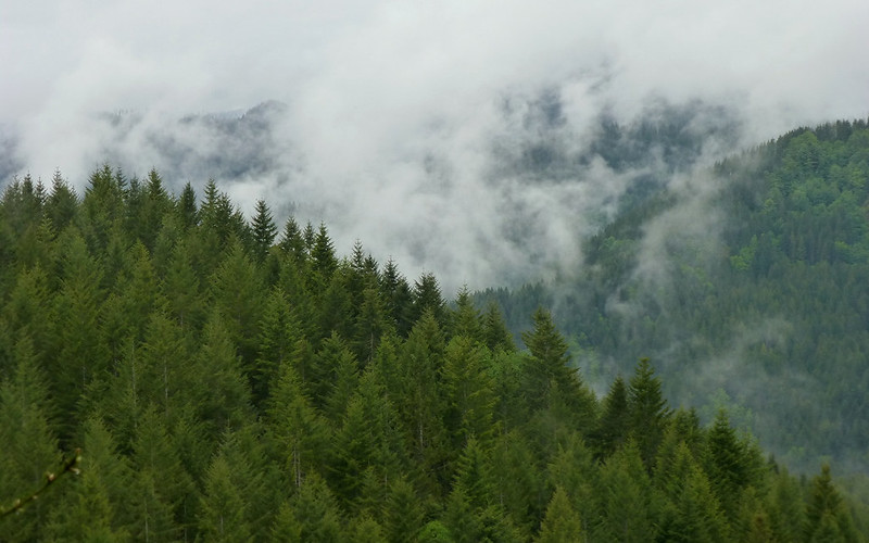
Low-flying clouds
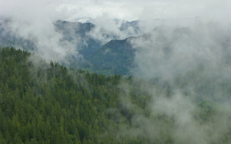
More clouds!
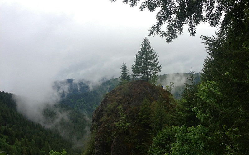
Then, we came to a little pinnacle of some sort. Mayhem and Crus were quick to point out that it was climbable. No problem, guys! Why don't you go do it, and we'll take photos! So, Brad and I being the WRT newbs, thought "WTH?", never considering it might be some sort of initiation.
Can you see Brad?

My turn!
Heh, it only looks something like Indian Point from that angle, of course. From the backside, it's a bit of a different story. (Not to post a spoiler, or anything. Just insurance in case my wife ever reads this!
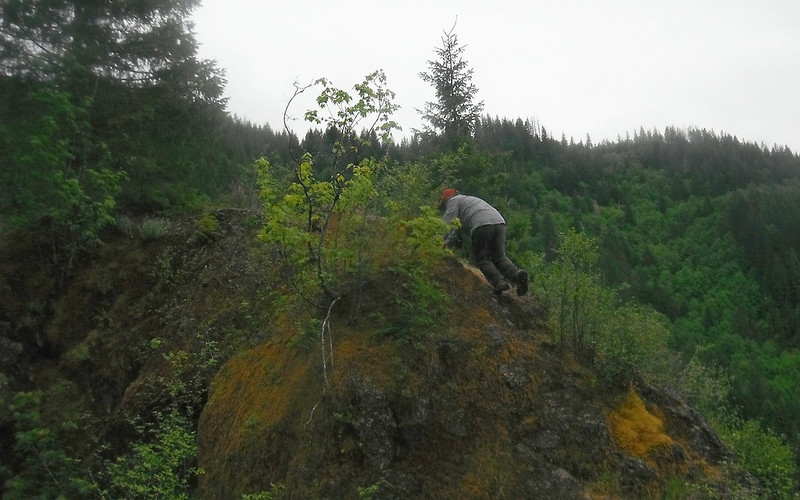
This is the worst part. True, if you fell, it wouldn't be cool. But just because it was slippery, ..., "What, me worry?"
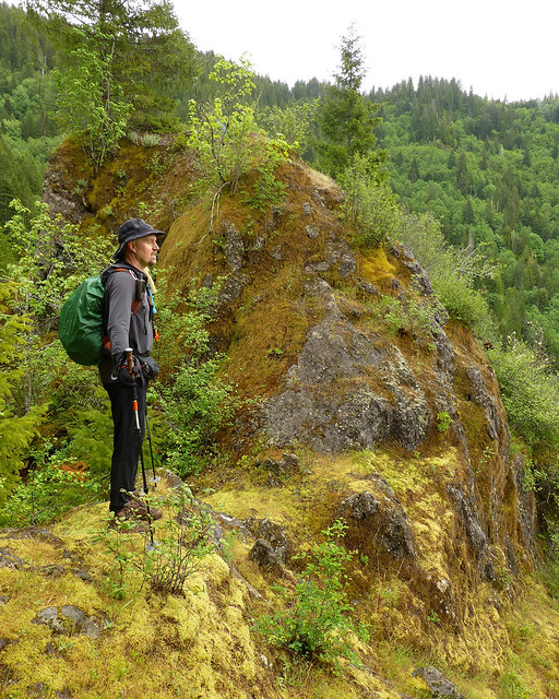
Jim just enjoying the views while Brad and I play on the rock.
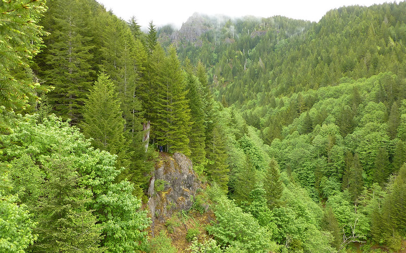
The "view" of Kings Mountain from atop the pinnacle. Can you see mayhem?
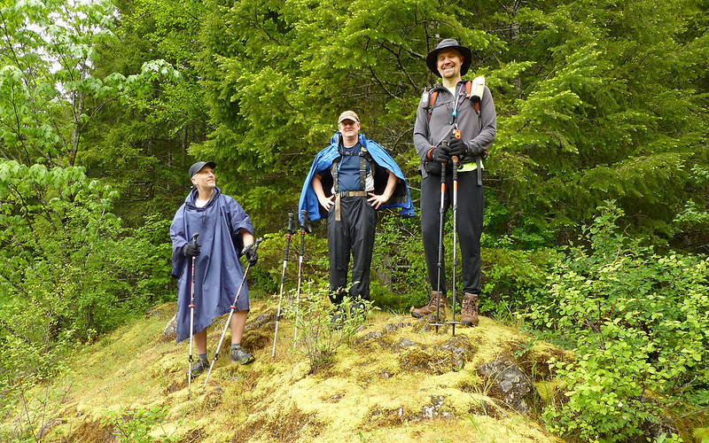
The "view" of three pretty happy guys near pinnacle.
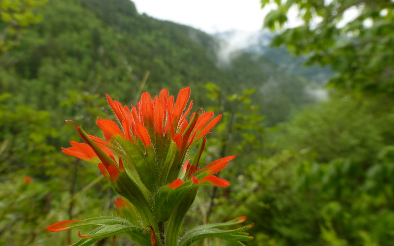
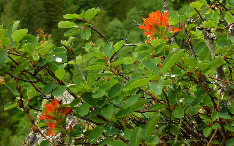
The paintbrush is coming on...
More low-flying clouds in background.
Just a drippy bush.
About this time, the heavy drizzle almost turned to mist, and it started to feel like things might dry out a bit. (Boy were we fooled!)
Trail along an overlook...
... at which we had to stop, to get an expansive view of...
... low-flying clouds!
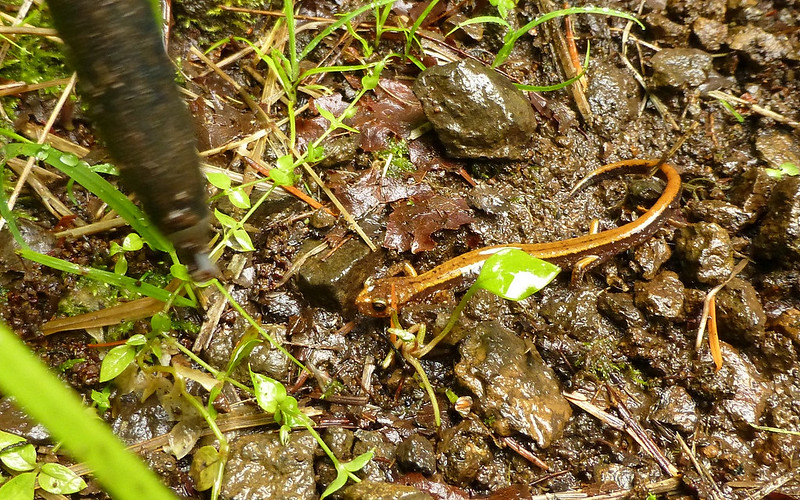
These little guys were numerous along the trail!
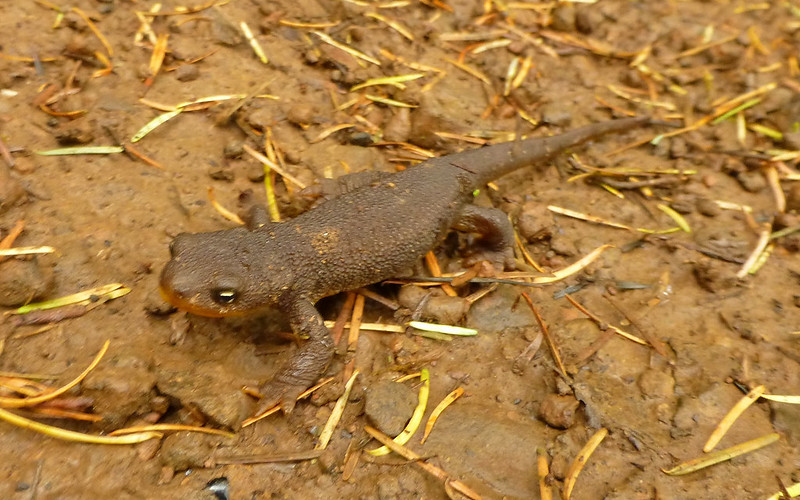
More newts than we bothered to count.
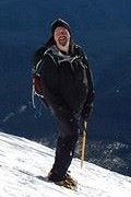
I gotta ask, have you ever seen a guy looking more at peace with the world? Love this shot!
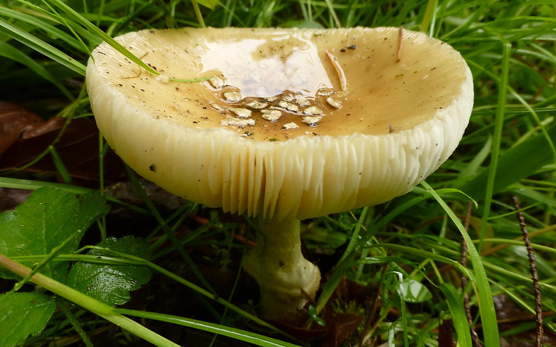
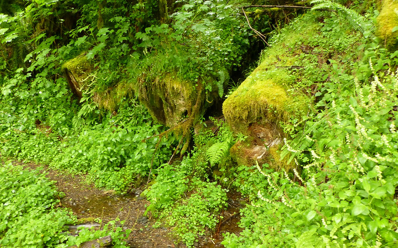
Fungus loves a rainforest!
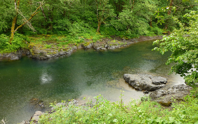
Then we came to the Diamond Mill bridge over the North Fork Wilson River. What an idyllic spot! Well, other than the guys playing with their little motor bikes, at any rate. But I digress. Sounds aside, the setting was blissful. The water sublime!
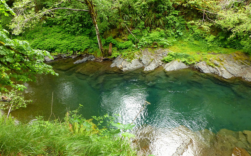
Incredible aquamarine clear water.
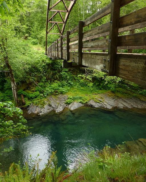
Diamond Mill bridge over the North Fork Wilson River.
Driest 15 minutes all day long! We all celebrated with a sandwich, I think.
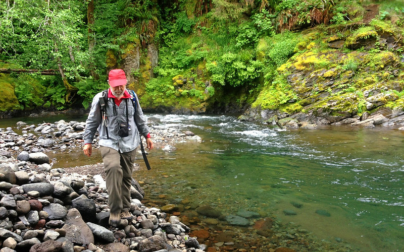
Then it was climbing down the banks, to play along the shoreline a bit.
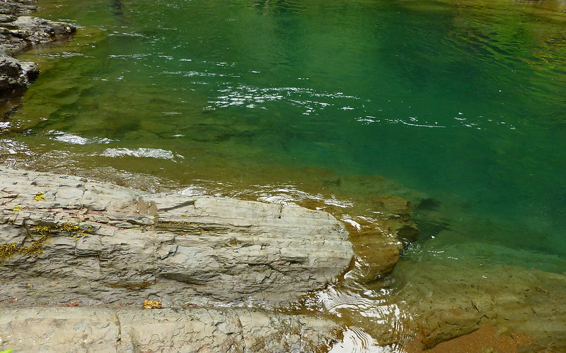
The rocks along the shore competed pretty fiercely with the colorful water for the photographer's attention!
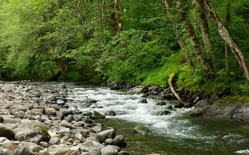
Just upstream, a beautiful cascade flowed to meet us.
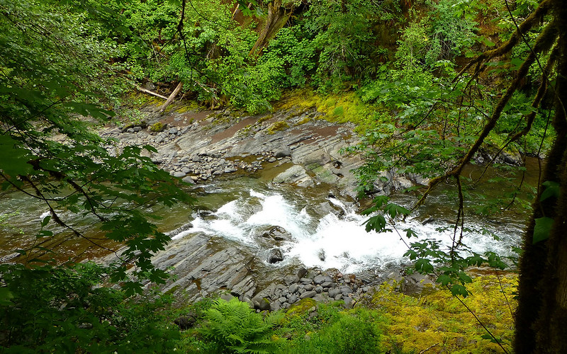
Just downstream, another set of rapids crashed over the stratified rocks.
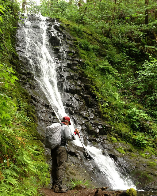
As we walked on, we were met with a view of a most pleasant little waterfall flowing into the North Fork.
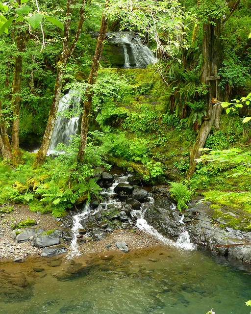
Lovely waterfall, with an ugly Private Property sign nailed to the tree beside it.
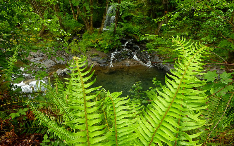
Couldn't resist trying to be a little artsy-fartsy with this one.
There were some purple flowers out, along the trail, at this point...
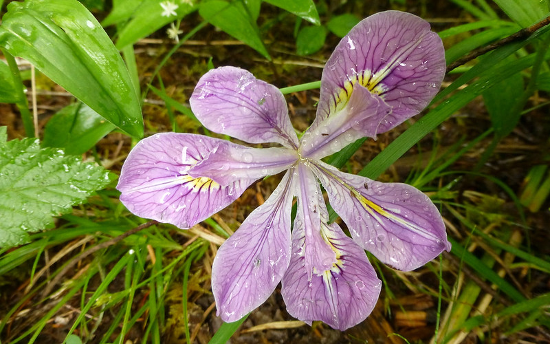
Wild iris
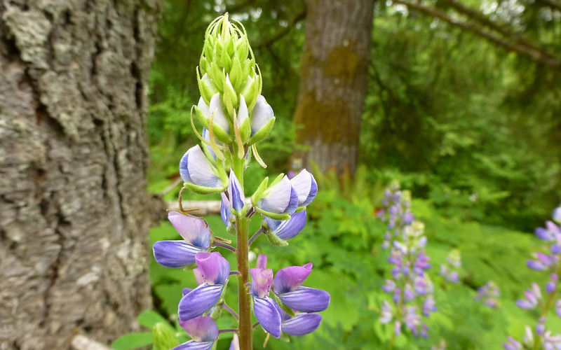
Lupine
We kept heading west. Eventually, we hit the Jones Creek campground. Shazbot! This is *precisely* where I had been 33 years, to the day, ago. How weird is that? Had to take a picture.

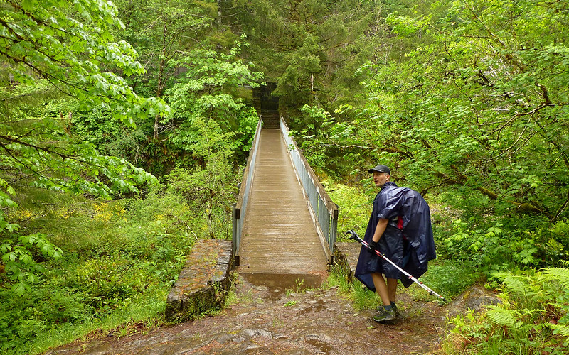
Well, this bridge is new, that's for sure. I wonder if the drunk kids still jump from it?

Looking upstream. See all the pretty raindrops on the river?
Looking downstream. The rain was really coming down now!
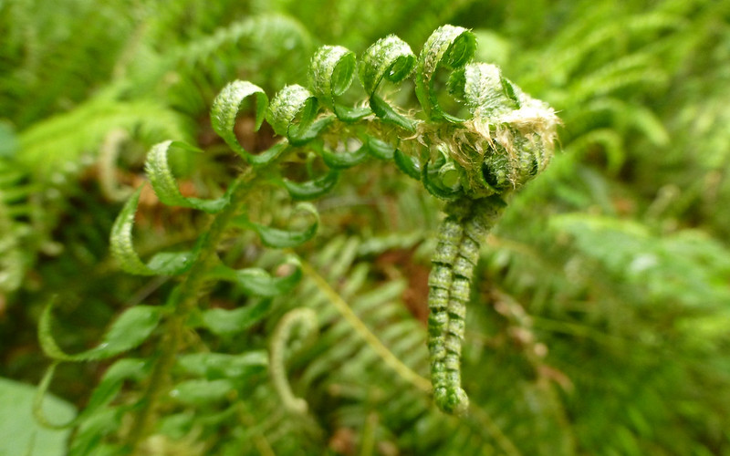
It was as if the ferns were rejoicing, though.
Not sure where this is, but it's almost the half-way point! Woot!
Sign says 10.9 miles to Elk Creek Campground and 9.6 miles to Keenig Creek Trailhead.
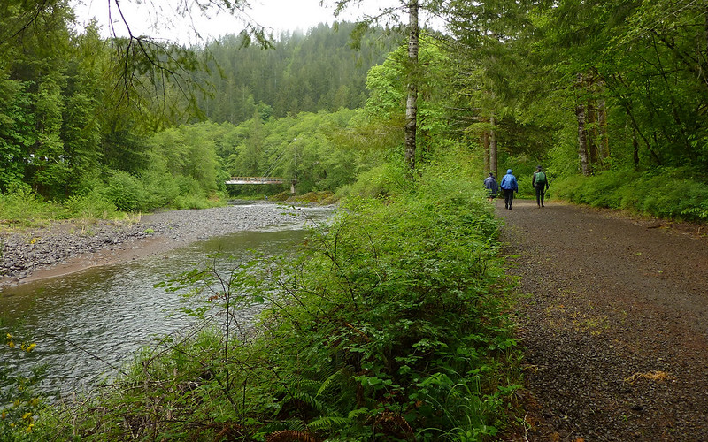
The trails got downright civilized as we approached the Tillamook Forest Center.
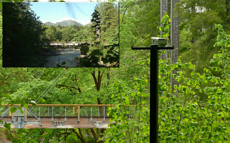
This webcam would normally show Kings Mountain to web surfers . (Simulated here, for your viewing pleasure.)
No idea #2690.
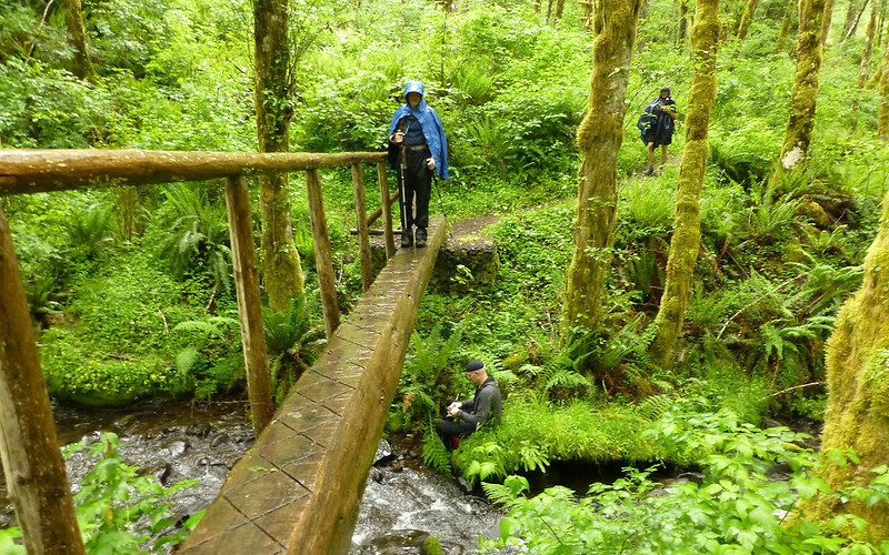
Some time later, we encountered another bridge to nowhere in particular.
Seems like as good a place as any for another sandwich!
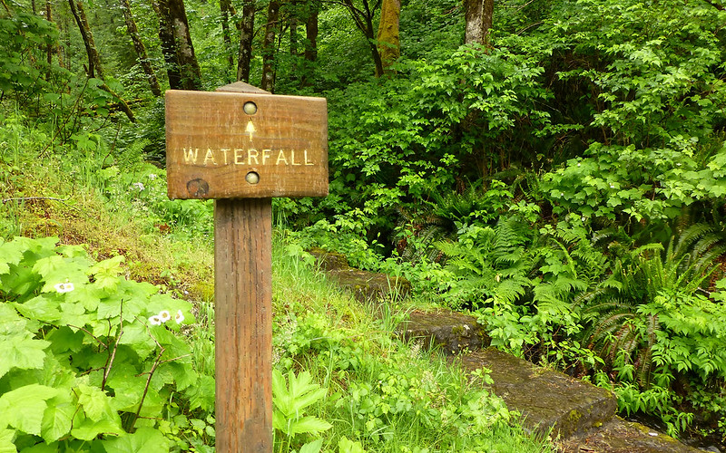
For many miles, we'd seen signs pointing us to the Wilson Falls. Anticipation was building big-time, lemme tell ya!
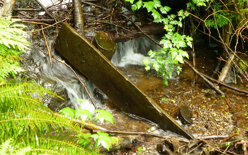
W.T.F...? This is it??? You have *got* to be kidding?
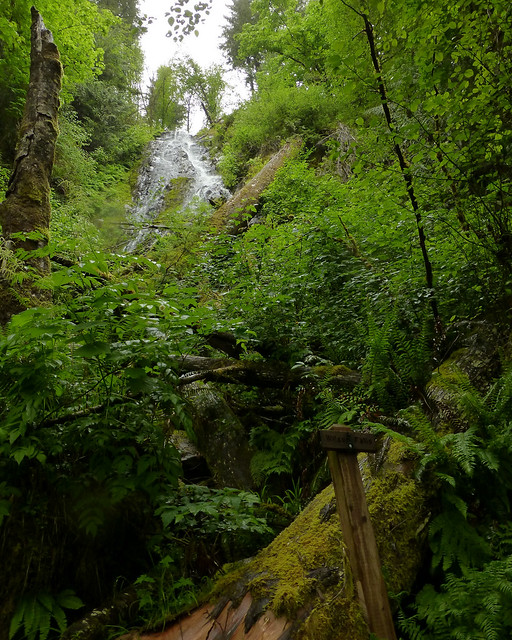
Oh! Okay. That's better, I guess.
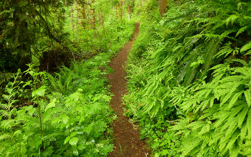
And then we were back into the woods for miles and miles and miles...
Didn't see a single soul out here, except within a mile or so in either direction of the Forest Center.

Definitely the trail less traveled!
Mayhem found another bridge! This one was to Bridge Creek, of all places. And, apparently, a waterfall. Time for another diversionary sidetrip...
Our fearless tourguide alerts the crowd, "Let's go check this out!"
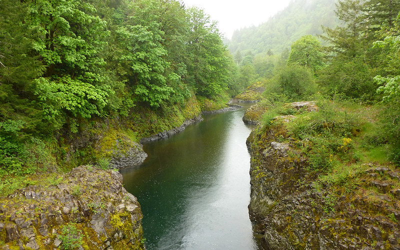
The Wilson flows through a pretty narrow gorge right at this point. Very pretty indeed.
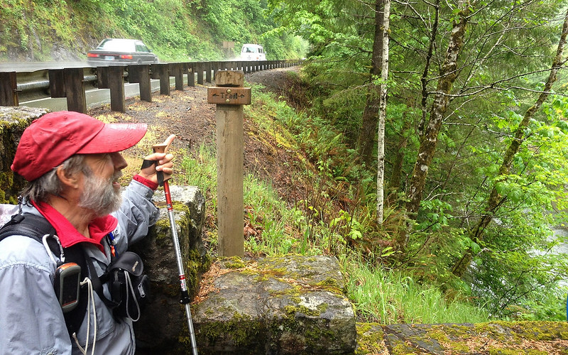
Helpful signs abound. We were very grateful.
Something cool no doubt lies ahead.

Oooooooohhh...
A guy walks 15 miles to see a waterfall, and *this* is where he's supposed to sit?
Worth it.
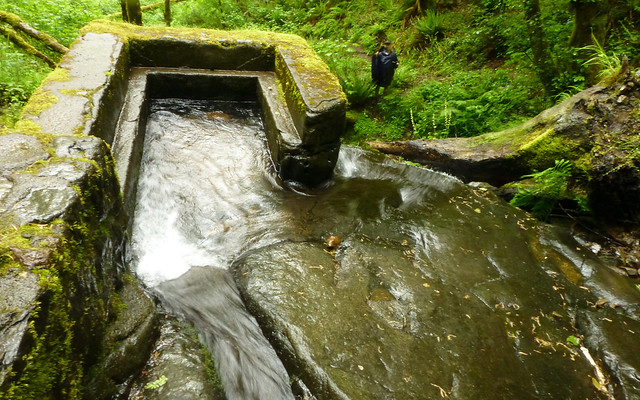
There was this odd cement thing, though. We couldn't figure out WTH it was?
Despite all the concentrated thought that went into it!
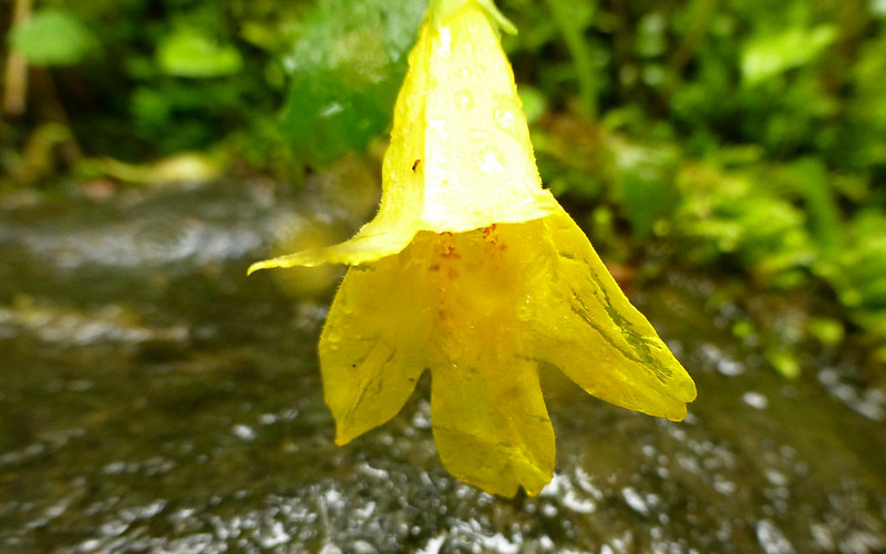
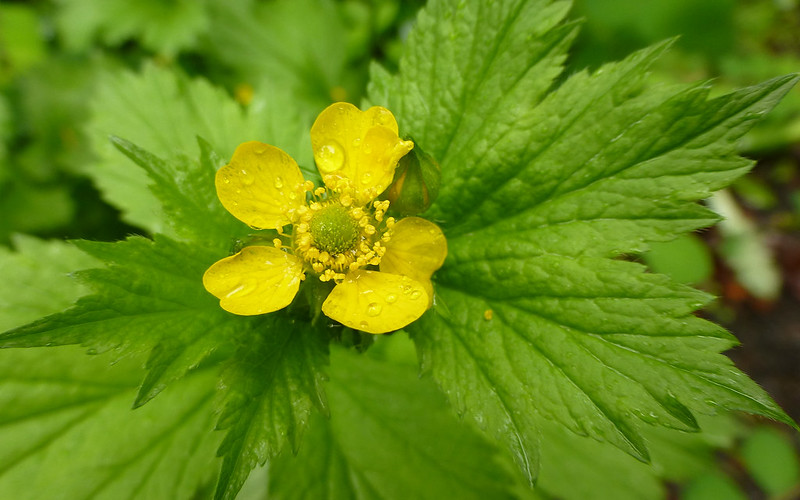
Gratuitous yellow flower shot. (No idea #2730.)
Back across the river, the tour continued westward.
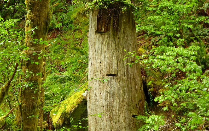
Found a 15-20' tall "stump" that had three (visible) springboard notches cut into it!
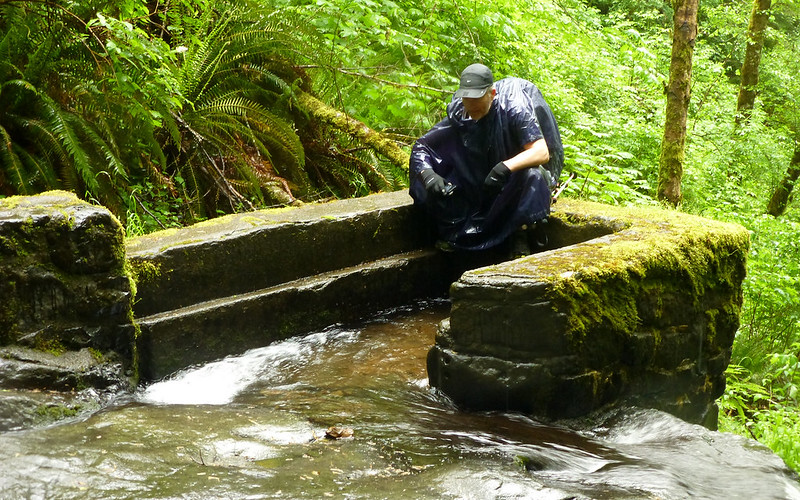
Wolk Creek offered us our last break before the final climb. Jim took the chance to try out his nifty new water filter, and refilled his tank, while the rest of just snacked and watched the show.
Wolf Creek
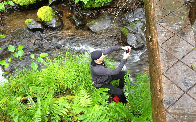
Crusak playing with new toy! (A very cool one, at that!)
Time to get a move-on again. I think we're down to 4-5 miles to go, or so. But a bit of a climb ahead.
At this point, the number of photos really dropped off. It was raining pretty good, and our feet were all pretty prunish. Blah. Still soaked in the beauty around us, just, well, didn't record quite as much of it.
We climbed, once again, right back into the low-flying clouds.
Very cool bend in the trail where three ancient giants had been cut away for us to pass.
The littlest salamander! The tip of a hiking pole included, for reference.
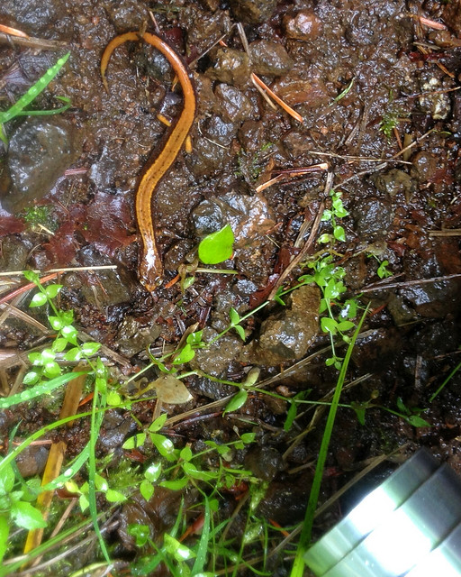
We couldn't even see his legs, with our eyes, at first. That's my camera lens poking in!
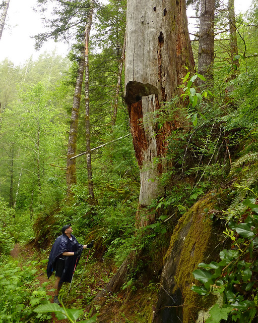
One incredibly humongous stump!!!
Approaching the last summit of the day, back in the clouds again.
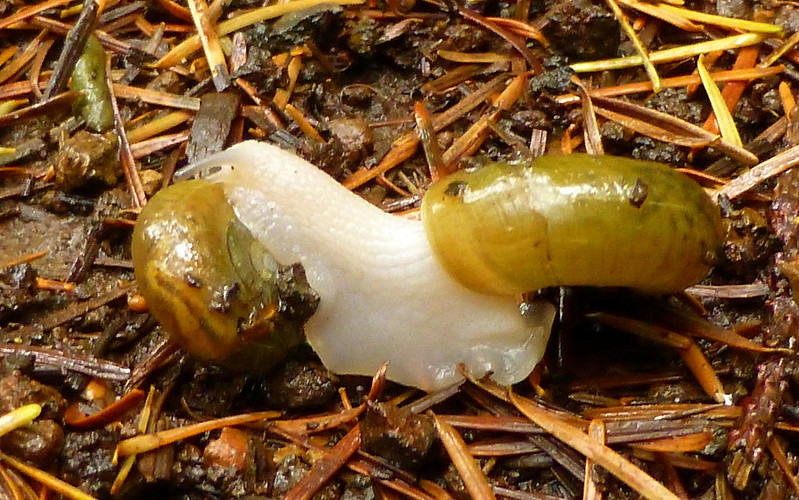
Then, as if we hadn't been entertained enough, we encountered a pair of snails putting on a show just for us! I am not making this up, folks...
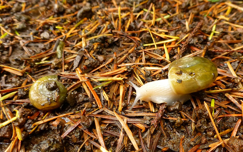
The guy on the right is obviously the more interested party in this situation.
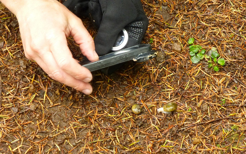
Mayhem moves in for some close-up work! The stage is set.
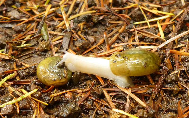
This being a family forum, we should probably let the photos speak for themselves.
...
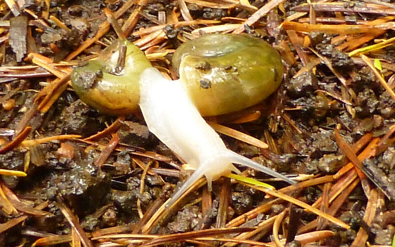
Whew! Smokin'...!
And from there, well, what more could any group of TFFs want or hope for? What a great day in the woods!
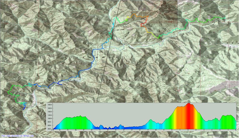
Where we were. Right-click, "View Image", for full-sized map.
http://gpsfly.org/gps_map.php?gps_id=2405&w=645&h=440
Gpsfly says 22.9 miles, 3735' EG, and 4200' EL.
YMMV
Great day, guys! To quote a prophet, "Bamm!"