Eagle Creek, 20-April-2013

This forum is used to share your experiences out on the trails.
User avatar
kepPNW
Posts: 6411
Joined: June 21st, 2012, 9:55 am
Location: Salmon Creek

Eagle Creek, 20-April-2013

Post by kepPNW » April 23rd, 2013, 11:43 pm

Tim was heading out with Cole, a co-worker, on Saturday to go exploring on Eagle Creek. They were gracious enough to let me tag along. Seemed like the kind of day we wouldn't run into too many others out there, and that turned out to be exactly the case. I think there were 10 cars when I got there at 8:00am, and fewer when we returned to the TH that afternoon. Probably didn't see even one other group per hour out there. Not bad for that trail! It drizzled until around noon-ish, which also probably held down the tourist count. The wetness was pervasive, so I brought my old camera rather than the new one.

Probably everyone here has been up Eagle Creek, so it's tempting to simply report, "It's still there!", and be done. :)

There were a couple things of note, however, that folks may be interested in. Most prominently, the streamflow is simply prodigious. Pretty clear the snow melt is on! Sevenmile Falls is kicking up mist as if it were Multnomah! The base of Twister Falls is visible from the Vertigo Mile! Sorenson Falls is visible beside Metlako! There were falls I'd never seen coming off the Tanner side of Eagle Creek. Worth checking out, if you'd like to see EC nearing its peak flow.

Check out the spray shooting out of the base of Twister in this video walking the Vertigo Mile...


EDIT: This wasn't in the original post. Hadn't put a warp on it yet.


Image
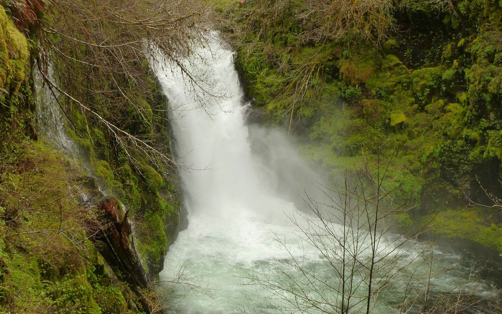
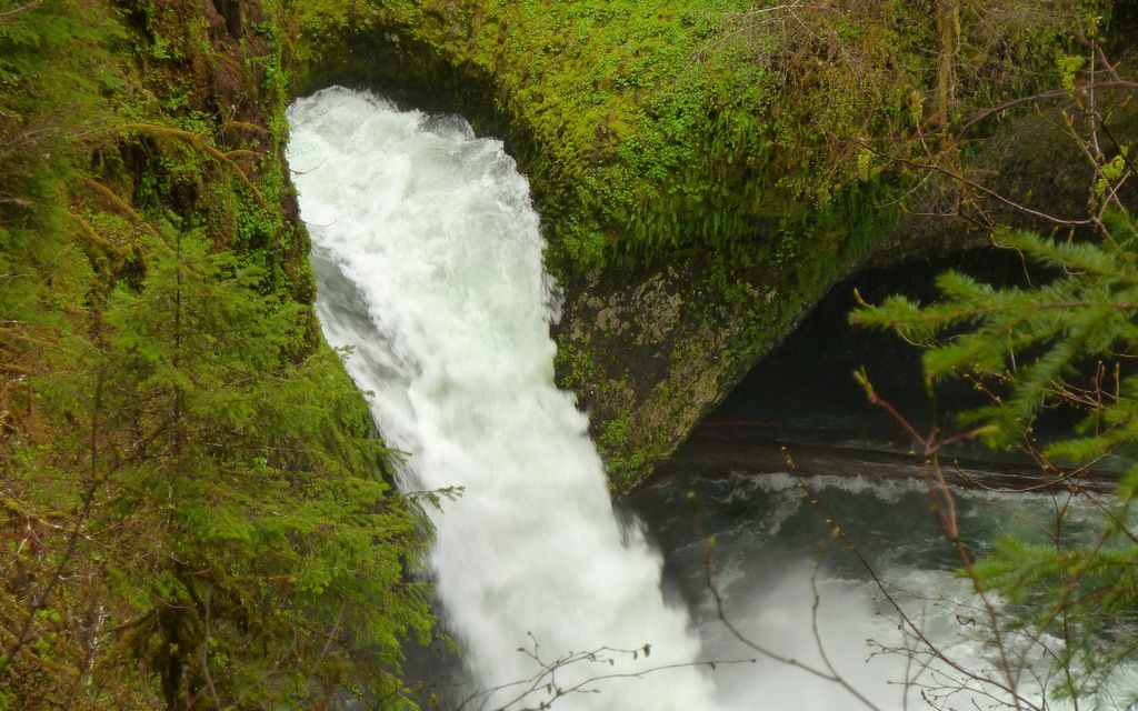
Looking down into Twister Falls.


Image
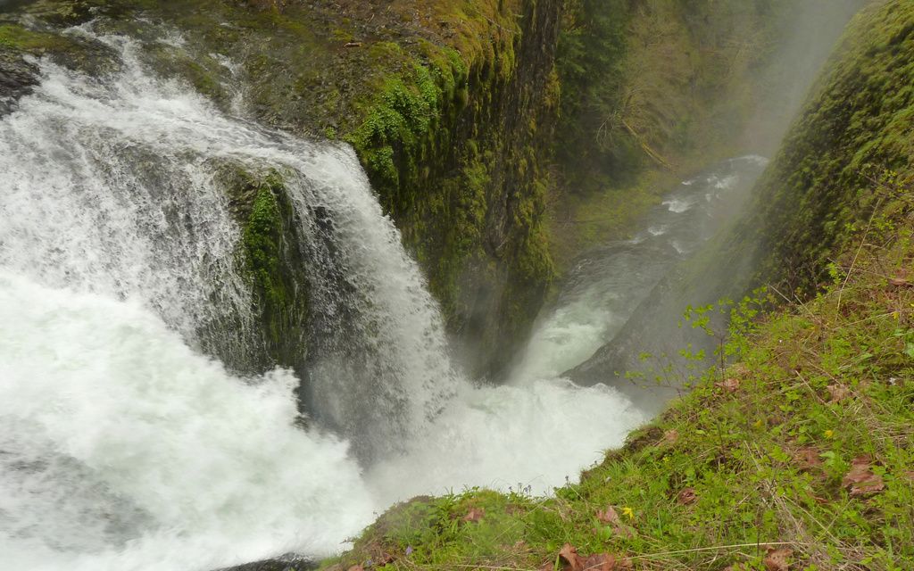
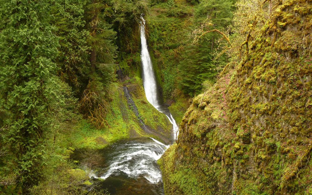
Sevenmile Falls kicking up a mist.


Image
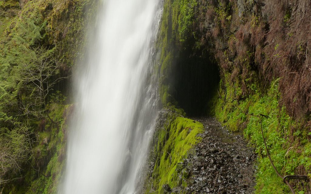
Tunnel Falls (had to include that, right?).


Image
Punchbowl Falls


Image
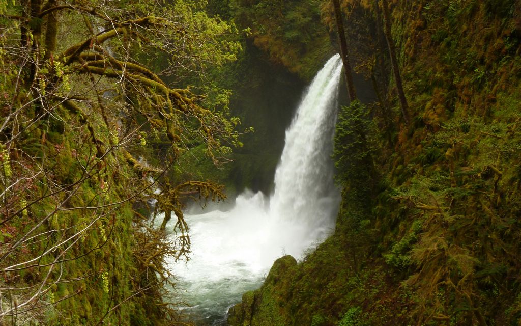
Metlako Falls on right. Sorenson Falls, barely visible, on left.


Image
Loowit Falls


Image
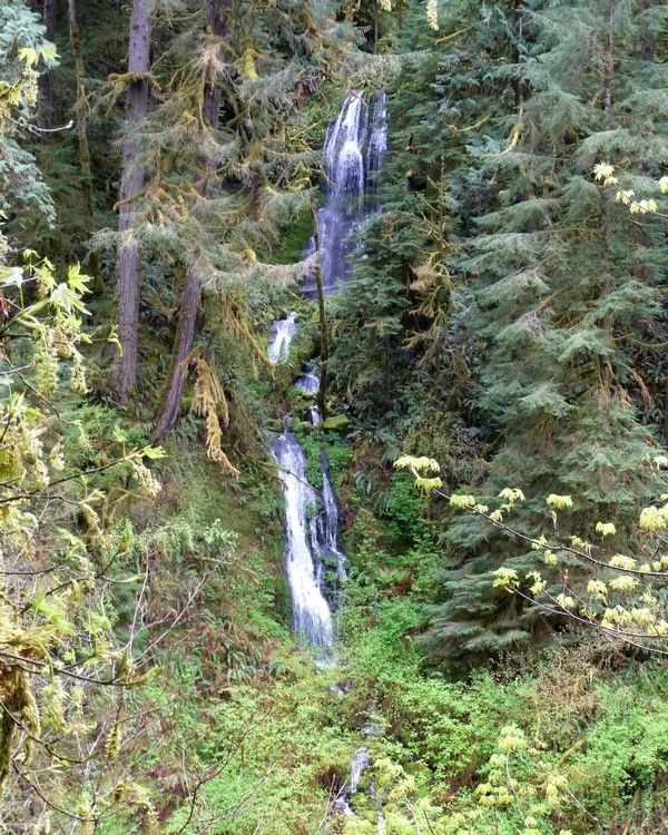
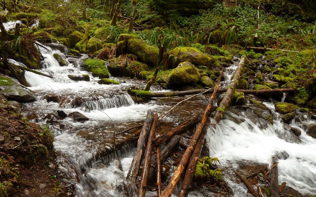
Previously unknown (to me) falls near trailhead. One of many "new" ones.


We decided to see how far we could go up the main Eagle Creek trail, sort of hoping we'd at least make it to the crossing that leads to the Tanner Butte trail. But we came to a creek well past the Wahtum Lake junction that just didn't look like much fun. The safest way across was clearly to just wade on through. Being as far as we were from the trailhead, there seemed like drier options we could pursue to fill the rest of the day.

Image
Choices were to get really wet or to get hurt, it seemed. Neither appealed, so we turned around here.


Image
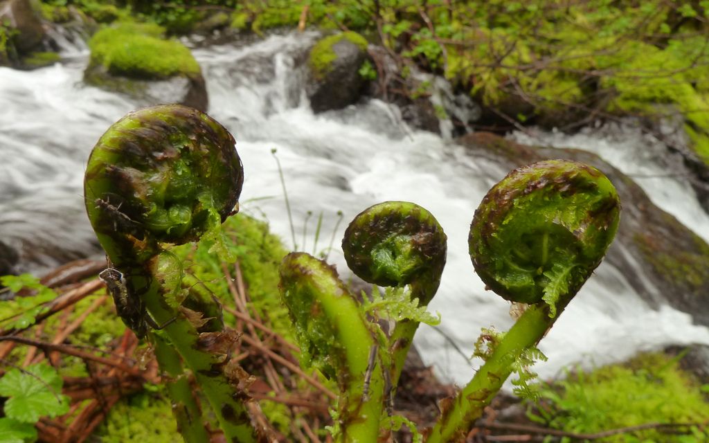
I did spot this cool little growth of ferns about to unfurl, though.


Decided we'd wander up the trail to Whatum Lake for a while, to see what we might see. My knee was starting to "feel it" at this point, so the other guys kept saying we ought to turn around for my sake. That, and neither wanted to be responsible for me standing up Crusak if I shot the wad here on EC. :lol: (Jim and I had plans to go explore Coyote Wall the next day!)


Image
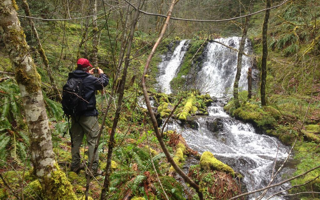
Pretty good sized waterfall on Whatum Lake trail!


Image
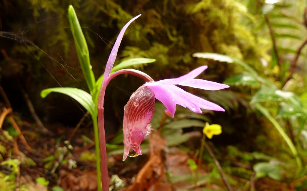
Saw lots of these (fairy slippers?) on the Whatum Lake trail.


The trail wasn't overabundant in flowers, but there were a few others along the way.

Image
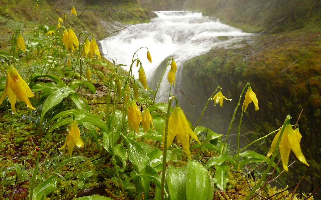
I really liked these yellow things by Twister Falls.


Image
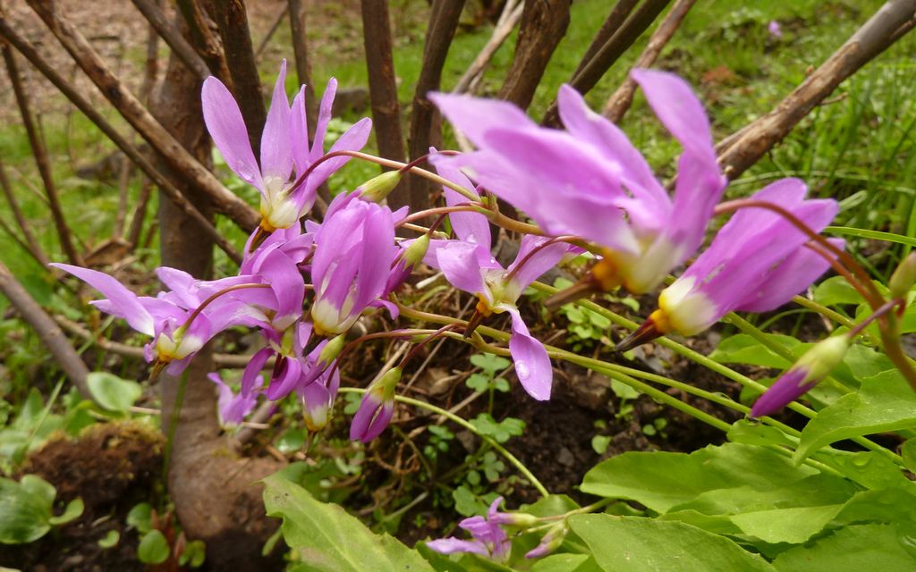
The shooting stars were out here and there.


Image
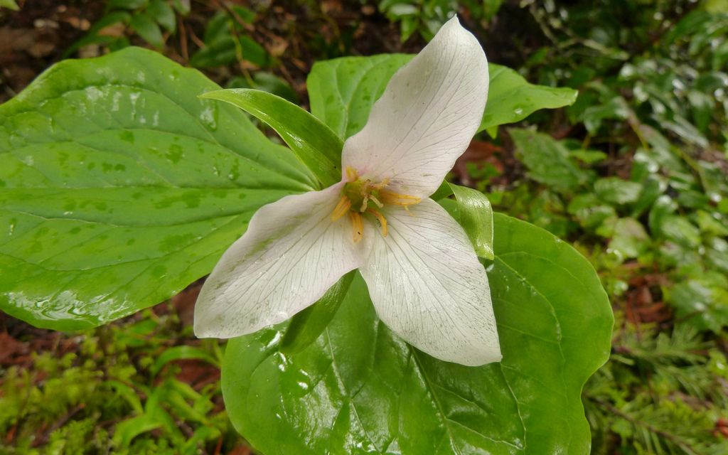
Lots of trillium. Mostly the purple kind, but a good number of these white jobs too.


Changes along the trail...

Image
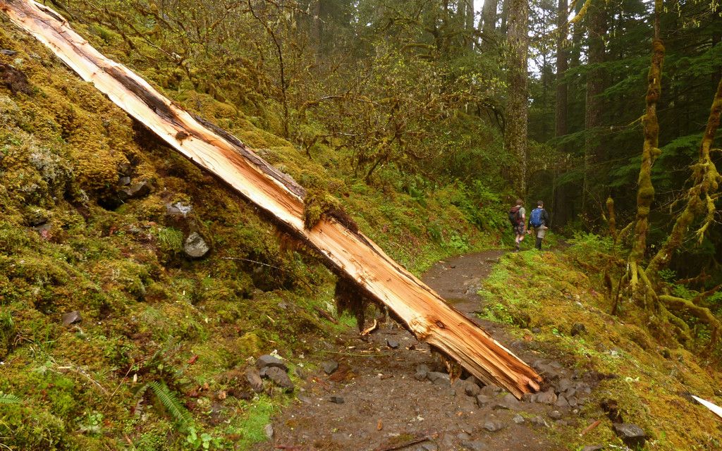
Saw a number of fresh falls. This one was on the TH side of Loowit Falls.


Image
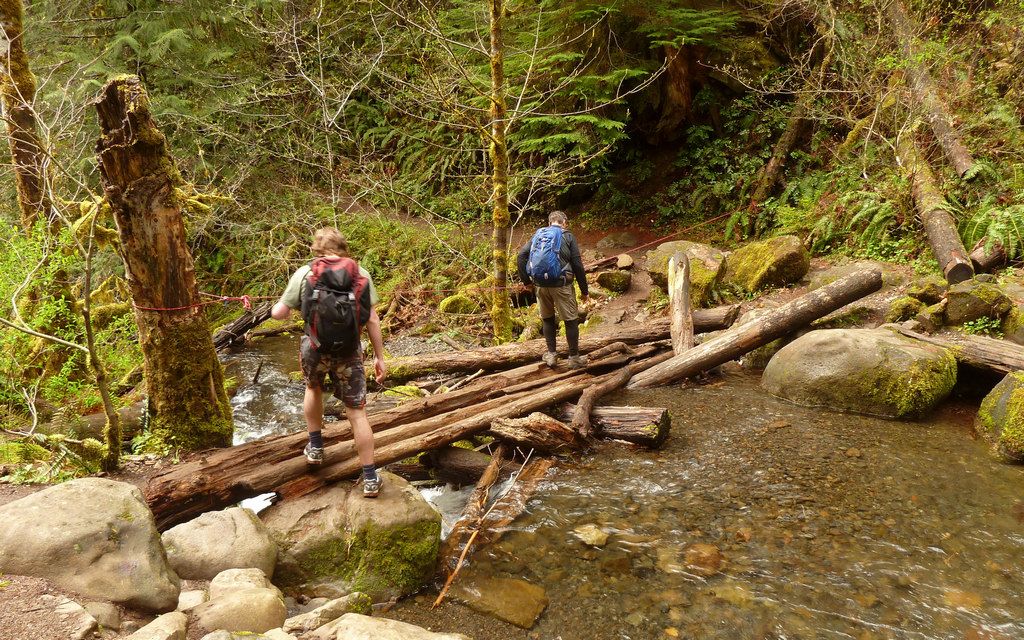
Someone tied up a rope at one of the log crossings.


Image
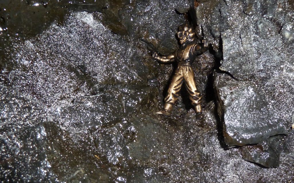
New guardian of the trail?


The best news, perhaps, I saved for last. I believe the invasive English Ivy is gone! I got down and crawled all around the stump where I'd pulled some last December. Couldn't find any trace whatsoever of it anymore. Worth looking again at the end of this growing season, but I took this to be a very good sign. (Clearly, too, someone else besides me had gotten more of it out, since the snow has been gone!)

In the end, I made it down just fine. Used a knee brace for the last 9-10 miles, and I think that helped. We ended up with right around 22 miles and maybe 2000' EG? Could've been more (GPS said 2700', but they're notoriously wrong in that valley).

http://gpsfly.org/gps_map.php?gps_id=2329&w=645&h=440"


As much time as I've been spending on the east side, Tim was right, it felt really good to get wet again in the lush, deep green rainforest!

Another great day in the woods!


Image
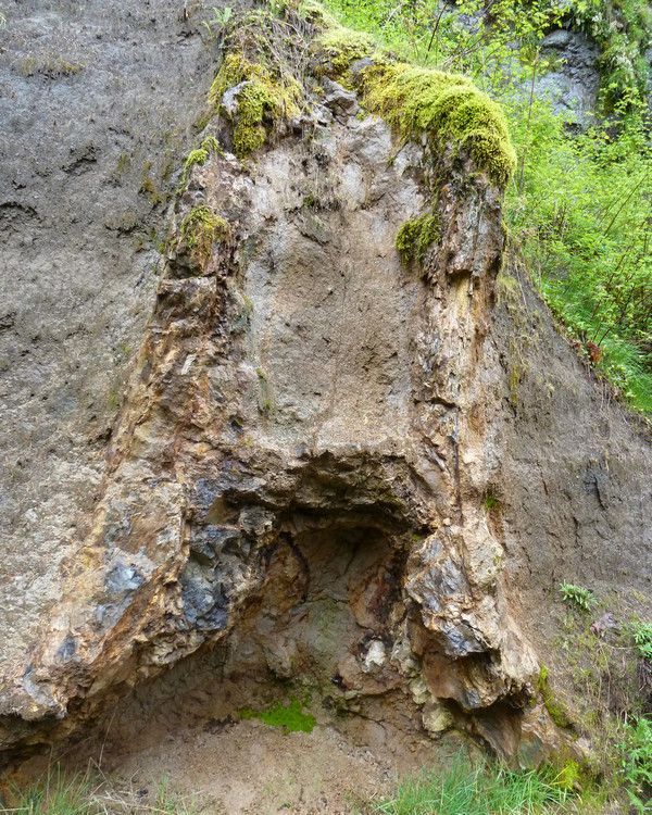
Oh, and I finally saw the petrified stump, too!
Last edited by kepPNW on April 24th, 2013, 2:28 pm, edited 1 time in total.
Karl
Back on the trail, again...

User avatar
chiefWright
Posts: 101
Joined: April 20th, 2011, 5:30 am
Location: Marquam
Contact:

Re: Eagle Creek, 20-April-2013

Post by chiefWright » April 24th, 2013, 5:52 am

Wow! Eagle is positively raging right now.
Isn't that stump way, way cool? And how many times have you passed it without noticing it's there? If it had limbs, it would slap you in the face....

User avatar
MarsIsCobra
Posts: 569
Joined: November 27th, 2012, 7:57 pm
Location: Camas

Re: Eagle Creek, 20-April-2013

Post by MarsIsCobra » April 24th, 2013, 12:12 pm

Thanks Karl - great time, great TR

Heres a little video from the trip.


http://www.youtube.com/watch?v=iVYGIGOnVSQ

User avatar
kepPNW
Posts: 6411
Joined: June 21st, 2012, 9:55 am
Location: Salmon Creek

Re: Eagle Creek, 20-April-2013

Post by kepPNW » April 24th, 2013, 2:36 pm

chiefWright wrote:Wow! Eagle is positively raging right now.
Isn't that stump way, way cool? And how many times have you passed it without noticing it's there? If it had limbs, it would slap you in the face....
Totally raging! I don't recall seeing it flow with this much force.

It was funny. I knew about the stump, but had never seen it. Bam! There it is! Cole was actually the one who spotted it. Another curiosity nailed. :)
MarsIsCobra wrote:Thanks Karl - great time, great TR

Heres a little video from the trip.
Really was a great day out in the woods, wasn't it?! That video captures a lot of it really well. Love it! As it happens, I was just putting the final warp on one I took walking along the Vertigo Mile. So, without further ado, its premier...


Also added it directly into the top-post. Apologies to anyone "reading" it twice.

Thanks for having me along!
Karl
Back on the trail, again...

User avatar
Crusak
Posts: 3617
Joined: August 6th, 2009, 7:33 pm
Location: Oregon

Re: Eagle Creek, 20-April-2013

Post by Crusak » April 24th, 2013, 5:17 pm

That's a lot of water! On my Feburary 16th hike to Twister Falls the water was raging, but not at the level that you guys encountered on Saturday. wow!

Nice TR - I'm glad you decided to post one after all.
Jim's Hikes

Solvitur Ambulando

User avatar
kepPNW
Posts: 6411
Joined: June 21st, 2012, 9:55 am
Location: Salmon Creek

Re: Eagle Creek, 20-April-2013

Post by kepPNW » April 24th, 2013, 5:42 pm

Thanks, Jim! Finding the time's what almost killed the deal. :)

I don't think I've ever seen spray coming out of the base of Twister from the cliffs of Vertigo before. It really was something.
Karl
Back on the trail, again...

User avatar
miah66
Posts: 2039
Joined: July 6th, 2009, 8:00 pm

Re: Eagle Creek, 20-April-2013

Post by miah66 » April 24th, 2013, 8:39 pm

You were there on Sat. too? Lots of raging water, definitely. I laughed when you said you didn't run into many people. They must've all been hiking alongside us. We arrived at around 10 to completely full parking lots at the trailhead, the hatchery and most of the road on one side. Then we hiked practically alongside groups of people for the first 3 miles or so. There was a 20 member Boy Scout troop in front of and behind us. Wy'East camp was completely full. We hiked to Tunnel Falls, then set up camp near Blue Grouse. The next day we hiked out with the crowds as well. You probably got there early enough and went deep enough that you missed most of it. I personally haven't hiked a trail that crowded since my first visit to Multnomah Falls about 8 years ago.
"The top...is not the top" - Mile...Mile & a Half

Instagram @pdxstrider

User avatar
Splintercat
Posts: 8333
Joined: May 28th, 2008, 10:03 pm
Location: Portland
Contact:

Re: Eagle Creek, 20-April-2013

Post by Splintercat » April 24th, 2013, 8:54 pm

Love the Vertical Mile vid, Karl! It just needs a Vince Price narration... "Where careless hikers slip to their terrible, grisly death on the pointy rocks below... hahahahahaHAHAHAHAHA!!!"

:)

User avatar
BrianEdwards
Posts: 2405
Joined: February 2nd, 2010, 1:32 am
Location: Oregon City, OR
Contact:

Re: Eagle Creek, 20-April-2013

Post by BrianEdwards » April 24th, 2013, 9:03 pm

Ya know, that's the first photo and video I've seen looking down into twister falls, that is way cool! Did you use your camera stick to get that glimpse of Sorrenson?
Clackamas River Waterfall Project - 95 Documented, 18 to go.

User avatar
Rustygoat
Posts: 507
Joined: August 27th, 2012, 2:28 pm
Location: SE Portland

Re: Eagle Creek, 20-April-2013

Post by Rustygoat » April 24th, 2013, 9:20 pm

That's neat that you got a glimpse of Sorenson Falls this time out. :) Also cool that you saw the petrified stump. I have never been past Tunnel Falls...so I appreciate your pictures. I'll be changing that later this year, and exploring all of the water falls up there that I can. Nice report Karl. :)
Tim

Chasing waterfalls can be addictive.
NW Off-trail Waterfalls -Facebook Group

Post Reply