MSH Worm Flows Beginner's Snowshoe, 15-Feb-2013

This forum is used to share your experiences out on the trails.
User avatar
kepPNW
Posts: 6411
Joined: June 21st, 2012, 9:55 am
Location: Salmon Creek

MSH Worm Flows Beginner's Snowshoe, 15-Feb-2013

Post by kepPNW » February 16th, 2013, 8:08 pm

Nearly a week ago, the 15th appeared like it was going to be a very fine day. It was supposed to be a work day for me, but given the forecast, and Peder's urging to get above the timberline...

All of us being novice snowshoers, each of us having only bought the things this year (this was my third time out), we thought we'd take a fairly straight-forward trip away from all those pesky trees. Little did we know, it may have been one of the best days ever for what we decided to do! Last weekend, we had the whiteout between sunny days. Finding that non-optimal, we plotted to return at the next opportunity. Wow! What a day. One I know I'll never forget. :D

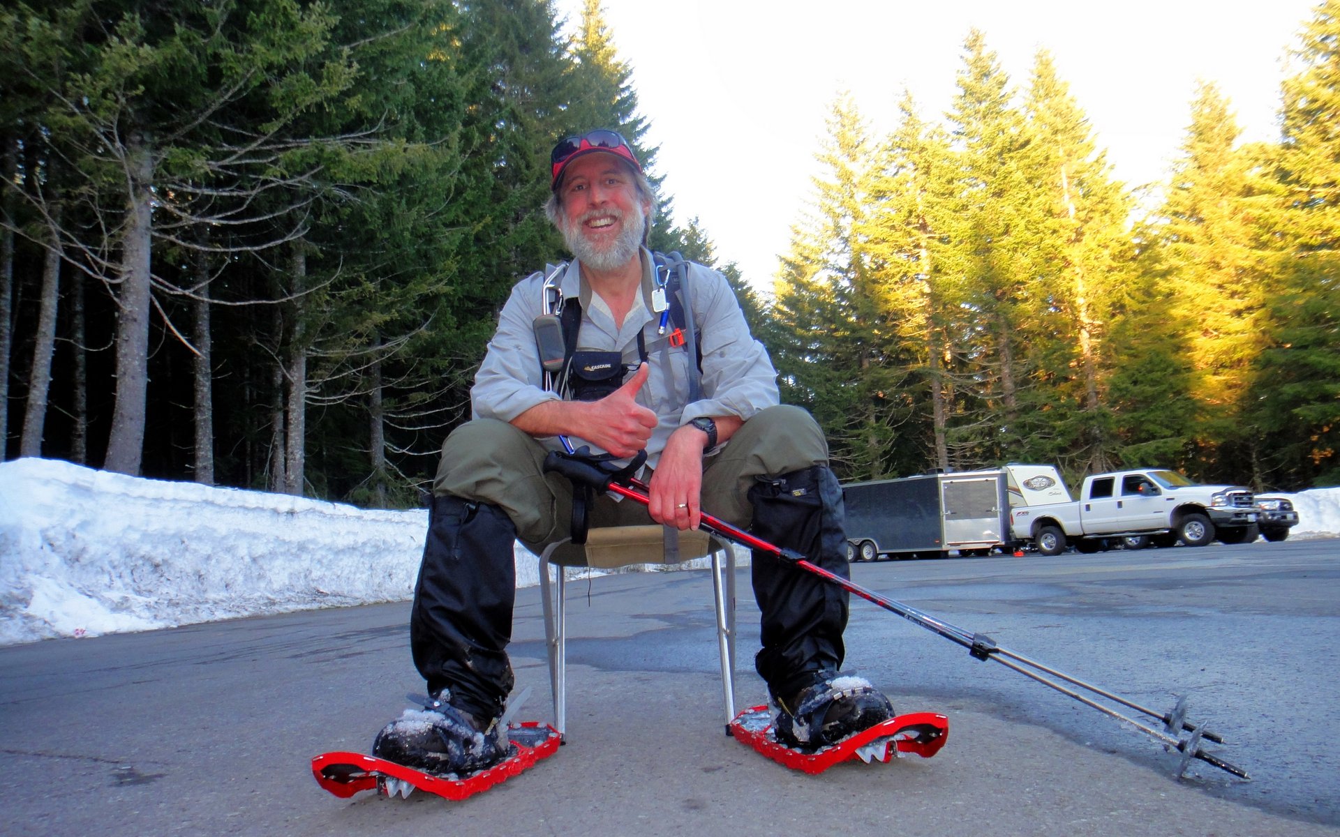
Peder, Acorn Woodpecker, and I met up in Salmon Creek at 6am, and carpooled to the Marble Mountain Sno-Park on the southern flanks of Mount Saint Helens. This made sense not only from the conservation standpoint, but also because Washington is an incredibly expensive place to park! $20 for a one-day pass. Yikes. At least you can get them online.

We set out from the parking lot about 7:40am, and took this shot at 1:00pm (after soaking in the glorious surroundings a bit):

Image
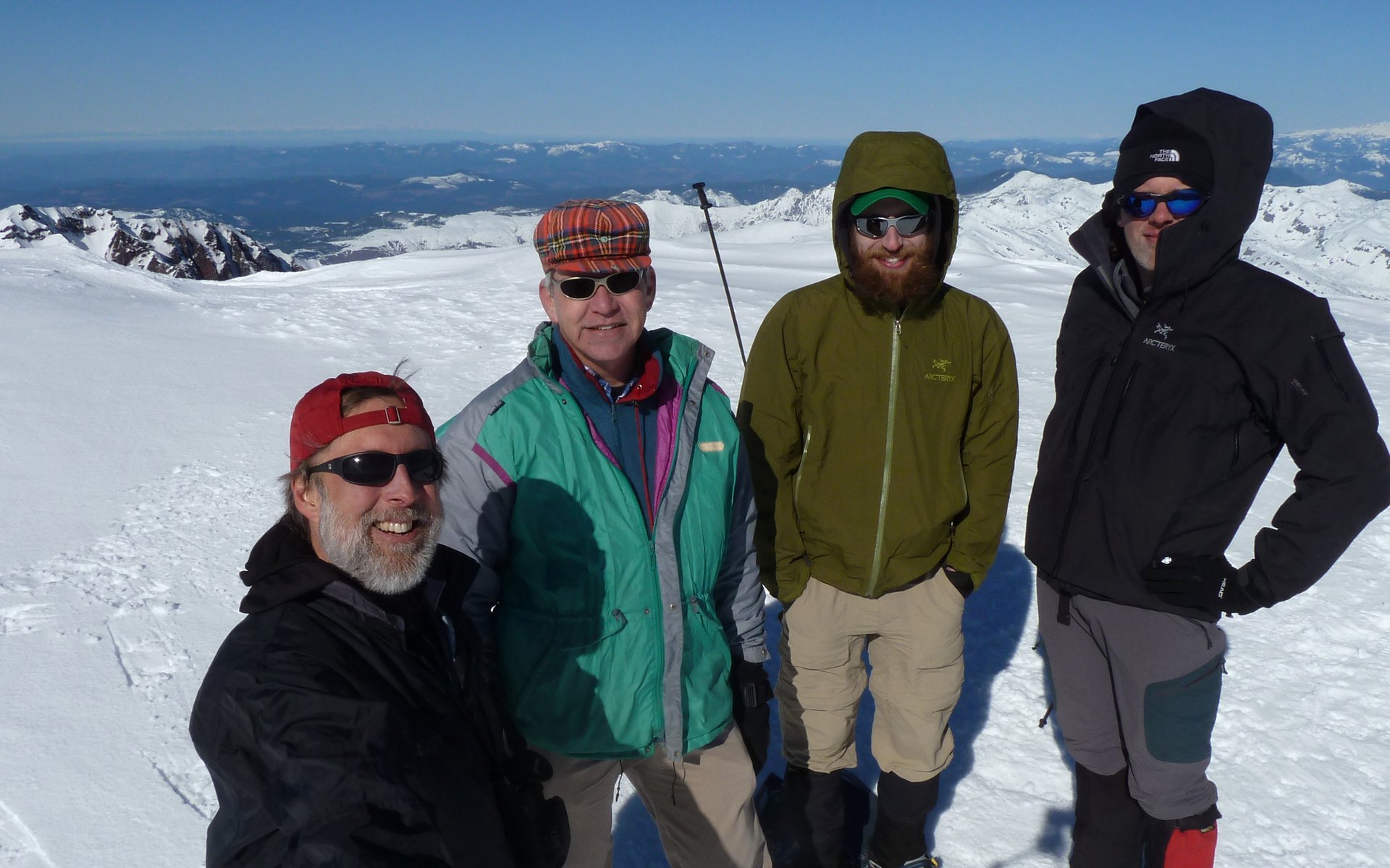
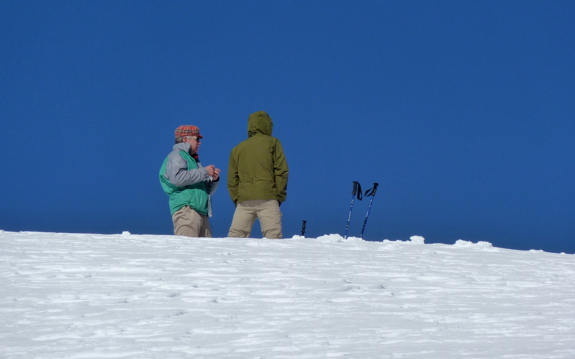
Group shot on the crater rim. The fellow on the right is a new friend we made on the way up,
who will probably be swinging through here now that we told him about PH.


Marble Mountain offers quite a nice array of XC and snowshoe trails. It was about 34°F at the parking lot, and the snow was still quite hard. I started in microspikes, because it seemed easier than carrying them. The other guys were just in boots. The first two miles travel through the forest, and barely ascend 900'.

Image
Anticipation was high, as the dark blue and bright white shone ahead.

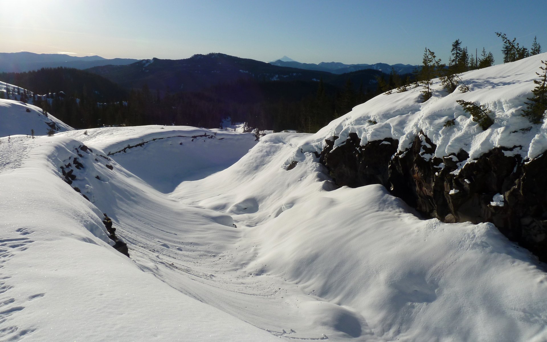
I have heard, more times than the subject has probably come up, that climbing MSH is "just a slog!" It's usually said in the most derisive manner imaginable. Well, the winter scenery on Friday so more than made up for the slog aspect, that it's, well, nearly indescribable.

Image
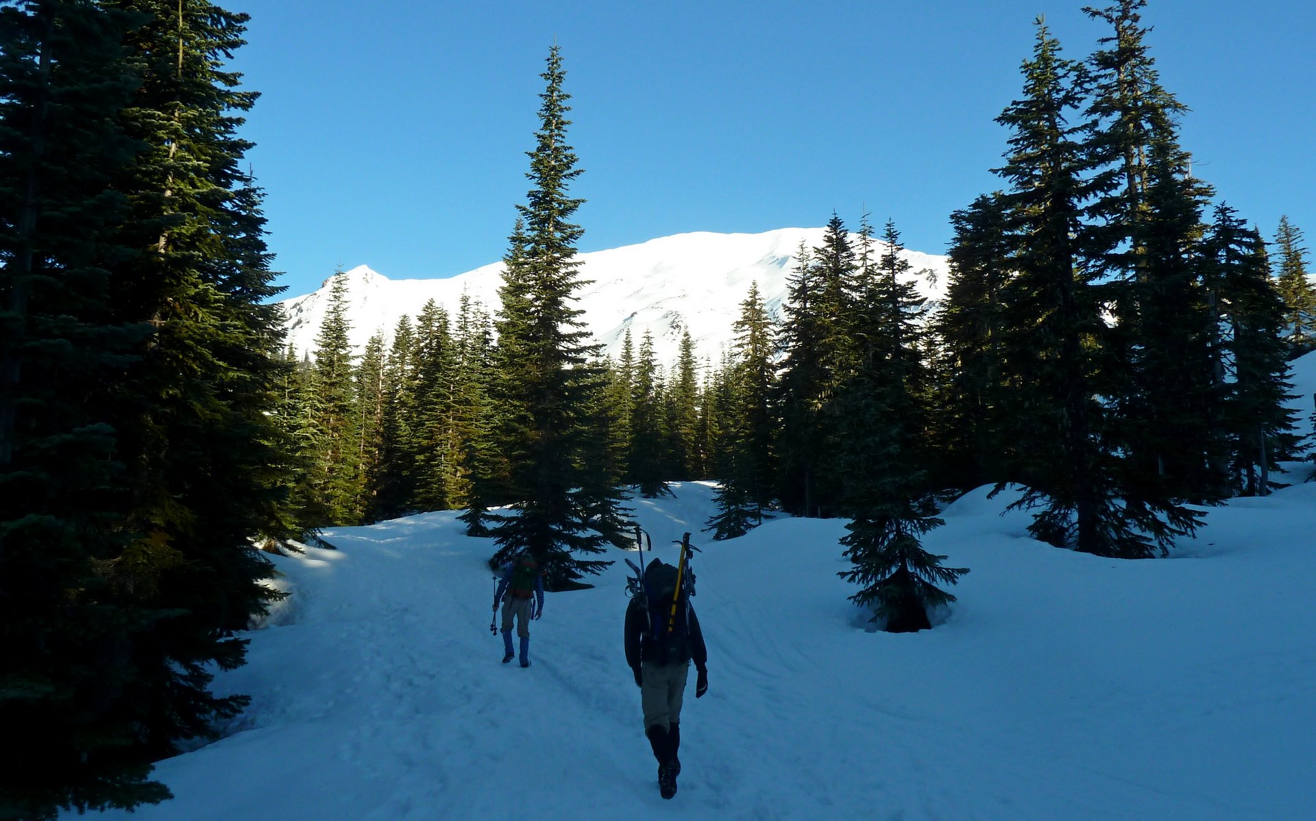
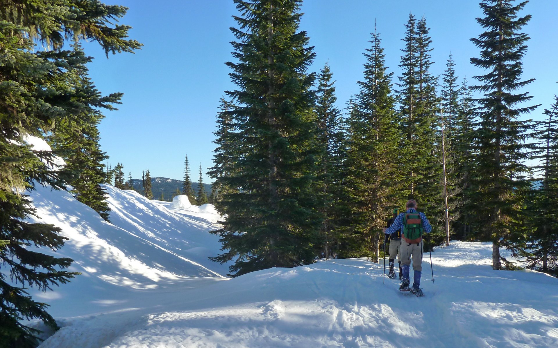
As soon as we broke out of the woods, the scenery just exploded!

Image
We traveled 2.5 miles without snowshoes.

Image
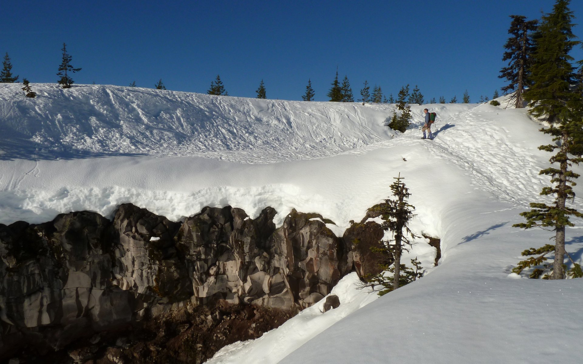
Site of Chocolate Falls, in warmer times.

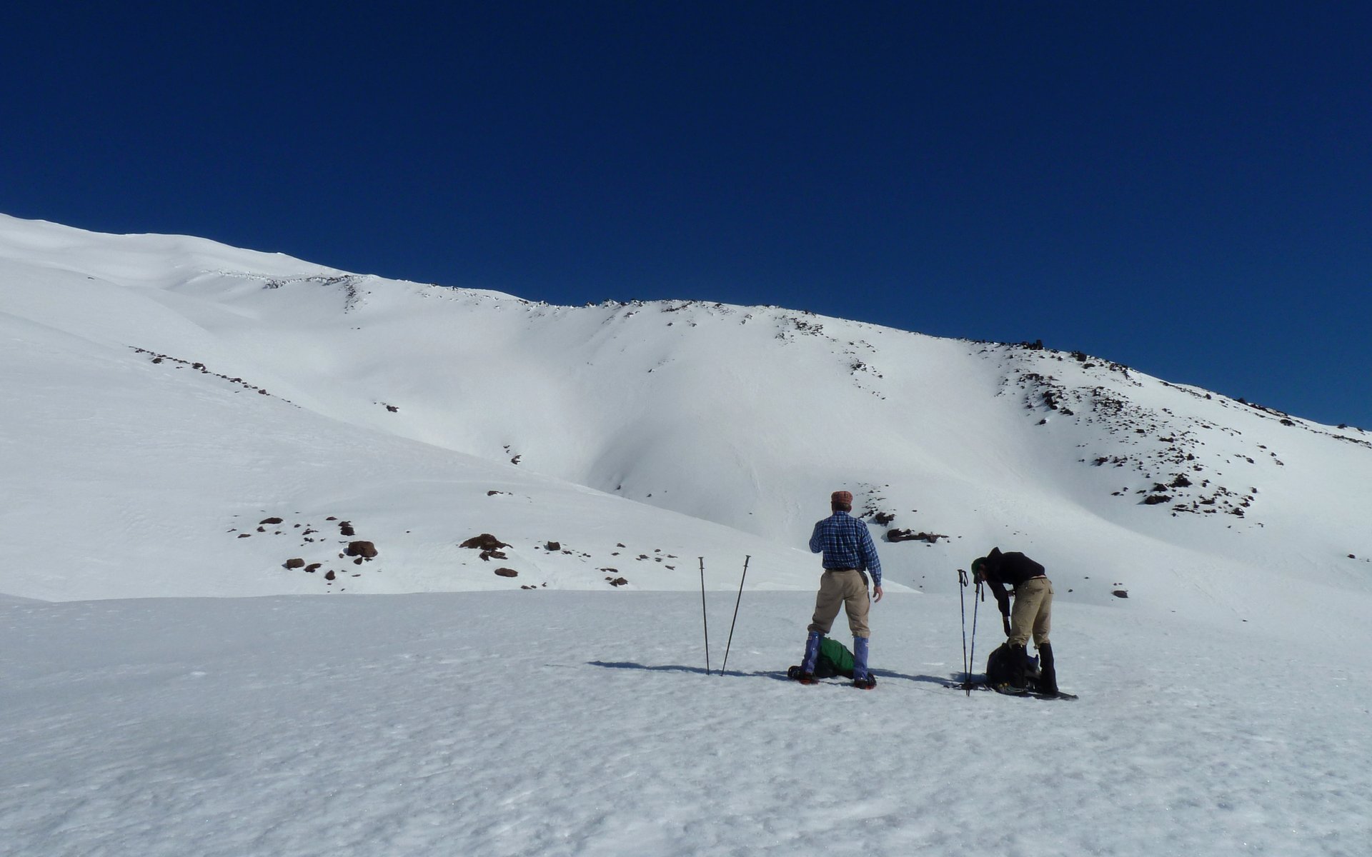
About "half-way there" (mileage, not EG!), we had started to sink in a bit, so we stopped to put on our snowshoes. I stripped out of my baselayer at this point, too. It was just getting way too warm, already!

Image
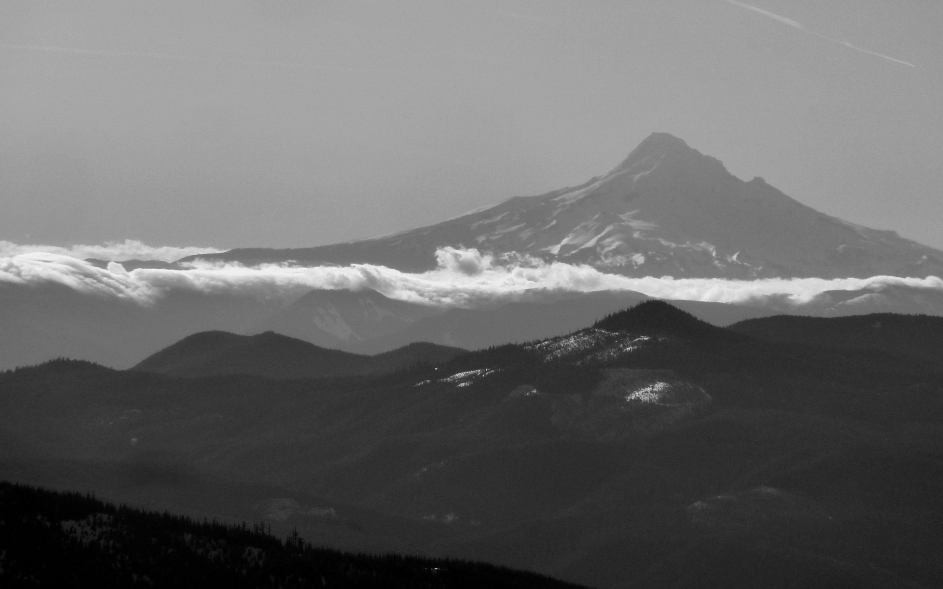
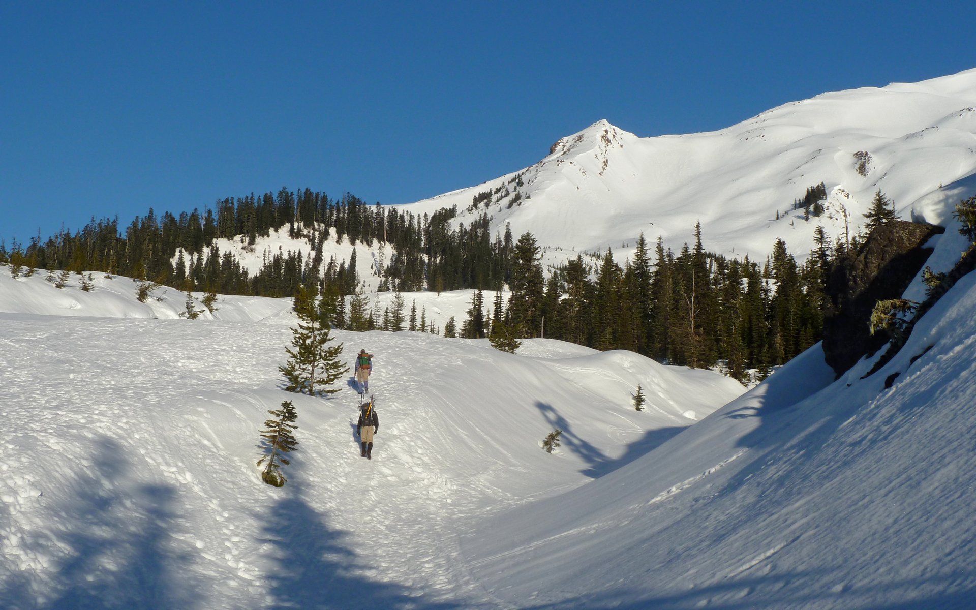
Mt. Hood was with us on the southern horizon all day. As we climbed, Jeff and the Sisters appeared too.

Image
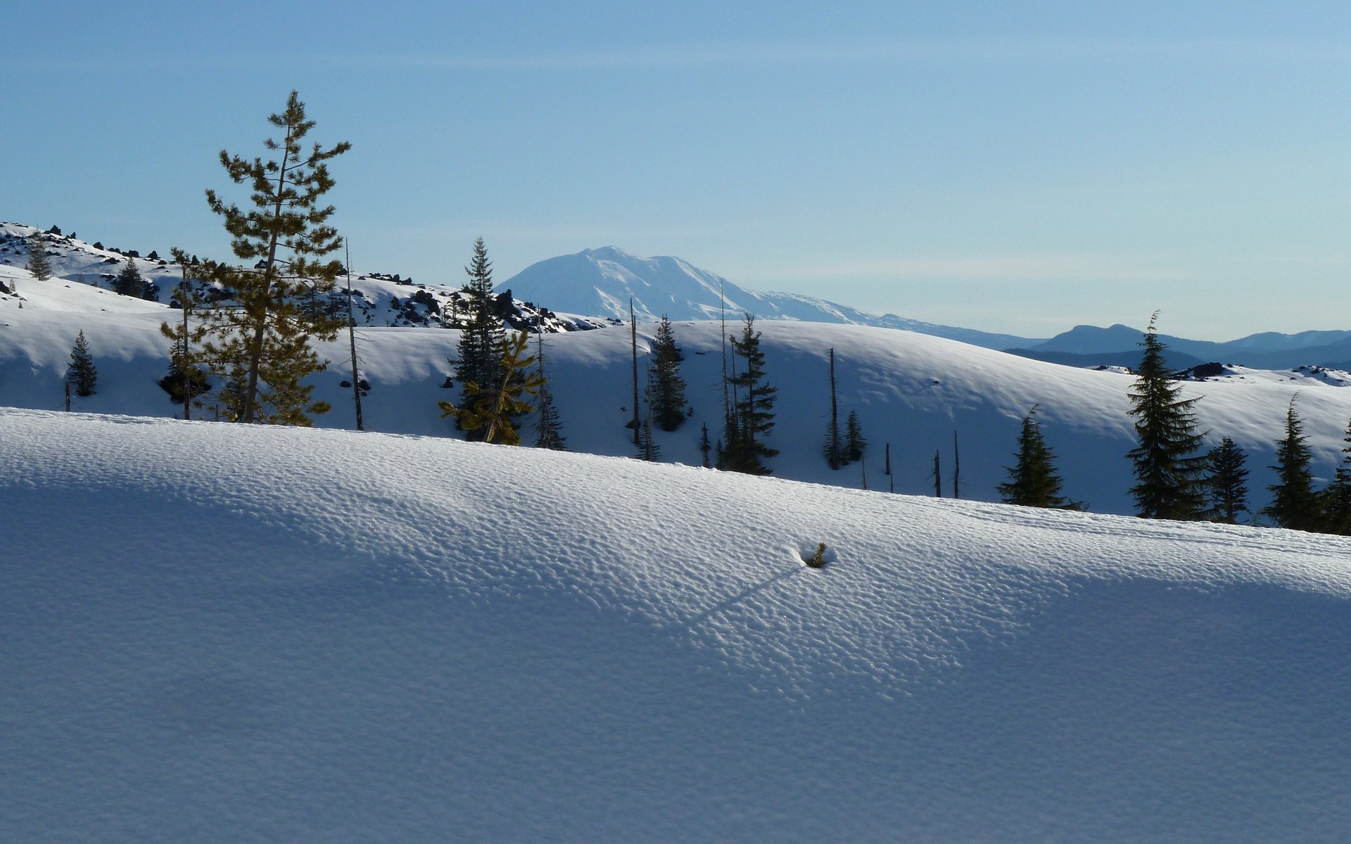
Pretty soon, Mt. Adams appeared on the eastern horizon, and was with us from then on.

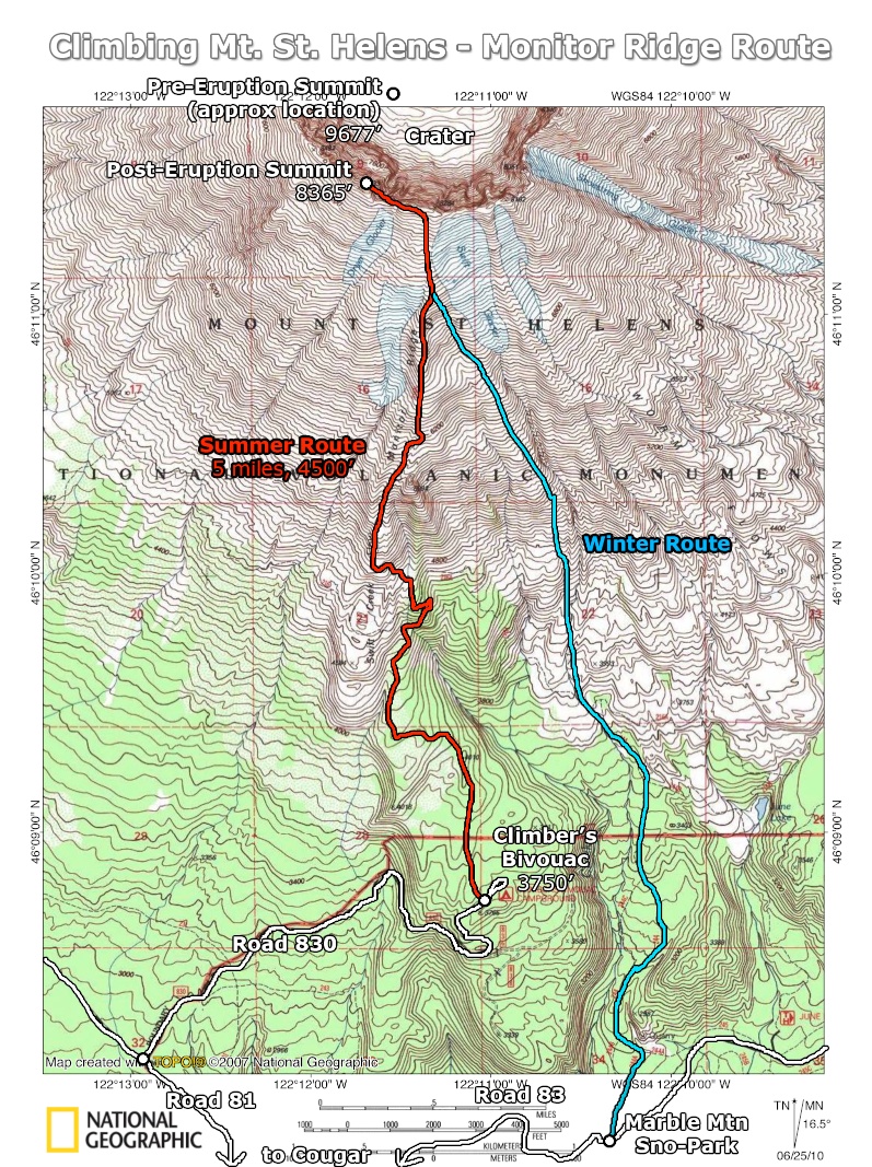
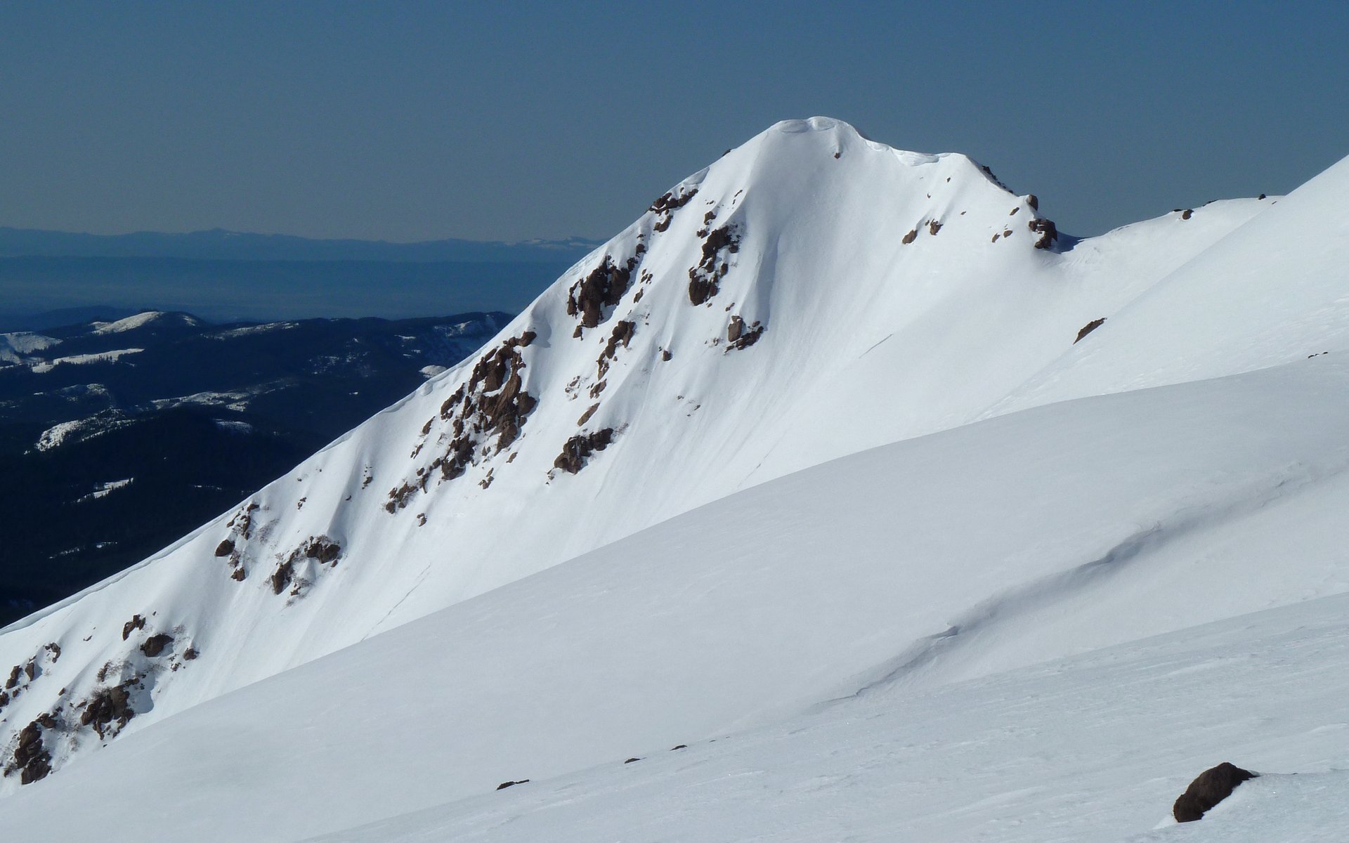
In the winter, there's no (easy) way to get to Climber's Bivouac to follow the traditional Monitor Ridge climbing route. We instead took the Worm Flows climbing route, named after immediately recognizable worm-shaped lava flows coming down the side of the volcano.

Image
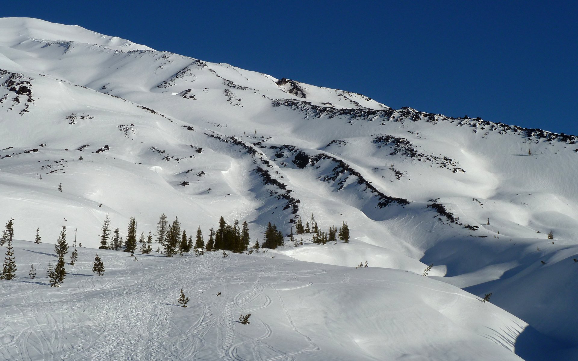
Our route would follow the "worm" dead-center in this photo.

Image
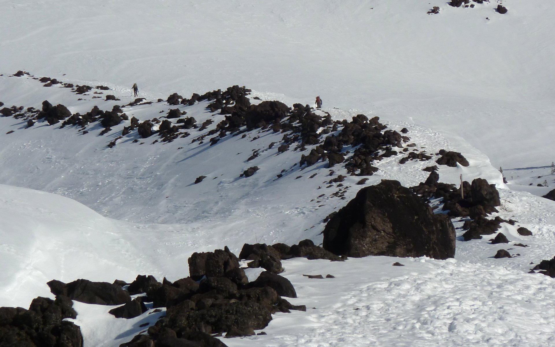
The party ahead of us, ascending the worm. 15 people scaled MSH this fine day.

Image
AW coming up the worm.

Image
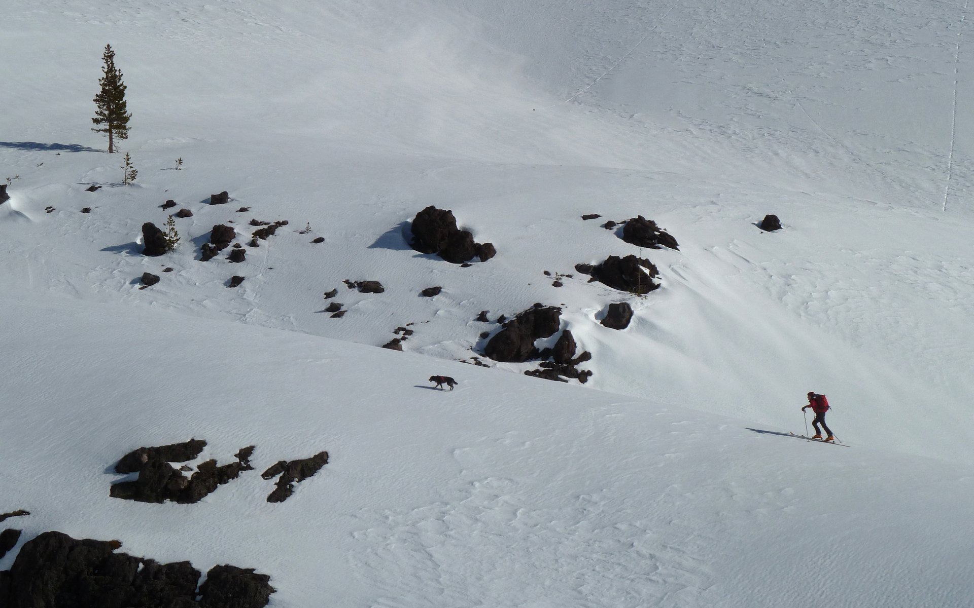
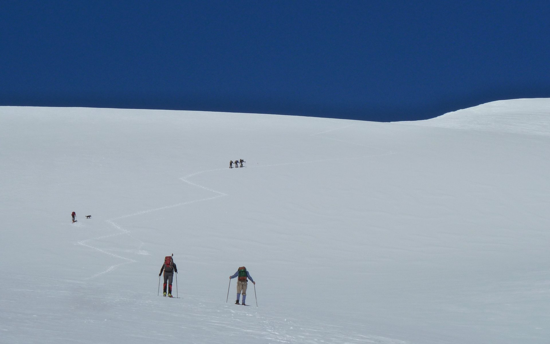
One worm over, a skier and his dog made steady progress in parallel to ours.

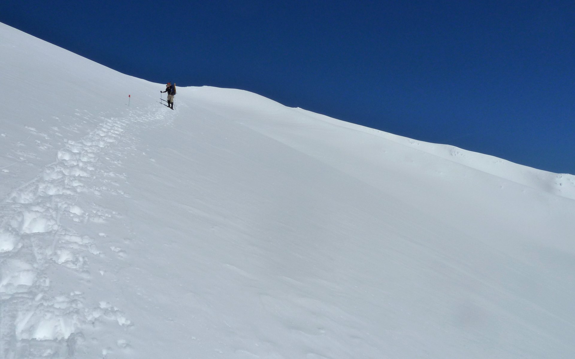
A group perhaps an hour ahead of us had abandoned their snowshoes at 5000', choosing to go with crampons from that point upward. At this point, for us, the snow was definitely starting to soften up - no ice at all. They also flagged their route, carefully placing a new flag about every 1/2 mile or so, presumably to help them down in case of a whiteout?

Image
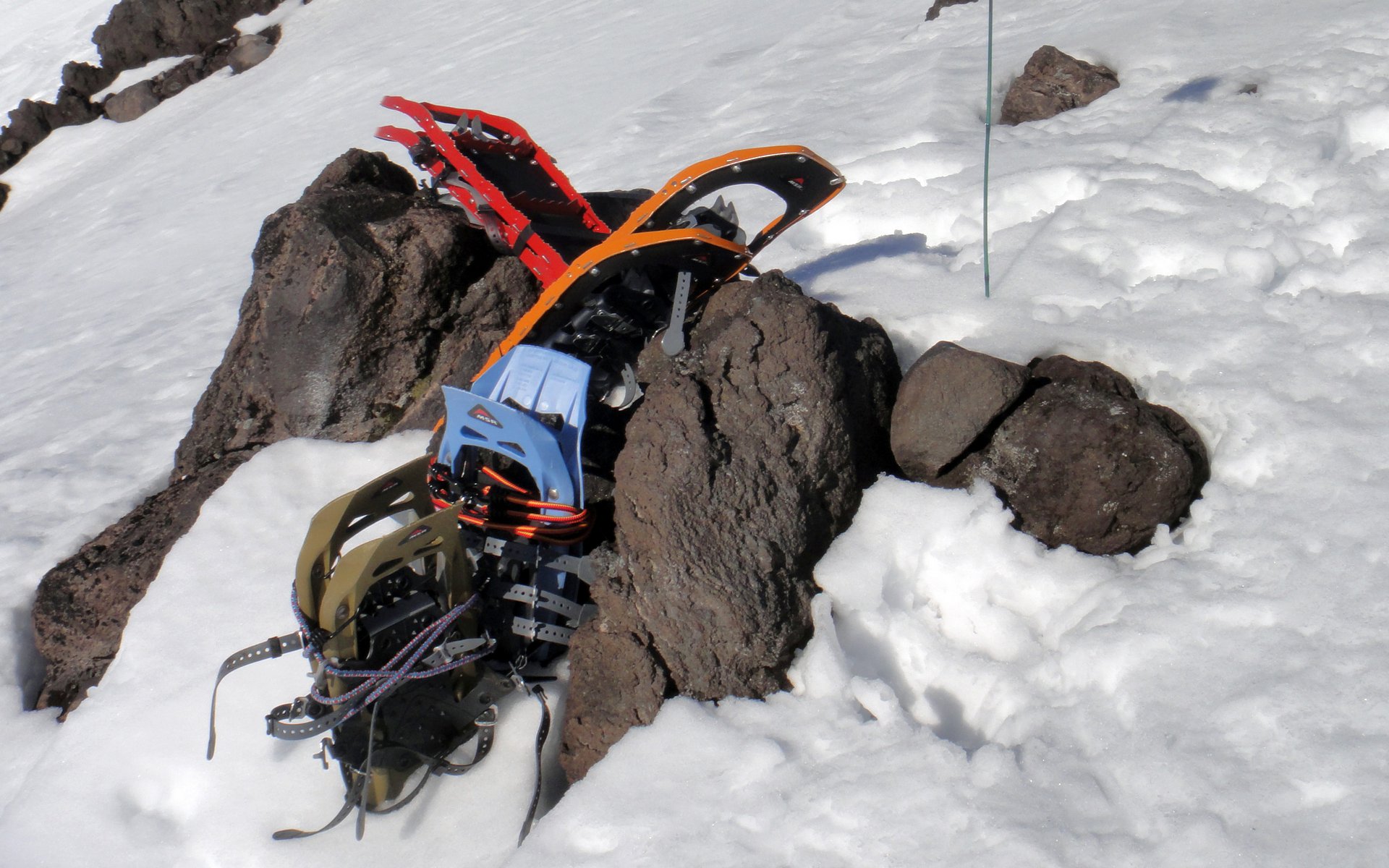
Snowshoe cache at 5000'. (Photo credit: Peder)

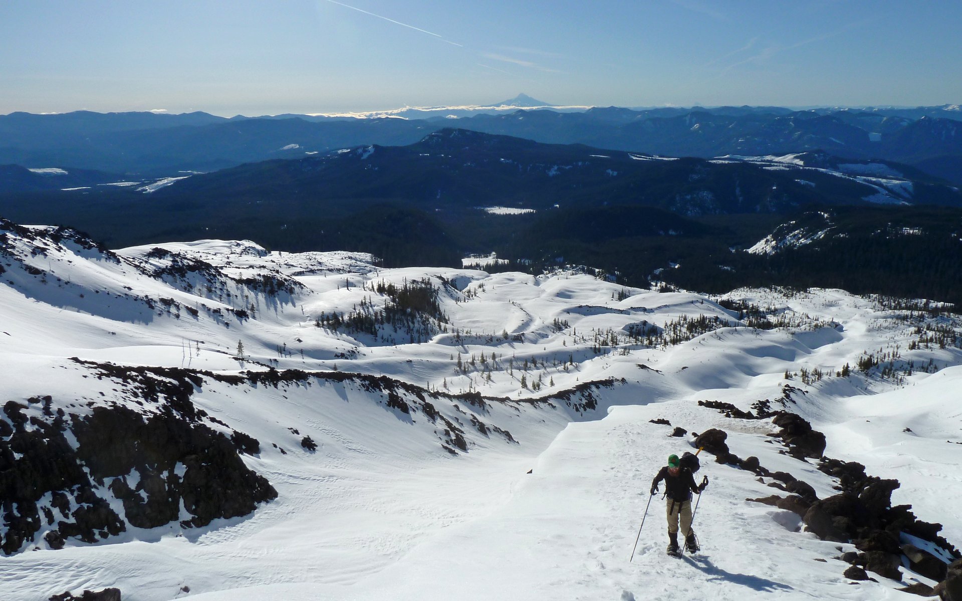
We had eye-balled a little knoll at about 5600', and thought that'd make a great place for a snack break. Peder proved to be a mountaineering motorman! His pace was steady the entire way up, hardly ever pausing other than for an occasional photo. Just an amazing show of endurance!

Image
Peder motoring up the steepest stretch we'd encountered yet.

Image
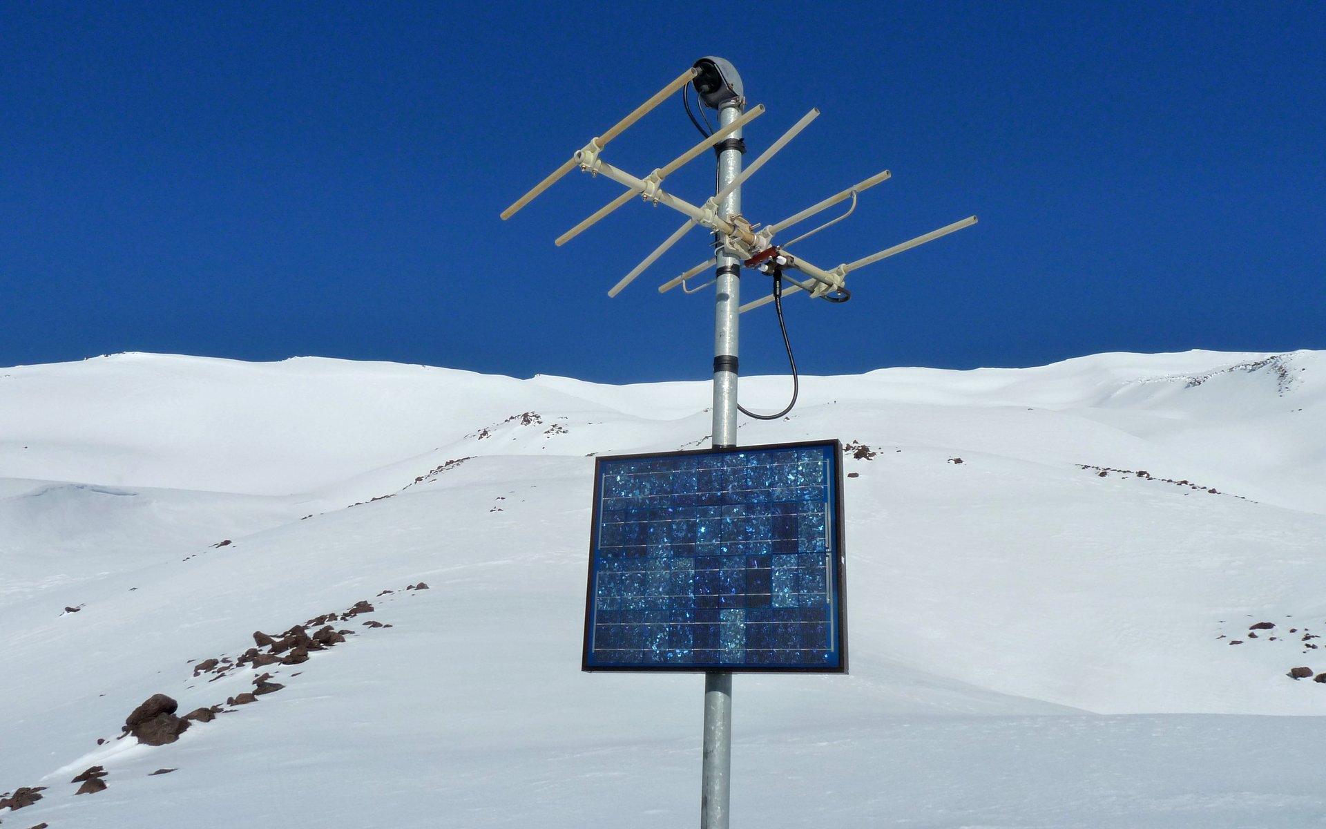
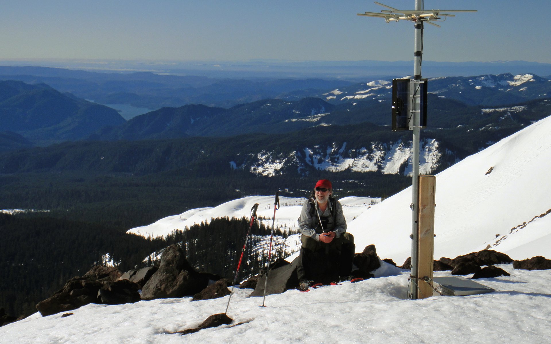
There was a USGS seismograph and transmitter here, to monitor the volcano.

Image
This was one of the few flat spots we encountered, once the real climb began.

Image
I took advantage of a nice nearby rock. This was the only time I sat down all day, honest.
(Photo credit: Peder)


I think I mentioned the scenery was spectacular?

Image
Cool little knob at 6000'.

Image
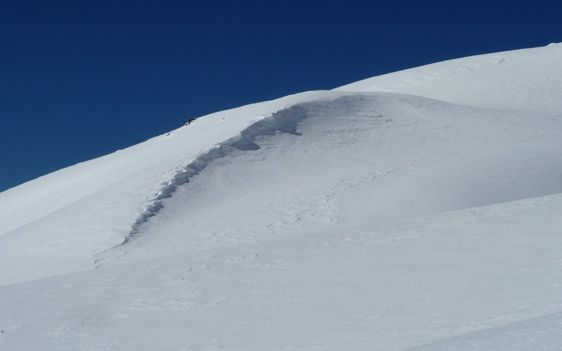
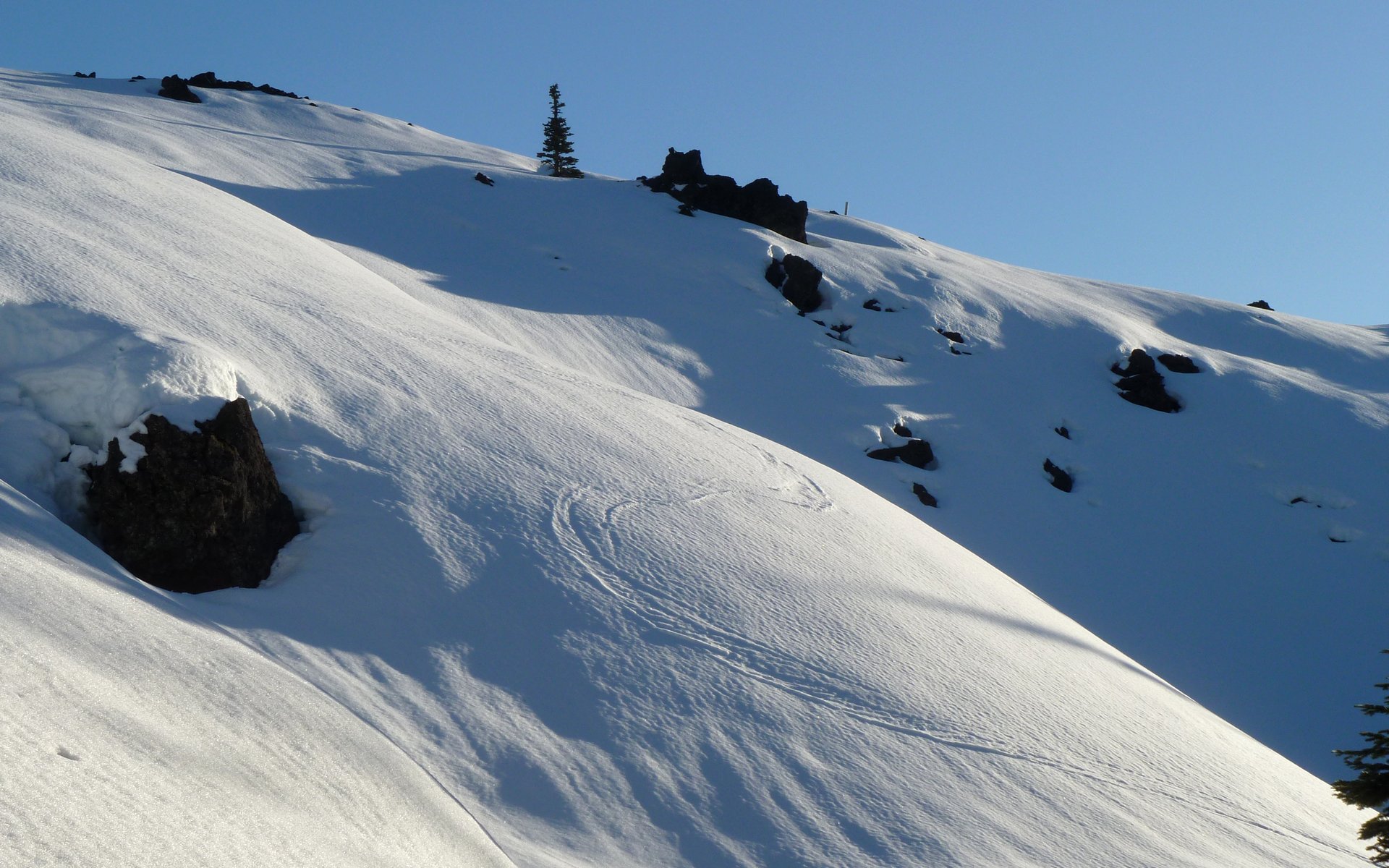
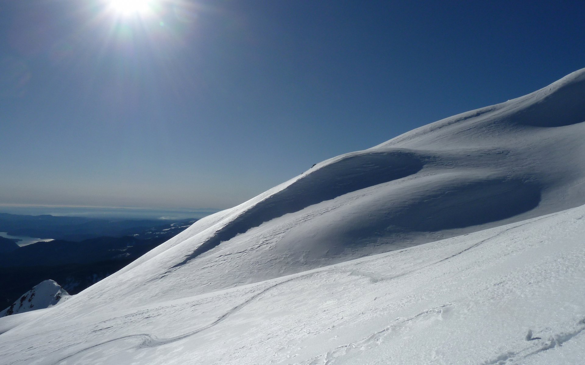
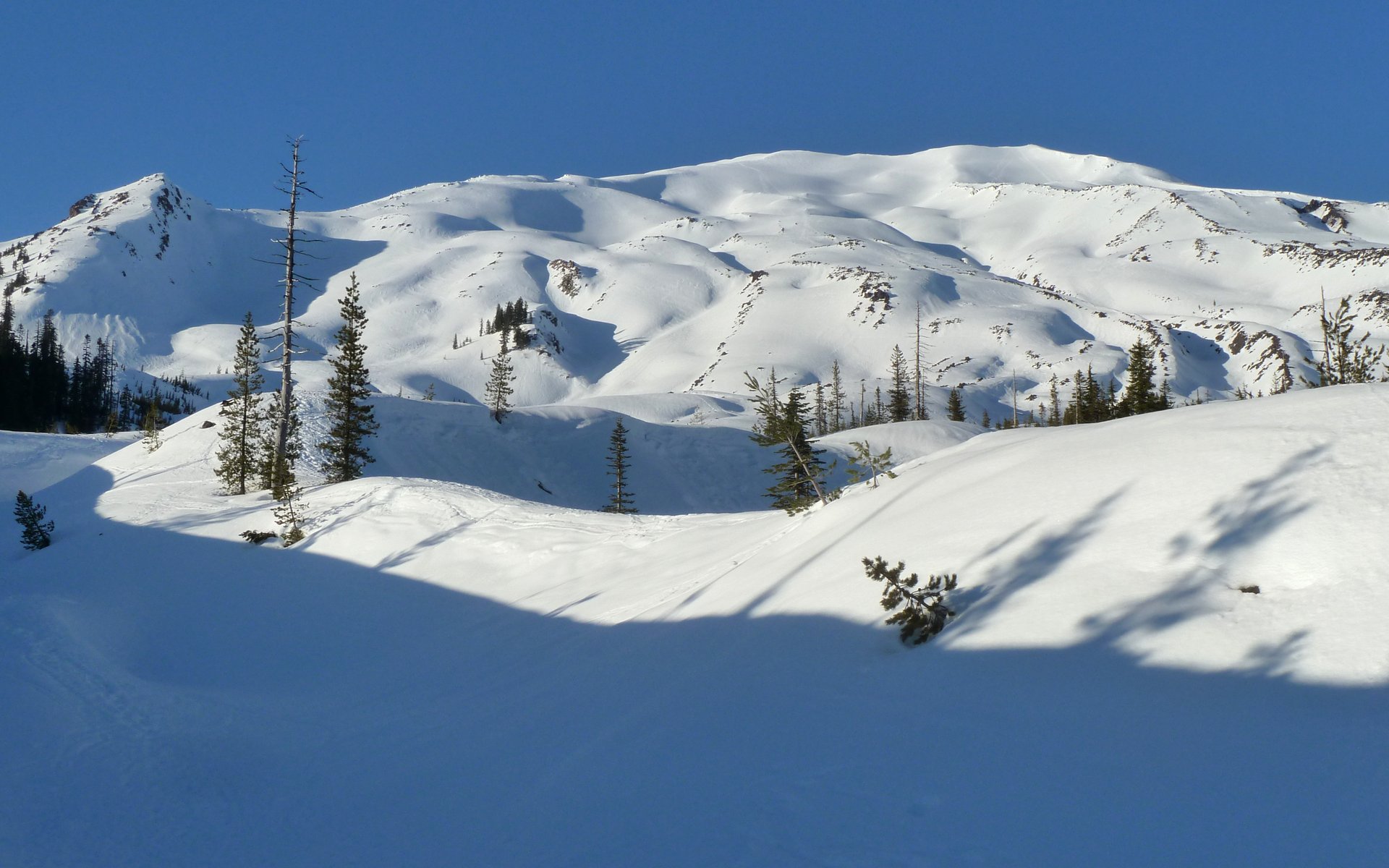
Fabulous wave-like cornices on the ridges.

Image
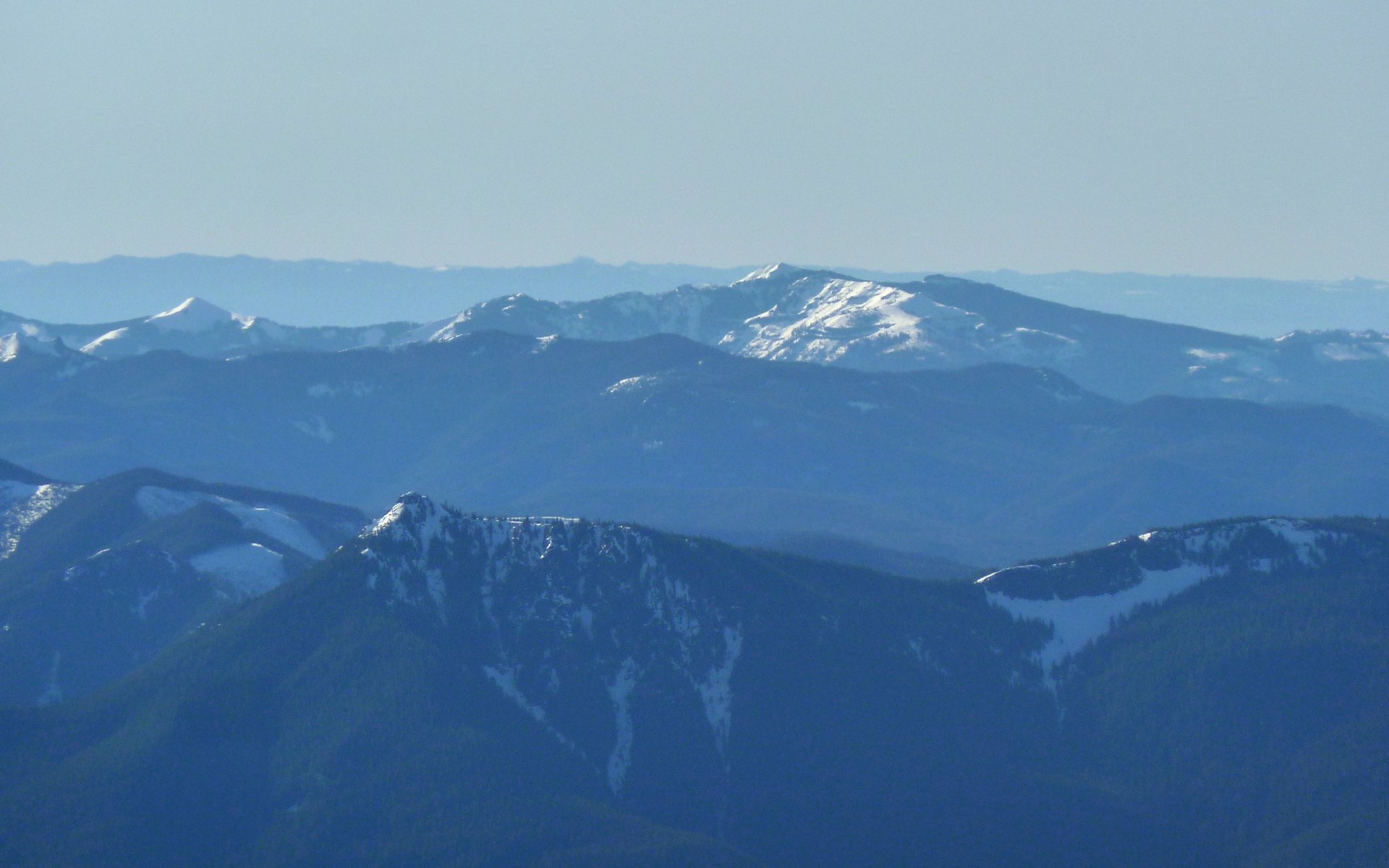
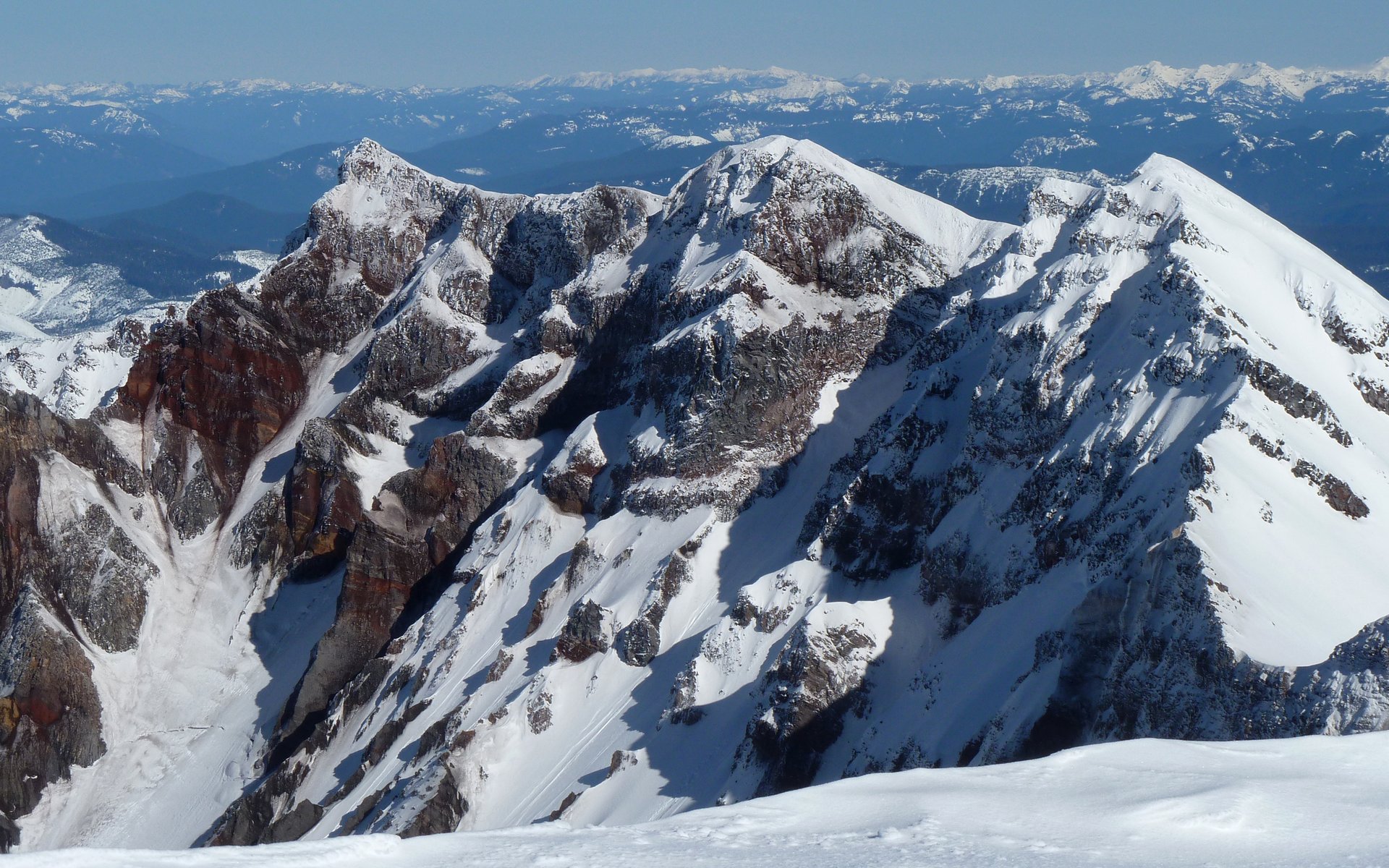
Silver Star and Little Baldy were shiny jewels to the south. (Mt. Mitchell in foreground?)

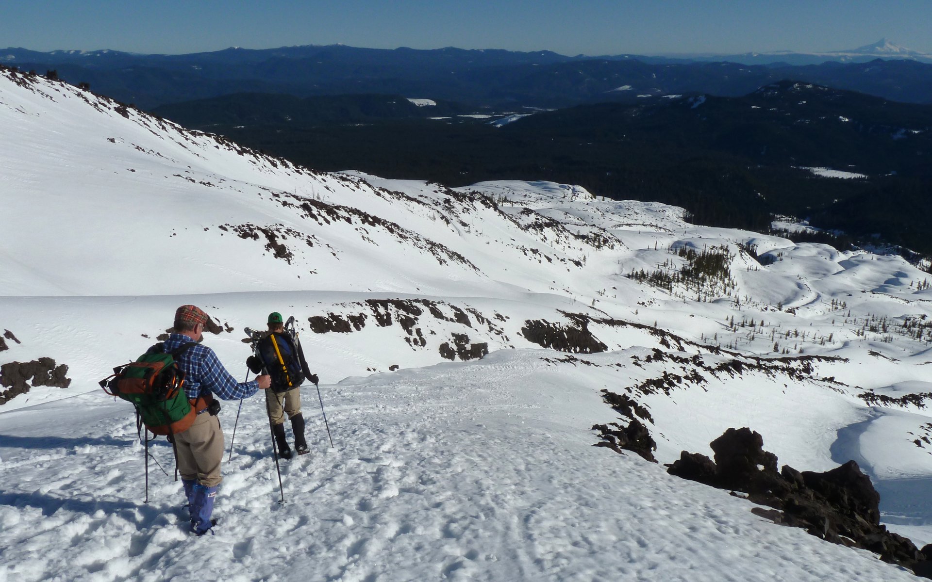
The folks without snowshoes were now cutting switchbacks into the mountainside, while it was far easier for us to just go straight on up.

Image
No route-finding skills needed today!

Image
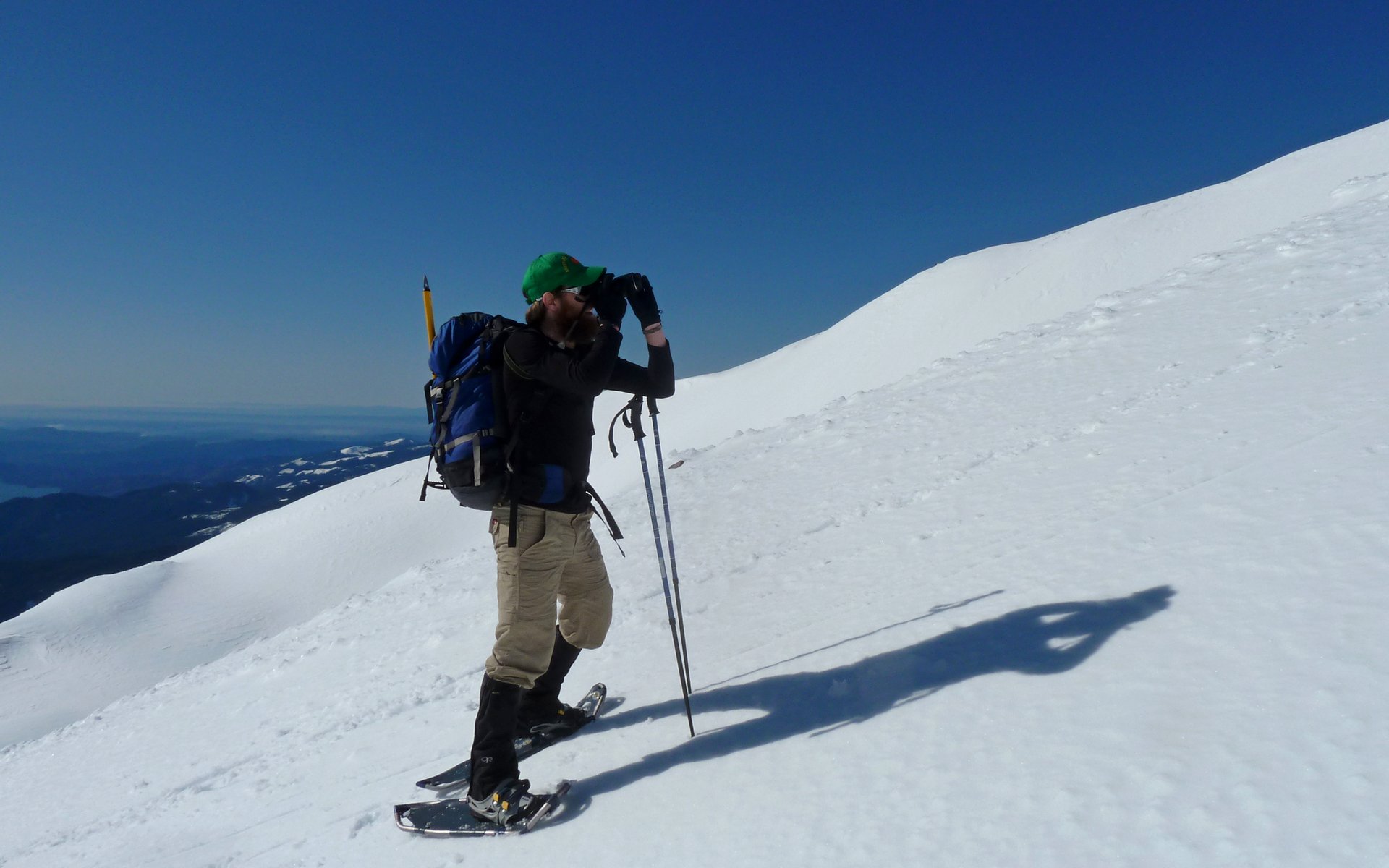
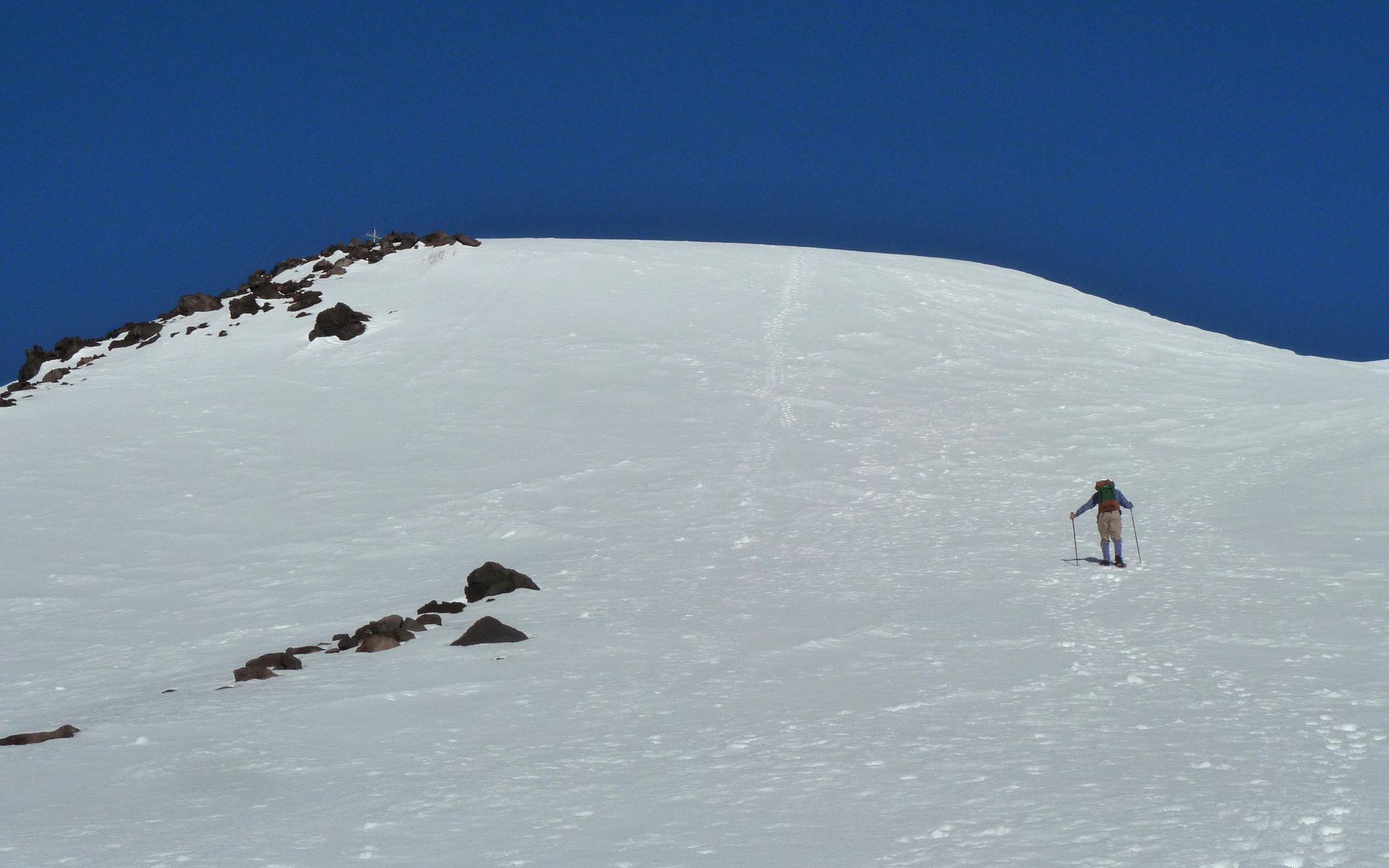
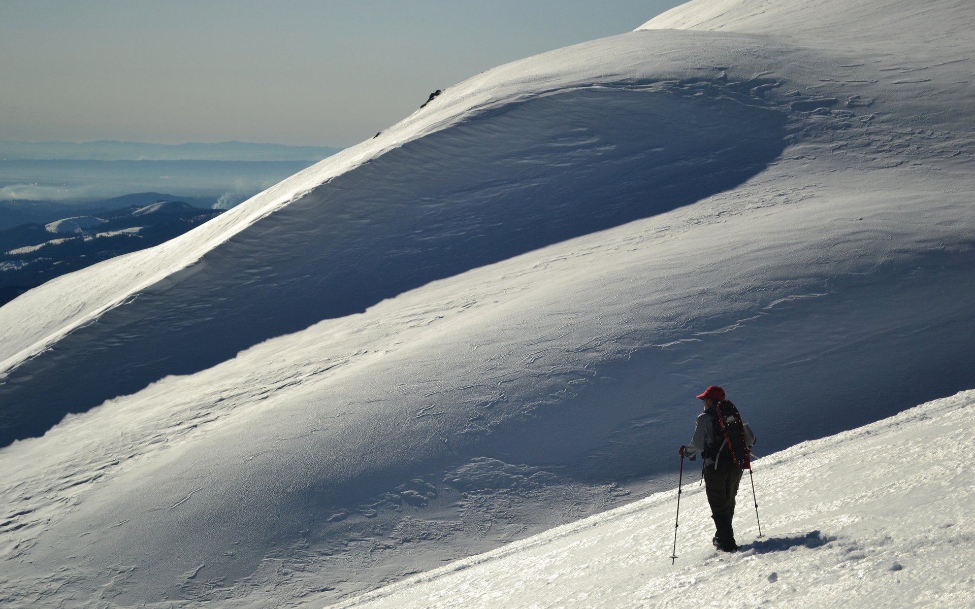
AW scopes out the ascent route.

Image
There was pretty much a single trail of footprints going up at this point.

Unfortunately, I suffered an equipment failure of a most dire nature. My water hose seems to have developed an air leak, and that pretty much crippled my water supply. As I'd suck, it was probably supplying 90% air and 10% water. Not only was that frustrating, but it also led to gas (from swallowed air) of a most unpleasant nature. Subsequently, I was really hurting on that last 1000' or so, suffering from multiple dehydration symptoms. The other guys beat me up there, by some distance. At the top, I discovered my 2L bladder was about 1/3 full. :( But I did have the opportunity to make a new friend who was slowed to my pace by the ski boots he was climbing in.

Image
Peder and AW beat me up there, by a bit.

I crested the summit 5h5m from the trailhead. The first thing I hear on my arrival was that they could see from the Olympics and Canada to the Three Sisters to the Pacific. It was just astounding! No way you'd get anything approaching this clarity in our typical summer haze!

Image
One of my favorite shots of the day. Peder taking in the magnificent views!

Image
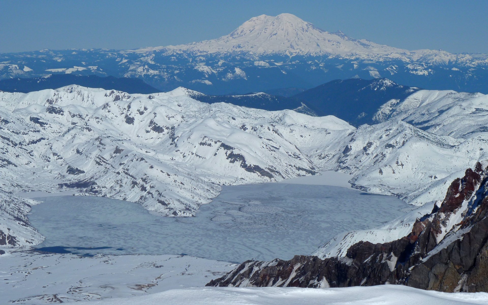
North view overlooking Spirit Lake and on to Mount Rainier.

Image
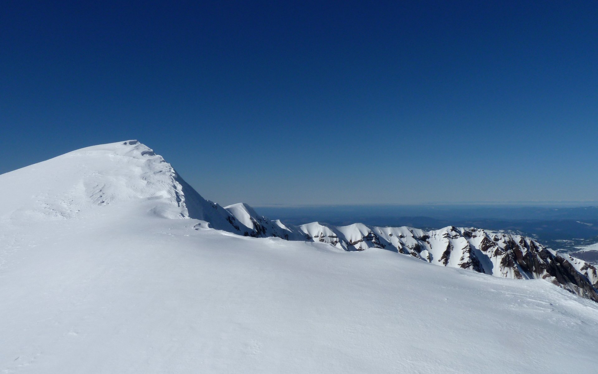
The true summit of MSH. We were close enough. No footprints were visible beyond our position.

Image
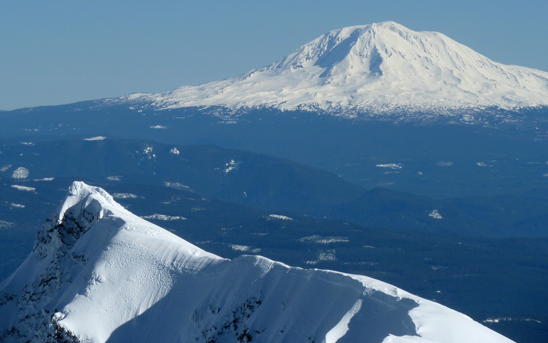
Mount Adams and the eastern crater rim.

Image
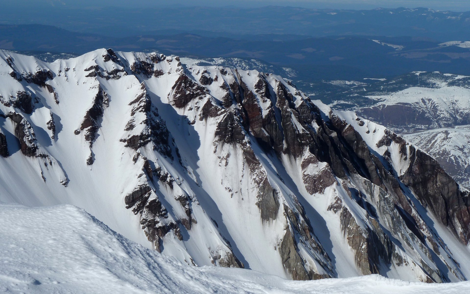
Spectacular cliffs on the western rim of the caldera...

Image
... and the eastern rim too! Goat Rocks in distance.

Image
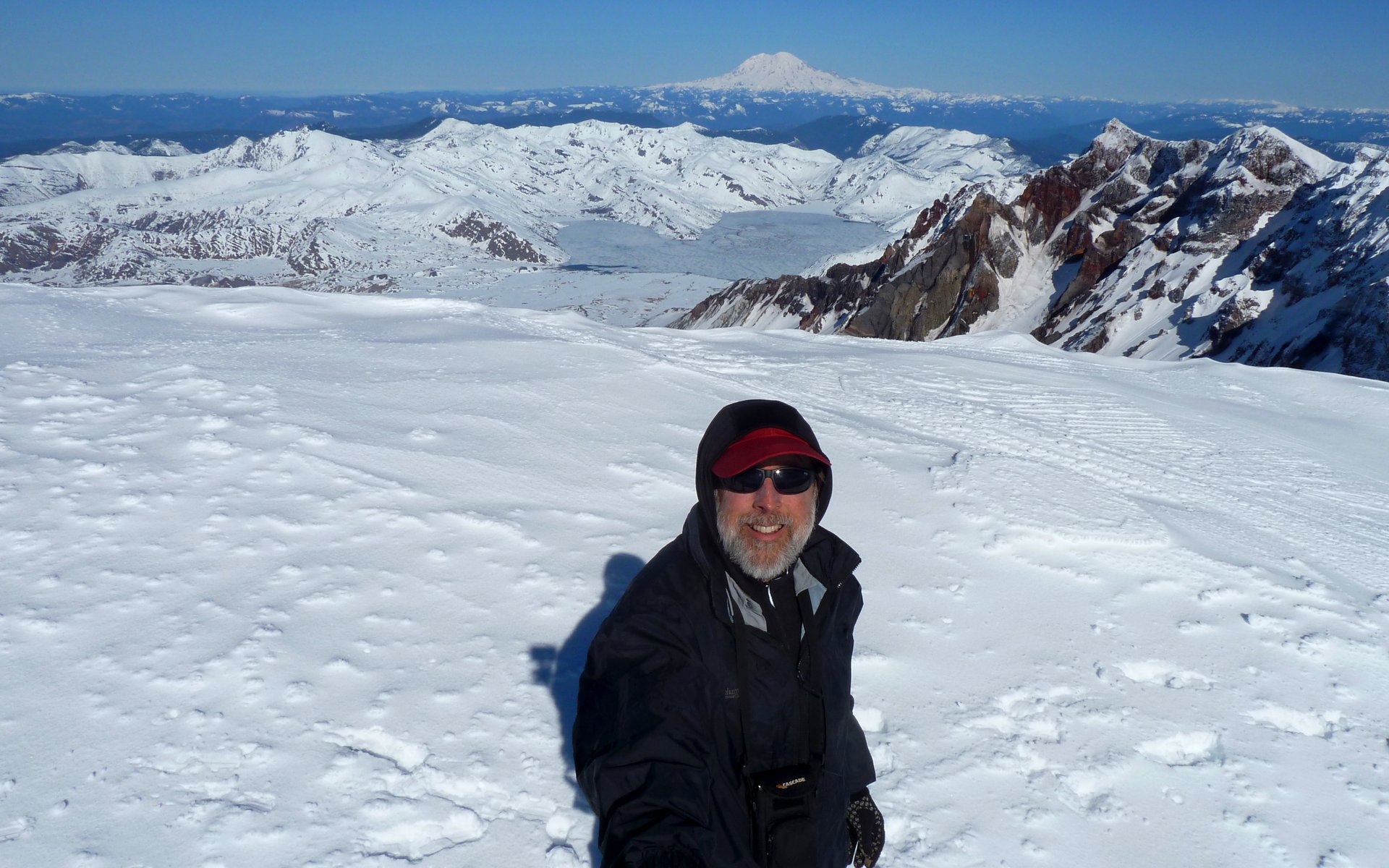
Obligatory "I was there" stickpic self-portrait!


Quick west to east pan, looking north.

Although the sky was clear in virtually every direction, there was a persistent layer of clouds that hung in there all day long just north of Mount Hood. We speculated bunches, but never came up with (what I felt) was a good explanation...

Image
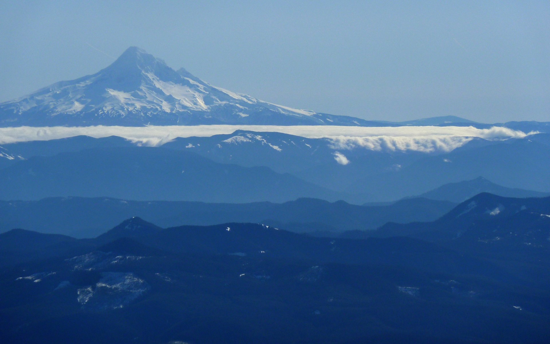
Why were these clouds holding tight there all day long, when the entire PNW was cloud-free?

While the air was almost dead still most of the way up, on the summit it was persistent at 20-30mph, and quite chilly. I had to put my baselayer top back on, a wind breaker and gloves too. We were probably up there for about 45 minutes, or so.

Image
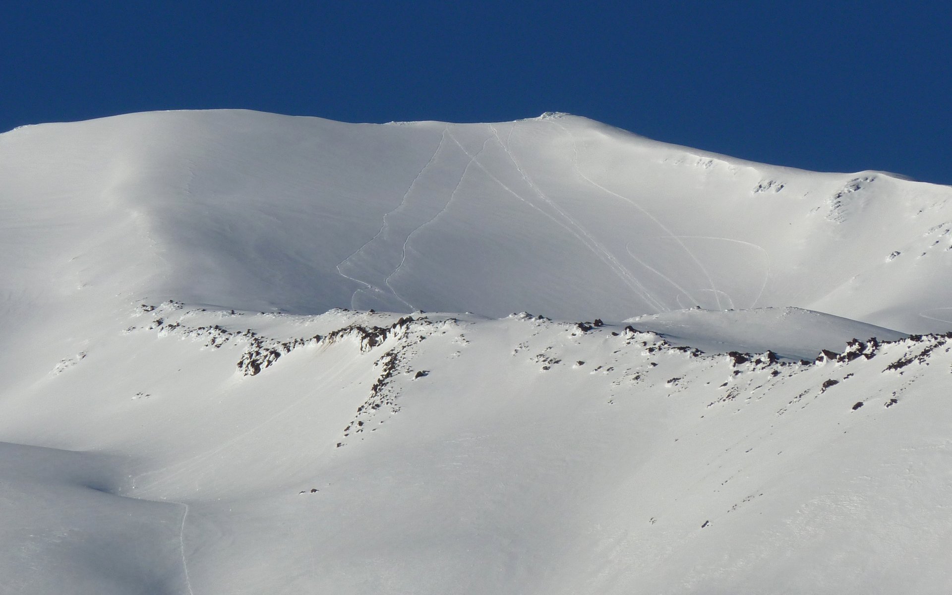
The descent was steep, and the snow was softening rapidly!

Image
Nowhere to go, now, but down!

Image
Less than 1000' from the top, we took off the snowshoes as they were hindering the descent.

Did I mention the scenery was spectacular? No one, this day, called it "a slog!"

Image
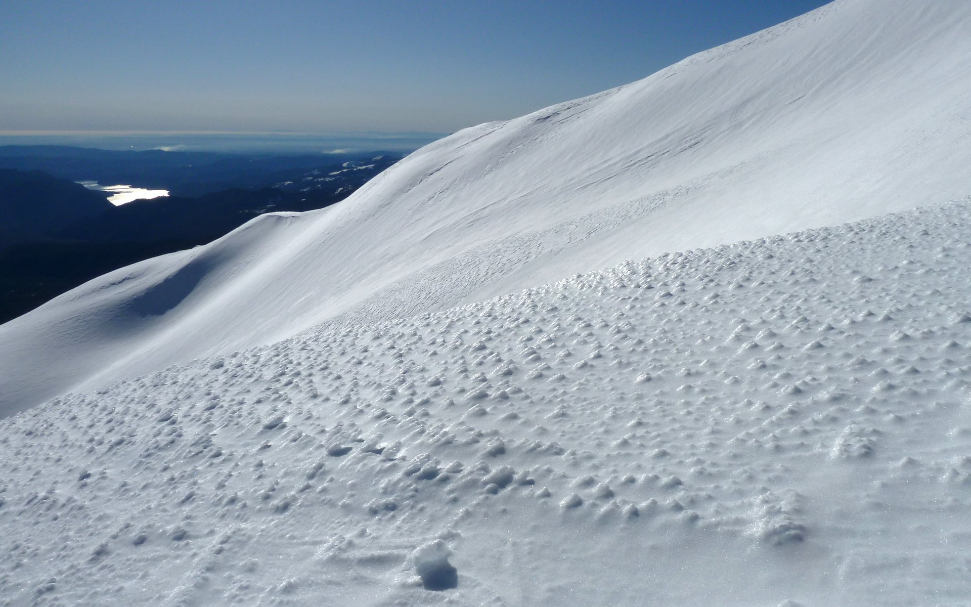
Very cool snow patterns. Lake Merwin shimmering in distance.

Image
Fabulous snow waves. Unrelenting sun. Indescribable shadows.

Image
I stood mesmerized for some time. (Photo by Acorn Woodpecker.)

Image
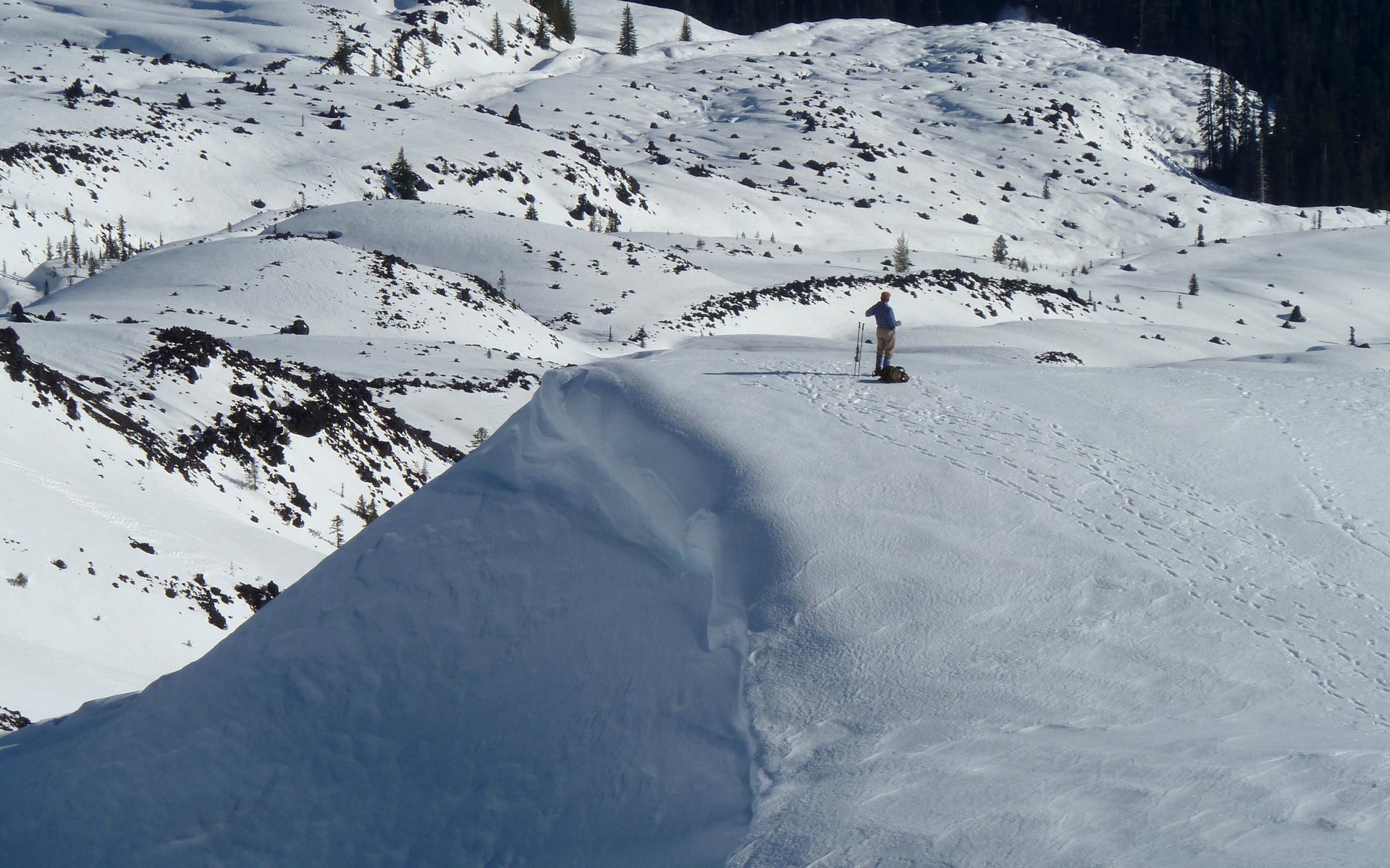
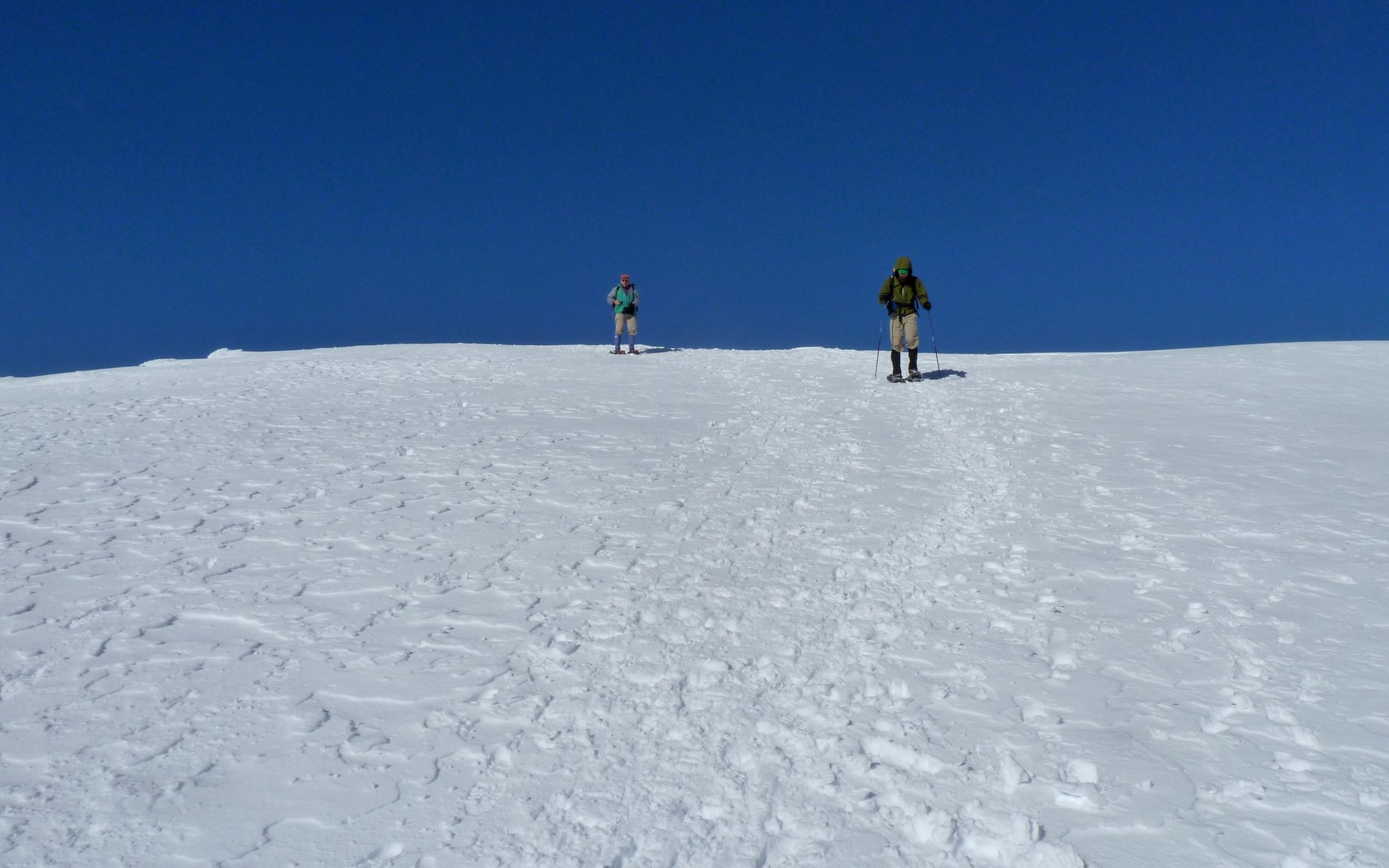
Peder waiting for us dilly-dallying photographers to catch up at 5600'.

Image
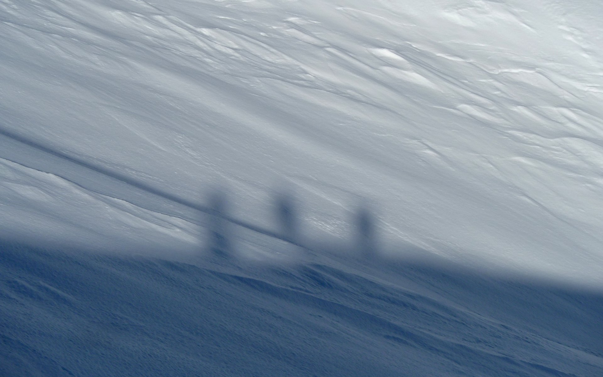
Three Shadowy Amigos!

Image
Descending a worm.

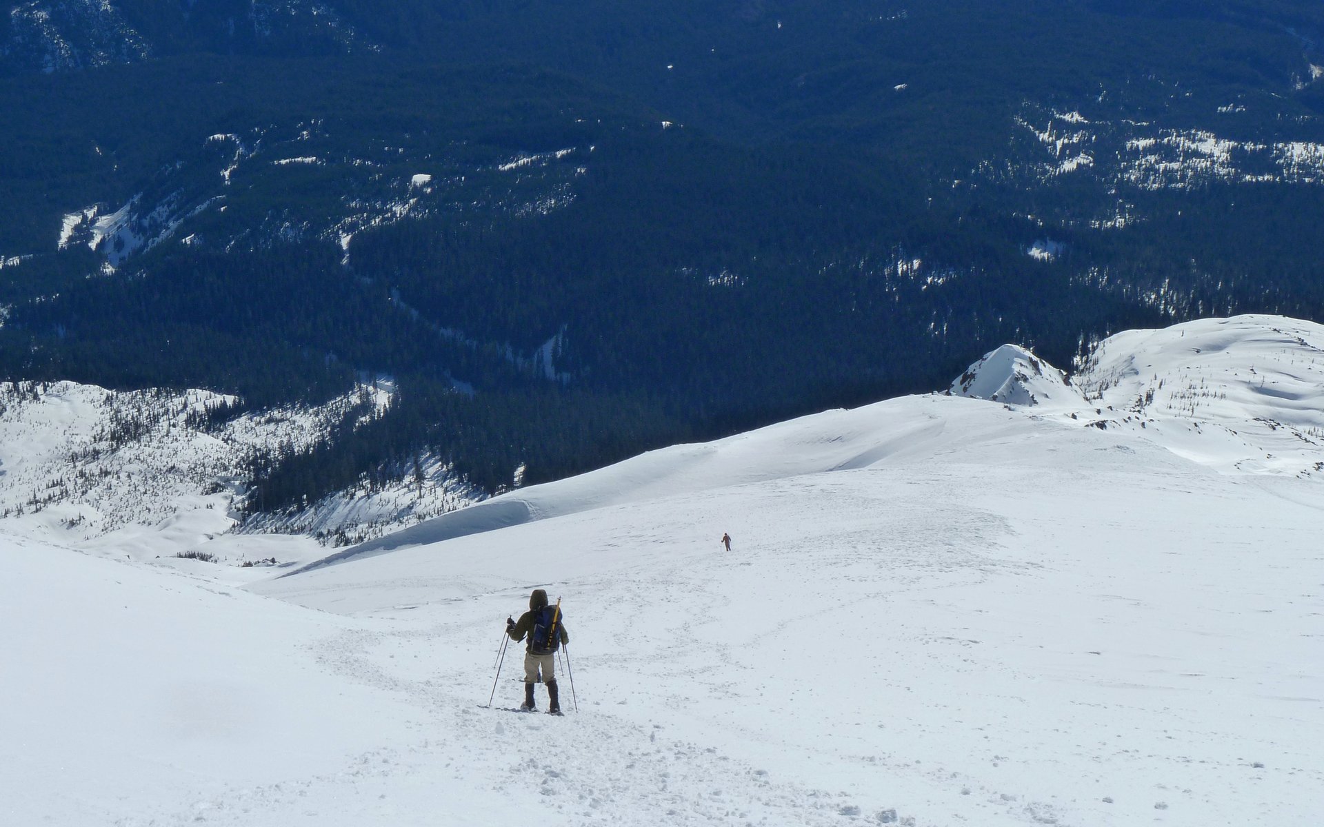
We began postholing again, sometimes to the hip, a bit below 5000'. So we put our snowshoes back on at that point, and wore them all the way back to the trailhead.

Image
Looking over our shoulder. The 4:00 shadows were starting to appear.

Image
Snowmobile tracks were clearly visible, coming down from the rim.

Image
The last two miles were uneventful. All in all, these were the 10 longest miles I've ever hiked!

Image
Last up top; First back down! (Photo credit: Peder)

I think each of us, at some point, or probably at many points, expressed that this was "a day I'd never forget!" They just don't get any better, folks. We hit the perfect hole in this unpredictable weather. I'm sure it was in the 45-50°F on the descent.

The final stats weren't all that unimpressive, either, from a beginner snowshoe perspective at any rate. The elevation gain really deserves to be broken down mile-by-mile:
    • Mile 1: 370' EG
      Mile 2: 500' EG
      Mile 3: 950' EG
      Mile 4: 1820' EG
      Mile 5: 1970' EG
Grand total of 10.5 miles and 5600' EG in 9h20m (8h moving). We believe 15 people summited this day.

Last two miles to the summit? 3800' EG! :shock:

http://gpsfly.org/gps_map.php?gps_id=2094&w=645&h=440

Not bad for a bunch of beginners? :lol:

EDIT: Glibness aside, as Peder mentions downthread, MSH is a very real mountain. Although we picked a day where anyone in fairly decent physical fitness could've made it to the summit, doing so without a modicum of mountaineering sense could easily have proven fatal. There are cornices overhanging dropoffs that range from "that would hurt!" to "goodbye cruel world!" We fortunately didn't run into any ice that would've required ice axes and crampons, but that's also a strong possibility we were aware of, and prepared to turn around in the face of. Be careful out there!
Attachments
hk20130215-WormFlows.kmz
Winter "Worm Flows" climbing route in Google Earth format.
(30.61 KiB) Downloaded 425 times
Last edited by kepPNW on February 18th, 2013, 11:29 pm, edited 3 times in total.
Karl
Back on the trail, again...

Limey
Posts: 707
Joined: December 19th, 2012, 2:34 pm

Re: MSH Worm Flows Beginner's Snowshoe, 15-Feb-2013

Post by Limey » February 16th, 2013, 9:50 pm

Karl, that looks like one heck of a fine day. I agree, that scenery is awesome. I have an explanation for the cloudbank stubbornly hanging in north of Mt. Hood. You see, that is where I live and mother nature delights in keeping me socked in for days even weeks on end. It is one of the peculiarities of the upper hood river valley.
On days like that i can drive a few miles south to the sun or a few miles north. It is really weird. Looks like you knew the right place to go. I'll have to do that one of these days.


Marilyn.

User avatar
Peder
Posts: 3401
Joined: May 28th, 2008, 10:02 pm
Location: Lake Oswego

Re: MSH Worm Flows Beginner's Snowshoe, 15-Feb-2013

Post by Peder » February 16th, 2013, 10:24 pm

Yes, definitely a great beginner's snowshoe. We did experience a number of falls, both due to inexperience and to tree wells. With time, we will iron out those shortcomings. :D

I take back what I said about looking into Canada yesterday; the mountains we saw just west of Mt Baker (180 miles away) were also at that distance according to Peak Finder. To the south, we could easily see the Three Sisters. I thought that I could see the waves breaking and whales spouting off Seaside, but my companions disagreed...
Our tracks were clearly visible, coming down from the rim.

Karl - I think that those are snowmobile tracks (try to look at the large version of the photo in your TR). The winter route is further west; see photo below.
DSC02931 with text2.jpg
MSH
That said, the fact that the Mount St Helens National Volcanic Monument is open to snowmobiles is a nuisance. Those machines are very noisy and can be heard over great distances. Snowmobiles are allowed to drive right up to the crater rim: "Snowmobiles are prohibited in the the Non-motorized corridor between Monitor Ridge and the Worm Flows climbing routes." One snowmobile made tracks in the that "restricted" area yesterday, thankfully while we were much higher up, so we were not at risk of being run over!

Practical:
Though the summit of MSH could easily be reached yesterday on foot, it is not always a "hike" in winter. At times there will be avalanche dangers and navigation would be very difficult in poor weather: Financially, you need the $20 parking permit in winter (Nov 1 - April 30) and in summer (May 1 - October 31) each member of your party needs a $22 climbing permit and a Forest Pass or NP pass for your car. Only 100 climbing permits are issued for each day and they sell out in the summer months. So there is no such thing as a free lunch on MSH!
Some people are really fit at eighty; thankfully I still have many years to get into shape…

User avatar
Eric Peterson
Posts: 4097
Joined: May 11th, 2009, 5:39 am
Location: Oregon
Contact:

Re: MSH Worm Flows Beginner's Snowshoe, 15-Feb-2013

Post by Eric Peterson » February 17th, 2013, 2:40 am

Nice work guys :)

Was going to ask if Worm Flows was the summer route? And Monitor Ridge is usually the
winter route?

Hope to get a weather repeat like you guys had before the quota rules kick back in...

User avatar
kepPNW
Posts: 6411
Joined: June 21st, 2012, 9:55 am
Location: Salmon Creek

Re: MSH Worm Flows Beginner's Snowshoe, 15-Feb-2013

Post by kepPNW » February 17th, 2013, 8:41 am

Limey wrote:Karl, that looks like one heck of a fine day. I agree, that scenery is awesome. <snip> Looks like you knew the right place to go. I'll have to do that one of these days.
The day was simply magnificent. Knowing what I might otherwise have been doing, sitting at the office would've been a heartbreaker. That said, Peder properly pointed out I may have been a little too glib in my initial TR. This mountain is a serious challenge. Certainly doable without technical skills, but consuming vast amounts of energy and will power. (And of course, worth it! :))
Limey wrote:I have an explanation for the cloudbank stubbornly hanging in north of Mt. Hood. You see, that is where I live and mother nature delights in keeping me socked in for days even weeks on end. It is one of the peculiarities of the upper hood river valley. On days like that i can drive a few miles south to the sun or a few miles north. It is really weird.
I'll be darned! That right? I sure wouldn't have placed those clouds in the HRV. Here's a higher zoom...

Image
Persistent cloud bank between Mt. Hood and the Gorge.

I'm having trouble identifying the peaks. I thought for sure that pointy one (on a direct line of sight to Hood) was Mount Defiance, but playing with Google Earth leads me to think not. I'll bet someone here can say for sure.

Image
Yellow is direct line-of-sight between the summits. Others are CRG hikes I've taken.


Image
Oblique view makes it obvious the clouds are indeed following the West Fork Hood River! Generally along Lost Lake Rd.

So, one mystery down, more raised! Now we know where they are. I never knew that valley was so notorious, especially on a day like Friday was. I'm curious now why that is. (As well as in ID'ing some more of the peaks we saw.)

Thanks much!
Last edited by kepPNW on February 17th, 2013, 9:12 am, edited 1 time in total.
Karl
Back on the trail, again...

User avatar
kepPNW
Posts: 6411
Joined: June 21st, 2012, 9:55 am
Location: Salmon Creek

Re: MSH Worm Flows Beginner's Snowshoe, 15-Feb-2013

Post by kepPNW » February 17th, 2013, 8:58 am

Peder wrote:Yes, definitely a great beginner's snowshoe. We did experience a number of falls, both due to inexperience and to tree wells. With time, we will iron out those shortcomings. :D

You just can't beat experience(s) like that! :D
Peder wrote:I take back what I said about looking into Canada yesterday; the mountains we saw just west of Mt Baker (180 miles away) were also at that distance according to Peak Finder. To the south, we could easily see the Three Sisters. I thought that I could see the waves breaking and whales spouting off Seaside, but my companions disagreed...
Well... A little hyperbole on a day like this is to be understood. :) So you don't think that farthest peak was Baker anymore? I'm pretty sure it wasn't Glacier. Unfortunately, or not, the camera still cannot resolve as well as the eye, and none of my photos are zoomed enough in that direction to really even attempt an ID from them.
Peder wrote:
kepPNW wrote:Our tracks were clearly visible, coming down from the rim.

Karl - I think that those are snowmobile tracks (try to look at the large version of the photo in your TR). The winter route is further west; see photo below.
I think you're right, yep! My bad. I need to do a little editing on the original TR, and will try to hit that point, as well.
Peder wrote:That said, the fact that the Mount St Helens National Volcanic Monument is open to snowmobiles is a nuisance. Those machines are very noisy and can be heard over great distances. Snowmobiles are allowed to drive right up to the crater rim: "Snowmobiles are prohibited in the the Non-motorized corridor between Monitor Ridge and the Worm Flows climbing routes." One snowmobile made tracks in the that "restricted" area yesterday, thankfully while we were much higher up, so we were not at risk of being run over!
That was simply unbelievable to find those tracks where we did on the way down! The noise was more irritating than the persistent drone of mosquitoes in the ear. And to see they had ventured into the hiking area was appalling.

(And, as a side note, this reminds me to mention that where we found the snowmobile tracks was also where we found the remnants of a very small avalanche. These things do happen there!)
Peder wrote:Practical:
Though the summit of MSH could easily be reached yesterday on foot, it is not always a "hike" in winter. At times there will be avalanche dangers and navigation would be very difficult in poor weather: Financially, you need the $20 parking permit in winter (Nov 1 - April 30) and in summer (May 1 - October 31) each member of your party needs a $22 climbing permit and a Forest Pass or NP pass for your car. Only 100 climbing permits are issued for each day and they sell out in the summer months. So there is no such thing as a free lunch on MSH!
Peder, thank you for always being the calm, cool voice of reason in the face of my exuberance. :) On reflection, my TR was far too glib, in that it didn't touch at all upon the very real risks involved on this trip. I'm actually far less concerned about "the cost of doing business," even though I did peripherally mention that. I think I'll study that TR, and see what I can augment it with to at least point out this isn't a flip-flop trail! ;)

So, now we're all just waiting on your (and AW's!) favorite photos of the day. (Dang, there's another edit! Gotta give photo credit to a couple in the original to Peder.) It was a joy spending the day with you two! :)
Karl
Back on the trail, again...

User avatar
kepPNW
Posts: 6411
Joined: June 21st, 2012, 9:55 am
Location: Salmon Creek

Re: MSH Worm Flows Beginner's Snowshoe, 15-Feb-2013

Post by kepPNW » February 17th, 2013, 9:05 am

Eric Peterson wrote:Nice work guys :)

Hope to get a weather repeat like you guys had before the quota rules kick back in...
Thanks, Eric! I hope you do, as well! We were talking on the way up how odd it was to have not seen any TRs on that peak during the long inversion. (My excuse was that nasty virus!) Days like Friday are to be savored, for sure!
Eric Peterson wrote:Was going to ask if Worm Flows was the summer route? And Monitor Ridge is usually the
winter route?
Nope, other way around. The Monitor Ridge route is just a little bit shorter, and starts at Climber's Bivouac which is about 1000' higher. They don't plow the road to there, but only to Marble Mountain, so that then becomes the shortest route in winter. Here's a map comparing to two:
Image
Karl
Back on the trail, again...

User avatar
Eric Peterson
Posts: 4097
Joined: May 11th, 2009, 5:39 am
Location: Oregon
Contact:

Re: MSH Worm Flows Beginner's Snowshoe, 15-Feb-2013

Post by Eric Peterson » February 17th, 2013, 9:12 am

Ahh, thanks for the clarification Karl :)

Nice map too.

I wonder where one could park to avoid the 20 dollar sno-park fee, but carpooling from your
meet up spot makes sense to divvy that fee up.

User avatar
kepPNW
Posts: 6411
Joined: June 21st, 2012, 9:55 am
Location: Salmon Creek

Re: MSH Worm Flows Beginner's Snowshoe, 15-Feb-2013

Post by kepPNW » February 17th, 2013, 9:26 am

Eric Peterson wrote:I wonder where one could park to avoid the 20 dollar sno-park fee, but carpooling from your
meet up spot makes sense to divvy that fee up.
It worked out well. I bought the pass, and the other two split the gas.

Not sure there are any good alternatives on parking. The last few miles in were snowbanks from 3-8' high right on the edge of the road. No shoulder at all. I can't say I saw any pullouts on the far side of the road to Ape Cave.
Karl
Back on the trail, again...

User avatar
Crusak
Posts: 3617
Joined: August 6th, 2009, 7:33 pm
Location: Oregon

Re: MSH Worm Flows Beginner's Snowshoe, 15-Feb-2013

Post by Crusak » February 17th, 2013, 11:29 am

Oh my. I'm having trouble wrapping my head around the awesomeness of your Friday! :) Nice report. That's no slouch of a day, on snowshoes, with that kind of EG. Did anyone get sunburned?
Jim's Hikes

Solvitur Ambulando

Post Reply