Silver Star, South Ridge, 19-Jan-2013

This forum is used to share your experiences out on the trails.
User avatar
kepPNW
Posts: 6411
Joined: June 21st, 2012, 9:55 am
Location: Salmon Creek

Silver Star, South Ridge, 19-Jan-2013

Post by kepPNW » January 21st, 2013, 10:20 am

Yeah, another one. I'll try to mostly add new info, but can't help share a few photos, too. The prior reports by Pablo, VanMarmot, and acorn woodpecker were an energizing force! In fact, Pablo's alone got my mind made up, VM reinforced that and added some good info that helped a lot, and AW's was just icing on the cake. I ran into one other group out there, and the flurry of recent TRs had brought them out as well.

I made the mistake of a late start on Saturday, and didn't get to the trailhead until 10:30. For some reason, it always takes longer to get to Silver Star than it seems like it should. The road out of Washougal had spots of rather slick ice, and the last mile or so of 1200 Road had snow/ice up to 8" deep for stretches, with ruts for a single vehicle to pass through. On the way out, I hit a really icy spot climbing a short shaded hill, and started sliding up sideways for a bit. (I was back in 2WD by then.) Plan on some winter driving!

Was it worth it? Oh yeah...

Image
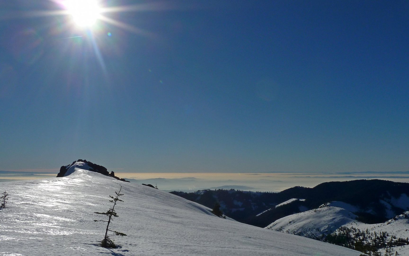
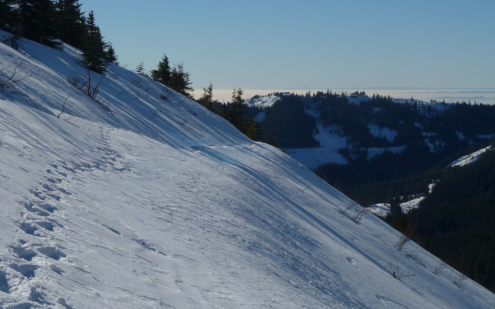
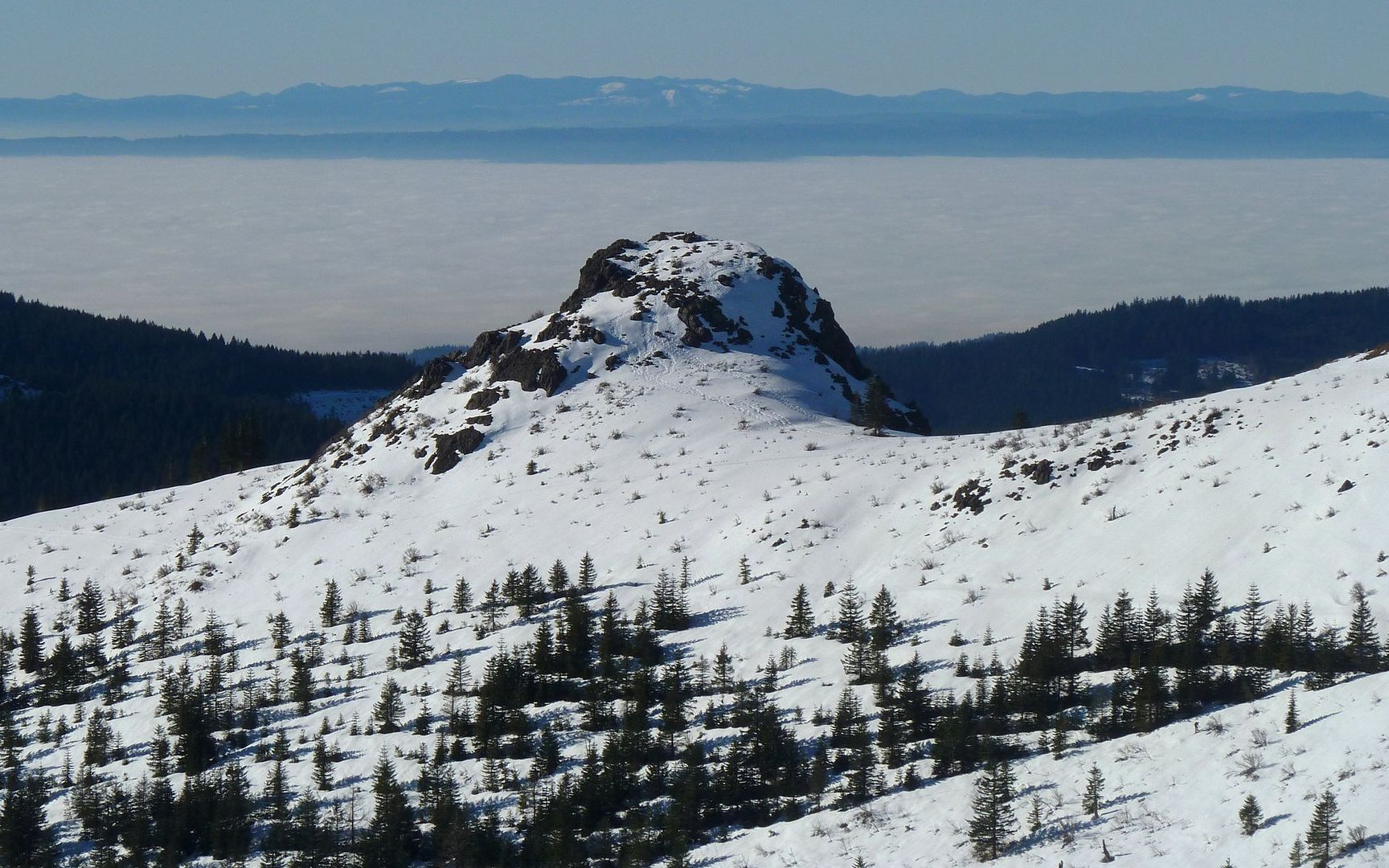
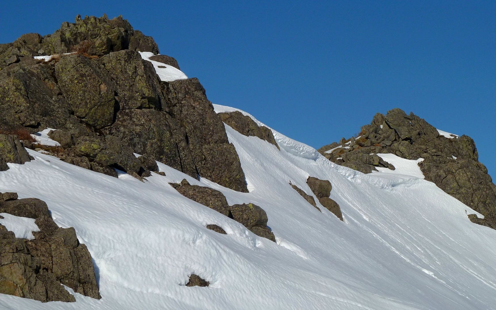
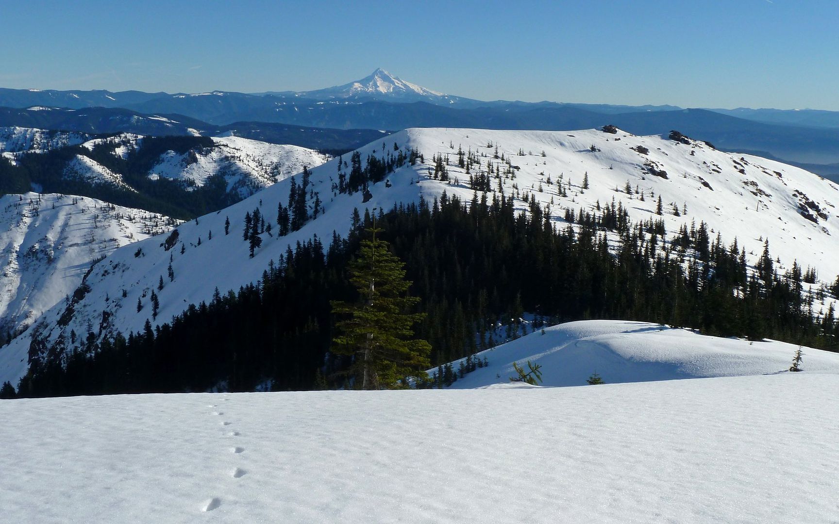
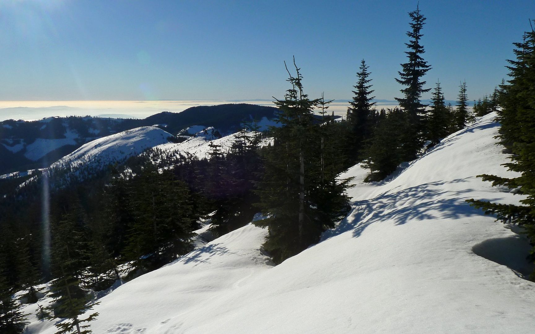
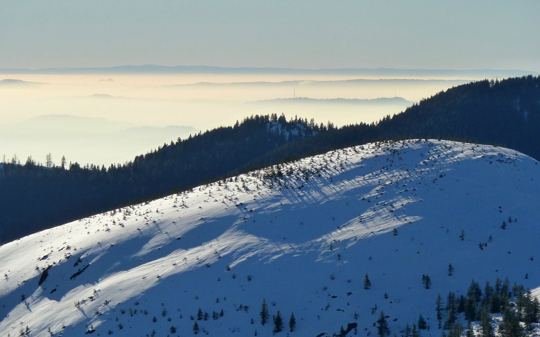
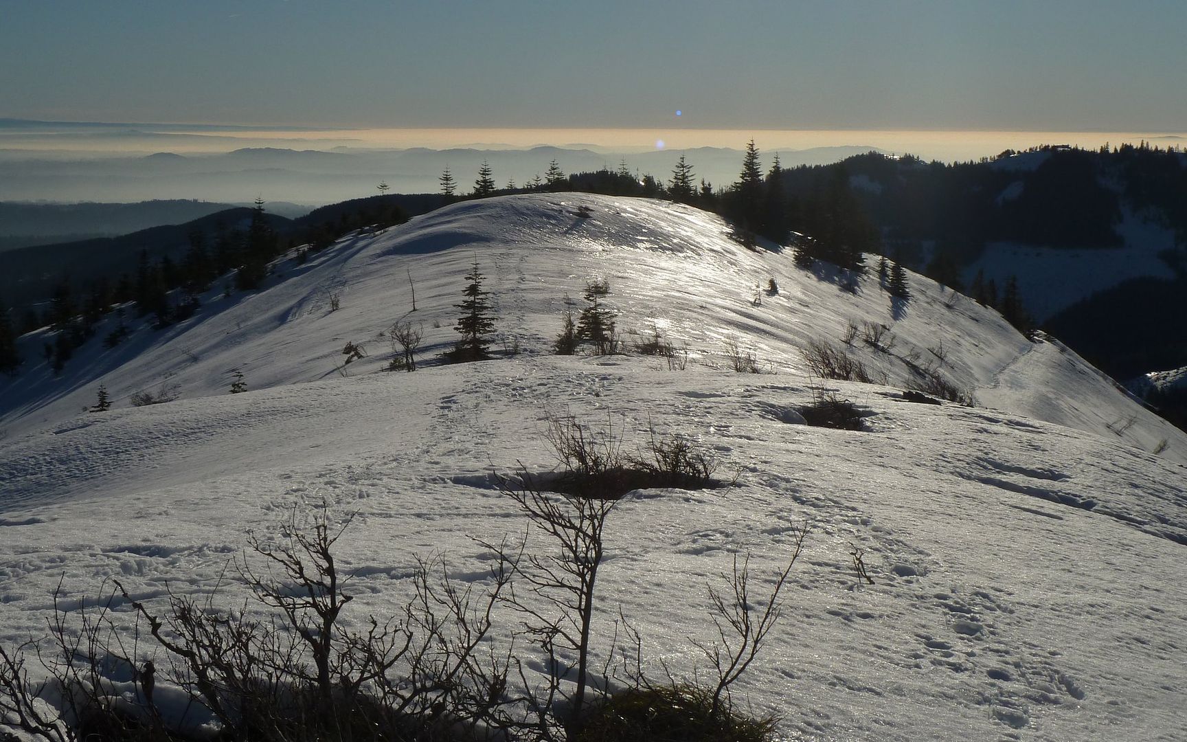
Looking south near the Indian Pits.

Click any photo for a fullscreen enlargement.

The trailhead is at about 1650', and there was a fair bit of snow to start out. The ground was still frozen, but the air was warming quickly. Didn't even consider using gloves or a coat. But did stop to put on the MICROspikes in well under a mile. But in just over 1.5 miles (about 2800'), I started post-holing and had to strap on the showshoes for the very first time! (Actually, I had used them once before - in 1974 - but the technology has <ahem> "advanced" a bit since then!) By now, it was also warm enough to remove my baselayer top, and roll up my sleeves. I'd have zipped off the lower legs too, if they weren't doing such a good job of keeping me out of the snow. :)

Image
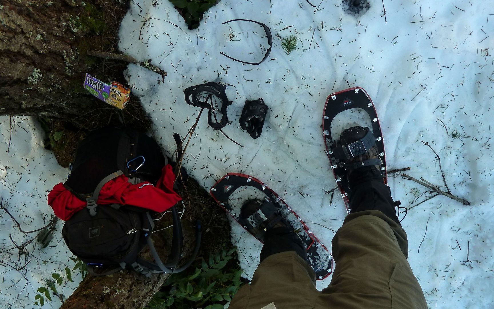
Newb Alert! First time on real snowshoes. This oughta be "an experience!"

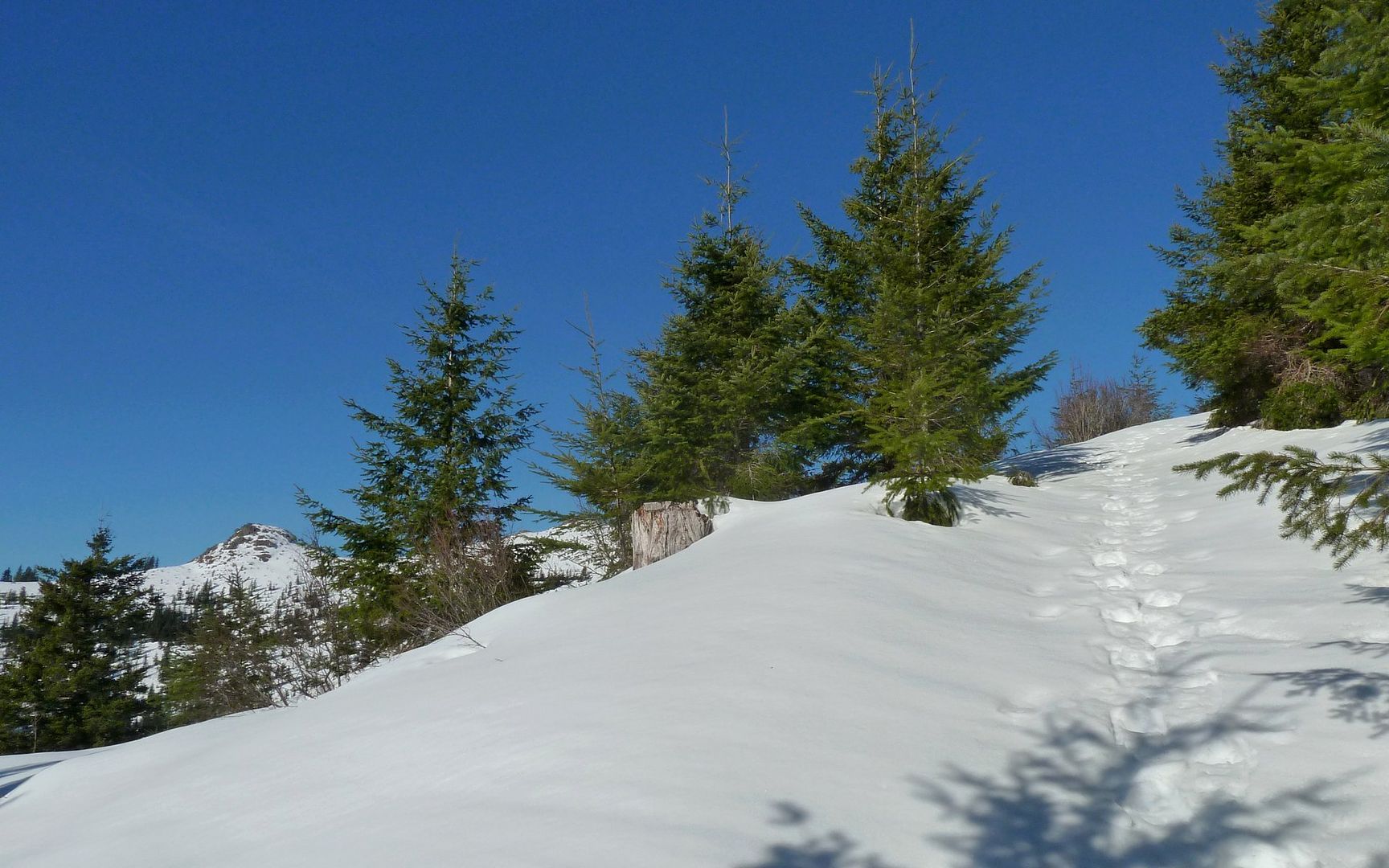
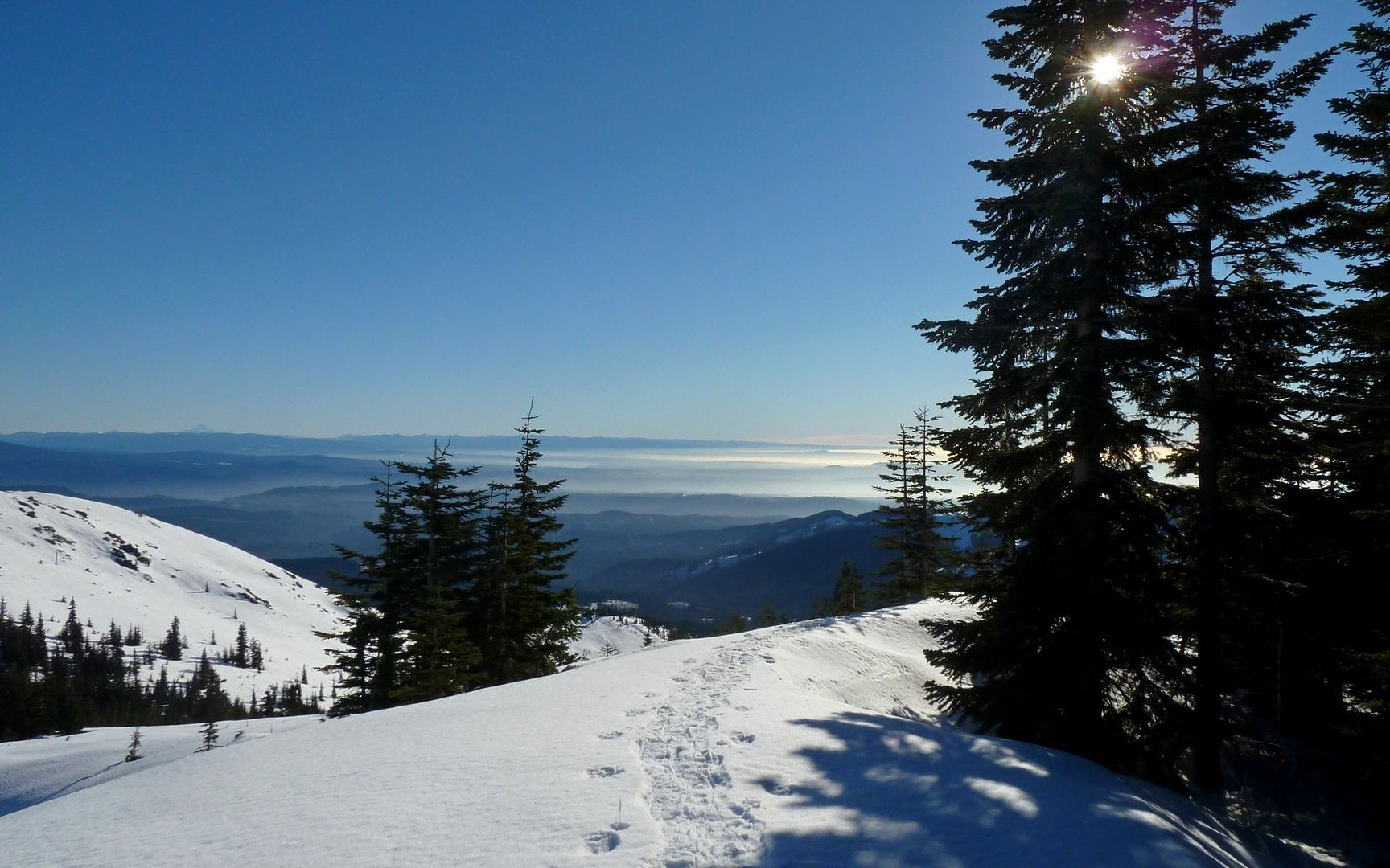
The trail is rather troublesome for the next half-mile or so, as there are a number of places where it's pretty well melted, and you need to plow through the small trees to stay on snow. And some climbing in and out of trenches. Not the best place to re-acquaint oneself with huge paddles on the feet.

Image
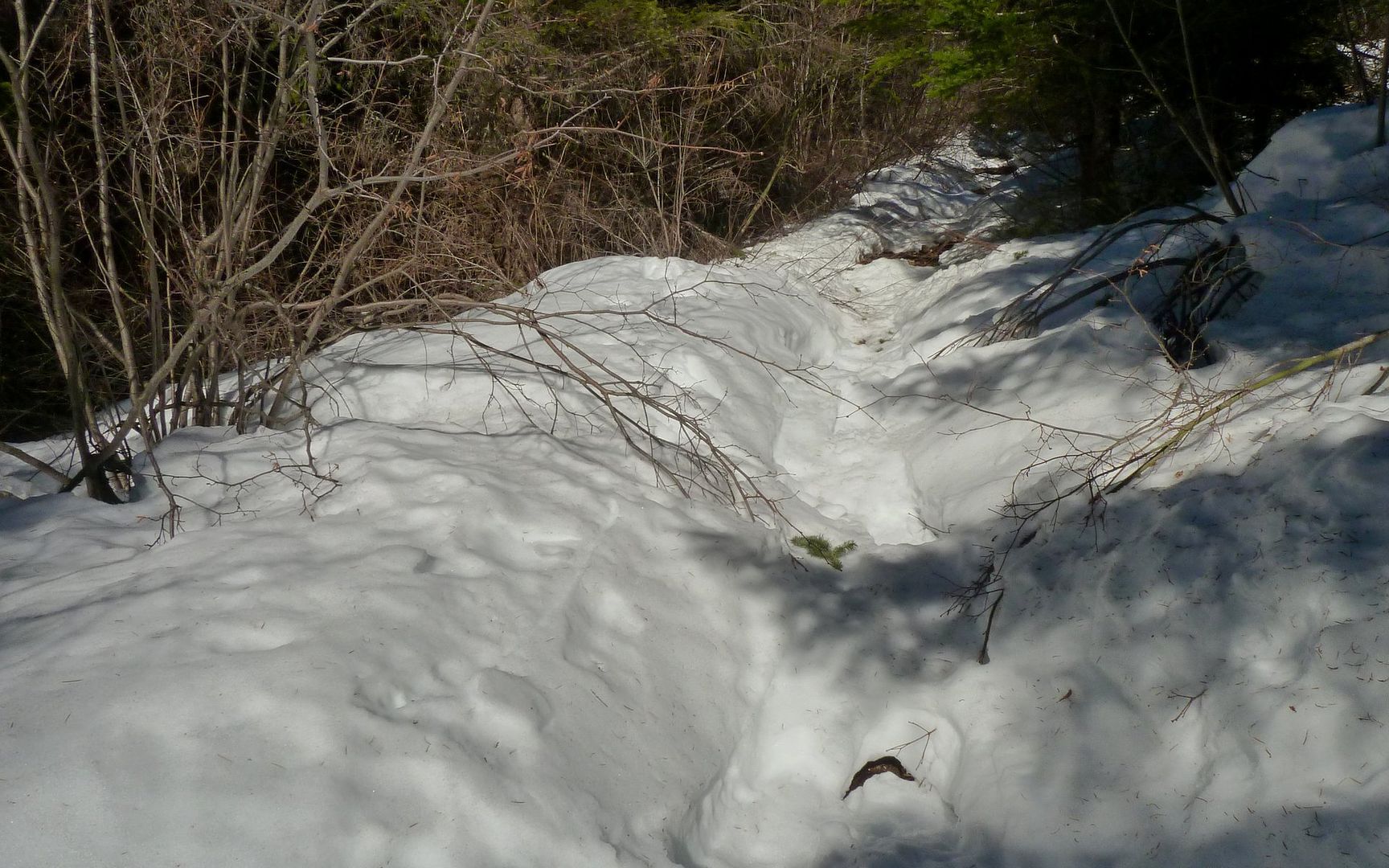
Worst part of the journey, but it doesn't last too long.

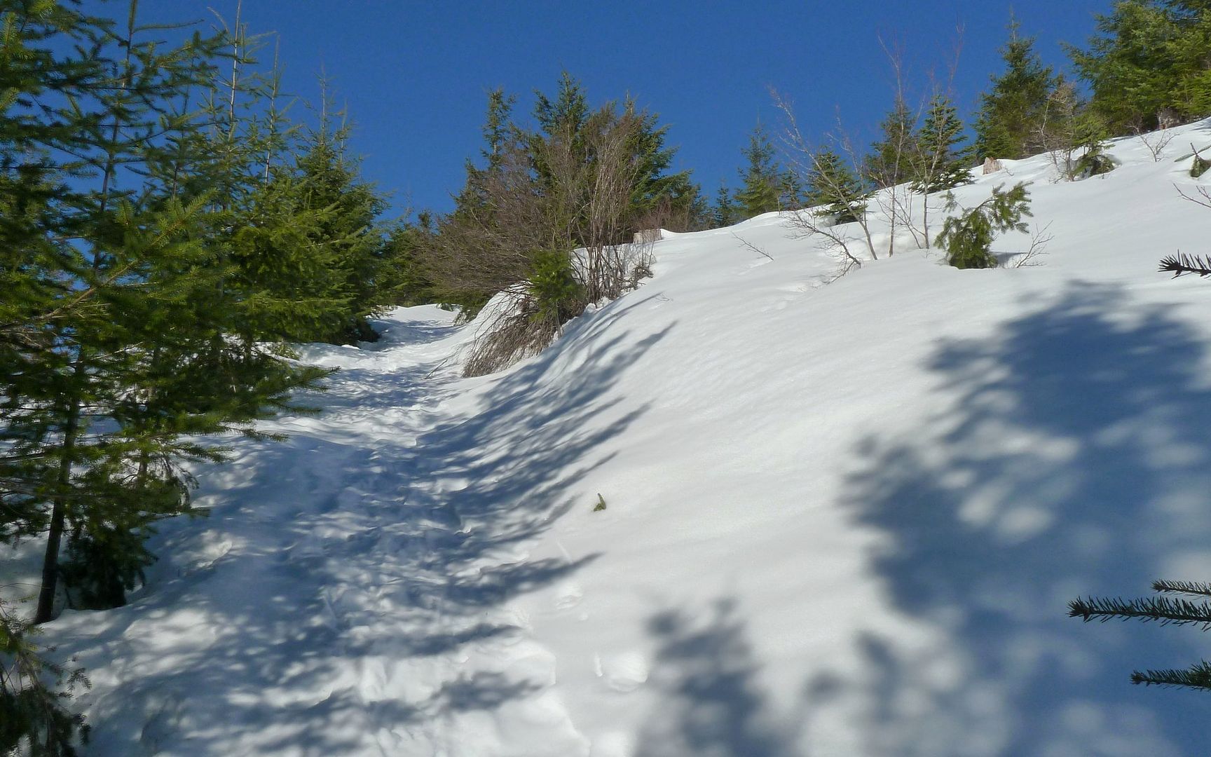
But it soon broke free, into the more treeless realm that is the upper flanks of Silver Star.

Image
2 miles in at 3100'.

Image
First view of Pyramid Rock, over on the Grouse Vista approach.

First major mistake - not packing for summer! I had a fleece stocking cap, and another fleece brimmed cap. Both were way too hot! No regular old baseball cap, to keep the sun off. No sunscream either, but I hate that stuff anyway. No shade from here on...

Image
Jefferson and the Sisters (indiscernable in the photo) in the distance.

The trail ahead was clearly marked by the authors of last week's TRs, though...

Image
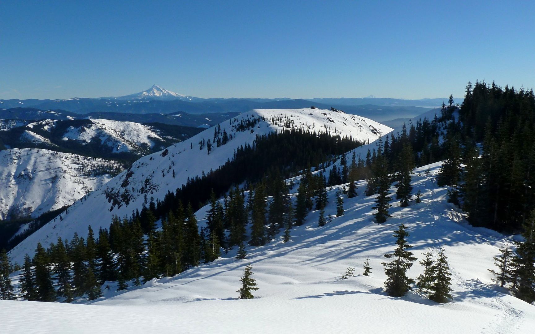
Indian Pits atop knob at middle-left; Star 2 on far left.

Image
Climb up to Indian Pits was 600' in .34 miles! Am I nutz? Kicked me hard. Zoom to see tracks.

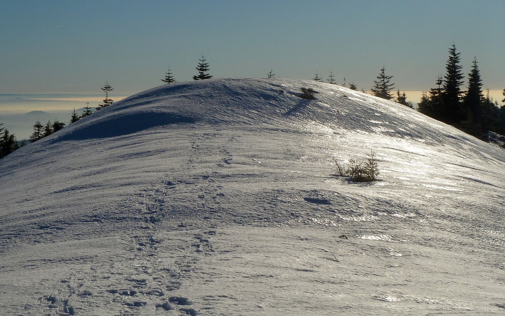
Snow was in great shape, though! Not too icy, and not at all slushy (yet).

Image
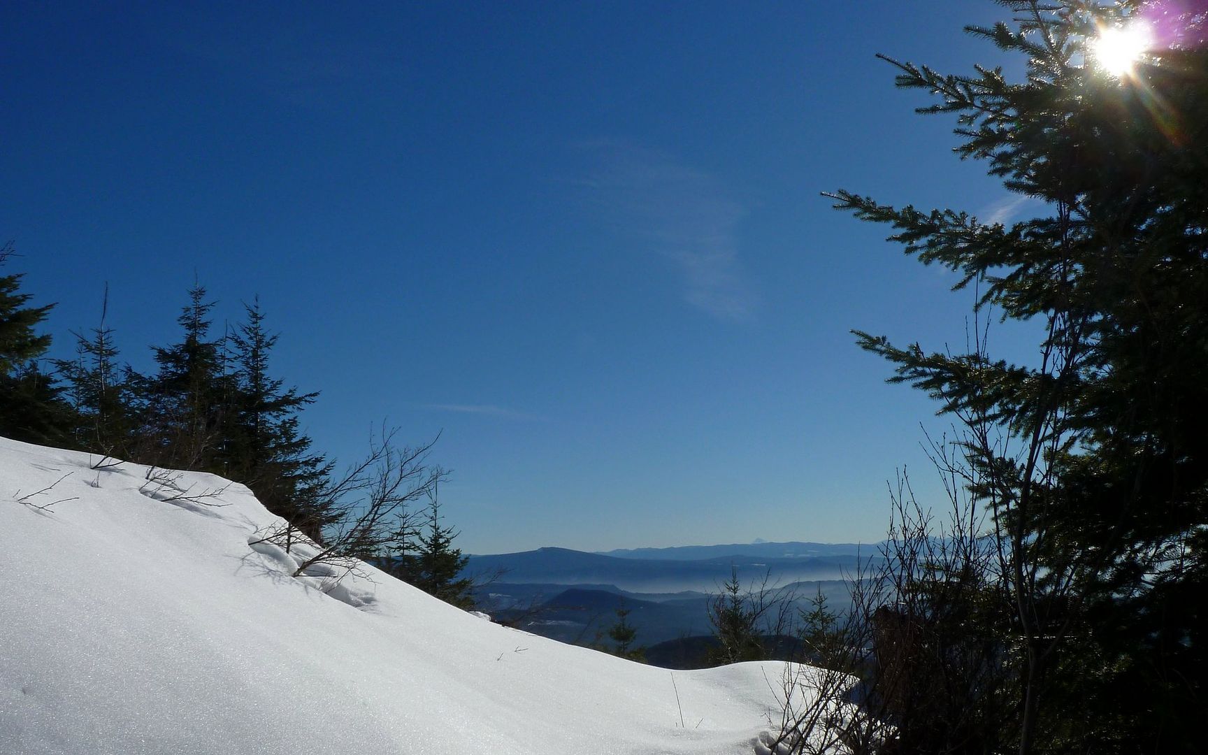
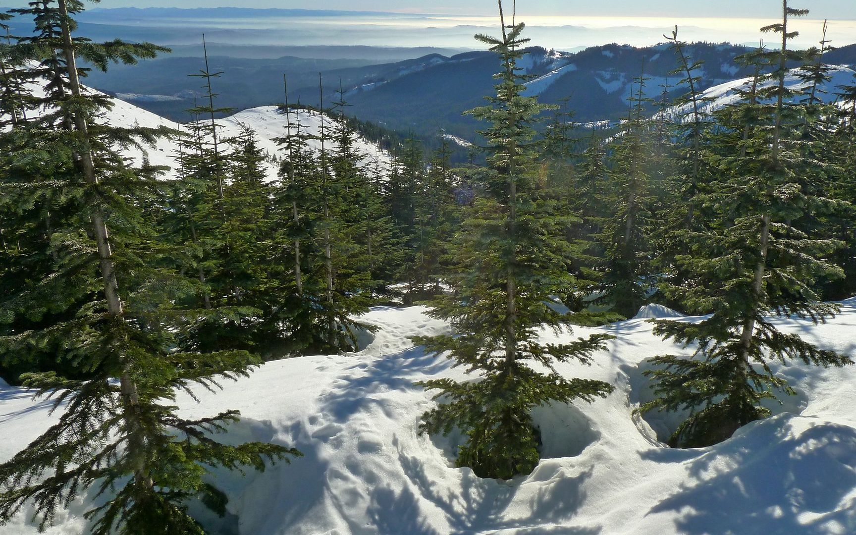
Looking back down the trail, fog enveloping the Portland area.

Image
It was impossible not to take far too many photos!

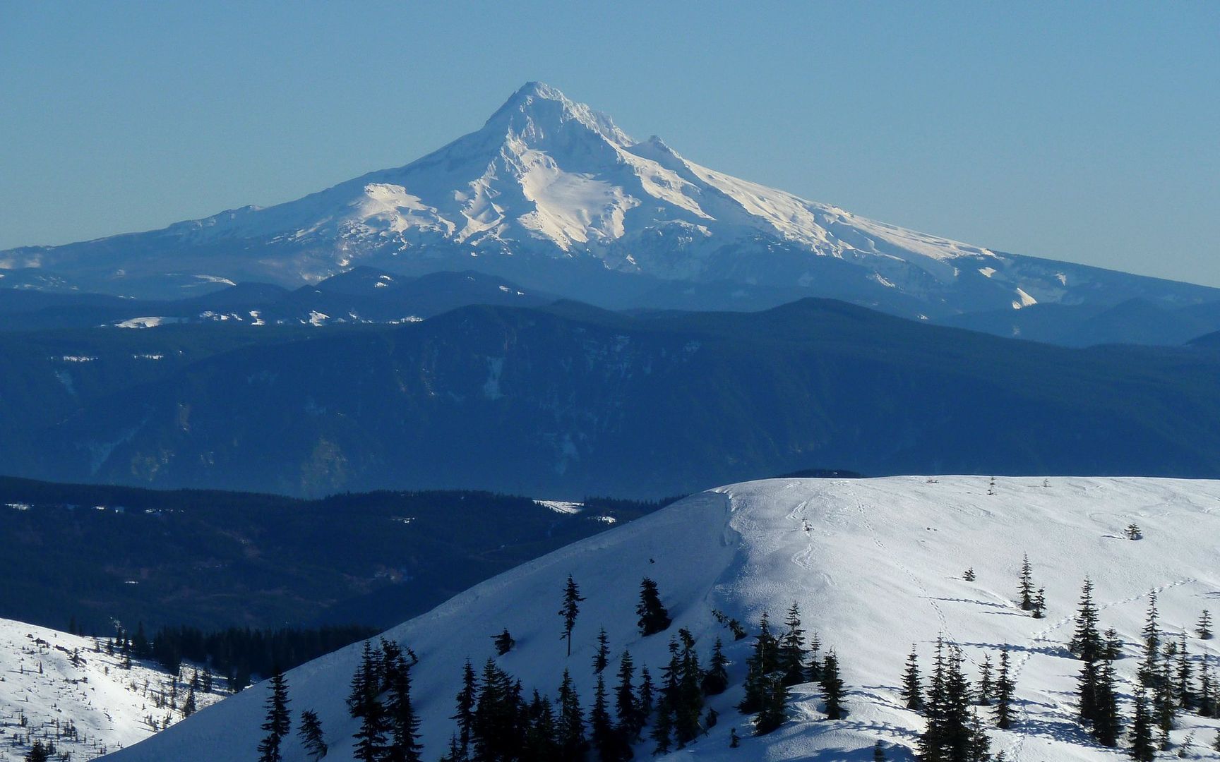
Cresting the ridge that would lead me up to the Indian Pits area, Mt. Hood made its first appearance.

Image
I believe, across the gorge, that's Nesmith Point and Larch Mountain in front of Mt. Hood?

Climbing this ridge was breathtaking. In every imaginable way. Last time I'd used snowshoes, they were made of wood and rawhide! But for scenery like this??? Incredible...

Image
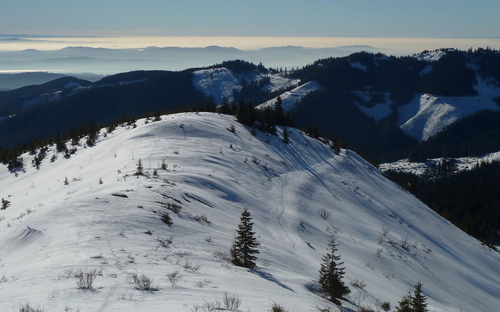
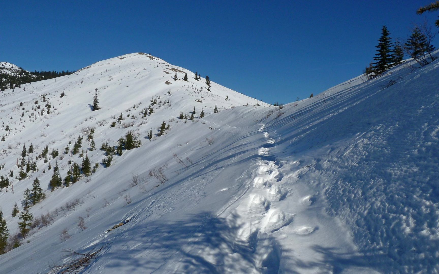
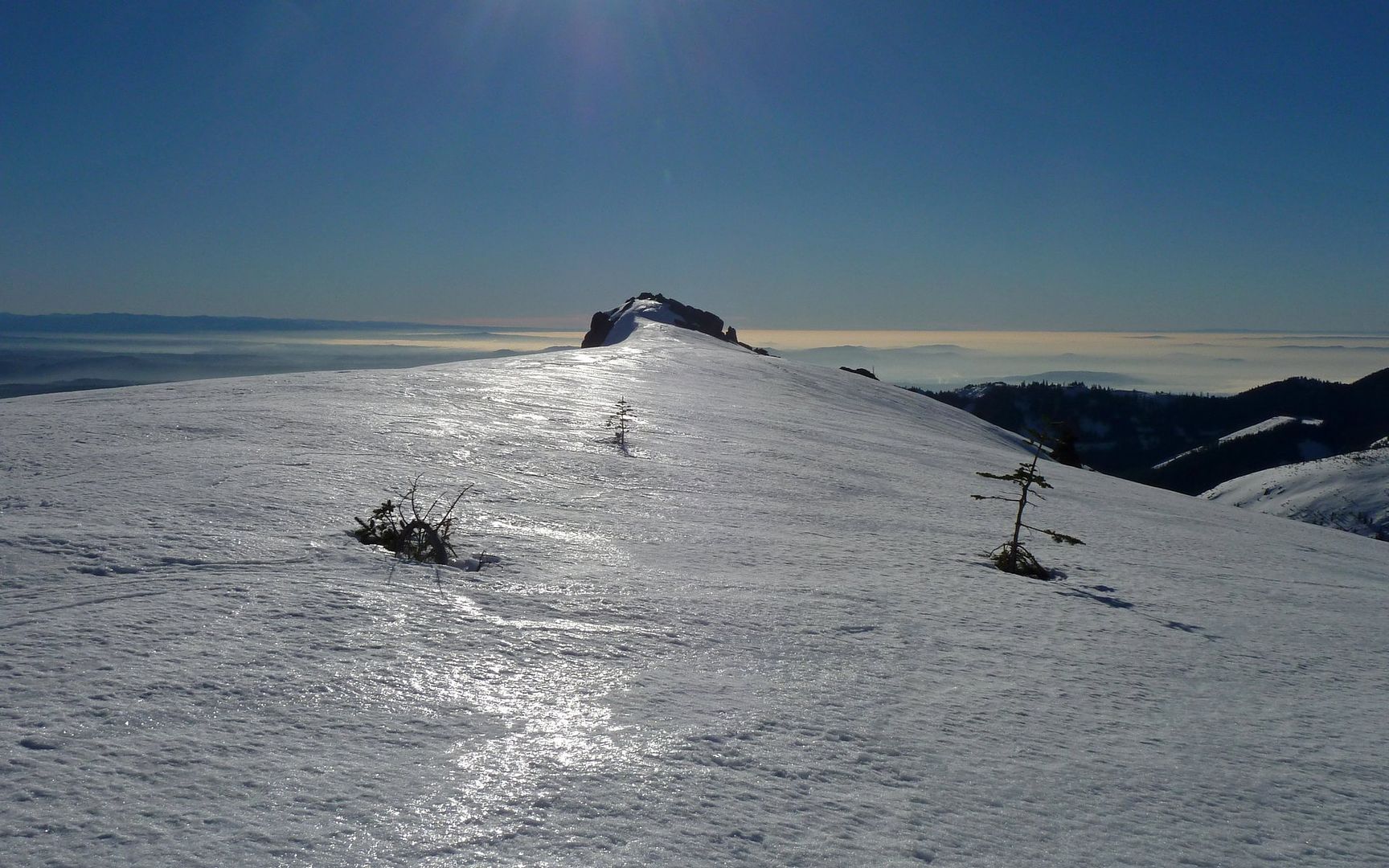
Looking back down the south ridge.

Image
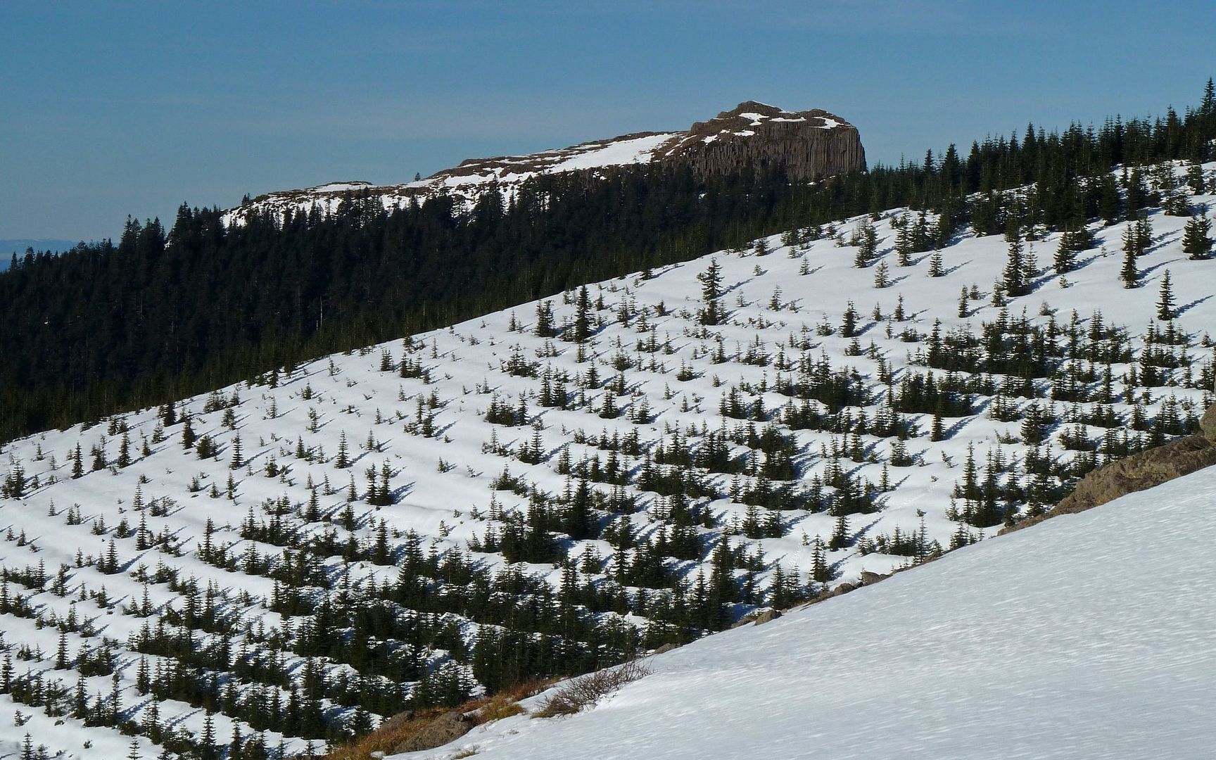
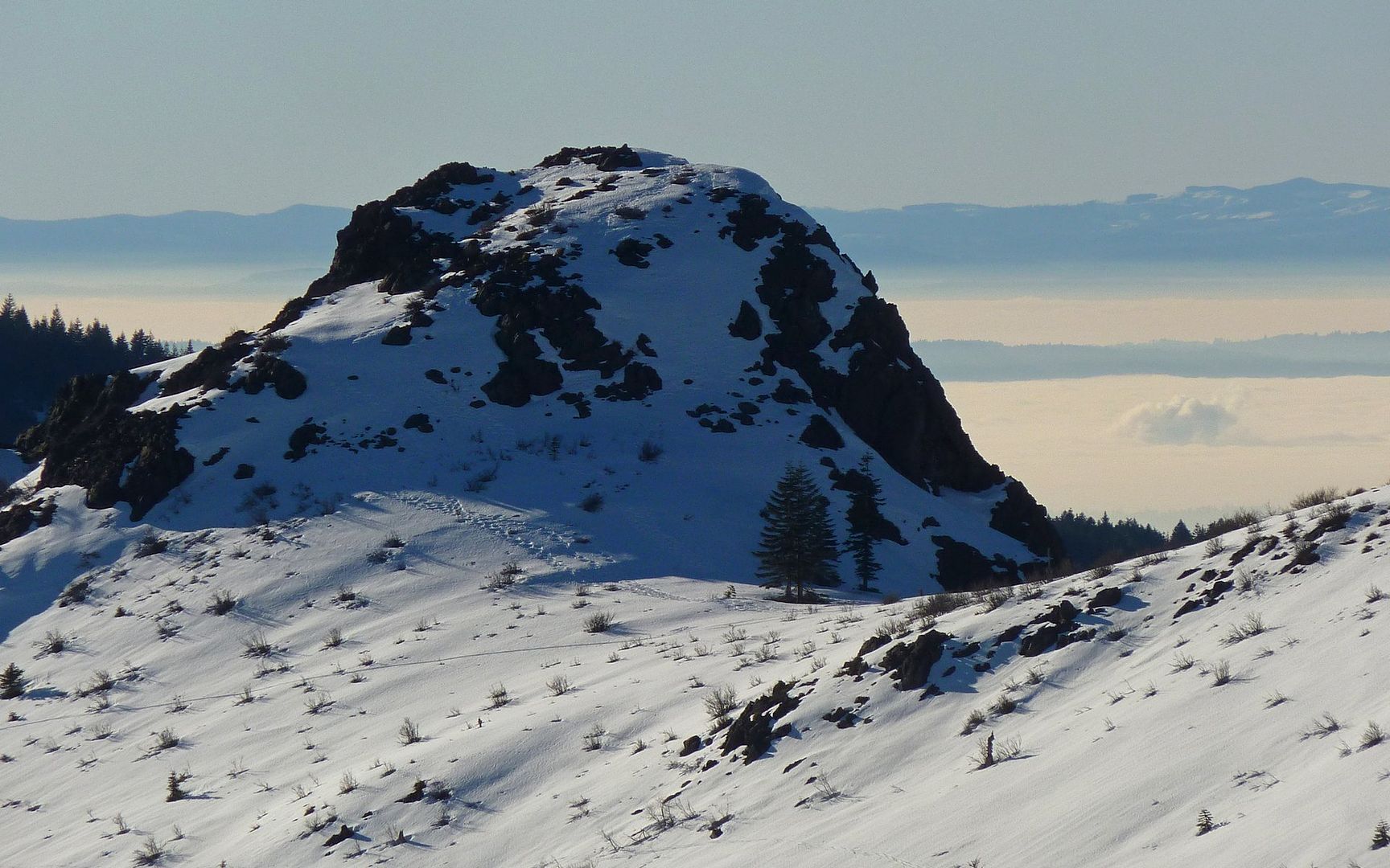
Pyramid Rock. Zoom to see tracks all over it. Haven't seen that TR!

Image
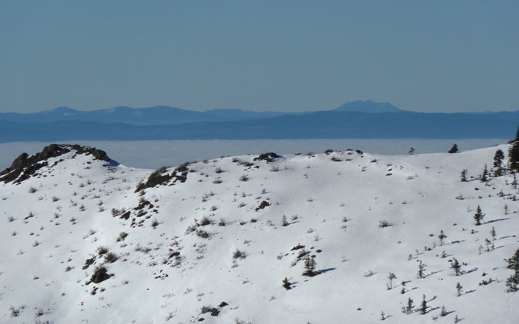
Saddle Mountain in the distance! Clark County in a dense fog.

Image
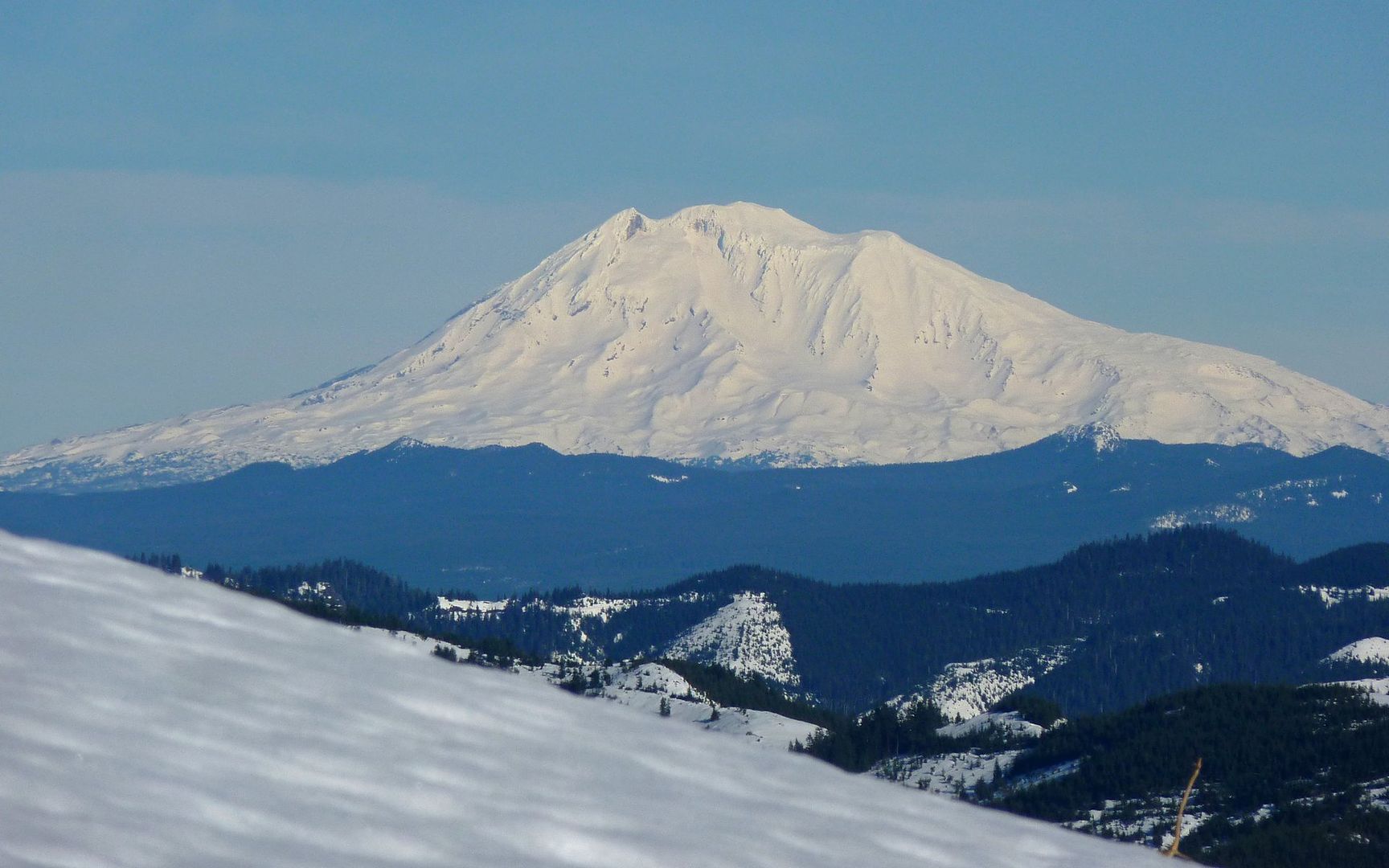
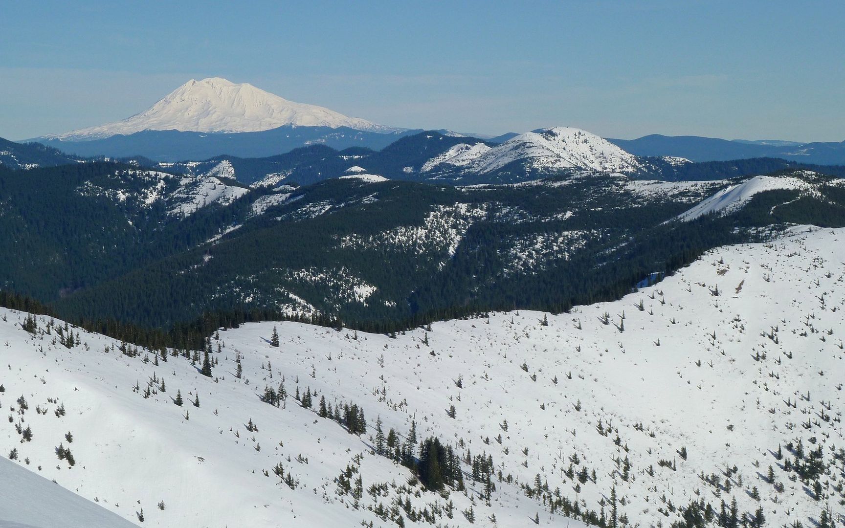
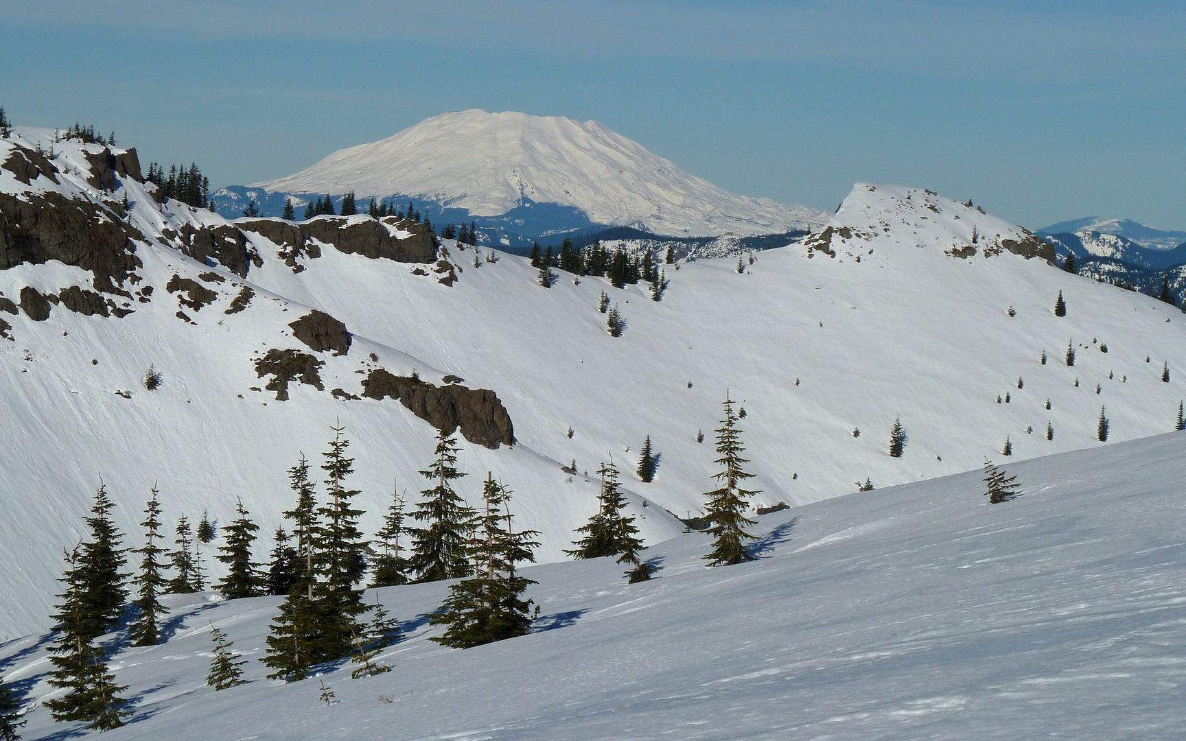
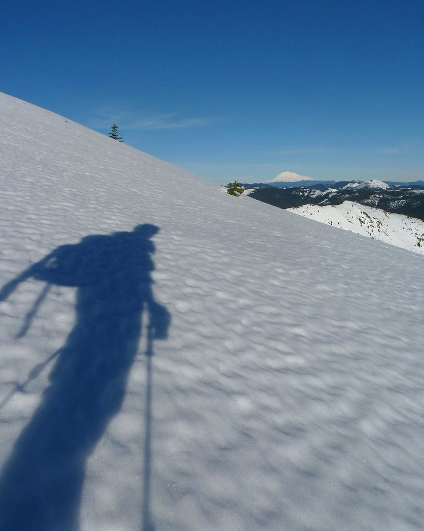
Mt. Adams comes into view.

Image
Sturgeon Rock rising above the linear replanting. My descent would take me through there.

Image
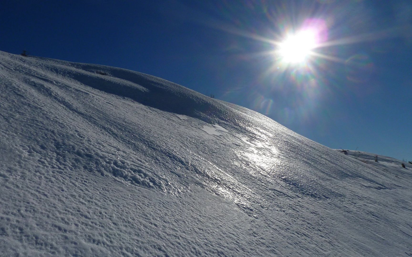
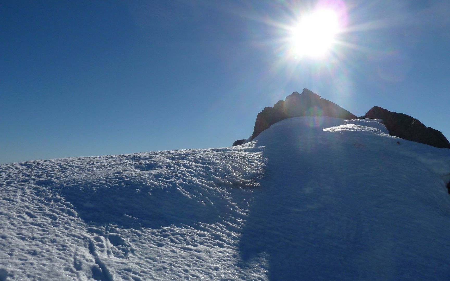
Cool cornices atop the ridge. Almost there!

Image
Last September, I followed that ridge in the foreground, picking huckleberries the whole way to Little Baldy!

On top of the ridge, I couldn't stop taking photos! So worth the effort to get here!!!

Image
:shock:

Image
Star 2, St. Helens, and Rainier.

Unfortunately, it's now 1:40, and I'm wondering if I'll make it to the summit. I definitely want to get out before dark. That drive was just too nasty to not be able to see. :(

But I digress... On with the show!

Image
Zoom on St. Helens.


Image
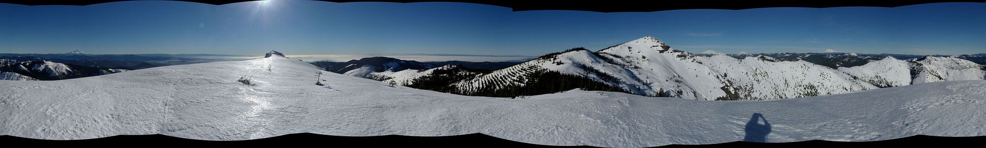
360° Panorama. Click photo for still image, or... 54-Megapixel Interactive Photosynth.


Image
Pretty harsh, but beautiful, environment! Wish I had a cap with a visor!

Image
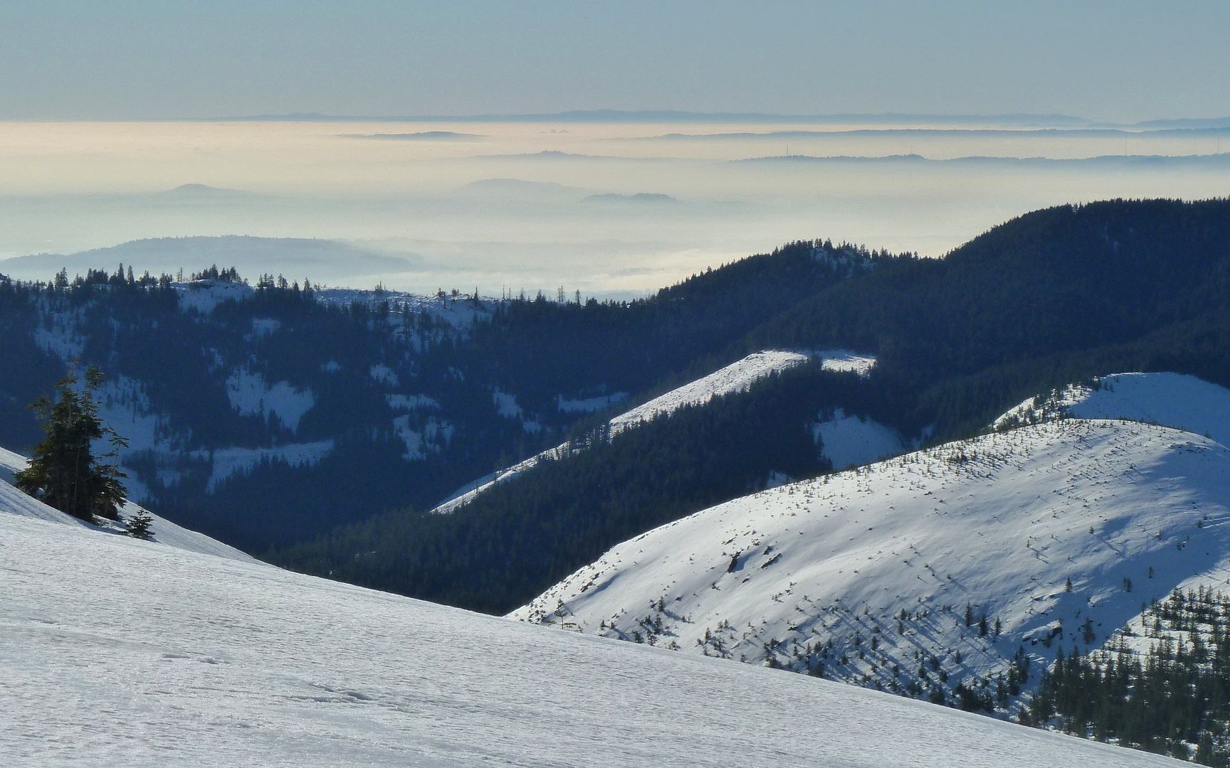
The fog doesn't seem to be letting up in the city, at all.

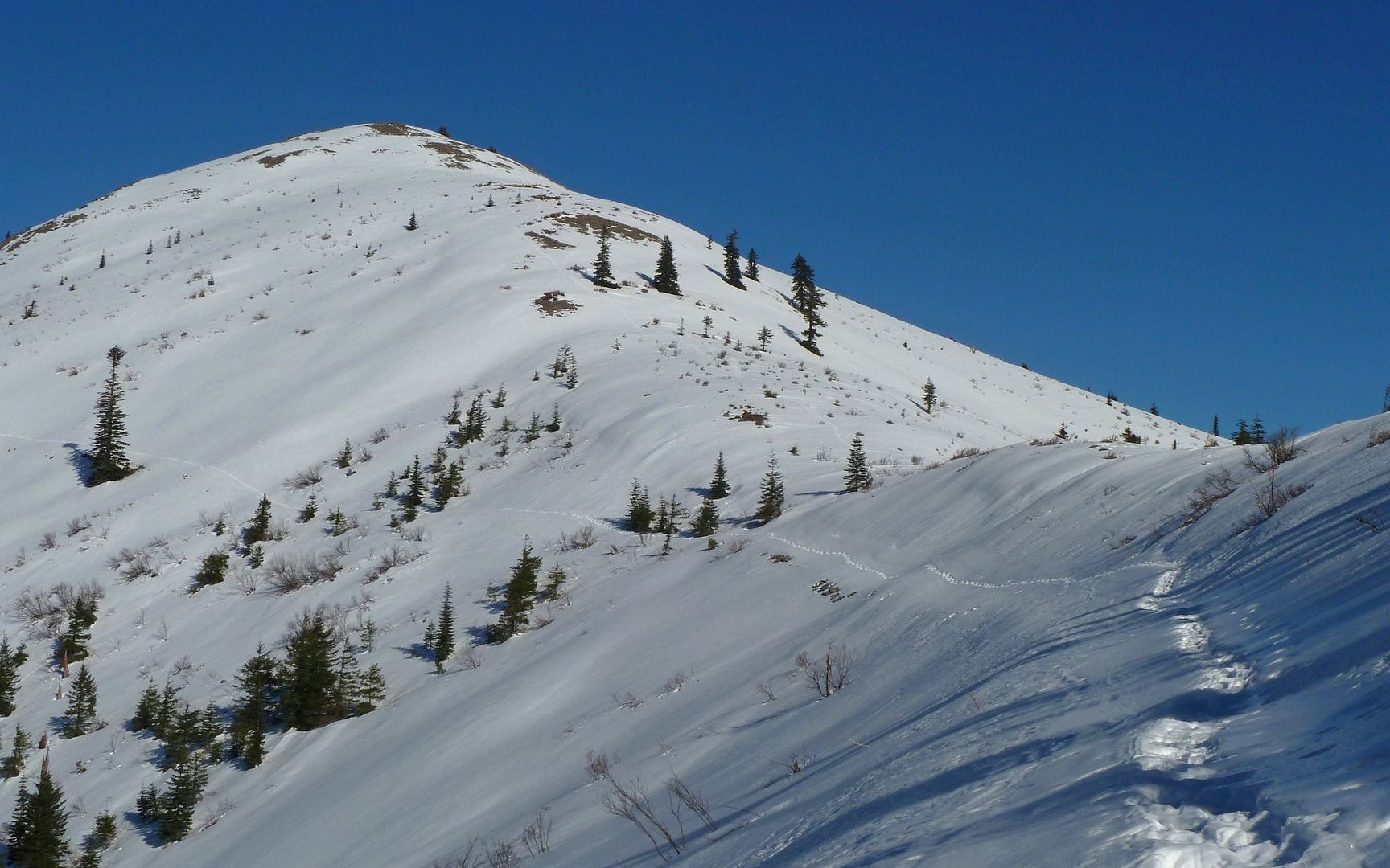
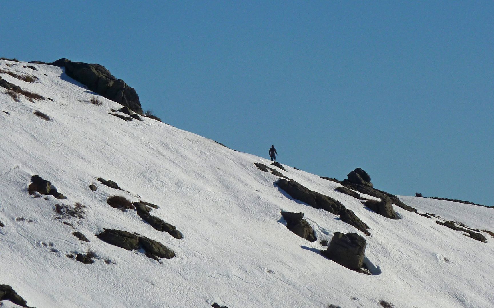
So I leave the ridge, heading north towards the summit. I spot an outcropping partway up, and decide that'll make a nice stopping point if I hit my turn around time, and push on.

Image
No idea what made those tracks heading down over the edge.

Image
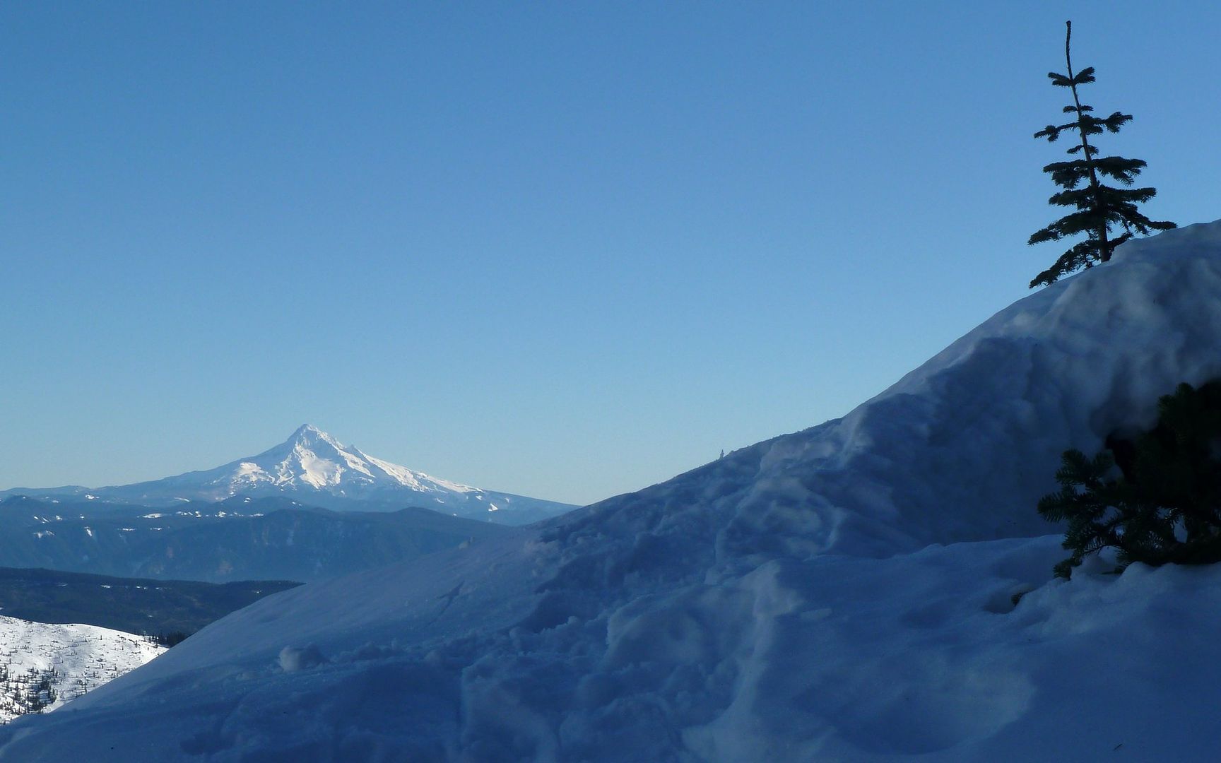
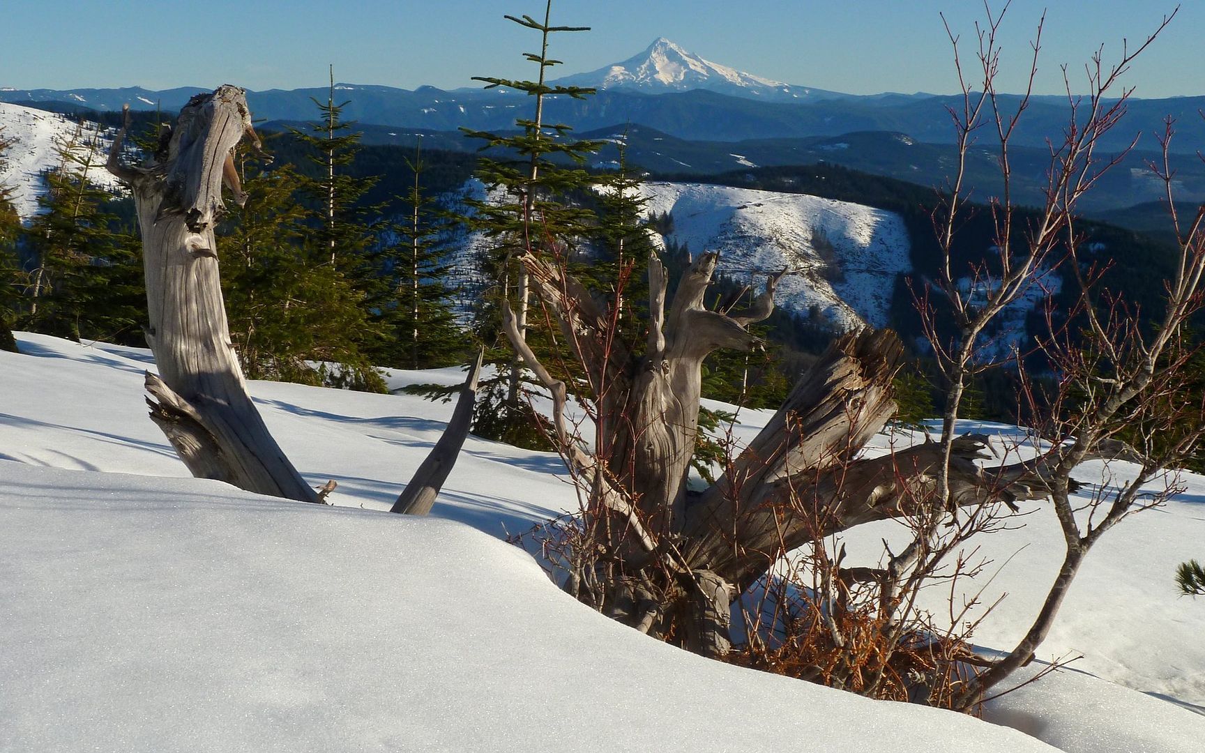
Mt. Hood rising above the Indian Pits ridge. My tracks were the higher line of the two.

Image
Looking back at where I'd come from, again.

Image
I'd have probably made better time if I weren't documenting every little hill and vale. Heheh...

Alas, I had told myself I'd turn around at 2:30, regardless of where I was. Wanted to be sure I was back at the Jeep by 4:30. So, 0.1 miles and 300' short of the summit, I made that hardest of decisions. Back down I go! I know that seems pretty darn close, and it was! But the final slope was somewhere in the 45-55% range. There was a roundabout way, that would've been 4x as far. Probably just as quick. Ah well...

Image
Walking directly into the sun now. The temperature is hovering right around 60°F.

Image
Weak attempt at a VanMarmot style self-portrait! :)

Image
The other group, who I'd last seen at the TH, was now near the Indian Pits. (Hey, mandrake!)

I was about to be reminded of why they taught us in Boy Scouts that you shouldn't go snowshoeing alone. My descent route was through that uniquely linear replanting area. Lots of trees. Lots of treewells! 'Nuf said? :oops:

Image
No mistaking you're in a "planned environment" here.

Image
Fog seems to be getting even thicker, if that's possible, down in the cities.

Image
I think it was VMs tracks I was following through here? Two days of sun later.

Image
So, would you have walked over this, to the right, after taking its picture? Whoooomp!
Sunk in to my armpits!!! Crap... Snowshoes prevented an easy escape, of course.
Took a fair bit of work to get my sorry arse outta there.


Obviously, I lived to tell about it. :)

Image
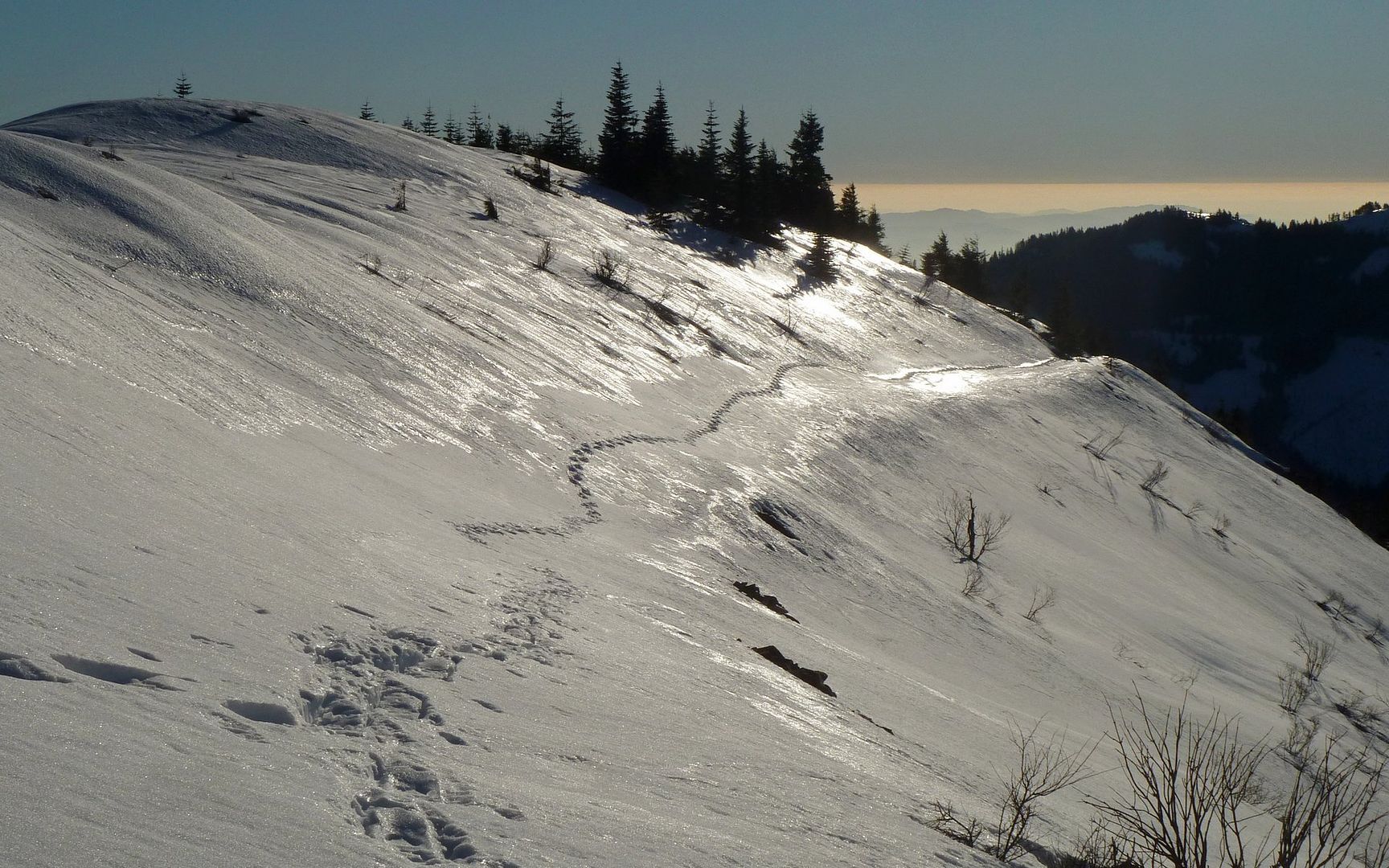
The remainder of the descent was, thankfully, uneventful.

Image
The valley fog was simply amazing!

Image
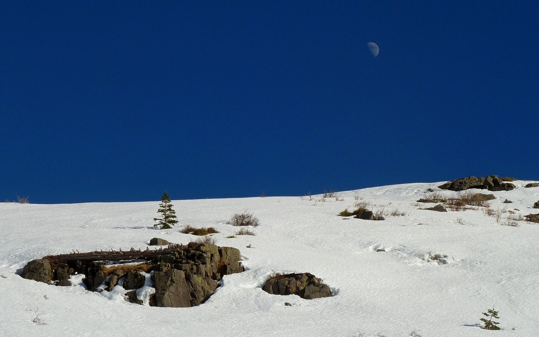
There was a beautiful moon rising over the ridge I'd traversed.

Image
The steam-generating plant on Lower River Road raises a plume behind Pyramid Rock.

Image
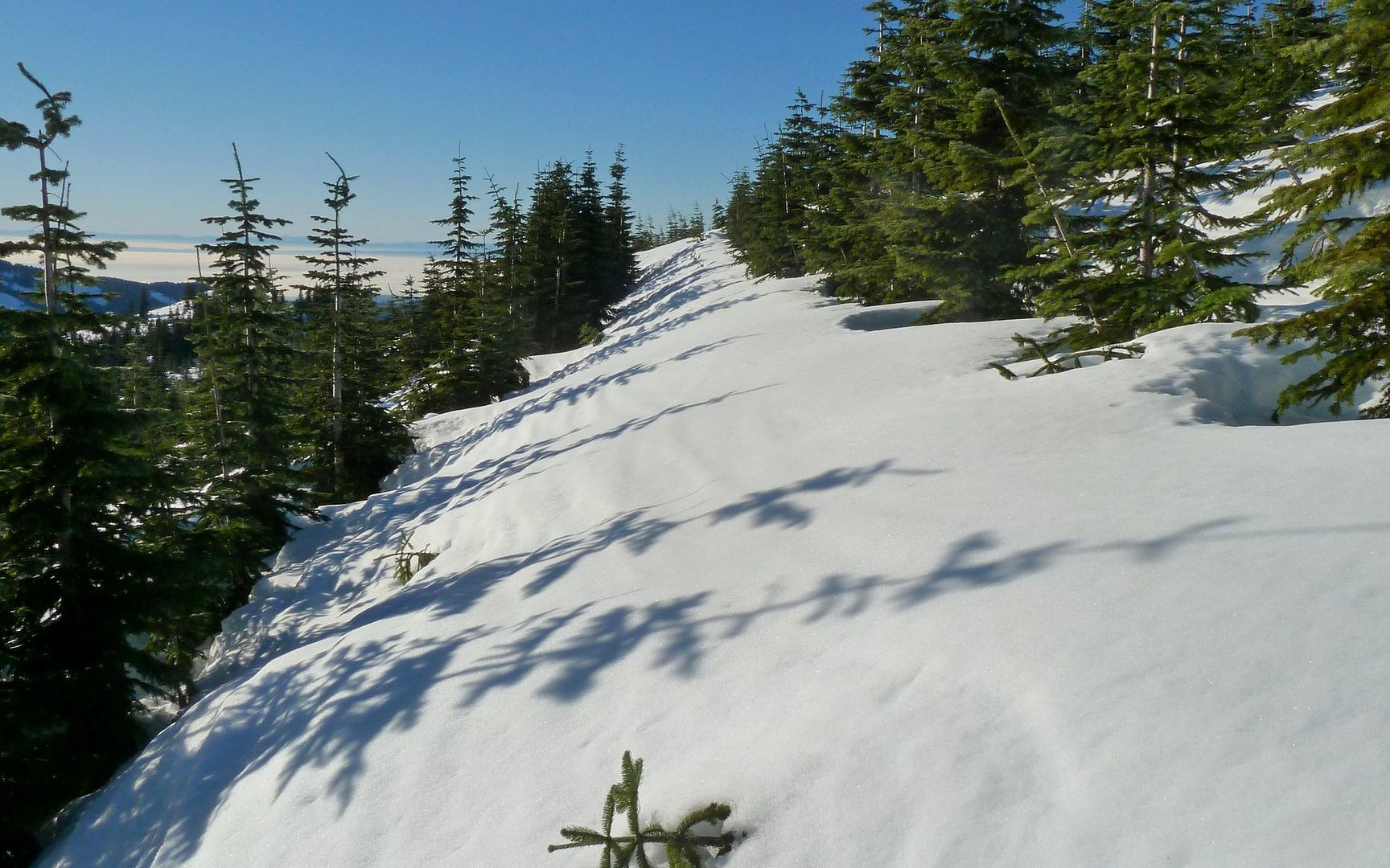
Here, I climbed back up to that ridge, and followed it down rather than the trail I'd come up.

Image
Goodness in every direction on Silver Star!

Image
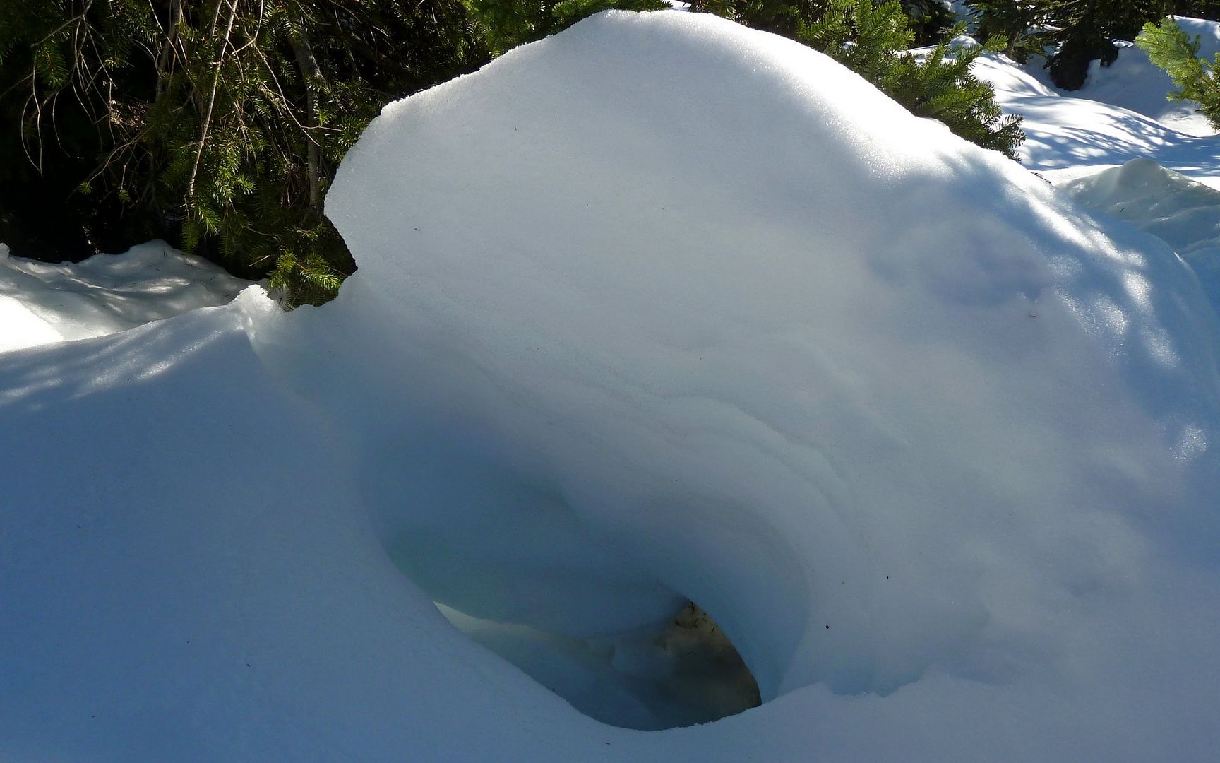
Cool ice dome at end of ridge.

Image
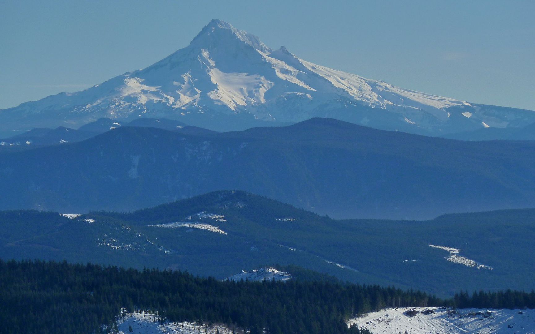
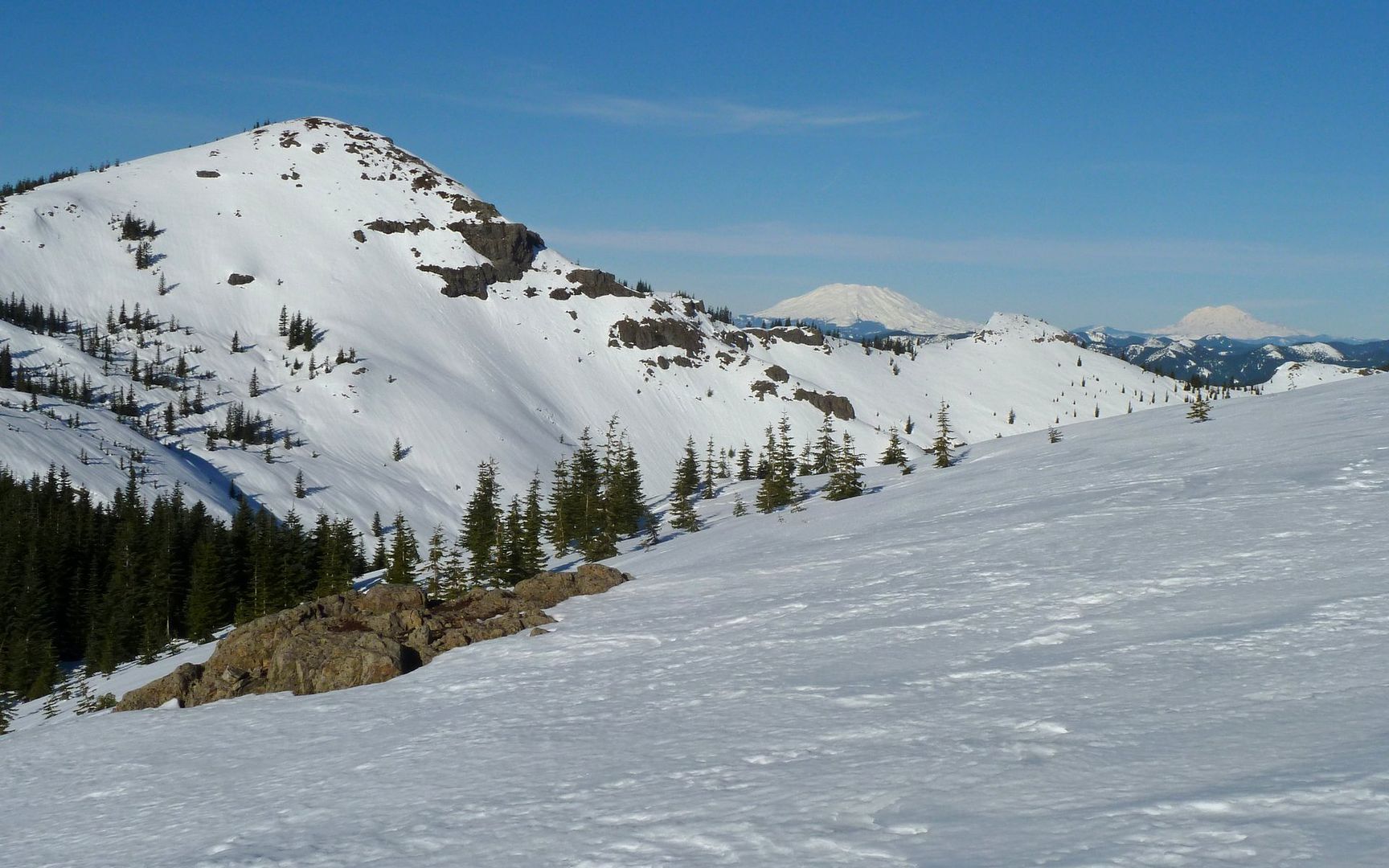
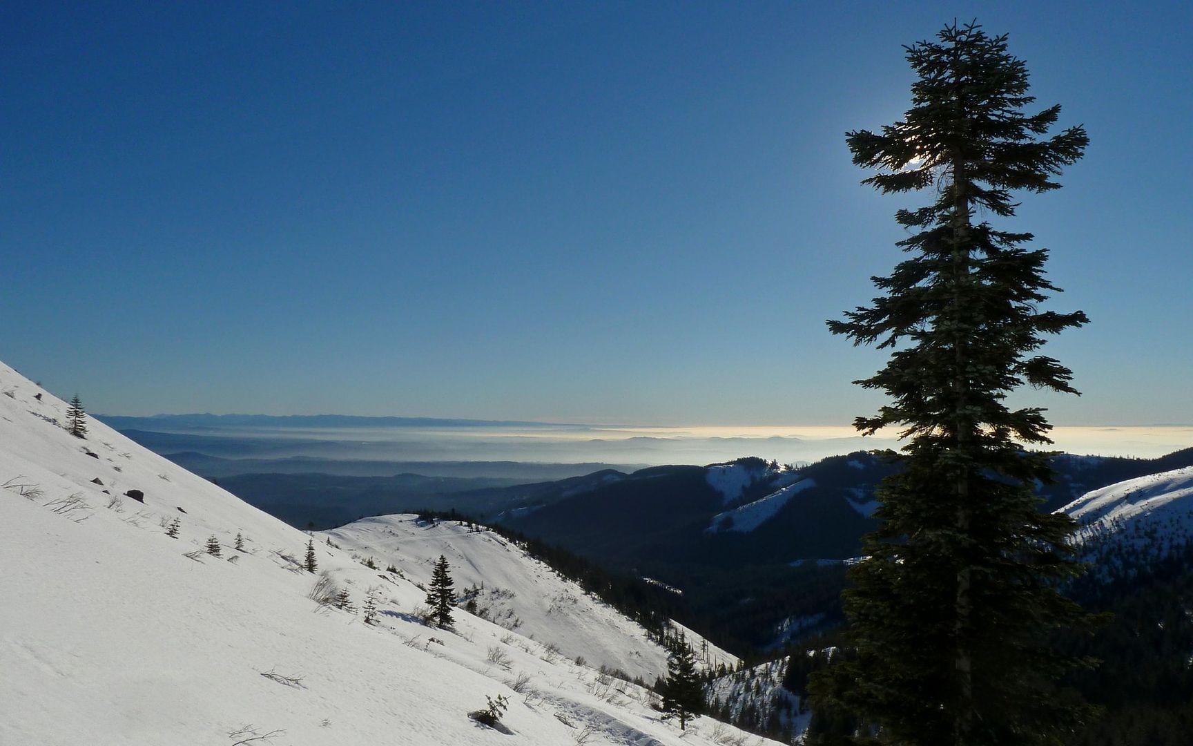
Parting shot of a distant volcano.

I kept my snowshoes on until about 2200' on descent. At that point, the trail was perhaps 25-30% uncovered. In all, it was about 7.5 miles and 2800' of EG. Some of the hardest 7.5 miles I've done! But totally worth it. :D

http://gpsfly.org/gps_map.php?gps_id=2044&w=645&h=440
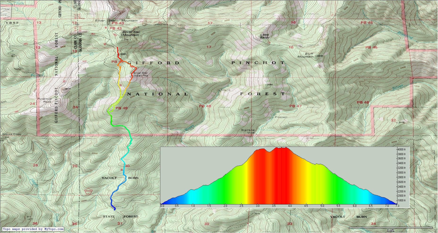
Image
Click map to zoom.

What a great day in, and especially out of, the woods! :D
Last edited by kepPNW on January 21st, 2013, 10:23 pm, edited 1 time in total.
Karl
Back on the trail, again...

User avatar
Peder
Posts: 3401
Joined: May 28th, 2008, 10:02 pm
Location: Lake Oswego

Re: Silver Star, South Ridge, 19-Jan-2013

Post by Peder » January 21st, 2013, 5:09 pm

That drive was just too nasty to not be able to see.
Sometimes you do not want to see...

Great TR and fantastic weather. Congratulations on joining the group of newbie showshoers, only 38 years late!
Some people are really fit at eighty; thankfully I still have many years to get into shape…

pablo
Posts: 1451
Joined: May 28th, 2008, 10:03 pm

Re: Silver Star, South Ridge, 19-Jan-2013

Post by pablo » January 21st, 2013, 5:25 pm

Hey Karl,

What a great set of photos, thx for the report. Looks like I see bare rock on the slope up to the pits where it was all covered when I went through there a couple of weeks ago. I'm looking at the weather report - all these clear blue sky trip reports are going away very soon, like tomorrow - glad you got out there while the gettin' was good.

--Paul
The future's uncertain and the end is always near.

User avatar
weathercrazy
Posts: 1478
Joined: May 28th, 2008, 10:03 pm
Location: Battle Ground, Washington
Contact:

Re: Silver Star, South Ridge, 19-Jan-2013

Post by weathercrazy » January 21st, 2013, 6:22 pm

That's my kind of trip report! Lots of photos! Sun and snow to boot!

mandrake
Posts: 389
Joined: May 28th, 2008, 10:03 pm
Location: Portland, OR

Re: Silver Star, South Ridge, 19-Jan-2013

Post by mandrake » January 21st, 2013, 7:25 pm

Great pics, Karl! Nice running into you up there!

We too were inspired by recent TRs on portlandhikers (big thanks to Pablo, VM and acorn) -- and given the amazing weather conditions, headed up the south ridge on Saturday equipped for a lux-style snow camp up near the Indian Pits. Found a nice spot, dug out some tent platforms, then headed on over to tag the summit; back to camp for happy hour, sunset and dinner. Wind came up a bit during the night, but it was totally worth it. We headed down via the SW ridge to Grouse Vista then hiked back along the road. (Found a water bottle over near Pyramid Rock incidentally -- PM me with description to claim.) Karl's already done a magnificent job of capturing the day up there, so I'll just add a couple more shots here.
IMG_0028.jpg
Returning to camp...
IMG_0050.jpg
Morning light
IMG_0065.jpg
IMG_0068.jpg

User avatar
Eric Peterson
Posts: 4097
Joined: May 11th, 2009, 5:39 am
Location: Oregon
Contact:

Re: Silver Star, South Ridge, 19-Jan-2013

Post by Eric Peterson » January 21st, 2013, 7:38 pm

!

Only been to the Silver Star area once lifetime on a DN led loop!

Need to get back there soon!

Excellent TR and photo bomb :)

User avatar
Splintercat
Posts: 8334
Joined: May 28th, 2008, 10:03 pm
Location: Portland
Contact:

Re: Silver Star, South Ridge, 19-Jan-2013

Post by Splintercat » January 21st, 2013, 7:39 pm

Thanks, Karl - great report! :)
Sturgeon Rock rising above the linear replanting. My descent would take me through there.
Anyone know the story behind this? I've always been baffled -- seems like a really bad idea, if you're trying to reestablish a forest (as opposed to corn).

Tom

User avatar
kepPNW
Posts: 6411
Joined: June 21st, 2012, 9:55 am
Location: Salmon Creek

Re: Silver Star, South Ridge, 19-Jan-2013

Post by kepPNW » January 21st, 2013, 10:42 pm

Thanks to all, for the very kind words! :)
Peder wrote:Congratulations on joining the group of newbie showshoers, only 38 years late!
The whole theory of my "Back on the Trail, Again!" revolves around that - better late than never! :D And I'll tell ya what -- these newfangled aluminum snowshoes got a lot to offer over the old 4' long wooden ones! Glad to be back. (Despite the tree-well fail. ;))
pablo wrote:Looks like I see bare rock on the slope up to the pits where it was all covered when I went through there a couple of weeks ago.
That can't have been a couple weeks ago, could it, Paul? Your report was my inspiration to this this one now. Yeah, that climb up the ridge definitely had a few bald spots, some actually rather sizable. Was totally able to stay on snow the whole way up, though. The lower (flatter) portion of the ridge actually had a few holes, as well. Today would've been another good day up there, or anywhere high. Wish I hadn't been tied to a darn computer all day!
weathercrazy wrote:That's my kind of trip report! Lots of photos! Sun and snow to boot!
My kind of day! Not as dramatic as your recent day on Hamilton, but pretty awesome in its own right.

(Responses like yours will only encourage me, y'know? ;))
mandrake wrote:Great pics, Karl! Nice running into you up there! ... We headed down via the SW ridge to Grouse Vista then hiked back along the road. (Found a water bottle over near Pyramid Rock incidentally -- PM me with description to claim.)
Great meeting you there, too! Sorry I really didn't get to make acquaintance with the rest of your group. It looks like you guys had one of the most awesome nights possible up there! Wonderful photos! Cool loop, too. Wish I'd had more time there. I did notice there were a few tracks over there on Pyramid Rock, but haven't seen any reports here claiming them. It even looked like a solitary set of ski tracks going down from there, too. Hmmmm...
Eric Peterson wrote:!

Only been to the Silver Star area once lifetime on a DN led loop!

Need to get back there soon!

Excellent TR and photo bomb :)
If you're ever looking for a supporting cast member, man, give a shout! I'm always up for that hill. But I suppose that needn't be said, huh? Heheheh... I've come at it from 3.5 different angles this last year, but there's still (at least) one that needs more exploring. :)
Splintercat wrote:Anyone know the story behind this? I've always been baffled -- seems like a really bad idea, if you're trying to reestablish a forest (as opposed to corn).
That one's baffled me, too. Walking through it, it's just like a Xmas tree farm. Only more organized! And just one slope. Go figure, huh?
Karl
Back on the trail, again...

User avatar
Roy
Posts: 2824
Joined: January 25th, 2010, 6:35 pm

Re: Silver Star, South Ridge, 19-Jan-2013

Post by Roy » January 22nd, 2013, 11:58 pm

I like to see multiple trs of hikes if no one posts who knows the conditions of roads and the hike without a tr. If Pablo had not posted this the assault on the south ridge would have never have came to be. That is a good thing. I recently posted a Hamilton mt hike just to show conditions so someone might say hey thats easy even with the snow. I been there more times than I can remember.

Lot of new members trs always seem to come from the same people any tr can inspire someone. cfms tr got me to go to the Mt Margaret BC a few years ago and now its favorite place around here.

Off subject this is great report thanks.
The downhill of the mind is harder than the uphill of the body. - Yuichiro Miura

User avatar
kepPNW
Posts: 6411
Joined: June 21st, 2012, 9:55 am
Location: Salmon Creek

Re: Silver Star, South Ridge, 19-Jan-2013

Post by kepPNW » January 26th, 2013, 8:12 am

Appreciated, Roy. I'm also clearly of the school of "the more info the merrier." Particularly when you're planning a trip somewhere you may not have been. Thanks...
Karl
Back on the trail, again...

Post Reply