Starvation-Defiance Loop, 16-Nov-2012

This forum is used to share your experiences out on the trails.
User avatar
kepPNW
Posts: 6411
Joined: June 21st, 2012, 9:55 am
Location: Salmon Creek

Starvation-Defiance Loop, 16-Nov-2012

Post by kepPNW » November 18th, 2012, 2:51 pm

Finally made it up Defiance! I've been thinking about this one for some time, asking questions in probably a half-dozen threads, but decided Friday was the day to do it if I was gonna get it in this year. What a difference a day makes - just finished browsing the Milkman/Duckman Saga. Ai yi yi. Happy to report, the only thing falling from the sky most of the day was ice melting and/or blowing off trees. Maybe had drizzle for 10 or 20 minutes. I started well below the clouds, climbed up into and through the lower strata, and spent a good deal of time well above those, but sandwiched below a higher deck.

In a word, Wow. The "mother of all gorge hikes" moniker in the FG probably sums it up best! :)

Image
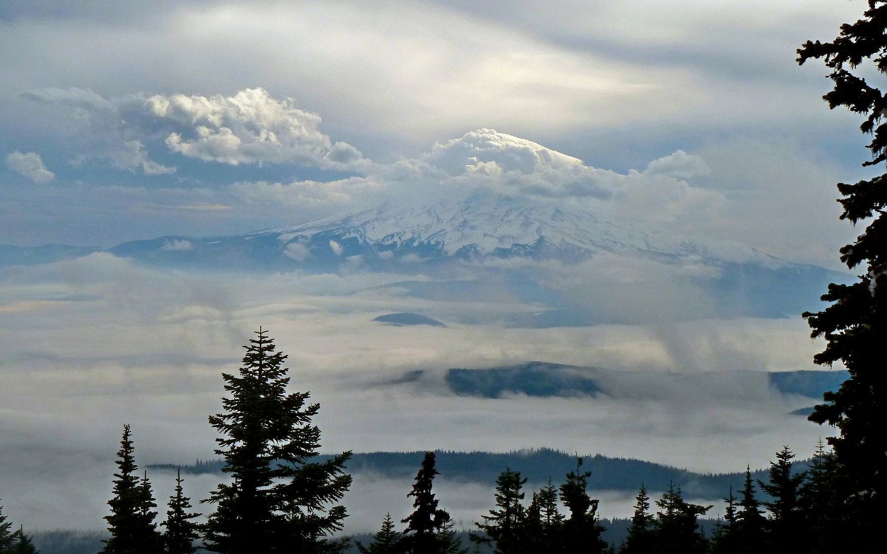
My summit reward: Mt. Hood swirling in clouds.

I know that many, if not most, folks here have been up Defiance before. So this may be a pretty boring TR for them. (Just browse the photos, and smile, 'k? ;)) I think I'll end up portraying it from the newb perspective, and perhaps someone else who's never been up there might benefit? To me, just finding info like which direction to do the loop in (clockwise! opposite of FG description) was something I had to ask for/why.

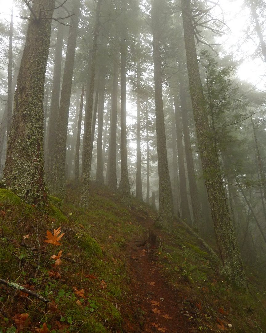
Seems a lot of folks favor just staying on Starvation Ridge (#414), but I do like to make a loop when possible. And I did find coming down the Mt. Defiance trail (#413) to be nicer than I imagined returning via my way up would've been. It just felt softer on the feet, and probably less slippery. I think it was a bit steeper, though. I'd been warned about blowdown, but it wasn't really much of an issue until the last mile or so of descent. Nor were a few washouts that simply called for momentary slow caution. These obstacles only would've been really problematic if I'd dawdled past dusk and was traveling by headlamp.

Overall, the GPS tells me it took a bit over three hours (3:17 moving) up, with over an hour (1:22) of stopped time. Obviously, I was taking far too many photos, eh? ;) Well, that and ran into Hayley and the Wolf, too, and we chatted a bit. She actually pulled into the Starvation Creek parking lot just as I was hitting the trail, and managed to catch-up and overtake me only about two miles up the ridge. (But she was extremely kind to the old guy, telling him what a good pace he was keeping!) I caught back up to her and Mattux once again, but only because she had stopped to recharge his batteries a bit. So yeah, that all explains why it took so long up! Oh, I also took a 20 minute detour, needlessly, but more on that below.

Image Image Image
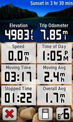
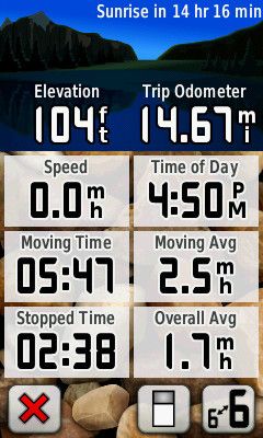
Trip Computer readings at summit and back at trailhead.

As it turned out, Hayley was the only other human I saw all day, other than in the parking lot. Hiking on weekdays is sweet! Well, on with some photos...

Image
Capturing the slope is always tough. This one starts out steep, and then gets steeper!
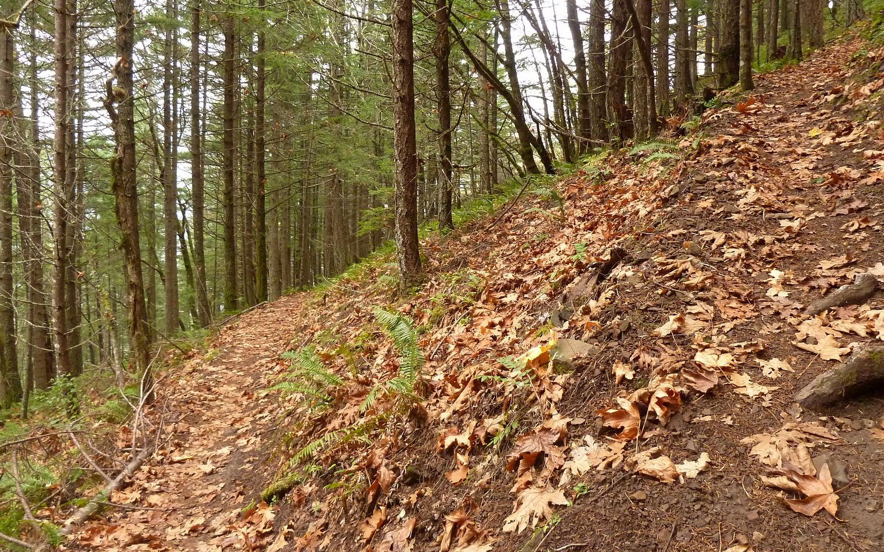
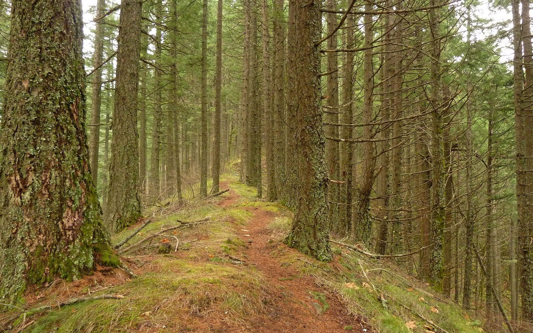
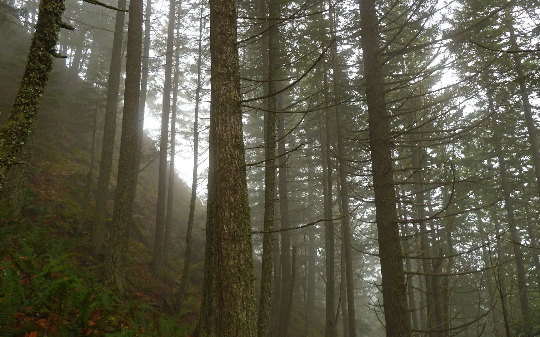
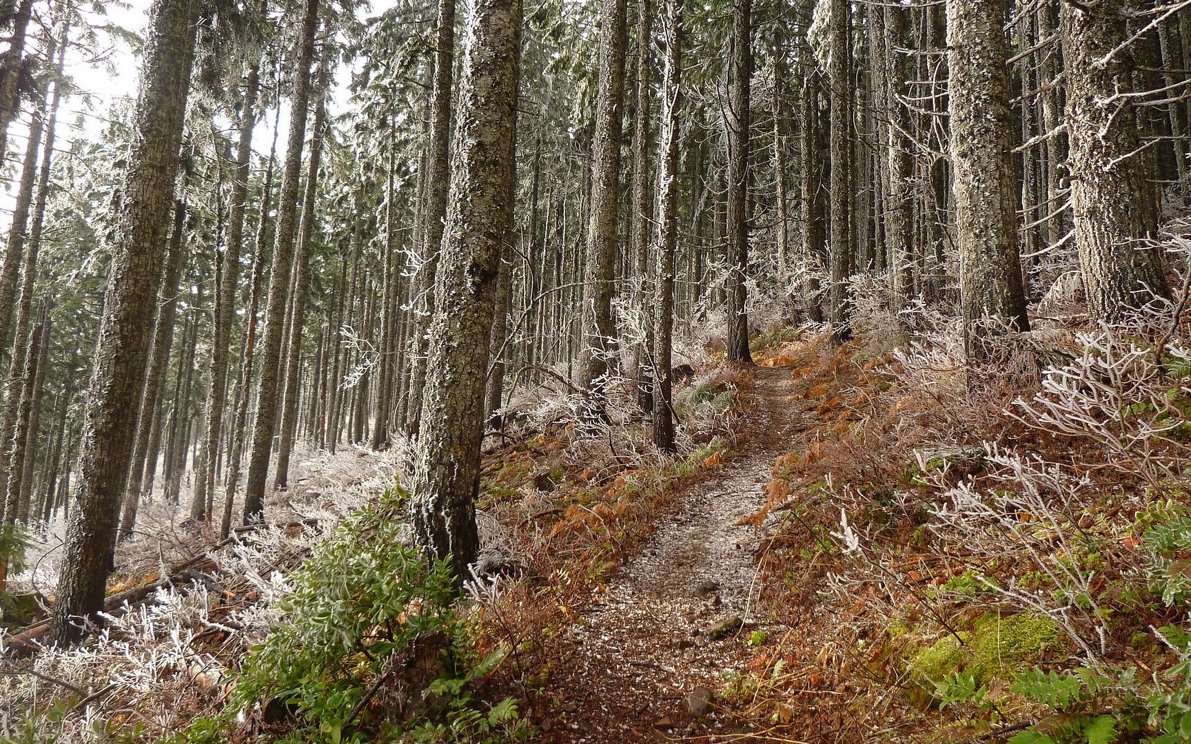
The first bit is through a forest, with deep leaf accumulations on the trail.


Image
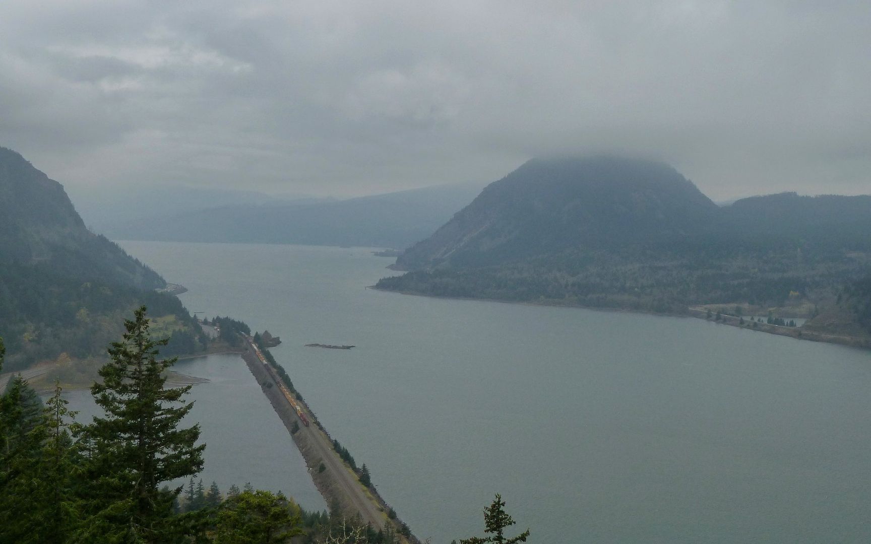
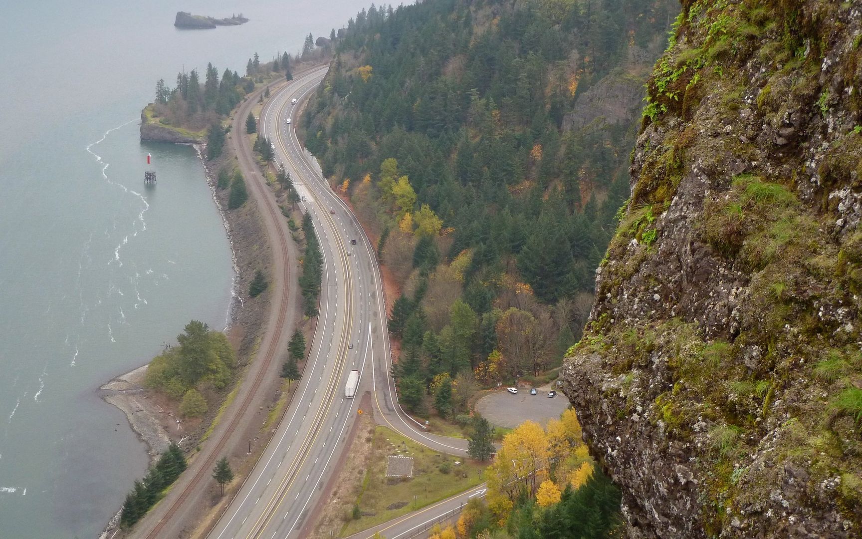
In no time at all, you break out into a clearing under the powerlines, and many iconic views.

Image
At 3/4 mile in, only half of it actually climbing, you're at 700' and getting nice shots.
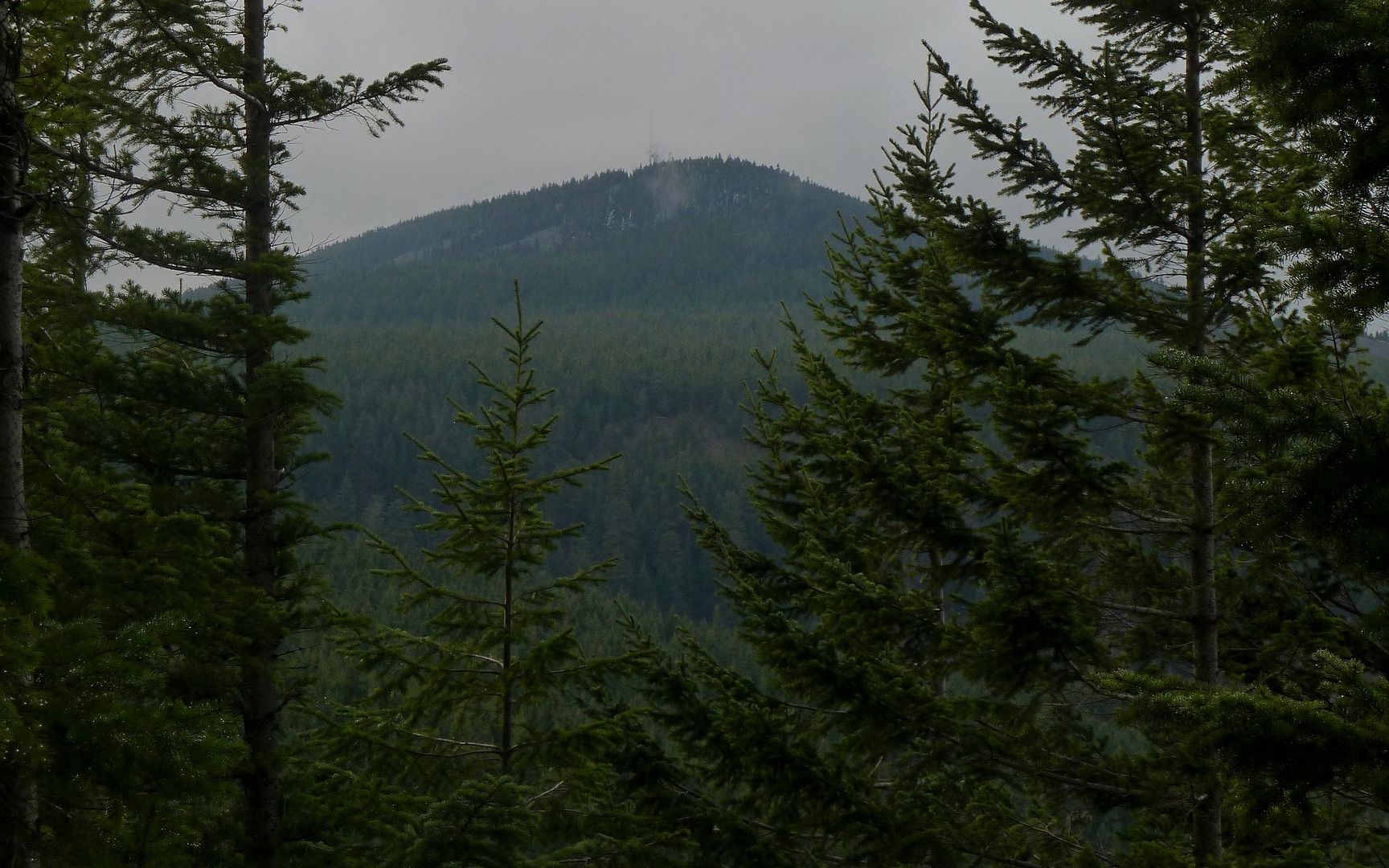
Top of Wind Mountain in the clouds.


Image
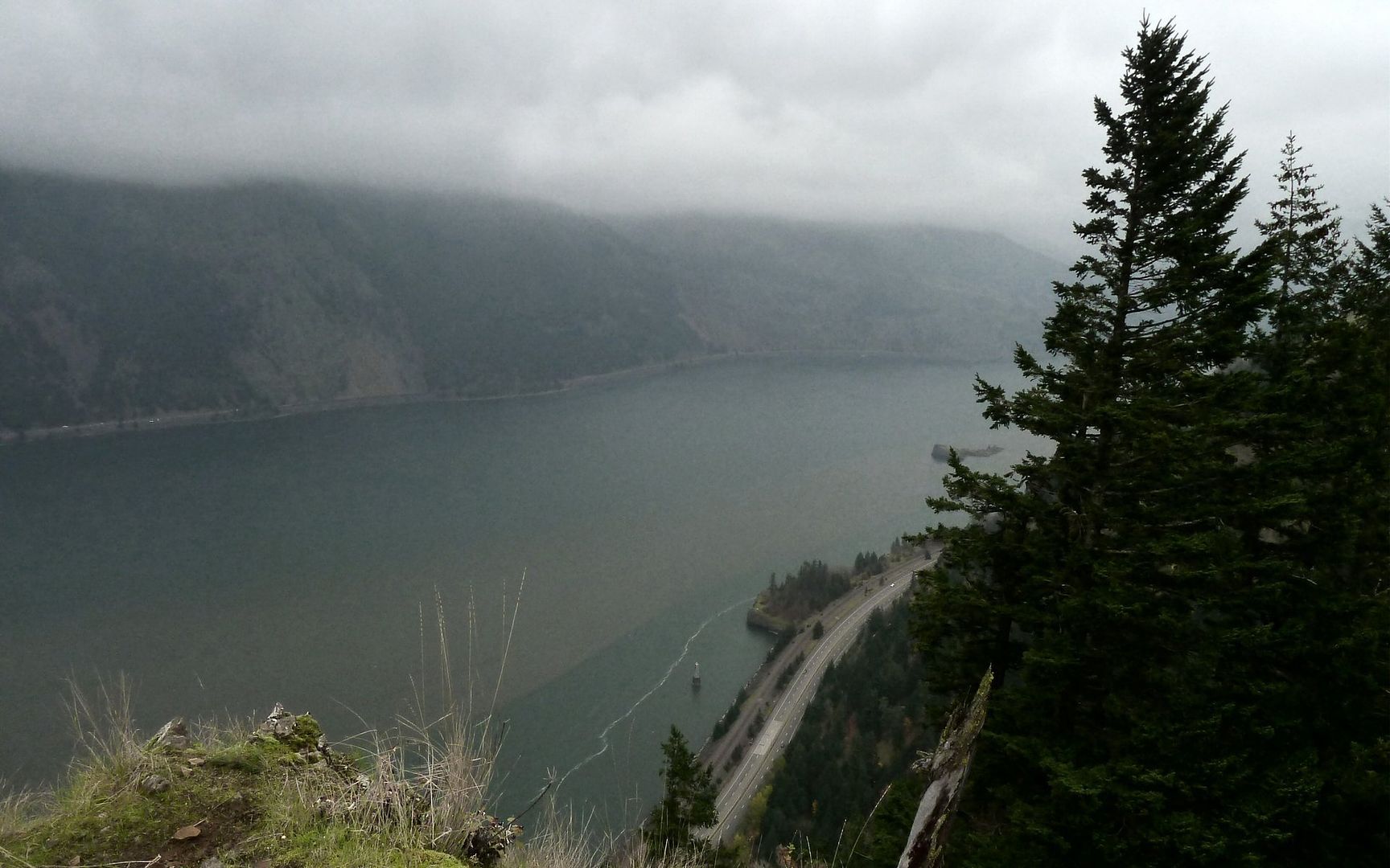
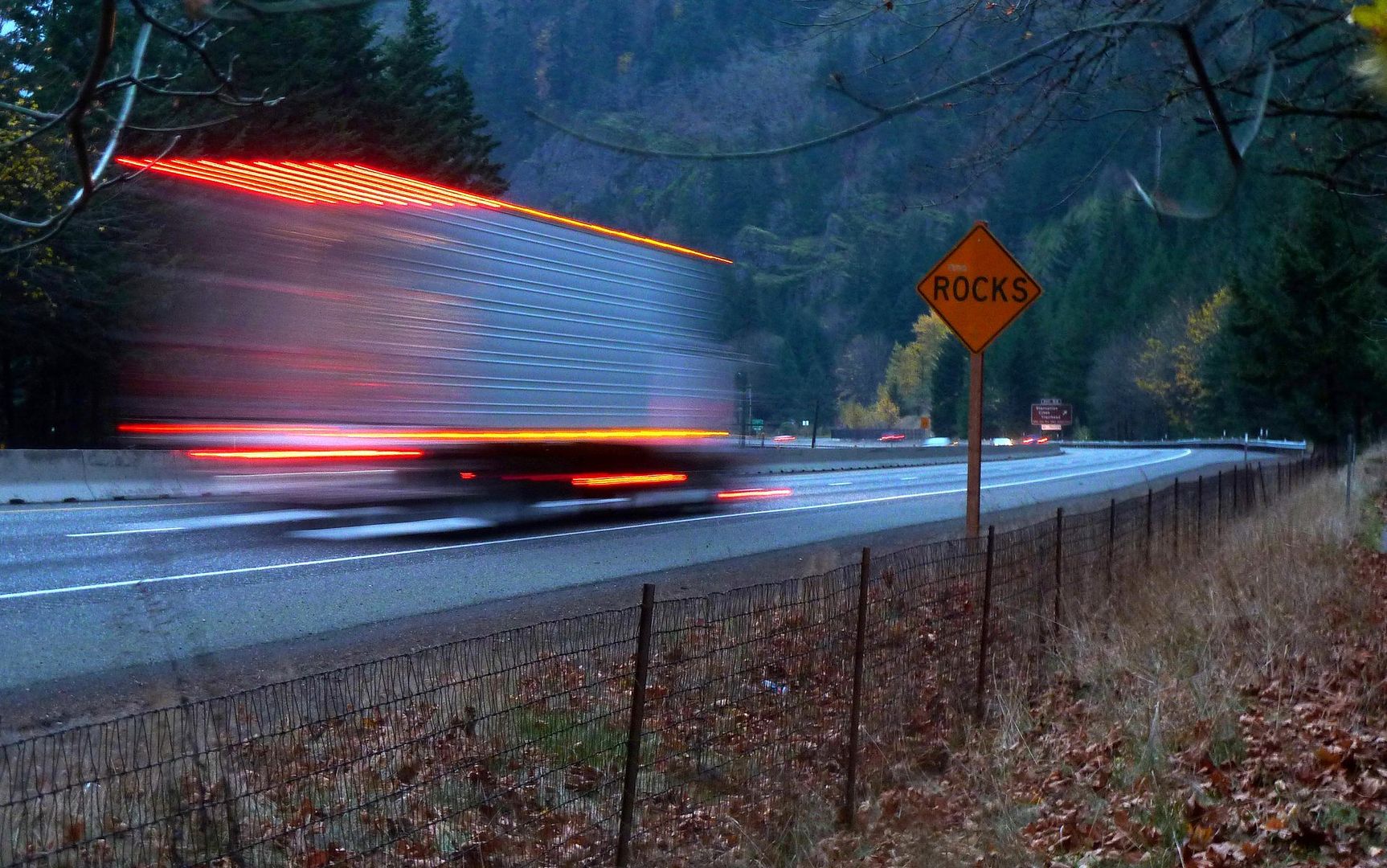
Last view of the Starvation Creek parking lot.

Image
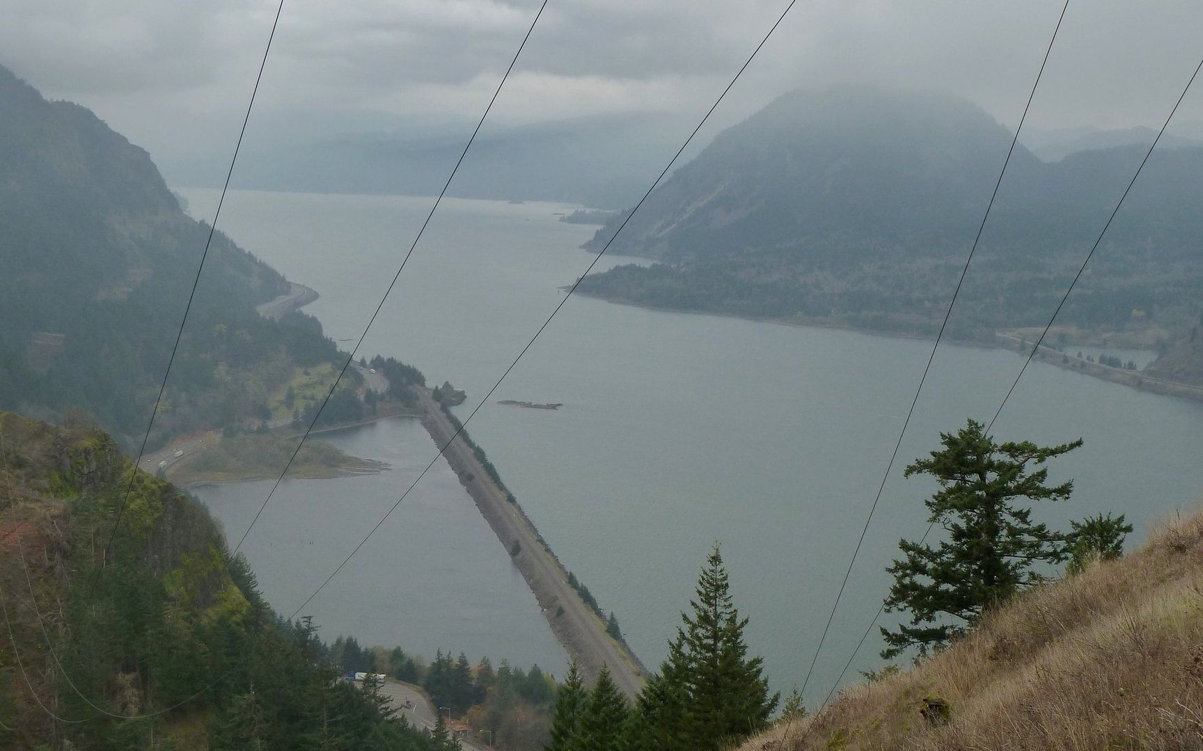
The powerlines give some sense of the slope.

Image
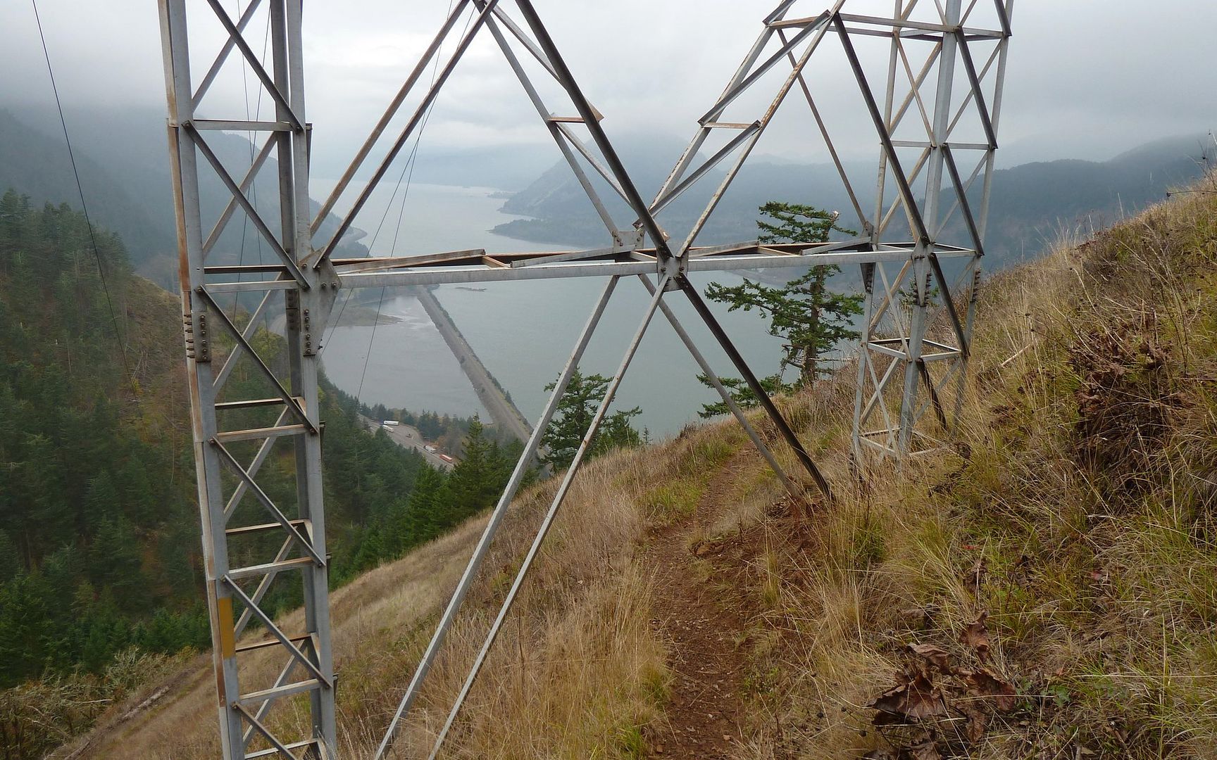
It was fun trying to combine the manmade with the natural elements in the photos.

Image
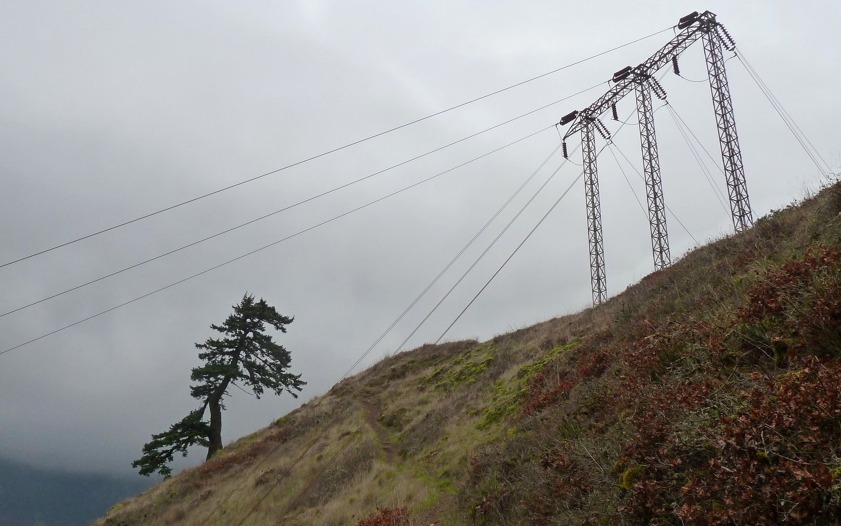
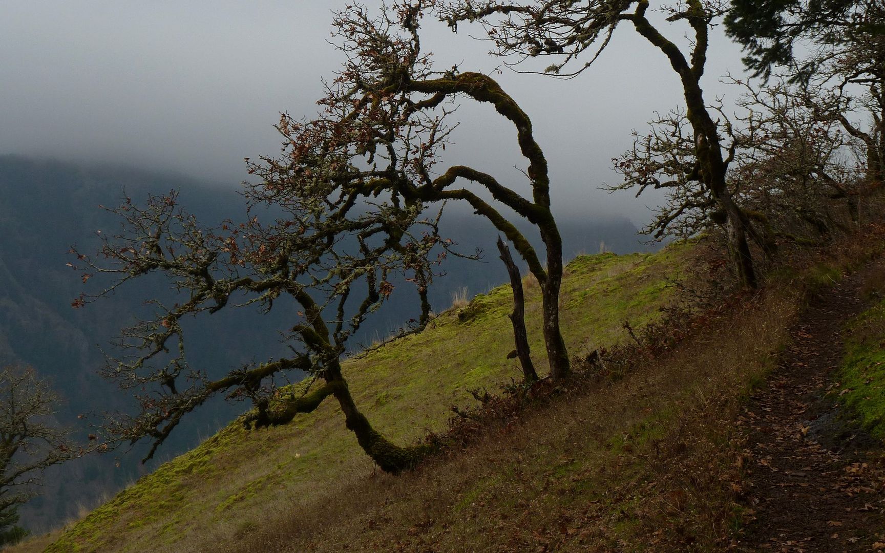
The tree I've seen so many photos of. Good a reason as any to take another shot.

Image
End of Starvation Ridge, 1.2 miles in and 1200' up. Just about to the clouds.

Image
The hike up Starvation Ridge is beautiful. It just goes straight up, with the ridge falling away on either side.

Image
As I entered the clouds, an opportunity to capture the true slope made itself apparent.

Image
Verticals make poor wallpaper, but this shows the challenge rather adequately.

Image
Wanting to meet the Wolf, it was about here I paused to let him and his keeper overtake me.
Hayley, it was a pleasure to stop and chat for a few! And your companion was as nice as they come!


Image
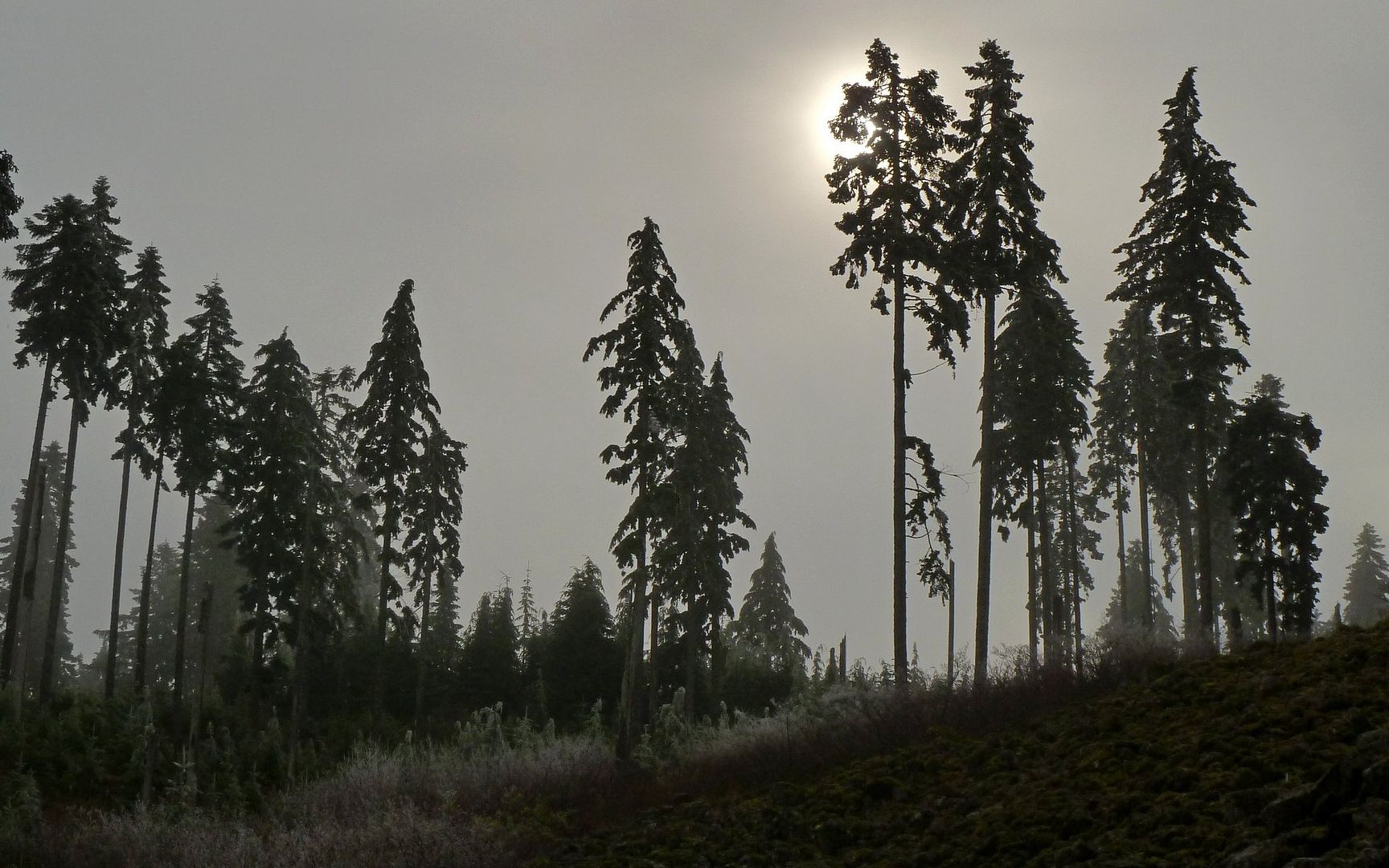
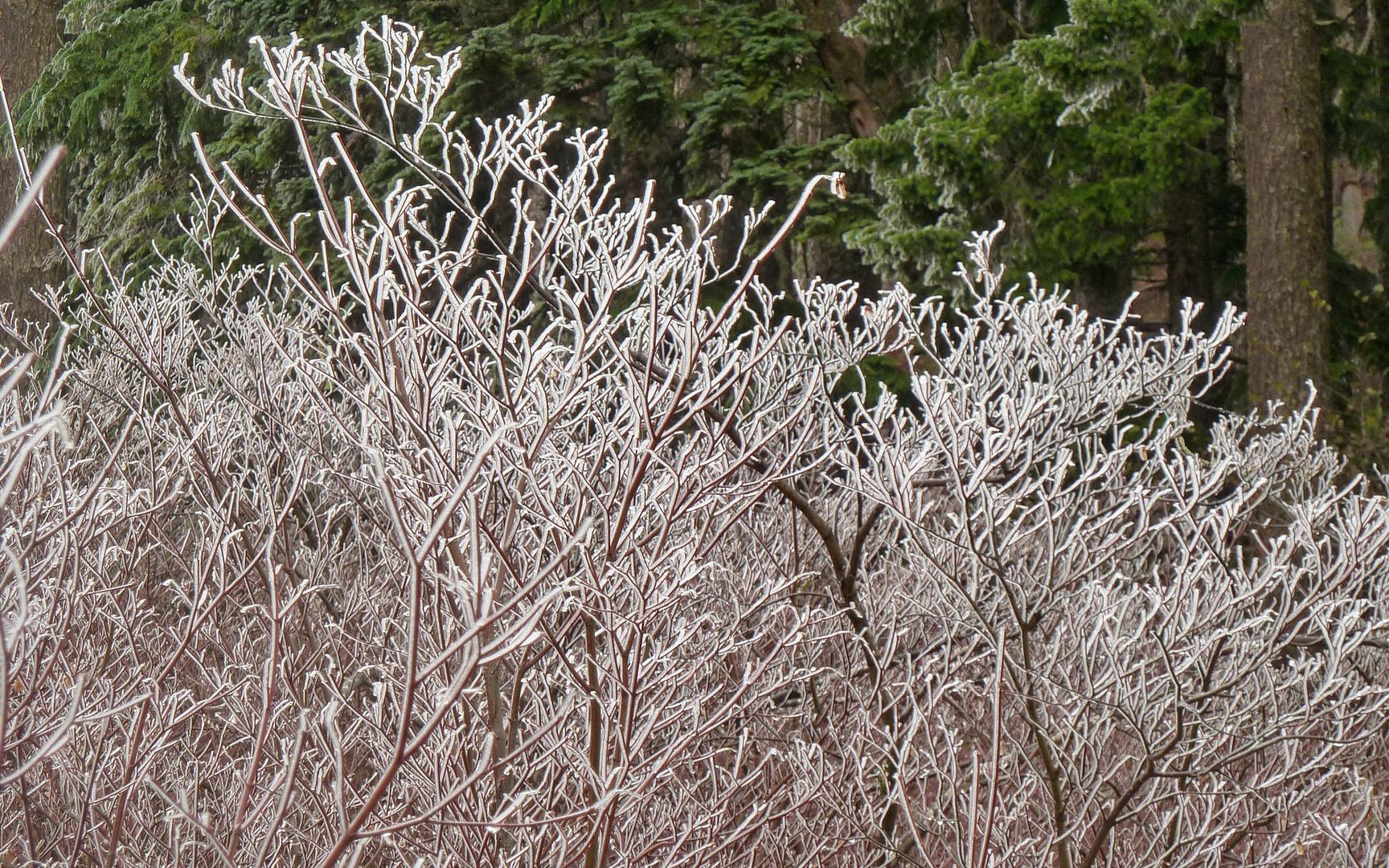
At about 3200', the landscape took on a frozen quality, and the sun was trying hard to emerge.

Image
Seemed like frozen rain at first.

Image
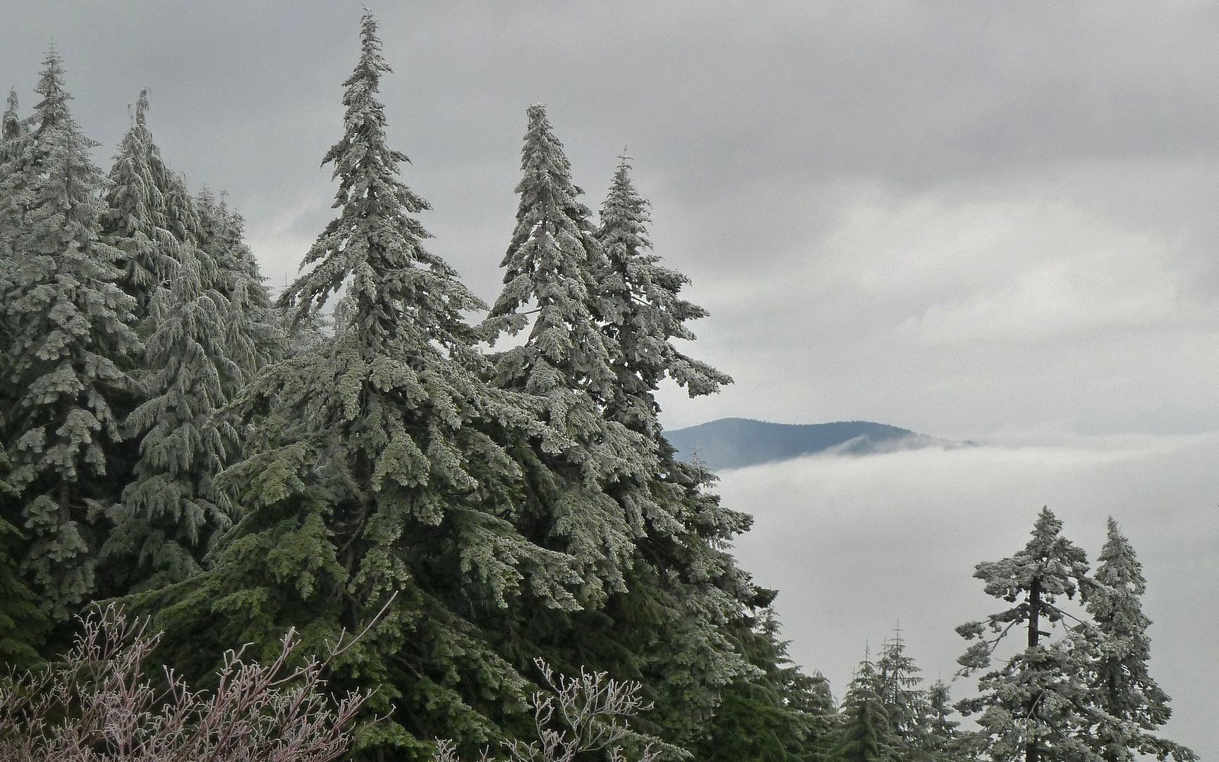
I was above the lowest layer of clouds, and rather suddenly the air felt 10° cooler.

Image
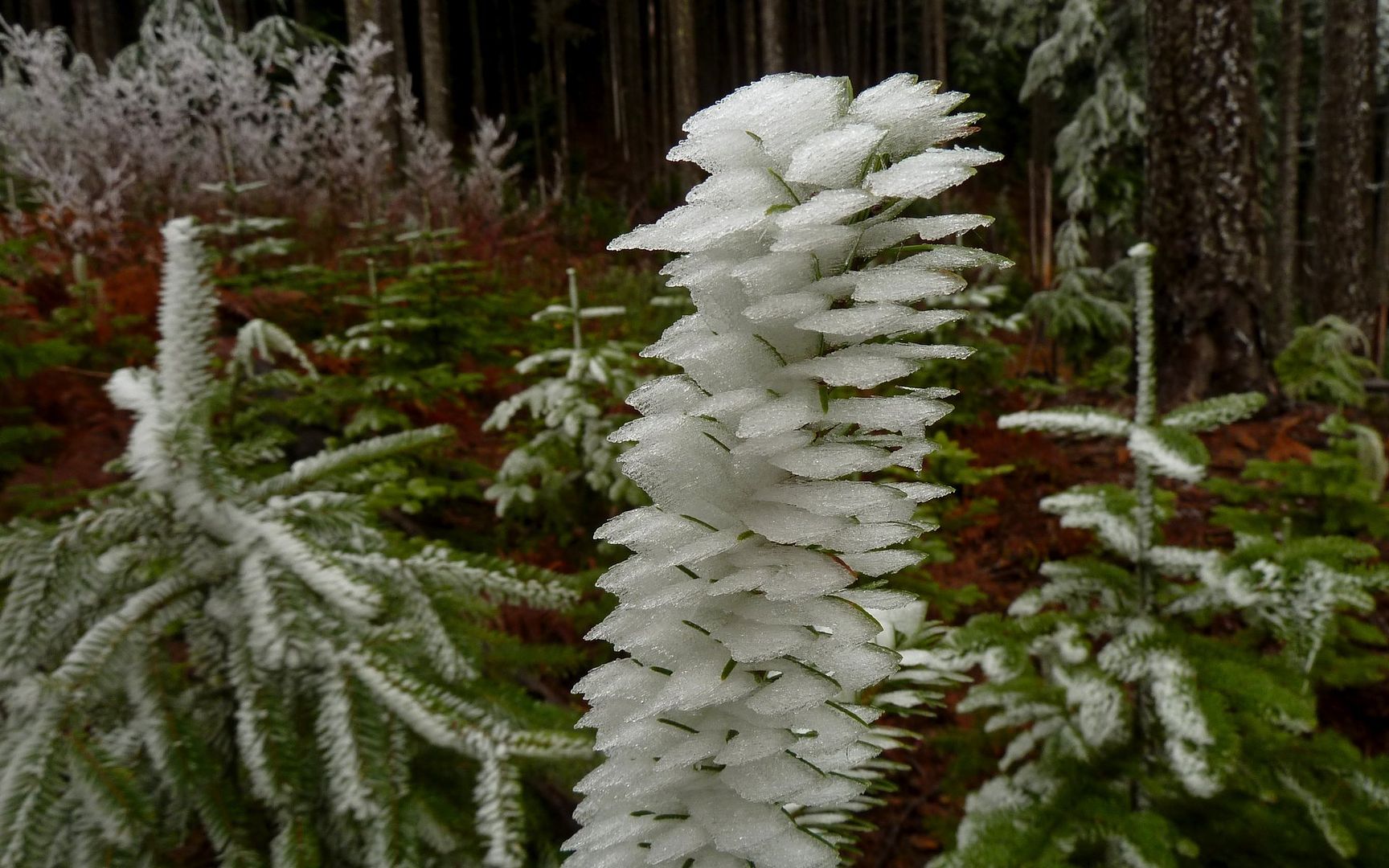
The rime on the many stubby conifers was captivating. Wasted a lot of time here on photos!

Image
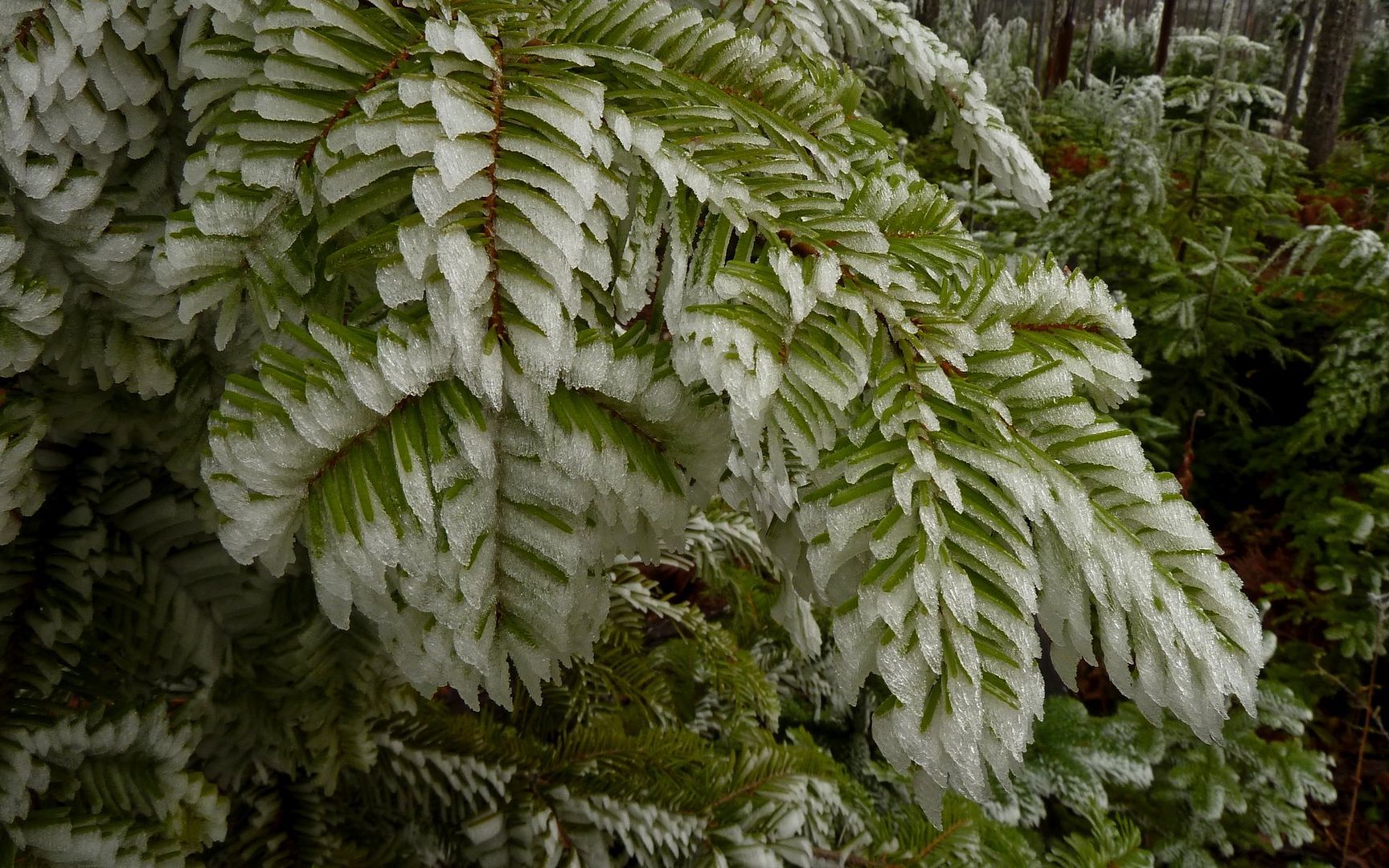
Could've shot for quite awhile here. At every turn was beauty on display.

Image
As I continued to climb, the air again warmed, and ice began falling off the trees.

Image
Nearly three hours from the TH, I see the destination for the first (and only) time.

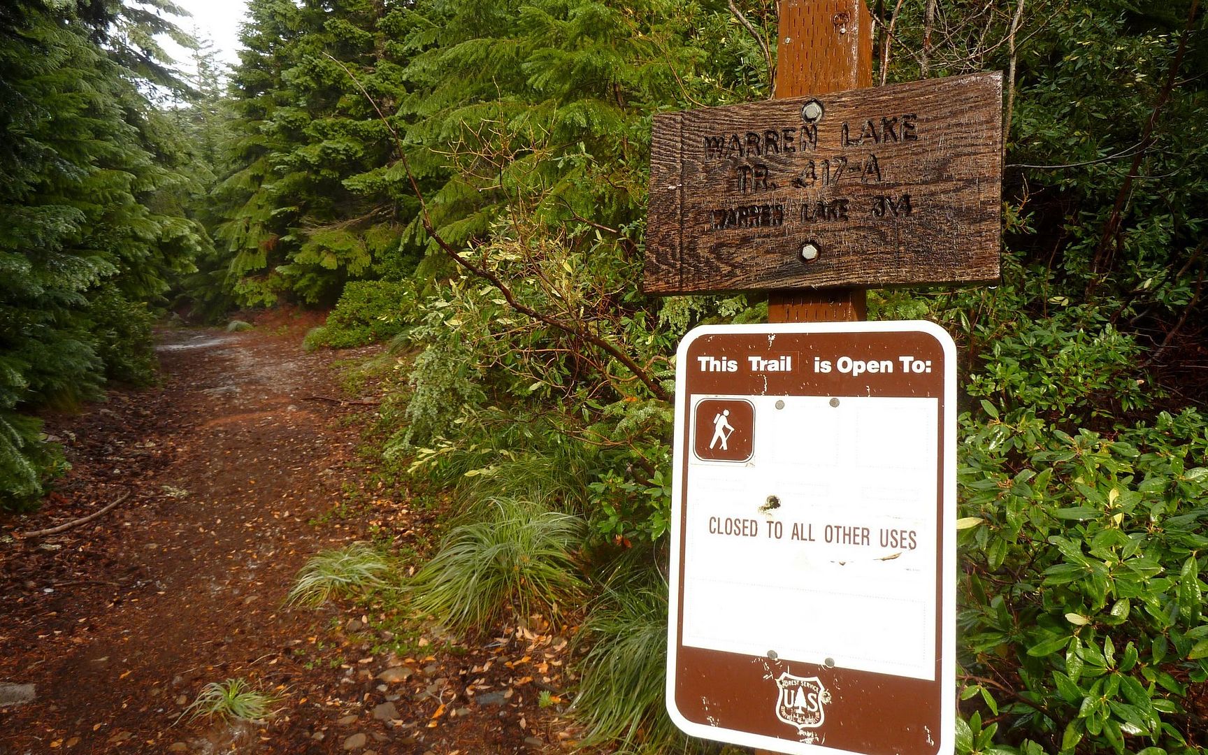
I need to add, here, that I should've been paying better attention to navigation on this segment. I never realized I had transitioned from the Starvation Ridge Trail (#414) onto the Mitchell Point Trail (#417), back around where all that rime was. So when I get to another junction with a sign pointing to the Warren Lake Trail (#417A), I stupidly take a left. As I'm cruising through the fallen ice accumulations, I wonder why I no longer see wolf prints. D'oh!

Image
Twenty minutes wasted wandering out to the jeep trail that offers direct trail access. :(

Image
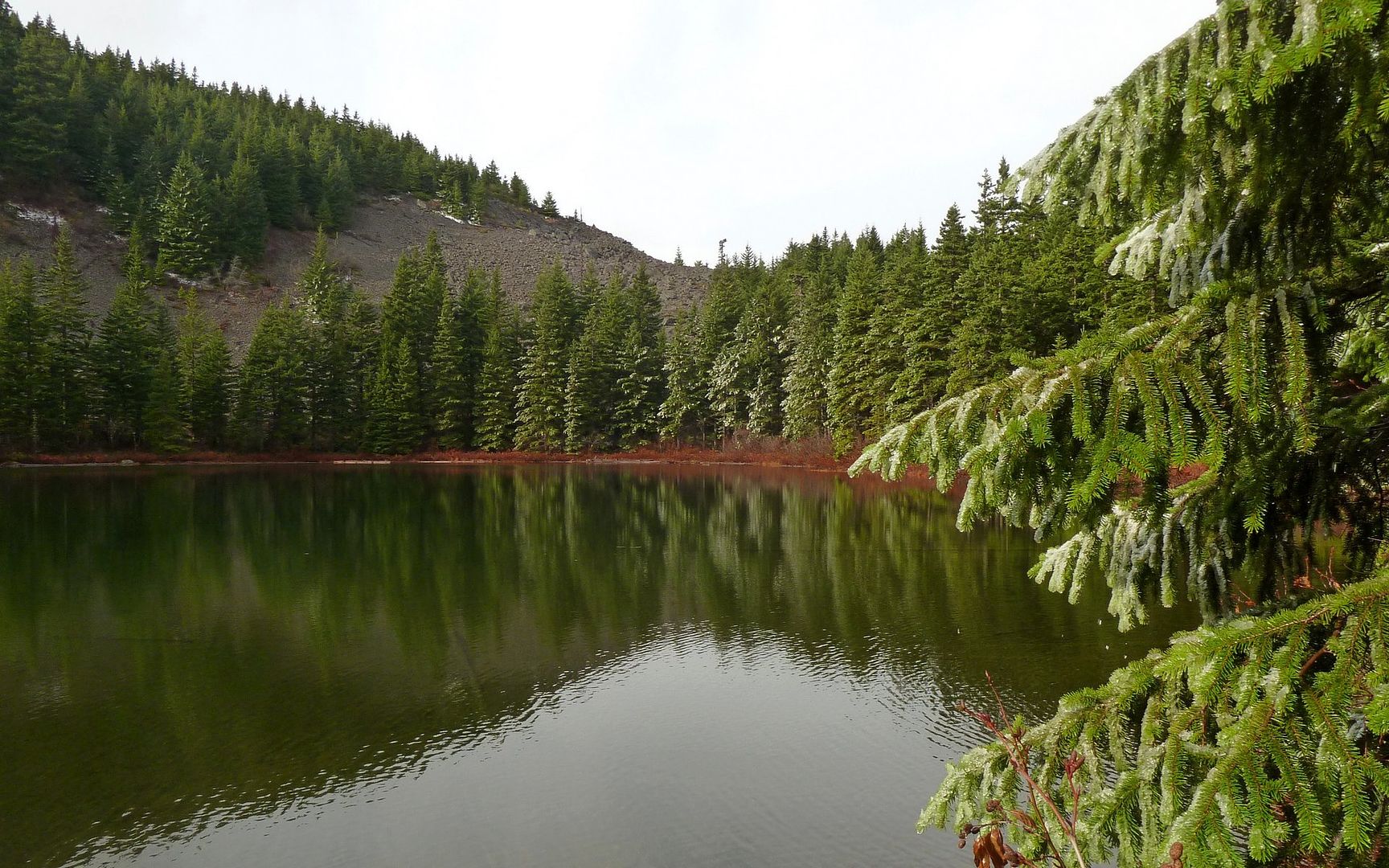
Backtracking, I quickly make it to Warren Lake. Most of the ice is off the trees, now.

Image
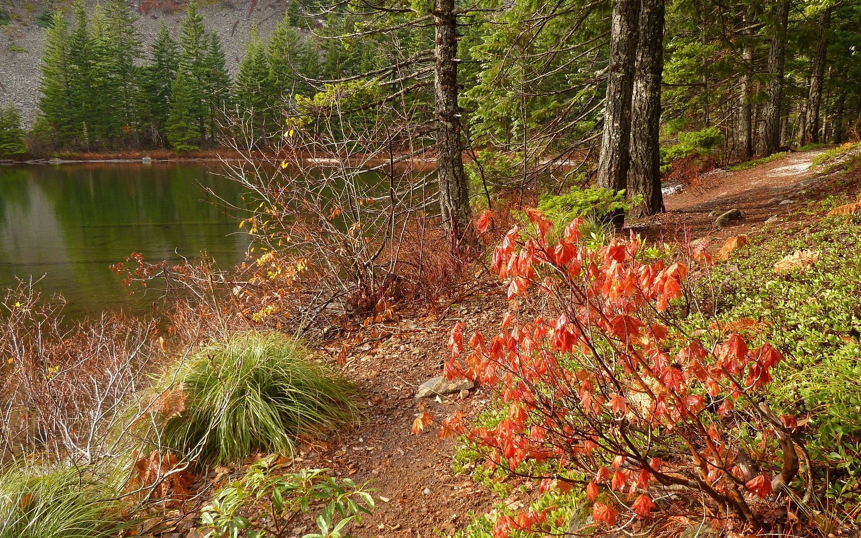
One last reminder of fall colors, stubbornly hanging on.

Image
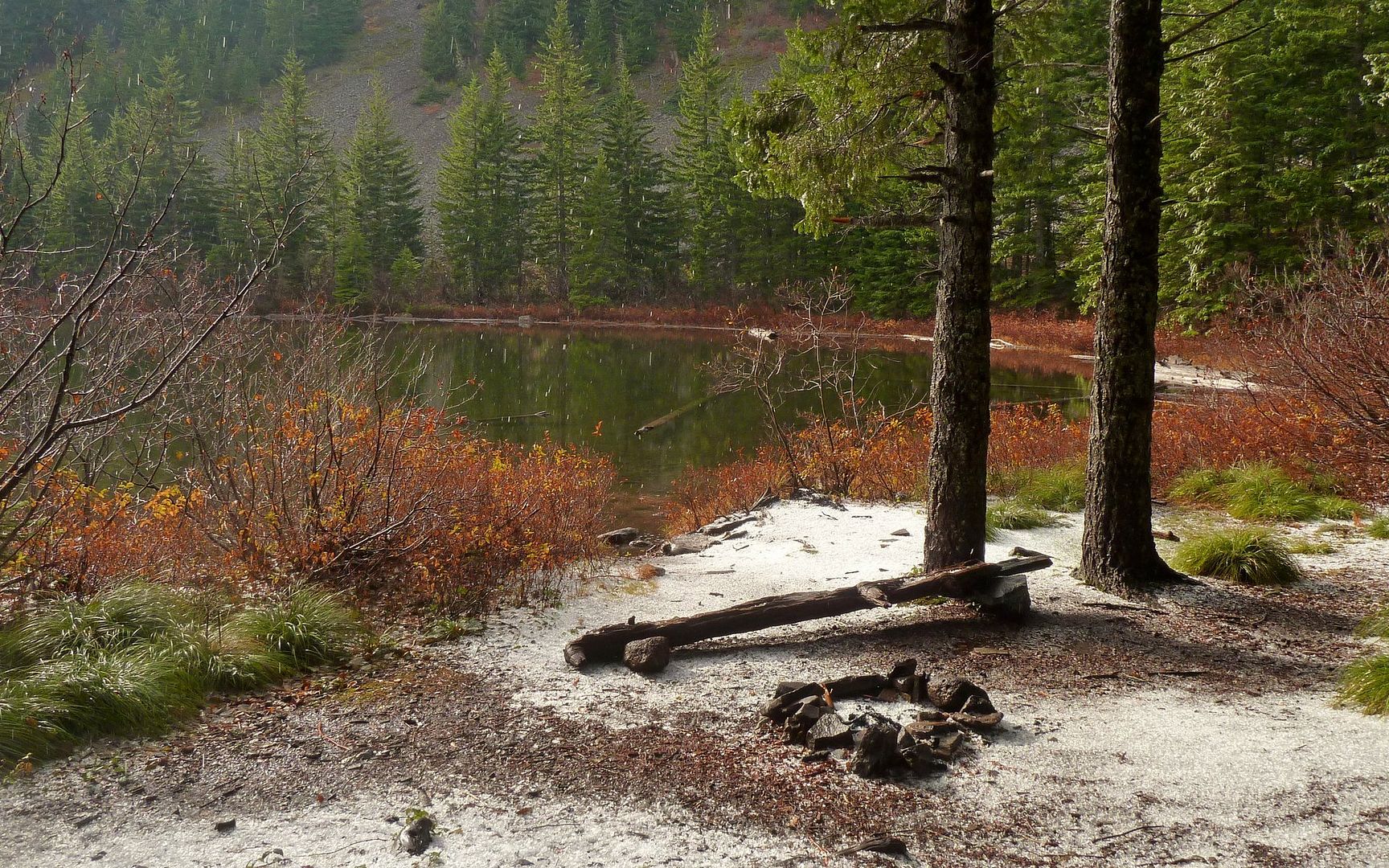
Pretty darn wet campsite.

Image
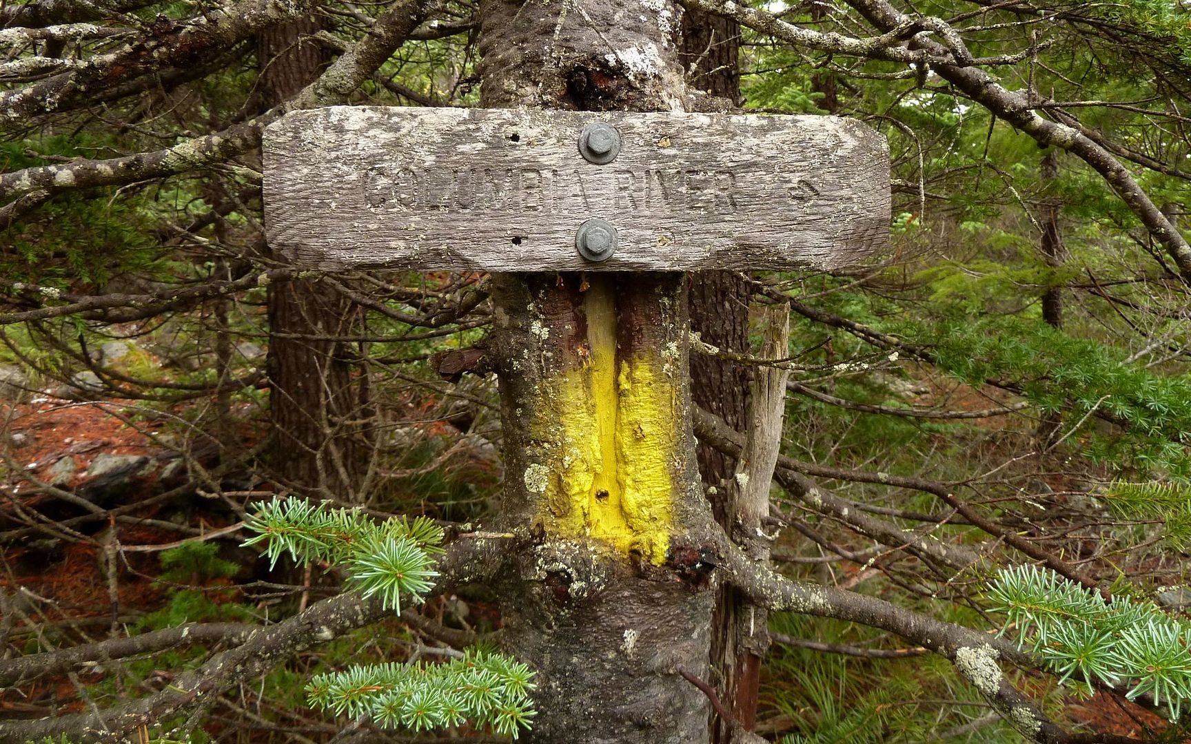
Trudging on, I note the "escape route" is clearly marked! Waypoint saved.

Image
Summit!!!

Image
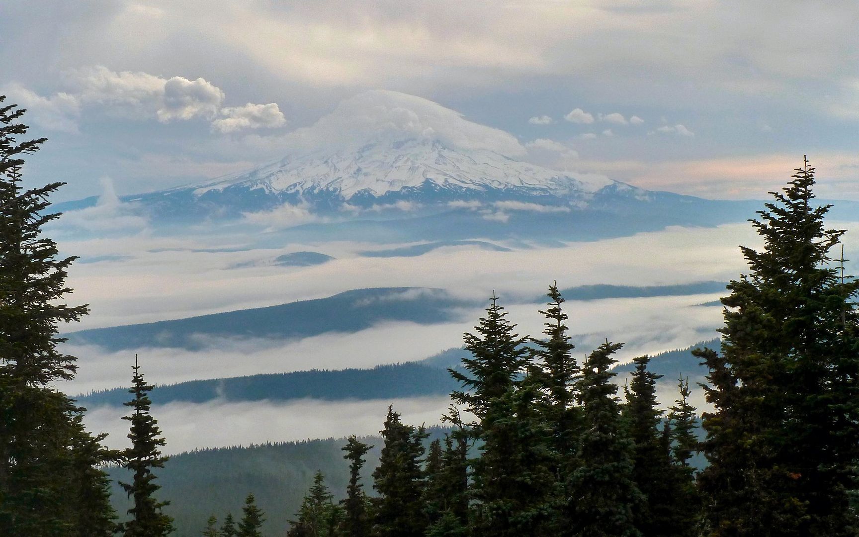
Hood had an eerie layer of clouds swirling about its summit the whole time I was up here.

Image
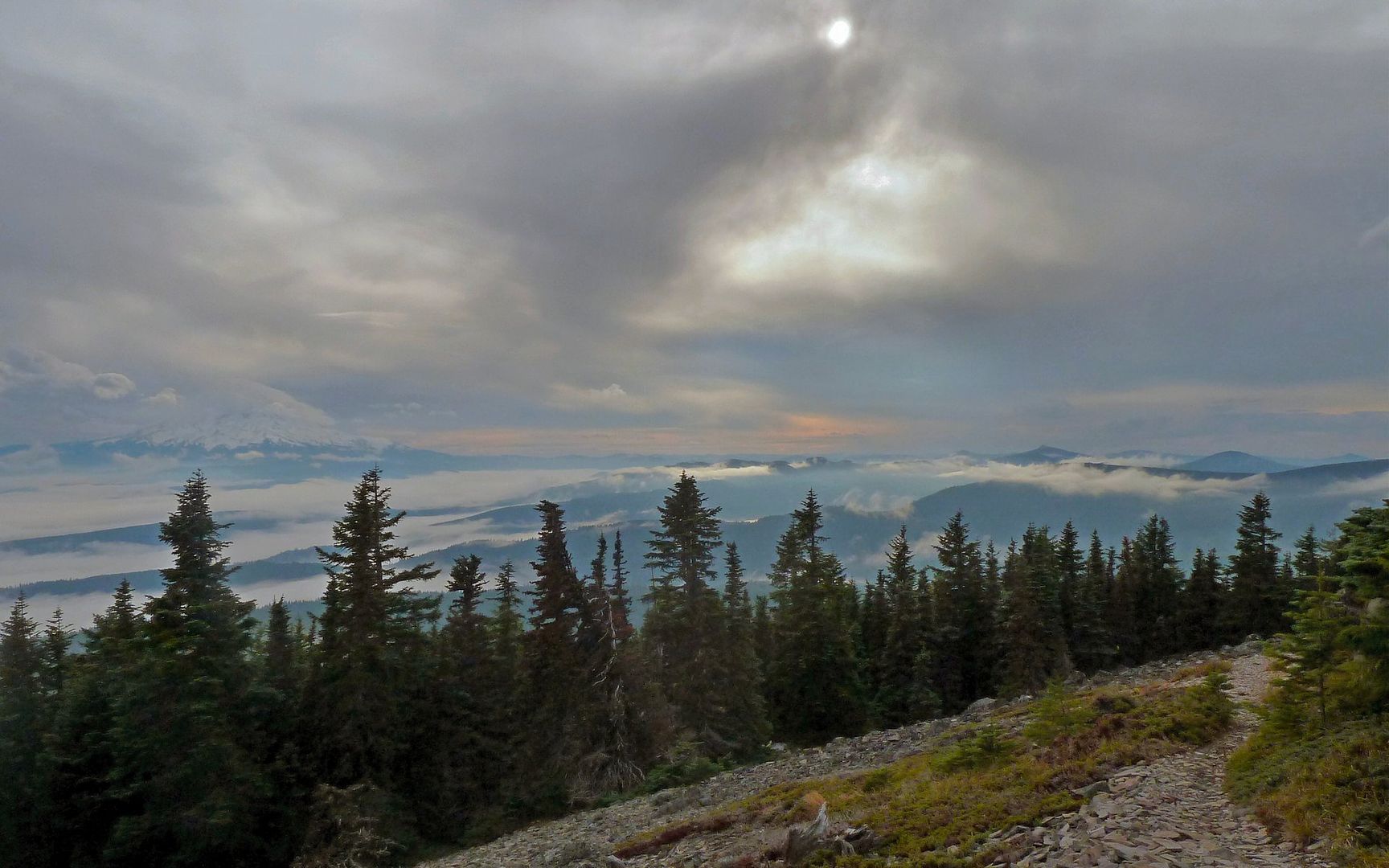
Didn't stay long, though. Ate a PB&J and headed out on loop around SW side to a view that I imagine
would've been superb in better weather. Sun still trying to slip through.


Image
Wasn't long before I could see a sea of clouds in the gorge again. (Three image panorama.)

Image
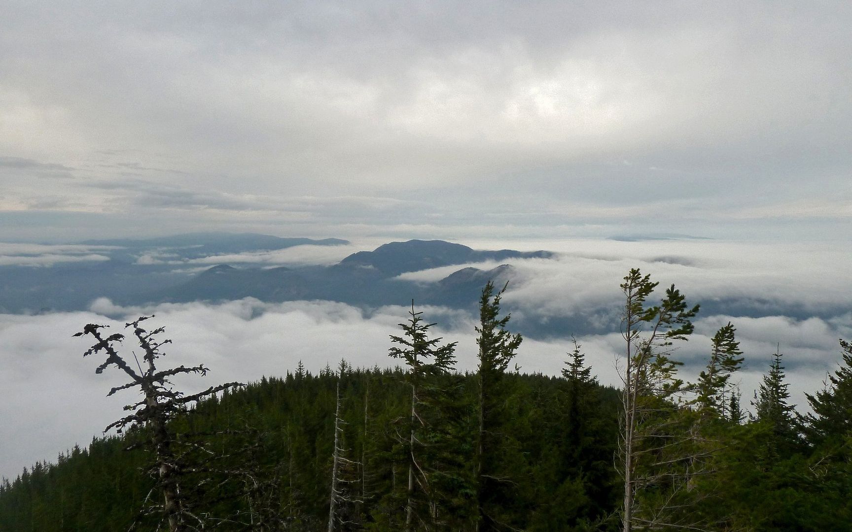
Views to the north, coming down, were spectacular. For cloud shots, at least.

Image
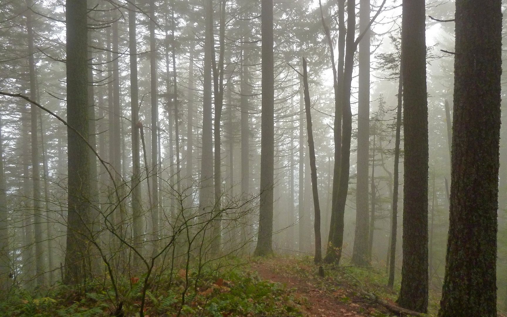
The descent was steep! But sure-footed and somewhat soft. Nice forest.

Image
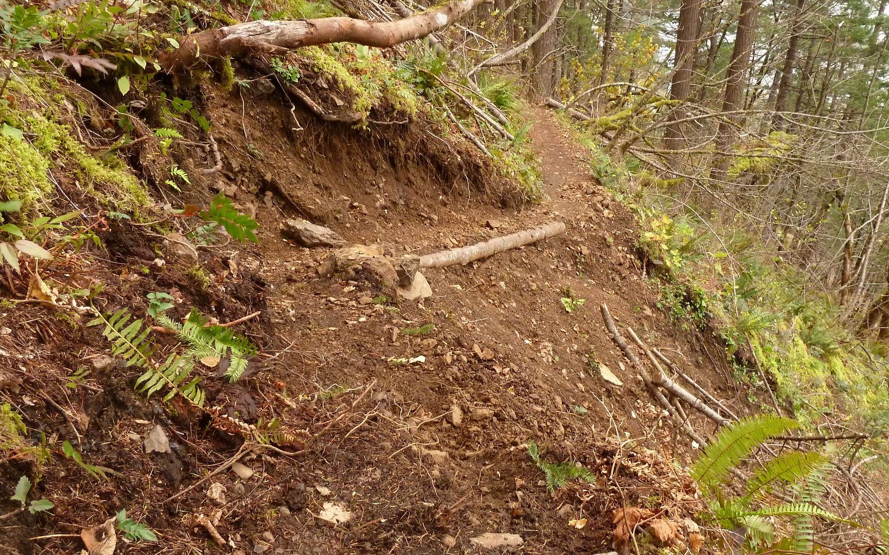
Example of washout that had been remediated fairly well.

Image
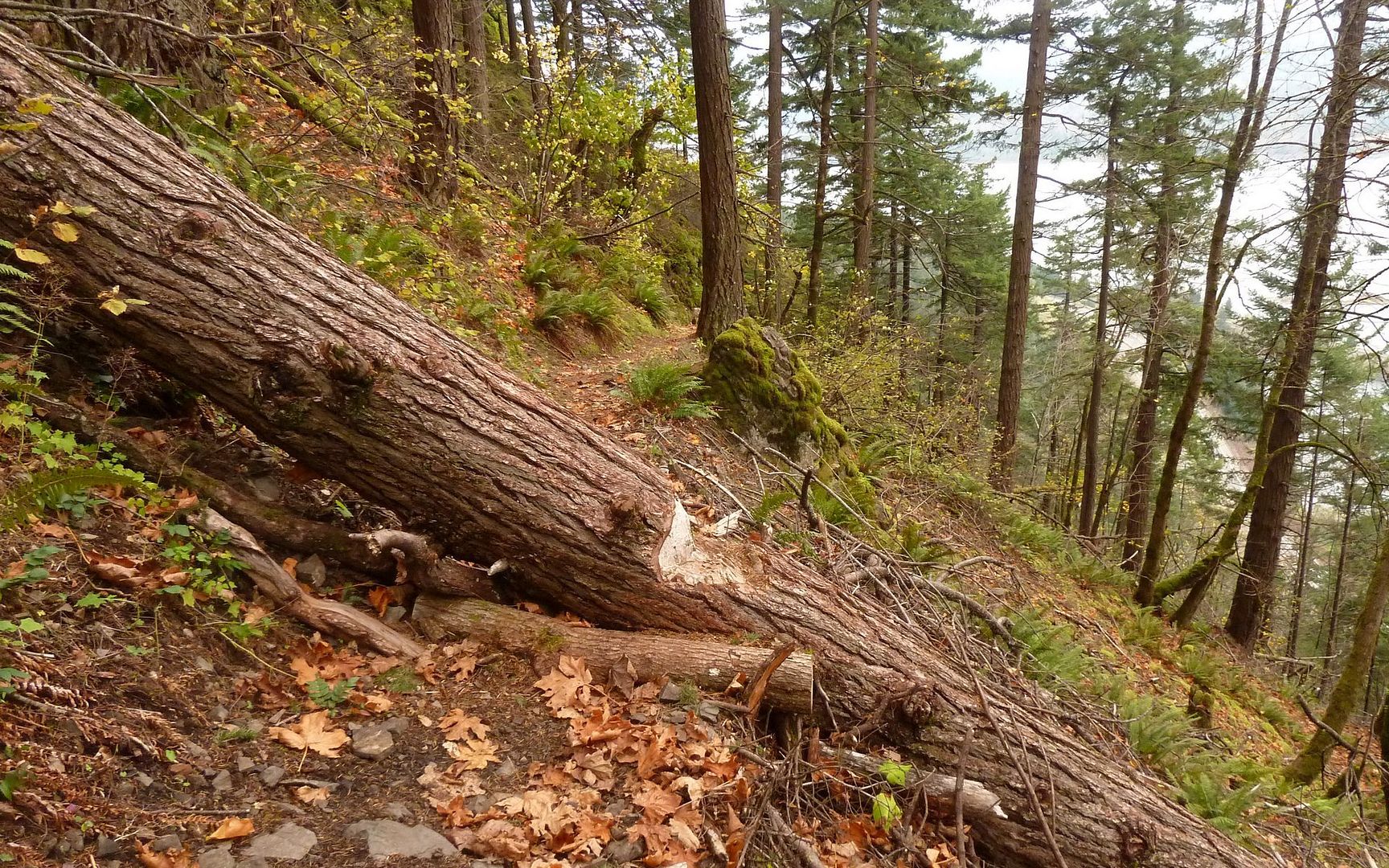
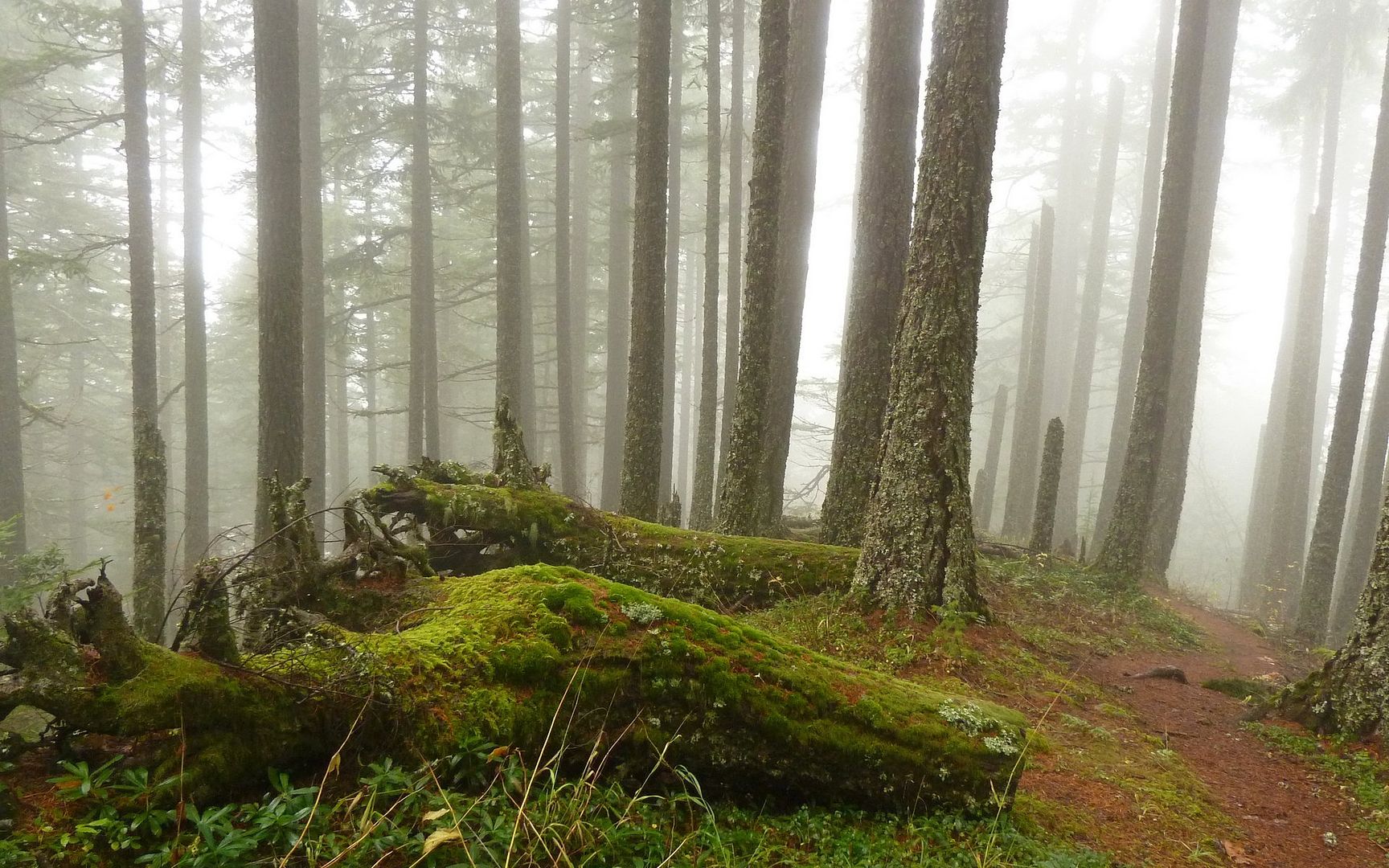
One of two large blowdowns that also seen some nice attention.

Image
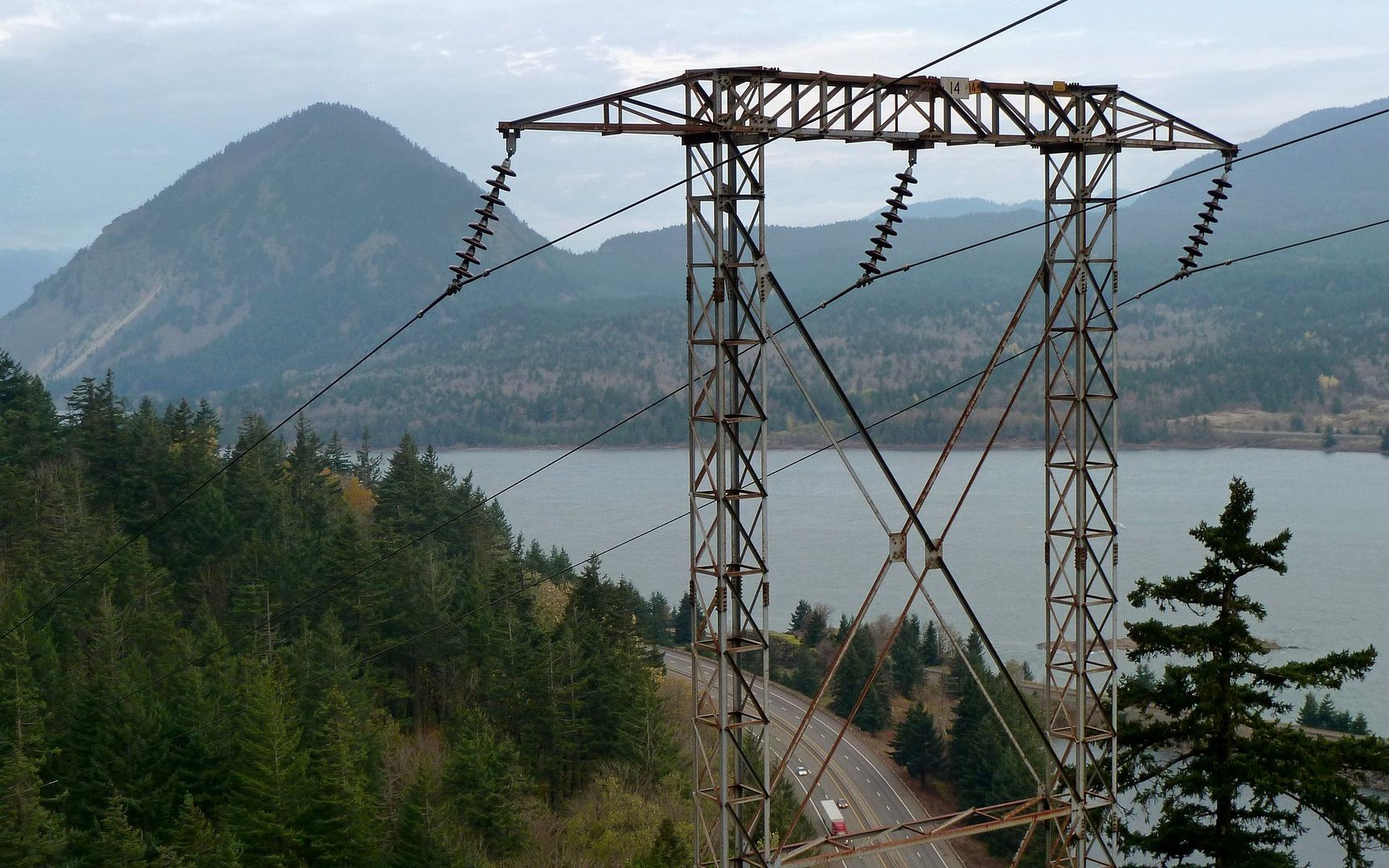
Back to the powerlines and more views of Wind Mountain again.
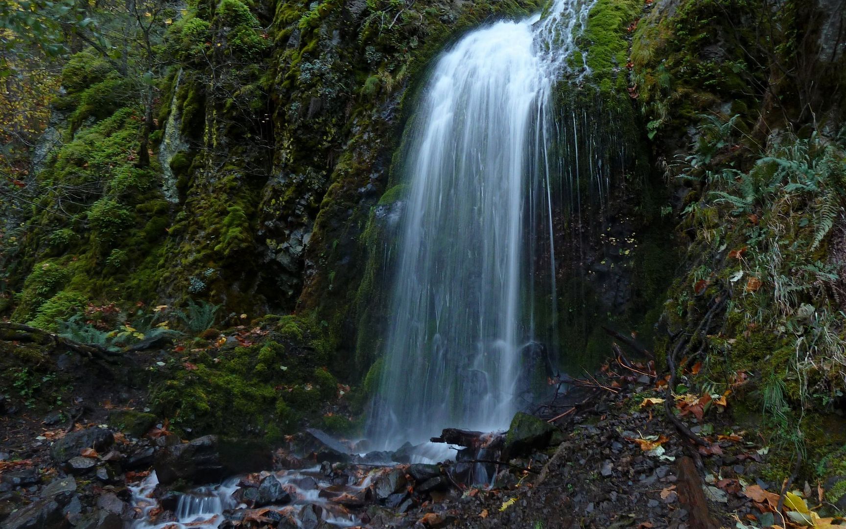
Image
Lancaster Falls

Image
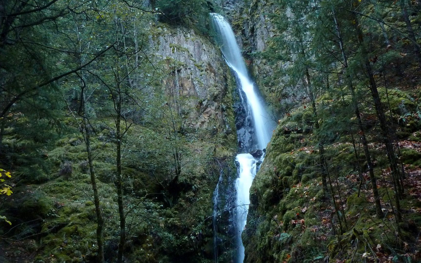
Hole-in-the-Wall Falls

Image
Final section of trail parallels I-84. Headphones helped for the last hour or so. :|

So, in the end, it turned out to be about 14.7 miles horizontal, with almost exactly one vertical mile up and down. I gotta say, I have walked nearly twice as far with more EG, and didn't feel it as much I as I did the day after this time!

Image
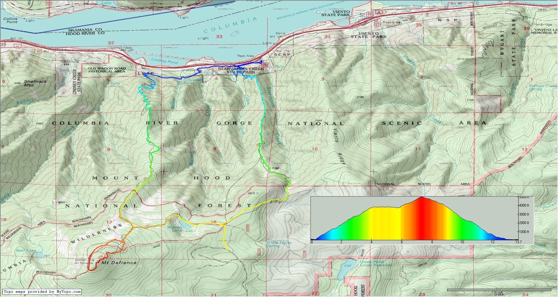
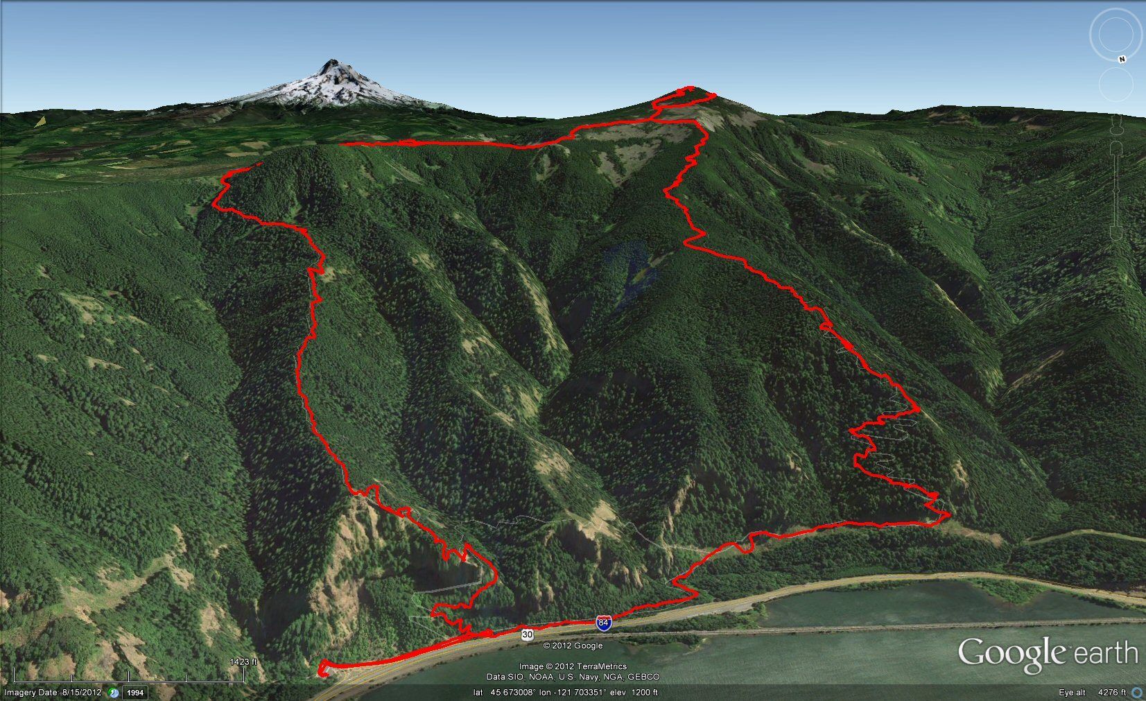
Took the clockwise loop. Click to zoom.

Image
Because it's there!

I'm very happy to say that my feet survived just fine, though! None of those blister horror stories to share. The replacement Merrells are a treat. My new goal is to make this hike as breezy-easy as Hamilton Mountain is now (which just six months ago, was also a challenge!) for me. Once again, I over-share with the photos, but that's just something I tend (and like!) to do. Thanks to all here who helped me plan ahead for this. I had a wonderful time! :D
Karl
Back on the trail, again...

User avatar
Waffle Stomper
Posts: 3707
Joined: May 28th, 2008, 10:03 pm

Re: Starvation-Defiance Loop, 16-Nov-2012

Post by Waffle Stomper » November 18th, 2012, 6:28 pm

Wow that is awesome.Thank you for the great trip report and all the photos you took. I especially love the first shot and the rime photos. Thank you for sharing your hike.
"When we try to pick out anything by itself, we find it hitched to everything else in the Universe." - John Muir

User avatar
Crusak
Posts: 3617
Joined: August 6th, 2009, 7:33 pm
Location: Oregon

Re: Starvation-Defiance Loop, 16-Nov-2012

Post by Crusak » November 18th, 2012, 7:13 pm

Great TR Karl.

Defiance is quite the Mother of All Gorge Hikes for sure. I've only done it once (with EP). As you mentioned, this hike feels more difficult than the stats.

So there's some kind of temperature inversion going on in the Gorge right now? That makes for an interesting day.

EP and I headed over on that Mitchell Point Trail on purpose, looking for... something I can't remember... what. Haha
Jim's Hikes

Solvitur Ambulando

User avatar
mayhem
Posts: 3579
Joined: December 22nd, 2009, 7:46 pm
Contact:

Re: Starvation-Defiance Loop, 16-Nov-2012

Post by mayhem » November 18th, 2012, 10:10 pm

My new goal is to make this hike as breezy-easy as Hamilton Mountain is now (which just six months ago, was also a challenge!)

Thanks for sharing pics & TR :) never to many pics and never not post because days change & each person has a different perspective.

Bammmm! You got'er done .

It seems there are at least 3 folks on PH that have already gotten into the breezy easy Defiance style shape & I want to be the 4th.
Shoe Shine Boy Has Left The Building!

User avatar
kepPNW
Posts: 6411
Joined: June 21st, 2012, 9:55 am
Location: Salmon Creek

Re: Starvation-Defiance Loop, 16-Nov-2012

Post by kepPNW » November 19th, 2012, 6:56 am

Thanks, folks! It was a blast. Good to see you back again, WS! That icy stretch cost me a good 20 minutes as I thoroughly enjoyed the scenery.

Crus, dunno but would guess the inversion got blown away by the front. Seemed EP/Mayhem were seeing less of it the next day? I was really wondering though, when it was that icy at 3200', what another 2000' more would add! Turned out, nothing much. :) Your earlier mention of it taking you 7 hours had me wondering, though... Tell me that was "moving" hours, eh? ;) Somehow, I always seem to stretch any hike into the number of hours of near-visibility I have left. :lol:

Mayhem, if you're not already in the breezy-easy category on that hill, I got a looong way to go! HA! It's a great hike, and I was only marveling at the difference between Fri and Sat, not at all discouraged in sharing it. :)
Karl
Back on the trail, again...

User avatar
hayes
Posts: 9
Joined: October 8th, 2008, 3:27 pm

Re: Starvation-Defiance Loop, 16-Nov-2012

Post by hayes » November 19th, 2012, 9:24 am

Great trail report! I love lots of pictures. Your summit view was much clearer than mine and that 3000 ft level was gorgeous. I stopped to take a few shots myself but didn't turn out that great. iPhone's cameras don't do views like that justice. Could have gone without the several snow/ice chunks dropping off the trees on me though! ;) Wonderful meeting you and my chattiness definitely slowed your pace. You would have easily made it back to the car well before dusk. You're ready to tackle anything now!
"The distinguishing mark of true adventures, is that it is often no fun at all while they are actually happening."
- Kim Stanley Robinson.

User avatar
kepPNW
Posts: 6411
Joined: June 21st, 2012, 9:55 am
Location: Salmon Creek

Re: Starvation-Defiance Loop, 16-Nov-2012

Post by kepPNW » November 19th, 2012, 12:18 pm

I can see the attraction that place holds. Even in what most would consider pretty mediocre weather, there was a lot of beauty to be enjoyed. :)

I'm sure you didn't slow me down as much as I did myself, taking all those (230! :lol:) photos. Though it's very kind of you to say so. I had to stop to dig out a better hat too, when the ice really started raining down!

Glad we crossed paths! :)
Karl
Back on the trail, again...

User avatar
Crusak
Posts: 3617
Joined: August 6th, 2009, 7:33 pm
Location: Oregon

Re: Starvation-Defiance Loop, 16-Nov-2012

Post by Crusak » November 19th, 2012, 12:34 pm

kepPNW wrote:...Tell me that was "moving" hours, eh? ;) Somehow, I always seem to stretch any hike into the number of hours of near-visibility I have left. :lol:
I checked the gpsfly upload from my one trip up Starvation Creek and Down Defiance, and here's what it shows:

Distance: 11.73 mi
Elapsed Time: 07:44:07
Moving Time: 06:10:52


So my moving time was pretty slow, by loony standards. :) EP and I took a detour over on the Mitchell... something trail and went up a forest road for a bit before hitting the summit, so our route was a little different from the norm. I think it took us about 4 hours overall to get to the top, including breaks. It surprised me that it took nearly as long to get back down, but toward the bottom my legs were really feeling the steep downhill hiking.

Eric Peterson graciously hiked at my pace. However, I could tell that at times he was prancing like a race horse dying to get out of the gate and get moving. :lol: But EP and Mayhem and Sean the rest of the loony bunch would never leave a fellow hiker behind! They're that awesome.
Jim's Hikes

Solvitur Ambulando

User avatar
kepPNW
Posts: 6411
Joined: June 21st, 2012, 9:55 am
Location: Salmon Creek

Re: Starvation-Defiance Loop, 16-Nov-2012

Post by kepPNW » November 19th, 2012, 1:15 pm

Looks like I (somehow) did about 2 miles more, with an added 45 minutes, so not all that different. Here's my gpsfly track for comparison. Only "breaks," really, were chatting with new trail friends, equipment adjustments (falling ice! gps battery swap), photo ops, and a quick bite at the summit.

As much as I'd like to join in on some of those adventures, I wonder how I'd feel if it seemed like I was holding everything up... Hmm, that said, I wonder too if I just did the mental calcs needed to set the pace such that I'd arrive back at the TH right after dusk, as I usually tend to do...? My pace on the last 20+ miler was definitely higher. Hmmmmm... :)
Karl
Back on the trail, again...

forestkeeper
Posts: 1291
Joined: July 23rd, 2011, 8:31 pm
Location: Canby, Oregon
Contact:

Re: Starvation-Defiance Loop, 16-Nov-2012

Post by forestkeeper » November 19th, 2012, 2:59 pm

:) Nice TR and pictures, Karl!!! You don't know slow until you hike with the recliner hikers like Tom/Roy and myself. When I'm with the Loonies, I do actually feel bad for holding them up, but like Jim (Crusak) stated, they're excellent guys, true Trail Friends, and they leave no one behind, no matter what the cost!!! Those guys will always be legends in my book. But, I'm a little like you; I love taking a lot of pics, dealy dallying around and listening to how "the forest speaks and breathes." ;) I actually didn't make it all the way around, partially cuz my legs felt like rubber, and mostly because I was lonely. I do want to take one of those retractable fishing poles to Warren to see if there's any trout in there. Hopefully this Spring/Summer, we can all do any over nighter up there.

Will

Post Reply