11/17/2012 The "Other" Eagle Creek-Cutoff Trail #504 /Snow!

This forum is used to share your experiences out on the trails.
Post Reply
User avatar
mileagemike25000
Posts: 475
Joined: February 8th, 2012, 7:40 pm
Location: Vancouver, WA

11/17/2012 The "Other" Eagle Creek-Cutoff Trail #504 /Snow!

Post by mileagemike25000 » November 17th, 2012, 10:34 pm

This is a great time of year to have one last hike at the higher altitudes while the roads are still driveable. My son and I had gone backpacking on the "Other" Eagle Creek, and I wanted to complete the other half of the trail; Eagle Creek Cutoff Trail #504.

The TH for this hike is located on the SW side of the Salmon-Huckleberry Wilderness off of NF4614. The road that gets to this location is the Tumala Mountain Rd. This same road is used to get to Tumalo Mt. and the Fanton Trail. We've been on the Old Baldy trail before and could never find the true TH. This time we were lucky as we stopped at a small turnout where some large boulders were placed, and a trail apparently started there (but I wasn't sure which one). There was also an old fire ring just off the road.
1 TH is at a bunch of boulders with no sign_(1).JPG
Almost immediately past the boulders there was a trail that headed to the north. This was obviously the Old Baldy Trail (no sign though) that led to Old Baldy Summit. :) Continuing along the main trail we intersected another trail in less than 1/10th mile. Turning to the right will lead you along the southbound Old Baldy Trail. This trail will ultimately lead you to Tumalo Mt. or around the SW side of the Salmon Huckleberry Wilderness toward Sheepshead Rock. We decided to go straight and hike down the Eagle Creek Cutoff Trail #504.
2 Clearly marked sign for Eagle Creek Cutoff Trail #504_(1).JPG
The trail is in excellent condition and didn't require any maintenance. The first mile or so the trail feels like you're hiking along a ridge. There are quite a few rhodies along the trail, and it would be quite a site if they were in bloom!
3 Trail in excellent shape - Like a ridge walk for first 1+ miles_(1).JPG
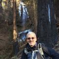
And there was an excellent mood along the trail. :o
4 Stellar atmosphere!_(1).JPG
There were a few obstructed views along the trail but they didn't offer much visibility of the Eagle Creek drainage. :(
5 A few obstructed views of the Eagle Creek drainage_(1).JPG
Let me explain a bit about the terrain on this trail. The trail basically goes down, but with variations on the steepness along the way. The initial first mile isn't too bad, and as I described it feels more like a ridge walk. After this first mile you can expect the trail to descend at an increasing rate. When you're about 1/2 mile from Eagle Creek the trail descends along some very steep switchbacks where the grade is similar to Dog Mt. :shock: Much of the 2000ft+ (in 2.5 miles) of elevation loss occurs in the last 1-1/2 miles.

Not having done much elevation in the past couple of months (pampering the bum knee), our knees felt like rubber and were shaking on the switchbacks near the river. I've never felt so out of shape. :? For those who know about the Roaring River Trail, off of Abbott Road, this trail feels very similar in elevation loss.

We finally got within sight of Eagle Creek, and it was flowing fairly heavy. :D
6 Eagle Creek has plenty of flow_(1).JPG
And then we reached the shoreline. :) You can see the trail continuing, directly across the creek. Sorry about the angled picture but it was a downpour during the entire hike out to the creek and I pointed the camera without looking at whether it was level.
7 Trail continues across creek_(1).JPG
And here is a picture pointing upstream.
8 Looking upstream - gorgeous!_(1).JPG
We weren't going to cross the creek as there were no felled trees and the water was too deep and cold. We were already soaked from sweating and didn't want the possibility of wet feet.

We had a small snack and some very hot tea (yes I lugged this all the way, and it was worth it!). We then turned around and headed back up the trail. We could tell the temperature was dropping, but we were very overheated from ascending up the steep switchbacks. The cooler air was a relief. The rain then finally transitioned to flurries. It wasn't until we looked up that we noticed the white blanket of snow covering the tops of the trees. We finally made it to the ridge area where the snow was starting to stick on the ground. Here's a picture of the view area with the trees covered in snow! :)
9 On the way back it's snowing!!!_(1).JPG
And it was a fantastic winter wonderland the entire way back to the car!! :D
10 Snow!_(1).JPG
11 Snow!_(1).JPG
12 Snow!_(1).JPG
Here is the TH, covered in a thin blanket of snow, when we returned to the car!
13 TH at the end of the hike!_(1).JPG
Did I forget to mention that there were NO people on the trail. Hikes just don't get better than this; no people, snowing, beautiful scenery, plenty of exercise, a wife to share it with! :D I also forgot to mention that this hike didn't bother my knee very much. :D I'm going to start hiking a bit more aggressively to see if the knee will hold out. If it doesn't, then at least I can have the surgery and move on instead of being concerned during every hike.

The hike was a short, but sweet, 5.2 miles with an elevation gain of just over 2000ft.
The Other Eagle Creek Cutoff Trail #504.JPG

User avatar
RobFromRedland
Posts: 1096
Joined: May 28th, 2008, 10:03 pm

Re: 11/17/2012 The "Other" Eagle Creek-Cutoff Trail #504 /S

Post by RobFromRedland » November 18th, 2012, 7:16 am

I did this hike a couple of month ago, when the water level was much lower, and the creek crossing was a simple rock hop. The cutoff trail actually ends at the creek - there is an old sign on the other side of the creek. I hiked up the other Eagle Creek trail a mile or so so I could say I completed that trail. When I've done it previously, I never hiked all the way to the creek (end of the trail).
PA080045.jpg
Old sign
I really liked the cutoff trail except for that last half mile down to the creek - it feels more like a rock climb/slide than a hike. And the switchbacks are not much help - it was more of a zigzag than a switchback. I guess that is due to these being very old indian trails - the indians liked to go straight to their destination - straight up and straight down.

Also, there is a really nice viewpoint on a short side trail right about at the high point of the trip. Based on your photos, I'm guessing it was all fogged in. When I went, it was pretty sunny:
PA080032.jpg
Viewpoint view
Neat to see the snow on the trail! As others have commented previously, it is neat to see trails in different seasons.

FYI, on the Old Baldy trail - the official trailhead is farther east, off the 4610 road, pretty much right across the road from the old Twin Springs campground. There is a trailhead marker there - one of the nice new ones. That is where the trail starts, although it intersects the 4614 road in a few spots for access points, but as far as I know, none of them are marked.
Life is not a journey to the grave with the intention of arriving safely in a pretty and well-preserved body, but rather to skid in broadside, thoroughly used up, totally worn out, and loudly proclaiming: WOW! What a ride! - Hunter S. Thompson

User avatar
mileagemike25000
Posts: 475
Joined: February 8th, 2012, 7:40 pm
Location: Vancouver, WA

Re: 11/17/2012 The "Other" Eagle Creek-Cutoff Trail #504 /S

Post by mileagemike25000 » November 19th, 2012, 7:00 pm

Rob - Thanks for all the info about this trail! :) I'm also trying to complete the trail and hope to do it when I can "rock hop" later in the summer when the creek is low. You mention that the trail ends at the creek but my Garmin 24k map shows it going across the creek and heading back to the TH at SE Harvey Rd.?

I agree that the cutoff trail is quite nice except for the last 1/2 mile, where the switchbacks really don't offer much in the way of knee relief. :shock: I had never heard that these were old indian trails? It's definitely direct, and might not be as difficult if I didn't have all the weight on my back!

Viewpoint? What viewpoint? There were a couple of areas with views but the trees blocked the bulk of the view. I would have had to zoom in to get it to look similar to your picture. I didn't see any side trail. :? Do you happen to have a waypoint where this view is located? Here are the best views we saw.
_06C5516_(1).JPG
_06C5521_(1).JPG
Thank you for drawing my attention to the real Old Baldy TH! :D I completely missed that, and now it's obvious from my map! :x You can see that we cut in to the trail in a couple of places but never drove far enough on 4614. I don't even see the 4610 road on my maps? The first time we visited we had to bushwack up to the trail (it was actually quite fun though) as we couldn't find the TH.
Missed Old Baldy TH.JPG

User avatar
RobFromRedland
Posts: 1096
Joined: May 28th, 2008, 10:03 pm

Re: 11/17/2012 The "Other" Eagle Creek-Cutoff Trail #504 /S

Post by RobFromRedland » November 19th, 2012, 7:50 pm

mileagemike25000 wrote:Rob - Thanks for all the info about this trail! :) I'm also trying to complete the trail and hope to do it when I can "rock hop" later in the summer when the creek is low. You mention that the trail ends at the creek but my Garmin 24k map shows it going across the creek and heading back to the TH at SE Harvey Rd.?
The trail on the other side of the creek is the "other" Eagle Creek Trail (#501) The cutoff trail (the one you hiked) is #504 - they meet at the creek. You can head up the Eagle Creek trail from the other end and hike to the creek if you want. That trail is a little over 6 miles long, so a round trip would be over 12 miles. The best description of how to get there is in the Sullivan book - It is hike 191 in the third edition book or 195 in the second edition book. The roads to get to that trailhead are pretty confusing, but once you have been there, it kind of makes sense. The trailhead is not marked, though. It starts at the top of an old logging road.
mileagemike25000 wrote:I had never heard that these were old indian trails? It's definitely direct, and might not be as difficult if I didn't have all the weight on my back!
I've been told by knowledgeable people that many of the trails in this area were old indian trails that kind of "evolved" into FS trails. They definitely have a different feel than a "regular" FS trail.
mileagemike25000 wrote:Viewpoint? What viewpoint? There were a couple of areas with views but the trees blocked the bulk of the view. I would have had to zoom in to get it to look similar to your picture. I didn't see any side trail. :? Do you happen to have a waypoint where this view is located? Here are the best views we saw.
My waypoint for the viewpoint is 5010803.70 0575519.75 . It is essentially at the high point of the trail - there is a short side trail up a short hill where you get a nice view. You probably didn't see it because you were in the clouds. See the spot on this map segment:
EagleCreekCutoffTrailMap-Partial.jpg
mileagemike25000 wrote:Thank you for drawing my attention to the real Old Baldy TH! :D I completely missed that, and now it's obvious from my map! :x You can see that we cut in to the trail in a couple of places but never drove far enough on 4614. I don't even see the 4610 road on my maps? The first time we visited we had to bushwack up to the trail (it was actually quite fun though) as we couldn't find the TH.
You are more than welcome. The west end of the 4610 road starts directly across from the Promontory Park at North Fork Reservoir. You take a left to head up the road - it is quite a ways to the Old Baldy trailhead. You can also get to it from 4613 if you look at the district maps. I think the Old Baldy trailhead is something like 12 or 13 miles up the road. If you like the area, there are a couple of unofficial, although pretty well maintained (depending on your standards) trails that intersect the Old Baldy trail. One is the Bissell Trail and one is the White Iris Trail. You can read more about them on the trailadvocate page here:

http://www.trailadvocate.org/?page_id=99

All I ask if you hike these trails is to help contribute a little trail maintenance. Since they are unofficial, the only maintenance they get is from "friends". They were brought back from oblivion by dedicated volunteers and I'd hate to see them revert to nature.
Life is not a journey to the grave with the intention of arriving safely in a pretty and well-preserved body, but rather to skid in broadside, thoroughly used up, totally worn out, and loudly proclaiming: WOW! What a ride! - Hunter S. Thompson

forestkeeper
Posts: 1291
Joined: July 23rd, 2011, 8:31 pm
Location: Canby, Oregon
Contact:

Re: 11/17/2012 The "Other" Eagle Creek-Cutoff Trail #504 /S

Post by forestkeeper » November 20th, 2012, 6:45 am

As soon as I'm back in a pickup truck, hopefully in a few months, I'll make it a point to get up there and do some trail grooming. These last two years, I've really abused my sedan with doing FS work. I'll need both of your guy's advice and Trail Rx reports then. Last year, while driving on 4610, my oil pan was scraping the gravel in the center of the road, because of the log truck use. I also plan on performing some TH sign renovation/ sanding/refinishing up there, so hopefully both of you can point me in the right directions. Thanks for your TR's.

FK

User avatar
mileagemike25000
Posts: 475
Joined: February 8th, 2012, 7:40 pm
Location: Vancouver, WA

Re: 11/17/2012 The "Other" Eagle Creek-Cutoff Trail #504 /S

Post by mileagemike25000 » November 20th, 2012, 9:15 pm

Rob -

Thanks for the clarification on the Eagle Creek Trail numbers. :) It's only been in the past year that I started looking at the trail names/numbers and hope get more proficient using them. I've hiked both trails but haven't yet connected them (only about 1/2 mile of missing trail in my log), as previously mentioned. I really need to get some of Sullivan's books, and have been lazy with purchasing them. I know they will give us many new possible hikes, and shouldn't procrastinate. :( I've been to the #501 TH and it is convoluted, but not too bad. The last time we were there we hiked the Douglas Trail #781. That trail seemed a bit overgrown (first 1/2 - 1 mile) and in very bad shape. I tripped on a hidden branch in the low brush (the very start of my knee issues). :x

Regarding the trails that were orginally old indian trails; it would be nice to designate them on maps for historic purposes. Perhaps that information is already available? The last 1/2 mile of the Eagle Creek Cutoff trail sure did have a different feel. :o

Thanks for your map and waypoint for the location of the viewpoint. It appears to me that my waypoints appear to be in the same location as yours. :? We must have just missed the short trail you talked about? Just another reason to go back and scout it out, when it's clear!

My Garmin map doesn't seem to have the 4610 road, or perhaps it goes by another name. I do see where the 4613 road leads into the 4614 road, though. This appears to be the Clackamas Hwy access to the SW Salmon Huckleberry area. Thanks for letting me know about the other Unofficial trails on the way to Old Baldy. :) We're always looking for new trails! I'll look them up on the Trail Advocate site.

You may be happy to know that my wife and I are avid trail maintenance hikers! We carry pruners and spend time clearing the smaller debris off the trails, and have been for several years. :) Up until my shoulder injury (1-1/2 months ago), I carried large loppers to clear branches up to 1-1/2+ inches. I need to throttle back until my shoulder gets better. :(


ForestKeeper - I'm sorry to hear about your truck. :( Our vehicles have also gotten beaten up by the bad roads. We have scratches on all our vehicles, from the branches sticking out on narrow forest roads, but that's the price for getting to these fantastic places. Crazy question, but do you think there will be access to these trails (~4000ft) in a few months? :?

Personally, my wife and I thought the trail was in fantastic shape, and quite clear of debris. :o We only had to use our pruners in a few spots. Also, the signs we saw seemed to be in great shape, although we only saw the Eagle Creek Cutoff trail sign and those near the Wilderness Boundary area. Since all my pictures are geotagged, I can give you the locations of those signs. However, I didn't go north or south on the Old Baldy Trail beyond the trail intersection, and don't know if the signs are in bad shape?

User avatar
RobFromRedland
Posts: 1096
Joined: May 28th, 2008, 10:03 pm

Re: 11/17/2012 The "Other" Eagle Creek-Cutoff Trail #504 /S

Post by RobFromRedland » November 21st, 2012, 6:27 am

A couple of comments:

Although I've never hiked the Douglas trail, I had heard there was some significant trail maintenance done, especially brushing, so maybe it is better shape now.

I know of nothing that lists trails as old indian trail. It may be out there, but i'm not aware of it. I think the trails were initially indian trails, and when the FS took over management of the land, the trails "evolved" - meaning some parts were brought up to FS standards, rerouted, etc, but many parts of them are still the original tread.

Thank you for helping with trail maintenance. While cutting downed logs off the trail is important, I think it is equally important to keep the tread free of debris and brush. I've been on trails that have very few downed logs, but are almost impassable due to heavy brush. These lightly used trails need all the friends they can get.

I doubt you will be able to get to any of these 4000' trails soon. They may still be accessible now, but the snow is rapidly coming and will remove access to them until next spring/summer.

I would say trail signage can always be improved. There was a big improvement after the stimulus money (I think that is where the cutoff trail sign came from). Many trails got new trailhead signs and there were quite a few places that got new or fixed trail signage too. But there are still a lot of areas where signs would be helpful.

If you want to explore these areas, the best way is to get the FS district maps. They are probably the best map for this kind of thing, but even they have problems, and are not current. They have decomissioned roads that are not reflected on the current FS maps. But it is probably the best resource available. The 4610 road is sometimes called the Abott (or Abbott) road. It is a very old route.

Here is a gmap map of the west end of the 4610 road. You can pan with your mouse to see where it goes, but you can drive it up from this end over 20 miles until a slide wiped it out. You can also drive it from the east end up to the slide area.

Life is not a journey to the grave with the intention of arriving safely in a pretty and well-preserved body, but rather to skid in broadside, thoroughly used up, totally worn out, and loudly proclaiming: WOW! What a ride! - Hunter S. Thompson

User avatar
mileagemike25000
Posts: 475
Joined: February 8th, 2012, 7:40 pm
Location: Vancouver, WA

Re: 11/17/2012 The "Other" Eagle Creek-Cutoff Trail #504 /S

Post by mileagemike25000 » November 21st, 2012, 7:13 pm

It's good to hear that the Douglas trail has had significant trail maintenance. The area where the brush is taking over was obviously thinned, which has made quite a bit of light available for the brush to flourish. The Oregon Grape and Blackberries where especially nasty! :x

I guess the knowledge of the Old Indian trails are just going to passed down through rumors and from what historical documentation can be found? :?

It's our pleasure to help with maintaining the trails. Our feeling is that if we use them, then we need to make them better for our having been there! :)

I was actually being rhetorical about ForestKeeper accessing those elevations by truck. Weve tried, in frustration, to gain access during the winter/snow season but it doesn't take very long before we give up. Actually, once is enough. :lol:

I think you're right about the signage always needing improvement. :) It was evident that the stimulus money was helping with trail improvements, but there never seems to be enough to do it right. I would really like to see a new CCC chartered to expand/improve our trail system. :D

I'll have to start looking at the forest service district maps, along with the multitude of sources that are available. Because funds will always be limited for updating maps, I believe groups such as the PH'ers (and many others) can help make the changes more visible to their community. I just wish there was a single repository for these updates?

Thanks for the map of the 4610 road. My map called it "N. Fork Rd.". By the way, I never saw the Gmap4 utility before, and it looks very interesting!

Post Reply