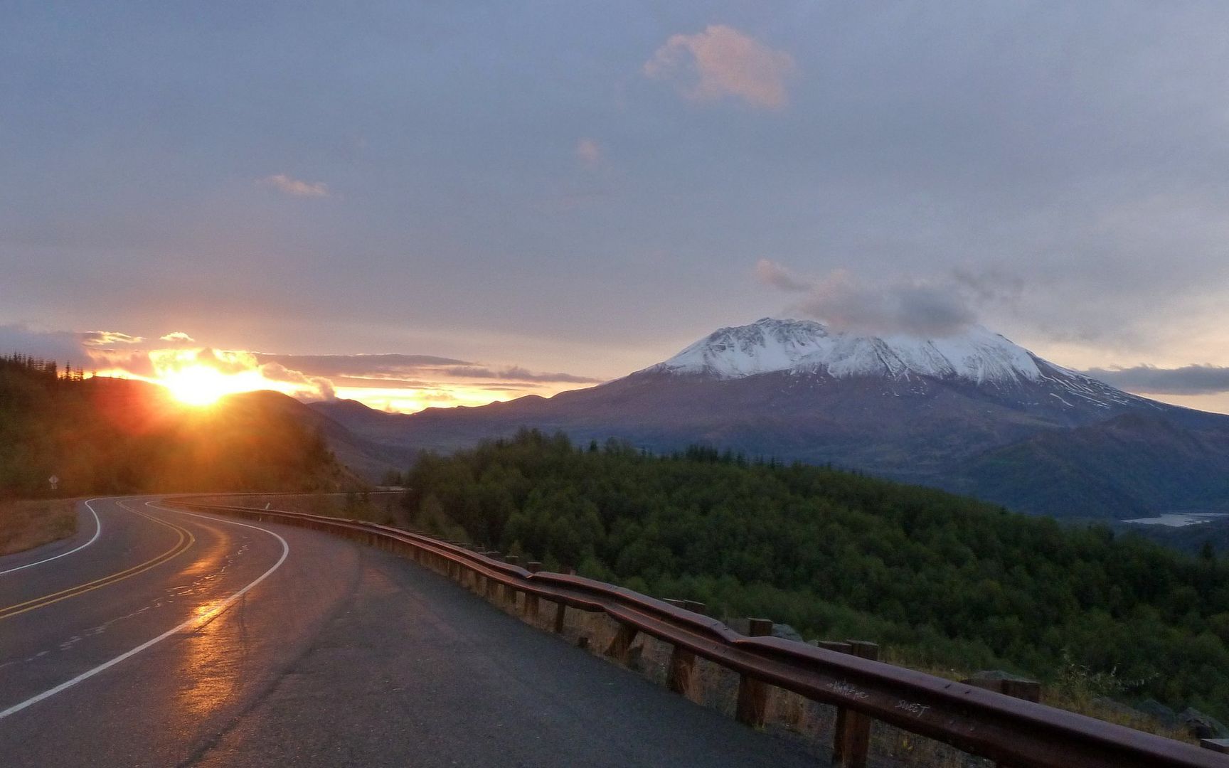
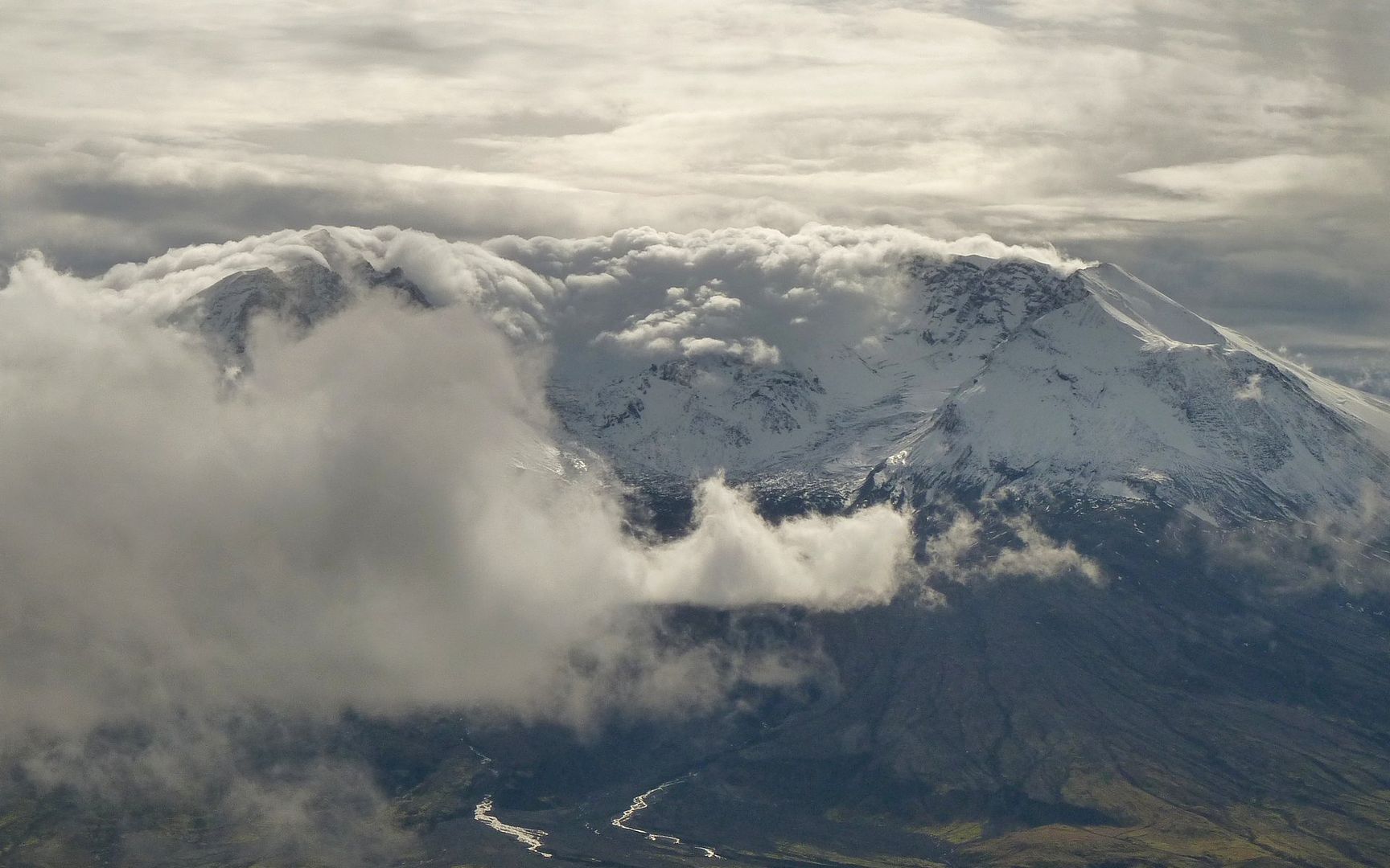
With limited daylight this time of year, I hit the road just a little after 6am. It was still dark as I turned off I-5 onto SR-504, with the sky just starting to lighten by Toutle, and first sun peaking through near the viewpoints past the Forest Center. I could see that the snows that fell over a week ago had only melted up to about the 6000' level during the ensuing Pineapple Express.
I took far too many photos. Here, I'll share just a tiny percentage of them...
Late dawns mean I can finally feel like I'm getting a good start on the day!
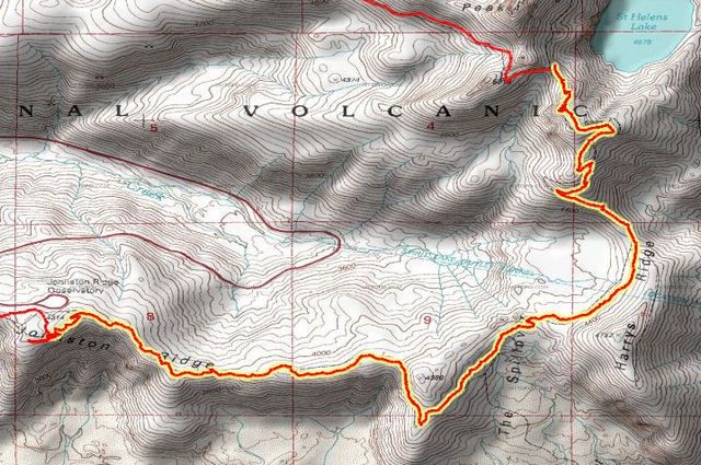
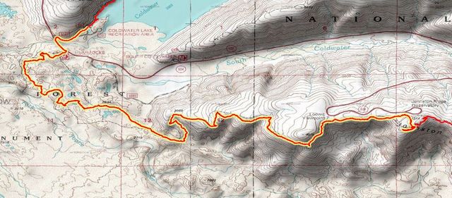
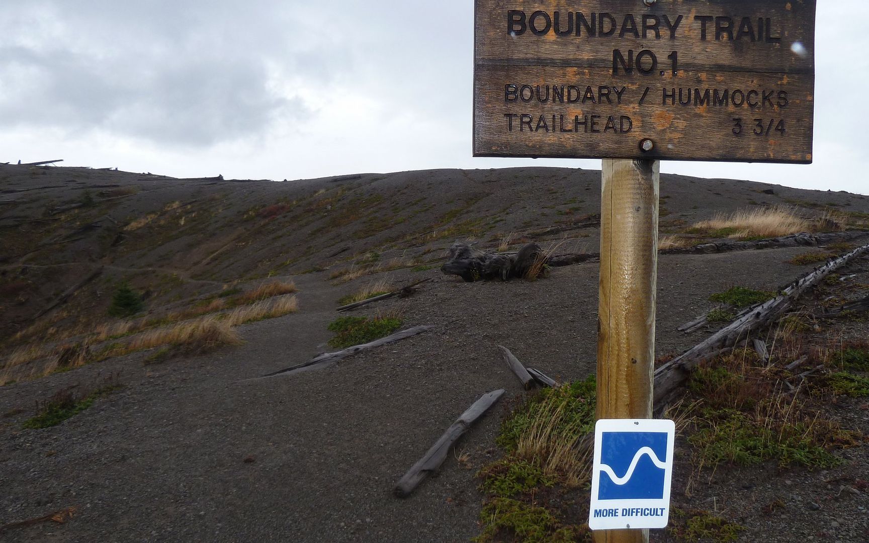
My plan was to park at Coldwater Lake, follow the Lakes Trail (211) along the north shore to the other end, take a hard right there and head uphill to Saint Helens Lake, then follow the Boundary Trail first to Johnston Ridge Observatory, and finally on down to the Hummocks area which is just across the road from my starting point.
The first segment along the north shore of Coldwater Lake was idyllic and mostly flat. There were two guys out fishing on the lake, but otherwise not a single other human encounter. The only footprints on the trail were made by elk.
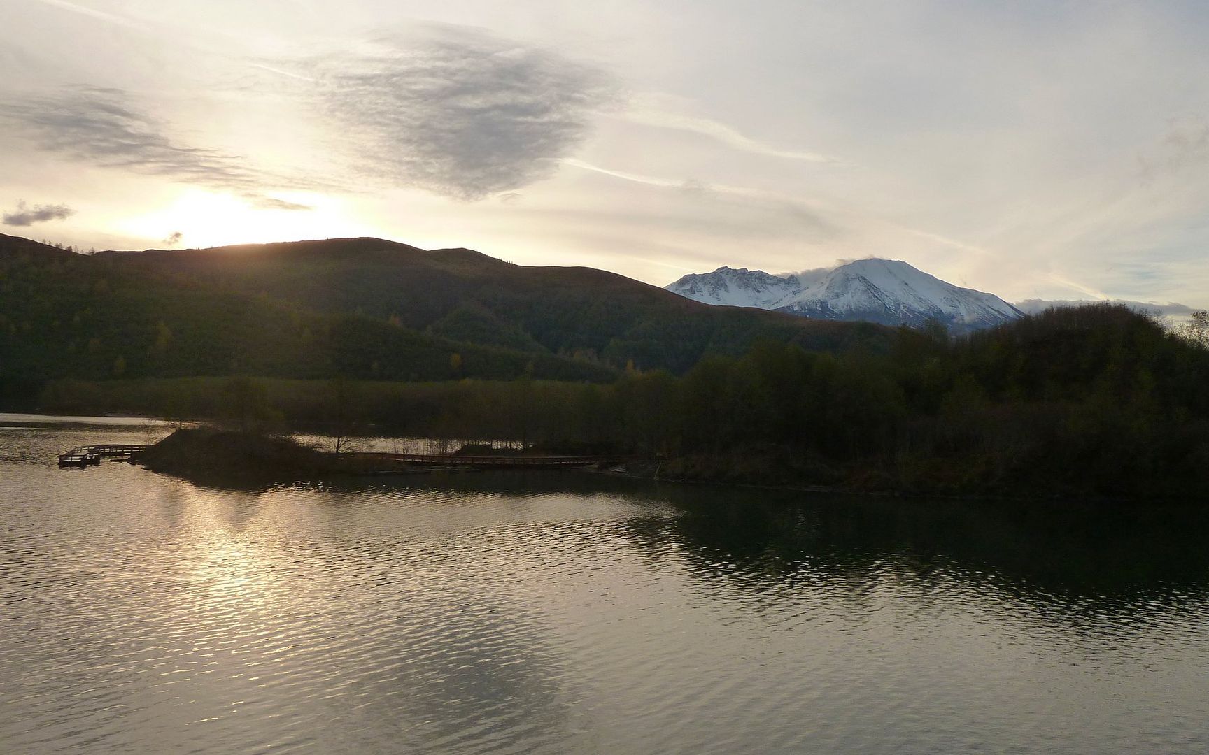
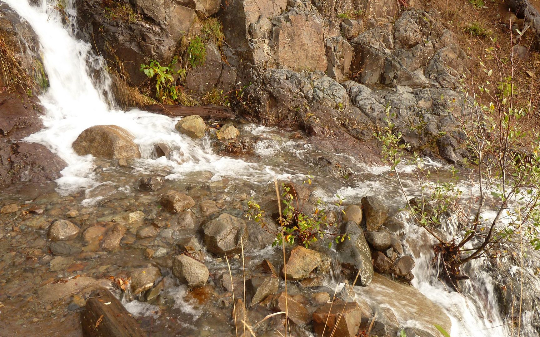
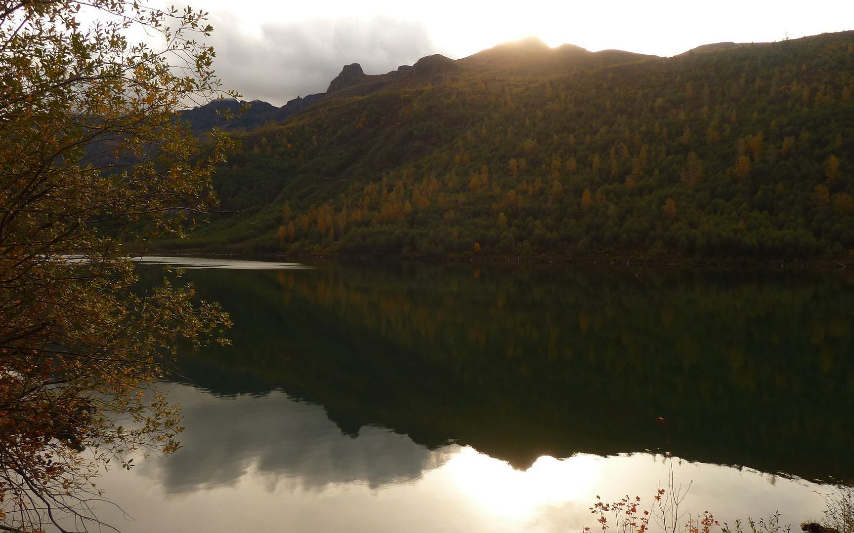
At the western end of the lake, Mt. St. Helens poked over the ridge to my south. The view of rugged Minnie Peak, downlake, was with me all the way. At the east end of the lake, was a huge alluvial debris fan, then a bit past was a little beaver pond. The trail crossed numerous little streams, and one fairly substantial one. This segment ended where the rushing Coldwater Creek crossed under a beautiful footbridge.
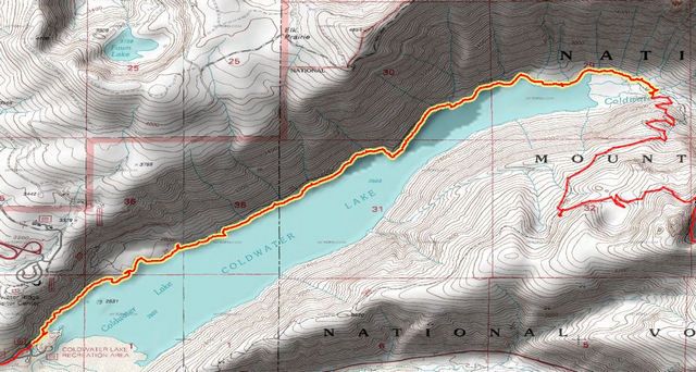
Mini-Hike #1 (highlighted): 5.0 miles, 926' elevation gain, 877' elevation loss.
Click any photograph below for a screen-sized enlargement.
The sun was low behind the ridge on south side of Coldwater Lake as I hit the trail.
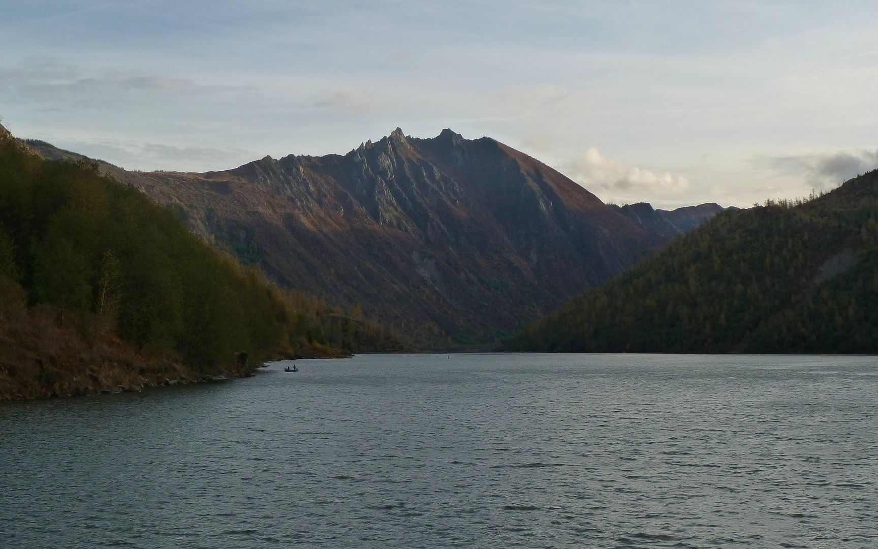
Minnie Peak (5505') was always in view at east end of Coldwater Lake.
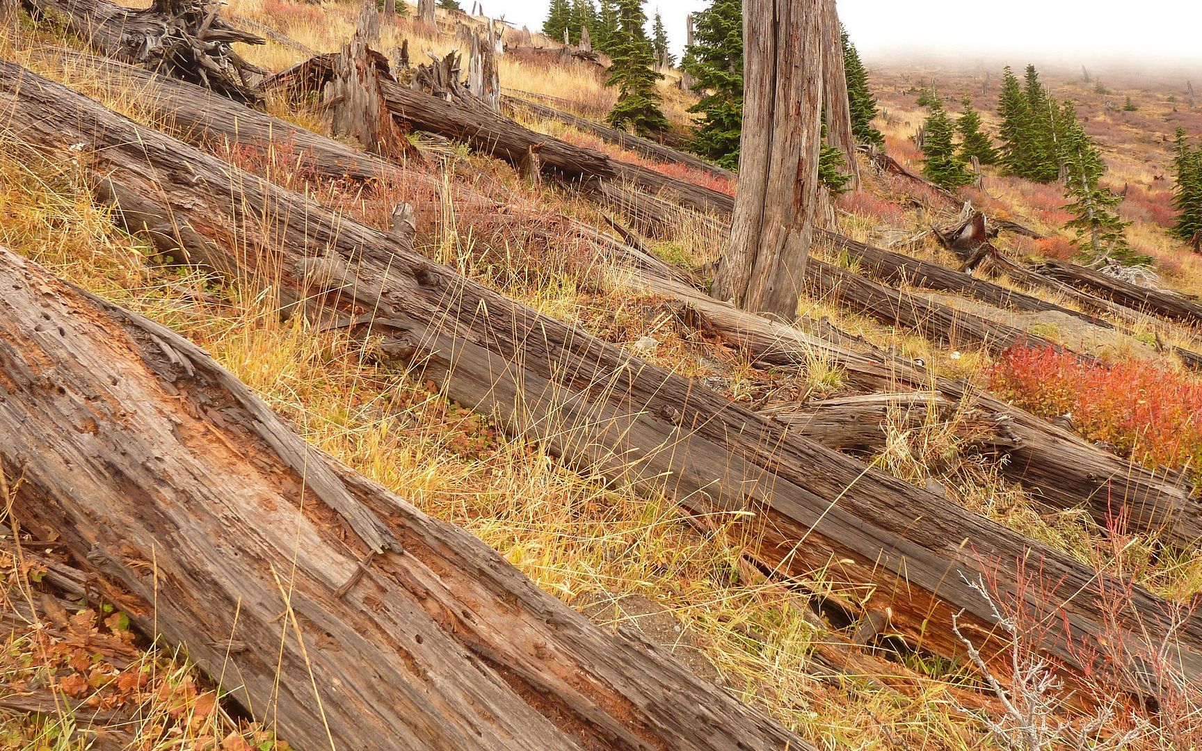
Couldn't believe the cuts in this blowdown! It was easily taller than I am.
Somewhat tricky crossing. Very swift! Landing zone is dry, light grey rocks on far side.
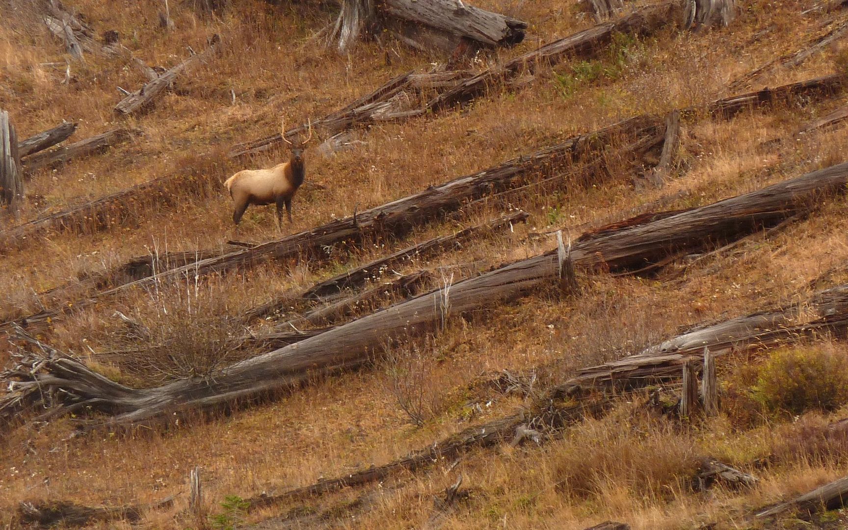
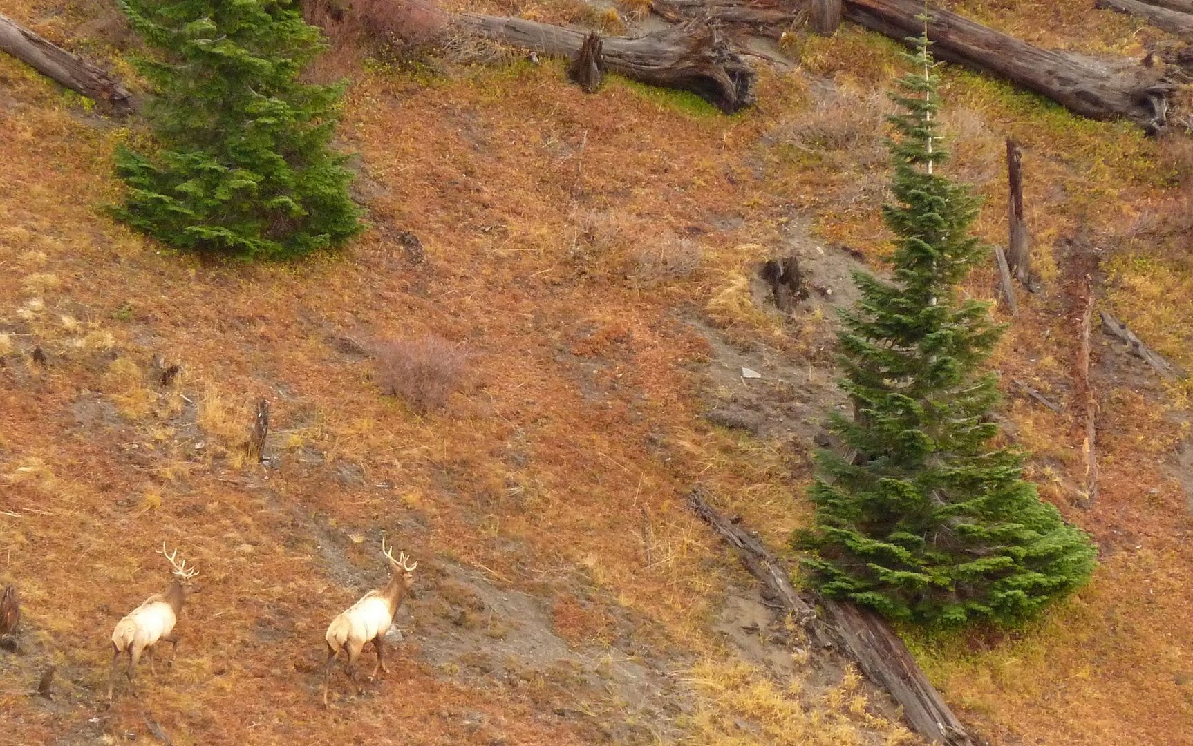
The first of what turned out to be countless elk I would encounter today. One bull I startled, which
startled me, was less than 50' away in a thick alder forest on this segment.
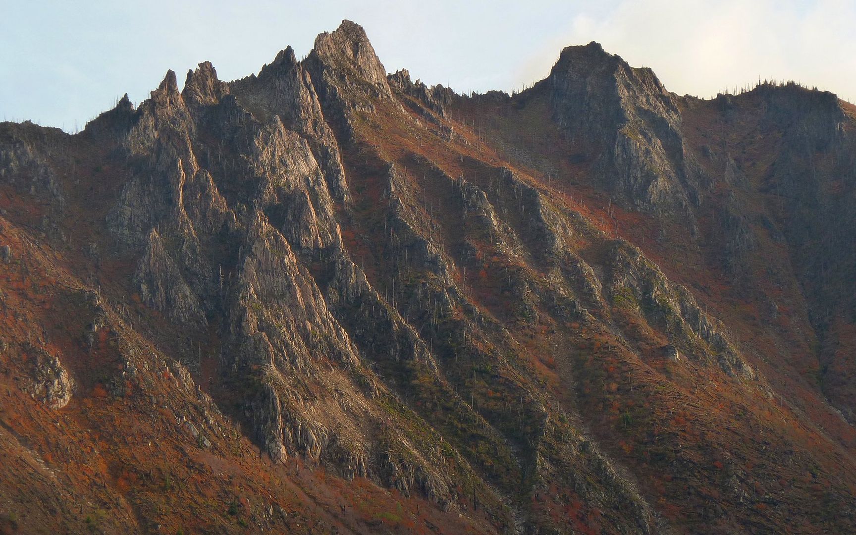
Fall colors on Minnie Peak.
Sun peeking out from behind Coldwater Peak. Next segment of this trip heads up that ridge to nearly
that exact point.
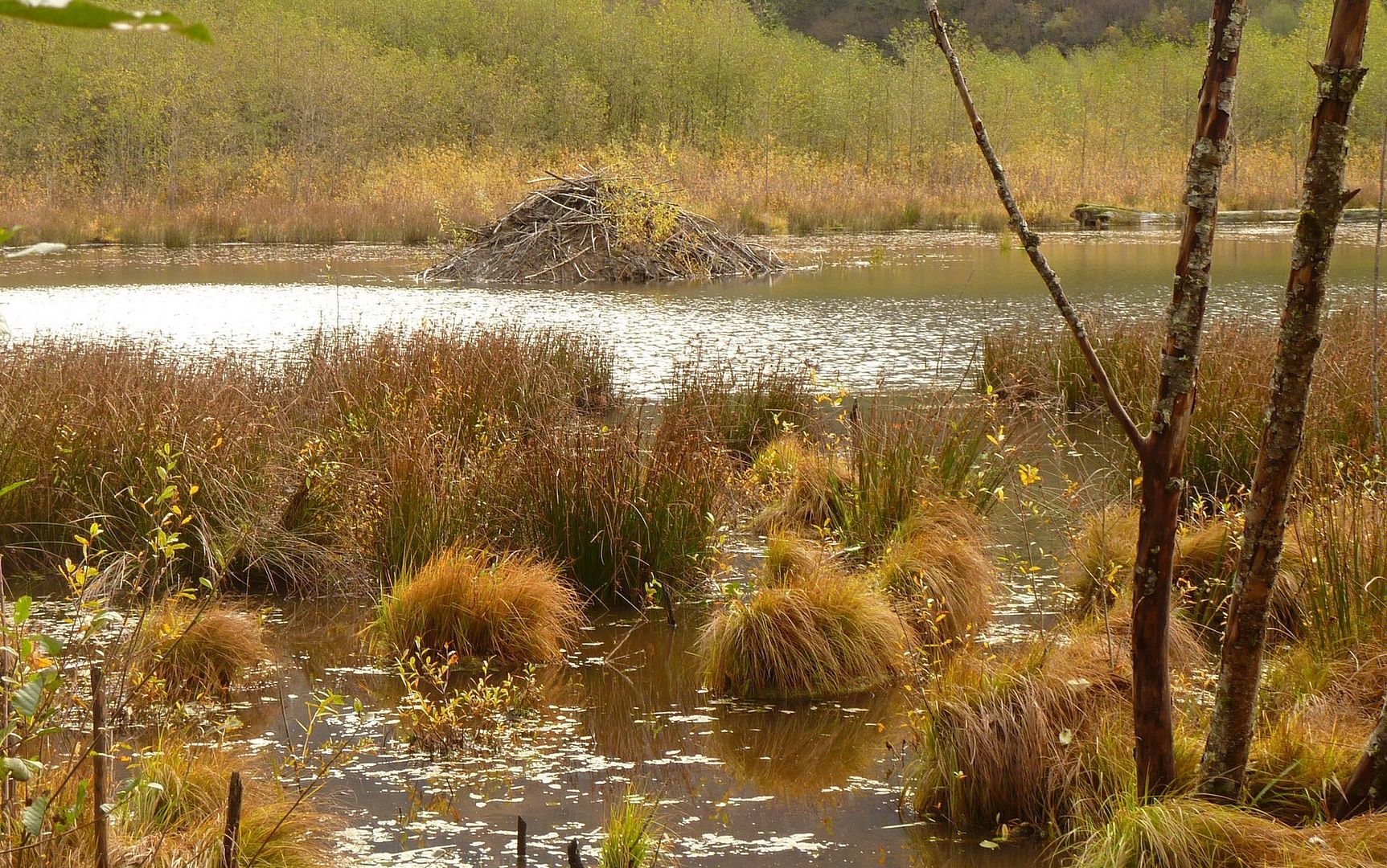
Beaver pond just east of Coldwater Lake.

Coldwater Creek was roaring down the valley! The 1980 eruption dammed this creek, to create
Coldwater Lake.
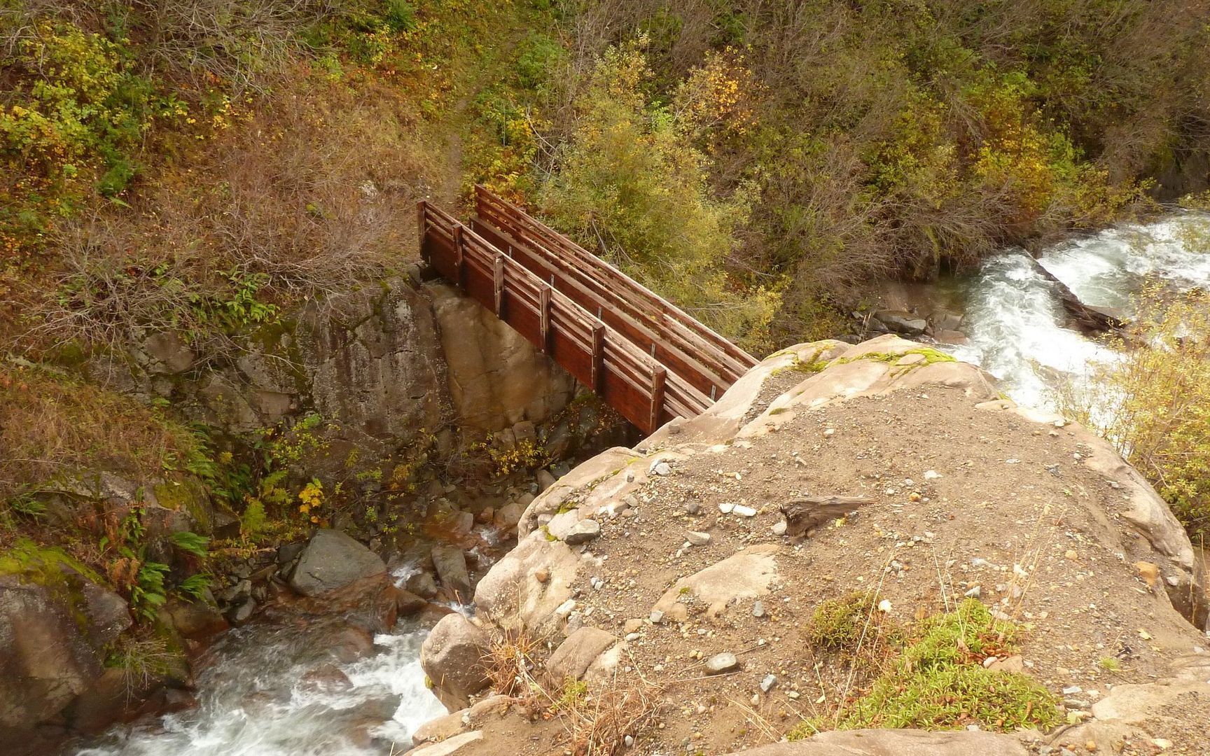
Really nice footbridge over Coldwater Creek. Probably had to be flown into place.
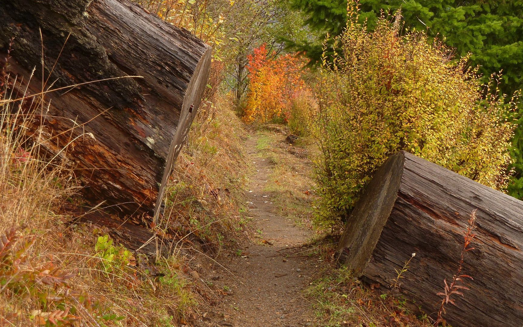
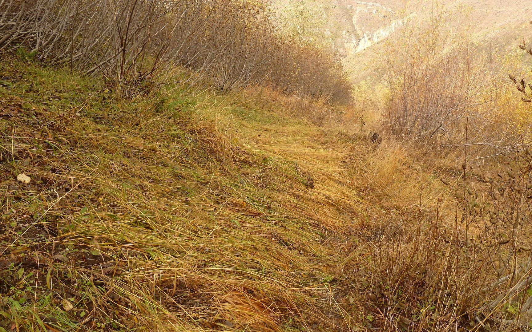
At the creek, I hit the junction with the Coldwater Trail (230), which comprised segment two and took me up to Coldwater Peak and Saint Helens Lake. This segment climbed steeply from the beginning, and only moderated a bit as I took on elevation. Initially, it was somewhat overgrown in places, although with most of the leaves gone it wasn't very irritating. This dense alder mix gave way to grasslands and stumps as I climbed.
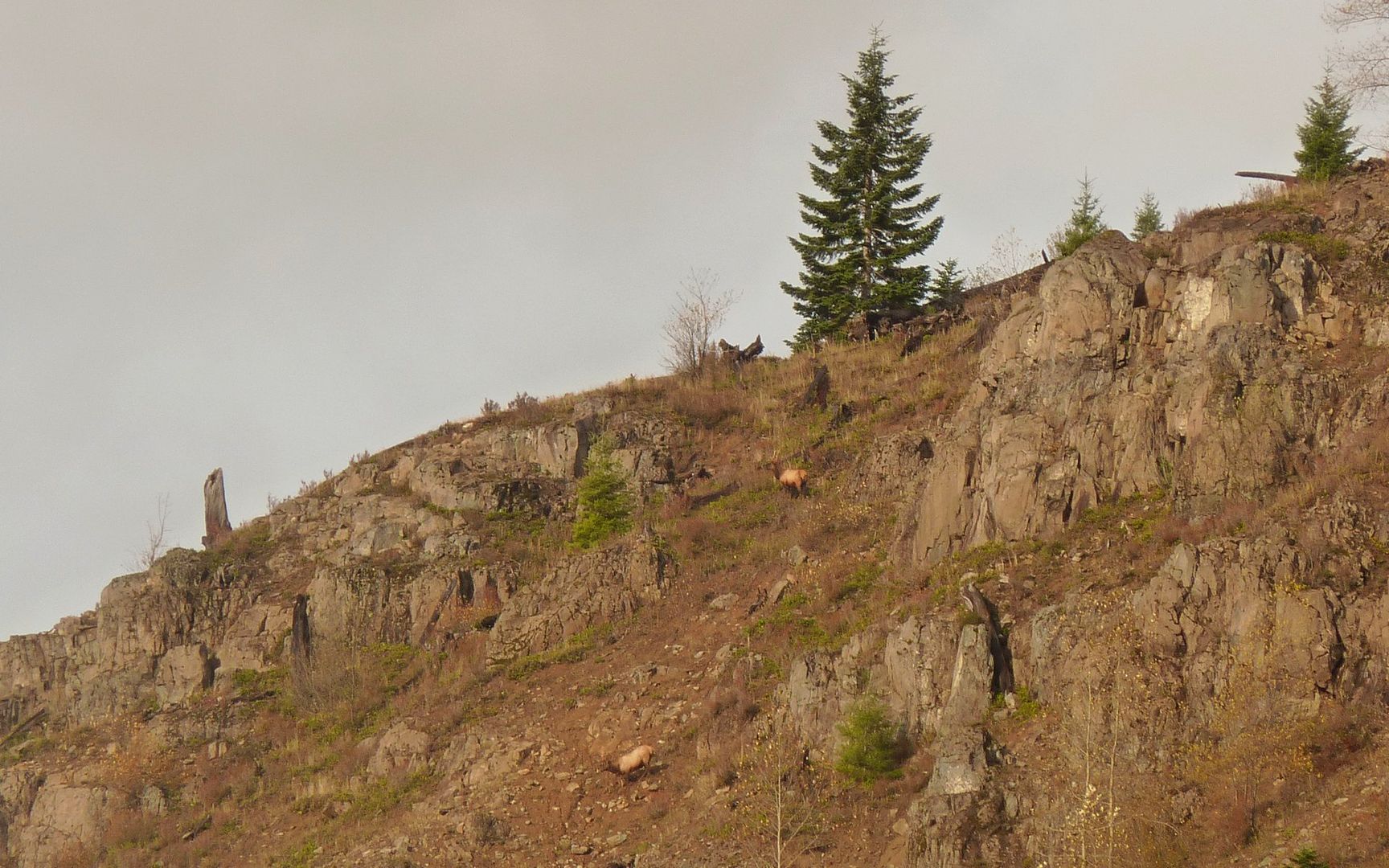
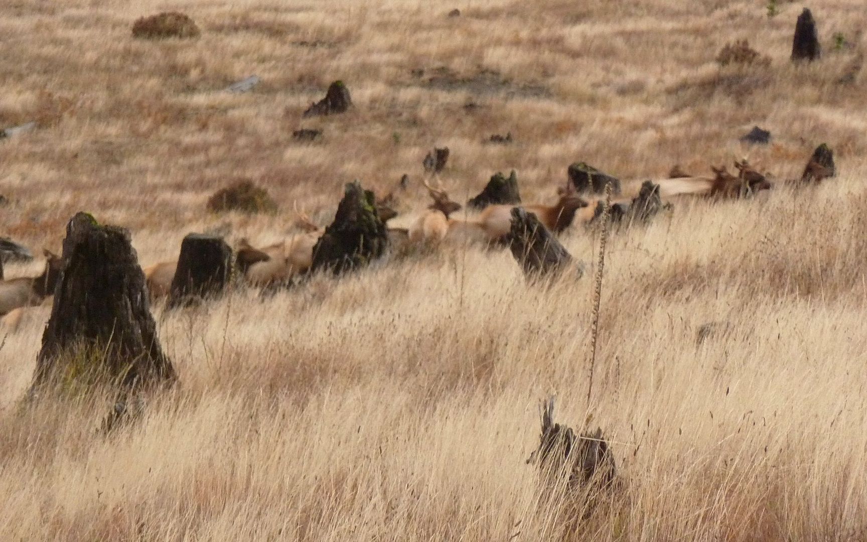
At about 3800', the South Coldwater Trail (230a) merged in. If you follow my route, be sure to pay attention at this junction. Just a 100 or so yards down the other trail lies some logging equipment destroyed in the 1980 eruption. Definitely worth the slight detour. The trail then continues up, past a campsite just a bit farther along, and through territory just crawling with elk!
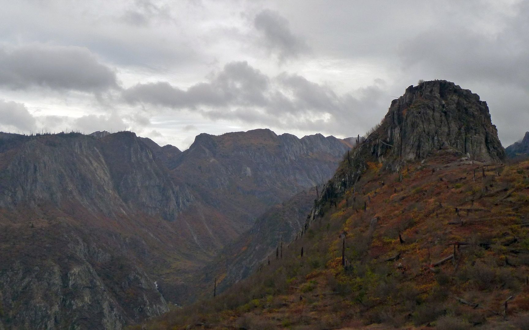
The final 1.5 miles follow rather steep topography, as you look out over the Mount Margaret Backcountry, and could easily give some folks pause. Especially in high winds, as I encountered this day. Along a few unconsolidated hillsides, small washouts essentially erased the trail for short segments. Certainly smart to stop before gazing about at the (stupendous!) scenery.
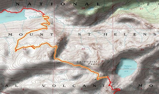
Mini-Hike #2 (highlighted): 4.9 miles, 3056' elevation gain, 572' elevation loss.
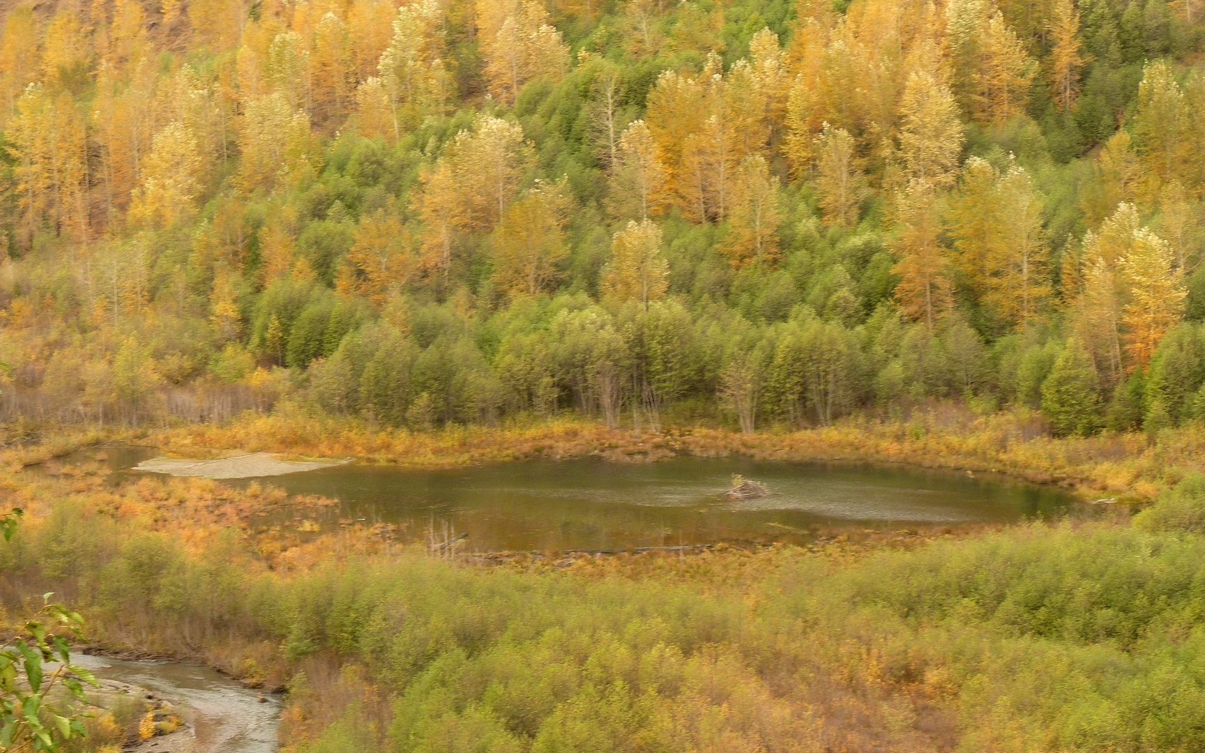
The beaver pond from above.
Looks like a gang of elk bedded down for the night right here on the trail.
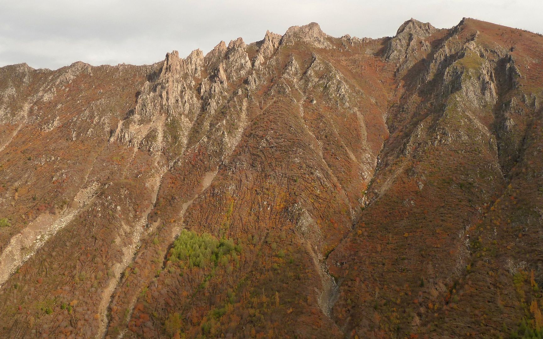
Within no time, I was looking directly across to the halfway-up mark on Minnie Peak.
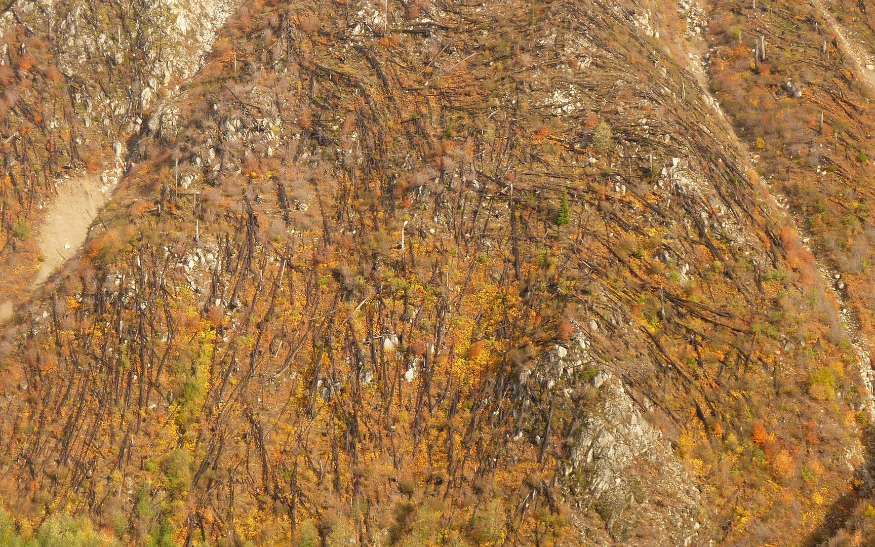
Minnie Peak was apparently far too rugged for viable salvage logging following the eruption.
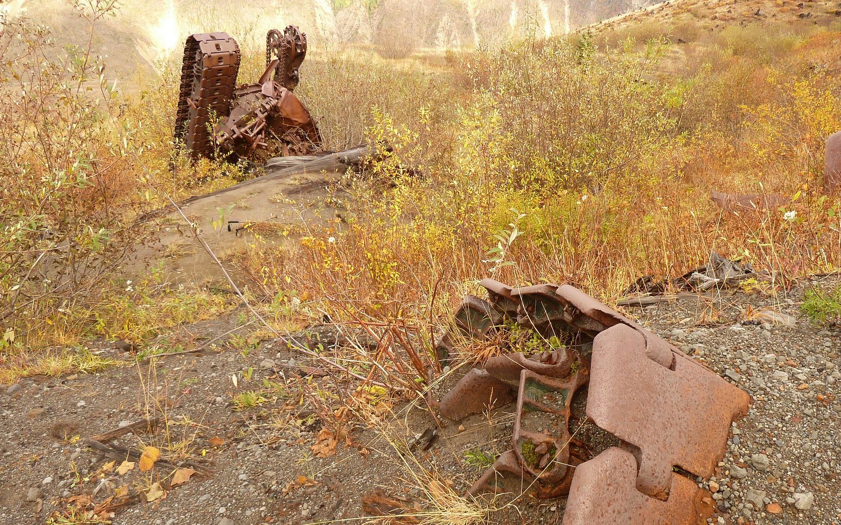
Logging equipment destroyed in 1980, near junction 2 miles from beginning of climb.
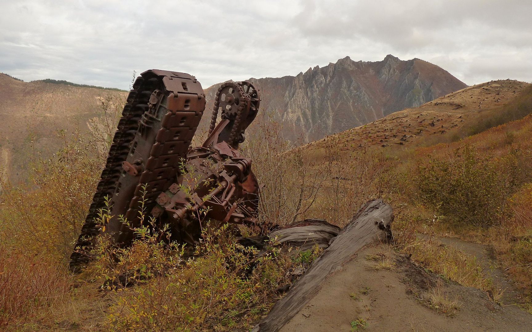
Another view of bulldozer. Note the gathering clouds above Minnie Peak.
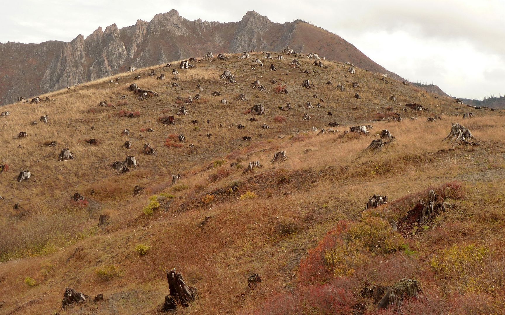
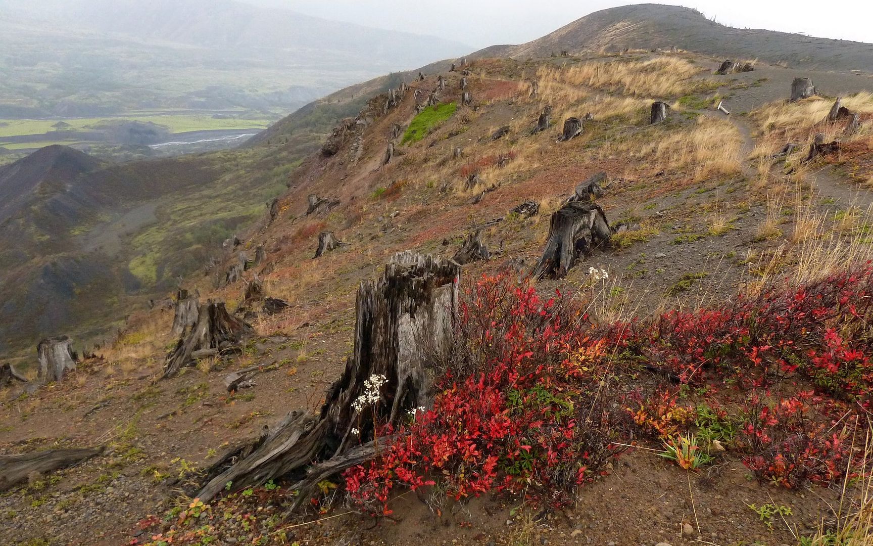
The landscape is wide open now, with mostly just grasses growing amongst the stumps.
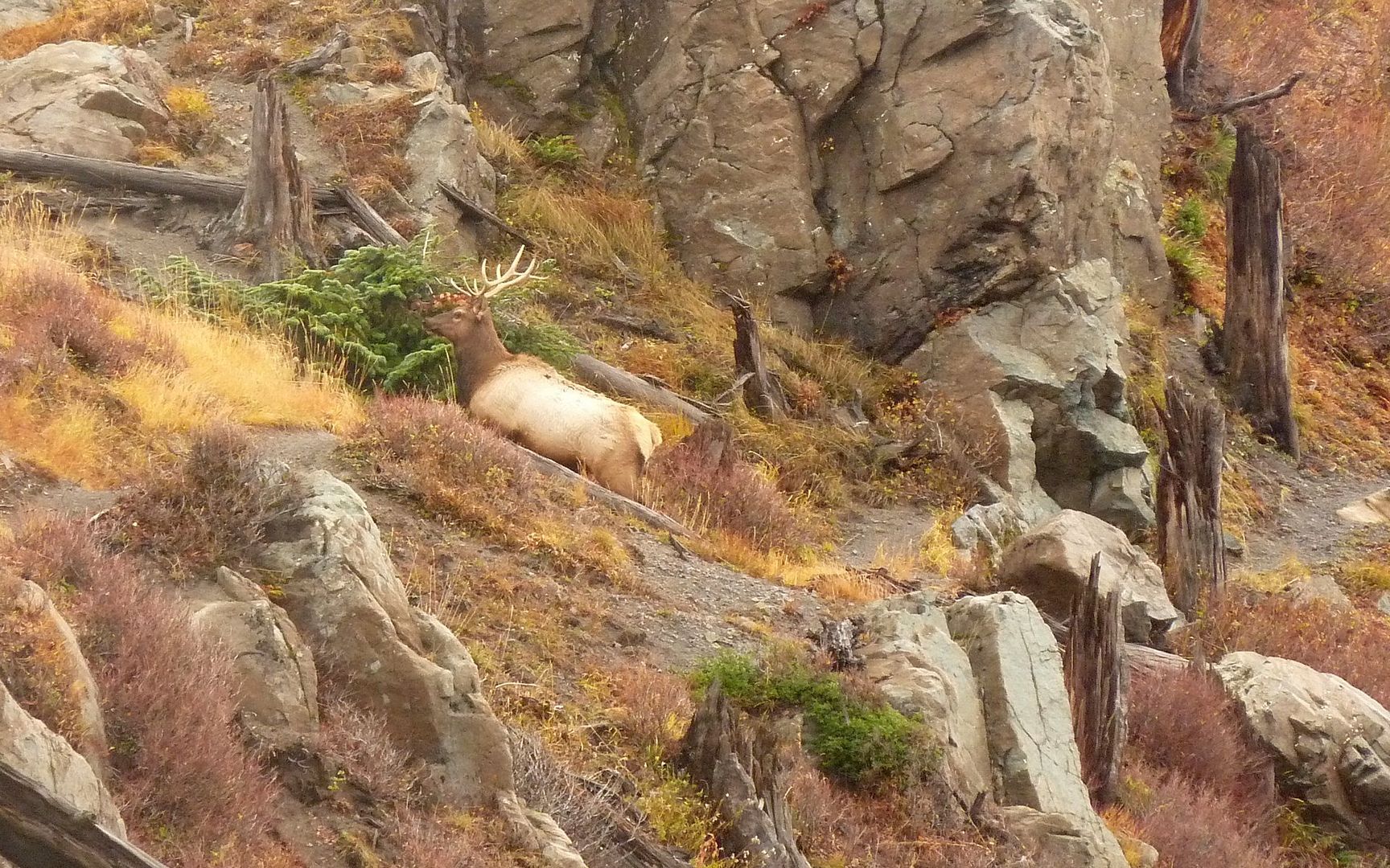
A bull elk sizes me up. I was actually surprised at how skittish these great beasts were.
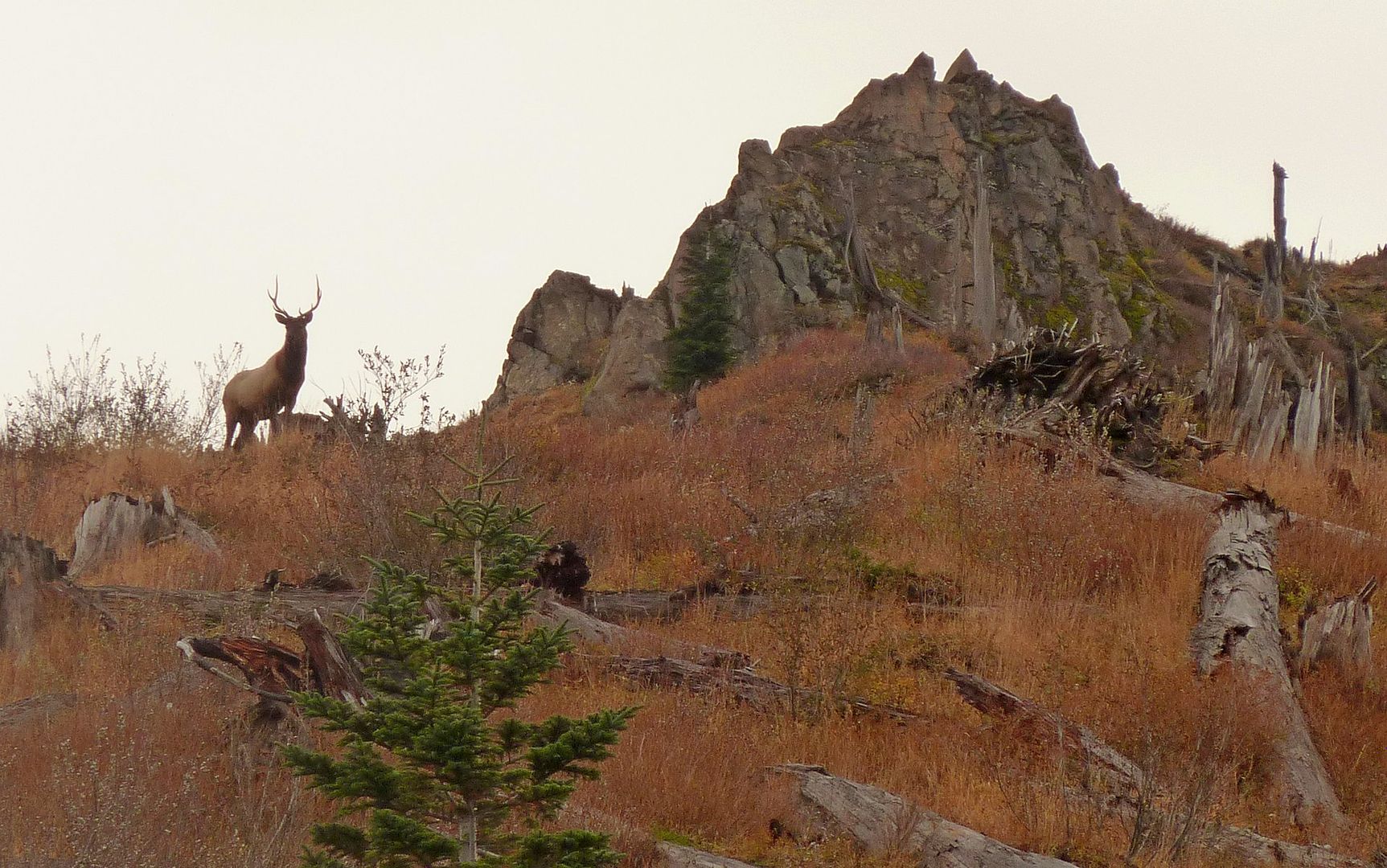
Another bull looks down from the ridgeline above.
The scenery is becoming spectacular as I climb! The unsettled weather adds to the drama.
Coldwater Creek is far down below, in the lower-left.
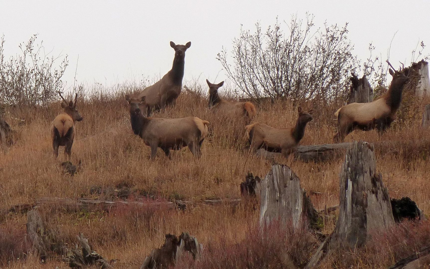
Elk everywhere! I suppose, because I'm the only human within many miles?
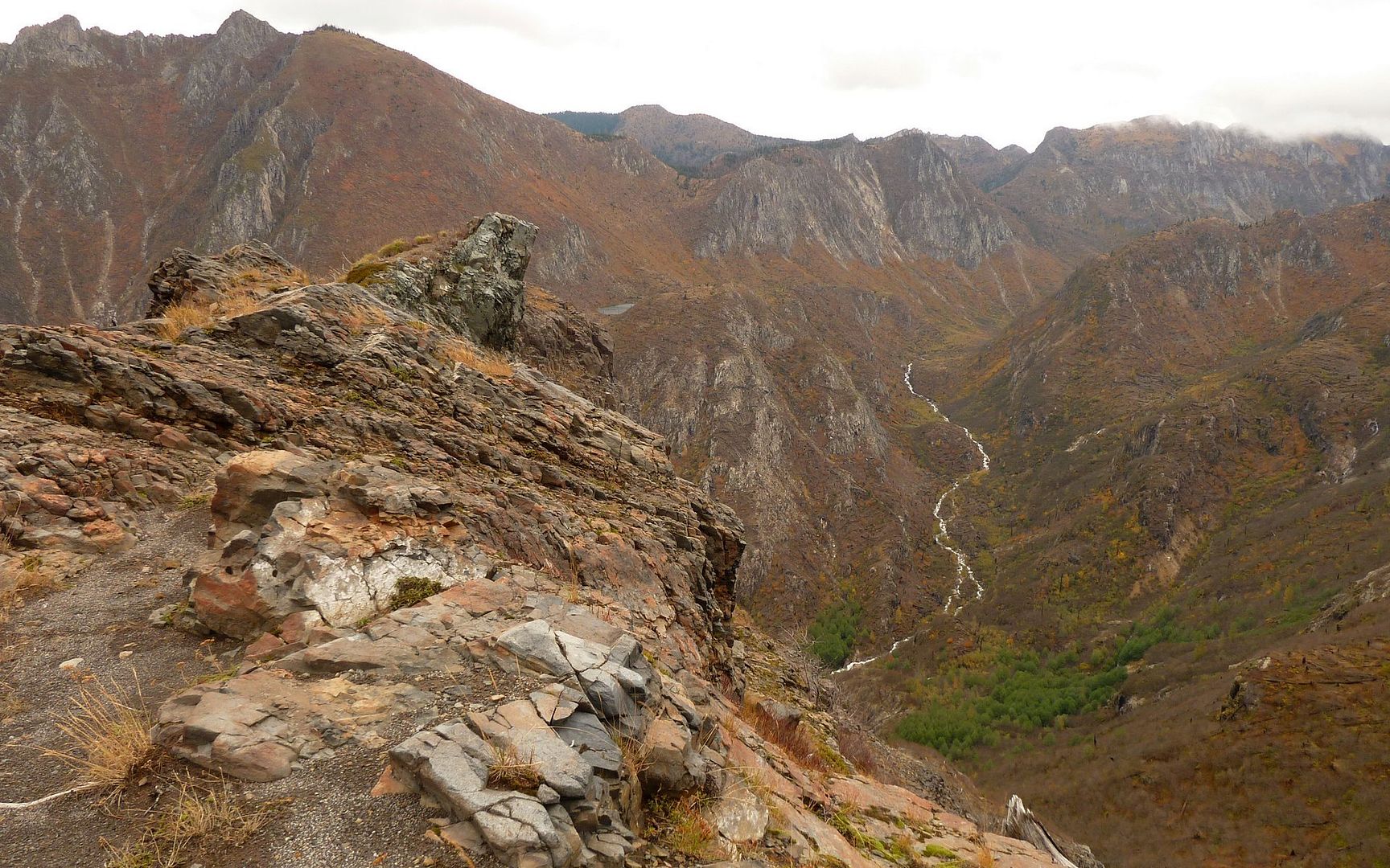
The views just open up into the Backcountry. Amazing! Hard to keep moving!
Around this bend, I cross that saddle and encounter gale force south winds...
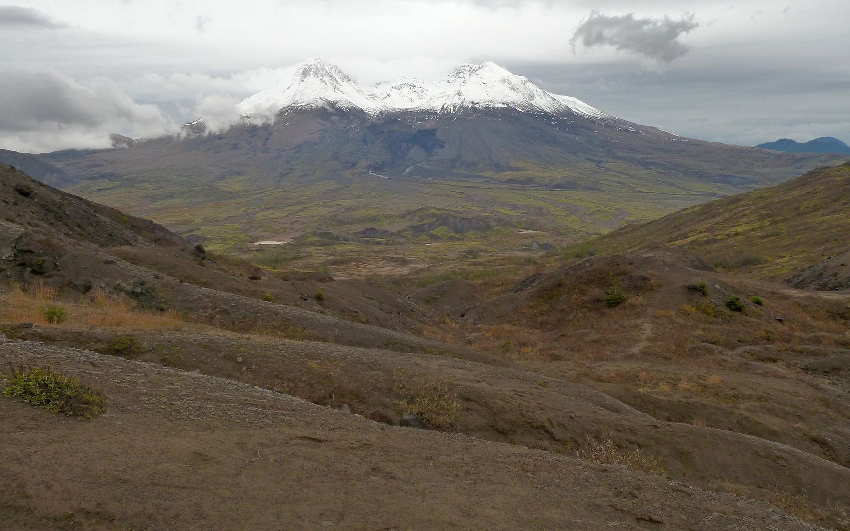
...and a view that was to die for! Hard to hold the camera still, though.
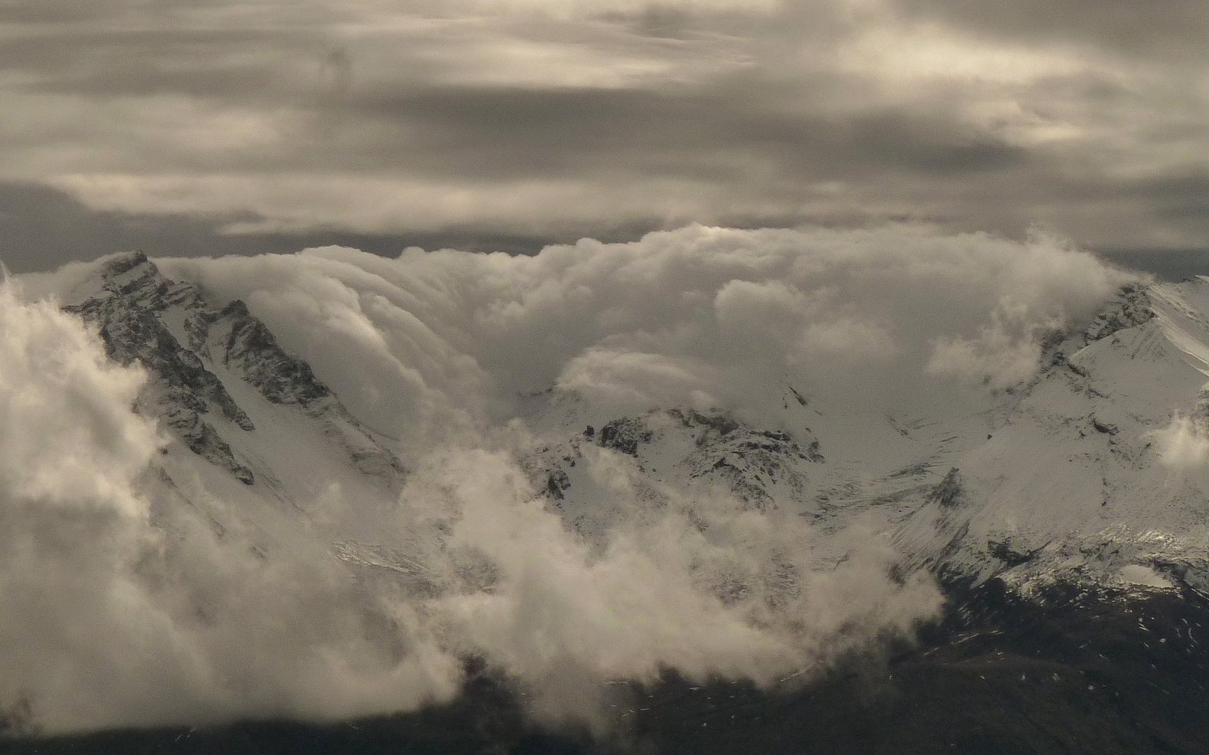
I had considered climbing MSH from the south today. The wisdom of my final choice was really
brought home at this moment! Can you even imagine standing at the lip of that crater?
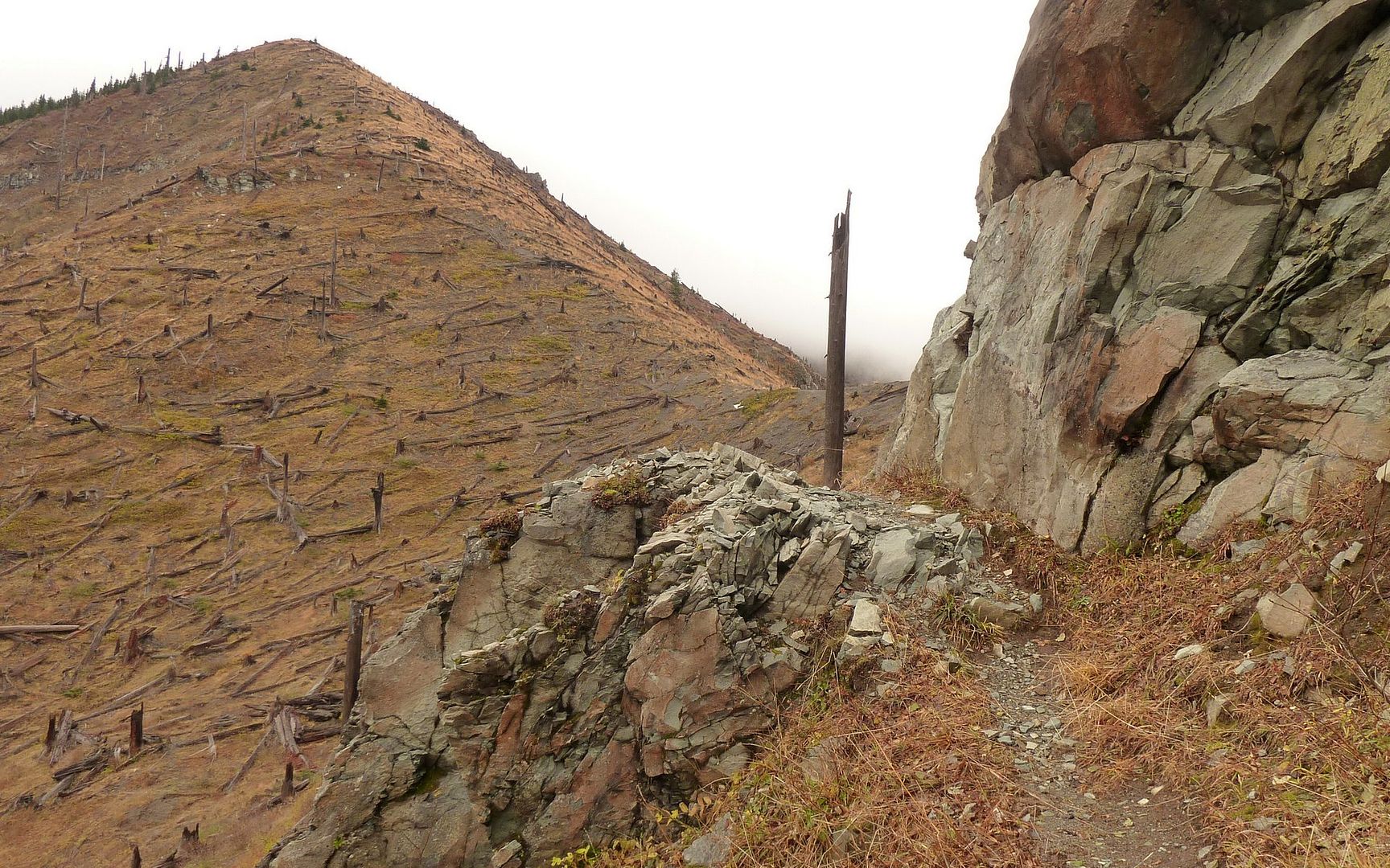
Unsalvaged blowdown on flank of Coldwater Peak. I had just about climbed to the clouds, now.
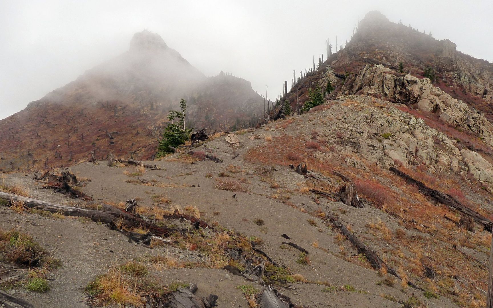
One of the very few moments all day where I could see the top of Coldwater Peak. Sort of.
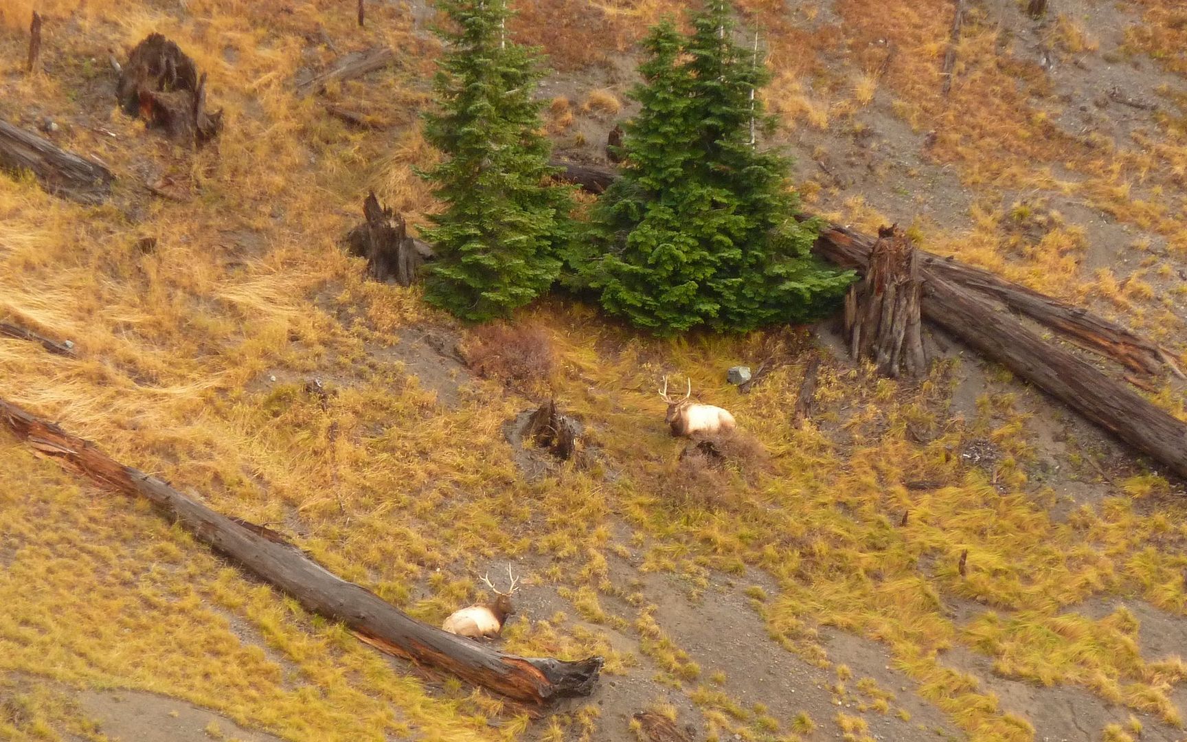
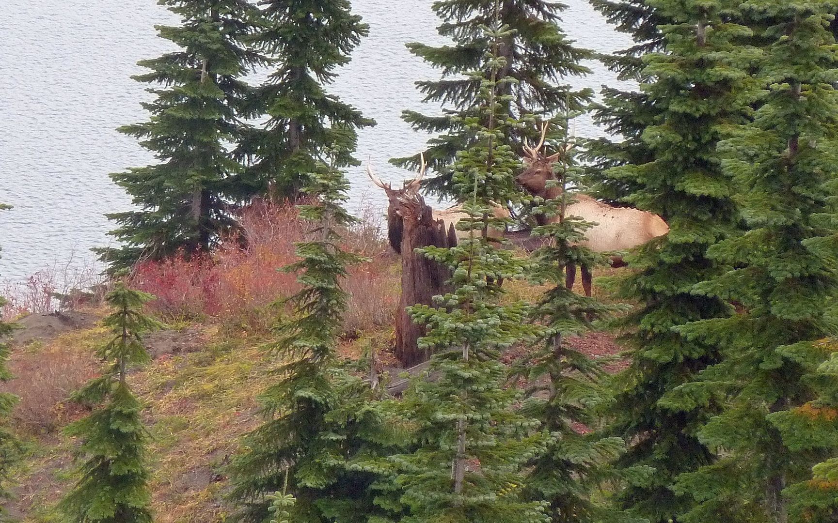
Two bulls chewing the fat, passing the time of day.
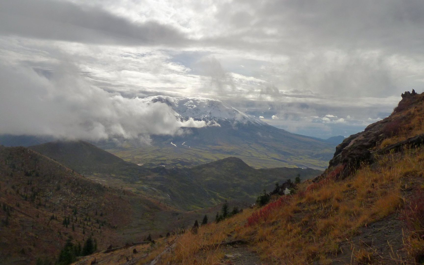
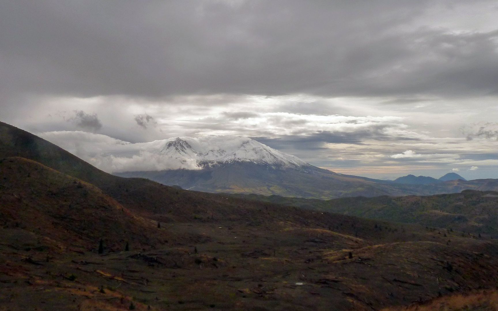
As I watch the elk, the clouds part again on MSH. Don't know which way to look!
Amazing... Sun over the south side. Weather on display.
The bulls aren't happy with all my sightseeing, though, and decide it's time to wander.
Their chief defense mechanism seems to be following the fall-line. Uphill!
Peek-a-boo!!!
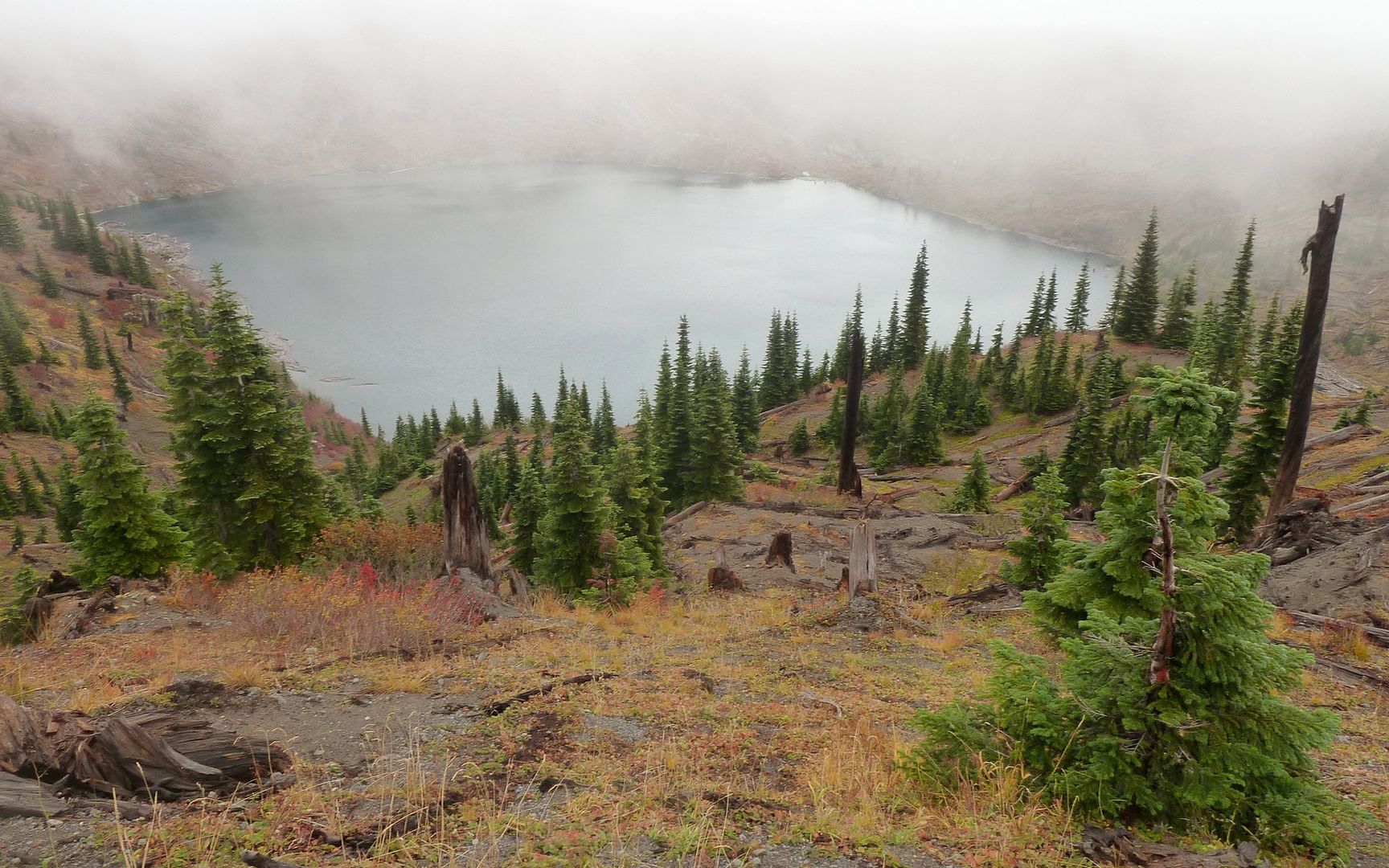
I'd now reached Saint Helens Lake. And I could almost see it, too! The thick clouds made a run up
Coldwater Peak seem pretty pointless right now. Here ends the second segment of this journey.
It was about 1:30 in the afternoon, now, so I took the time to find a PB&J to enjoy as I swapped out batteries in my GPS. Lunch with a view!
The next segment along the Boundary Trail is one I had traveled before, and would pass through a wonderful rock archway, before descending down past Spirit Lake and Harry's Ridge, then meandering on the bluffs above the Pumice Plain to Johnston Ridge Observatory. I had yet to see another human. Not even a footstep of one! The solitude was unparalleled, and could be the main explanation for why I was encountering elk at every turn. Every other time I had been up here, I failed to see a single one. But then, I had never been totally and absolutely alone, either.
Between Harry's Ridge and the junction with the Truman Trail, I encountered two pairs of other hikers heading away from JRO. The first pair I met told me about a herd of elk they had just seen, and I told them about a couple that had just crossed up and over Harry's Ridge. As it turned out, those were the last elk I saw between there and JRO.
At the great hairpin turn in the trail, where it bends back to the north and that section that traverses the somewhat steep hillside, the rain began. That would be with me for the next two hours or so.
Mini-Hike #3 (highlighted): 5.5 miles, 1064' elevation gain, 1908' elevation loss.
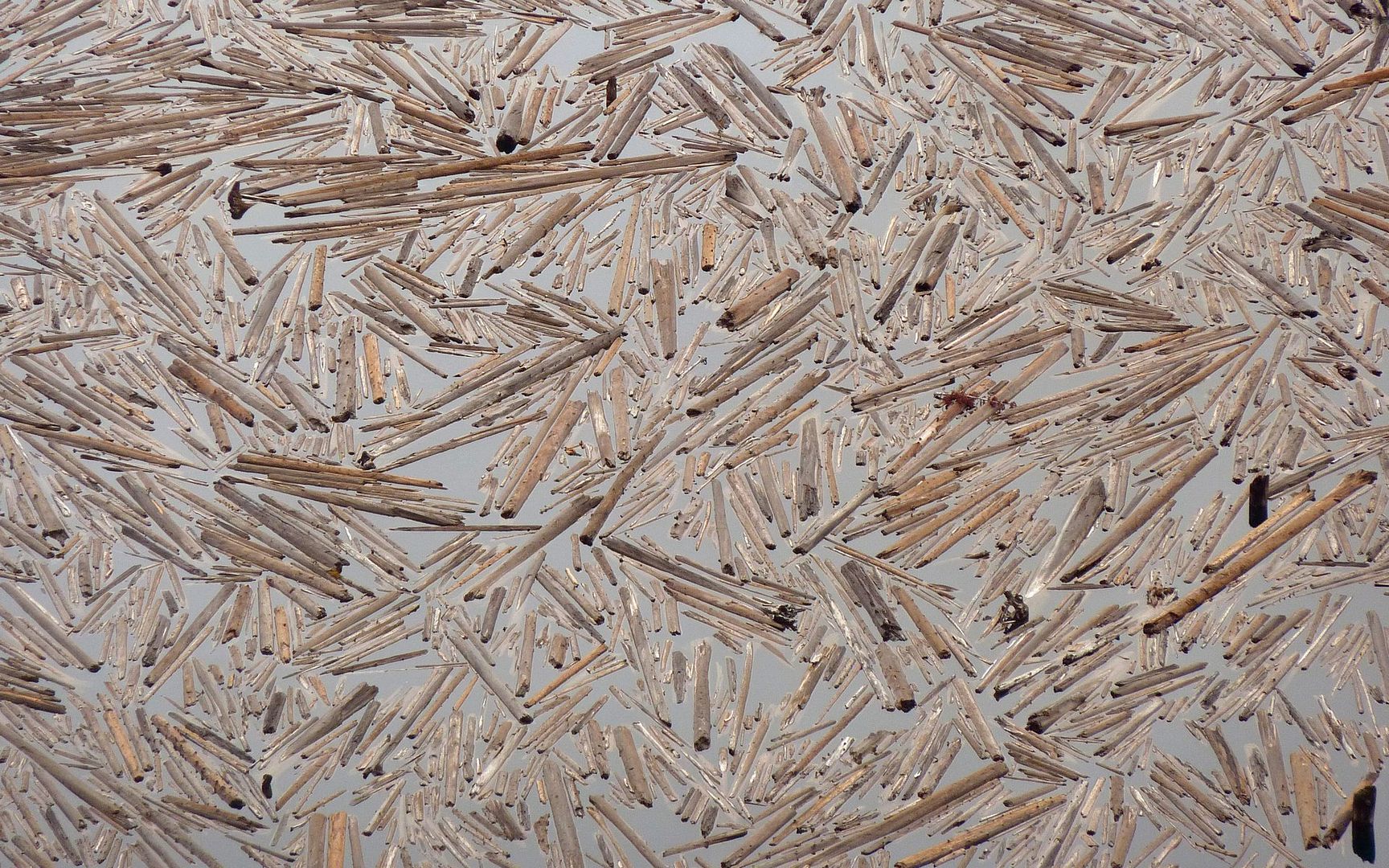
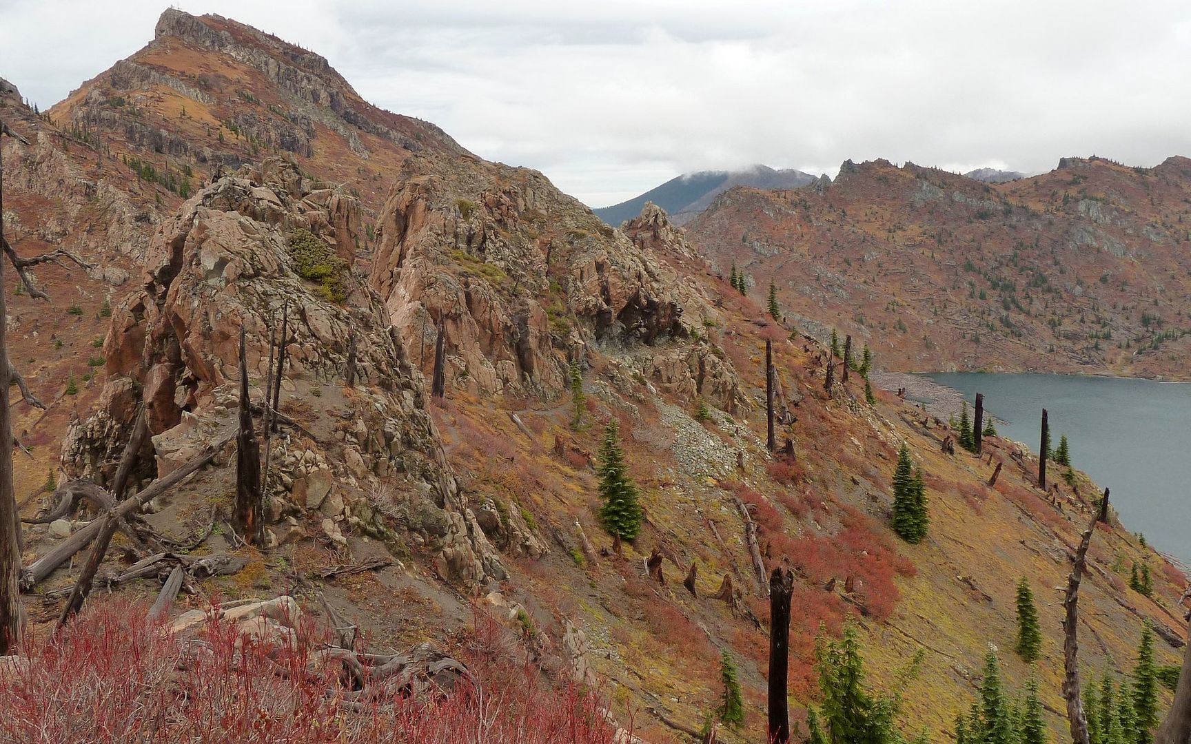
Blowdown from 1980 in Saint Helens Lake. Good jigsaw puzzle shot?
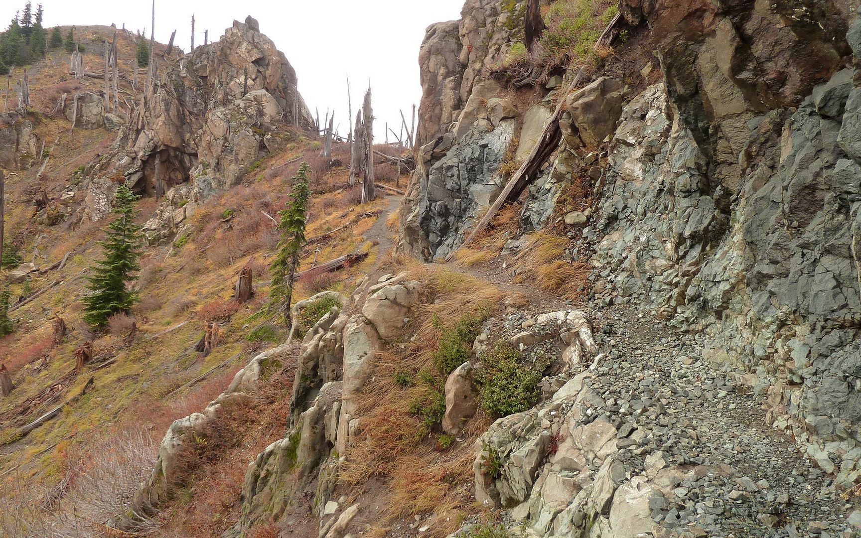
Boundary Trail as it approaches the rock archway from the north.
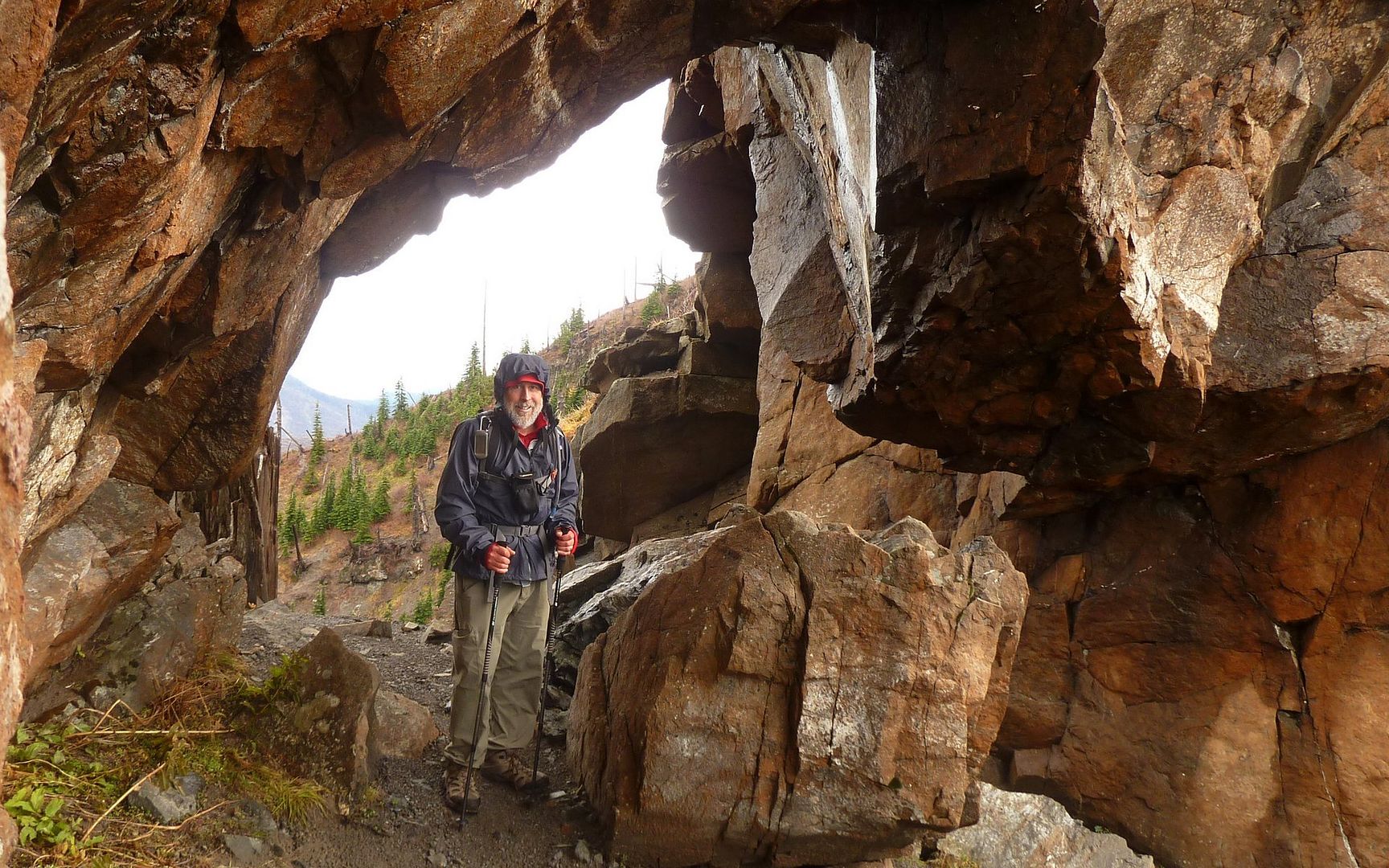
Obligatory "I was there!" self-portrait in the archway. 35°F. The hood was holding my hat on!
As I passed the arch, Coldwater Peak teased me horribly, as the clouds fully lifted off it. Check out
that trail that leads to the arch. Could certainly cause some to stall out.
Spirit Lake didn't offer a lot of photo ops, given the weather. Still a splendid vista as I descended.
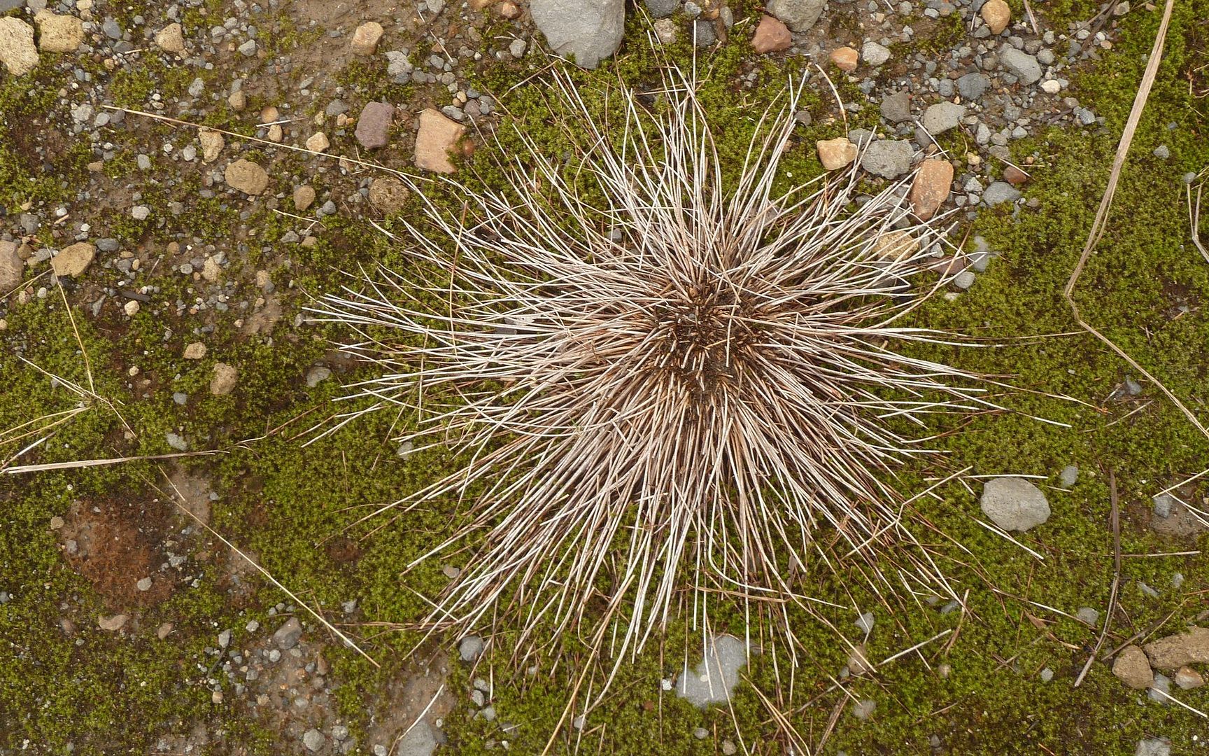
I didn't remember the lush moss everywhere, when hiking here in the summer. It covered much
of the landscape. This dead plant reminded me a sea anemone.
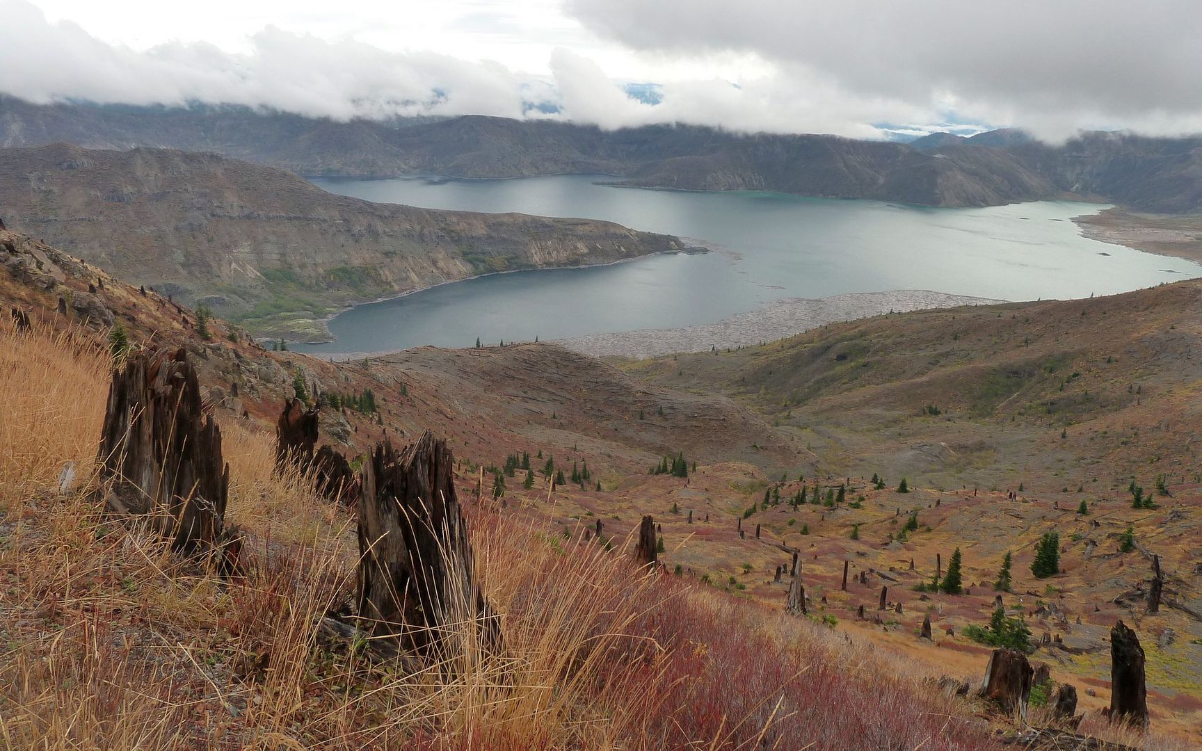
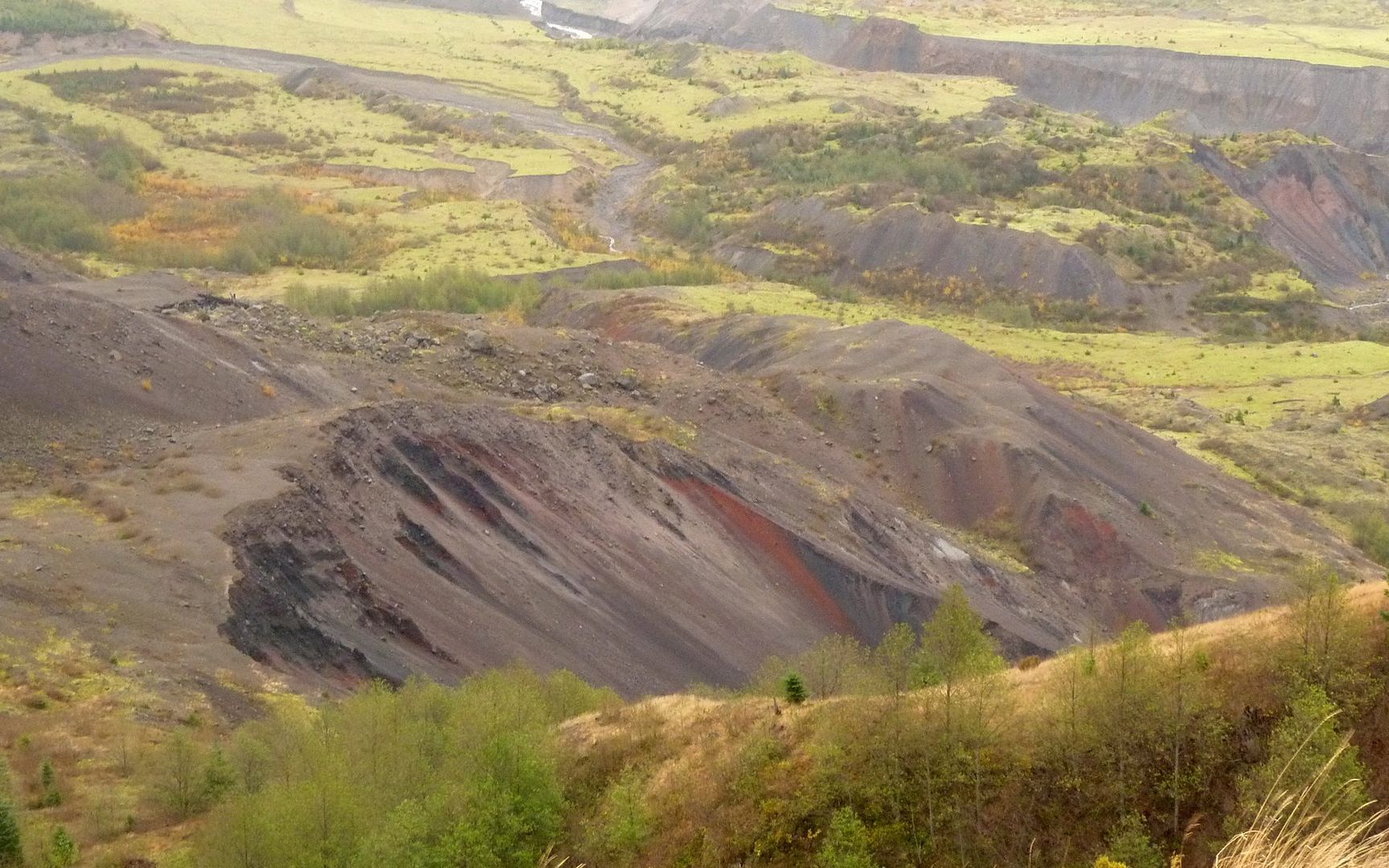
Here you can see the moss covering most of the Pumice Plain.
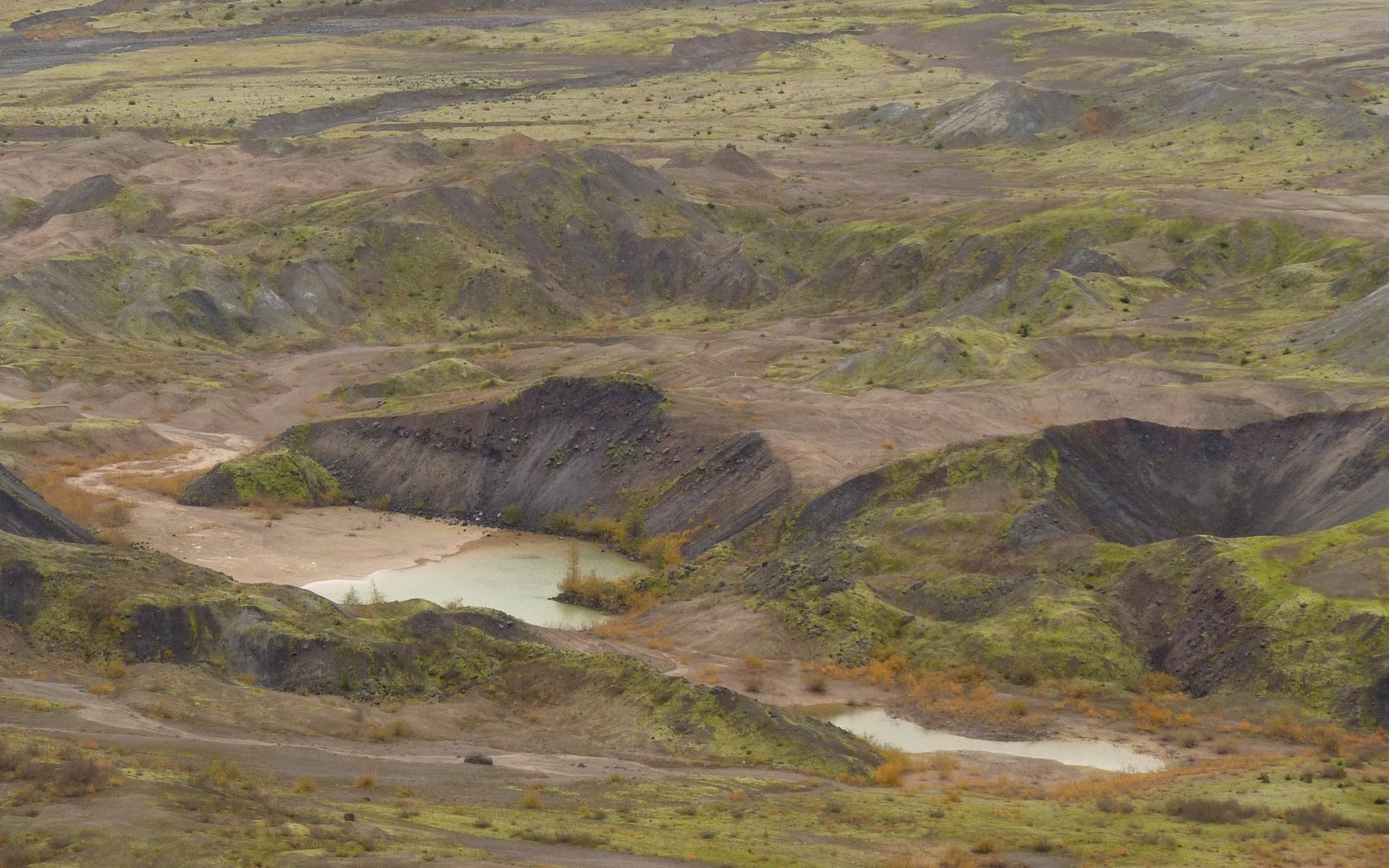
The colors down on the Pumice Plain were so much more vibrant than I could recall seeing before.
The trail marker system in use in the NVM. Are they really saying this is similar to Whittier?
This is where the rain and wind really kicked into high gear. Added a bit of excitement to the route.
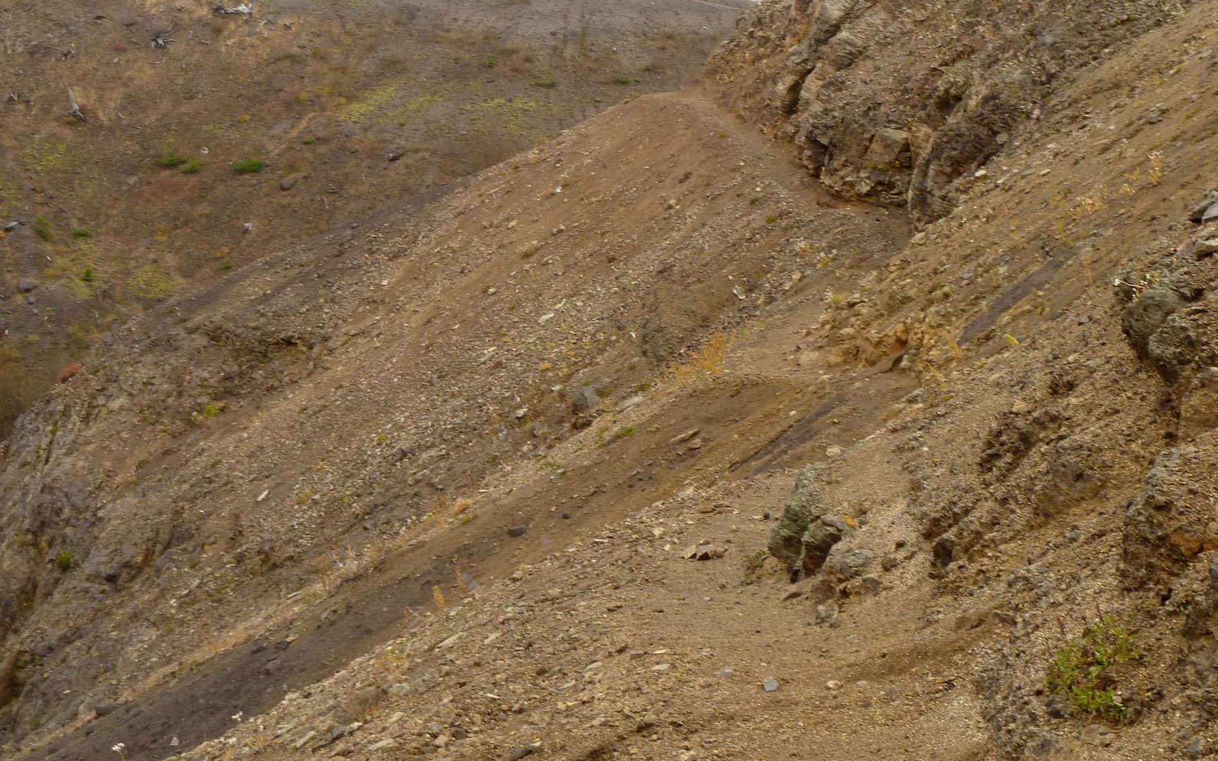
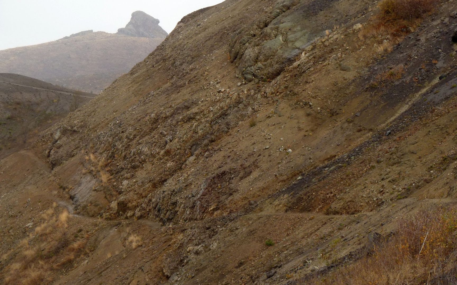
Some portions of the trail had washed out in the recent rains?
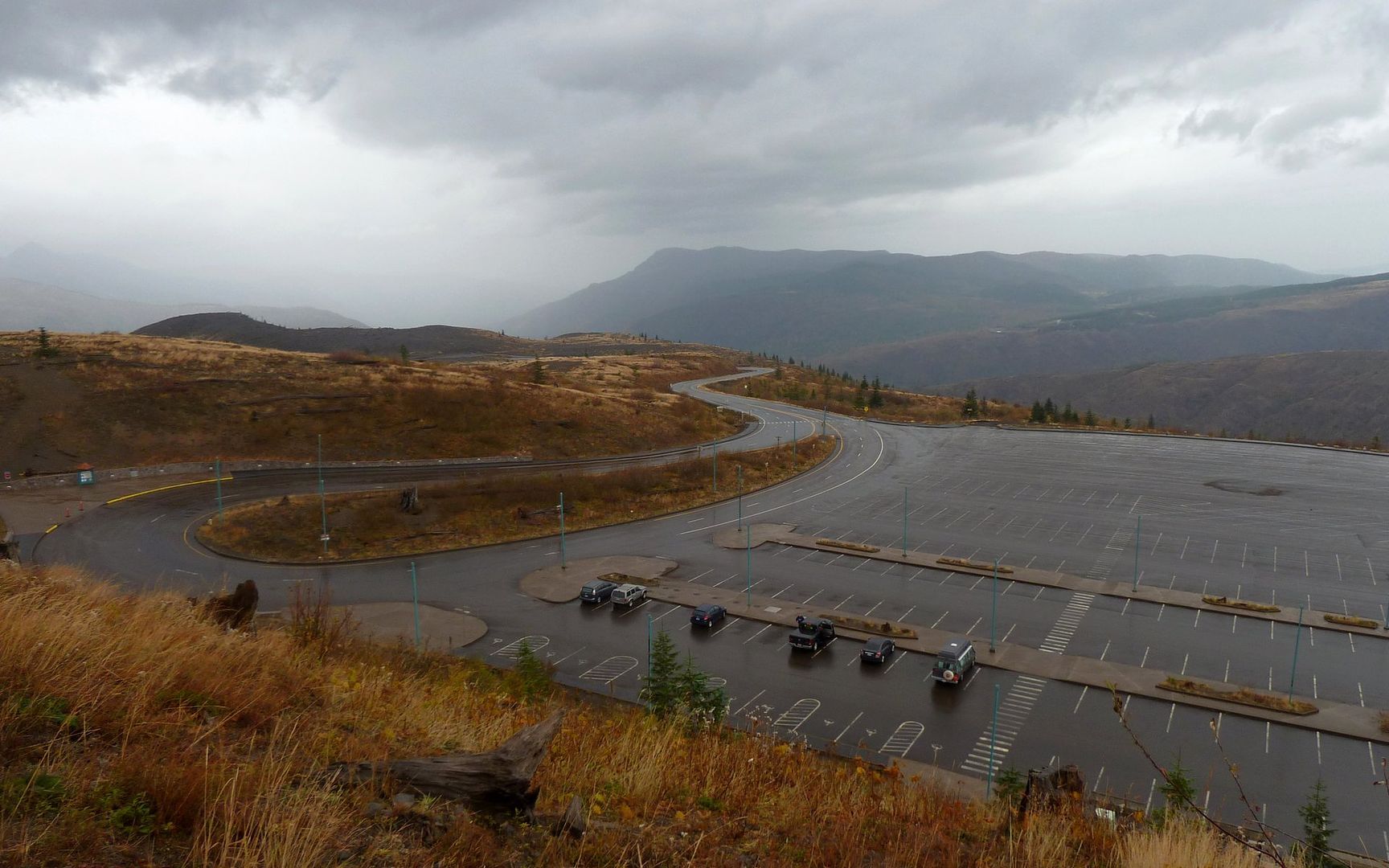
Johnston Ridge was virtually deserted.
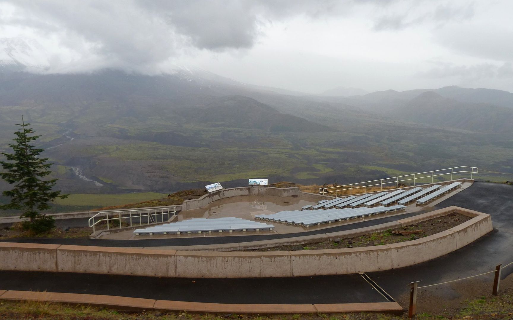
The new amphitheater looks like a wonderful place for a summer concert!
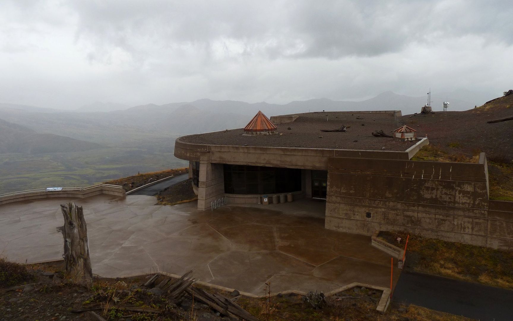
Closed for the season. I hunkered down to eat a huge Honeycrisp out of the rain in the doorway.
The final segment of this journey continues along the Boundary Trail, on down into the Toutle Valley and through the Hummocks before reconnecting with SR-504 and crossing back to Coldwater Lake. This segment was also entirely free of any/all primates other than myself, and again I ran into numerous elk. Lots of downhill here, and a fair bit of hillside traversing out in the wide open. Absolutely no shelter from the weather. About halfway down, though, the rain and wind subsided. And even when it was howling, it was mostly at my back.
Mini-Hike #4 (highlighted): 6.4 miles, 593' elevation gain, 2317' elevation loss.
Fall colors along Johnston Ridge.
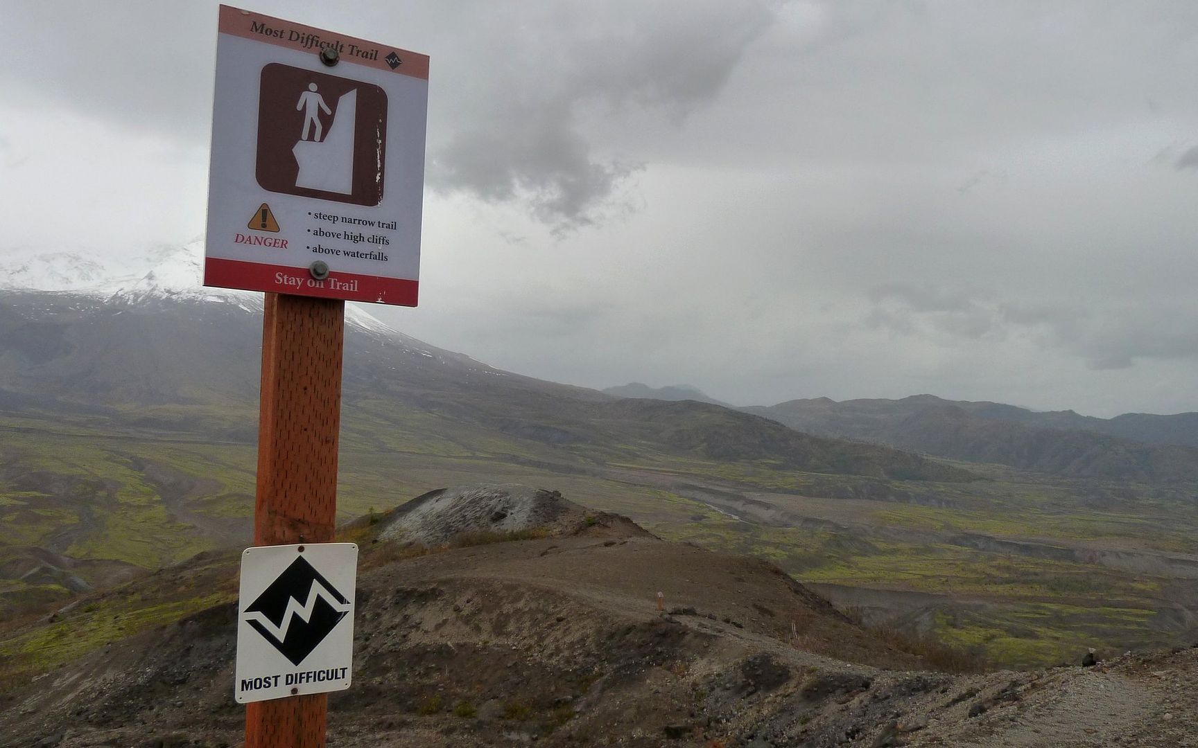
Warning just past Loowit viewpoint. I really don't know where these ratings come from.
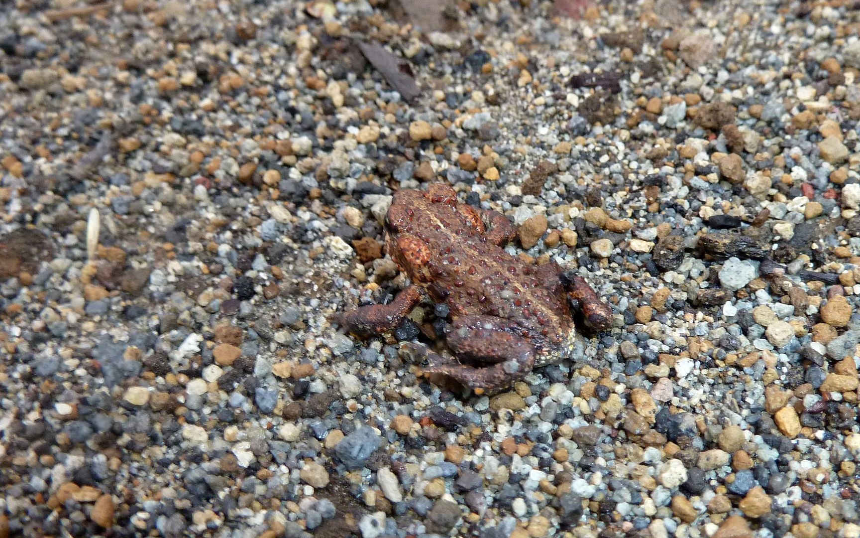
These little critters were all over the trail at this point. It was often hard not to step on them.
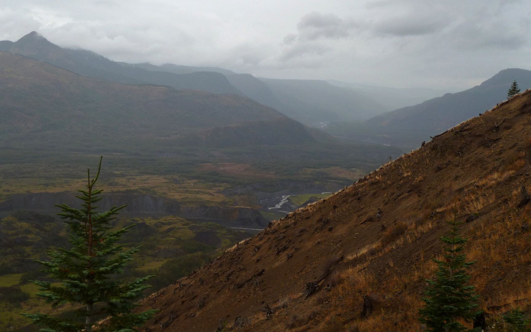
Weather coming up the Toutle Valley doesn't look very promising.
The colors on the valley floor were just astounding, though!
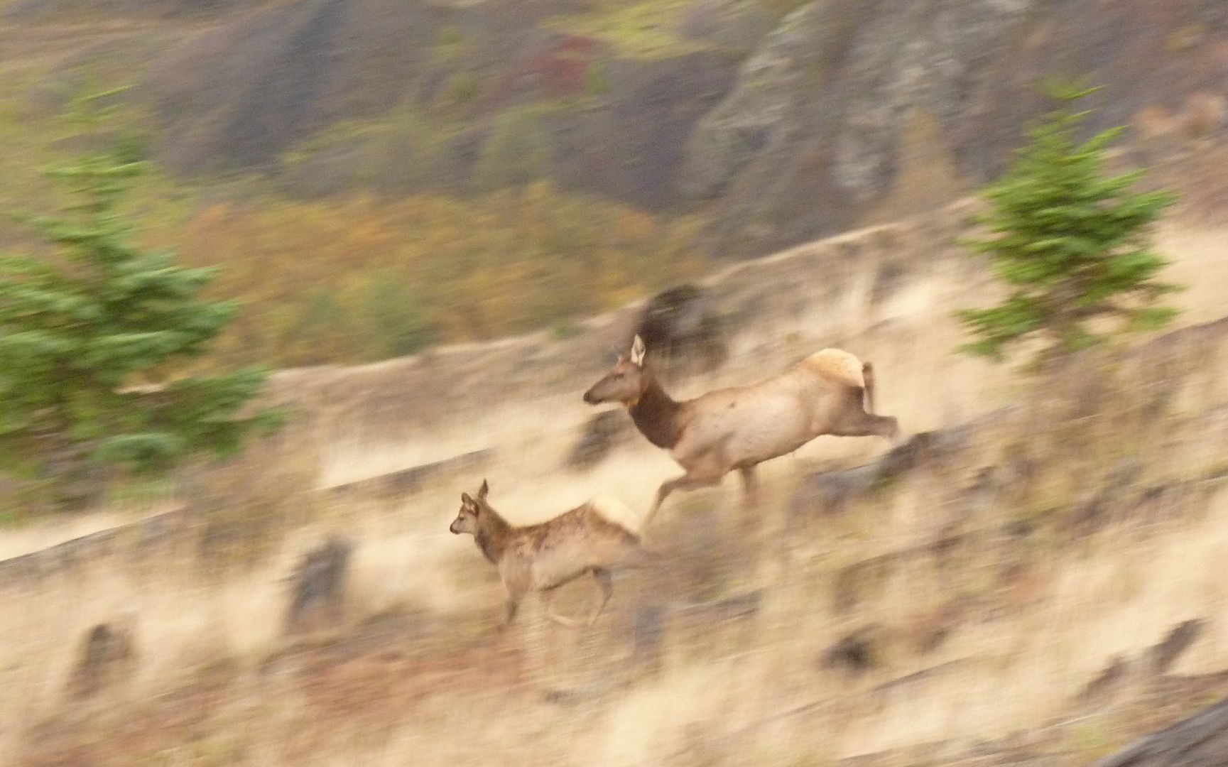
A cow and her calf racing across the hillside in anticipation of my arrival.
The wonders of auto-focus. They blend right in with their environment, don't they?
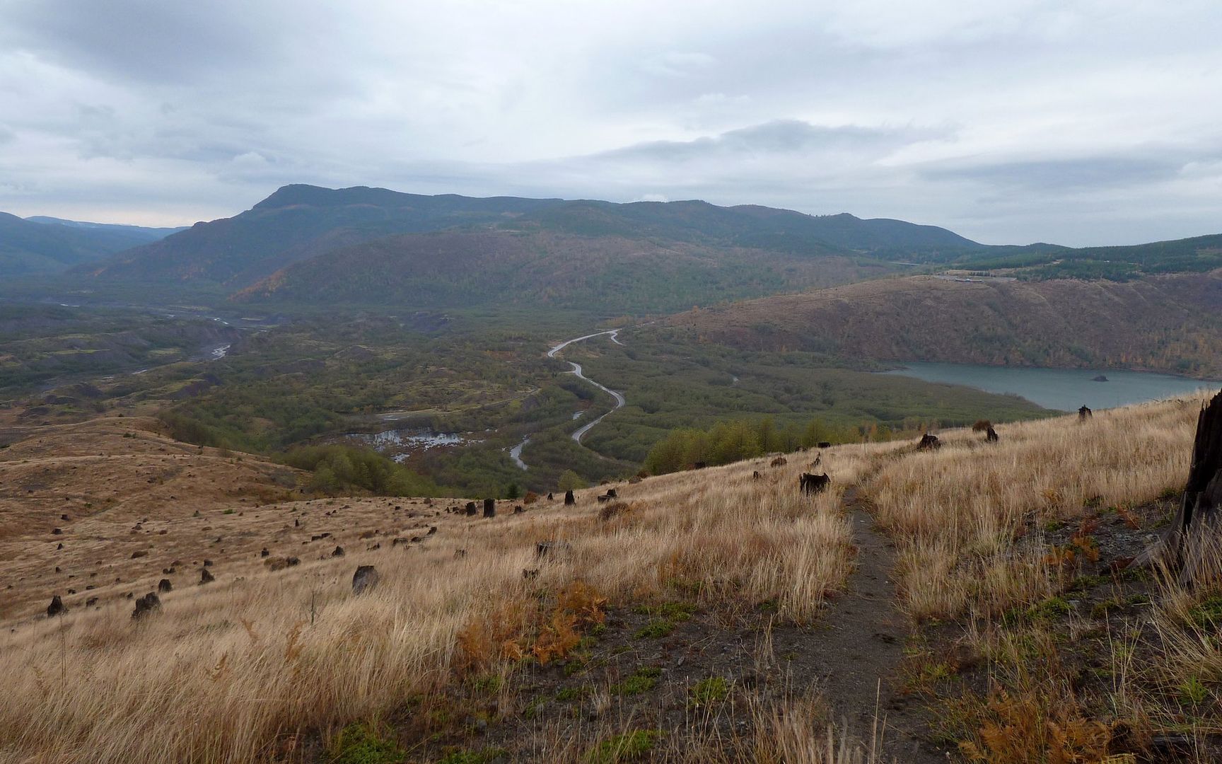
The Hummocks area is ahead, just to the left of roadway. My final destination is now in sight.
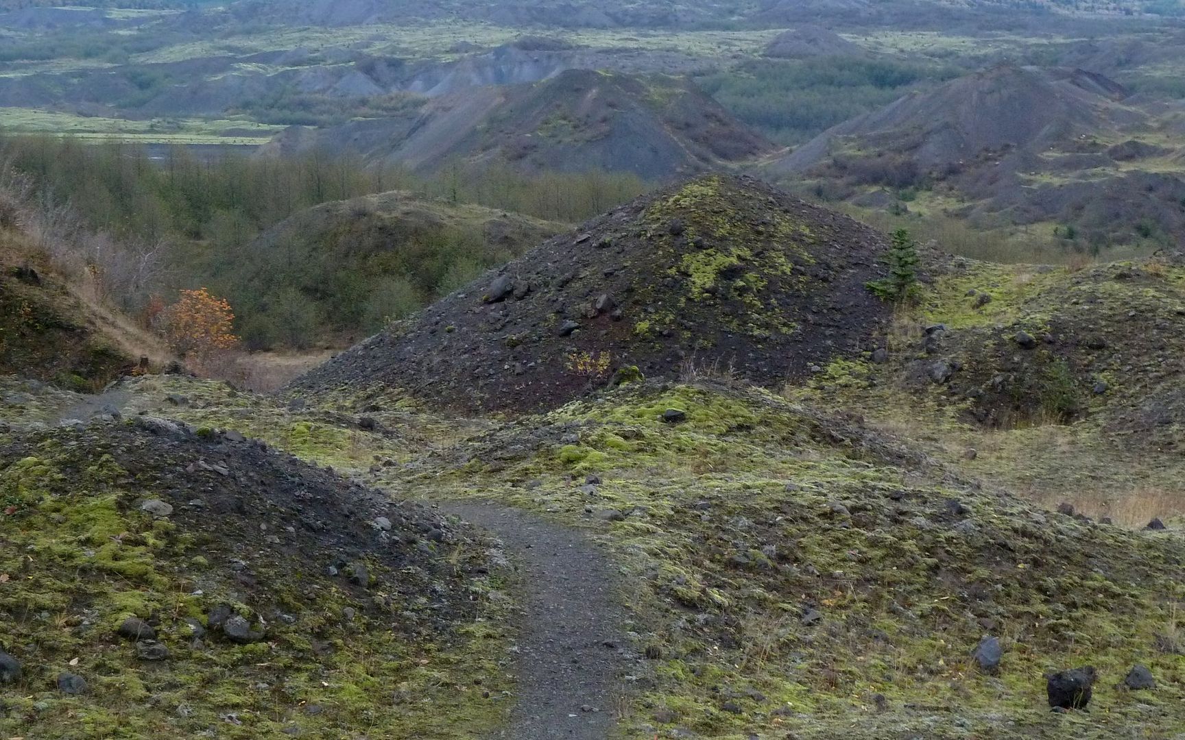
Wandered the next 2 or 3 miles through these hummocks. Easy to get lost in there.
And here, my light faded, and no more pictures were possible.
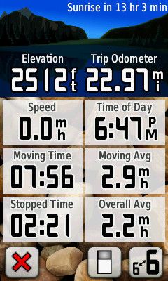
What a remarkable day!!!
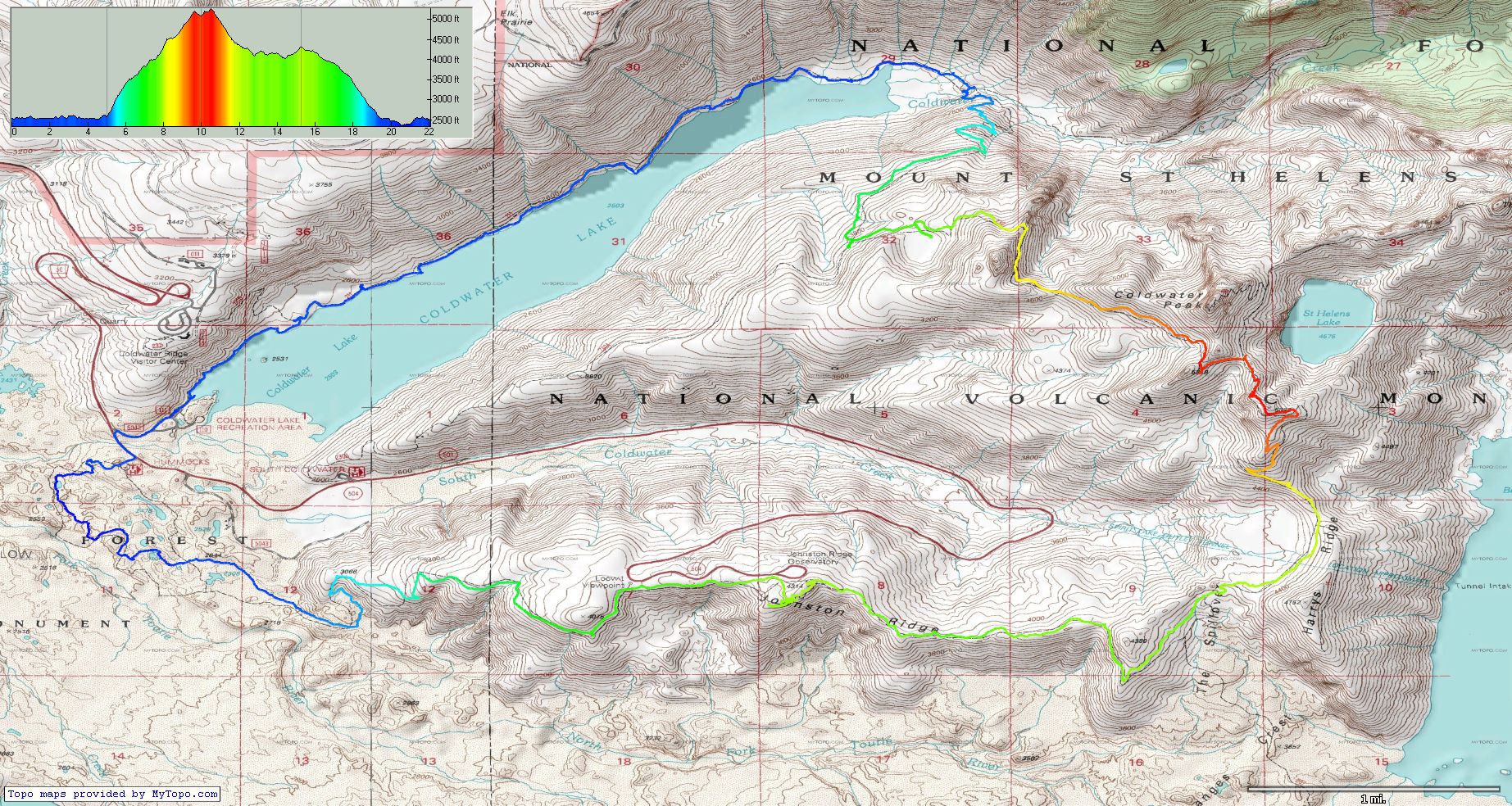
Click for an enlargement of the entire loop and elevation profile.
http://gpsfly.org/gps_map.php?gps_id=1965&w=645&h=440
Grand total about 23 miles and roughly 5800' EG.