Wildcat Mountain and McIntyre Ridge - 8/25/12

This forum is used to share your experiences out on the trails.
justpeachy
Posts: 3068
Joined: May 28th, 2008, 10:03 pm
Location: Portland, OR
Contact:

Wildcat Mountain and McIntyre Ridge - 8/25/12

Post by justpeachy » August 26th, 2012, 8:06 pm

I have hiked in the Wildcat Mountain area twice in recent years without actually reaching the mountain, so that was my modest goal for yesterday.

Since that's a short hike my intention was to do another short hike first. My plan was to hike up decomissioned Road 255 to the site of the long-gone Eagle Creek lookout. There's a geocache there and several along the road too, which would help break up the monotony of road walking.

I parked right off of Road 36. The pavement around here was carpeted with broken glass, trash, and shotgun shells. There's a huge berm that blocks Road 255 and the concrete barriers in front of the berm are so shot up that at first I didn't realize what they were.

Image


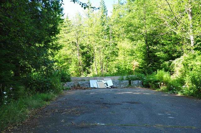
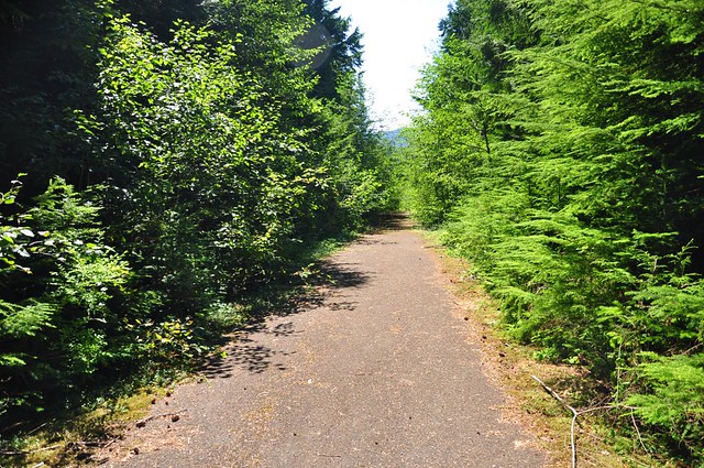
There's a well-established path in the trees to get around the berm. On the other side it was more of the same glass, trash, and shells. After a few minutes, though, I left most of the trash behind, at least for a short while.

Image


All the while I could hear target shooting in the distance and even though I saw no shooters on this old road I started wondering what would happen if they showed up in the time it took me to hike up and back down. This area was giving me the creeps and then I came across this, a car hood propped up by logs and all shot up.


Image

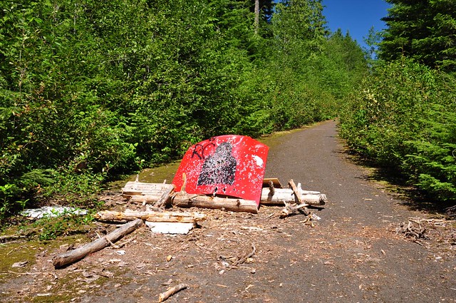
By now I was a quarter mile in, which means someone dragged/hauled that big heavy hood back here somehow. Then I reached a creek crossing where the bridge had been removed and even though it would have been easy to rock hop the creek this late in summer I decided it was the final straw and I turned around. Moments earlier I had pushed through a patch of vegetation and spiderwebs (eek!) in a section of really overgrown road and I figured there would be much more of that the further up I went.

Image


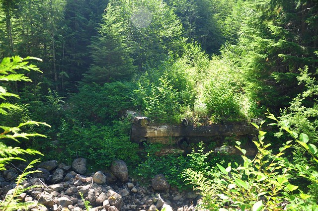
A side note about the bridge crossing here. I assumed the bridge had been removed as part of the decommissioning process, but when I got home I found this 2010 document about road decomissioning options in the Zigzag Ranger District. Evidently vandals were responsible for the bridge removal, not the FS: "Access to the Road 255 trailhead was blocked when an abandoned car was burned on the bridge over Eagle Creek and destroyed the bridge. Subsequently, Road 3626-255 was blocked at Road 3626 eliminating this trailhead and convenient access to the lower part of Douglas, Douglas Tie and Eagle Creek Trails."


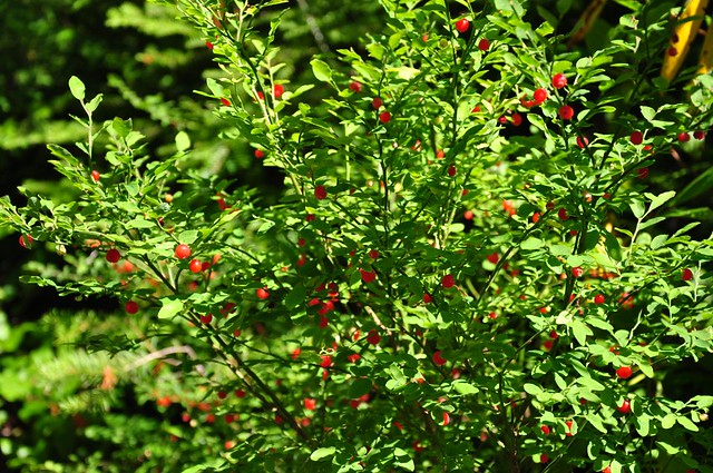
My short little walk was not in vain, though, because there were a lot of huckleberry bushes along the way and they were FULL FULL FULL of berries!

Image


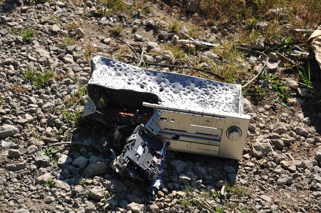
So much for that little jaunt. I will try that one again another time with a different approach. There's a side trail off of Eagle Creek Trail 501 that goes up to the lookout site. Back at my car I drove over to the quarry. A car was parked at the bottom of the rutted hill but I forced the Subaru up the road to the quarry, where there were no other cars. I got the same creepy feeling here in the quarry, where evidence of the unsavory crowd who hangs out here is everywhere. The place is a dump. Here is a shot-up tape deck, complete with cassette tape (there were other pieces of electronic equipment nearby too).

Image


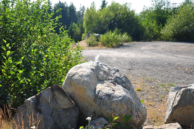
This glass bottle on a boulder had clearly been used for target practice. This is right where you leave the quarry to get on the trail, meaning that people were shooting in the direction of the trail.

Image


I hoped I wouldn't find my car gone, burglarized, or full of holes when I got back and quickly headed into the trees.
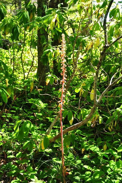
Image


I saw the tallest coralroot pine drops I've ever seen, about four feet tall!

Image


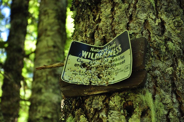
Wilderness boundary sign shot to bits.

Image


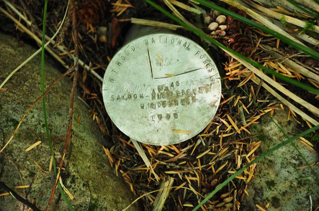
Not far off the trail I spotted this metal survey disk that marked the boundary of the wilderness. I've seen plenty of USGS survey markers, but I've never seen a NF wilderness boundary marker like this.

Image


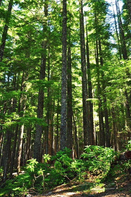
I reached the junction with the spur trail up to Wildcat Mountain. No signage of any kind, but the trail is easy to spot. It is, however, getting quite overgrown with rhododendrons. Many spiders had made their webs across the trail, so the going was VERY slow as I waved my hiking poles around in front of me to knock them down (I'm sure THAT would have looked funny to any bystander!). Damn I hate spiders. After what seemed an eternity of the rhodie/spider hell I reached the summit.

Image


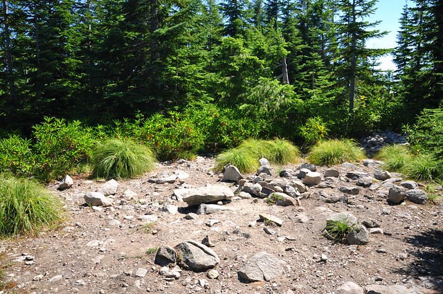
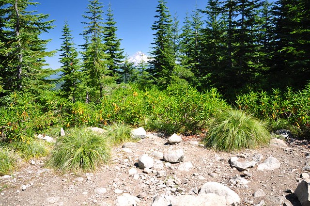
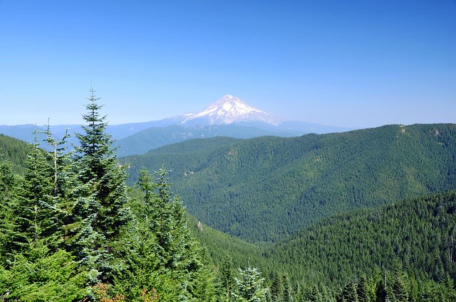
A fire lookout stood here once but is long gone. The trees are growing up but you can still get a peek at Mt. Hood.

Image


Bill Sullivan recommends pushing through the rhododendrons to the edge of the summit for a better look at Mt. Hood. I attempted this and all I got for my troubles were two bleeding scraped-up legs. Rhododendrons are pretty to look at when they're in bloom but they are hell to navigate through.

On my way back I took the side trip out McIntyre Ridge to the bench at the awesome viewpoint. (Once again, no signs at this junction. It's like the MHNF has forgotten about this area of the forest.) I had the viewpoint all to myself so I just sat and enjoyed the scenery for awhile. The wildflowers that bloom here earlier in summer are all bloomed out, but the view made up for it.

Image


And then I headed back down to my car, which was safely intact. There were, however, two men just out of sight down the hill in another part of the quarry. I got a glimpse of one of them and he definitely didn't look like a hiker. So I got in my car and drove off right away instead of doing my usual drinking-water-and-taking-off-the-boots post-hike routine.

It was nice to check Wildcat Mountain off my list but if I ever hike someplace in the "Hwy 224 corridor" of the Mt. Hood National Forest again I won't go alone.
Last edited by justpeachy on August 27th, 2012, 12:24 pm, edited 1 time in total.

User avatar
Splintercat
Posts: 8334
Joined: May 28th, 2008, 10:03 pm
Location: Portland
Contact:

Re: Wildcat Mountain and McIntyre Ridge - 8/25/12

Post by Splintercat » August 27th, 2012, 6:41 am

I don't blame you for being nervous at the Wildcat Quarry TH, Cheryl - it's very sketchy site, with lots of illegal shooting and OHV activity. Though the OHV ban is only a year old, the area has been a no shooting zone for decades, to little effect.

For what it's worth, TKO proposed an alternate hiking/equestrian trailhead at a large, existing pullout along Wildcat Mountain Road to the Forest Service two years ago, and offered up volunteer labor to survey and construct a spur trail to connect to the existing Douglas TH. This would have allowed the Forest Service to completely close and decommission the quarry and its access road, but so far, no interest (or response) from the agency. It seems like a pretty simple fix, so maybe they'll come around some day, who knows? Hopefully, it won't ake some sort of tragedy at the quarry TH to get their attention.

Tom

justpeachy
Posts: 3068
Joined: May 28th, 2008, 10:03 pm
Location: Portland, OR
Contact:

Re: Wildcat Mountain and McIntyre Ridge - 8/25/12

Post by justpeachy » August 27th, 2012, 8:01 am

Skimming that road decommissioning document I linked to above it seems the FS is well aware of the problem at the quarry, but for whatever reason (money?) isn't addressing it. (Although if TKO has offered up free labor for creating a new TH than their list of excuses would be shortened considerably!) They created an alternate TH along Road 255 a few years back but that is inaccessible due to that road being closed now. If I understand their proposal correctly, they're considering a TH at the end of Road 105 so that they can shut down the quarry TH. Whatever the method, I hope an alternative TH is found at some point, but you know how fast the wheels of government move. Not fast at all!

justpeachy
Posts: 3068
Joined: May 28th, 2008, 10:03 pm
Location: Portland, OR
Contact:

Re: Wildcat Mountain and McIntyre Ridge - 8/25/12

Post by justpeachy » August 27th, 2012, 8:11 am

By the way, Tom, is there a place online where TKO posts the various proposals/letters/suggestions that have been sent to the FS? I would be very interested in seeing them, as well as a response section noting what (if any) response TKO received from the FS for each.

User avatar
hlee
Posts: 513
Joined: April 16th, 2012, 12:41 pm
Location: St. Helens, Oregon

Re: Wildcat Mountain and McIntyre Ridge - 8/25/12

Post by hlee » August 27th, 2012, 11:23 am

Yikes, that is creepy. :? I don't know that I would have been brave/determined enough to go ahead with that hike.

Hannah

Only those who will risk going too far can possibly find out how far they can go.
-- T.S. Eliot

User avatar
bobcat
Posts: 2769
Joined: August 1st, 2011, 7:51 am
Location: SW Portland

Re: Wildcat Mountain and McIntyre Ridge - 8/25/12

Post by bobcat » August 27th, 2012, 11:40 am

Unfortunately, that trailhead is just close enough to civilization to invite such abuse and just remote enough so that it doesn't get checked very often. I also think the USFS might be tolerating these activities here so they don't move to the newer McIntyre Trailhead to the north.

Glad someone else gets lots of spider facials so the suffering spreads around. I hike a lot of little-used trails and am usually the first one on them anyway, so I experience the privilege of "breaking web" on many of my summer hikes. It's a relief when the frosts come in the fall.

Your "coral root" would indeed be magnificent if it were an orchid, but it's really in the Heath family - pine drops (Pterospora andromedea) - like Indian pipe, pinesap, etc. Four feet is a good specimen though; they're coming up all over about now.

justpeachy
Posts: 3068
Joined: May 28th, 2008, 10:03 pm
Location: Portland, OR
Contact:

Re: Wildcat Mountain and McIntyre Ridge - 8/25/12

Post by justpeachy » August 27th, 2012, 12:30 pm

bobcat wrote:Glad someone else gets lots of spider facials so the suffering spreads around.
It's getting to that time of year when I can't hike by myself because of the spiderwebs everywhere. In fact as I was hiking down from Wildcat Mountain I was hiking into the afternoon sun which illuminated many spiderwebs high over the trail that I hadn't seen on my way in. They were too high to be disturbed by hikers and all the webs were occupied by big scary spiders. But merely having to walk under them caused me to shudder every time. Horror. :o

Greg got me this t-shirt a few years back. I wore it at a conference once and got LOTS of great reactions.

Image

bobcat wrote:Your "coral root" would indeed be magnificent if it were an orchid, but it's really in the Heath family - pine drops (Pterospora andromedea) - like Indian pipe, pinesap, etc.
Doh! Thanks for the correction. I've corrected my TR.

User avatar
Splintercat
Posts: 8334
Joined: May 28th, 2008, 10:03 pm
Location: Portland
Contact:

Re: Wildcat Mountain and McIntyre Ridge - 8/25/12

Post by Splintercat » August 27th, 2012, 1:49 pm

By the way, Tom, is there a place online where TKO posts the various proposals/letters/suggestions that have been sent to the FS? I would be very interested in seeing them, as well as a response section noting what (if any) response TKO received from the FS for each.
Not yet, Cheryl - but it's a good idea. Not too many responses to post, unfortunately.

On the "New McIntyre" trailhead -- just to be clear, that is not an official USFS trailhead. The trail connection was obvious enough when Jamie and I scouted it a few years ago, and I simply posted it in the PH Field Guide as a perfectly legal way to park on a maintained forest road and hike the short dirt road spur to the trail. You don't even need a Northwest Forest Pass!

Tom :)

forestkeeper
Posts: 1291
Joined: July 23rd, 2011, 8:31 pm
Location: Canby, Oregon
Contact:

Re: Wildcat Mountain and McIntyre Ridge - 8/25/12

Post by forestkeeper » August 27th, 2012, 2:08 pm

:) Nice TR Cheryl. Nice pictures too. I was up there yesterday and noticed the same trashed out sites. I actually cleaned up about 500 yards of the 255 about 8 months ago, along with many other old FS roads. Clackamas County Forests used to have anti vandal cams up there, but must have taken them down during last year's major government job layoffs. I'll head that way after Labor Day, to pick those areas up again. It's so much work with little or no rewards. Especially to spend a week up there, then it's trashed out again in a few weeks. It's pretty sad about that bridge, huh? If you have any questions about FS trails, my supervisor is in charge of them. But new trails are NOT in the agenda right now. We can barely maintain the ones we have now. :(

FK

User avatar
BigBear
Posts: 1836
Joined: October 1st, 2009, 11:54 am

Re: Wildcat Mountain and McIntyre Ridge - 8/25/12

Post by BigBear » August 27th, 2012, 2:16 pm

It's been a while since I've hiked to Wildcat Mountain. I'm thinking fifteen years. The view of Hood was better back then and kevlar jackets were not one of the ten essentials. I think it was the 1996 washouts that took this hike off my list. now, I think it's the target practice that would keep me hiking elsewhere.

Post Reply