Coldwater Peak (and more), 28-July-2012

This forum is used to share your experiences out on the trails.
Post Reply
User avatar
kepPNW
Posts: 6411
Joined: June 21st, 2012, 9:55 am
Location: Salmon Creek

Coldwater Peak (and more), 28-July-2012

Post by kepPNW » July 30th, 2012, 6:26 pm

Well, I gave up waiting for crystal clear conditions, because they really don't seem to be in the cards this summer, do they? The forecast for the entire weekend was morning clouds, and some clearing in the afternoon. So I headed up to JRO on Saturday, not arriving there around 11am. It actually turned out to be the clearest time all day, darn it.

While at JRO, I cleared up some confusion (mostly mine, I suppose) about requirements for a Monument Pass versus a NWFP. Short story is, no need to hang a NWFP on the car, but you can get one adult wristband by showing it to them in the visitor's center. Everyone hiking out (or their pack) is supposed to be wearing a wristband.

Anyway, the place was unusually quiet for a fairly nice Saturday in late July! I'd left all sign of other people behind within a couple miles of the paved walkways. I don't think I ran into another soul until I was just about to the rock archway. And after that, only two or three other small groups all day long. I keep wondering, "Are these folks I talk to everyday [here]?" That button idea was a cool one. But, in the spirit of hoping those I cross paths with any of you out there, I might include a face shot below. Fair warning.

Image
People wearing jeans and no pack seem to not make it past here.

I think the greatest hazard of the Blast Zone is that your camera batteries are almost certain to die up there. Bring spares! I took about 500 photos on this Saturday ramble. The 100 best (and/or most representative) are in a slideshow here.

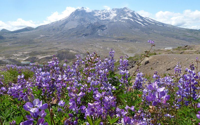
Last year at this time, it was all penstemon and paintbrush. This year, not so much penstemon. Wetter July, maybe? But the lupine was certainly out. Quite a bit moreso, as you climbed higher.

Image

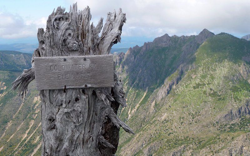
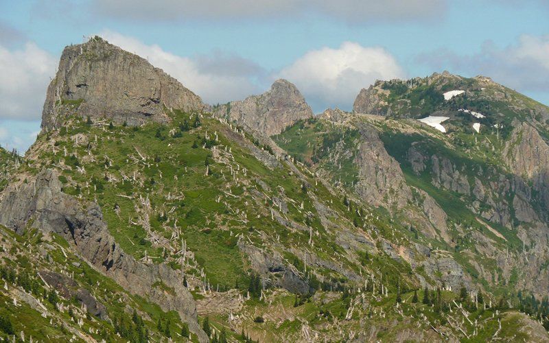
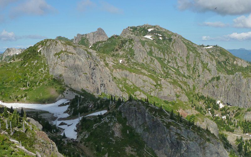
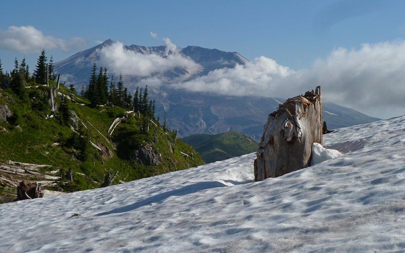
Coldwater Peak had its head in the clouds most of the day, so far, with only occasional appearances.

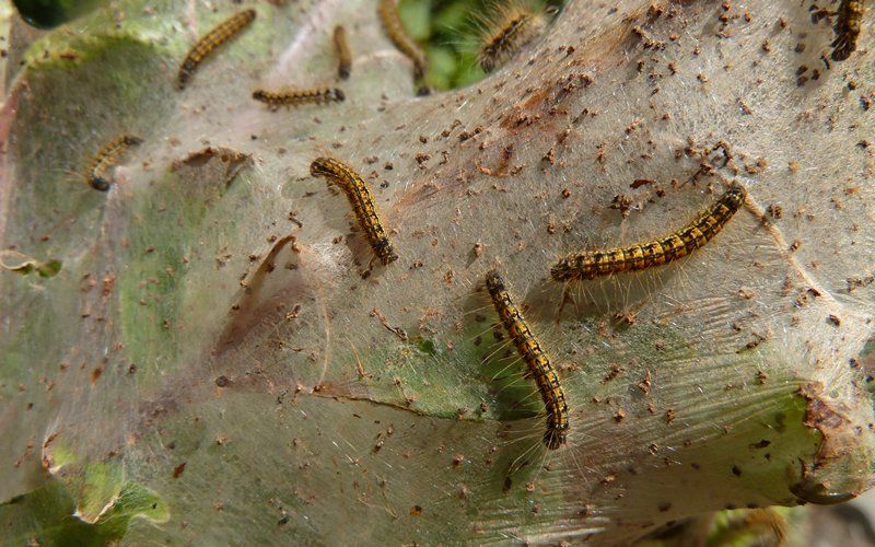
It seems I also missed most of the Tent Caterpillar hatchings, as I only saw a few active tents. Most of them must've already morphed into whatever it is they become?

Image

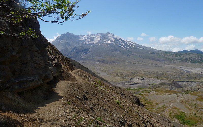
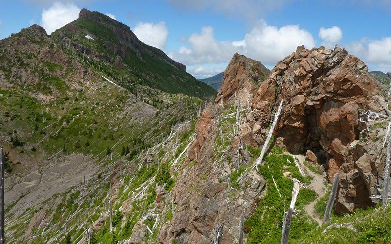
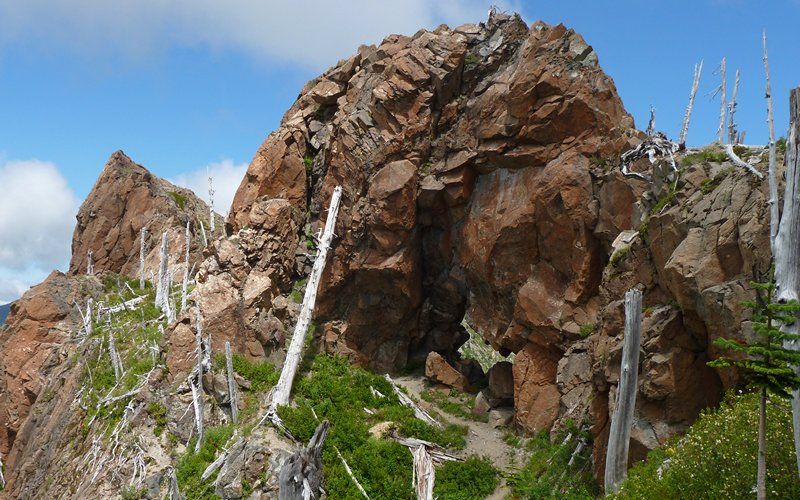
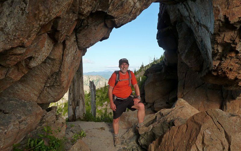
The trail seemed to want to get a little sketchy up around the arch. It was as though the backcountry didn't really want to admit anyone that didn't belong there. Here, it calls for a little scramble up over these rocks, against the cliff. Not so bad, for anyone paying attention.

Image

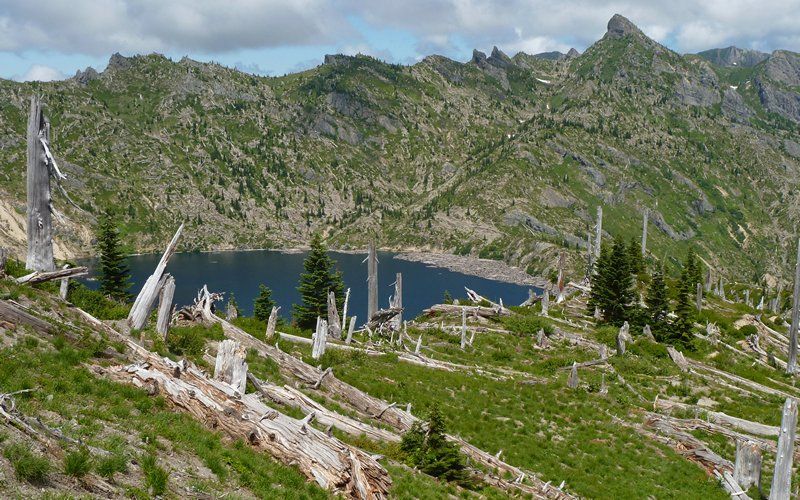
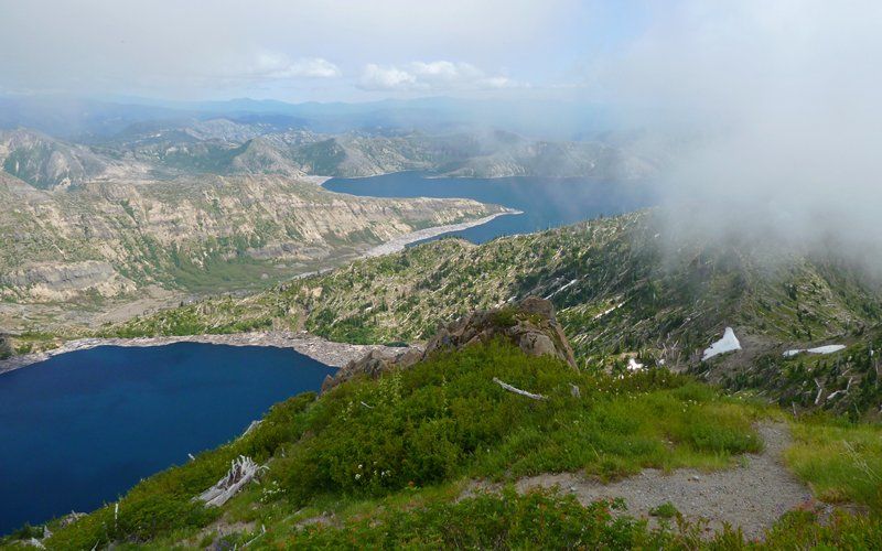
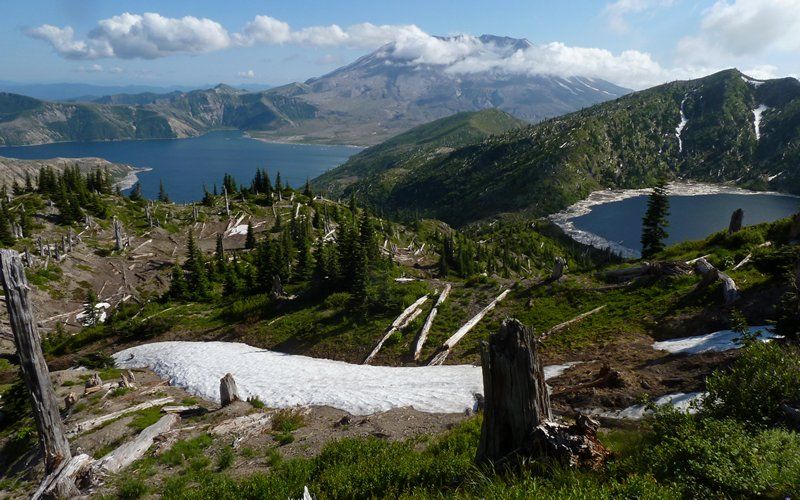
Soon, Saint Helens Lake came into view. With a backdrop of those glorious Mount Margaret Backcountry mountains! Wow. I bet 10% of all my photos are some variation on this initial view. That pointy knob is called The Dome - more on that later.

Image

The rock arch was definitely a scenic highlight. I've read reports that "this is all some will talk about" after coming down. Not sure I get that. I mean, yeah, it was very cool. But compared to what lie ahead? Hmmm, maybe not so much?

Image
Coldwater Peak in background.

Image

Shortly after, I came across this sign (looking the way I had come) which seems to imply that straying off-trail isn't subject to fine anymore?

Image
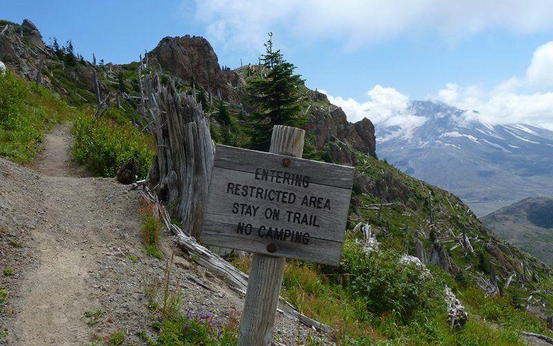
<voice-over>Hikers needing to urinate are free to move about the backcountry.</voice-over>

Seemed that as I climbed, the clouds just kept building atop Coldwater. No matter, I'd come this far. And actually, when I got up there, the views were still pretty darn good. All except those of the other Cascade volcanoes, of course.

Image

Image

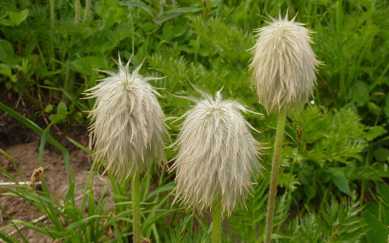
Took photos of scores of wildflowers on the way down. The one that really caught my attention was the remnants of Western Pasque flower, or Hippy on a Stick!

Image

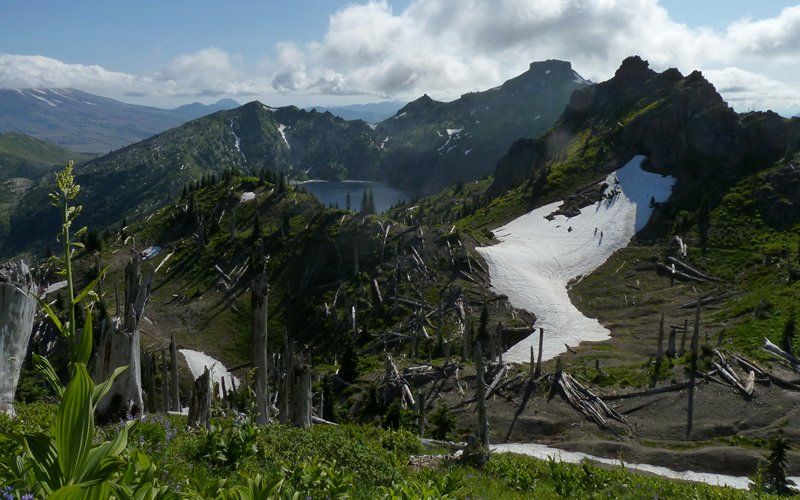
So I get back down to the main trail, and there's still lots of daylight left! Decided to meander over to, maybe past, The Dome to see if I can get a better look down at the hummocks in that northeast bay of Spirit Lake.

Image
Must get around that beast!

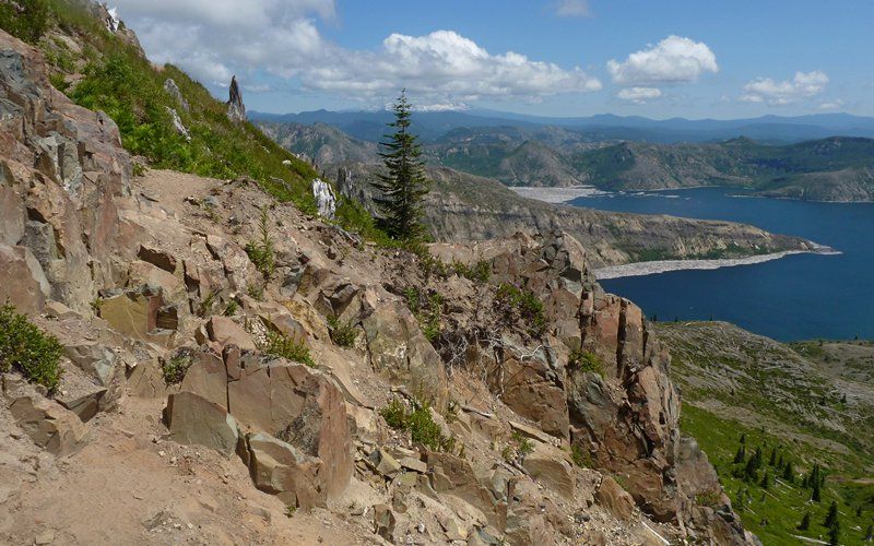
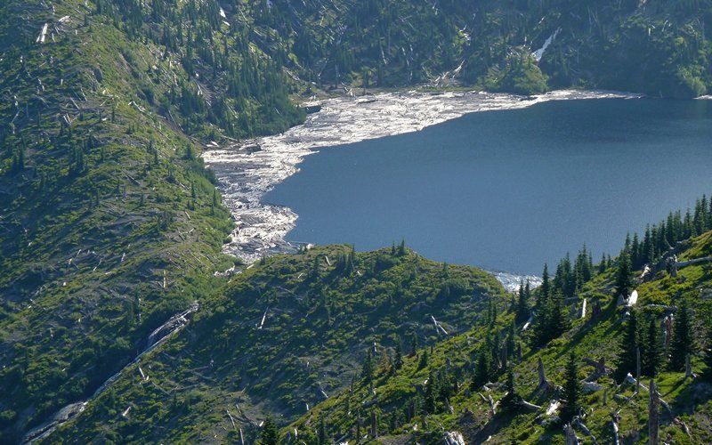
The views of Saint Helens Lake are simply spectacular as I wander westward.

Image

Image

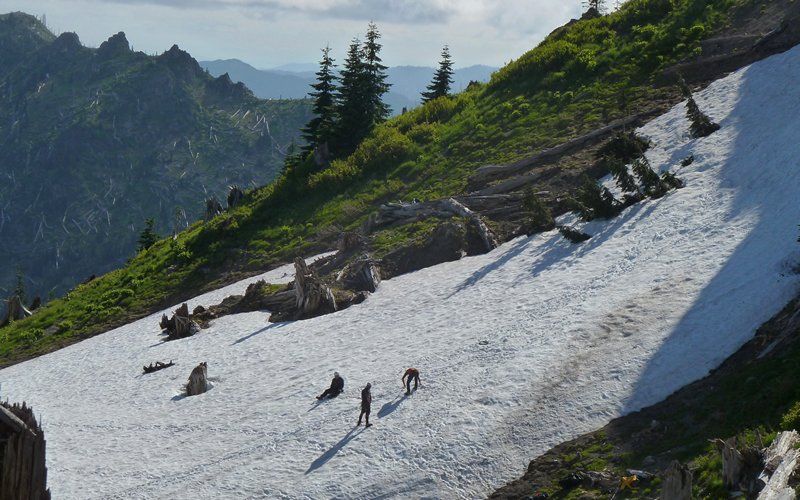
Around one corner, I ran into three guys practicing self-arrest on a (steeper than it looks here) snow field. I think I need one of those buttons, because I'm not always best at starting "Do I know you?" conversations in the field.

Image
You guys hang out here?

Image
Coldwater Peak in background. Three amigos on snowfield.

The Dome.

Image

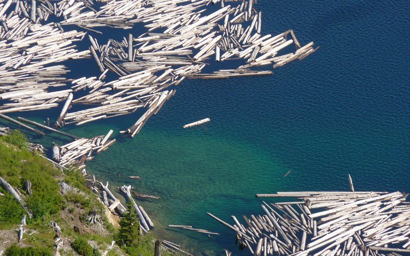
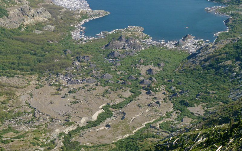
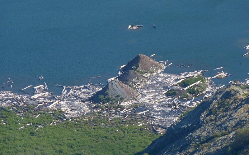
But perhaps more interesting were the hummocks-from-hell down in/near Spirit Lake, which were now visible.

Image

Image

A little after 5pm, I found myself on the east side of The Dome, and a slushy 45° snowfield was crossing the trail. It was a sign. Not one I was happy about, but I figured I was at least several hours away from the car, and still wanted to get down into the Pumice Plain. Took a close-up of Mount Margaret, and hope to get back there soon to come in from that side!

Image

Return was uneventful, but still hazardous in that photos (plural, yeah) were required at nearly every turn. I hadn't seen that Saint Helens Lake was emptying into Spirit Lake on the way out, for example.

Image

Most of the trail was snow free. This was the biggest patch that needed to be crossed. (Given I'd used the other as "a sign.")

Image

Okay, I warned about this before! When I got back to the arch again, the three amigos were there and asked if I'd take their picture. Sure! Just do the same for me. Sure!

Image
So, did I cross paths with any of you out there? There were two or three other groups on the summit trail.

I was boogying at this point, sorta doing that shuffle-jog thing down to the Truman Trail, and out onto the Pumice Plain. Had a map that showed where Spirit Lake Lodge used to be, and thought it'd be kinda cool to go say a quick Howdy to Harry. Had to respect that guy, crazy as he was.

Image
Spirit Lake Lodge is about 300 feet below that dark hummock on the right.

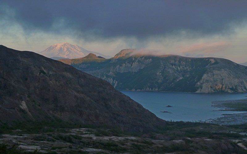
As I began my climb back, Mount Adams finally graced me with a quick glimpse! Normally, it would've been a near-constant presence on nearly this entire route.

Image

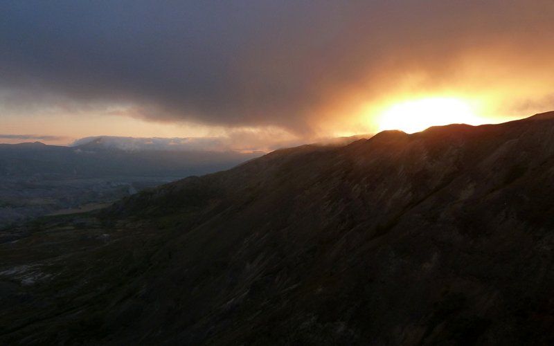
But the sun was setting on Johnston Ridge, and the clouds were now descending right along with me...

Image

Image

Image

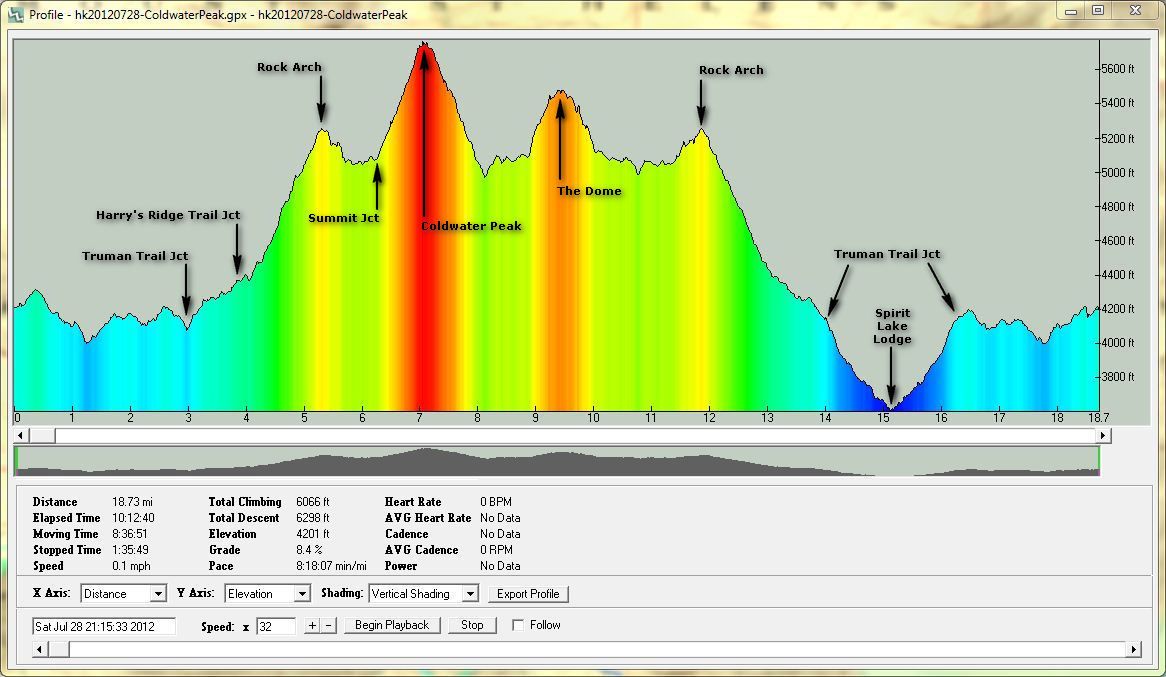
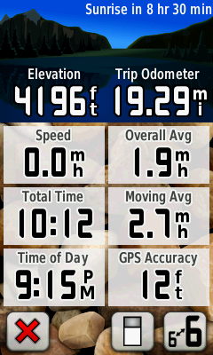
Final numbers are in the neighborhood of 19 miles and just a bit under 5000' EG.

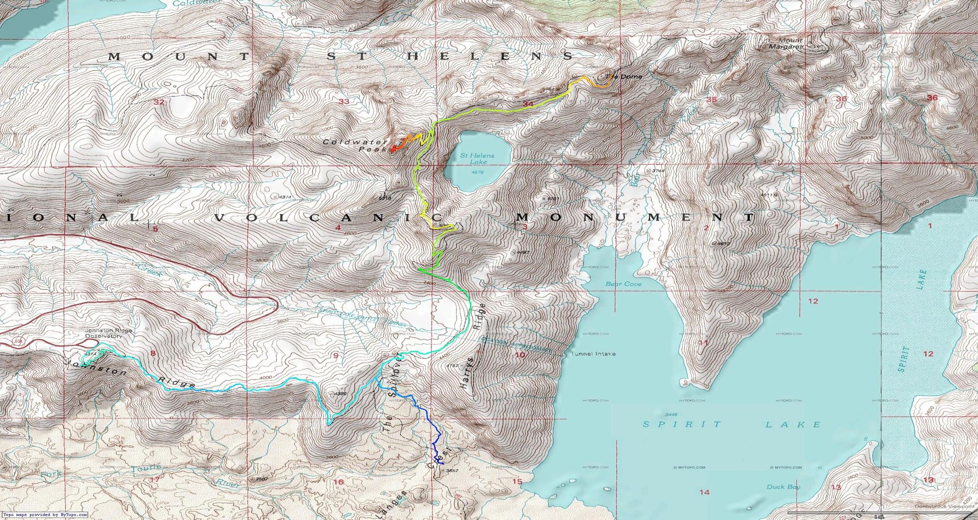
http://gpsfly.org/gps_map.php?gps_id=1698&w=645&h=440

Image

I'm actually starting to think that I could loop that entire lake. (Time for an intervention?)
Last edited by kepPNW on May 6th, 2013, 5:03 pm, edited 2 times in total.
Karl
Back on the trail, again...

User avatar
kepPNW
Posts: 6411
Joined: June 21st, 2012, 9:55 am
Location: Salmon Creek

Re: Coldwater Peak (and more), 28-July-2012

Post by kepPNW » July 30th, 2012, 6:39 pm

Coldwater Peak summit...


From just below The Dome...

Karl
Back on the trail, again...

User avatar
hlee
Posts: 513
Joined: April 16th, 2012, 12:41 pm
Location: St. Helens, Oregon

Re: Coldwater Peak (and more), 28-July-2012

Post by hlee » July 30th, 2012, 6:44 pm

Ah, glad for the TR! Now I don't have to look up these pesky details like mileage and such. I don't know that I could manage that entire route--I've never done more than I think 13 miles in one day, and I hate to be out on my own and find out that I can't.

Still, I am glad to have an idea what the route looks like really recently! Great photos!

Hannah

Only those who will risk going too far can possibly find out how far they can go.
-- T.S. Eliot

User avatar
kepPNW
Posts: 6411
Joined: June 21st, 2012, 9:55 am
Location: Salmon Creek

Re: Coldwater Peak (and more), 28-July-2012

Post by kepPNW » July 30th, 2012, 7:16 pm

hlee wrote:Ah, glad for the TR! Now I don't have to look up these pesky details like mileage and such. I don't know that I could manage that entire route--I've never done more than I think 13 miles in one day, and I hate to be out on my own and find out that I can't.

Still, I am glad to have an idea what the route looks like really recently! Great photos!
Thanks! It's almost exactly 13 miles from JRO to Coldwater Peak and back. The rest were just bonus. And damn hard to not do, once you're up there!
Karl
Back on the trail, again...

User avatar
kepPNW
Posts: 6411
Joined: June 21st, 2012, 9:55 am
Location: Salmon Creek

Re: Coldwater Peak (and more), 28-July-2012

Post by kepPNW » July 31st, 2012, 5:48 am

hlee wrote:Ah, glad for the TR! Now I don't have to look up these pesky details like mileage and such. I don't know that I could manage that entire route--I've never done more than I think 13 miles in one day, and I hate to be out on my own and find out that I can't.
Well, thing is, you have no choice once you're out there, do you? (No cell service much beyond JRO, either.) That thought stuck with me last night. It was also one that definitely entered my mind at that last snowfield. Odds were pretty high no one else would pass through there until the next day, as it was almost half way between THs on either side. For me, it's been extremely refreshing (not sure that's the right word?) to face these things again. Fwiw, though, I don't think I ever did more than 12 before this spring. And at the end of the day (literally!), my feet were whining a bit, but otherwise I would've truly enjoyed a few more hours of wandering.
hlee wrote:Still, I am glad to have an idea what the route looks like really recently!
A little more data...

Image
Click to enlarge.

Image
Click to enlarge.

This trail offers options to extend, depending on how you feel. I grabbed 'em while I could! :D
Last edited by kepPNW on August 7th, 2012, 4:35 pm, edited 1 time in total.
Karl
Back on the trail, again...

User avatar
Snorting Elk
Posts: 12
Joined: July 12th, 2012, 9:39 am

Re: Coldwater Peak (and more), 28-July-2012

Post by Snorting Elk » July 31st, 2012, 6:01 am

Hey Kep! I think my brother and I met you as we were coming out Saturday, we were the ones that left the car at 4:30am in the morning, went to Coldwater Peak, then down and east to Dome/Margaret Camp and back out to JR by 3:00 PM. 16 miles for us, I will be back this weekend for 3 days on #211 in the Panhandle area. We saw the "3 amigos" past the Coldwater peak trail turn off, they were going pretty slow.

Todd
Attachments
hike 3.JPG
IMG00507-20120728-1113.jpg
hike 2.jpg
hike 1.JPG
"The road of life is always under Construction!"

User avatar
kepPNW
Posts: 6411
Joined: June 21st, 2012, 9:55 am
Location: Salmon Creek

Re: Coldwater Peak (and more), 28-July-2012

Post by kepPNW » July 31st, 2012, 9:56 am

Snorting Elk wrote:Hey Kep! I think my brother and I met you as we were coming out Saturday, we were the ones that left the car at 4:30am in the morning, went to Coldwater Peak, then down and east to Dome/Margaret Camp and back out to JR by 3:00 PM. 16 miles for us, I will be back this weekend for 3 days on #211 in the Panhandle area. We saw the "3 amigos" past the Coldwater peak trail turn off, they were going pretty slow.
Hey Todd! Yeah, I do remember you guys, and it was that 4:30am start time that got me thinking about folks here! :lol: Maybe, lacking buttons, we need some sort of "secret PH hand signal" to flash at strangers on the trail? Nice to make the connection! :)

I'm not sure I know where that camp is - somewhere between The Dome and Mt Margaret? I only just got around the east side of The Dome, before a very steep snowbank made me look at my watch (~5:30pm) and consider whether to keep going or turn around. I was following those guys out, caught up, and kept (nearly) rear-ending their procession for nearly a mile, so I'd stop for a moment or three to take a few photos before catching back up again. They offered that I ought to pass them at the arch, though, and that was the last I saw of them. As usual, I was the last car in the JRO lot, when I finally made it back there.

Elk in that last shot? Cool!
Karl
Back on the trail, again...

User avatar
hlee
Posts: 513
Joined: April 16th, 2012, 12:41 pm
Location: St. Helens, Oregon

Re: Coldwater Peak (and more), 28-July-2012

Post by hlee » July 31st, 2012, 10:06 am

Yeah, you're right about not having a choice. You have to get all the way back. Just plan for contingencies I guess.

Thanks for the elevation profile!

Hannah

Only those who will risk going too far can possibly find out how far they can go.
-- T.S. Eliot

User avatar
BrianEdwards
Posts: 2405
Joined: February 2nd, 2010, 1:32 am
Location: Oregon City, OR
Contact:

Re: Coldwater Peak (and more), 28-July-2012

Post by BrianEdwards » July 31st, 2012, 11:13 am

What a great read, and beautiful shots to go along with it. Very impressive day hike.

**hits the Like button**
Clackamas River Waterfall Project - 95 Documented, 18 to go.

mtnhiker56
Posts: 125
Joined: August 21st, 2011, 7:29 am

Re: Coldwater Peak (and more), 28-July-2012

Post by mtnhiker56 » August 2nd, 2012, 5:51 pm

Heck, your pic ain't any worse than mine... I had to use the dog... ;)

Post Reply