Zigzag Mountain via Burnt Lake, 14-July-2012

This forum is used to share your experiences out on the trails.
User avatar
kepPNW
Posts: 6411
Joined: June 21st, 2012, 9:55 am
Location: Salmon Creek

Zigzag Mountain via Burnt Lake, 14-July-2012

Post by kepPNW » July 21st, 2012, 9:59 am

Spent four days up in the Zigzag area last weekend, and after a totally glorious Friday, I decided to go up Zigzag Mountain via the Burnt Lake trail on Saturday. Started early, hoping to be back down in time for a late lunch. That was a good choice.

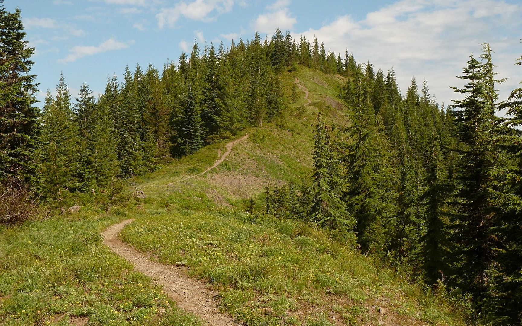
The initial trail follows a gentle creek for about two miles through a forest that's haunted by ghosts of old growth past. There are hulking burnt stumps, many more than 12 or 15-feet in diameter, scattered all about. The trail then turns and begins a more noticeable climb up to Burnt Lake.

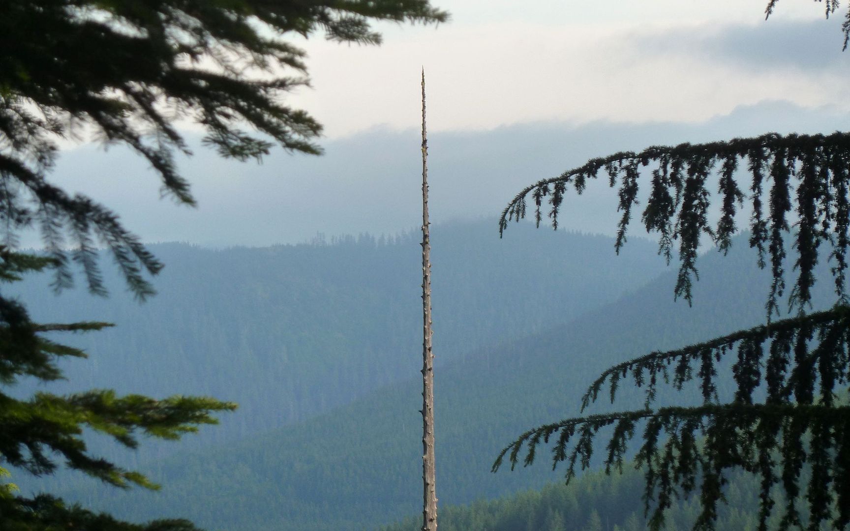
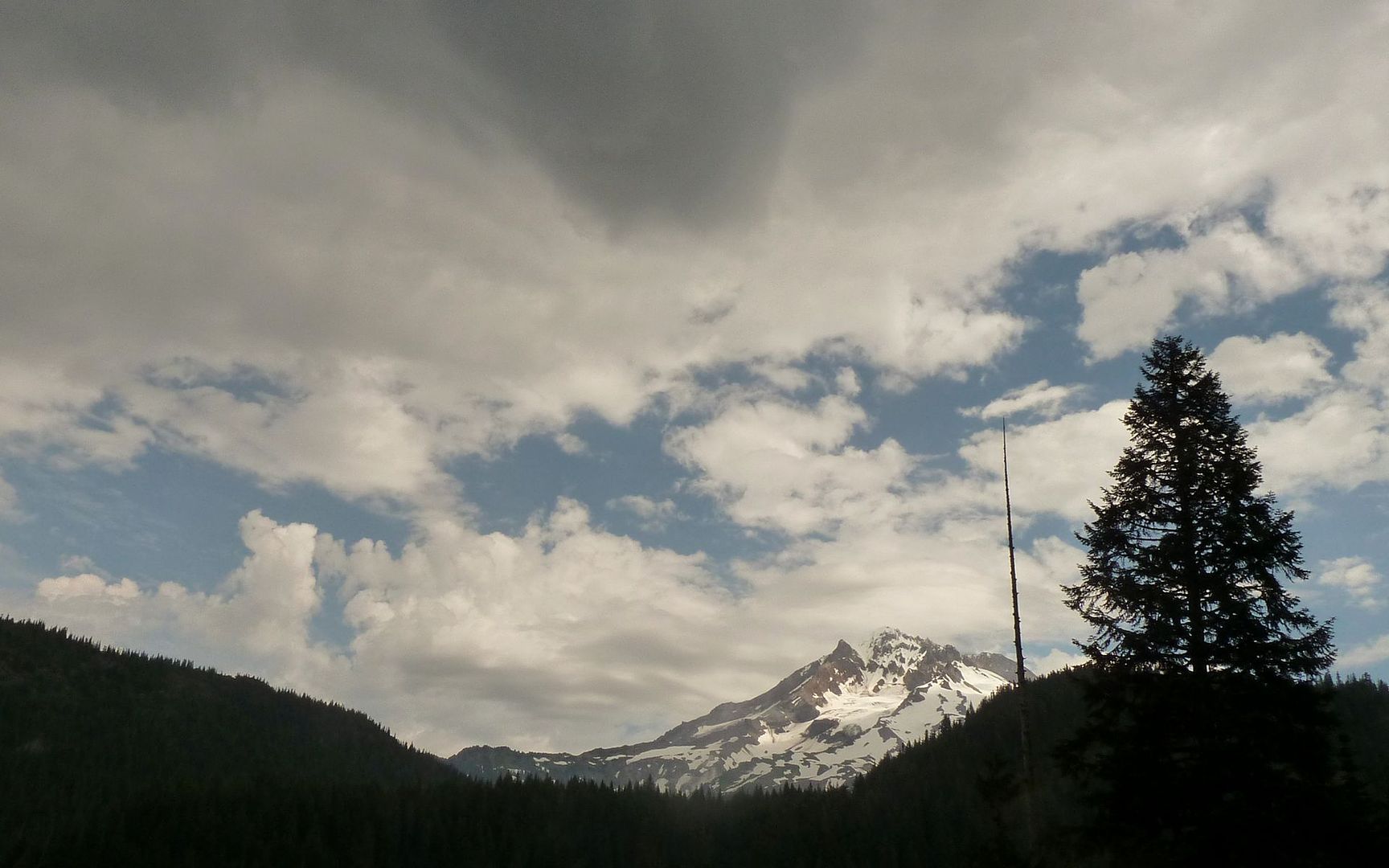
Here, a lone snag stands sentinel over the valley.

Image

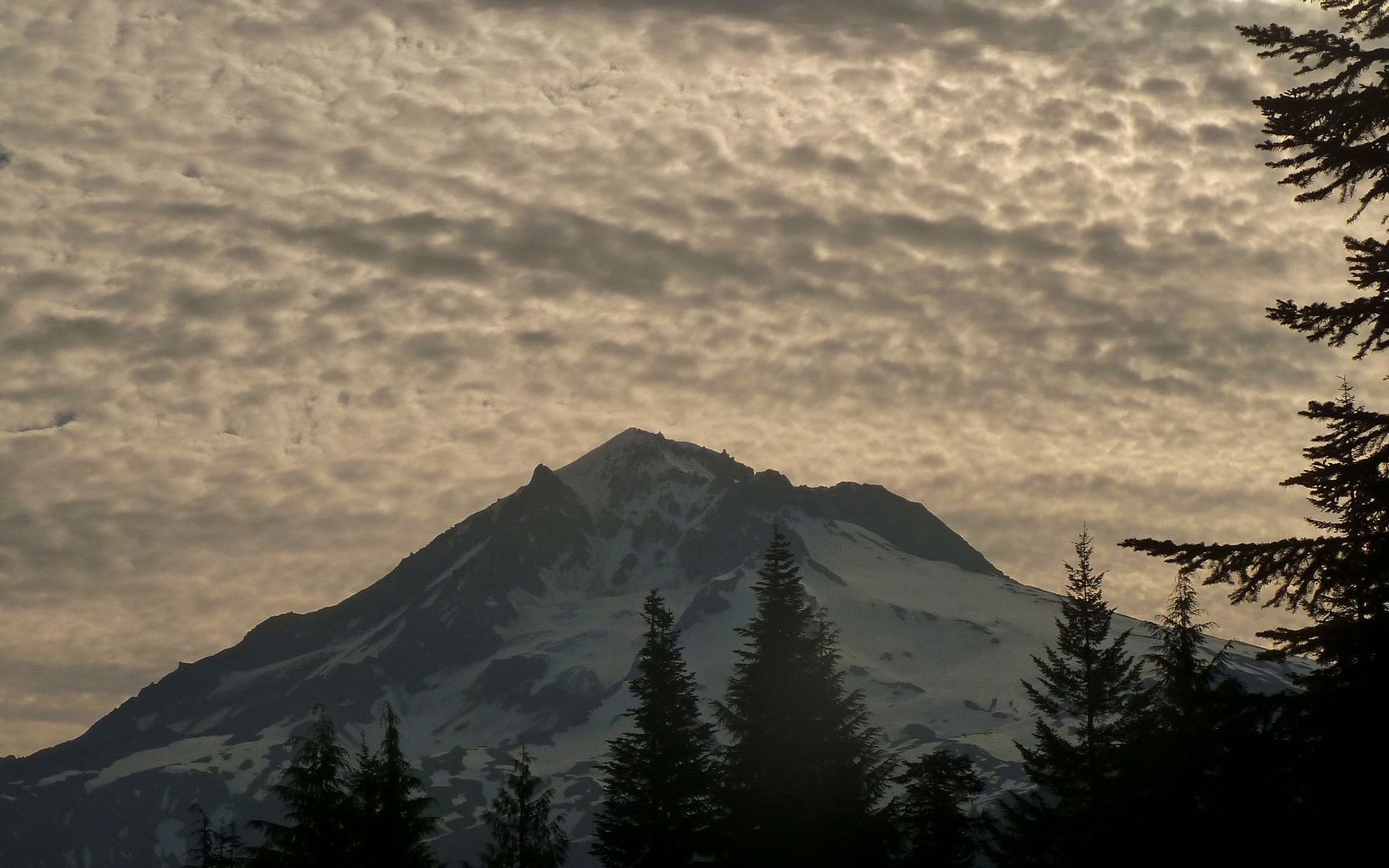
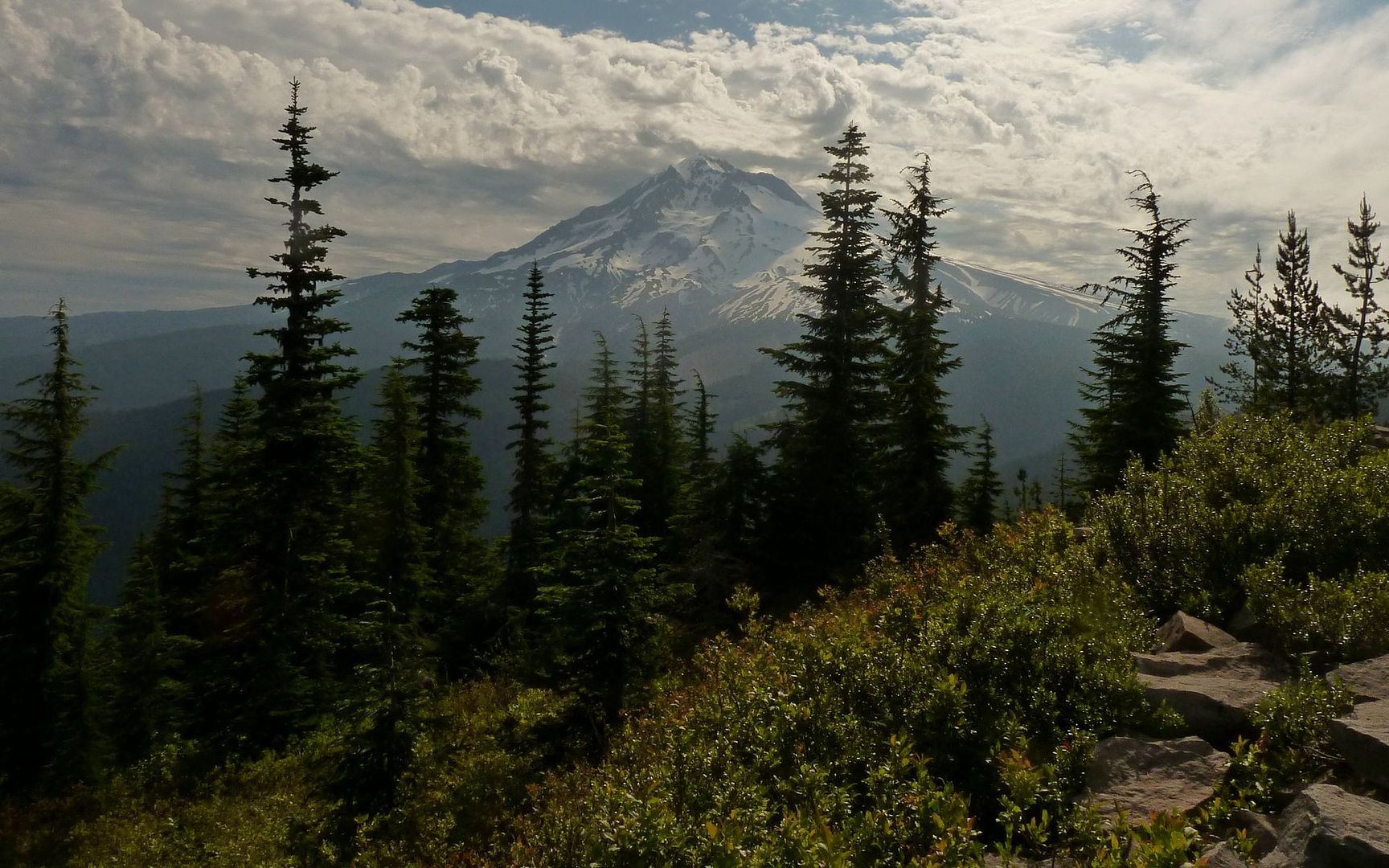
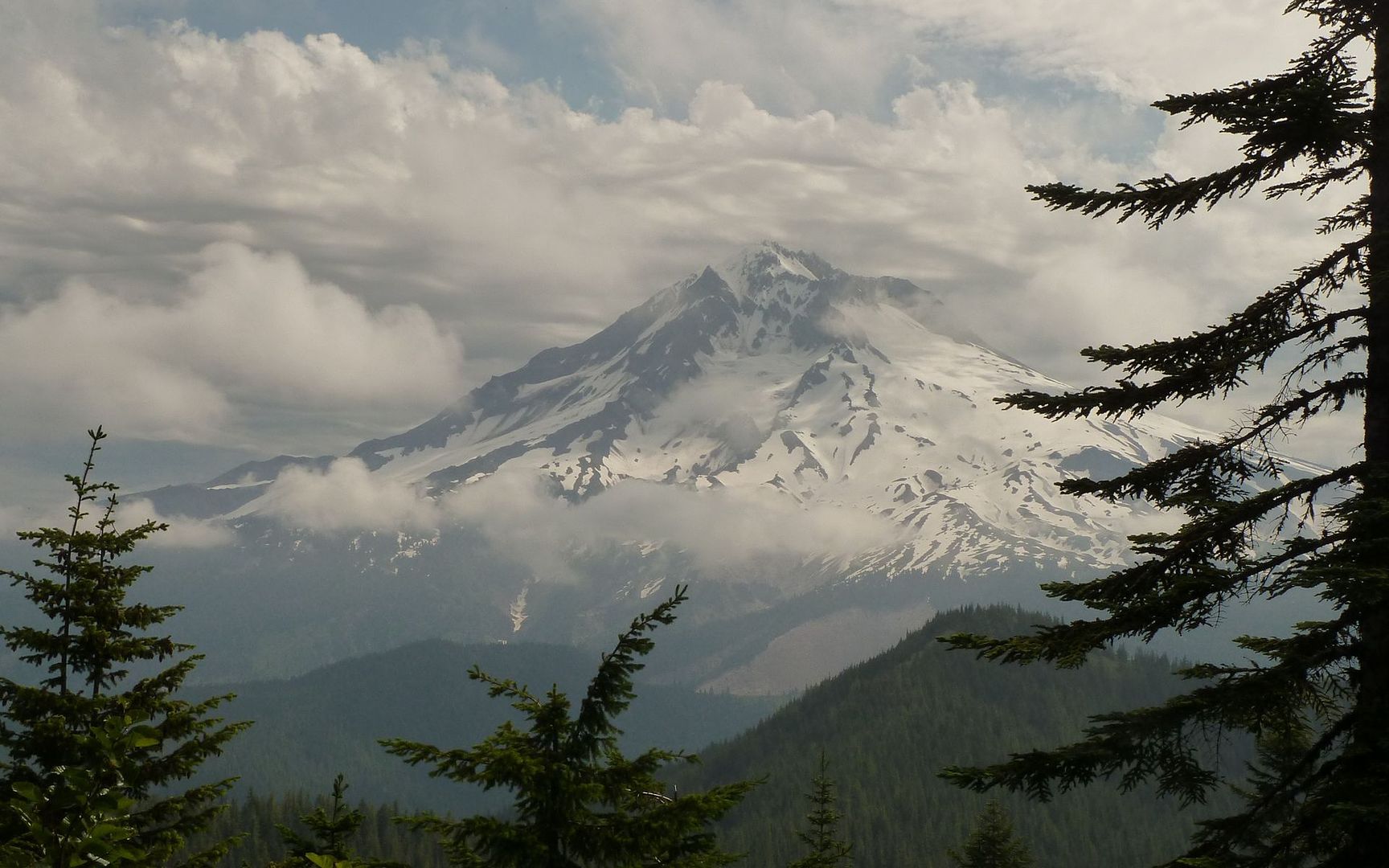
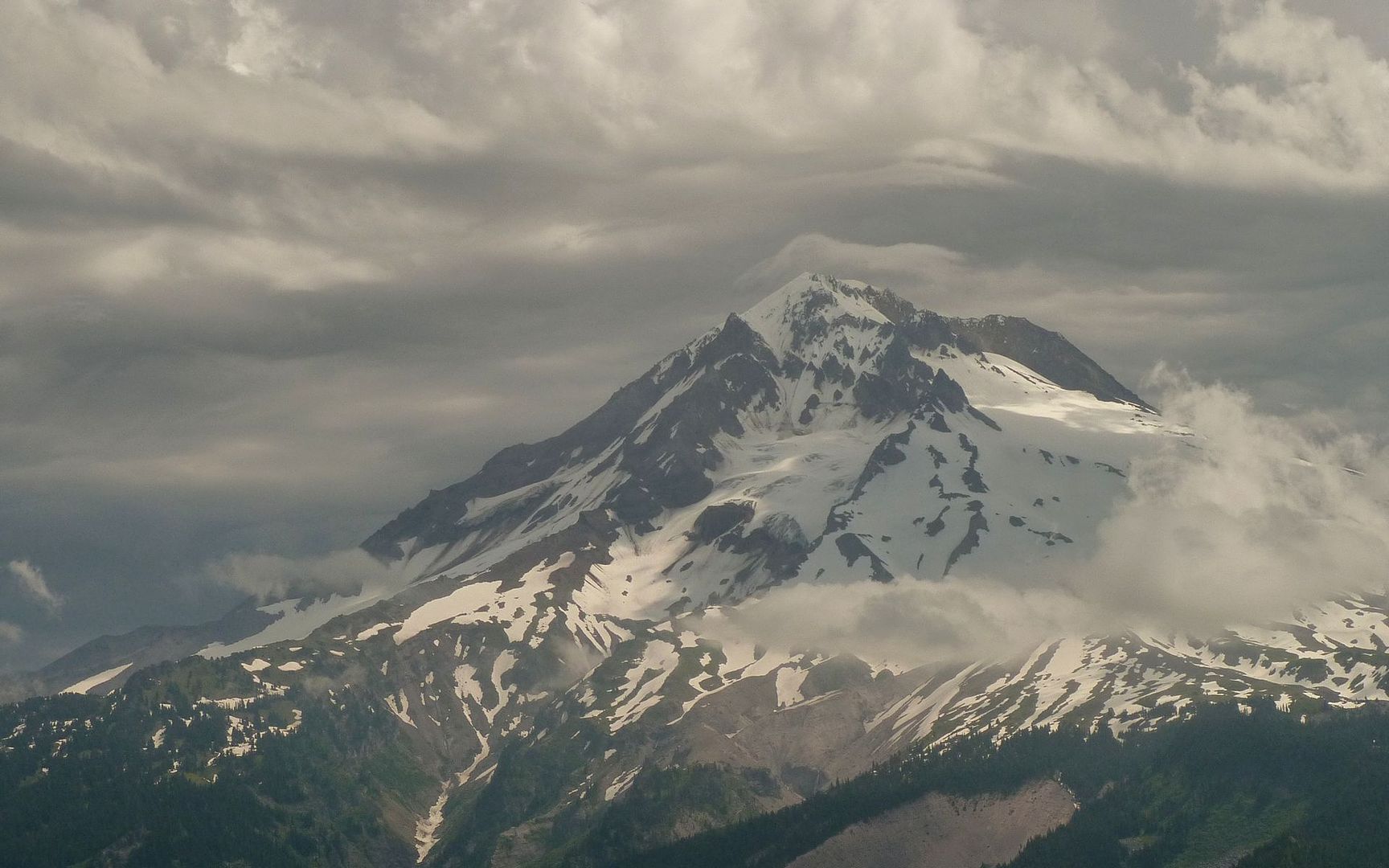
As I look over my shoulder at Mt. Hood, I'm hoping the morning clouds will burn off and provide another day just like the day before.

Image

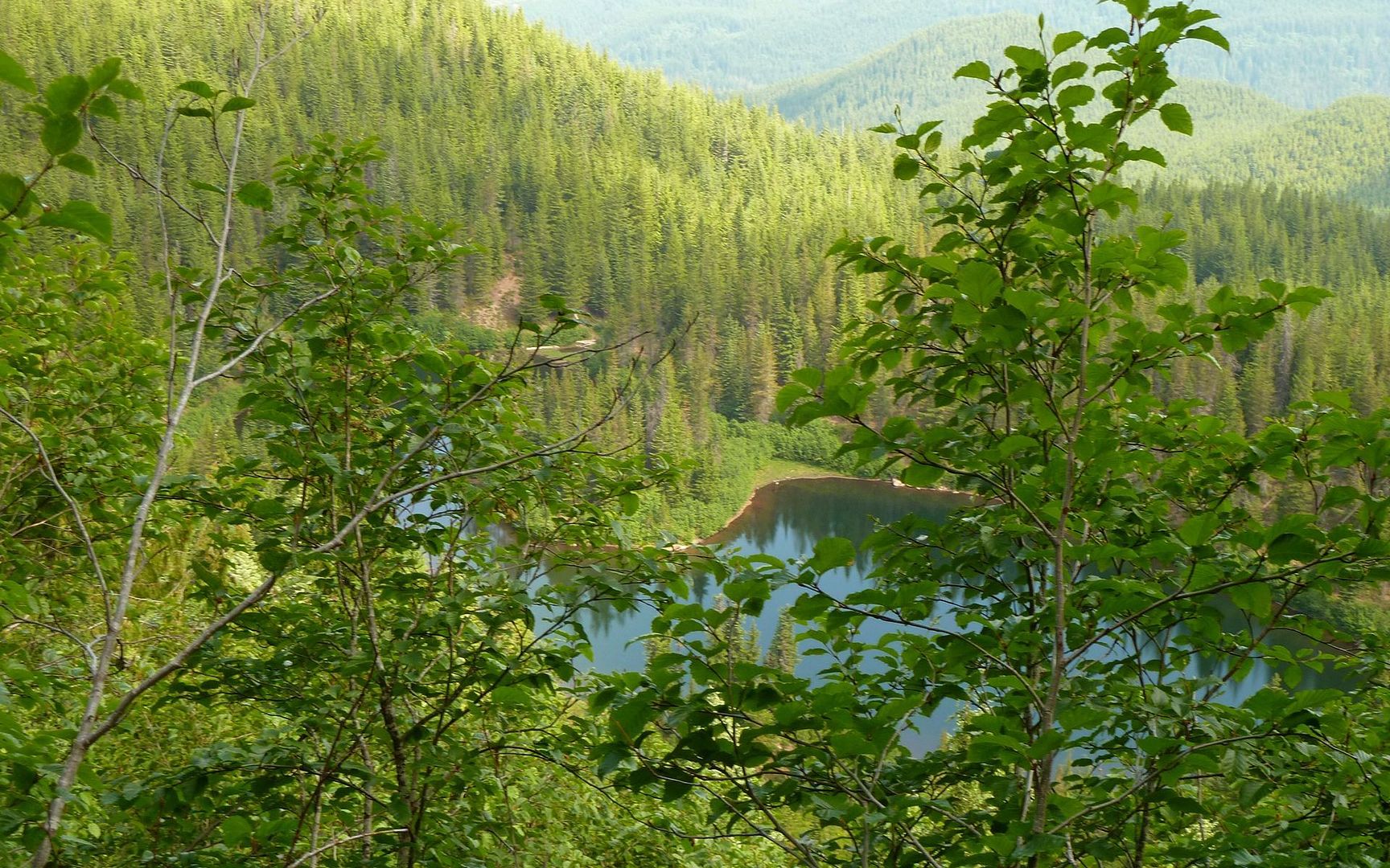
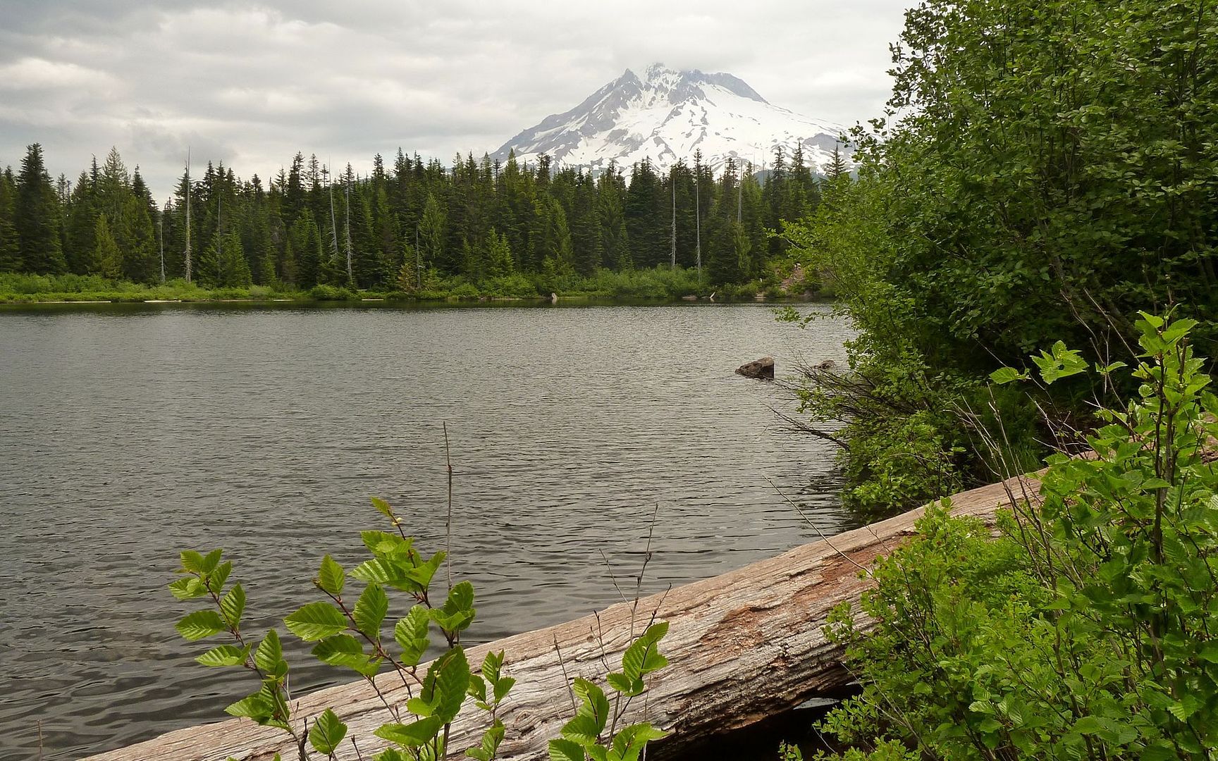
The situation is looking extremely promising by 8am, when I reach Burnt Lake. I decide to forgo a loop around the lake now, and just continue on up the trail to East Zigzag Mountain.

Image
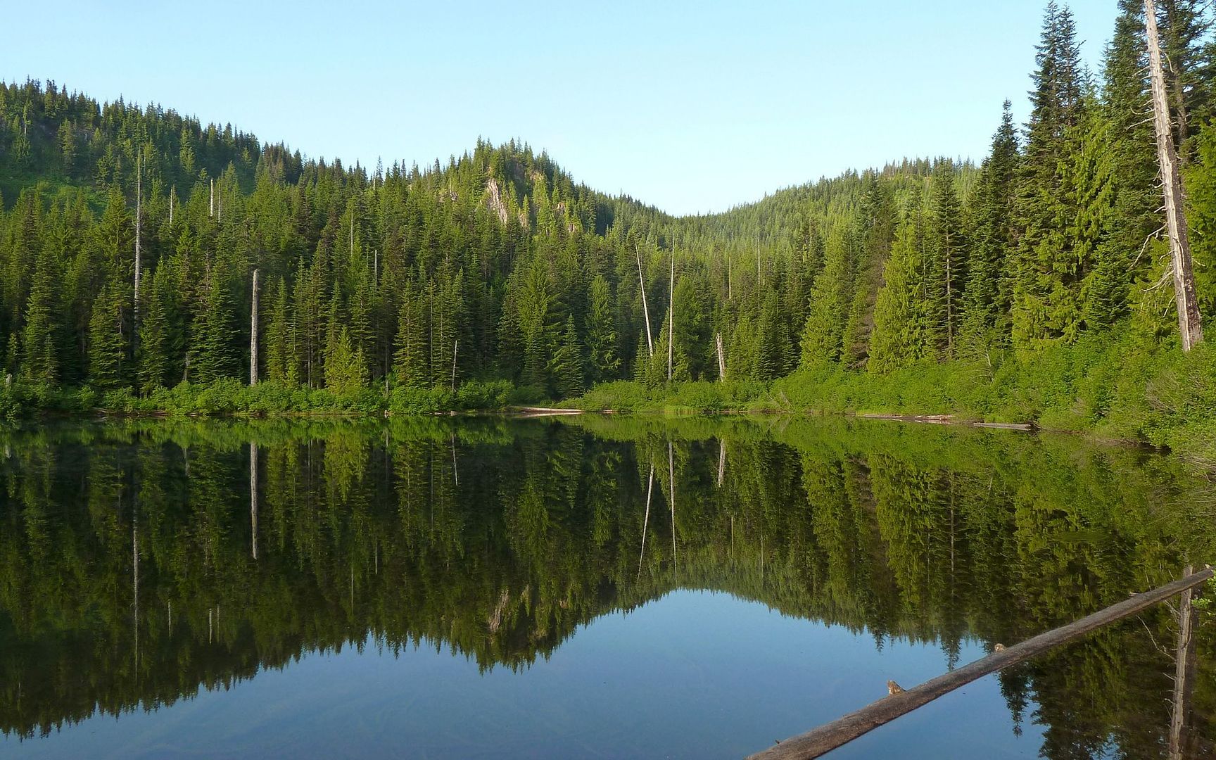
Photosynth of Burnt Lake (zoom/pan about a multi-shot composite)

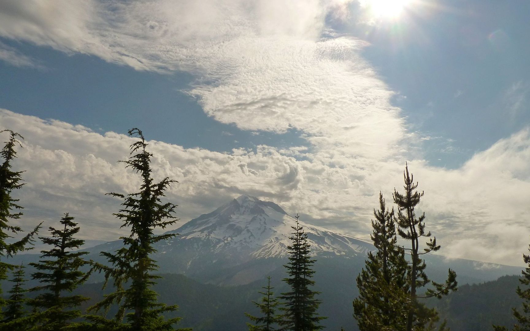
Hitting one of the first clearings, after turning off on the Zigzag Mtn trail, I see the clouds are again building over Mt. Hood. But the view of Burnt Lake from above is beautiful!

Image

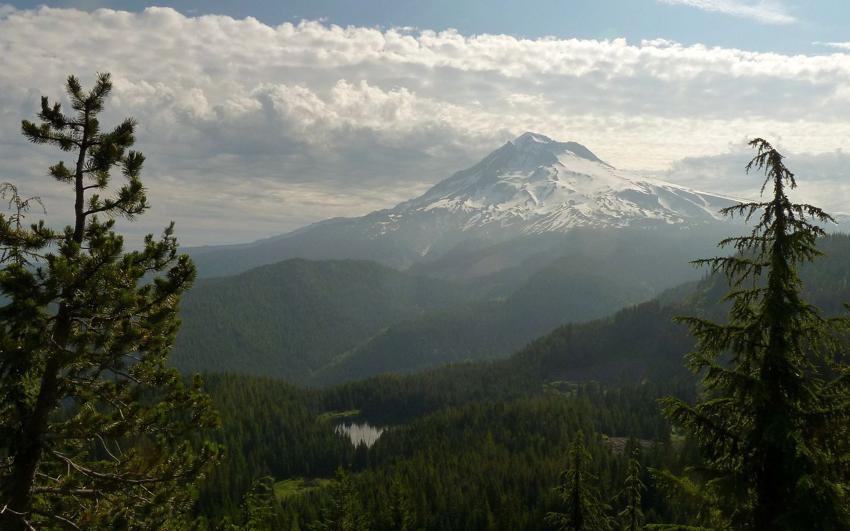
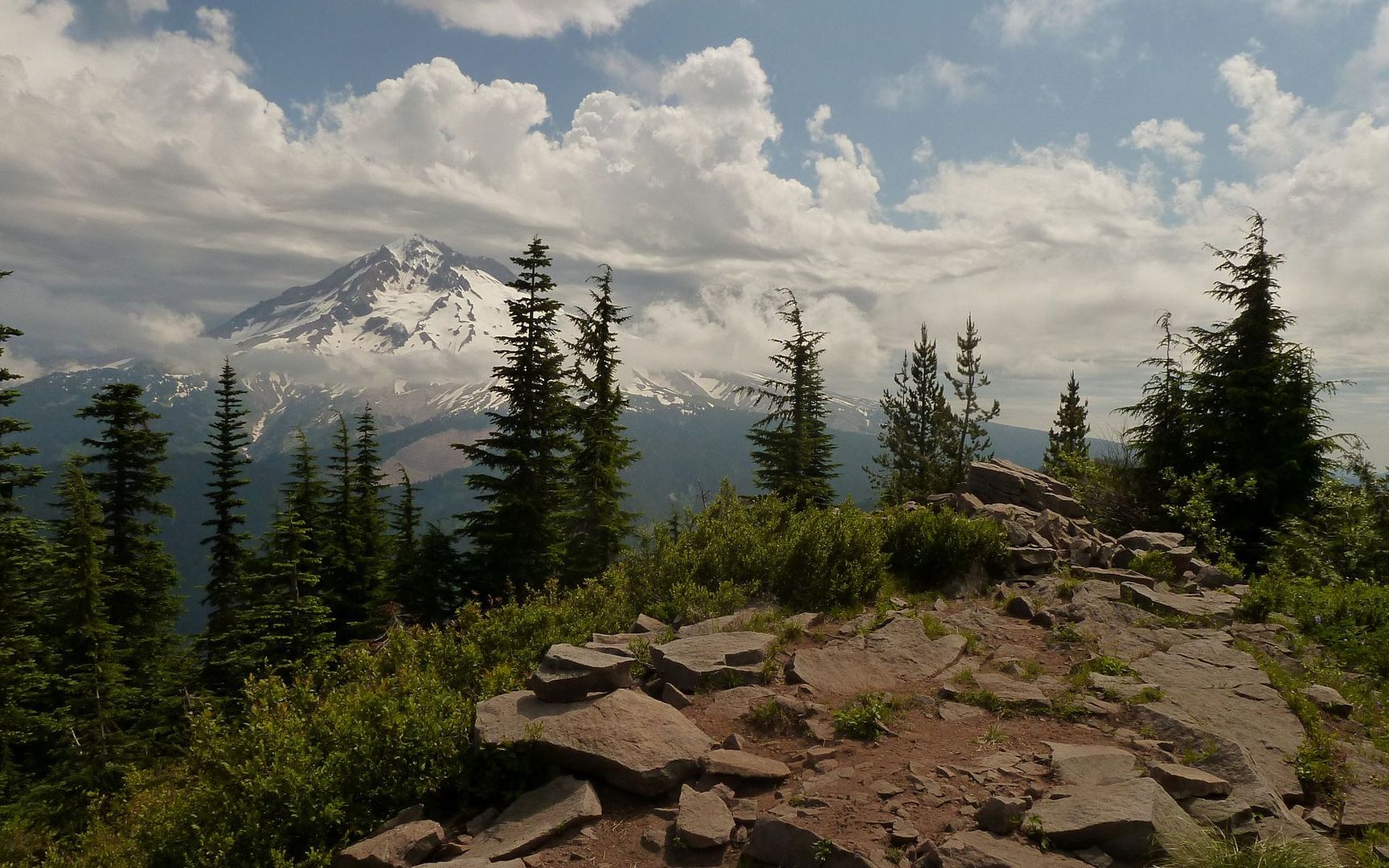
A final push up to the summit of East Zigzag, and then some more photos of Hood and the ever-changing clouds swirling about it.

Image

Image

Image

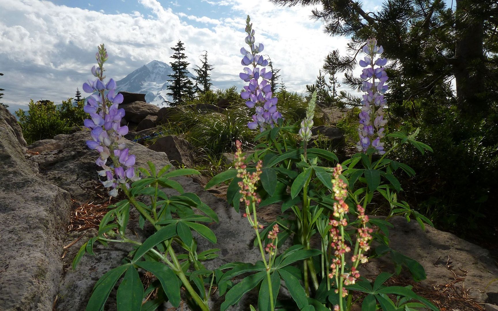
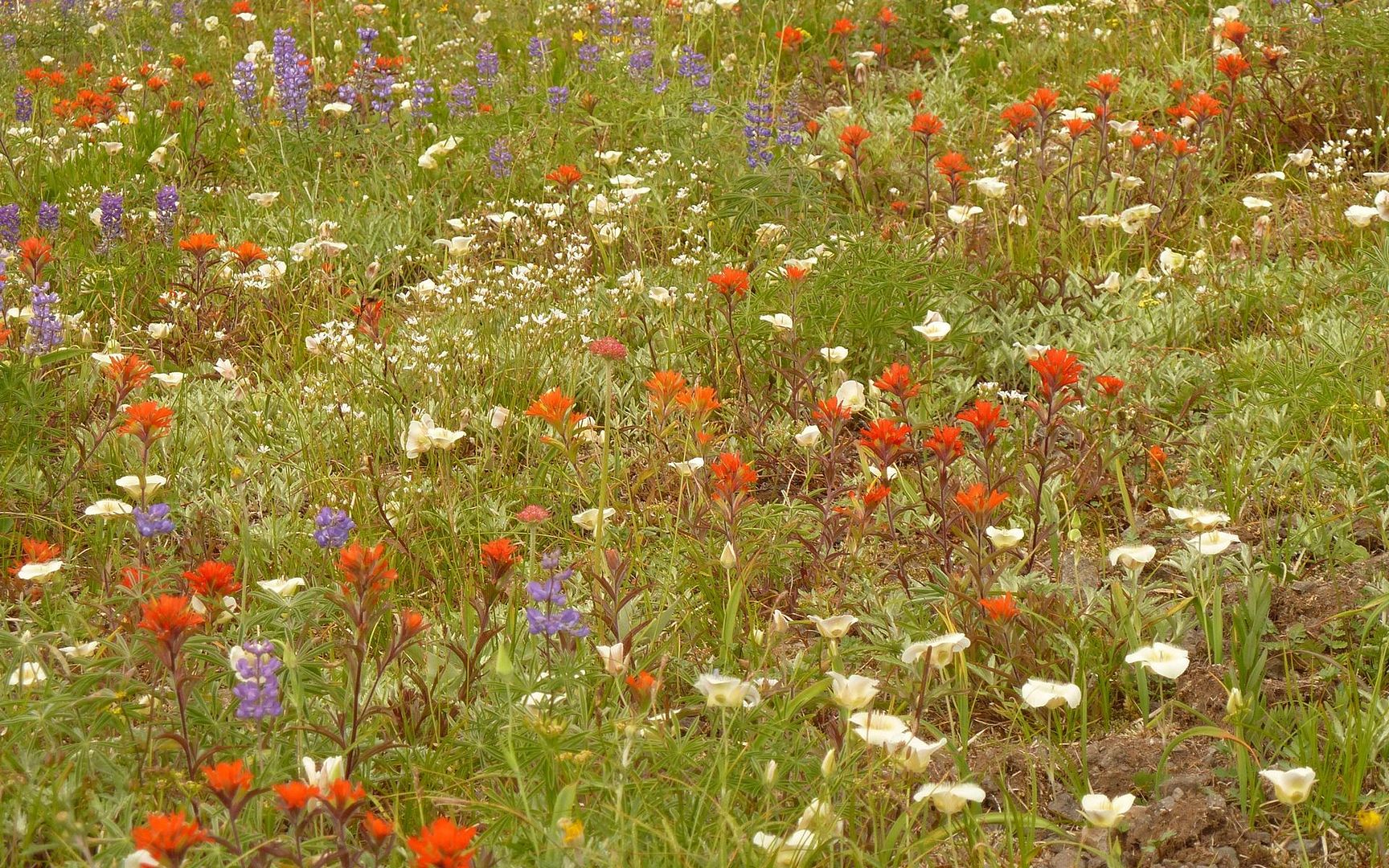
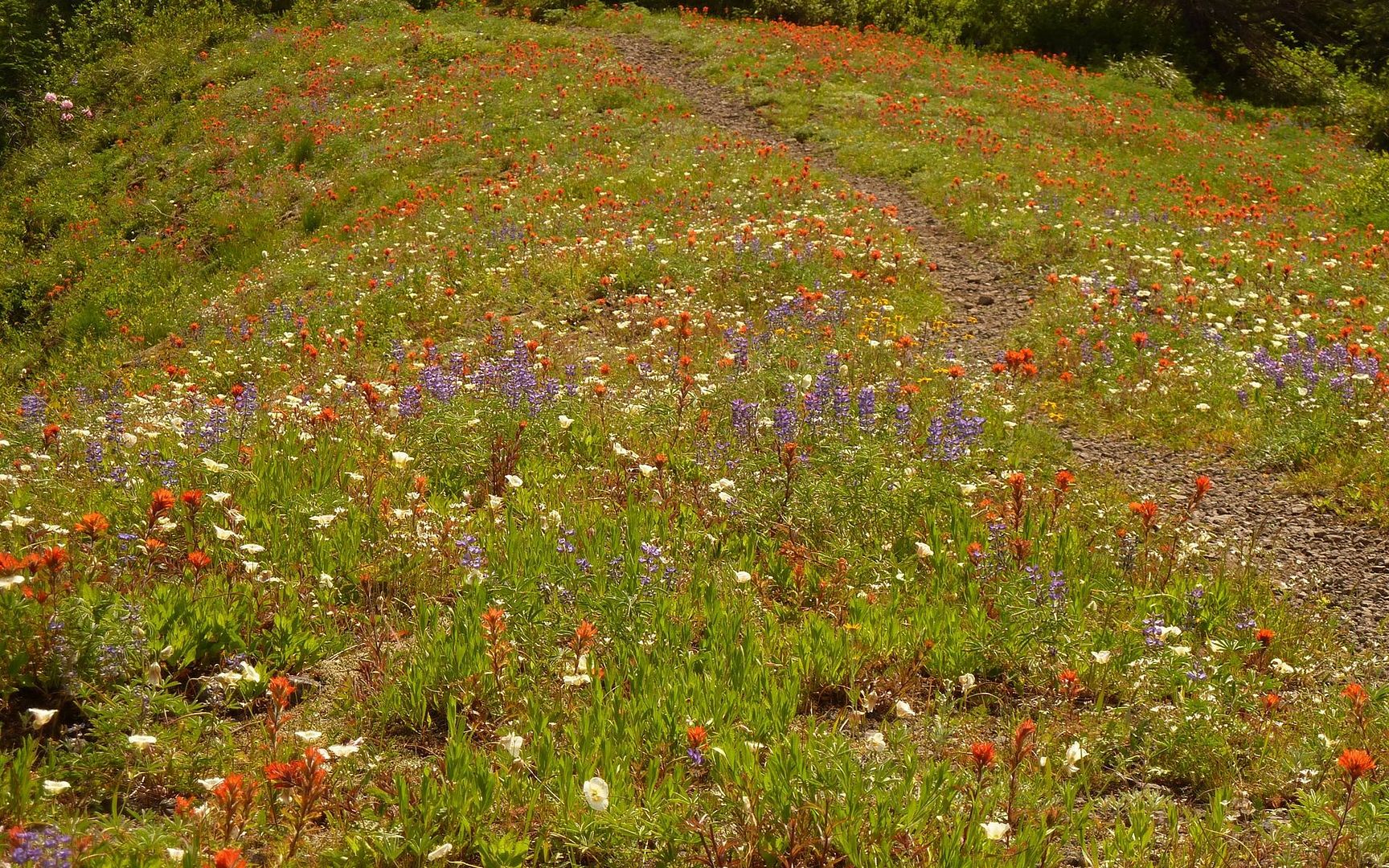
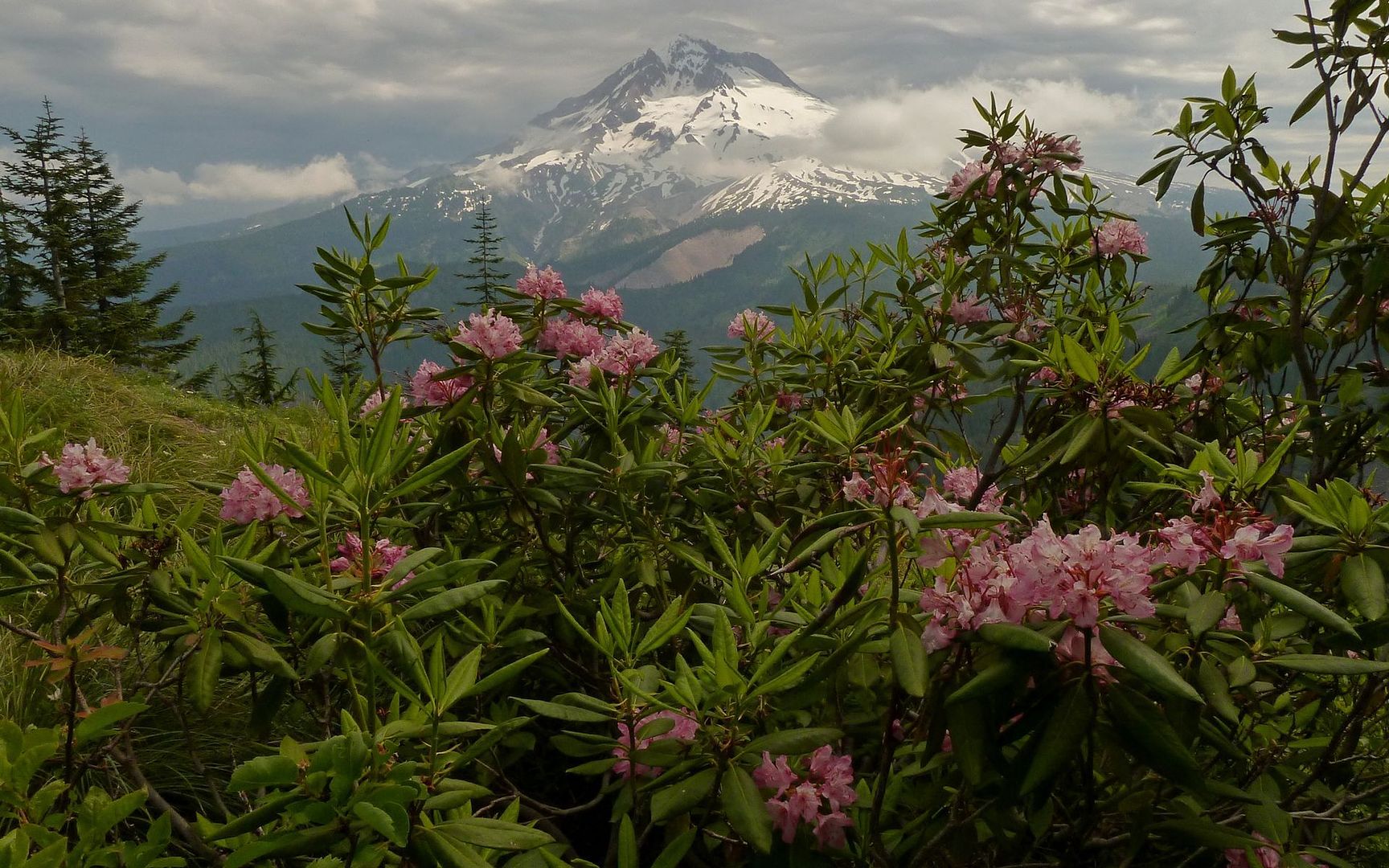
The summit of East Zigzag offered a few nice wildflower patches. But the descent into the saddle between East and West Zigzag peaks opened up into a meadow full of color!

Image

Image

The saddle itself was just terrible, though, for the mosquitoes seem to have peeked at just the moment I chose to wander through. Kicked into high gear for a couple miles, but couldn't outrun them, so had to admit defeat and pull out the deet. :(

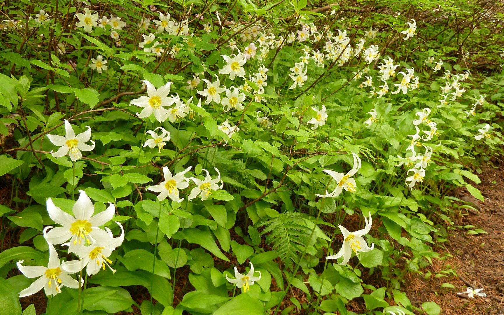
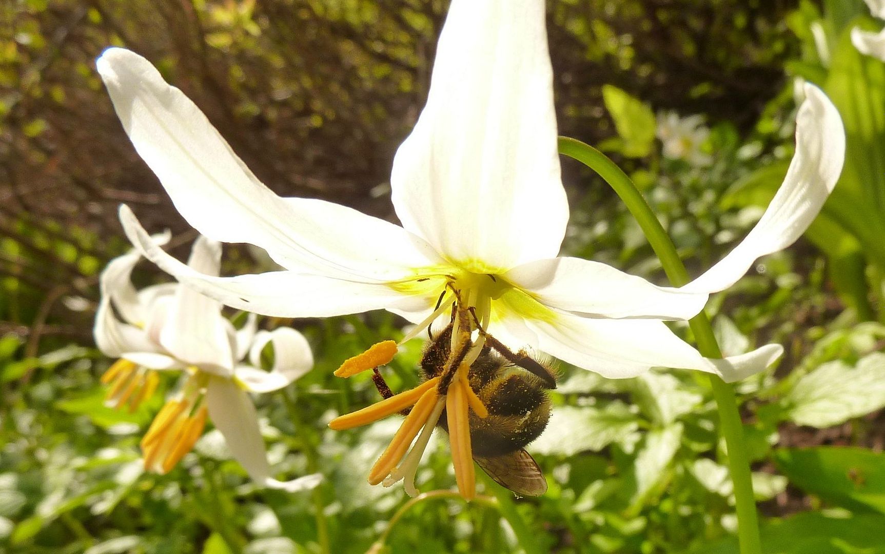
This area was just exploding in Avalanche Lilies. As well as still melting patches of snow beside the trails.

Image

Image

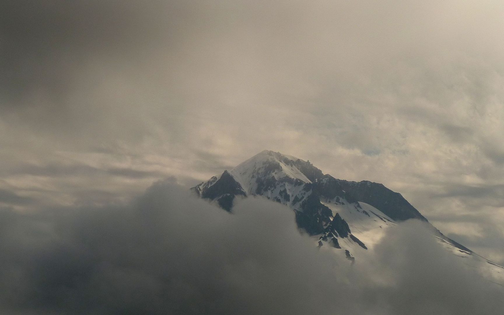
As the trail passed just under the summit of West Zigzag Mtn, the thunder up around Mt. Hood began to get more and more ominous. A significant storm seemed to be wrapping around the north side and heading pretty much right at me.

Image

I poked around a bit, looking for a trail to the western summit, but couldn't find anything obvious. And between those damned mosquitoes and the thunder, I decided it wouldn't be worth spending maybe an hour bushwacking around to get up there when the views I had were probably pretty much the same right here. The sky was changing by the minute.

Image

Still, Avalanche Lilies and snow patches everywhere! (Only a few actually on the trail, though.)

Image

Next time I'm in that area, I think I'll drop down to Cast Lake, rather than bother with the second summit of Zigzag. I saw a couple of folks floating around down there on air mattresses at 10am! Looked like a pretty nice lake, though I wondered if the mosquitoes were as bad there as in the saddle.

Image

Another trip through the meadow on my way back to the east peak.

Image

Image

By the time I'm back at this summit, the thunder is rumbling every 30 seconds or so just to the left of Hood.

Image

Image

Image

Lots of folks are just now getting there. Until now, I think I've only crossed paths with four or five. Time for me to get down!

Back at Burnt Lake, the winds are picking up, and it's starting to rain. I'd lost that perfect reflection shot that I should've taken on the way up. Ah well...

Image

It rained lightly most of the four miles back to the trailhead, with thunder crackling just overhead. I was glad at this point that I'd timed the hike as I had. :)

Image

Final stats, courtesy of GPSfly: 14 miles, 4200' EG (2640-4990' min/max).

http://gpsfly.org/gps_map.php?gps_id=1666&w=645&h=440

This was a great hike! I'd highly recommend it. After hitting the east peak, there are numerous options up top. On a clear day, I'm sure I'd have had views from Rainier to the Sisters. (I did see ghosts of Adams and Jeff at times.) The road to trailhead offers about four miles of one-lane cratered gravel, not great, but I've seen worse.
Last edited by kepPNW on August 7th, 2012, 4:15 pm, edited 3 times in total.
Karl
Back on the trail, again...

User avatar
Waffle Stomper
Posts: 3707
Joined: May 28th, 2008, 10:03 pm

Re: Zigzag Mountain via Burnt Lake, 14-July-2012

Post by Waffle Stomper » July 21st, 2012, 2:34 pm

Thank you for the trip report, looks like you had a stunning display of wildflowers.
"When we try to pick out anything by itself, we find it hitched to everything else in the Universe." - John Muir

User avatar
hlee
Posts: 513
Joined: April 16th, 2012, 12:41 pm
Location: St. Helens, Oregon

Re: Zigzag Mountain via Burnt Lake, 14-July-2012

Post by hlee » July 21st, 2012, 6:47 pm

Great pictures of Hood! I especially like the one with the rhodies.

Hannah

Only those who will risk going too far can possibly find out how far they can go.
-- T.S. Eliot

User avatar
kepPNW
Posts: 6411
Joined: June 21st, 2012, 9:55 am
Location: Salmon Creek

Re: Zigzag Mountain via Burnt Lake, 14-July-2012

Post by kepPNW » July 22nd, 2012, 5:35 am

WS, yeah, once above 4500', the lilies were everywhere moist. The others were all closer to 5000'+.

hlee, just goes to show what not tuning into a weather forecast will offer, huh? I'd heard others dissuaded by the tstorm predictions, but not being aware of them I got quite the sky show. :)

Thanks!
Karl
Back on the trail, again...

User avatar
Banksia
Posts: 46
Joined: June 13th, 2009, 8:50 pm

Re: Zigzag Mountain via Burnt Lake, 14-July-2012

Post by Banksia » July 22nd, 2012, 6:54 pm

Nice report, nice pictures.

But:
The white ones are Erythronium montanum, "Avalanche Lily".
"Glacier Lily" (Erythronium grandiflorum) is yellow.

User avatar
kepPNW
Posts: 6411
Joined: June 21st, 2012, 9:55 am
Location: Salmon Creek

Re: Zigzag Mountain via Burnt Lake, 14-July-2012

Post by kepPNW » July 22nd, 2012, 8:45 pm

Banksia wrote:Nice report, nice pictures.

But:
The white ones are Erythronium montanum, "Avalanche Lily".
"Glacier Lily" (Erythronium grandiflorum) is yellow.
Argh! I think I knew that, but I always get them mixed up for some reason. I definitely appreciate the correction! Gonna try to drill that one in. (And correct the TR above.) Thanks!

Hmmmm, what about that pink one? :oops:
Karl
Back on the trail, again...

payslee

Re: Zigzag Mountain via Burnt Lake, 14-July-2012

Post by payslee » July 23rd, 2012, 8:27 am

kepPNW wrote:
Banksia wrote:Nice report, nice pictures.

But:
The white ones are Erythronium montanum, "Avalanche Lily".
"Glacier Lily" (Erythronium grandiflorum) is yellow.
Argh! I think I knew that, but I always get them mixed up for some reason. I definitely appreciate the correction! Gonna try to drill that one in. (And correct the TR above.) Thanks!

Hmmmm, what about that pink one? :oops:
Common names are meant to be "looser"... that's why they came up with the whole scientific name system, so don't feel bad. ;)

If it's easier, all of these delightful flowers are *also* known as fawn lilies. The pink ones, sensibly, are known as pink fawn lilies (among other common names), and you can use "yellow" and "white" fawn lilies for the others with no head hanging!

-payslee

User avatar
kepPNW
Posts: 6411
Joined: June 21st, 2012, 9:55 am
Location: Salmon Creek

Re: Zigzag Mountain via Burnt Lake, 14-July-2012

Post by kepPNW » July 23rd, 2012, 9:24 am

Never heard of fawn lilies before! I might be able to remember that one. :)

Is there a good "go to" guide to wildflowers in our region? (For a non-botanist.) I seem to have more trouble finding good references, unless I know the name of what I'm looking for already. Which is, most often, the entire battle.

Thanks!
Karl
Back on the trail, again...

justpeachy
Posts: 3068
Joined: May 28th, 2008, 10:03 pm
Location: Portland, OR
Contact:

Re: Zigzag Mountain via Burnt Lake, 14-July-2012

Post by justpeachy » July 23rd, 2012, 9:52 am

Looks like a great hike! I've been to Burnt Lake before, but never been farther. LOVE the wildflowers! It has always seemed highly unfair that summer wildflowers and mosquitos peak at the exact same time! :cry:

kepPNW wrote:Is there a good "go to" guide to wildflowers in our region? (For a non-botanist.) I seem to have more trouble finding good references, unless I know the name of what I'm looking for already. Which is, most often, the entire battle.
Yes! Wildflowers of the Pacific Northwest, by Mark Turner covers (obviously) the whole PNW. When you're hiking in the Gorge then Wildflowers of the Columbia Gorge, by Ross Jolley is an excellent resource.

User avatar
kepPNW
Posts: 6411
Joined: June 21st, 2012, 9:55 am
Location: Salmon Creek

Re: Zigzag Mountain via Burnt Lake, 14-July-2012

Post by kepPNW » July 23rd, 2012, 10:16 am

It's really worth the push up top, Cheryl. A view like that above Mirror Lake, but without the tourist hordes. The thunderstorm really added to the "buzz," too. :)

Thanks for the guide pointers! I have them both on hold at the library, and will pick 'em up later today! (Always gotta try-before-buy, when possible.)
Karl
Back on the trail, again...

Post Reply