Brad had been reading TexasBB’s TRs on the Wenaha-Tuncannon Wilderness and thought this would be a good place to explore, so we gathered our maps, loaded up the dogs and gear, and headed out.
We weren’t disappointed!
Without a specific camping area in mind, we set out from Portland and headed east on I-84 to Pendleton. We decided to head north to the Wilderness via Hwy 11 north and then on Hwy 204 up through Tollgate. The Blue Mountains were gorgeous, even from just outside of Pendleton!
DSC04859 (Blues from Car)
I didn’t pay close attention to the map and blew past the left hand turn to Jubilee Lake just before you leave the town of Tollgate. So we continued on to Elgin, gassed up, and then turned north by Wallowa, following the signs to Troy, which turned out to be a back way into the area. To make a long story short, this was the long way to Troy. But no matter. We were treated to fabulous views and incredible scenery, while meeting some flavorful locals while asking for directions. ( Note to file: there aren’t a whole lot of signs in these parts, so unless you have a GPS, you might get a tad confused at times!)
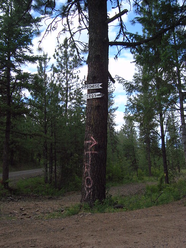
Of course, there are always the hand-made local signs you can use, too!
DSC04867 (Signage on Tree)
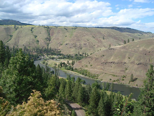
Down below, we saw the tiny town of Troy at the bottom of the canyon where the Grande Ronde and Wenaha Rivers merge.
DSC04876 (Grande Ronde/Troy)
We turned back west from Troy on Forest Road 62, and decided to try and make it to Bear Spring for the night. Along the way, we passed all kinds of side roads – amazing, actually. They all seem to lead off somewhere… invitations for future exploration!
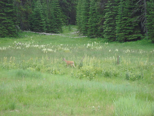
Saw lots of animals including deer.
DSC04880 (Deer/Field)
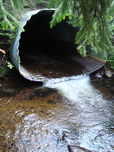
It was getting late but the sun kept the sky light, and we found the Bear Spring campground unoccupied.
DSC04903 (Bear Creek/Pipe)
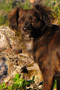
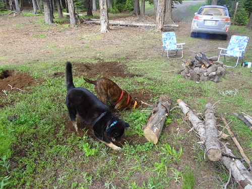
Yahoo! The dogs quickly found an activity to keep them occupied- they both love digging in the ground. Sure wish they were truffle-hunting pups! LOL
DSC02099 (Dogs Digging)
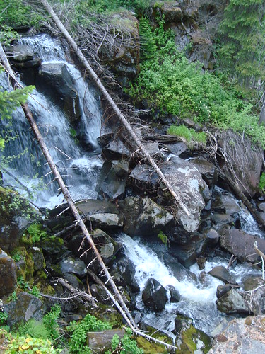
After camp was set up, I heard a muffled sound in the woods and decided to follow it. Just maybe 300 feet from the campsite, down a track and then some bushwhacking, I arrived at a 30-foot cliff and some pretty falls from Bear Creek as it started its tumble down into the canyon. Very scenic!
DSC04909 (Bear Creek Falls)
The next day, we decided to head out to Timothy Spring C.G. to catch a trail that followed the South Fork of the Wehana River over to Milk Creek as our hiking destination.
Following F.R. 62 was great- it was wide and well –graded. Then we turned onto F.R. 6413, then onto F.R. 6415. Usually, the more turns you take onto subroads means things get sketchy fast. The final 5 miles put my Subaru Outback through its paces and flirted with the threshold as to whether I turned the car back around. It’s not the worst, but you definitely will want to make sure you have an all-wheel drive when heading down this road and take care if you get caught in a rainstorm; I could see how this track could turn into a gooey mess real quick.
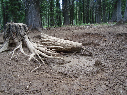
Not far from the Timothy Spring C.G., we came around a corner and scared a big herd of elk; oddly enough, there was a wallow right next to the dirt road that was well-churned and stunk to high heaven. I read up on this later on and apparently the male elk like to pee in there and then roll around in it; apparently, the smell holds great appeal for the lady elk. (!)
DSC04975 (Elk Wallow)
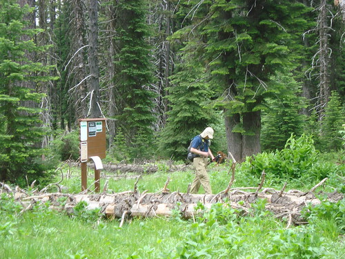
We bumped our way to the Timothy Spring C.G. and there wasn’t a soul to be seen- we hadn’t even spotted another car the entire time getting there, either. Parked and then headed out along the trail, which felt good under the feet – lots of spongy ground.
DSC04921 (Starting Hike/TH)
About 45 minutes into our hike, I looked up to see Brad heading back towards me and asked him what’s up. “BEAR” he said. And looking over his shoulder, I saw the biggest brown bear I’ve ever seen about 50 feet away and walking towards us. Thankfully, Brad had his industrial-strength bear spray at the ready, and we grabbed the dogs as Buddy the plott hound is a specific type of dog bred especially for bear hunting. So you can get the drift that it was probably a good idea to have Buddy especially under control otherwise he was going to be off like a shot after the bear!
DSC04931 (Bear)
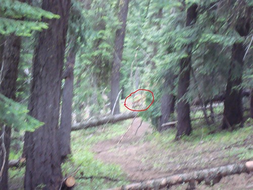
We hooted and hollered, and got Buddy bellowing, so after about 5 minutes, it was clear that Mr. Bear had wandered away from the ruckus, so we continued along our way, hearts racing a little faster.
We saw some more elk in the forest (they seem to be doing VERY well in this area!) as we came around a corner- and saw their tan buttocks fleeing through the trees. Fortunately, the dogs were not too gung ho to take after them!
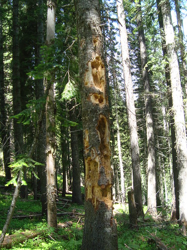
Apparently, there are a lot of woodpeckers around too. We first thought this tree was scratched up by a bear (wonder why we had “bear” on our minds??) , but I think that this is the handiwork of a pileated woodpecker.
DSC04936 (Woodpecker Tree)
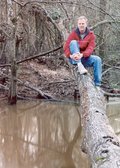
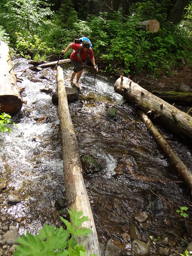
We finally came out of the forest and crossed the South Fork of the Wenaha River – there is no really good way of getting across it except for taking off your boots and wading. Unless you are a mountain goat like Brad. He did wade across the first time but jumped from one slippery log to another on the way back. Showoff!!! Me? I was going really slow because there was a rusted out metal culvert that was underwater and I had visions of slipping and gashing my leg… not a good thing any time but esp. since any kind of help was literally about 100 miles away. But I made it!
Dawn Crossing South Fork Wenaha River
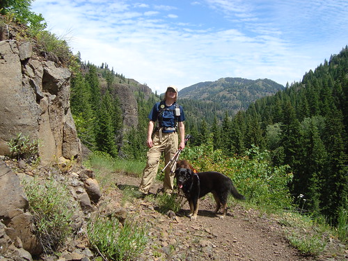
The trail followed the pretty river and climbed up into more of a dry, hot zone surrounded by cliffs. Our dogs got hot but thankfully, there were still plenty of creeks that were still flowing this time of year.
DSC04948 (Brad/Dogs on Trail)
Being the klutz that I am, usually I am watching where I put my feet (don’t ask… just trust me that this is required so I don’t trip and fall). However, I just happened to glance over while trekking through a somewhat shady section and managed to spot this beauty.
DSC04960 (White Orchid)
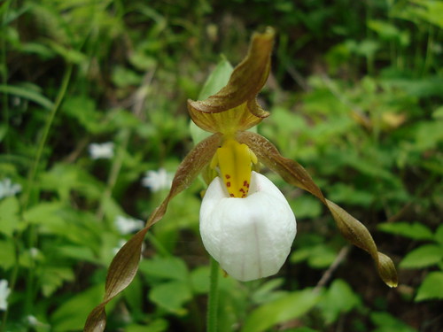
Fairly rare, this mountain lady slipper was absolutely charming. Very cool!
We continued on and according to my GPS watch, it looks like we got within .20 miles of Milk Creek, but the deciding point was another creek crossing that made me want to turn back. We had a short lunch and I spotted this critter slowly making its way in the forest.
DSC04964 (Snail)
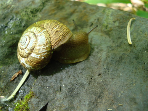
I think it was moving faster than me! LOL
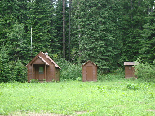
We made it back to the campground sans any other bear encounters, and took a minute to look around the spot. Looks pretty nice, especially when there aren’t a bunch of rowdy people there camping.
Apparently, this cabin is for rent from the USFS. Very cute. Somewhere nearby is a spring- might be inside one of the outbuildings here.
DSC04974 (FS Huts)
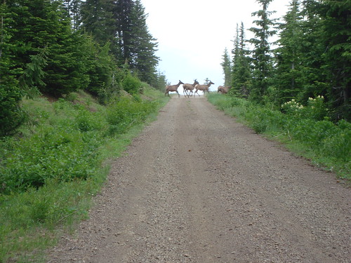
We headed back towards camp when all of a sudden, Brad said stop- there’s an elk in the road. And from that point on, a herd of about 100 elk (he counted) crossed the road for the next 10 minutes.
DSC04981 (Elk Crossing Road)
Got back to our campsite, ate some grub, and were just hanging out when we started hear a rumble rumble rumble in the distance. It was clear that a thunderstorm was steaming towards us at full speed, so we tidied up camp and got inside the tent.
First the wind started, then the rain (lots of it- we are talking total deluge), then the lightning was right over us. Brad wasn’t scared but the dogs and I were, and we were huddled in the middle of the tent. Buddy kept shaking and barking- I think he was scared and was trying to bark the thunder away.
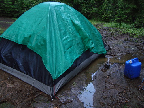
Probably about 1” of rain fell within ½ hour, and there was so much rain that at one point, our tent was literally floating. Fortunately, inside was only slightly damp, but underneath, it was a lake.
Storm
It was pretty much simultaneously flashing then booming and was so loud I could feel the vibration in my lungs. Just a tad terrifying.
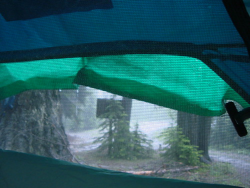
Once the storm had passed, I went outside to assess the damage. Sure looked like a flood had been through.
DSC04993 (Tent After Flood)
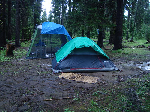
DSC04998 (Tent/Bug House After Flood)
Shortly after, a Jeep came racing up the road and turned into the campsite. Matt, the ranger who was staffing the Oregon Butte Lookout, smiled and asked if we were ok. He said he saw all kinds of lightning strikes right near the campsite and wanted to check on us. Awwww!!! Yes, we were ok, we said, and chatted a little bit before he headed back down the road about a mile back to the lookout. THAT was over and above the call of duty, I’d say, but very much appreciated.
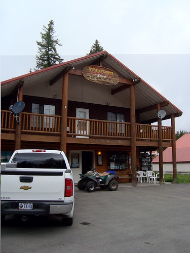
The next morning, as you can expect, things in our camp were still pretty drippy, so we packed everything up without eating breakfast and headed into Tollgate (population: 12) where we ate a DELICIOUS hot breakfast.
DSC05013 (Tollgate Store)
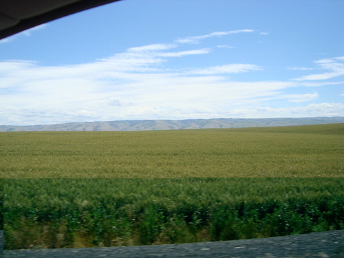
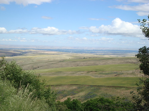
Then, it was down out of the mountains, back out into the warm wheat fields, and the long drive home.
DSC05015 (Wheat Fields)
And then, time to dry out all of our soaked gear. But the trip was totally worth it- what an adventure and soooo much wildlife. Very cool!!
We'll definitely be back!!