Grassy Knoll - Big Huckleberry Mtn, 4-July-2012
Posted: July 5th, 2012, 4:05 pm
Escaped from hell to find a bit of heaven on the 4th! Wow, what a beautiful little hike this one is.
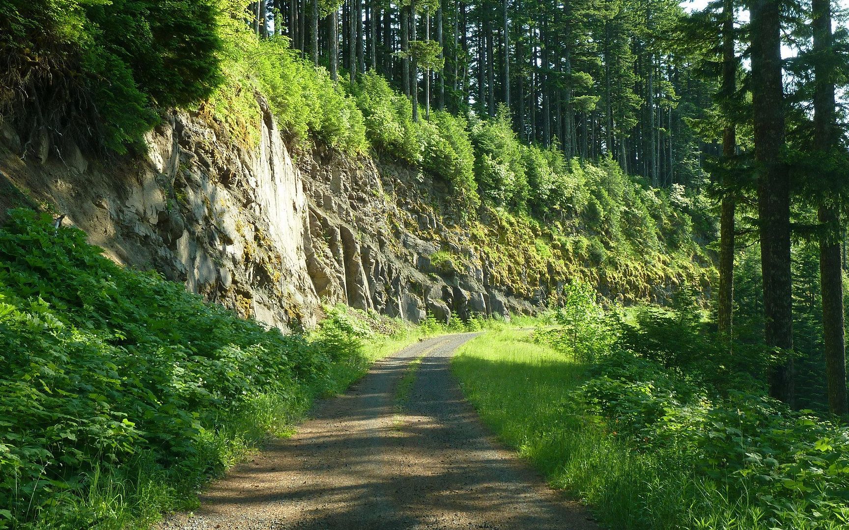
Assuming you can get to the trailhead. For all the crap the road to Silver Star gets, this one's arguably worse. Not only is it cratered well enough you'd be happy to have borrowed someone else's truck, but it's also one-way for about 10 miles forcing you to make a mental note of each turnout, in case you need to back up to facilitate passage with another car. Oh, and there's a number of trees (mostly small) down at one point, which forces you to the edge or to accept a scraping. If I'd had a saw... ah well. Nothing but high-clearance rigs at the TH. Just saying. My Suburban K2500 did fine, but I would've preferred the kids' Jeep Cherokee.
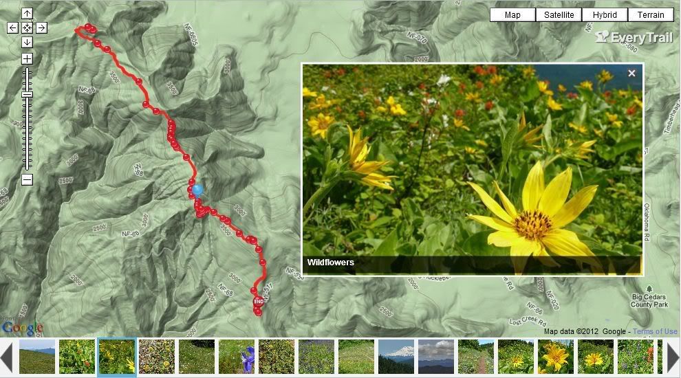
I've also read a lot of confusion on the roads to the Grassy Knoll TH. Maybe the nature of this forum is that folks are more spatially oriented, and just don't do as well with textual directions? (I am!) So I'll include a map I made that really helped me getting there. Just make a mental note of your odometer at the key waypoints noted here (taken from the Field Guide), do the math, and you'll have no problem navigating. The last junction, with NF-68 is totally unmarked, so if you didn't do the math you would have a hard time knowing it's the right one!
My GPS wanted me to come in from the east, but on forest roads I tend to trust those who've been there first and foremost. Has anyone here come in from the other way? I know it's shorter. Is it also a cratered one-laner?
Well, enough grousing. Here's the payoff. And wow, was it worth it! The first mile seemed to discourage a lot of folks I talked to (well, 4 out of 8), but it wasn't that bad (800'), and it was in the shade.
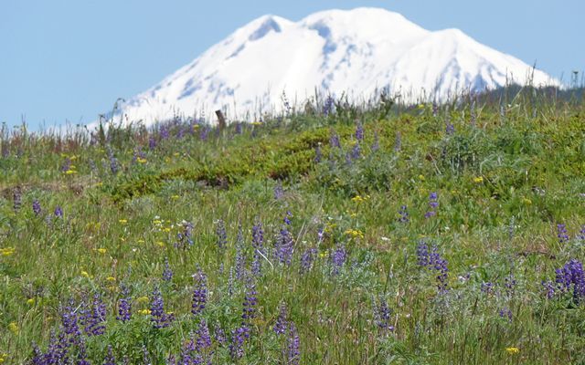
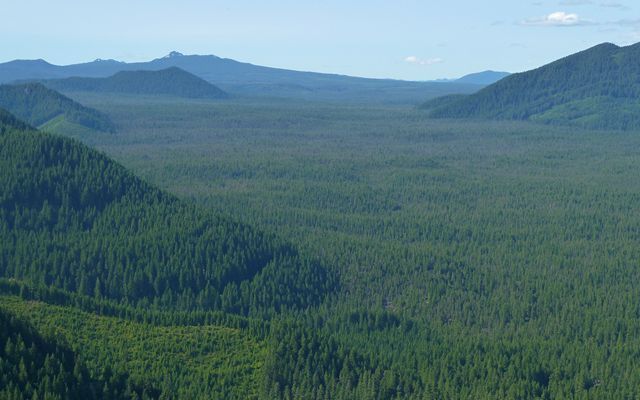
Not too much after the initial climb levels off, there's a really cool outcropping overlooking the "Big Lava Bed" and Mt. Adams.

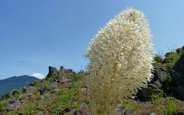
Here ends the beargrass, too, for some reason.
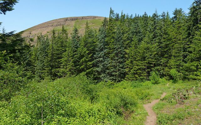
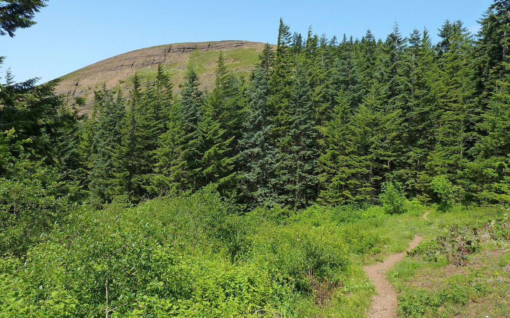
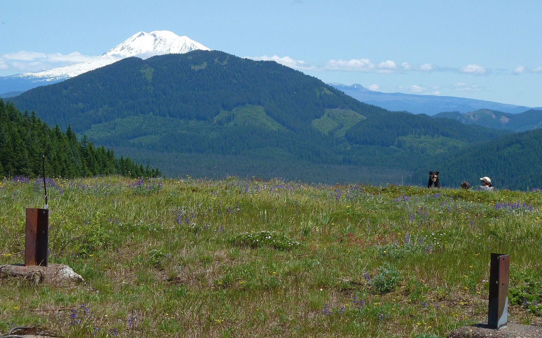
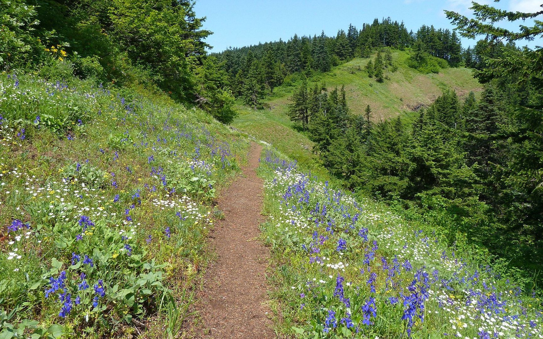
Then, Grassy Knoll comes into view, and your pace picks up a bit.
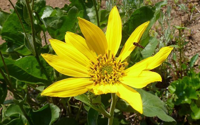
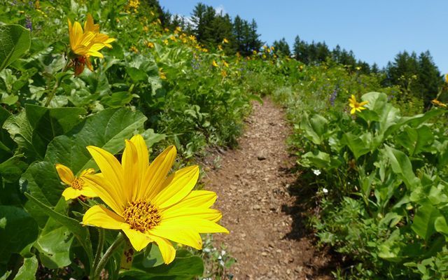
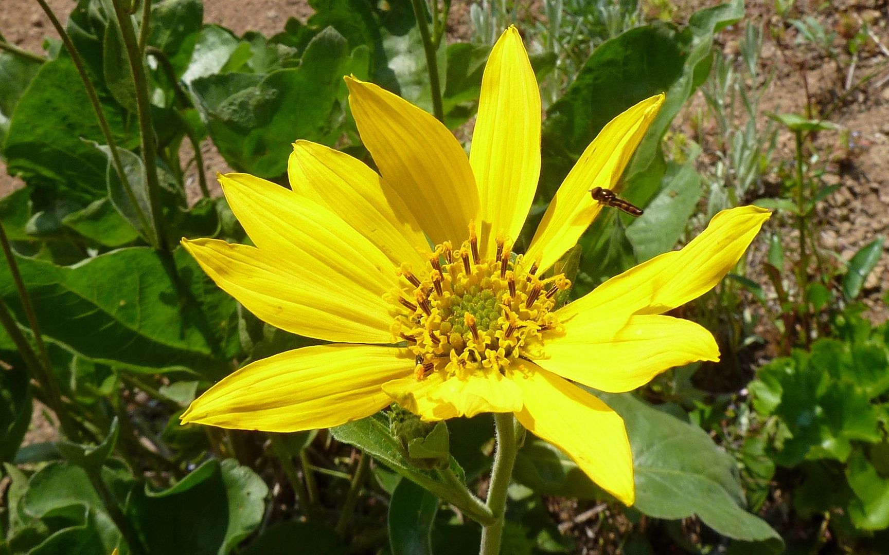
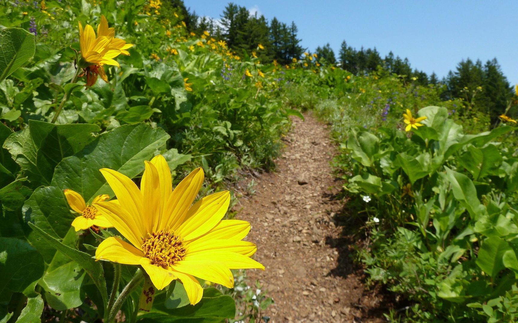
The balsamroot still seems to be going strong, here.
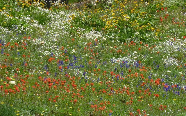
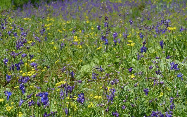
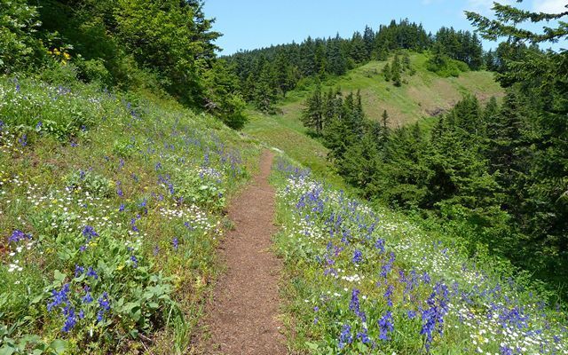
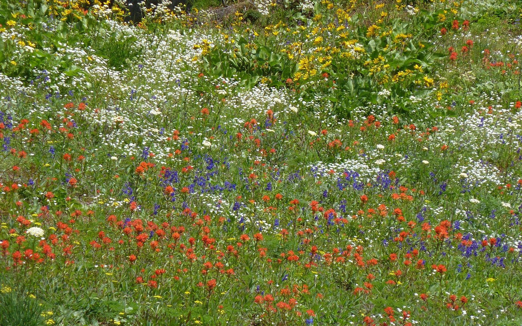
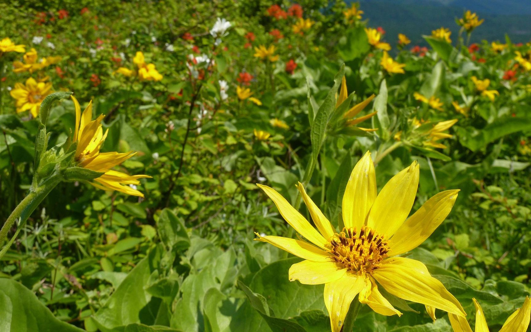
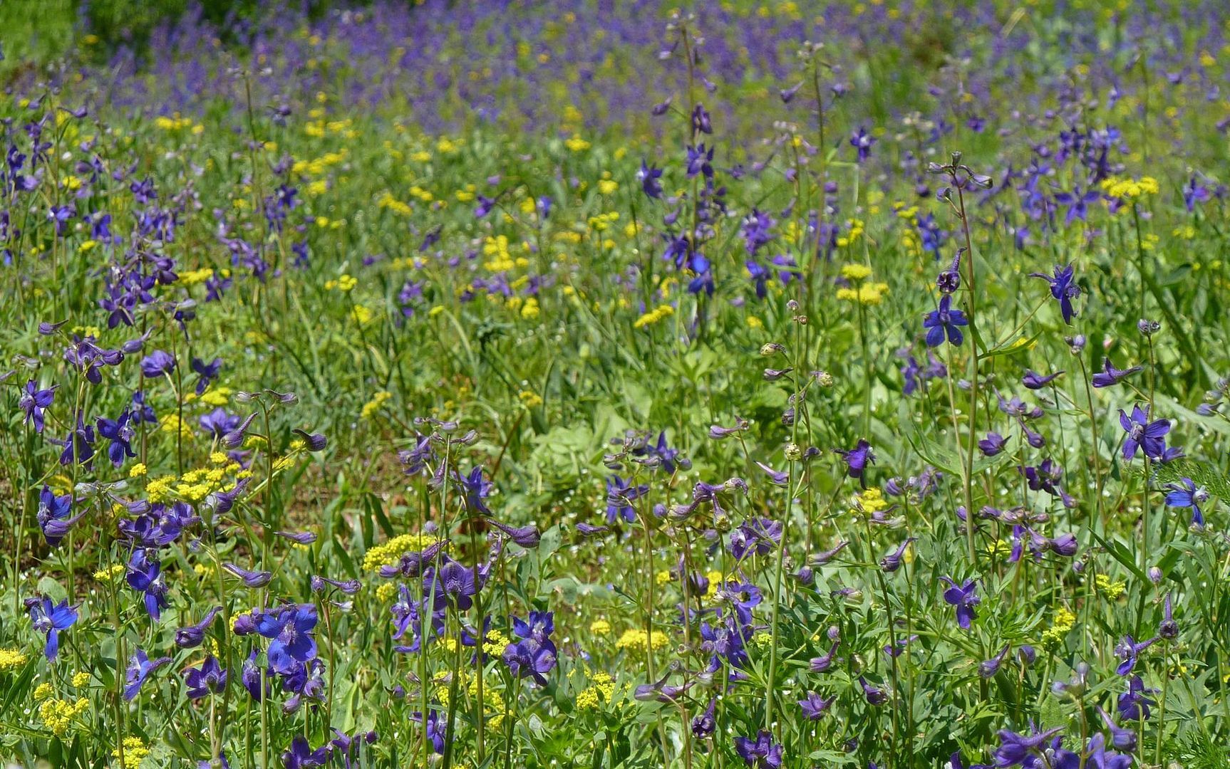
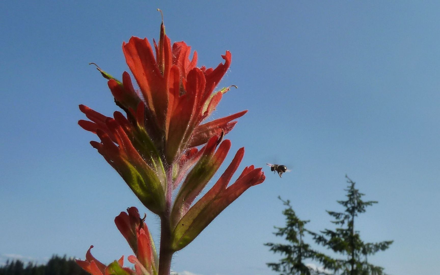
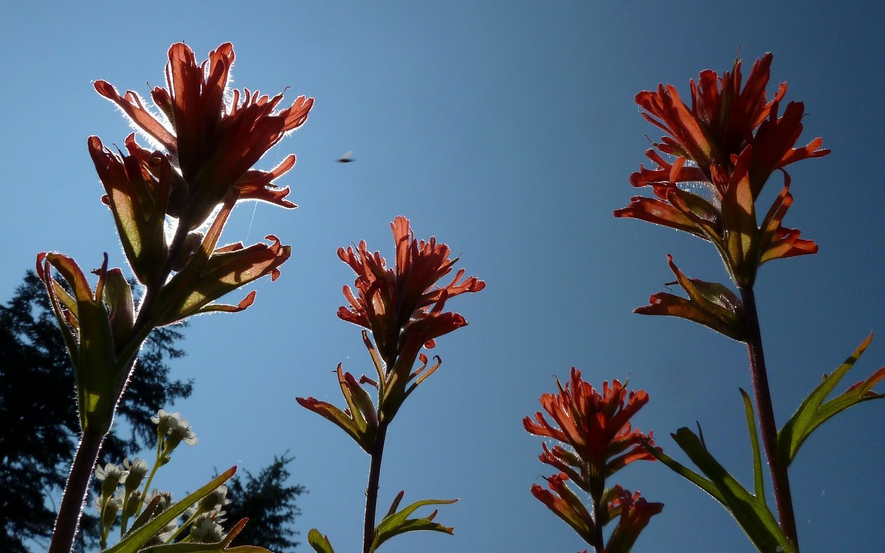
And you'll find rainbow assortments of wildflowers at many turns.
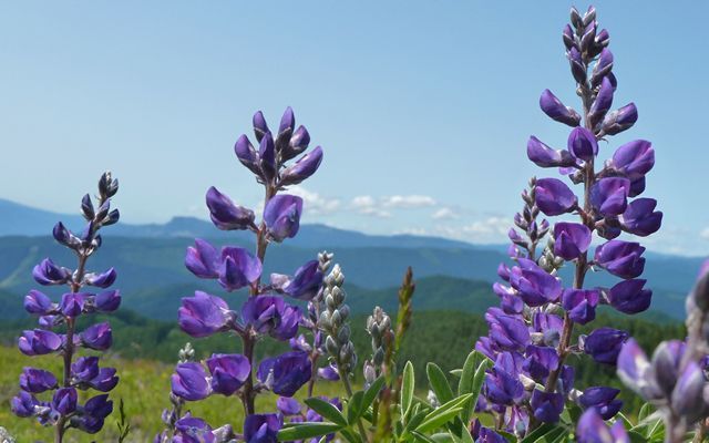
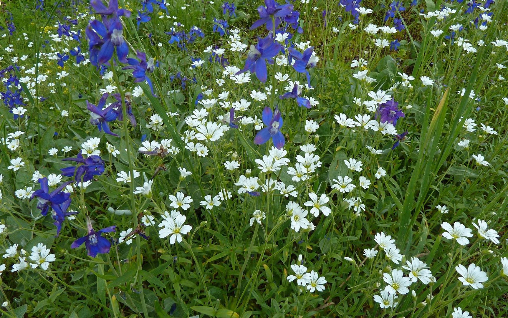
The knoll itself isn't incredibly dense in flowers, but there are a lot of littler ones, especially lupin.
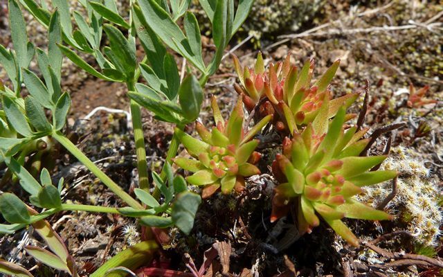
And funny little succulent-like things.
Is that a PH dog?

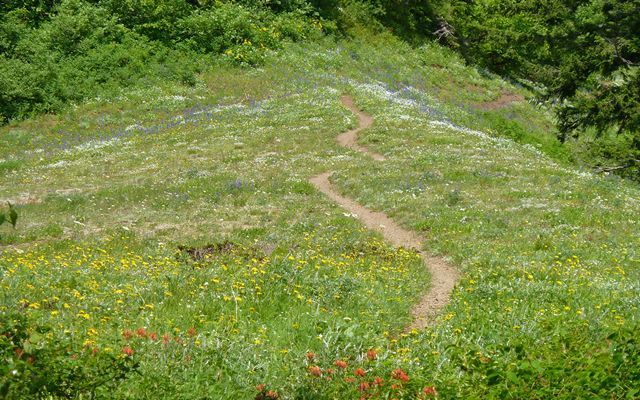
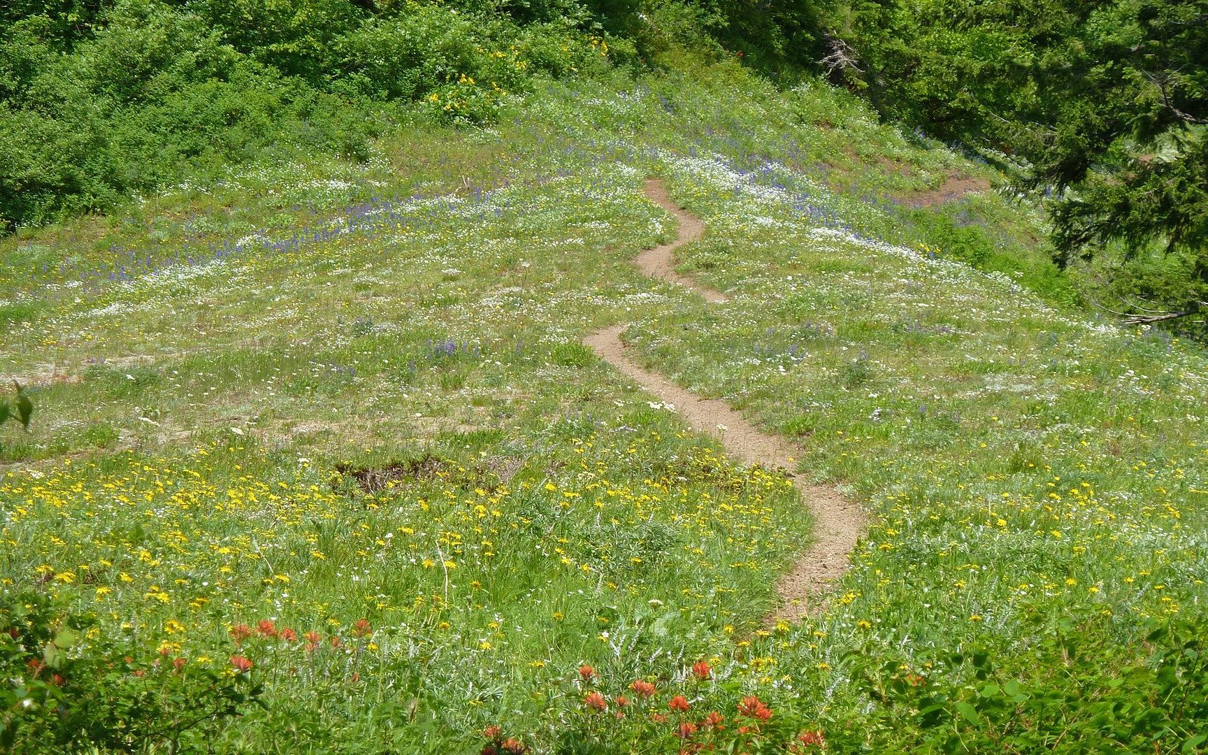
The folks that turned around at GK really missed out, though! The next mile and a half are where the real wildflower explosions are taking place.

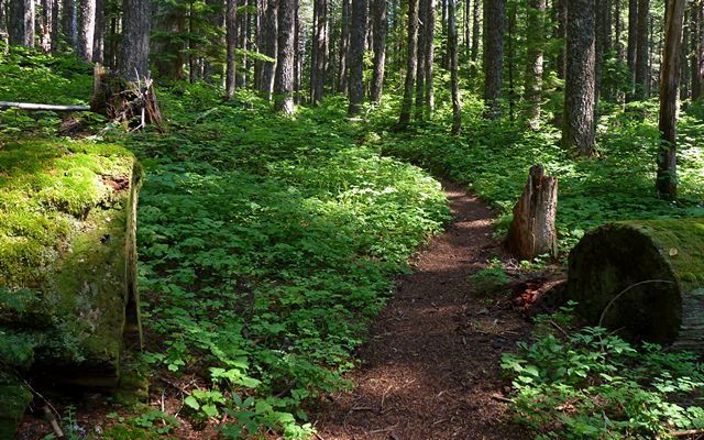
Then, there's a couple miles of darker forest.
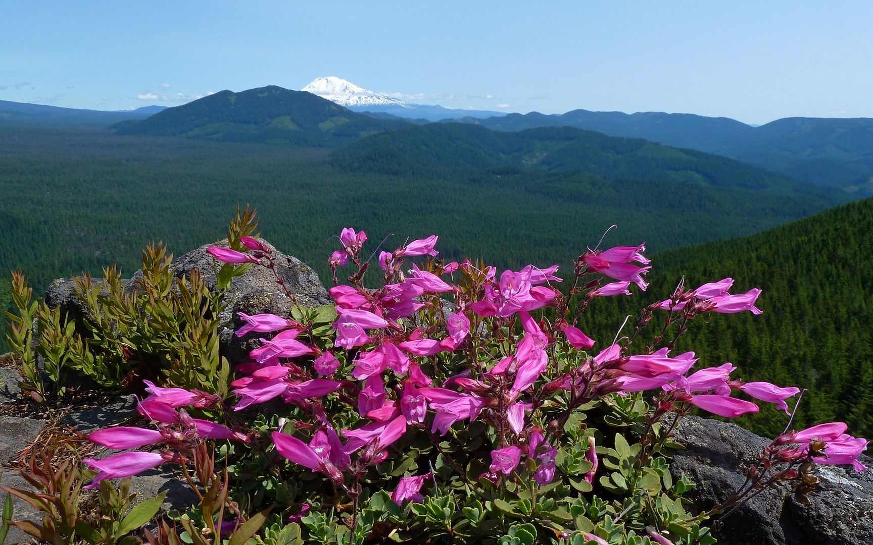
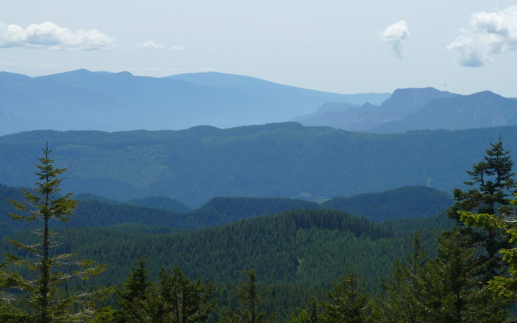
Until you emerge atop Big Huckleberry Mountain, with views to the east, west, and south. It's so nice to be getting up to some elevation now, and be able to look down on where I've been so much lately.
Seriously, I've always associated a certain smell with the Cascades. Yesterday was the first time I'd smelled that in a long time, and it was good!!! Anyone else know that smell? No idea what it is, but oh how I missed that. (Kept hearing Skynyrd up and down the trail.)
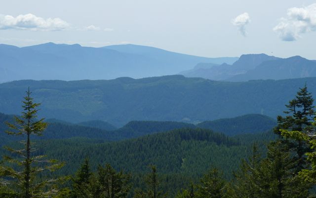
Anyway, here's looking west towards the gorge. Nesmith Point on the left and Table Mountain on the right.
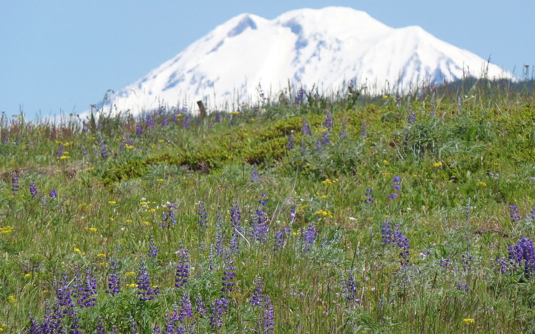
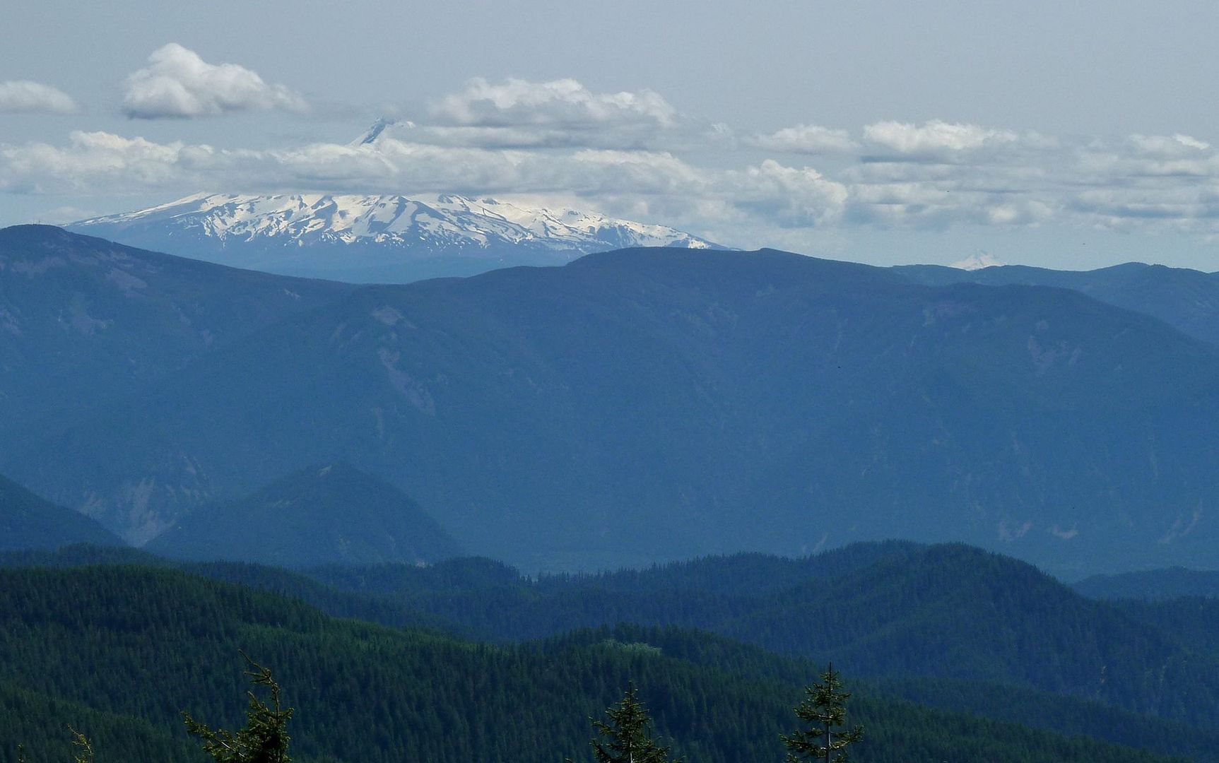
Mt. Hood pretty much kept its peak in hiding all day, but how odd is this? Jefferson is in clear view!

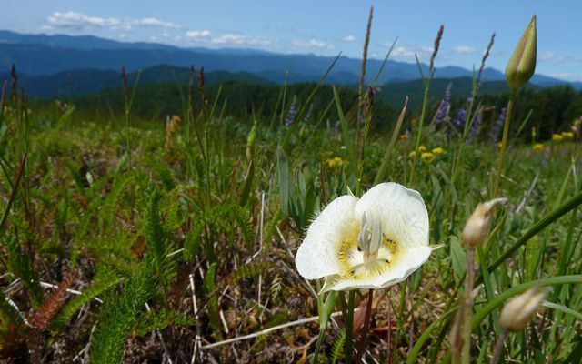
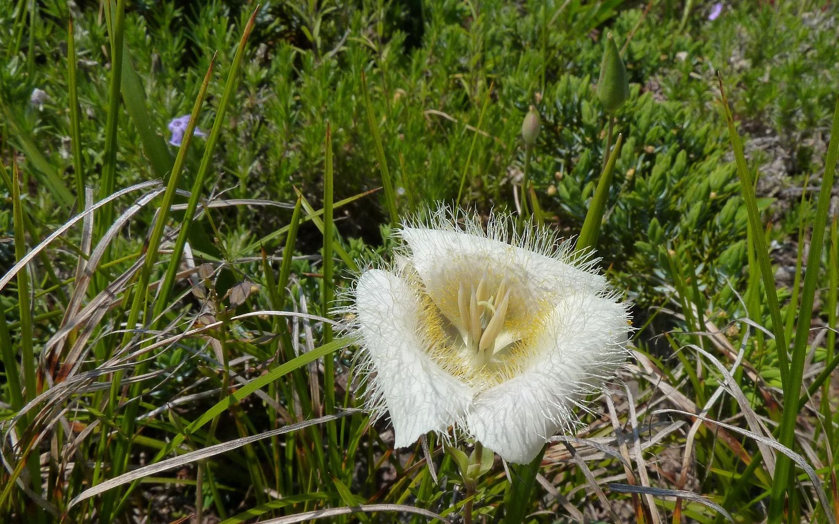
These Cat's Ear Lilies were everywhere, from the trailhead to the summit.

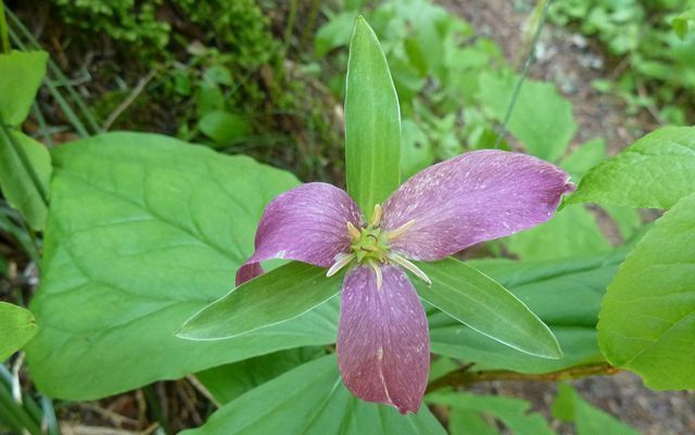
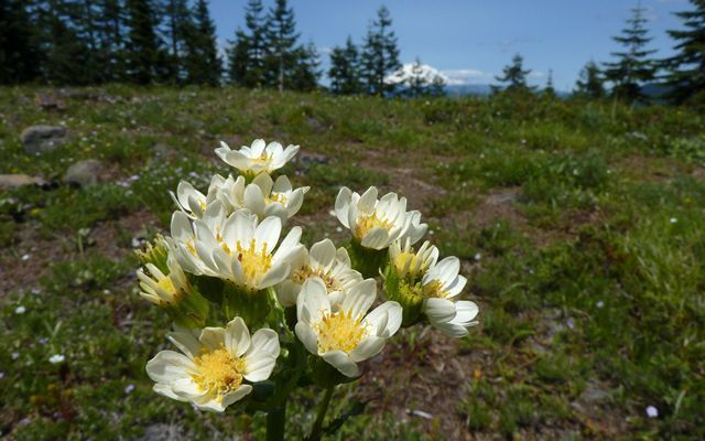
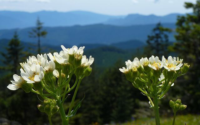
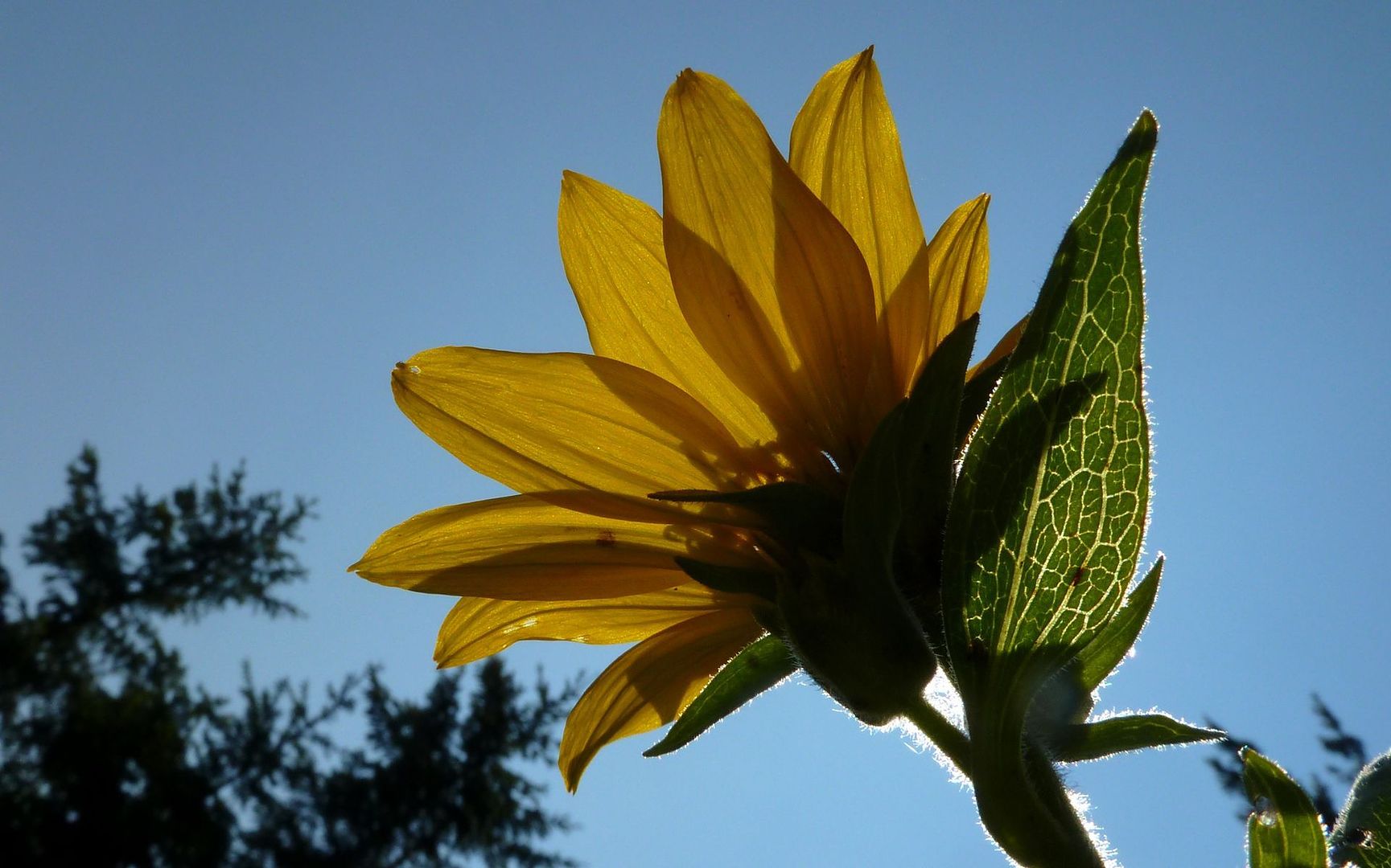
Not sure what these other summit flowers are.
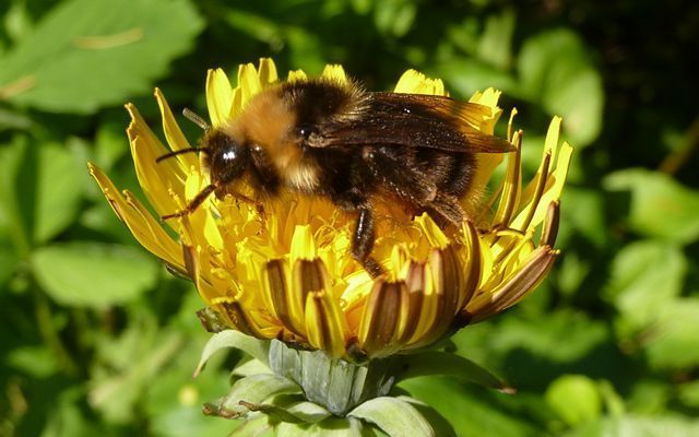
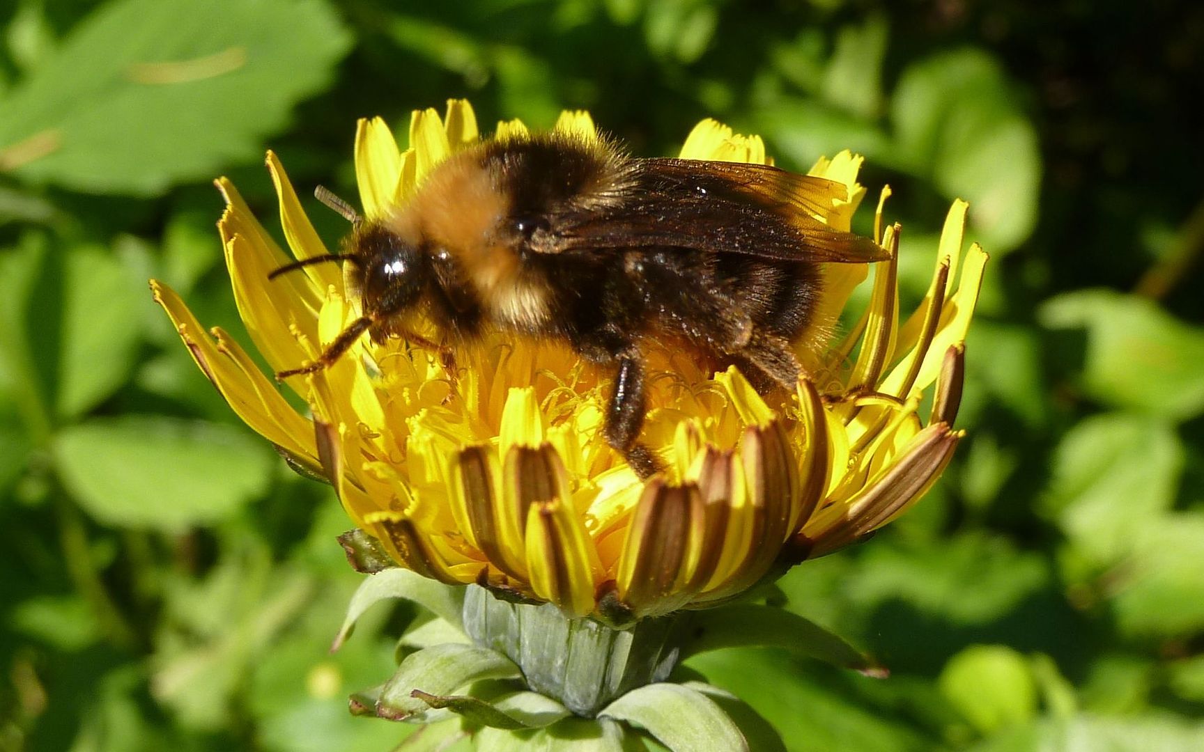
Most of the trip was with the ever-present company of flying things. There were little biting flies that'd dig in for dinner whenever you'd stop for more than a few moments. It wasn't troublesome to the point of pulling out repellent, but I did have rather bloody legs by now from swatting the little beasts. The bees were totally absorbed in what they were doing, though.
Edit: Two days later, my legs are driving me crazy! Those little suckers put a dozen-plus nasties on each! Use the darn repellent!

Totally overstayed my welcome at this point. And given the drive ahead, I knew I was late, but I just couldn't cruise past that field of balsamroot, et al, without stopping for a few more shots.


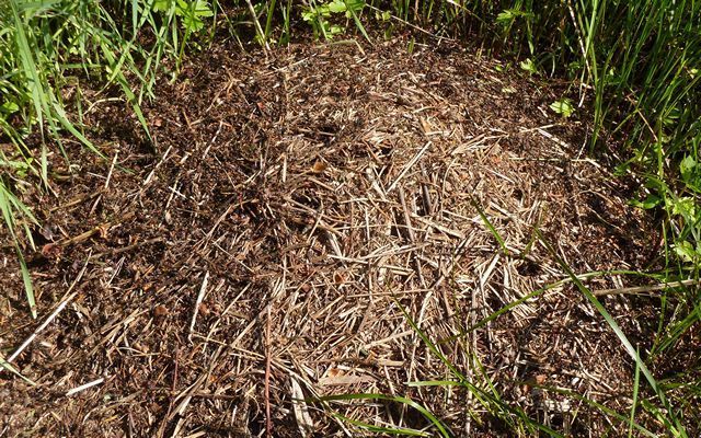
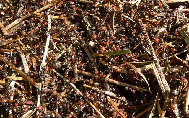
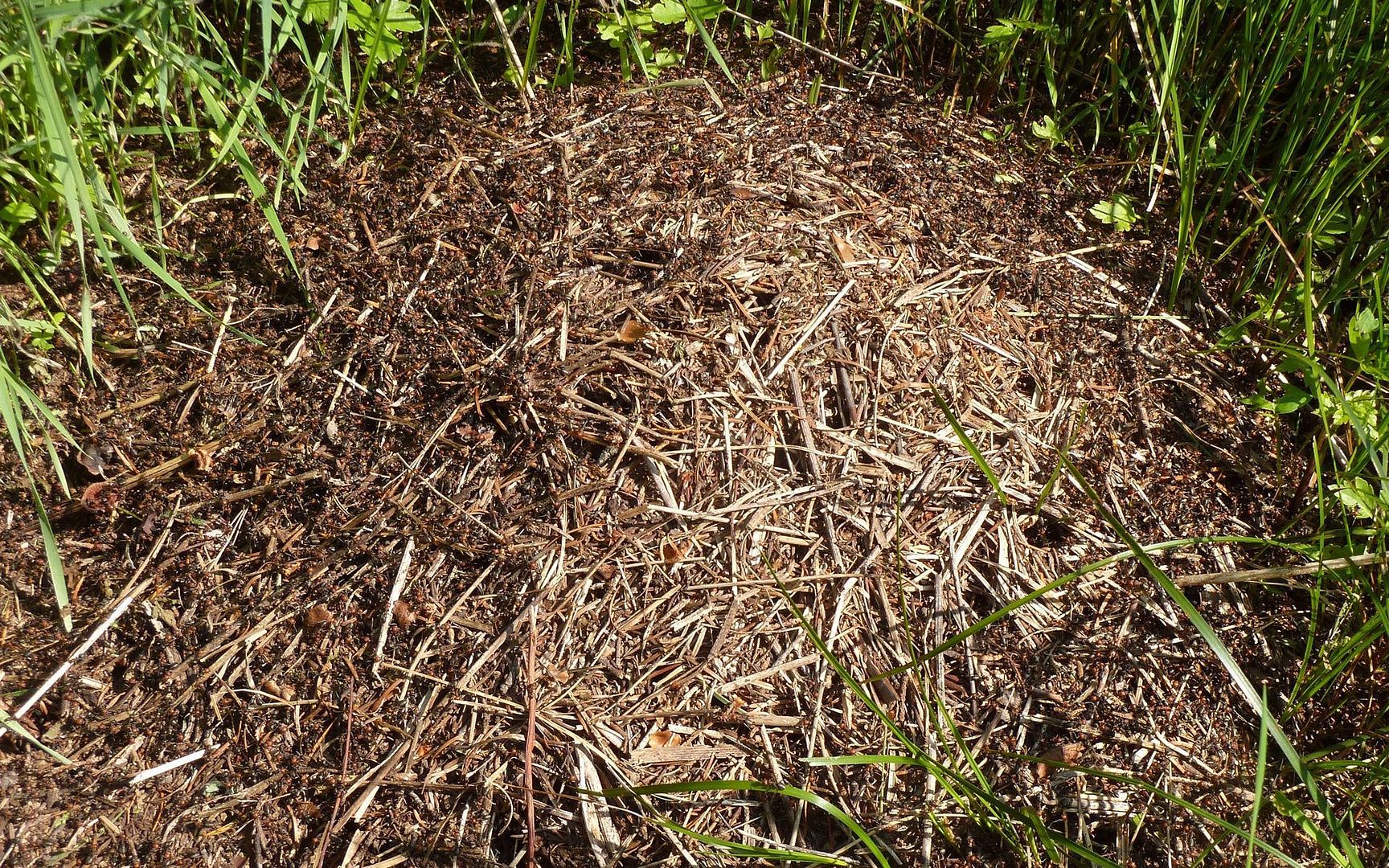
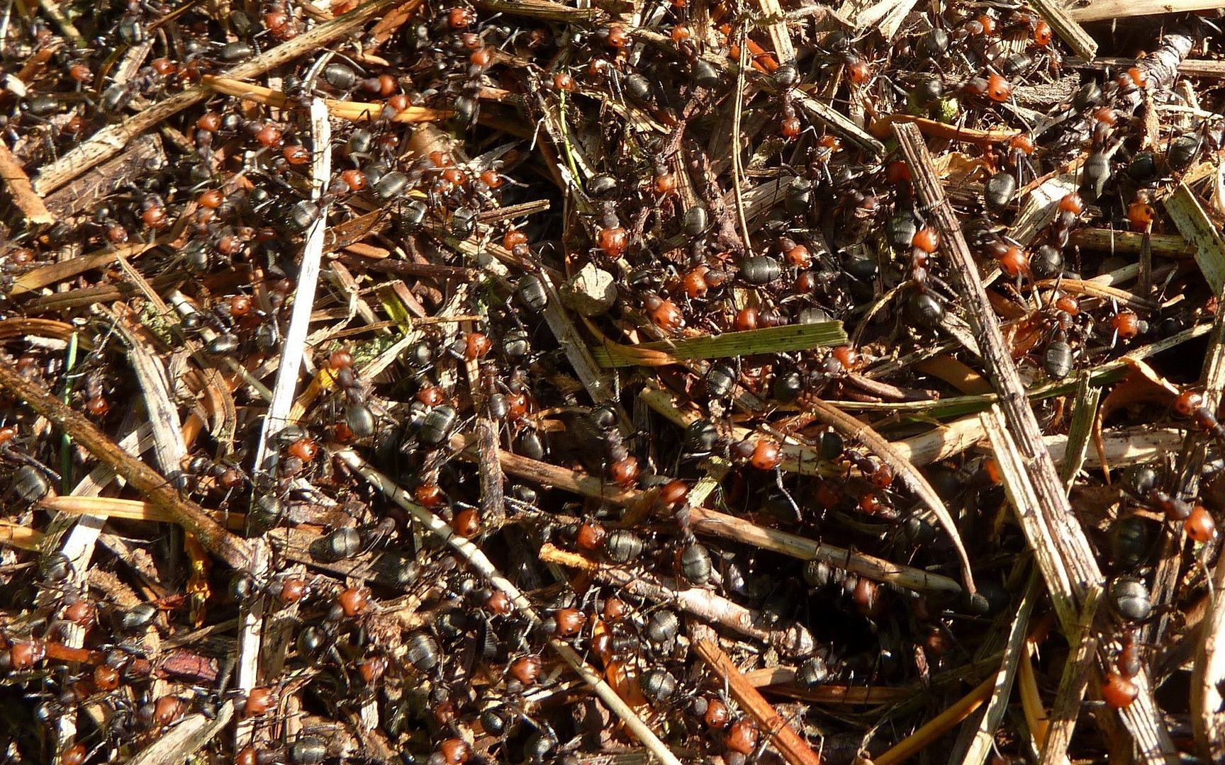
Oh, and at one point, I noticed a veritable ant freeway crossing the trail. Looking a foot into the flowers, there's this humongous anthill! Would've really sucked to have stepped on that one.
Okay, time to boogie! It's 40-50 minutes from the TH to Carson. One last look out over Big Lava Bed.
And away we go...
I was thinking throughout this hike that it's really not yet peaked. I'd have to guess that it'll be spectacular for at least the next two weeks.
Gpsfly says: 12.2 miles, 3625 feet EG, 4212 feet max elevation.
Fly the track. Photos along track.
Enjoy...
Assuming you can get to the trailhead. For all the crap the road to Silver Star gets, this one's arguably worse. Not only is it cratered well enough you'd be happy to have borrowed someone else's truck, but it's also one-way for about 10 miles forcing you to make a mental note of each turnout, in case you need to back up to facilitate passage with another car. Oh, and there's a number of trees (mostly small) down at one point, which forces you to the edge or to accept a scraping. If I'd had a saw... ah well. Nothing but high-clearance rigs at the TH. Just saying. My Suburban K2500 did fine, but I would've preferred the kids' Jeep Cherokee.
I've also read a lot of confusion on the roads to the Grassy Knoll TH. Maybe the nature of this forum is that folks are more spatially oriented, and just don't do as well with textual directions? (I am!) So I'll include a map I made that really helped me getting there. Just make a mental note of your odometer at the key waypoints noted here (taken from the Field Guide), do the math, and you'll have no problem navigating. The last junction, with NF-68 is totally unmarked, so if you didn't do the math you would have a hard time knowing it's the right one!
Well, enough grousing. Here's the payoff. And wow, was it worth it! The first mile seemed to discourage a lot of folks I talked to (well, 4 out of 8), but it wasn't that bad (800'), and it was in the shade.

Not too much after the initial climb levels off, there's a really cool outcropping overlooking the "Big Lava Bed" and Mt. Adams.
Here ends the beargrass, too, for some reason.

Then, Grassy Knoll comes into view, and your pace picks up a bit.
The balsamroot still seems to be going strong, here.
And you'll find rainbow assortments of wildflowers at many turns.
The knoll itself isn't incredibly dense in flowers, but there are a lot of littler ones, especially lupin.


And funny little succulent-like things.

Is that a PH dog?
The folks that turned around at GK really missed out, though! The next mile and a half are where the real wildflower explosions are taking place.
Then, there's a couple miles of darker forest.

Until you emerge atop Big Huckleberry Mountain, with views to the east, west, and south. It's so nice to be getting up to some elevation now, and be able to look down on where I've been so much lately.
Seriously, I've always associated a certain smell with the Cascades. Yesterday was the first time I'd smelled that in a long time, and it was good!!! Anyone else know that smell? No idea what it is, but oh how I missed that. (Kept hearing Skynyrd up and down the trail.)
Anyway, here's looking west towards the gorge. Nesmith Point on the left and Table Mountain on the right.
Mt. Hood pretty much kept its peak in hiding all day, but how odd is this? Jefferson is in clear view!
These Cat's Ear Lilies were everywhere, from the trailhead to the summit.
Not sure what these other summit flowers are.


Most of the trip was with the ever-present company of flying things. There were little biting flies that'd dig in for dinner whenever you'd stop for more than a few moments. It wasn't troublesome to the point of pulling out repellent, but I did have rather bloody legs by now from swatting the little beasts. The bees were totally absorbed in what they were doing, though.
Edit: Two days later, my legs are driving me crazy! Those little suckers put a dozen-plus nasties on each! Use the darn repellent!
Totally overstayed my welcome at this point. And given the drive ahead, I knew I was late, but I just couldn't cruise past that field of balsamroot, et al, without stopping for a few more shots.
Oh, and at one point, I noticed a veritable ant freeway crossing the trail. Looking a foot into the flowers, there's this humongous anthill! Would've really sucked to have stepped on that one.
Okay, time to boogie! It's 40-50 minutes from the TH to Carson. One last look out over Big Lava Bed.

And away we go...
I was thinking throughout this hike that it's really not yet peaked. I'd have to guess that it'll be spectacular for at least the next two weeks.
Gpsfly says: 12.2 miles, 3625 feet EG, 4212 feet max elevation.
Fly the track. Photos along track.
Enjoy...