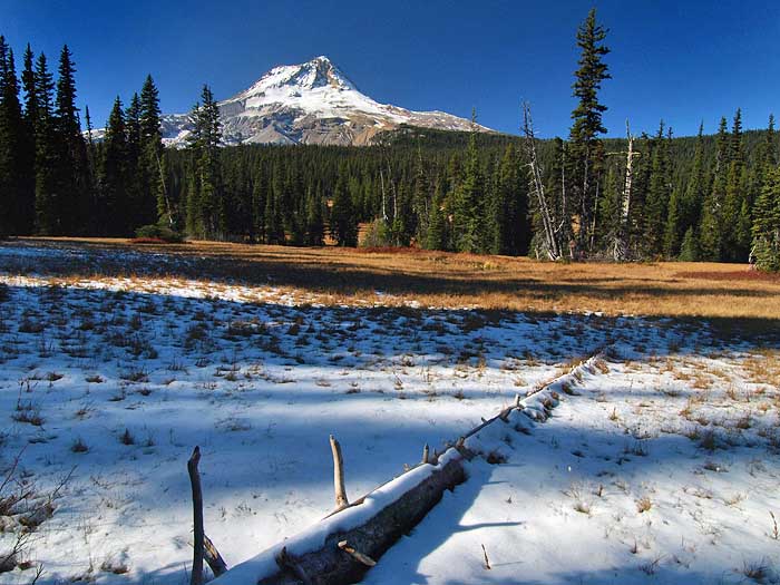
From the trailhead, I hiked to Elk Meadows, and took some photos of the early snow and autumn hues with my big camera - very peaceful in the meadows, with almost no wind -- odd, given the wind at the pass levels:
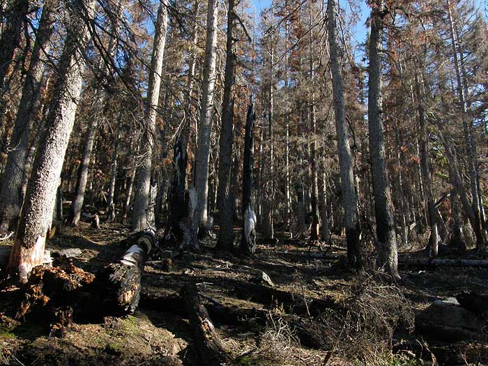
After taking in the meadows for an hour or so, I headed for the steep Bluegrass Ridge Cutoff trail, and immediately entered the fire zone, first with a combination of heat-killed trees and a lot of bug kill -- and a few trees surviving:
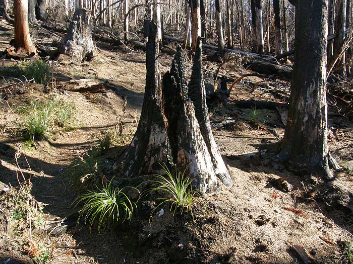
Further on, the devastation was more intense -- though the recovery has already begun. Beargrass are about the only plants that survived the burn, thanks to their bulb-like roots that are generally out of reach of the fire:
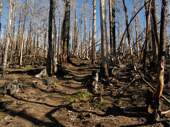
Approaching the crest, the devastation was almost complete - that's the trail running through the center of this photo:
Finally, at the junction with the Bluegrass Ridge trail, the fire has reduced the area to bare soil! It's an amazing scene, and will be fascinating to watch at it evolves into what will likely become a spectacular ghost forest filled with wildflowers and huckleberries.
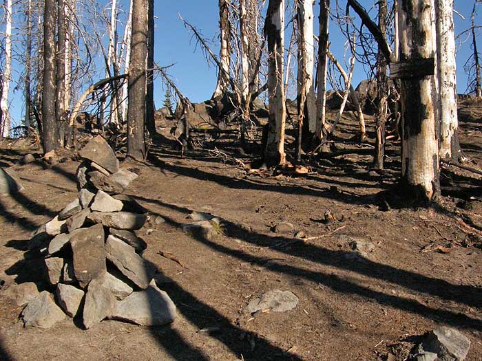
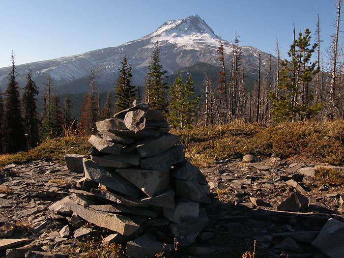
I had noticed some light trail maintenance along the Bluegrass Cutoff, but once on the Bluegrass Ridge trail, it was obvious that a lot of work had been done after the fire -- the cairn marking the path in the above photo was one of 47 (!) that line the newly maintained section of trail, running from just south of the cutoff junction to the Elk Mountain junction.
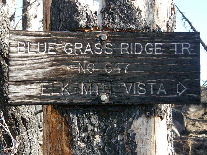
Here's a closer look at the crispy trail sign at the junction:
My main goal along Bluegrass Ridge was the rocky viewpoint described in various field guides, about 3/4 mile north of the cutoff junction. As I walked the newly-maintained trail, I was pleasantly surprised to see completely reconstructed trail switchbacking up to this little viewpoint, a few hundred yards from the junction - for the purpose of mapping, I've called this the Horsethief Viewpoint, since the meadows of that name can be seen from here:
This little viewpoint would make a worthy goal in its own right, with nice (and newly re-opened) views of Mount Hood to the west:
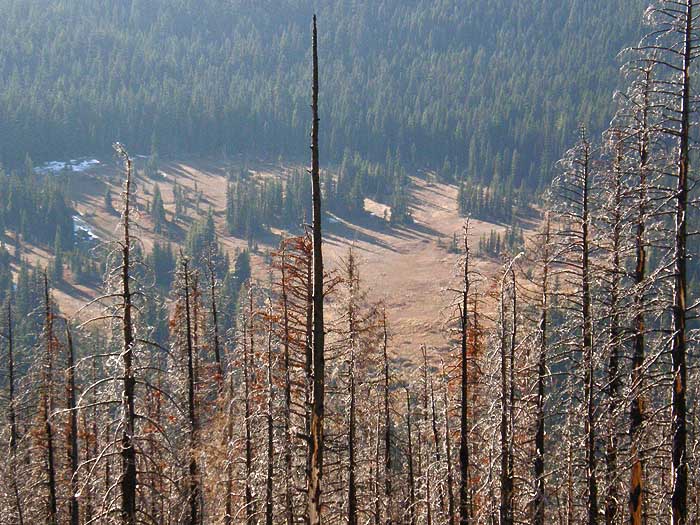
The fires have also opened views down into Elk Meadows:
Looking east, this viewpoint provides a wide-open view of the East Fork valley and Lookout Mountain, beyond:
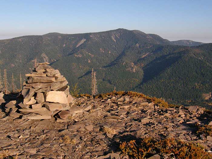
From this point, the trail reconstruction ends, and I was following pink flagging and a general recollection of where the trail was supposed to be. The ridge is MUCH more open as result of the fire, and there are a couple more viewpoints that have opened up between the Horsethief Viewpoint and the main Bluegrass Viewpoint that has been a traditional stop along this route.
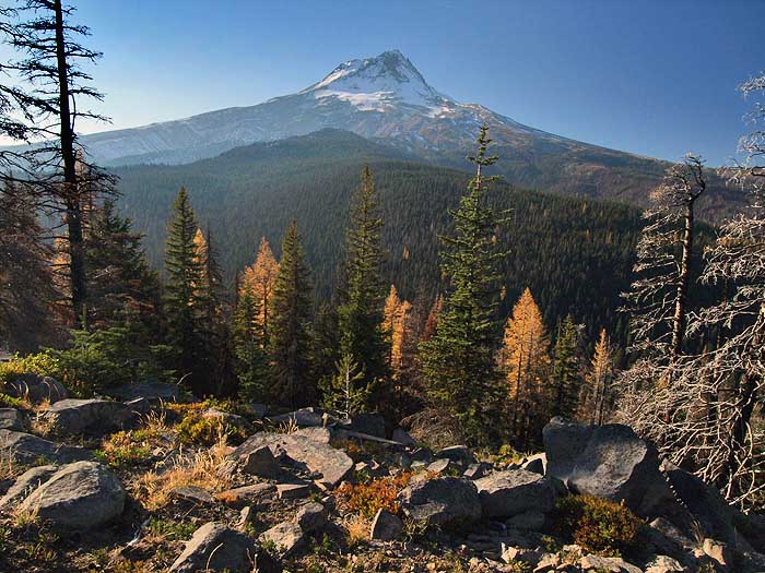
I'm hopeful that if the USFS is planning to continue rebuilding this trail for the rest of its course through the fire, that they will consider relocating it to the string of viewpoints..! Here is the view from the Bluegrass Viewpoint - I pulled out my big camera for this view. Note that the fire did not crest the ridge in this spot, leaving intact larch trees in the foreground. You can also see the browned extent of the Gnarl Fire from this season, in the distance on the left:
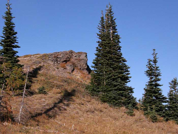
From the Bluegrass Viewpoint, I retraced my steps, and headed south toward Elk Mountain -- a spot that I'd never visited before. Once there, I was surprised to find that it had been a lookout site! Here's one of the footings:
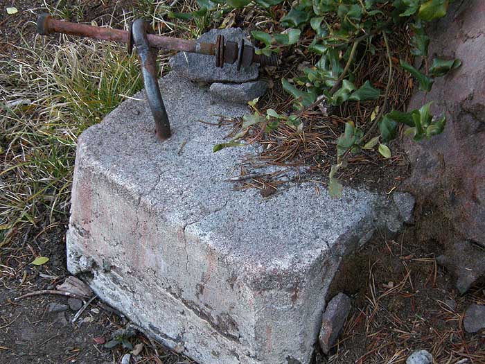
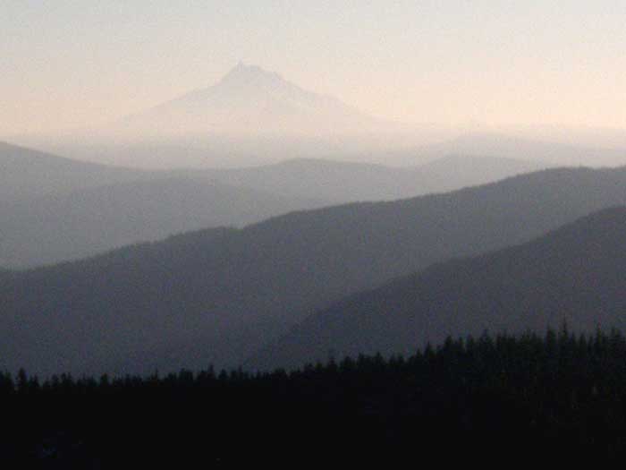
It's a short walk down the spur to Elk Mountain, but worth it for lookout site collectors, and for a couple of pocket views through trees. Lookout mountain stands to the east, and from the giant rock in the center of the lookout site, you have a nice view of Mount Jefferson -- although I was seriously running out of light at this point:
The fire zone ends abruptly at the Bluegrass Ridge/Elk Mountain spur trail junction, and as you hike back down to the main trail to Elk Meadows, you can't help but wonder if this intact forest is what Bluegrass Ridge looked like before the fire.
I followed fresh elk tracks along almost the entire Bluegrass/Elk Mountain loop, but the turned watching the fresh bear scat ON the trail all the way back to the trailhead... that hadn't been there on the way in..! It wasn't much comfort for my fertile imagination to discover that I was the last one out that night, as well, but without surprising any bears along the way!
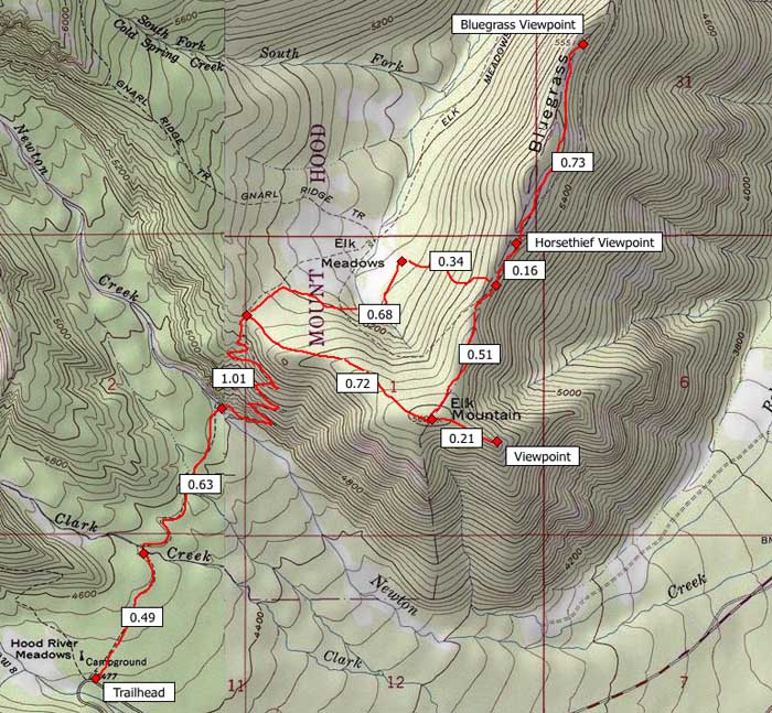
Here's a map of my route - I think it's about 8 miles and about 1700 feet elevation gain. For now, it's a fascinating glimpse into a recovering fire zone, but in a decade or so, I predict that this will be a wonderful wildflower path, among a forest of silver skeletons.
-Tom