Link to my photo album of this trip: http://picasaweb.google.com/olybear71/2 ... backMtn86# The photos of the hike are in reverse order. I was too busy huffing and puffing going up to take photos, so I took them coming down.
The hike to the viewpoint is about 4.5 miles and goes from 1bout 1,000 ft to 4,000 ft elevation. I will do a better trip report when I do the complete hike to Devils Peak in Sept.
Even though it was a lot cooler this year (75F) I knew I would need to haul lots of water as there are no water sources along the ridge line (duh). If I was in better woods condition I would not need so much water, but I took 5 liters in platypus bottles. I ended the hike with 1/2 liter.
The hike from Zigzag ranger station to Great Pyramid viewpoint is about 4.5 miles one way. I started about 8:15AM. The first mile is graded switchbacks through tall trees and a good warm up. The next mile or so is mostly straight up the ridge line in thinner trees. Then the trail eases up a bit and alternates between graded incline/decline along the ridge side, or steep up and down climbs along narrow ridge line. There are a couple of marked side trails to viewpoints, and a few high points to get a view. But most of the hike is in deep woods. Lots of rhodys, paintbrush, and tiger lilies above 3,000 ft.
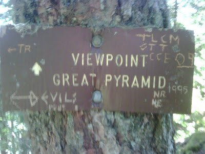
Just before the sign for Great Pyramid you top out on a rocky high point, then descend 100 ft or so. A small sign points strait ahead to the viewpoint and the main trail turns sharply left and gradually descends to a saddle before another strenuous climb toward Devil's Peak lookout. I arrived at the viewpoint about 1:15pm and explored around the area for about 30 minutes, had a snack/water break and headed back.
Funnily enough, I missed the viewpoint sign AGAIN this year. I suddenly found myself at the brink of a sharp drop-off and thought "How did I almost do the same thing again?!" I guess the hike up is grueling enough that I was too focused on just pushing ahead up, up and up and was oblivious to the small sign on the left of the trail.
It was a gorgeous day for hiking, of course no snow left on the ground. The trail is poorly maintained so lots of branches swatting me in the face in sections. The trail can be faint in areas and 20 ft away you might not even see the trail.
I arrived back at the parking lot about 5:00pm. I did not make very good time coming downhill as much of it is steep and aggravates my 55 yr old knees.
Hunchback is a great conditioning hike, especially when you have to carry all your water with you. I am planning several more hikes to get in shape for a possible attempt on Mt Rainier from Frying Pan creek to Indian Bar as a day hike. Besides hikes to West Zigzag (this Friday), McNeil Pt and Barret Spur, I am planning two more up to Devils Peak lookout. One via the shorter Cool Cr. trail and the other all the way up Hunchback to the lookout for about 15 miles round trip and 3,600 ft gain. If I can do this one then I should be ready for Indian Bar on the Wonderland trail over Panhandle Gap.
Photos coming down from viewpoint to trailhead:
Fateful turn in trail at 4.5 miles. Viewpoint is straight ahead, main trail turns sharply left and downhill.
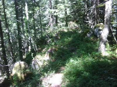
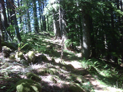
Typical section of trail along narrower parts of ridge line (going through center of photo), note the infrequent trail maintenance
One of the steeper sections of trail as ridge wanders up and down. At least going back it is mostly down.
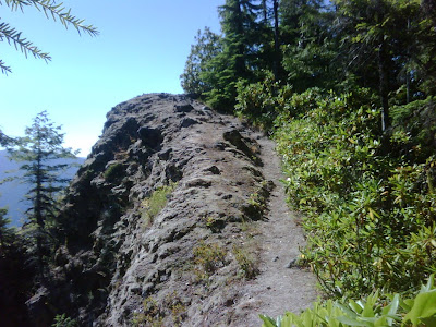
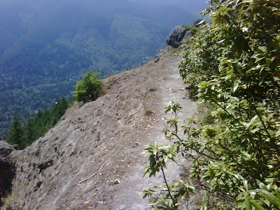
A narrow section of the ridge line I dubbed "The Razorback"
Back on the ridge top as we descend the overall ridge, near one of the occassional high points along the ridge.
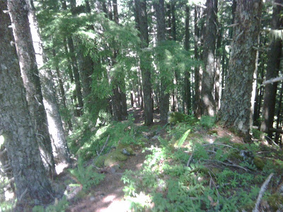
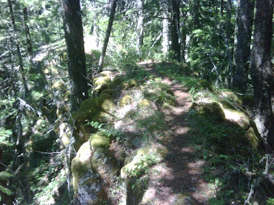
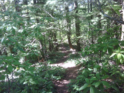
An occasional flat, shady section of trail on the ridge line. Enjoy the stroll while you can!
One of the more exposed sections of the trail. These occasional openings are the only places I could get a GPS fix as most if the trail is under tall trees.
Some more exposre and GPS readings. The Rhodys stick out enough to be bothersome on this narrow section. Thinking of taking my pruning shears next time.
One of the long climbs when coming up the ridge. Nice to be heading downhill going out!
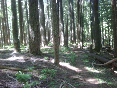
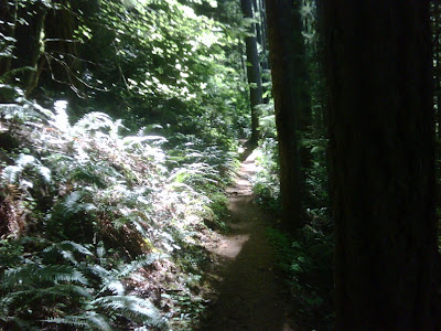
Lower part of trail is an easy incline on switchbacks and heavy shade.
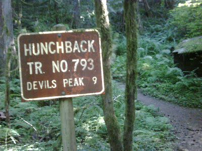
Trailhead at Zigzag Ranger Station parking lot along Hwy 26.