
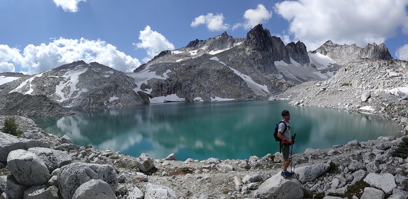
Opening picture:
What: Day hike to the Upper Enchantments Basin
Who: Me (Born2BBrad) and Adam (Cascade Hiker)
When: 8/17/14 (drive), 8/18/14 (hike)
Why: Because we’re loony hikers
Route: Stuart Lake TH (3400’), up the Stuart Lake Trail to the Colchuck Lake Trail (4500’), up the Colchuck Lake Trail to the south end of Colchuck Lake (5600’), up Aasgard Pass (7841’), down into the Upper Enchantment Basin, up to Little Annapurna (8440’), off-trail back down to the basin, back up to Aasgard Pass, down Aasgard Pass to Colchuck Lake and back to the Stuart Lake TH.
I took a trip to the Enchantments in 2012. While I enjoyed it, I did not enjoy the lottery permit hassle. Then I got to thinking, since a permit is not needed to day hike in the Enchantments, a strong, fit hiker could do the trip in a day. So I hatched a plan early in 2014 to get some of my PH TFFs together and do an old-school Loony Hiking Club day hike. At one point I had 12 people interested. But as the day approached, it was down to just me and Adam.
I picked up Adam outside of Seattle on Sunday 8/17/14 and camped in the car at the Stuart Lake TH. We were on the trail by 5:05 AM the next morning (Monday 8/18/14). After the hike, we drove back to Portland that night in order to be back to work on Tuesday 8/19/14.
-----------------------------------------------
Here is a bunch of information from the Enchantments TR I wrote in 2012:
Summary:
The Enchantments is an area comprising an upper and a lower basin, the lakes and tarns contained within them, and the peaks of the Stuart Range bounding the basins. The area is located entirely within the Alpine Lakes Wilderness about 15 miles SW of Leavenworth, WA. The Enchantments is regarded by many as one of the most spectacular locations in the Cascade Range.
History:
The first European American to discover the area and name it was A.H. Sylvester, topographer for the US Geological Survey and first supervisor of the Wenatchee National Forest. Sylvester visited the middle Enchantment basin and probably did not venture into the upper basin. This is because, at the time, Snow Creek Glacier covered more of the upper basin than it does today. He is credited with naming some of the features in the region.
By the 1940s climbers discovered the area and began naming the crags. Bill and Peg Stark of Leavenworth, WA became frequent visitors who drew upon various mythologies to name features of the landscape. When they made their first visit in the fall of 1959, they were captivated by the golden splendor of the larch trees in the fall, the numerous lakes and tarns, and jagged peaks towering above. They used fairy names such as Gnome Tarn, Troll Sink, Naiad Lake (officially Temple Lake), Sprite and King Arthur legends in the Lower Enchantment Basin because "the lower basin was not as austere as the upper basin," according to Peg. They used Norse names and mythology for features of the upper basin, for example Brynhild Lake (officially Inspiration Lake), Lake Freya (officially Tranquil Lake), and Valhalla Cirque because, Peg said, it felt "as if the Ice Age had just gone off."
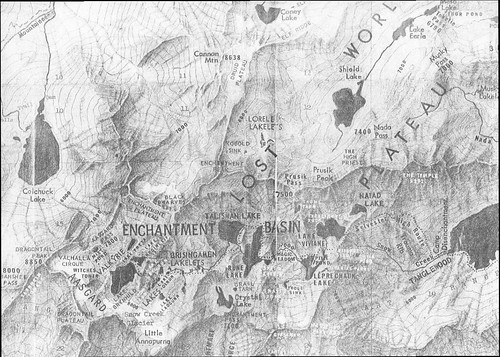
A scan of the original Stark-created map was on the Summitpost.org trip report:
The official naming rulings of the US Board on Geographic Names in the 1960s resulted in a mixture of two name sets being adopted as official, particularly for the lakes, but also exemplified by the feature popularly known as Aasgard Pass being officially designated Colchuck Pass. Different sources still use the unofficial names in some contexts. The current policy of not adopting new names for geographic features in wilderness areas probably precludes the rest of the names identified by the Starks from achieving official status.
Restrictions/Permit Process:
The USFS restricts access to the Enchantments permit area, which includes five zones. The three most popular zones are the Snow Zone (from Icicle Creek up to Snow Lakes), the Colchuck Zone (the area surrounding Colchuck Lake) and the Core Enchantment Zone (the Upper and Lower Enchantment Basins and surrounding peaks). The other zones are the Stuart Zone (the area around Stuart Lake and the northern approaches to Mount Stuart) and the Eightmile/Caroline Zone (Eightmile Lake, Eightmile Mountain, Cashmere Mountain, and vicinity). In addition, the Forest Service has proposed adding the Ingalls Lake, Headlight Basin, and Mount Stuart areas to the permit area.
The 1981 Alpine Lakes Wilderness Plan established a quota of 60 people at one time as the carrying capacity of the Core Enchantment Zone. For overnight camping between June 15 and October 15, hikers in any of the five currently established zones must have permits. 75 percent of the permits for each hiking season are awarded in advance by lottery. For the first time in 2012, the lottery was online. Winners of the advance lottery must pick up their permit on the day of entry between 7:45-9:00 AM, or the afternoon prior between 2-4 PM. The other 25 percent of permits are issued each morning (except Sunday) at 7:45 a.m. at the Leavenworth ranger station for trips beginning the same day. If not enough permits are available for the day's applicants, the permits are awarded by lottery, literally by pulling names out of a hat.
Each entry into the lottery (you can submit multiple entries) is $6. If awarded a permit, the fee is $5 per day per person.
Routes:
There are two primary ways to reach the Enchantments Basin. The Snow Lake trail climbs 6.5 miles to Snow Lake gaining 4100'. From Snow lake the trail ascends over sloping granite rock another 1400' to Lake Viviane at the lower end of the Enchantments. This hike is described as long, steep, and grueling. The alternate route is via the Stuart Lake trail. The first part of the trail up to Colchuck Lake is 4.75 miles long and gains 2100'; another 1.75 level miles bring hikers to the south end of the lake and to Aasgard Pass, which climbs 2200' in less than a mile. That's right, 2200' in less than a mile. Aasgard Pass is a very steep scramble, which can be extremely dangerous in snow or icy conditions The two routes can be combined to form a loop if the hiking party has two cars, a bicycle, or otherwise arranges transportation between the trail heads.
-----------------------------------------------
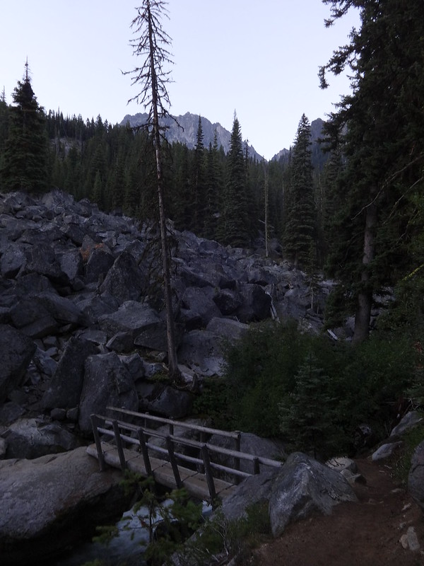
Bridge crossing Mountaineer Creek on the trail to Colchuck Lake with Dragontail Peak in the background:
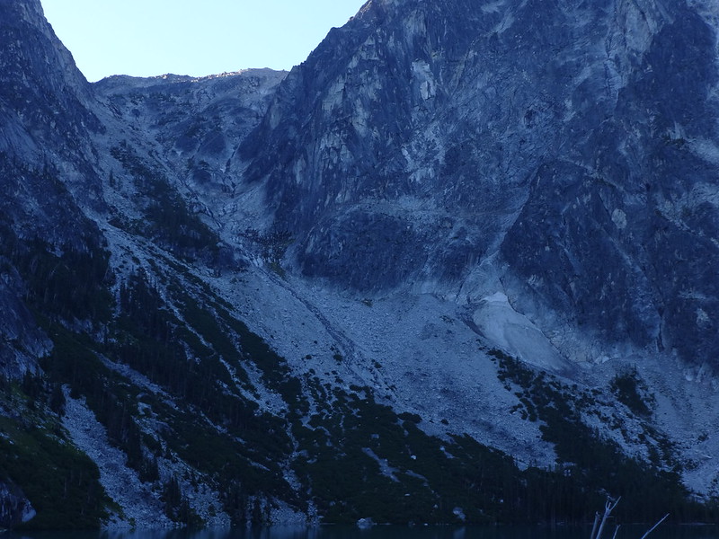
The first good view of Aasgard Pass, with Dragontail Peak to the right:
Zoomed in on Aasgard Pass:
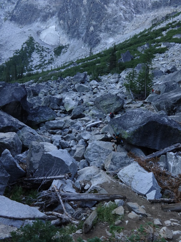
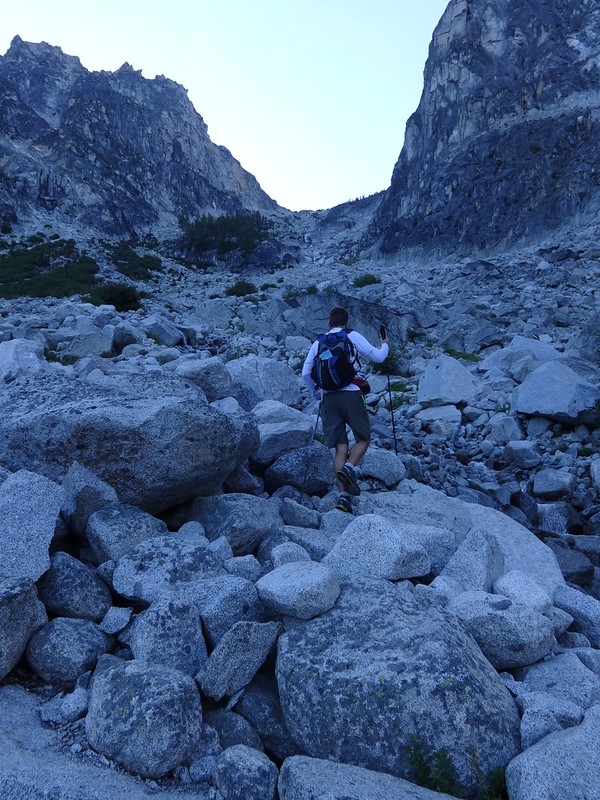
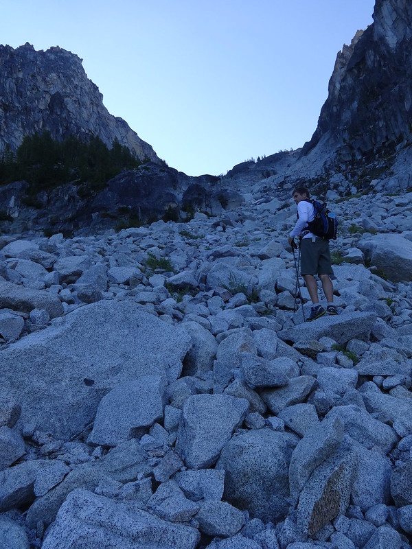
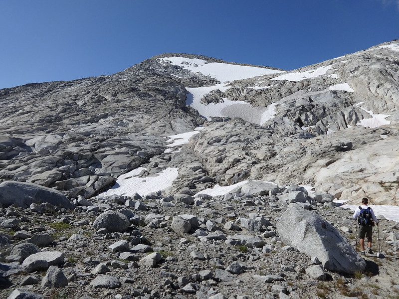
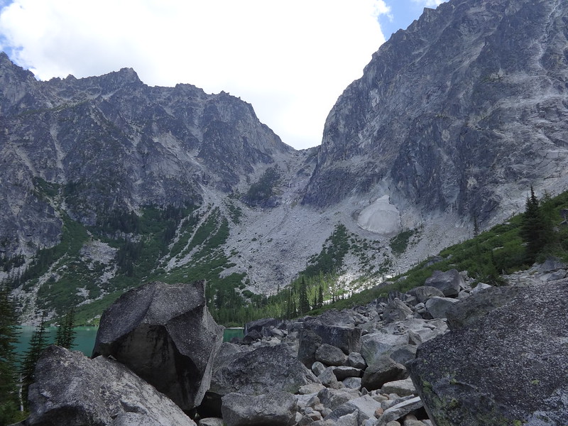
Before even getting to Aasgard Pass you have to go through a giant boulder field:
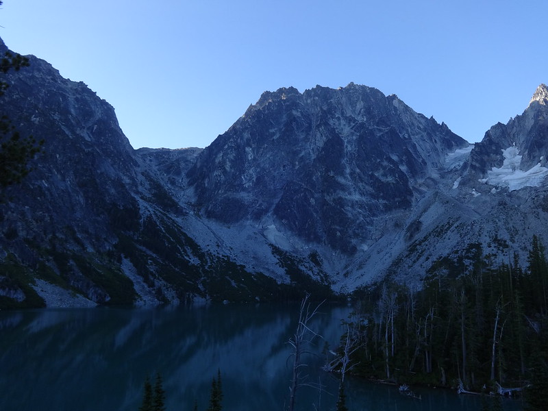
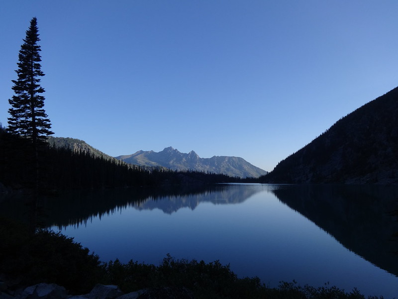
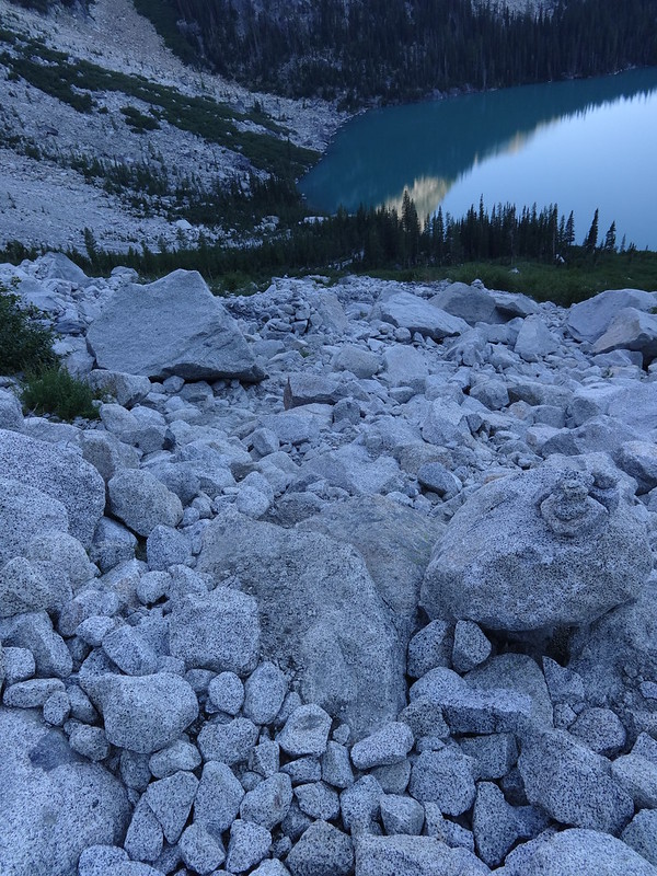
Colchuck Lake was very still in the morning light:
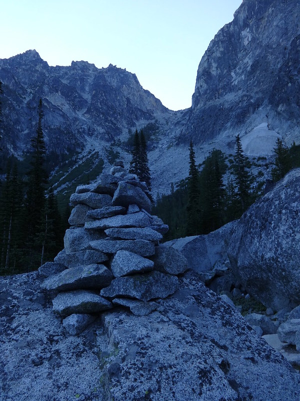
Many cairns guide the way:
We crossed paths with this guy at the bottom of Aasgard Pass:
Beginning the ascent of Aasgard Pass:
Quick facts about Aasgard Pass:
• The official name is Colchuck Pass, even though most people call it Aasgard Pass.
• The elevation at the pass is 7841’.
• Located at the saddle between Dragontail Peak and the Enchantment Peaks.
• Wikipedia has the climb gaining 2200’ in 0.8 mile. That sounds about right.
Looking back down:
Almost half way up:
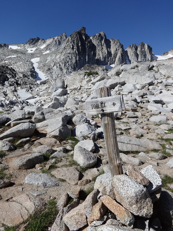
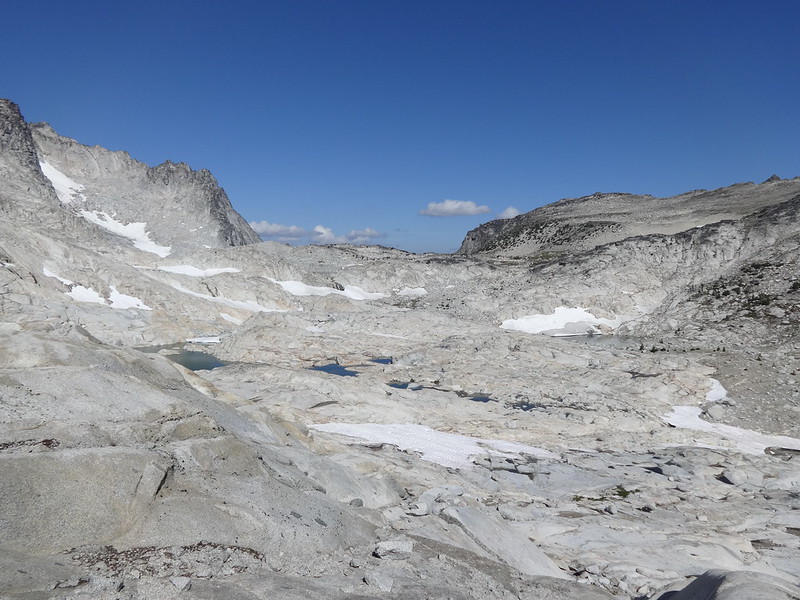
Up in the Upper Enchantments Basin you can have a loo with a view:
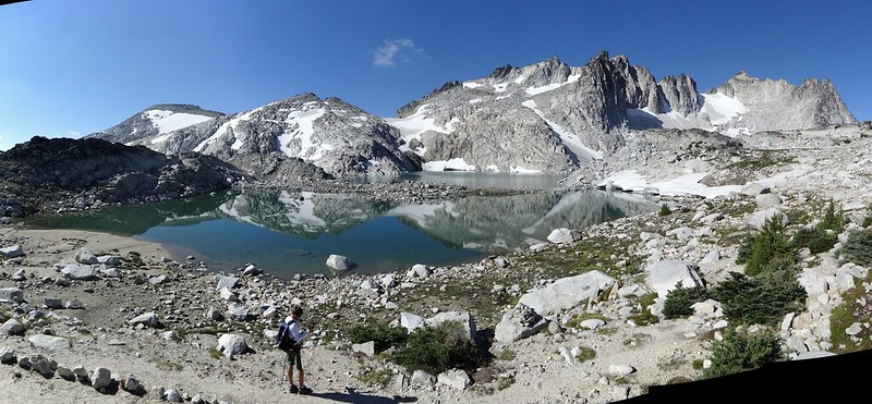
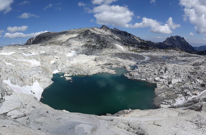
Isolation Lake with Dragontail Peak behind it:
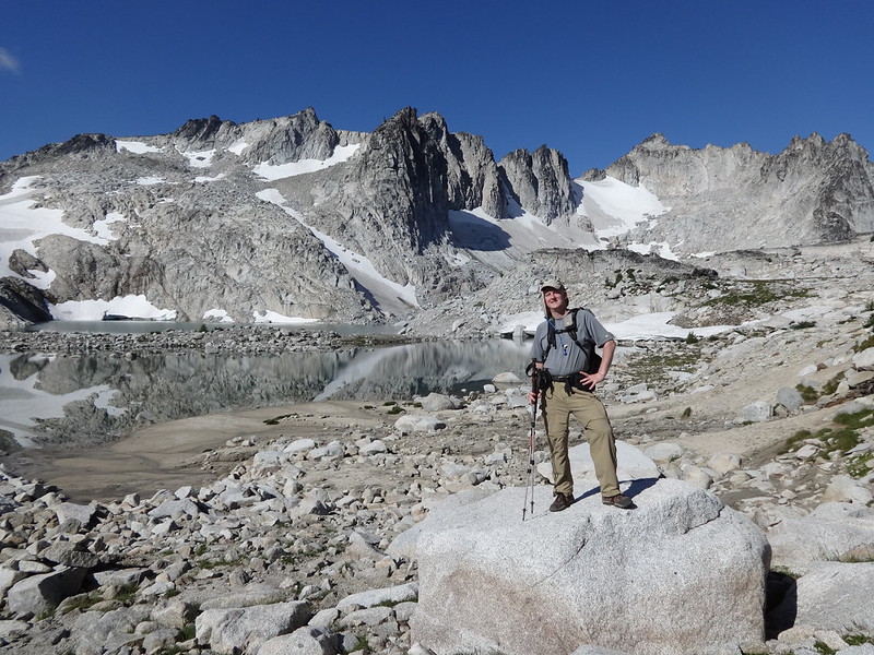
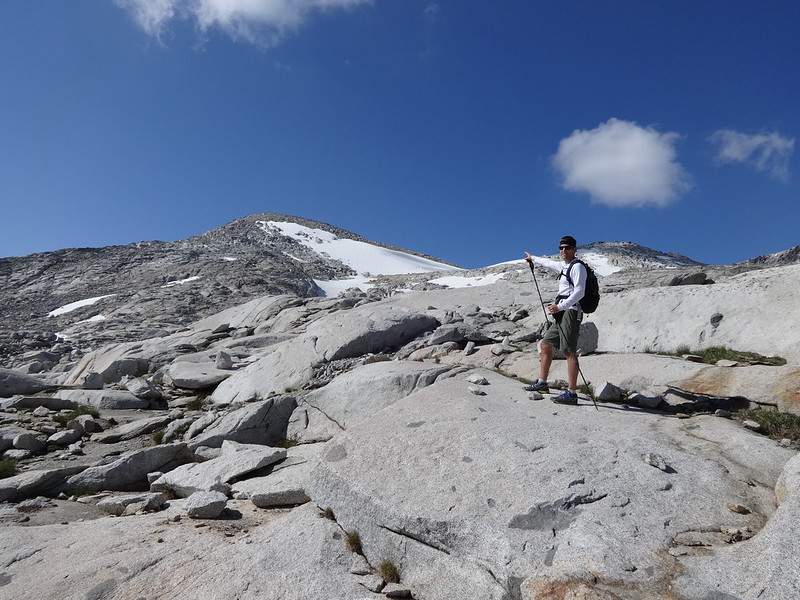
Hey Mom! Look at me!
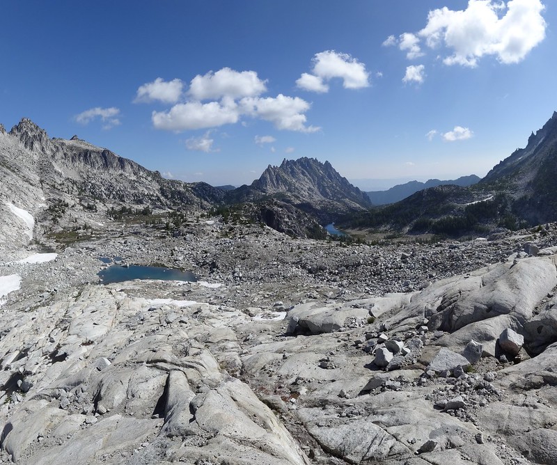
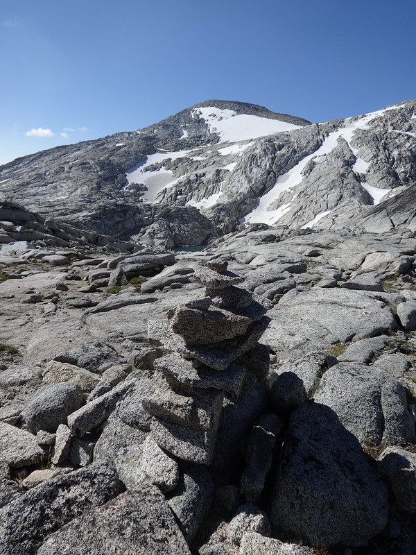
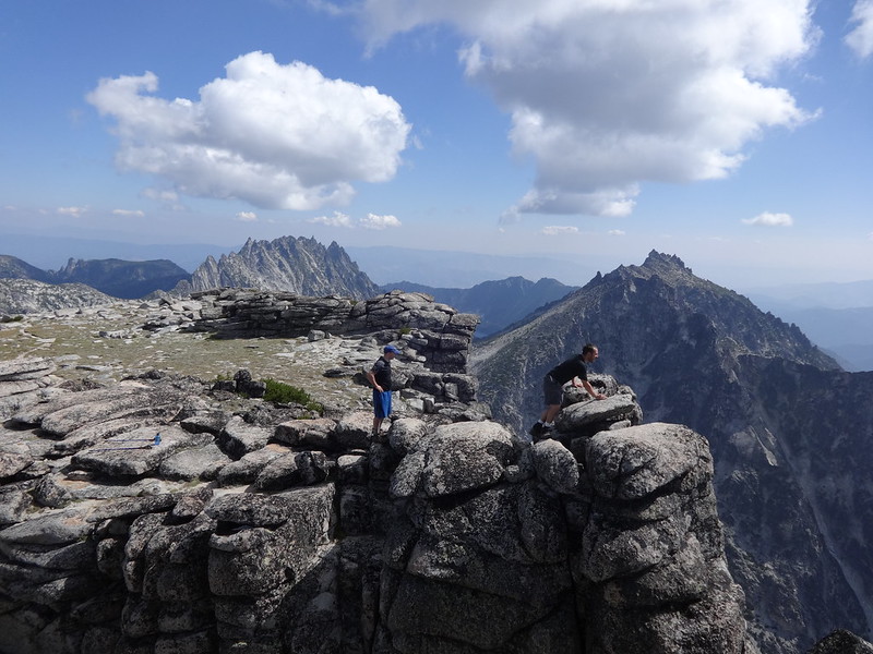
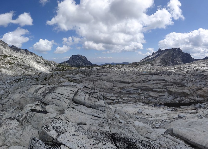
Cairns help guide the way in the Upper Enchantments Basin (Little Annapurna in the background):
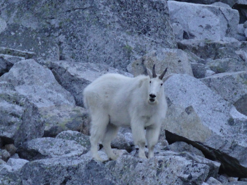
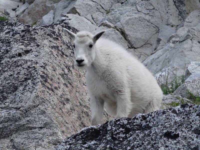
We saw at least three different sets of momma mountain goats (nannies) and their babies (kids):
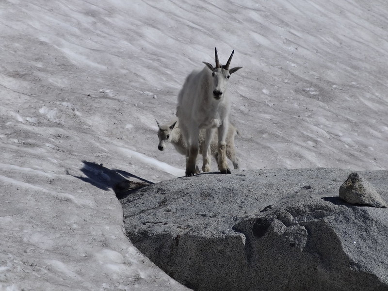
Quick facts about mountain goats:
• Mountain goats are not true goats, but are closely related to them. They are more closely related to antelopes, gazelles and cattle.
• They live to be 12-15 years old in the wild and 16-20 years in captivity.
• Adult males are known as billies.
• Their diet include grasses, herbs, sedges, ferns, mosses, lichens, and twigs and leaves from the low-growing shrubs and conifers of their high-altitude habitat.
• There is an indie folk rock band called the Mountain Goats.
• From around the age of 22 months, it is possible to tell the age of a mountain goat by counting the number of rings on its horns.
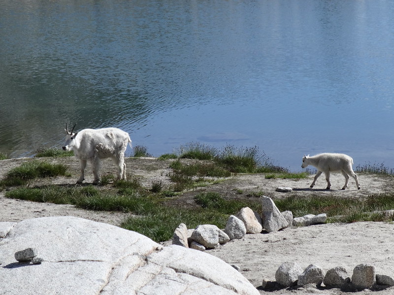
More mountain goats at the edge of Tranquil Lake:
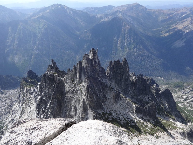
Prusik Peak (8000’) poking its head above the basin:
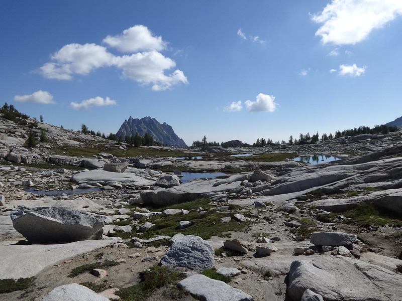
Example of the solid slabs of Granite in the Enchantments:
Adam pointing to Little Annapurna, where we were headed:
Quick facts about Little Annapurna, courtesy of SummitPost:
• The summit is at 8440’.
• Named after the Annapurna of Himalayas fame.
• One translation of the name is Goddess of the Harvests.
• Getting to the top is not a climb, but a walk up.
• It is the 52nd highest summit in the state of Washington.
• There is a large enough flat area at the top to make for a good campsite, but not during stormy weather.
• Many peaks can be seen from the top, too many to mention here.
Follow the leader:
Over there is Aasgard Pass:
Not quite to the top yet. Prusik Peak (center), McClellan Peak at 8364’ (right), Crystal Lake (hanging on the edge) and Perfection Lake (behind Crystal Lake):
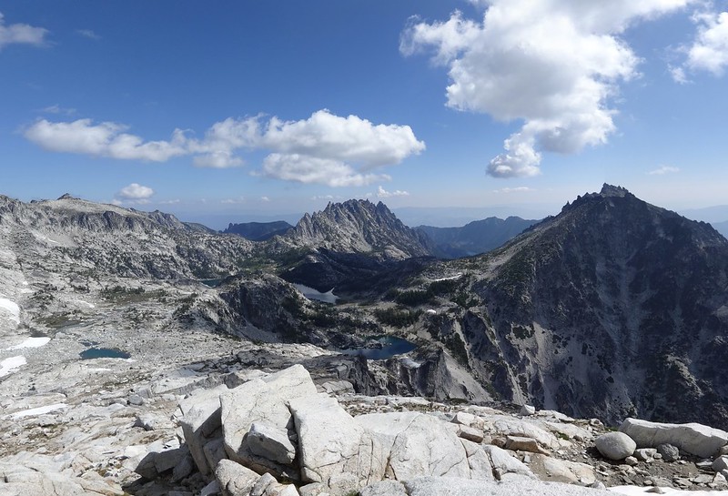
Looking down at the jagged peaks below the summit of Little Annapurna:
These guys were freaking me out, peering over the edge at the top of Little Annapurna:
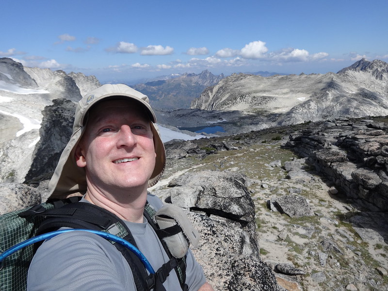
Hi Mom again!!
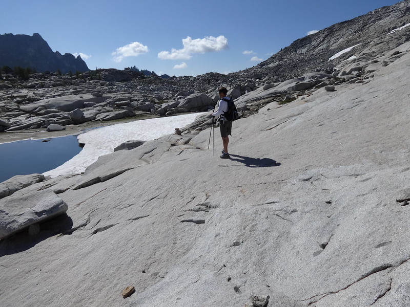
Off-trail wanderings over a snow field:
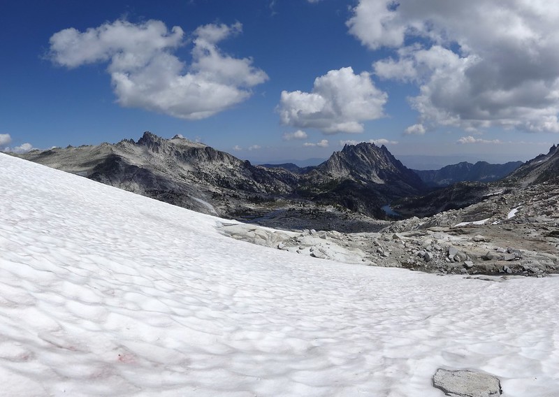
Somehow we gotta get down to Isolation Lake:
This way…
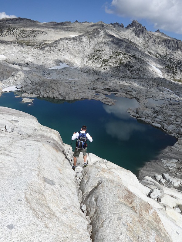
… and this way:
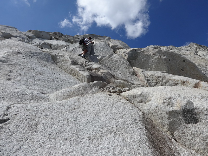
Granite. Nuff said:
Isolation Lake again:
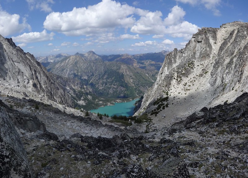
Headed back down Aasgard Pass, look at emerald-green Colchuck Lake:
On the way down we ran into more mountain goats, including this cute kid:
View of Aasgard Pass and the boulder field in better lighting than the morning:
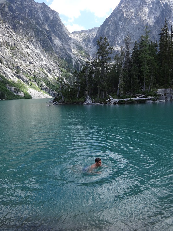
Adam just had to take a dip in Colchuck Lake:
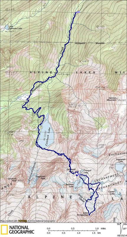
Tracks in NatGeo:
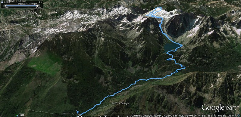
Hike overview in Google Earth:
Aasgard Pass in Google Earth:
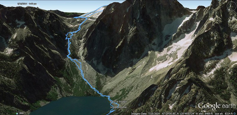
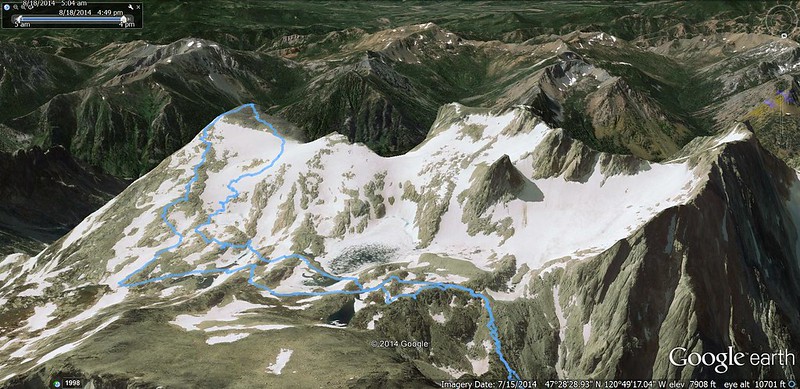
Upper Enchantment Basin in Google Earth:
-----------------------------------------------
Final comments:
• Miles: 19.1 (trip computer); 16.09 (GPS Fly)
• Elevation gain: 6800' (trip computer), 6339' (GPS Fly)
• Mountain goats are not afraid of humans. Wary, but not afraid. We saw 10 in total, most of them at close range.
• Made it up Aasgard Pass in an hour and a half. Made it back down in an hour and ten minutes.
• The last few hundred feet going up Aasgard Pass are the hardest.
• If attempting Aasgard Pass, I recommend getting an early start to avoid going up it in the sun.
• We saw no FS rangers.
• Very few mosquitoes to speak of.
• I drove up I-5 to pick up Adam outside of Seattle. Remind me never to move to Seattle. They can have their traffic mess.
• The drive back from the Stuart Lake TH took just under five hours, including a stop for gas and snacks.
• Unless I won a lottery spot for the Core Enchantment Zone, I would not go back to the Enchantments. That’s where you want to be and spend most of your time.
Link to all the pictures on Flickr:
https://www.flickr.com/photos/54959080@ ... 237653230/
Hike away!!
Brad


