Mt Hood’s Wy East Face is the backside of the Steele Cliffs. The upper reaches usually remain snow covered, but by this time of year the lower portion, just above the Newton Clark Glacier, melts out, exposing steep scree and a few bands of rock. The area below this, the Southern lobe of the Newton Clark Glacier, also called ‘Super Bowl’, can be accessed a few days a year from Mt Hood Meadows when their ski patrol permits.
Or you wing it after the ski area closes.
I’ve hiked and skied Super Bowl a half dozen times, always after the ski area has closed, and it is quite the exhilarating trip, but I’ve never done it as a hike until now. My expectation was a scree/sand slog similar to the South Sister climb
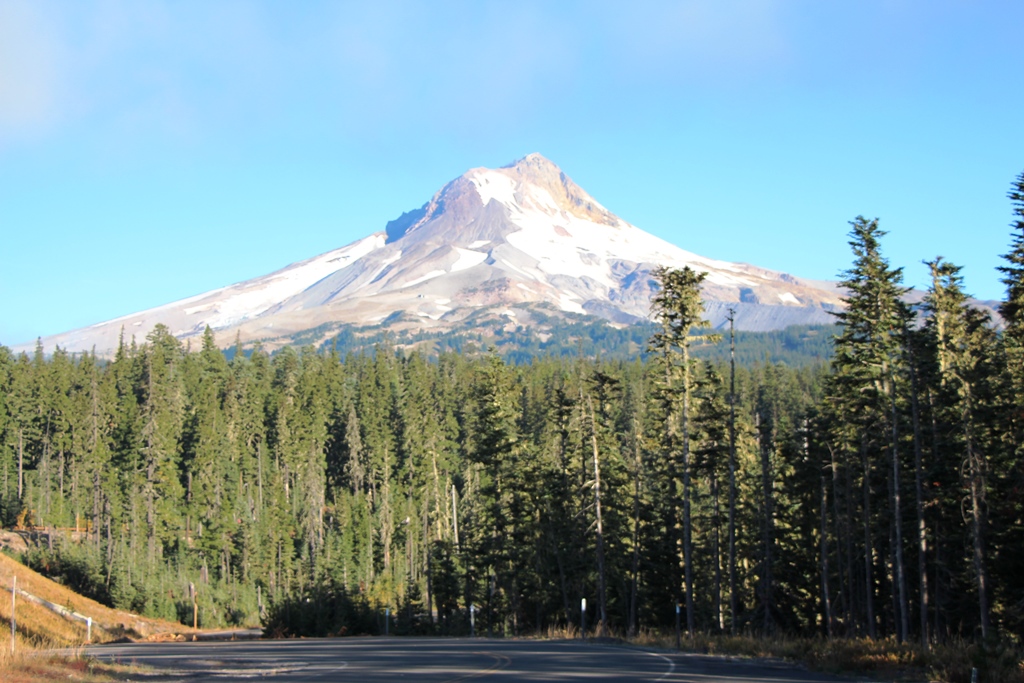
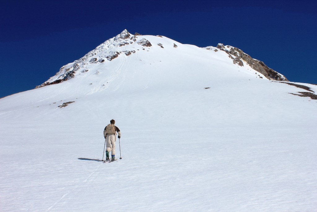
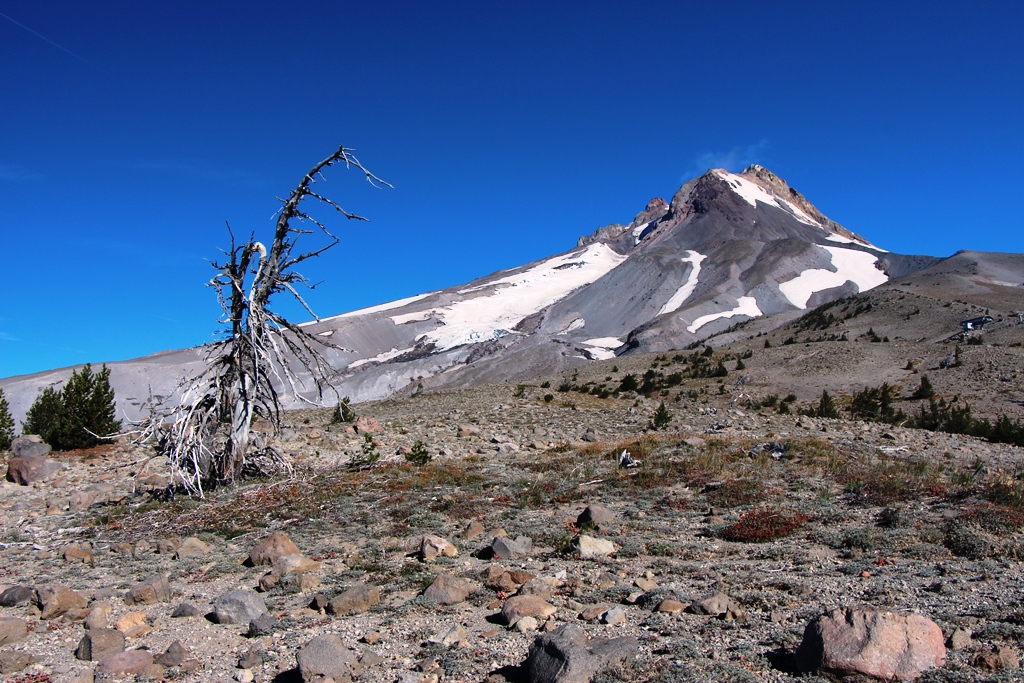
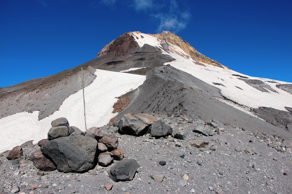
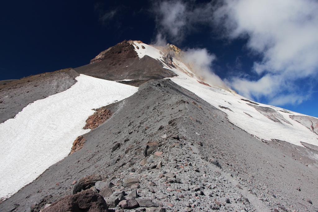
Mt Hood from Bennett Pass.
I started my hike where the Umbrella Falls trail crosses the road below Mt. Hood Meadows. I took the Umbrella Falls trail to the 600 trail, where I turned south until I gained the ridge that ascends above Mt Hood Meadows ski area. My route beyond this point is visible in the photo above—I followed the ridge that emerges from the trees at photo’s left to the photo’s center. I then followed the ridge straight up towards the summit cone until I reached the large crevasse in the Newton Clark Glacier. I then contoured left towards the Whitewater River drainage in hopes of catching a view of the Whitewater Glacier from the East. Failing in this (those scree slopes go on forever), I did a descending traverse thru upper Skylar bowl back to my ascent route.
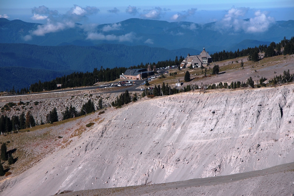
To get back to the hike's beginning, right where the Umbrella Falls Trail crosses Meadows’s access road, there is new construction. This photo was taken from the trail.
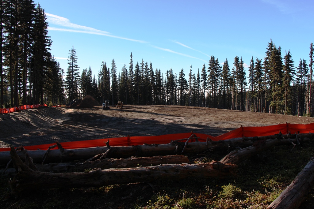
New Parking Lot???
The Umbrella Falls trail follows Mitchell Creek, then jogs over to Green Apple Creek, largely avoiding Mt Hood Meadows’s developed areas. Open areas become more prevalent as you climb, offering some scenary:
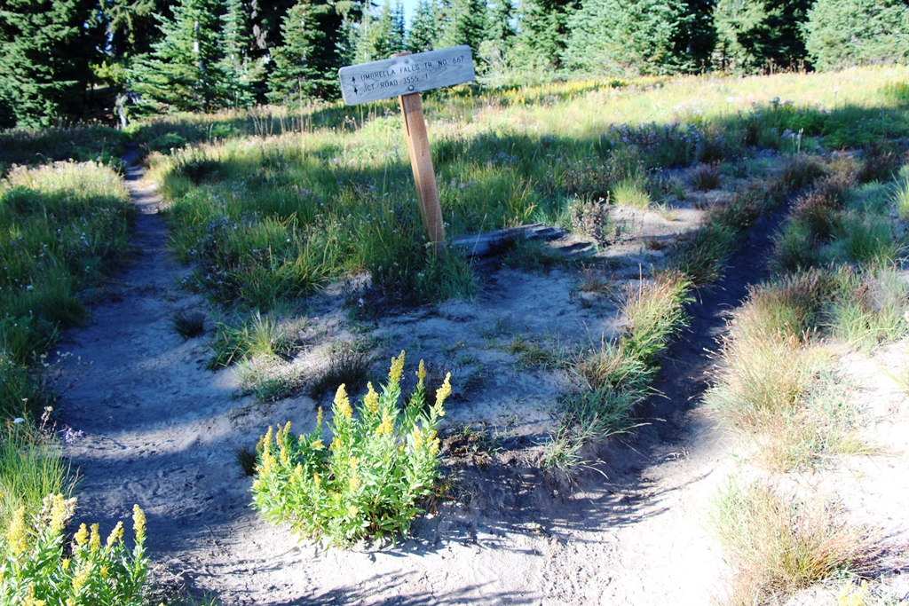
Trail Junction with 600 Trail.
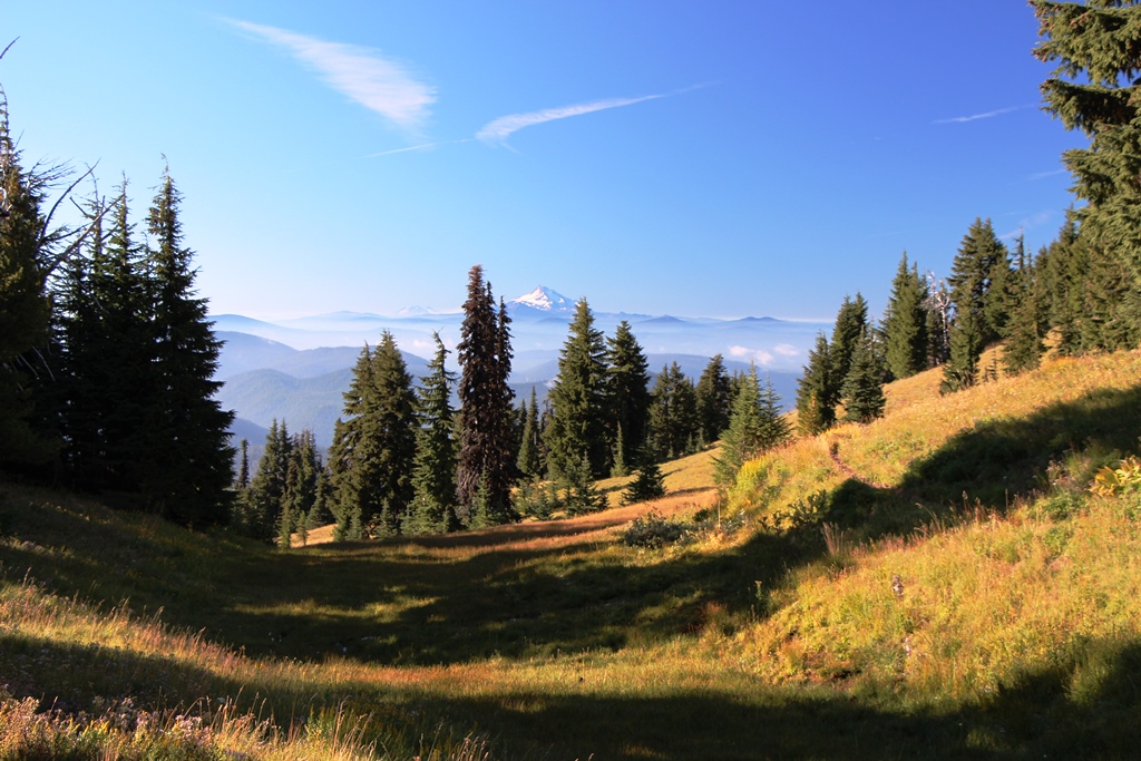
Mt Jefferson from 600 Trail. Two great secluded campsites in trees near here.
After accessing the ridge above Whitewater Canyon, trees soon give way, providing more expansive views:
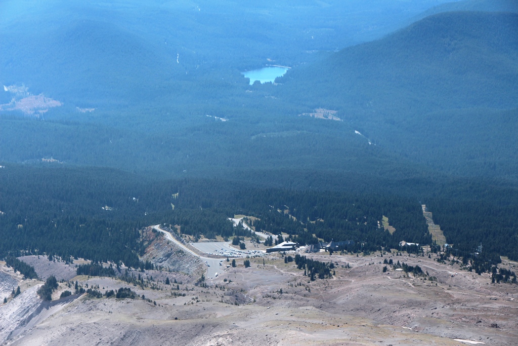
Mt Hood from Ridge—Vista Chair Top Terminal at Photo’s Right
Timberline Lodge
Mt Hood From Above Vista Chair—‘Clothesline’ on Tree is String of Himalaya Prayer Flags
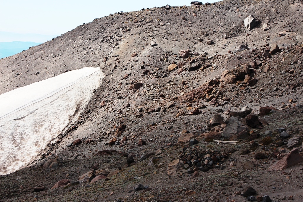
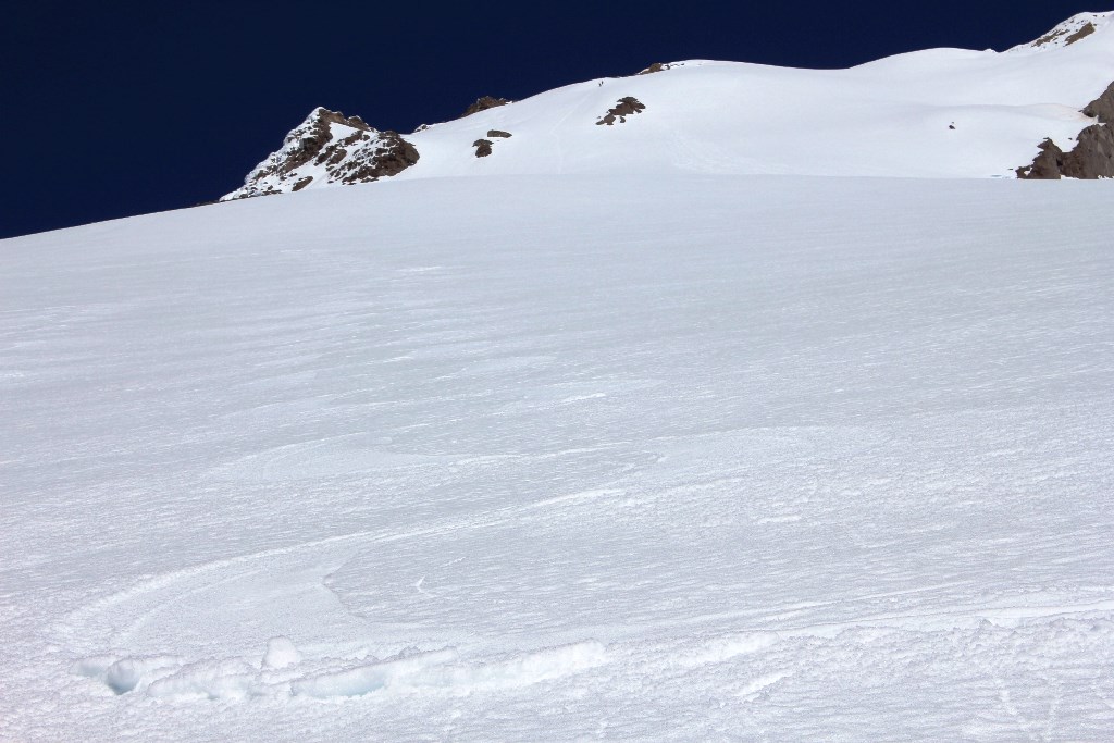
Skylar Bowl
Point 8,000. Ridge Crest Actually Flat Here—Great Views All Directions. Skylar Bowl Left, Newton Clark Glacier Right.
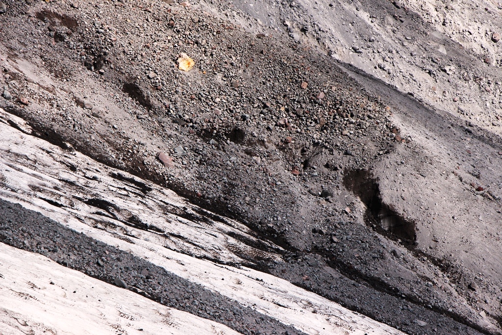
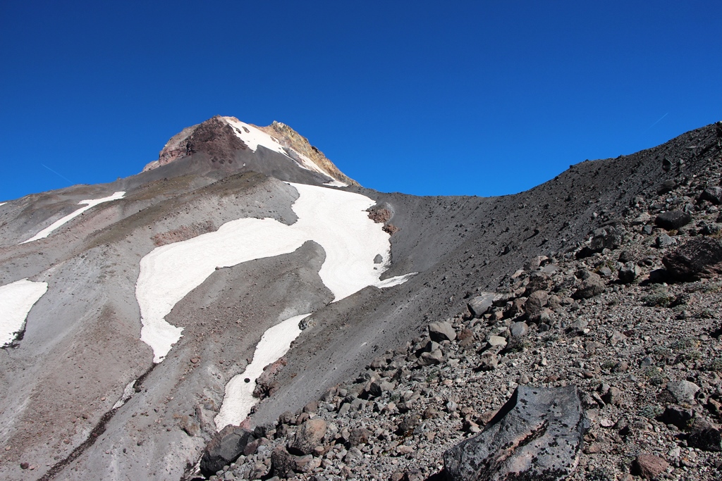
Crevasse at 9100’—Top of Mt Hood Meadows Permit Area
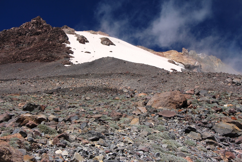
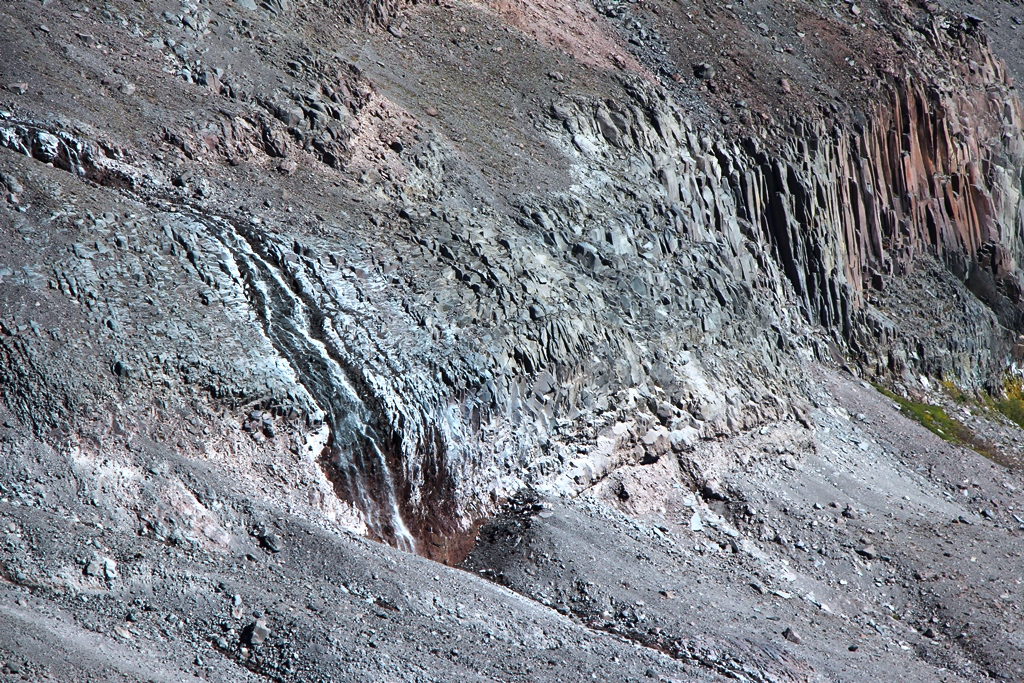
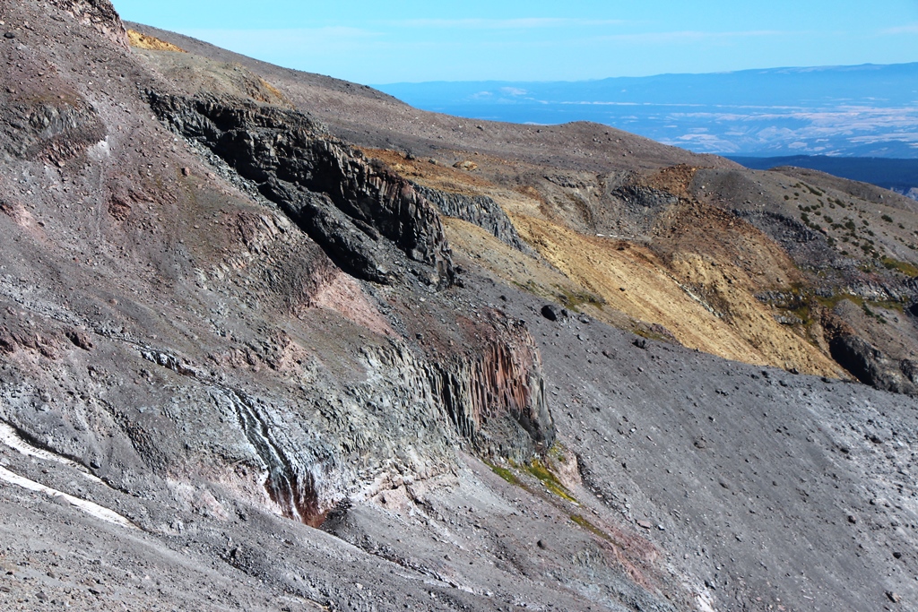
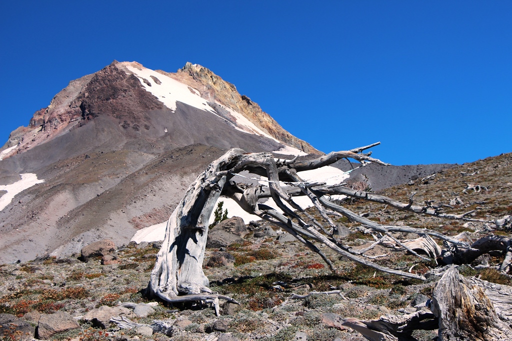
WyEast Face.
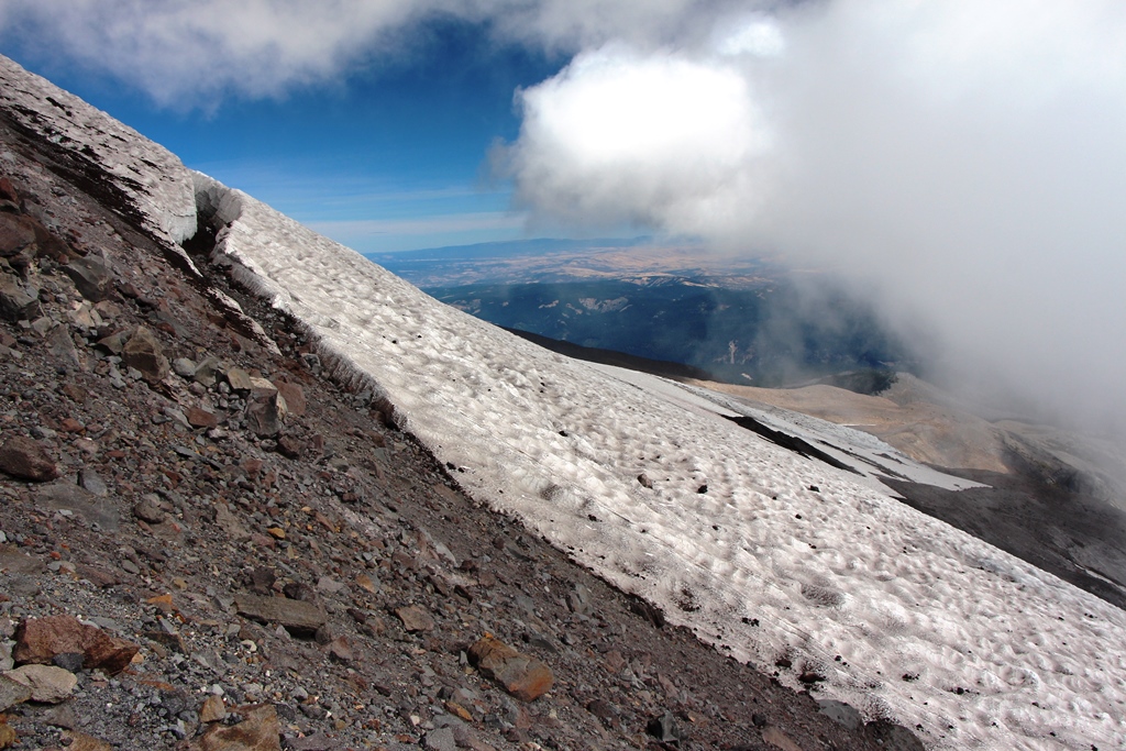
Footing is increasingly loose and sandy. While I have gone higher when there is snow, I opted to traverse towards the Whitewater River Canyon in hopes of a good view of the Whitewater Glacier. I travelled to the first horizon, which revealed another expanse of scree to another horizon. Repeat. Same result. Suspecting the next horizon would also be false, I settled for this shot of Timberline and Trillium Lake and began to descend thru upper Skylar Bowl.
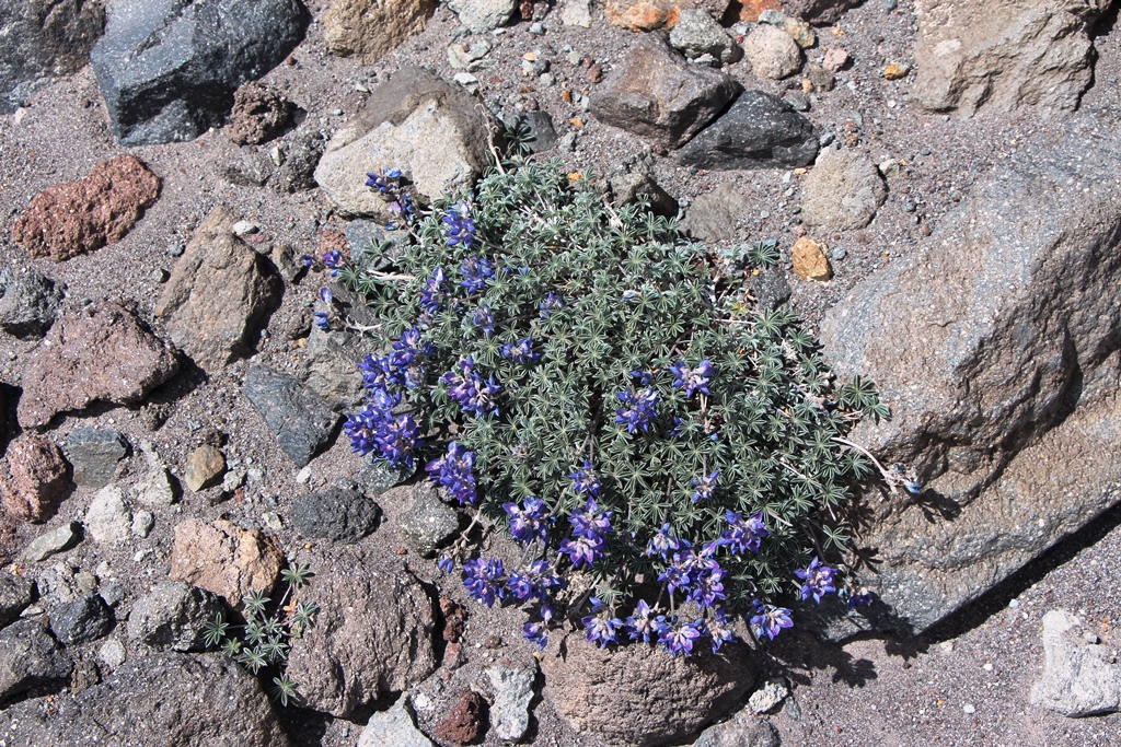
Up Here 75% of the Lupines had Bloomed, 25% in Mid-Flower—Genetics??
Lots of Sand and Gravel
Parting Shot
I liked this hike but my view is colored from my past ski excursions. Since I was hiking, I could venture West off route of the normal ski ascent straight up slope under the Vista and Cascade Express chairs. This gave some different views of Timberline and the Whitewater Glacier.
Hiking conditions, while on the sandy and loose side, were better than on South Sister. There are many areas where you can step rock to rock for firm footing. And the gradient is gentler—less back sliding—until you get above 8500’.
There is a defined use trail on the ridge crest from about 7300 feet on up to 9100 feet. This melts out fairly early in the year—by May in my experience. The ridge crest is exposed and can be windy.
Upper Skylar Bowl has a tent platform with some weathered lumber in it. Looks as if someone built the platform complete with wood structure to support tarps?? All some time ago since the tent platform has naturalized with native plants. But definitely an untold story—who, when, why??
I would do this hike again, but most likely when I could ski out. Going down, I did not follow my ascent route, opting to walk down thru the ski area. Kudos to Mt Hood Meadows for cleaning the mountain of litter—in the past I’ve found cell phones, car keys, season ski passes, unopened beer, coins, and the usual skier litter. Skunked!! No treasure—very clean.
Happy off trails to you!
WyEast Face and Super Bowl Sept 19, 2014
- BurnsideBob
- Posts: 540
- Joined: May 6th, 2014, 3:15 pm
- Location: Mount Angel, Oregon
WyEast Face and Super Bowl Sept 19, 2014
I keep making protein shakes but they always turn out like margaritas.
-
- Posts: 1291
- Joined: July 23rd, 2011, 8:31 pm
- Location: Canby, Oregon
- Contact:
Re: WyEast Face and Super Bowl Sept 19, 2014
Awesome report and photos, Dave!!! That "parting shot" photo invites the viewer (like me) to keep ascending up. What great views. Can't wait to return there.
Will
Will
Re: WyEast Face and Super Bowl Sept 19, 2014
Dave - What a great idea for a hike! I am keen to visit that area in summer, not that I have been above the ski tows at MHM in winter either... Thank you for sharing, I really enjoyed your TR!
Some people are really fit at eighty; thankfully I still have many years to get into shape…
- BurnsideBob
- Posts: 540
- Joined: May 6th, 2014, 3:15 pm
- Location: Mount Angel, Oregon
Re: WyEast Face and Super Bowl Sept 19, 2014
Thanks FK & Peder for the positive feedback.
Here's a few more photos from the trip, plus a couple photos of the same area on a ski day.
The Tent Platform With Lumber (Lower Right)
Turns Out A Rock Island Shown on Topo Map is Island of Ice with Rocks on Top
Waterfall on Clark Creek Below South Lobe Newton-Clark Glacier
Same Waterfall with Cooper Spur on Horizon
Skinning Upper Skylar Bowl To The WyEast Face June 26, 2010
Entering Super Bowl From The Top June 26, 2010
I keep making protein shakes but they always turn out like margaritas.
Re: WyEast Face and Super Bowl Sept 19, 2014
Love the old photo of you skinning up Skylar Bowl. That's an awesome shot.
I believe the top of Cascade lift is about 7,300'. You went up almost 2,000' above that?
Thanks,
Mike J
Mike J
- BurnsideBob
- Posts: 540
- Joined: May 6th, 2014, 3:15 pm
- Location: Mount Angel, Oregon
Re: WyEast Face and Super Bowl Sept 19, 2014
Hi Mike:
Actually, that's my son Chris. I don't look as good or move as fast!!
The highest I've made it is 9500', but other folks climb all the way to the top of the WyEast face, which is about 10,700. In the snow track photo (2nd ski photo) the two dots near the top of the snow are two guys climbing with skis. Wish I had the lungs!
I keep making protein shakes but they always turn out like margaritas.
- Splintercat
- Posts: 8334
- Joined: May 28th, 2008, 10:03 pm
- Location: Portland
- Contact:
Re: WyEast Face and Super Bowl Sept 19, 2014
Nice report, Dave! I used to ski Meadows a LOT during my skiing years, but don't get to that side of the mountain much for hiking (though I do love Clark and Heather canyons in summer!).
You may already know this, but there's a fascinating historical controversy involving what we now call the WyEast Route on Mt. Hood when Weekly Oregonian publisher Thomas Dryer attempted to be the first party to scale the mountain in August 1854. Dryer wrote an account that is still disputed today -- though most who have read it believe that his party got as far as the Crow's Nest on top of the Steel Cliffs, but not the true summit. Dryer was the first to report sulfurous vents near the summit, but also claimed that the elevation as so great that members of his party were passing out and had blood oozing from their skin -- so, obviously some embellishments to sell a few papers! He also reported seeing Fremont Peak in the Rockies and Mt. Shasta - both impossible, of course -- yet neglected to mention Lost and Bull Run lakes, which are prominent from the true summit.
The most common interpretation of Dryer's route is that they departed from somewhere near Government Camp and crossed the White River Glacier to reach the SE ridges that extend up to Steel Cliffs. Based on a fanciful measurement technique, he established Mount Hood's height to be in excess of 18,000 feet. His account wasn't questioned until Henry Pittock made the first undisputed climb in 1857, triggering the dispute that continues today. Pittock worked for Dryer at the Weekly Oregonian, later taking over for Dryer as the editor and publisher.
There's a detail narrative of this saga in "Mount Hood: A Complete History" by Jack Grauer.
Thanks for posting!
Tom