In the Bull of the Wood Wilderness are 3 named mountains in close proximity to each other with trails passing near by but none to the top or along the connecting ridges, Pansy Mtn, Mother Lode Mtn, and Silver King Mtn. Since the 2010 fire opened up the ridges and tops I thought I'd go take a look-see. The plan was to go up Pansy Mtn from the saddle above Pansy Lake, follow the ridge to Mother Lode Mtn, do an out 'n back to Silver King, and from Mother Lode follow the ridge east. I'd then hop off the ridge to visit some hidden lakes to the north, and pick up the Twin Lakes trail for the return. Topped off with a stop by the lookout for a before and after shot comparing the 1930s pano with after the fire. 2 out of 3 mtns is the best I could manage this day.
I started at the Pansy Lake TH and was attacked by hoards of mosquitoes (just like justpeachy mentioned in her recent BOTW TR). I scurried up the trail and made the saddle to go off-trail on up to Pansy Mtn. That part worked nicely. As has been mentioned, Pansy Lake is more of a pond, can't be more than 4' deep, the water is very clear, though.
Pansy Basin from Pansy Mtn
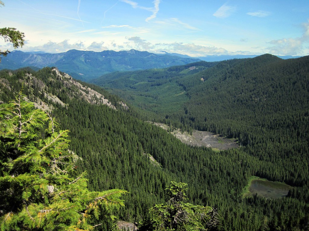 PansyBasin by pauljess999, on Flickr
The "lake":
 PansyLake by pauljess999, on Flickr
The summit is a little further up along this nice approach:
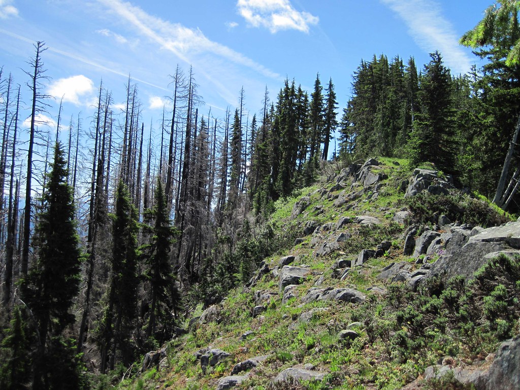 PansyApproach by pauljess999, on Flickr
Next stop, Mother Lode Mtn. Views are pretty nice all along Pansy Mtn.
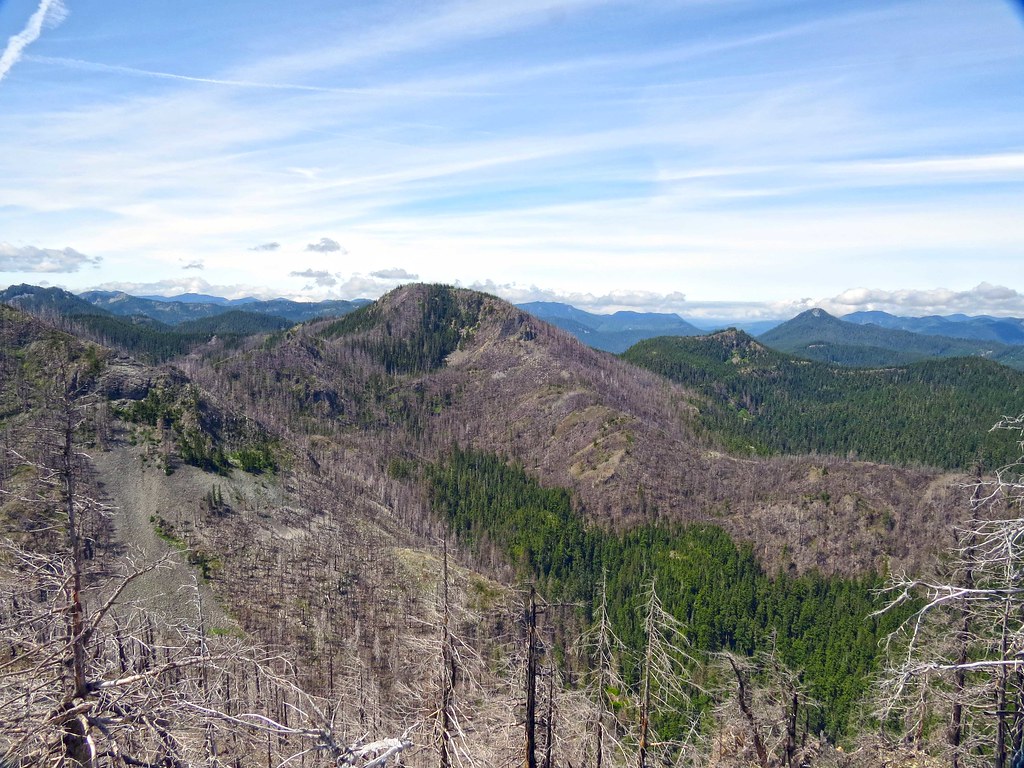
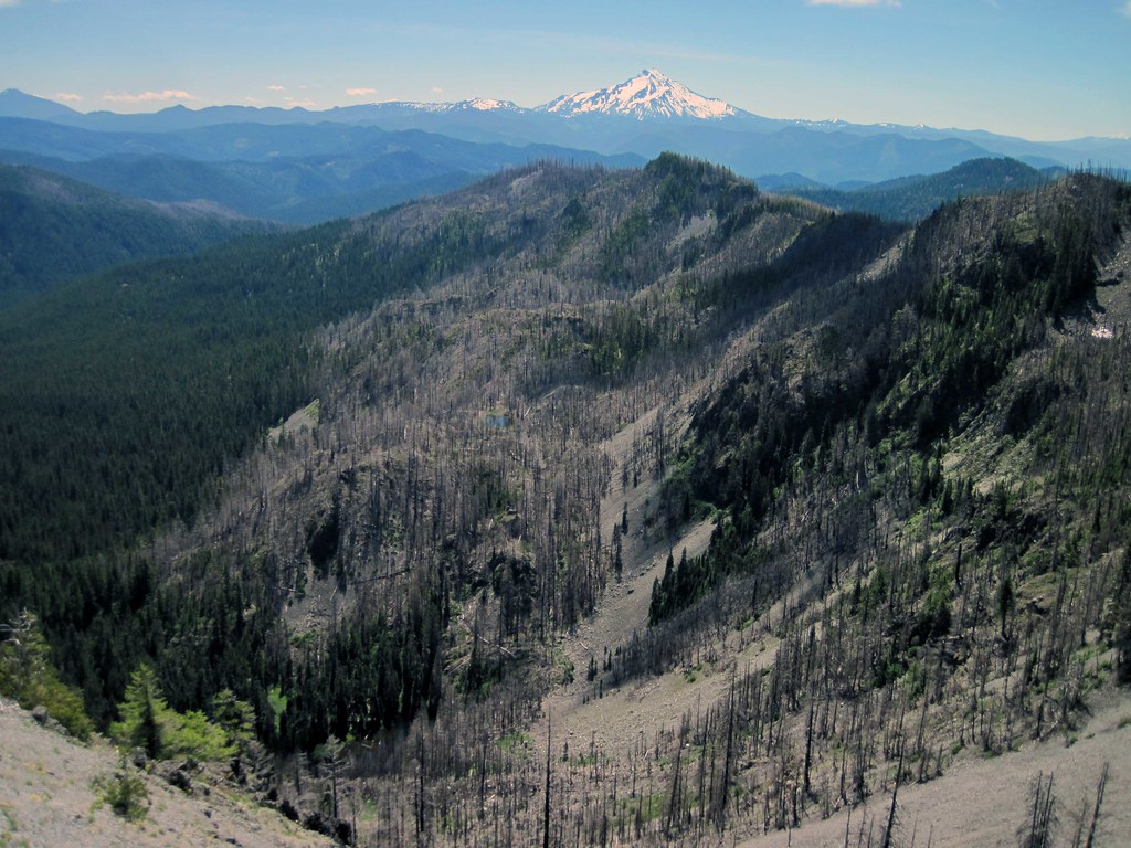
 MotherLodeMtn by pauljess999, on Flickr
And here is a bit of amusing trail planning gone awry. With Google's improved imagery, I've been using it more to plan my offtrail excursions, unfortunately, Google does not have the 3d data to make these images match the topography (lidar in the Gorge is a local exception). So in looking at the GE image of the connecting ridge between Pansy and Mother Lode I got the impression that it was smooth going, not even close. Here is the image from GE, piece of cake:
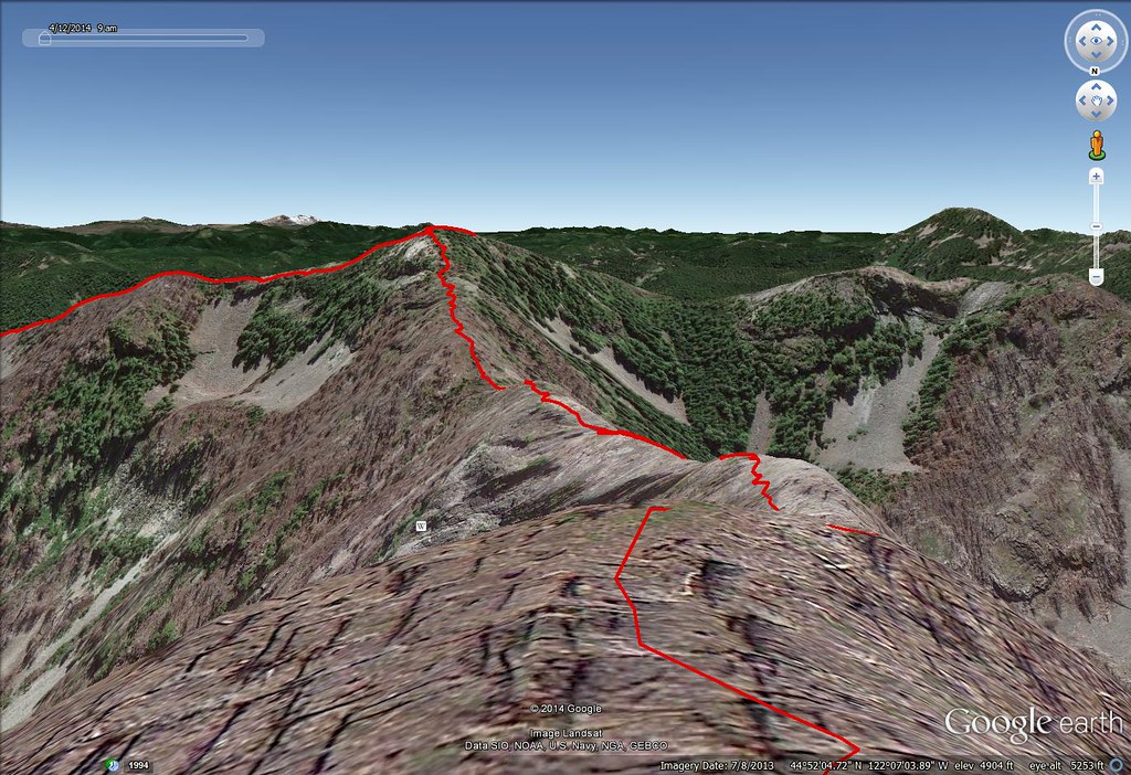 GEBad by pauljess999, on Flickr
Here's what confronted me when I got there, not quite what I was expecting:
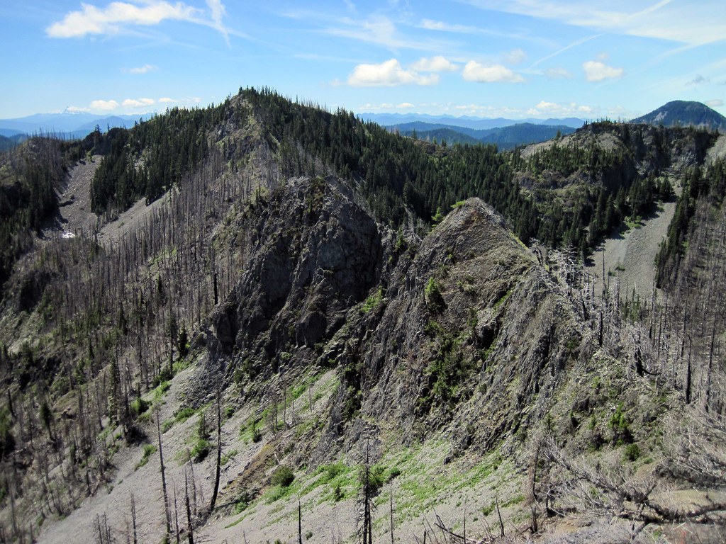 Gendarmes0 by pauljess999, on Flickr
Backside
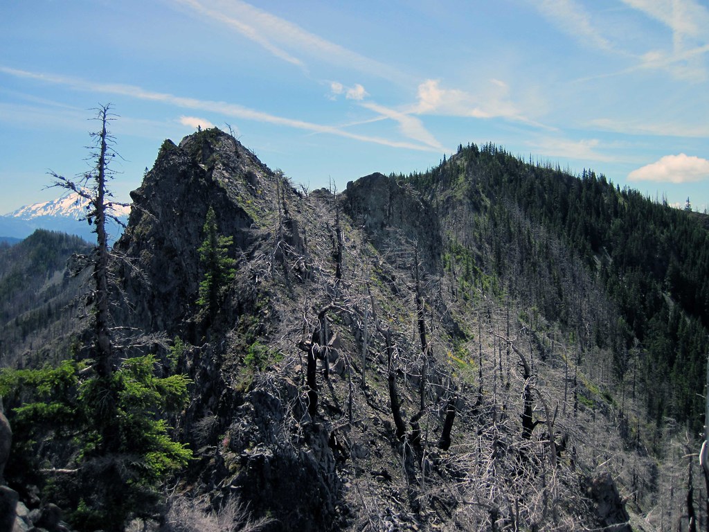 Gendarmes by pauljess999, on Flickr
So I commenced a steep scramble to go around the 2 gendarmes blocking the ridge, had to retreat a couple of times - it is possible that the easiest route is just to stay on the narrow top of the outcrops.
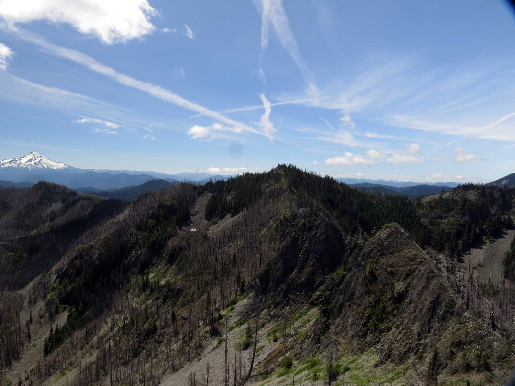
As this took up a bunch of time I'd not budgeted for, I scrubbed the trek to Silver King - so an outing for another day. At least I got some closeups of Silver king. Whetstone Mtn way back on the right.
 SilverKing2 by pauljess999, on Flickr
Here's the ridge going east from Mother Lode Mtn.
 MotherLodeRidge by pauljess999, on Flickr
From the ridge lower Twin Lake is visible.
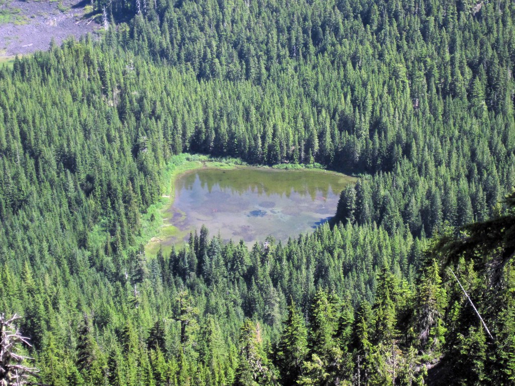
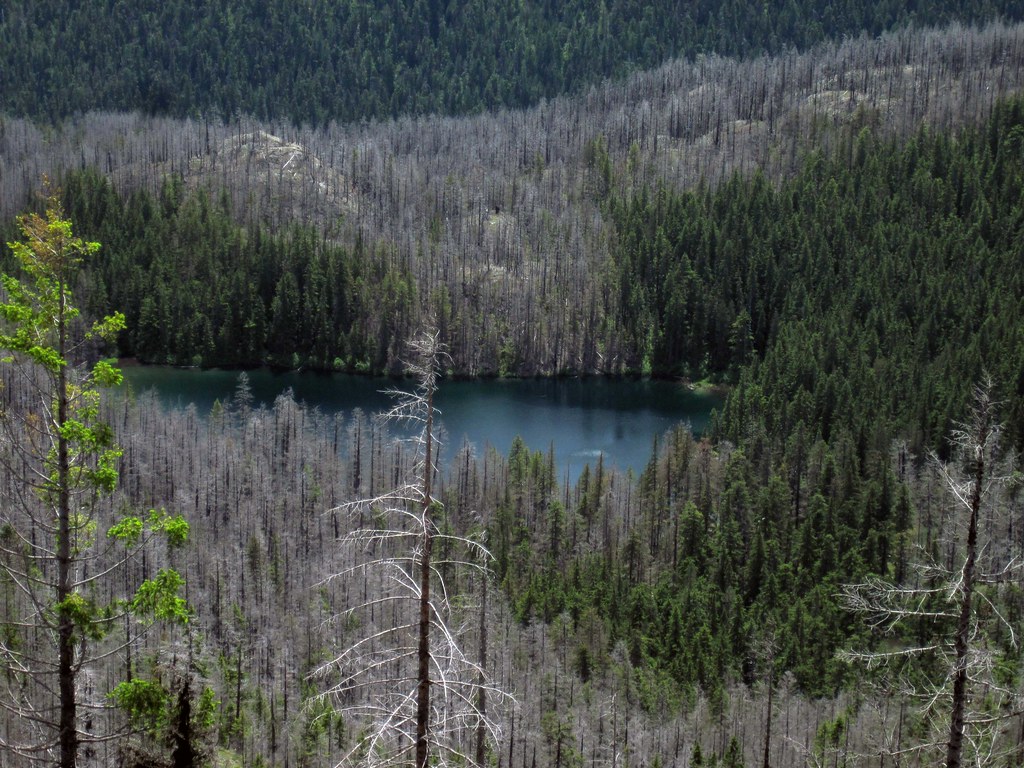 LowerTwin by pauljess999, on Flickr
GE imagery showed some lakes and ponds, here's a pano with about 5. I visited the largest and then made a beeline (or in my case a badline - overly steep, brushy, yuck) to the Twin Lakes Trail and swarms of mosquitoes.
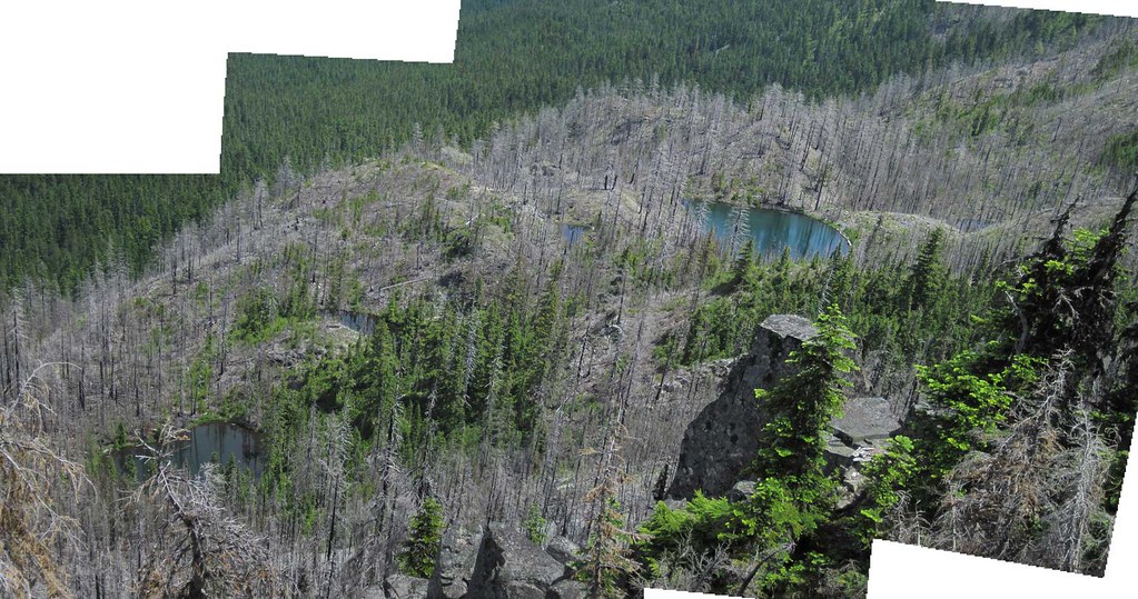 5LakesPonds by pauljess999, on Flickr
I stopped off at the lookout to do comparisons shot of the 1930s panos. Here's the ridge comparison:
1930s:
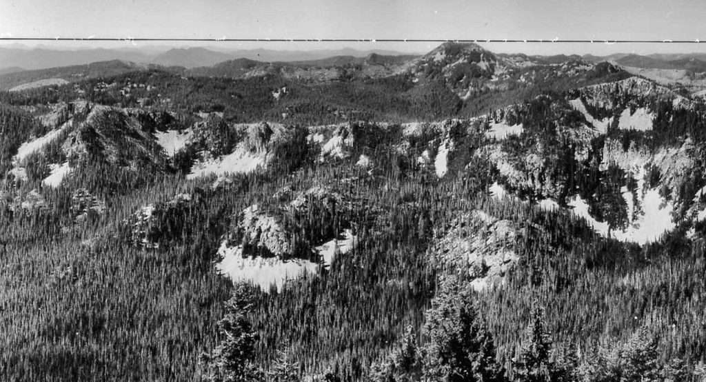 PanoThen by pauljess999, on Flickr
Now (wish I had a pre-fire photo - I actually visited the lookout in 2005 but it was socked in that day.)
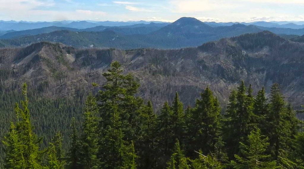 PanoNow by pauljess999, on Flickr
I'm calling it 12 miles, 4000' cumulative elevation gain.
KMZ file for GE
 PansyMotheLode.kmz
- (22.61 KiB) Downloaded 280 times
- PansyMotherLode.gpx
- (504.69 KiB) Downloaded 267 times
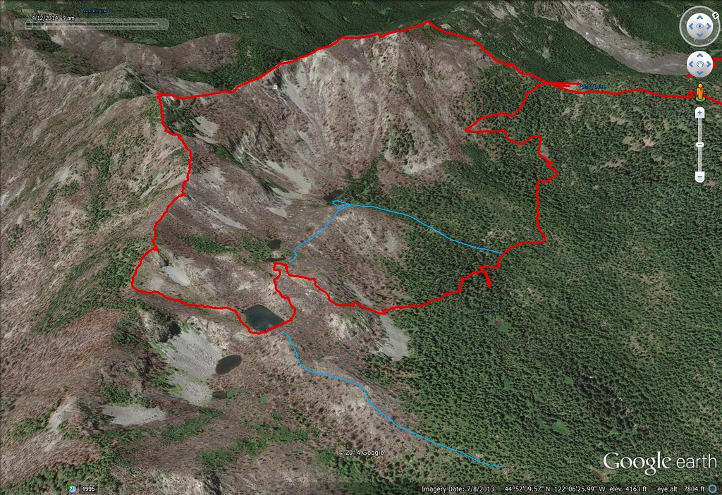 GEPansyMLode by pauljess999, on Flickr
TOPO
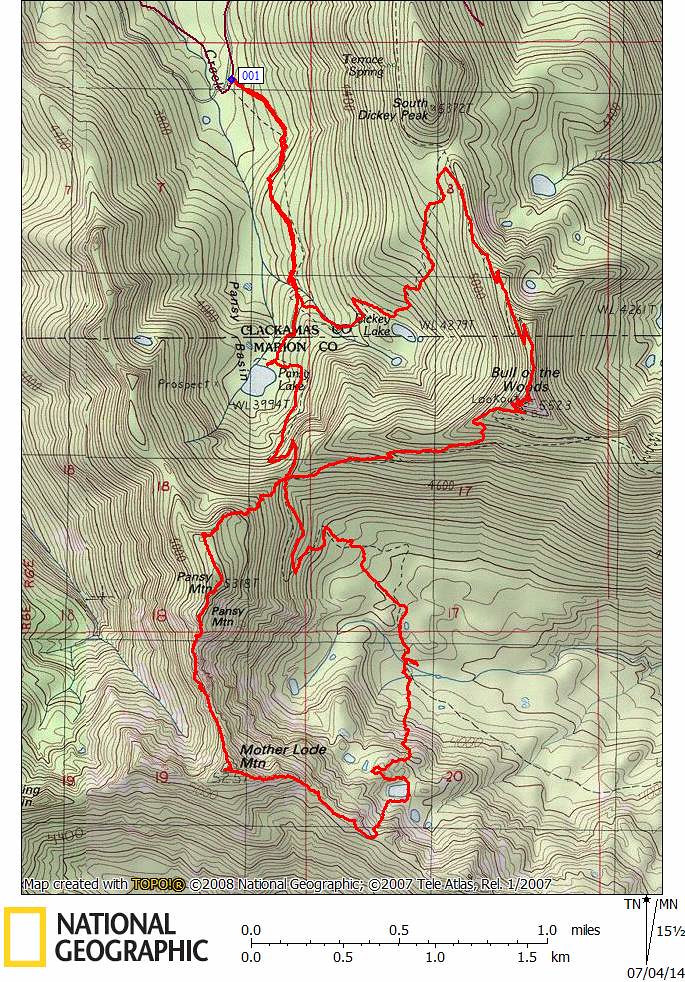 PansyMtnTOPO by pauljess999, on Flickr