Deadwood Direct, June 17, 2012

Discussions and Trip Reports for off-trail adventures and rediscovering lost trails
pablo
Posts: 1451
Joined: May 28th, 2008, 10:03 pm

Deadwood Direct, June 17, 2012

Post by pablo » June 17th, 2012, 8:55 pm

Yesterday I did Casey Creek and once on Nick Eaton Ridge, I took the nearby cutoff trail to Gorton Creek Trail near Deadwood Camp. There are lots of little stems across the cutoff trail, none of it mcds class material so I thought I'd go back today with a saw and see what I could do to clean things up. Rather than take the overly long Nick Eaton or Gorton Creek trails I thought I'd just see what the direct route up from a ridge near Wyeth looks like. Long story short, very nice route and less than 2 miles [lots of poison oak to start but no stems very high mostly along the ground]. Only problem is once there I did not have much time to do any fixups on the cutoff as I wanted to do a loop on Wyeth so I guess I get to go back out there and try again to clean up the cutoff trail. I did manage to saw up some stuff on the plateau on the way back to Wyeth Trail so it wasn't a total loss.

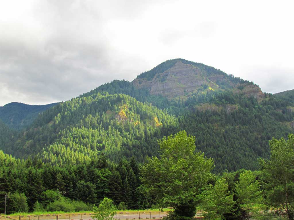
The route is a beauty with some good views and not much brush - there was one cliffy obstacle I avoided going climbers left. In the photo below I see now I should have visited the viewpoint at the top of the big cliff - the view must be pretty huge from there. I took this photo of the ridge I traveled from the other side of the freeway at the end of the day - Wyeth campground is just to the left out of the picture. You can see most of the route, just follow the trees up from the left all the way up.

Image

There was a nice opening for a view early on at the north end of a nice little bench.

Image

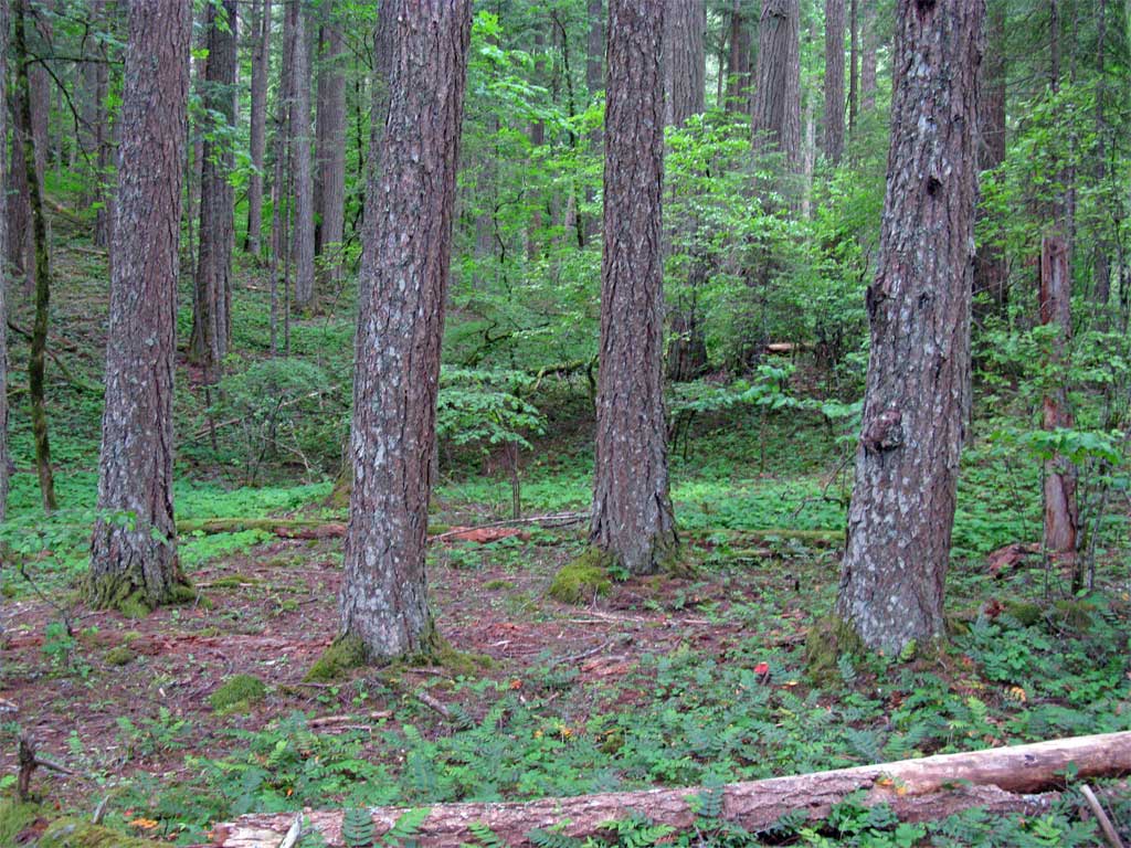
The bench - not much brush along the entire route and lots of game trail to travel.

Image

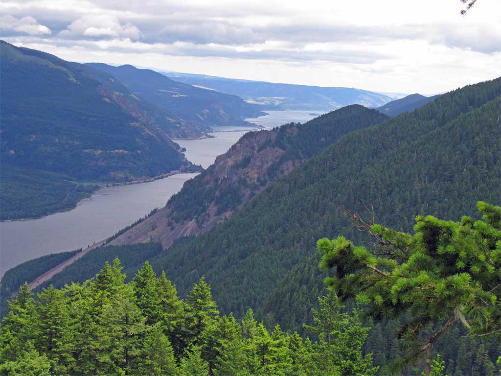
I routed around a cliff and circled back around to get above the cliff on a spot with good views from higher up:

Image

I made my way up an open slope, steep but not uncomfortably so.

Image

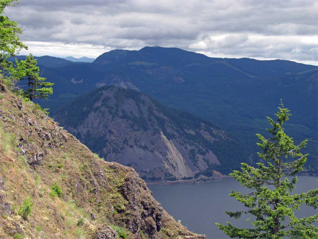
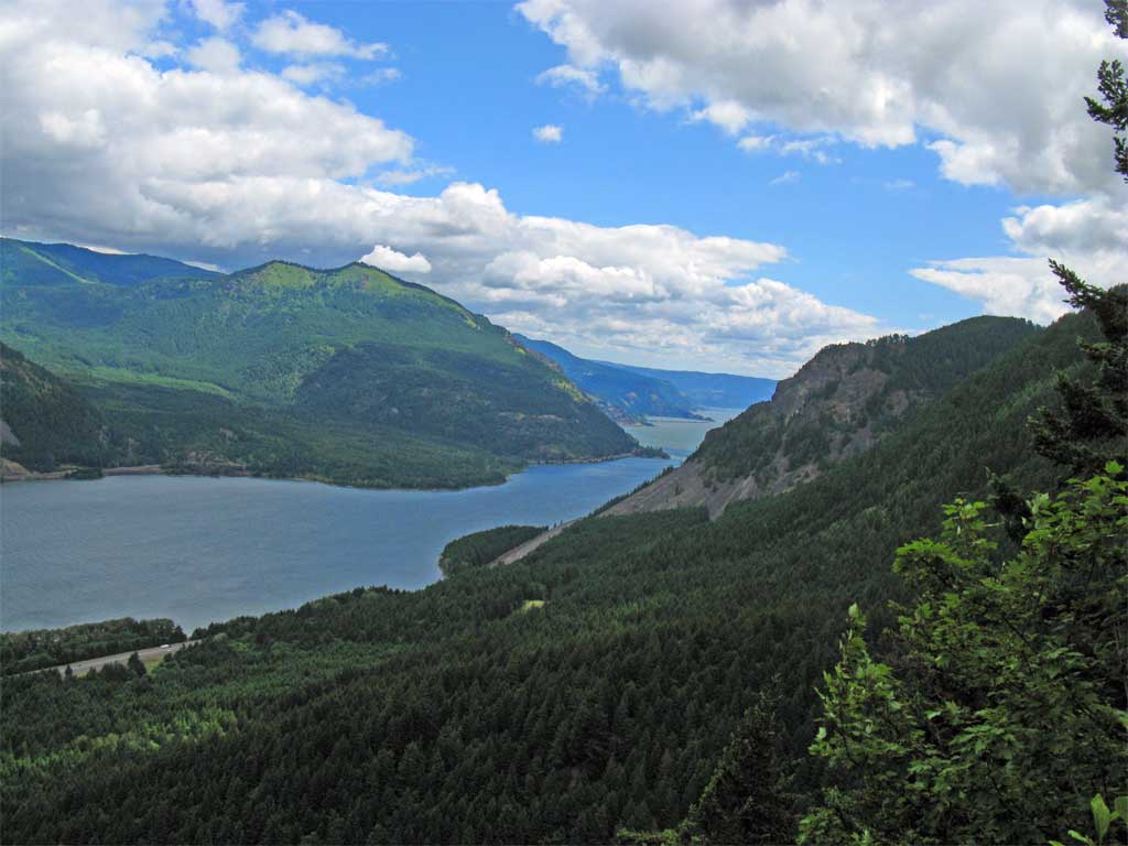
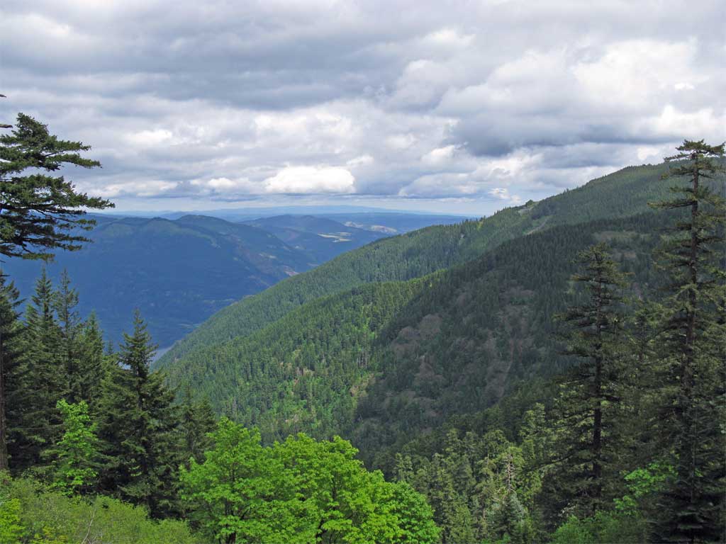
From the steep slope I got a good look at the Gorton Creek drainage. The ridge on the left (east) side of Gorton Creek is referred to as Wyeth Spur from Gorge Classic Climbs and is apparently doable as a hike (I've not done it).

Image

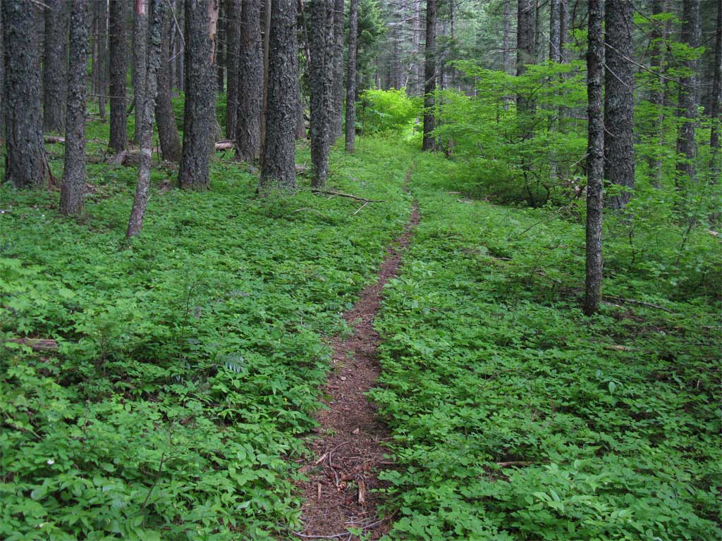
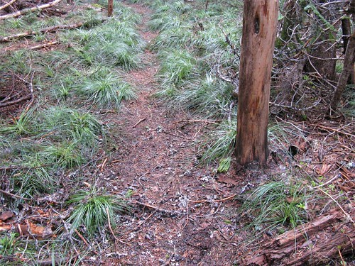
I topped out on the ridge and intersected Gorton Creek Trail - very pretty and nicely graded:

Image

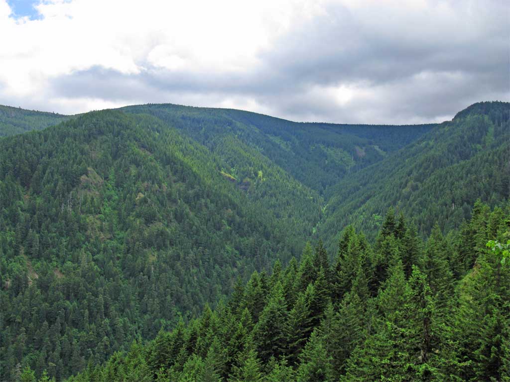
From Gorton Creek trail I got a look at Wyeth Spur. The near ridge is Wyeth Spur and the one beyond is the ridge Wyeth trail traverses:

Image

The trip across the plateau was nice, still early spring there with patches of rapidly melting snow. I treated myself to unfiltered water from the headwaters of Gorton Creek, very tasty and ice cold.

Some stuff got moved around:

ImageImage

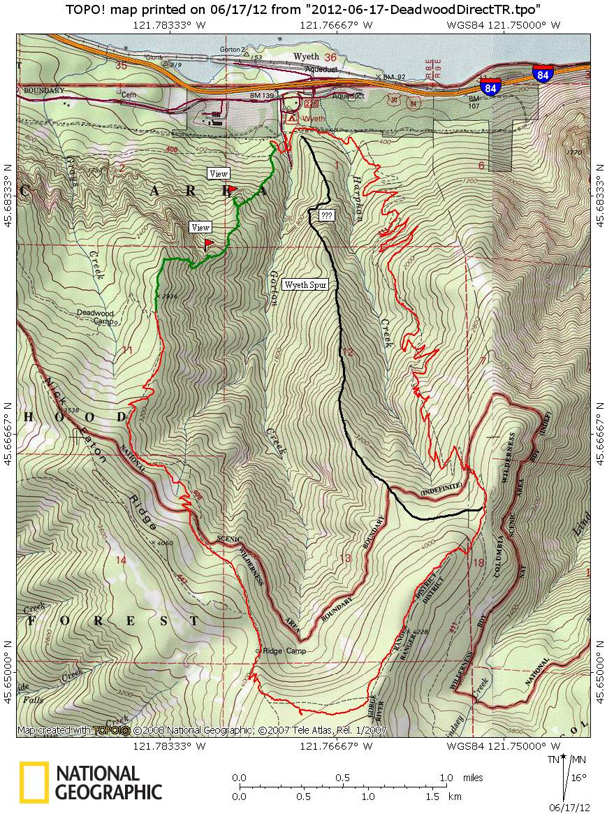
11-12 miles with ~4300' cumulative elevation gain in 7.5 hours. On the map below green indicates the off trail route I traveled today and the black line is a suggested route up Wyeth Spur. The question marks on Wyeth spur are around a rock outcrop that needs avoiding - GCC sez use a nearby game trail to get above - I'm guessing that it is climbers right (west).

Image
The future's uncertain and the end is always near.

User avatar
Eric Peterson
Posts: 4097
Joined: May 11th, 2009, 5:39 am
Location: Oregon
Contact:

Re: Deadwood Direct, June 17, 2012

Post by Eric Peterson » June 17th, 2012, 9:50 pm

Too cool! Been thinking about Wyeth Ridge off and on since last year and every time
I hiked up 413 looking over at it. Least I think that's Wyeth Ridge that one
can see from 413?.

So at trail 400 where it crosses Gorton Creek there is a old road there that you
started up to make your off trail ascent, no?

Very nice work as usual! :)

EDIT - nm, I keep forgetting those ridges visible from 413 are the ridges around Lindsey Creek,
don't think one can see Wyeth Ridge from the Defiance Trail.
Last edited by Eric Peterson on June 18th, 2012, 5:15 am, edited 1 time in total.

User avatar
Peder
Posts: 3401
Joined: May 28th, 2008, 10:02 pm
Location: Lake Oswego

Re: Deadwood Direct, June 17, 2012

Post by Peder » June 17th, 2012, 9:56 pm

In the photo below I see now I should have visited the viewpoint at the top of the big cliff - the view must be pretty huge from there.
Sorry that we missed you Saturday but I'm glad that you had a great day out. Yes, the view from the top of the big cliff must be something akin to the view from Table Mountain. Obviously, I must find time to go check it out... That looks like a fun loop.
Some people are really fit at eighty; thankfully I still have many years to get into shape…

mcds
Posts: 802
Joined: April 7th, 2012, 4:25 pm

Re: Deadwood Direct, June 17, 2012

Post by mcds » June 18th, 2012, 10:25 am

thanks for the trail work and poison oak beta. cool loop, kind of a multisport day with the offtrail, ontrail and trailwork. I assume you wear gaitors, do they cover your laces to any significant extent? I'm thinking once I arrived back on trail i could put on some gloves to strip off the contaminated gators and pants and get into some clean ones for the rest of the day. I'm not thinking of retracing your route, but these off-trail reports are making me curious. Maybe i'll start with route that is completely above the 2000' elevation limit of poison oak as suggested by Splintercat. Maybe from the SD junction over to Bear Lake, or a straight line across Benson Plateau.

pablo
Posts: 1451
Joined: May 28th, 2008, 10:03 pm

Re: Deadwood Direct, June 17, 2012

Post by pablo » June 18th, 2012, 7:41 pm

mcds wrote:[...] I assume you wear gaitors, do they cover your laces to any significant extent? I'm thinking once I arrived back on trail i could put on some gloves to strip off the contaminated gators and pants and get into some clean ones for the rest of the day. I'm not thinking of retracing your route, but these off-trail reports are making me curious. Maybe i'll start with route that is completely above the 2000' elevation limit of poison oak as suggested by Splintercat. Maybe from the SD junction over to Bear Lake, or a straight line across Benson Plateau.
I always wear long pants, long sleeved shirts and gaiters that cover most of my boots no matter what the temperature or humidity is - so far I'm either immune or lucky as I've never had a problem with poison oak - I do take great pains to avoid a possible unpleasant experience.

--Paul
The future's uncertain and the end is always near.

User avatar
Jack
Posts: 325
Joined: November 22nd, 2011, 3:36 pm

Re: Deadwood Direct, June 17, 2012

Post by Jack » June 18th, 2012, 8:06 pm

I just took this pic Sun. 6-17 from the Wyeth Tr. and was wondering what the ridge was between me and the treed outcropping that I was assuming to be Indian Point.
DSC02839 -.JPG
Nice report and photos, Pablo, and thanks. My gorge geography improves leaps and bounds with each of your TR’s.

pablo
Posts: 1451
Joined: May 28th, 2008, 10:03 pm

Re: Deadwood Direct, June 17, 2012

Post by pablo » June 18th, 2012, 8:59 pm

Jack wrote:I just took this pic Sun. 6-17 from the Wyeth Tr. and was wondering what the ridge was between me and the treed outcropping that I was assuming to be Indian Point.
DSC02839 -.JPG
Nice report and photos, Pablo, and thanks. My gorge geography improves leaps and bounds with each of your TR’s.
Thanks Jack. Say, I think Indian Point is just around the corner from the rock outcrop you have marked.

--Paul
The future's uncertain and the end is always near.

User avatar
Peder
Posts: 3401
Joined: May 28th, 2008, 10:02 pm
Location: Lake Oswego

Re: Deadwood Direct, June 17, 2012

Post by Peder » June 19th, 2012, 7:48 am

That is a good question from Jack! Is his "Indian Point" not your "view from the top of the big cliff"? I am wondering and will let the experts ponder this during the dark and dreary winter months...
Some people are really fit at eighty; thankfully I still have many years to get into shape…

User avatar
Splintercat
Posts: 8333
Joined: May 28th, 2008, 10:03 pm
Location: Portland
Contact:

Re: Deadwood Direct, June 17, 2012

Post by Splintercat » June 20th, 2012, 9:37 am

Thanks, Paul - another great report in your epic series of ridgeline bushwhacks! The escarpment at 2800 feet is interesting -- I've stared at that one from below, too. But based on your report, mere morals like yours truly could simply take the Gorton Creek trail to the ridgeline, then follow the ridge down to the cliff viewpoint?

Thanks for the trail tending, as always!

Tom :)

User avatar
Guy
Posts: 3333
Joined: May 10th, 2009, 4:42 pm
Location: The Foothills of Mt Hood
Contact:

Re: Deadwood Direct, June 17, 2012

Post by Guy » June 22nd, 2012, 8:33 pm

Image
We did a car shuttle Hike today going up the Wyeth trail then over & down the Gorton Creek Trail to Indian Point & on to the Herman Creek TH. Jack's photo was in my mind most of the way! & yes I concur that this photo is of the cliff face between the Wyeth Trail & Indian Point.

Earlier on the Wyeth Trail you can look East to Indian Point.

Image

But by the time you get higher on the ridge, up to the open areas Indian point is hidden behind the intervening ridge.

Image

Image

From Indian Point you can look right down to the Wyeth Trailhead, this photo is Zoomed in on our car at that trailhead:

Image

& finally from the Wyeth TH looking back up at Indian Point.

Image

When we planned this hike I made a quick estimation of distance using hillmap.com & came up with 12 miles & 4400' of EG. I need to put those path points closer together in the future! It clocked in at nearly 16 miles & 5000' of EG - Still a fun (& mostly dry) day!
hiking log & photos.
Ad monte summa aut mors

Post Reply