I had a free afternoon, and started off Equestrian trailhead to look for a shortcut path (mentioned in one of trip reports) between Hardy trail and lower Hamilton trail. That shortcut would make possible a large Hardy-Hamilton loop without going most of Hamilton trail back. I didn't quite expect everything to be snowed in, but decided to go with original plan.
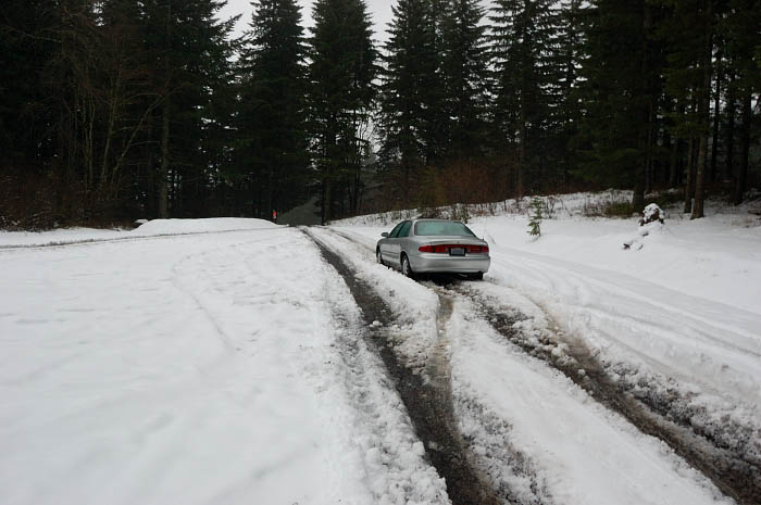
The view of parking lot. The snow was down to the river level today; on this hike it varied between 3-6 inches deep & was turning to slush
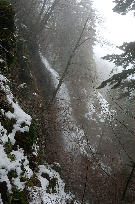
The shortcut I was looking for should have go right from the first major junction, about a mile from the trailhead. However, this spot had impenetrable vine maple thicket and not a hint of a path. I took the right-hand road for about 1/3 mile past the junction, then went downhill along a small stream. Got down to Hamilton trail after about 40 minutes bushwhacking through salmonberry and vine maples, and a sketchy creek/gully crossing on the logs, then going around some cliffs - not a good way. I went far east from where I intended to.
As a bonus, saw this seasonal waterfall which is now quite good.
Once on the lower trail, decided to visit Rodney Falls - it was a monster, and a noise was deafening! The water now runs over Windy Pool viewpoint, and at some point it ran over the rocks that wall Windy Pool. After Rodney, I went to Hardy Falls "viewpoint", but it was apparently fenced above where it used to be. It was pretty icy down there so I didn't want to scramble down above precarious drop-off to see Hardy Falls.
Rodney Falls flowing over Windy Pool viewpoint
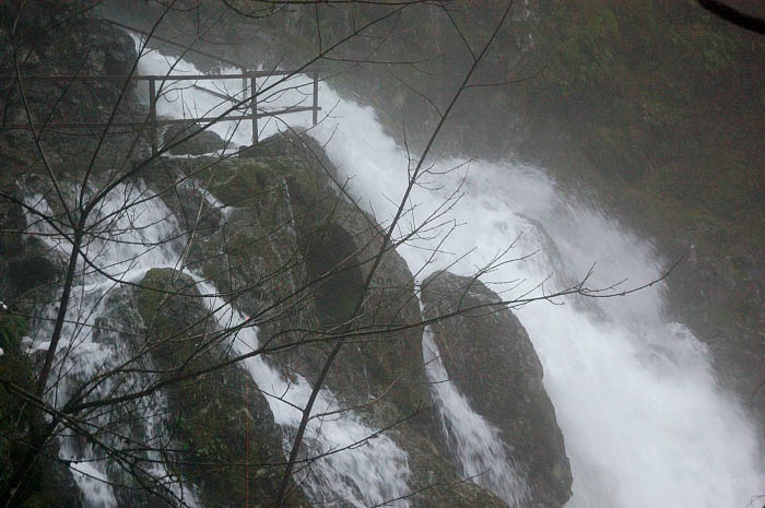
Rodney Falls from the bridge
B&W ice on vine maples along Hamilton trail (the rain was freezing on branches, but the road and trails were OK)
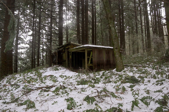
On the way back I went much closer to powerlines and found a small trail branching off uphill - the one I was thinking about. I soon lost it because of snow, but the brush was OK to navigate and it was generally easy going. About 1/2 mile up saw a structure I don't remember reading about on PH - some kind of wooden shelter with 2 rooms, shelf beds, and a stove. One room is missing a wall, another - two walls, the roof in big room looks like it's ready ready to cave in, but big room and the stove is so clean it seems someone still uses it . I would at least expect some fall foliage on the floor.
Does anyone know the story behind the shelter, and why it's built so far off-trail?
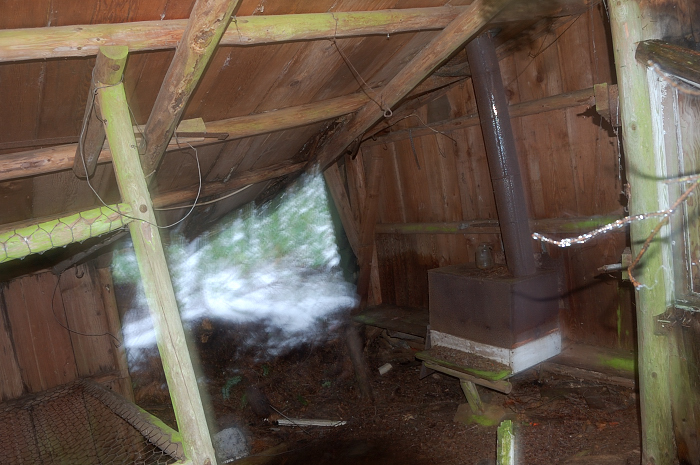
Big room with the stove
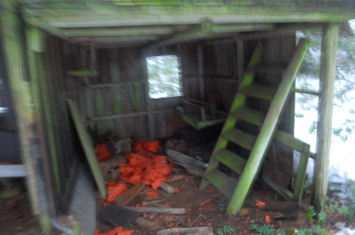
Little room was not so neat, but its roof is still good and only 1 wall is missing
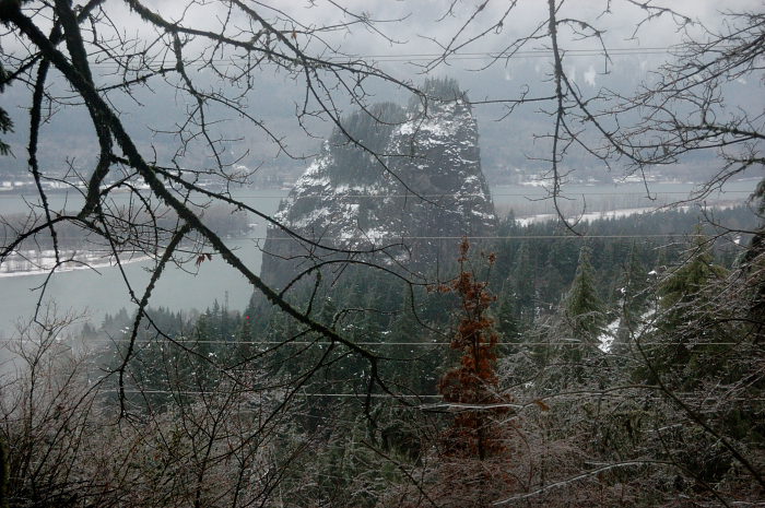
Beacon Rock view from near the shelter
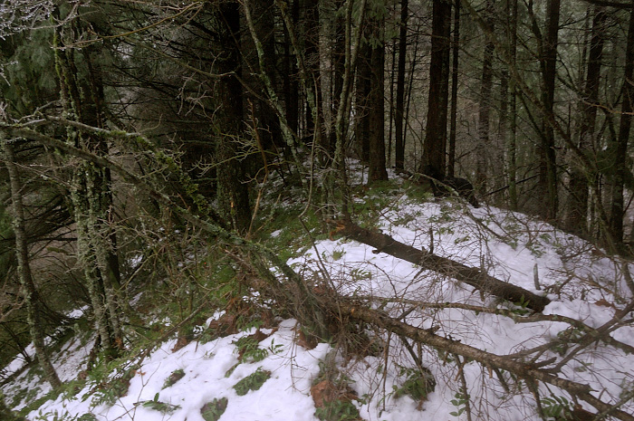
A faint trail re-appeared several times, but for the most part I went off-trail in the general direction "uphill" (forgot my compass). Followed this ridge for a short time
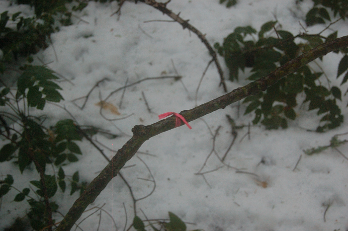
The only time I saw flagging, and trail vanished again right after this
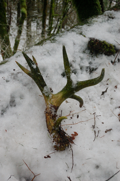
There was A LOT of deer tracks, so I had to expect this:
Right before I hit the road, vine maple thicket became almost impenetrable - it took me about 40 minutes for less than 1/4 mile! If not that last part, that shortcut I took on the way up is more interesting and easier to follow (even though it's longer) than where I went on the way down, but still takes considerably longer than the same distance on trail.
The quest for Hardy-Hamilton shortcut 1/20/12
-
- Posts: 267
- Joined: October 5th, 2010, 10:43 pm
- retired jerry
- Posts: 14417
- Joined: May 28th, 2008, 10:03 pm
Re: The quest for Hardy-Hamilton shortcut 1/20/12
When you said you had a "free" afternoon, did you mean you found a way to avoid the $10 fee?
Re: The quest for Hardy-Hamilton shortcut 1/20/12
Thanks Sas.sasquatch22 wrote:The B&W shot really makes the ice on the vine maple branches stand out.
On this trip the ice really was an advantage - I didn't take rain pants but despite all the brushing mostly stayed dry.
No, I have a Discover Pass (Hamilton Mtn is my family favorite hike). But as an afterthought, Topo map shows a patch of GPNF land on Kueffler Road just above the turn to equestrian trailhead - maybe one can park there for free?retired jerry wrote:When you said you had a "free" afternoon, did you mean you found a way to avoid the $10 fee?
Re: The quest for Hardy-Hamilton shortcut 1/20/12
I did the left half of your XC route last November but in the downhill direction (Hardy XC). Beag posted that I'd just missed an old cabin - which seems to be the one you found. Cool! He said it had water and electricity at one time.
Re: The quest for Hardy-Hamilton shortcut 1/20/12
Van - yes, I remember your report, and was looking for a shortcut path where it's shown on your GPS track. Found its lower end and some hint of it in the middle, but between the snow and ice-covered (and fallen) brush the trail has mostly disappeared. Was the upper end of the path obvious?
The cabin was at about 1/3 way up off-trail section, where the terrain temporarily levels off (and just above of a fair Beacon Rock viewpoint).
Since I go there often, I may take a handsaw when the snow melts off and do a little "trail maintenance"...
The cabin was at about 1/3 way up off-trail section, where the terrain temporarily levels off (and just above of a fair Beacon Rock viewpoint).
Since I go there often, I may take a handsaw when the snow melts off and do a little "trail maintenance"...
Last edited by romann on January 21st, 2012, 9:45 pm, edited 1 time in total.
Re: The quest for Hardy-Hamilton shortcut 1/20/12
I have explored all that area. There is a very good route from the 4 way junction a mile from the EQ trailhead. 8 or 10 years ago I followed the flagged route with Dick Thomas and a Ranger. Dick wanted to put a trail in there from the corner down to the Hamilton Trail but the area where a cabin is, is private property. I dont know who owns it and I never saw another person in there. I'm not sure we are talking about the same cabin. Did you see an outhouse over a canyon about 50 yards to the left of the cabin. There was an old bed in the cabin with a light socket hanging from the ceiling and a waterpipe from a spring up hill a little ways.
I used to hike from the Hamilton trailhead and a short distance past the junction to Little Beacon I would take an animal trail off the Hamilton trail. The animal trail is so good you can't miss it.It goes straight up for a bit and then you need to go SW where you will find the cabin on a flat area with a great view of Beacon Rock. from the Cabin I would head downhill W, where there is another animal trail heading a bit N. After following that route you will cross a bit of a Canyon and shortly after that there is a way out to an old road which may be the Powerline Road which joins up with the road up to the EQ trailhead. I done many a long hike using that short path. I would hike up to Hardy Ridge. At the N end of Flox Point there is a little Cairn. I would drop down there heading NW and find an old road which takes one over to the Source of Hardy Creek. From the Pylon I would drop down to Hamilton Creek and hike up to Berkinfeld or Table. I would return to the Pylon near Hardy Creek and pick up a Ridge going back to the saddle on top of Hamilton. Also I used to take the old Russ Jolley trail from Phlox Point west to Duncan Creek or to ST Cloud Park on SR14.
Re: The quest for Hardy-Hamilton shortcut 1/20/12
I don't remember an outhouse, but saw a light socket and a bit of white wire near the ceiling.beag wrote:I'm not sure we are talking about the same cabin. Did you see an outhouse over a canyon about 50 yards to the left of the cabin. There was an old bed in the cabin with a light socket hanging from the ceiling and a waterpipe from a spring up hill a little ways.
Just looked at topo once again and it shows a "gap" in state park there, so that cabin might be someone's property. However, the lower Hamilton trail crosses the same gap (in its wide portion) above the powerlines and it seems OK with whoever owns this parcel.
Re: The quest for Hardy-Hamilton shortcut 1/20/12
Romann If you saw a wire hanging from the ceiling it's probably the same cabin I saw.Looking at the picture I'm not sure if it is the same cabin. My memory is not good anymore. I need to take a trip back in there. I dont have a pass so I'll find someplace to park my car and ride my bike in there.
Re: The quest for Hardy-Hamilton shortcut 1/20/12
I started just S of the road junction but there was no obvious path. I thought I saw one from time to time but it was always sketchy at best. Probably best in the middle of my XC adventure. I realize now that I wandered too far to the E (left) and should have stayed up on the ridge to the W.romann wrote:Van - yes, I remember your report, and was looking for a shortcut path where it's shown on your GPS track. Found its lower end and some hint of it in the middle, but between the snow and ice-covered (and fallen) brush the trail has mostly disappeared. Was the upper end of the path obvious?