Revisiting Bridal Veil plateau and the Primrose Path

Discussions and Trip Reports for off-trail adventures and rediscovering lost trails
Post Reply
aircooled
Posts: 454
Joined: May 28th, 2008, 10:03 pm
Location: Portland, OR

Revisiting Bridal Veil plateau and the Primrose Path

Post by aircooled » June 29th, 2014, 12:38 pm

We paid a visit to the lost trails above Bridal Veil yesterday, starting at the gate where Palmer Mill and Brower Roads meet. I was amazed at how overgrown the trails have become. Super brushy on the east end of the plateau - we totally missed the junction where a trail takes off to see the famed "Bullet Car".

We crossed the plateau and headed for Devil's Rest via old logging roads that lead to 420C about a 1/4 mile east of Devil's Rest, then picked up 420C to get to the summit. We then headed down the Primrose Path to 415A. Another surprise - the Primrose is clearly getting some use. The tread is now a worn path, easy to follow all the way from the summit down to 415A. We saw a number of bootprints. Poles are helpful as the steep slope was muddy and slick in spots. We returned via the Upper Foxglove and finally by Palmer Mill Road. Palmer Mill is now badly overgrown and in spots is down to a path wide enough for only one hiker.

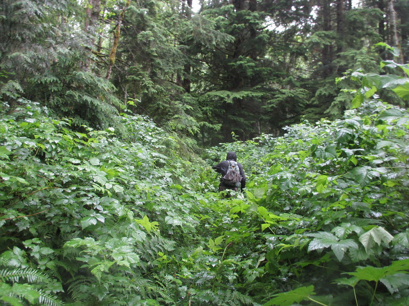
All in all, a very soggy day as pushing through wet brush is like taking a shower. My socks were squishing and even with gators my Vasques were collecting water. I weighed my boots back at the car and they'd added 1.6 pounds (without the socks). I like to say "no bad weather, just bad gear." These Gore-Tex Vasques have never been waterproof. They are worthless for wet days in Oregon. Bad gear.

Cindy on the trail near Pioneer Orchard on the Old Smith Road
Image

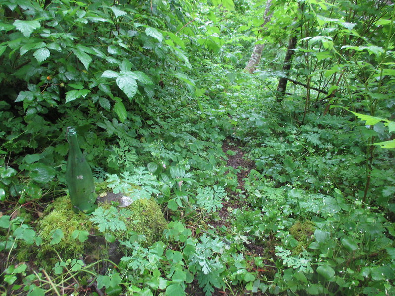
Wine bottle junction. I barely spotted the junction! I found the wine bottle on it's side in the brush.
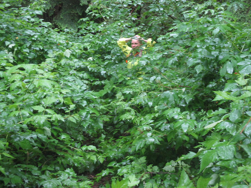
Image

Me enjoying the wet
Image

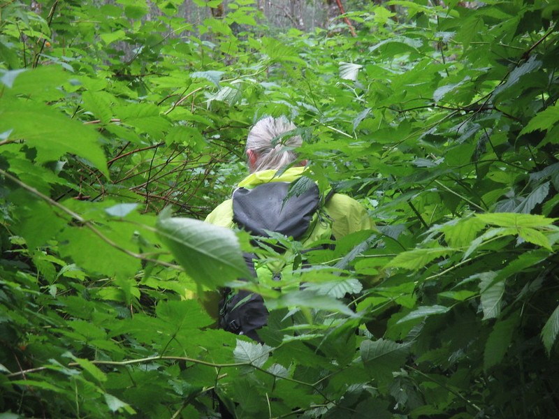
It just doesn't get any better than this! :)
Image

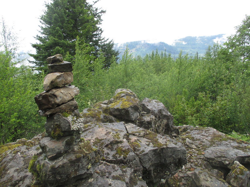
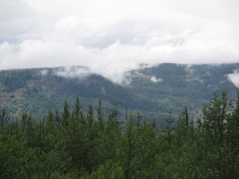
At least we had some views from the rocky outcropping halfway down the Primrose.

Image

Image

Then it was back into the brush. Even 415A was a little brushy in spots. And the Foxglove definitely needs some TLC.

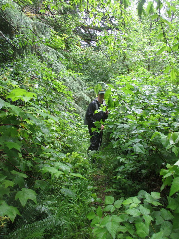
This is on the trail just south of where the Foxglove turns left to head up to Devil's Rest
Image

User avatar
Splintercat
Posts: 8334
Joined: May 28th, 2008, 10:03 pm
Location: Portland
Contact:

Re: Revisiting Bridal Veil plateau and the Primrose Path

Post by Splintercat » July 3rd, 2014, 9:03 am

Wow - that's pretty overwhelming, Jeff... :? How long since it was maintained? I've always understood these to be unofficial trails, not acknowledged by the USFS, but wasn't sure if they originated during the Mazama era of the late 70s/early 80s when the Chetwoot and Trapper Creek trails were built.

Tom

airoff
Posts: 422
Joined: March 15th, 2012, 8:35 am
Location: Portland, OR

Re: Revisiting Bridal Veil plateau and the Primrose Path

Post by airoff » July 4th, 2014, 5:11 pm

Not sure how wise an idea this is given the number of confused day hikers roaming the area, but this is new as of the past week.
Attachments
14045224595980.jpg

pablo
Posts: 1451
Joined: May 28th, 2008, 10:03 pm

Re: Revisiting Bridal Veil plateau and the Primrose Path

Post by pablo » July 4th, 2014, 7:20 pm

airoff wrote:Not sure how wise an idea this is given the number of confused day hikers roaming the area, but this is new as of the past week.
Wow, I'll have to go up and check this out, I assume this is at the Devils Rest end. Is the tread clear enough to justify a sign like this? Not been my experience. Probably not a good idea. BTW, if I see the sign I will not remove it...

Thx,

--Paul
The future's uncertain and the end is always near.

airoff
Posts: 422
Joined: March 15th, 2012, 8:35 am
Location: Portland, OR

Re: Revisiting Bridal Veil plateau and the Primrose Path

Post by airoff » July 4th, 2014, 8:09 pm

pablo wrote:
airoff wrote:Not sure how wise an idea this is given the number of confused day hikers roaming the area, but this is new as of the past week.
Wow, I'll have to go up and check this out, I assume this is at the Devils Rest end. Is the tread clear enough to justify a sign like this? Not been my experience. Probably not a good idea. BTW, if I see the sign I will not remove it...

Thx,

--Paul
No, that's actually on the Wahkeena end, if you can believe it. The photo is looking toward the Wahkeena trail which is about 10 below the sign; it's in plain view heading east. I didn't happen to check from the Devil's Rest side.

I went down it a few weeks back. The area above the lookout was super easy to follow. Less so below it. If you know where you're heading you'll be be fine, but I hike those trails a lot and encounter confused people each time I'm out.

User avatar
wsevert
Posts: 61
Joined: September 3rd, 2013, 7:03 am
Location: SE Portland

Re: Revisiting Bridal Veil plateau and the Primrose Path

Post by wsevert » July 12th, 2014, 6:33 pm

airoff wrote:
I went down it a few weeks back. The area above the lookout was super easy to follow. Less so below it. If you know where you're heading you'll be be fine, but I hike those trails a lot and encounter confused people each time I'm out.
Yep, I remember that :)

airoff
Posts: 422
Joined: March 15th, 2012, 8:35 am
Location: Portland, OR

Re: Revisiting Bridal Veil plateau and the Primrose Path

Post by airoff » July 13th, 2014, 1:11 pm

wsevert wrote:
airoff wrote:
I went down it a few weeks back. The area above the lookout was super easy to follow. Less so below it. If you know where you're heading you'll be be fine, but I hike those trails a lot and encounter confused people each time I'm out.
Yep, I remember that :)
Ha! :D

Quite the opposite in your case, severt!

Update: the sign at the Wahkeena end was removed, but there is a sign marking the path at the Devil's Rest end, in case anyone was interested.

aircooled
Posts: 454
Joined: May 28th, 2008, 10:03 pm
Location: Portland, OR

Re: Revisiting Bridal Veil plateau and the Primrose Path

Post by aircooled » July 21st, 2014, 3:07 pm

Splintercat wrote:Wow - that's pretty overwhelming, Jeff... :? How long since it was maintained? I've always understood these to be unofficial trails, not acknowledged by the USFS, but wasn't sure if they originated during the Mazama era of the late 70s/early 80s when the Chetwoot and Trapper Creek trails were built.

Tom
I don't know that it has ever been officially maintained. Maybe more of a use trail? The Primrose was mapped and described in a hiking book by Tom and Roberta Lowe in the early 80s and maintained for a while (as you know) by Basil Clark.

http://www.splintercat.org/BasilClark/B ... kStory.pdf

When I did a recon here in early spring, the lower half of the trail, from the old logging road to 415, was narrow but very visible and easy to follow. It was a hike, not a bushwhack until the last 15 feet just above 415A, when the tread disappeared.

Above the old logging road was a cross country trek through open forest on a wide ridge. There is now a well-worn and easy to follow use path there that switchbacks down the ridge. Lots of fresh boot track.

From Devil's Rest down heading slightly NW there was a well worn path that stopped rather abruptly at an opening with outstanding views of St. Helens. Another path had been flagged off to the right heading east and then down. Both paths stopped above an open stand of Devil's Club, really the only "obstacle" to hiking the Primrose. Amazing what a few boots on the ground have done. This section is easier to get through now, though IMO the trail here is too steep and prone to erosion (probably always was as this has always been a semi scramble according to veterans who know it). A steep and wooded area just above the Devil's Club clearing is a little confusing. I saw what looked like false starts here and there, or maybe not false, as I didn't follow them all but stuck to the route I knew.

I'm undecided on whether signs are an attractive nuisance or an aid to navigation, but we're probably safer without a marker on 415A. I bet a lot of hikers blow right by the use trail where the Primrose exits and assume it's a pee trail if they even notice it. Oh the other hand, I think the maze of Upper and Lower Foxglove Trails (also unofficial) is terribly confusing and begs for renaming and decent signage. I've run into lost hikers up in there more than once.

Post Reply