Portland Hikers ArchiveReturn to Portland Hikers Archive Eagle Creek to Wildcat Mtn loop Aug 5, 2007 Posted by pablo (2007-08-06)
|
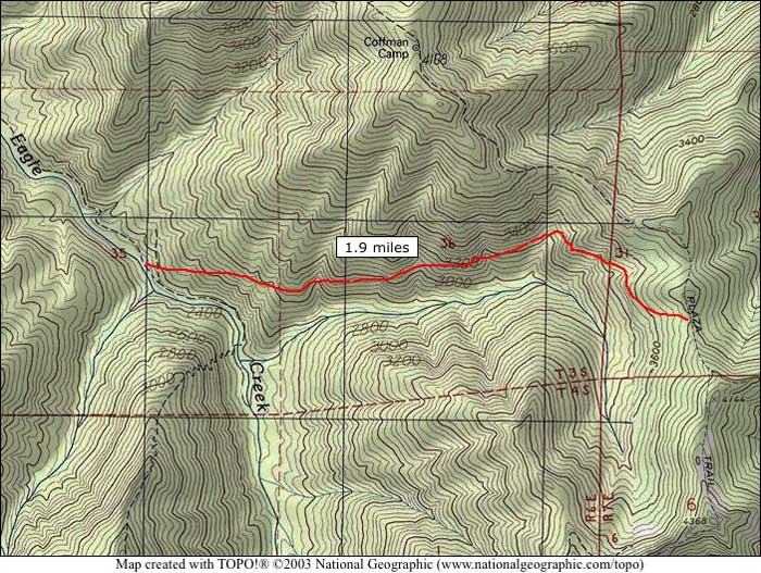
This weekend I continued my exploration of the Salmon-Huckleberry Wilderness with a large loop hike encompassing Eagle Creek (no, not that Eagle Creek), the Eagle Creek Cutoff, the Plaza Trail and then to the Douglas Trail and Wildcat Mtn. The distance was more than I usually do - came in at around 24-25 miles in TOPO!. The research I'd done on trail conditions for each piece indicated recent maintenance on all sections so I went light with a small pack and trail running shoes instead of the usual load of crap.
About a half mile down the Eagle Creek Trail I ran across a side trail branching off to the north heading towards Wildcat Mtn. I was unsure where this trail was going as it was in great shape. Turns out it is the lower part of the Douglas trail that comes down from the rock pit. In TOPO! the trail returns down a logging road but since the map in TOPO! was done (1983-85), the trail was relocated so it is entirely inside National Forest ground. Previously, the trail crossed private land to return to the trail head. Funny, the recommended trail head from USFS for Eagle creek is entirely on private ground, from what I can determine.
Eagle Creek is a wonderful place with lots of camp sites carpeted with oxalis, fir needles and moss. The forest in here is mature but not what I would call old-growth - it was a mention somewhere of old-growth in this area that lured me to this trail so I was a little disappointed not to see larger stems. I'd guess a fire rolled through the canyon 150-200 years ago and took out the big trees.
Still, this is a lush riparian environment and there are a few remnants that speak boldly of Eagle Creek's productivity. Wait another 400 years and they'll be back.

I proceeded up Eagle Creek to the signed junction with the Eagle Creek cutoff. The Eagle Creek trail continued east and upward and I was tempted to sleuth out the possible lost trail connecting Eagle Creek with the Plaza trail southeast of Coffman Camp that I saw on an old map at the Trail Advocates web site. Maybe someday when I'm younger.
The Eagle Cutoff starts with a short steep pitch with sharp switchbacks for about a 1/4 mile but mellows out into a modest ridge climb. The trail is in great shape with no blowdown to speak of. The only time I thought I lost the trail was under a dense canopy where trail and forest floor merged into a carpet of fir needles but frequently placed blaze on trees were sufficient to keep me on track so I never got off the trail. I came to the Old Baldy trail near a paved road and headed south toward Tumala Mountain (note the PC name change, I have no opinion and will go along to get along). By this time I was getting starved for a panoramic view - I planned to skip Tumala Mtn as it lies south 1/4 mile of the main trail but I had to see what was about. Good thing as views from anywhere were about to be swallowed up by the low hanging clouds that plagued the valley being sent up the ridgetops by a west wind.
Trail conditions for the Eagle Cutoff to Tumala Mtn are good but you can see where in the past motorcycles had torn up the trails leaving the tread with a deep V or U shape. Like hiking in a ditch. A lot of effort has gone into repairing the damage in this section with fillins and re-routes, thank you USFS and volunteers.
Tumala Mountain had a lookout at one time as can be seen. The first step said 'Welcome' so I just let myself in.

Got there just in time to see Mt Hood erupting.

The views were nice but any volcanoes to the south were obscured by clouds.
With one eye on my watch and another on the trail I departed Tumala Mtn and lit off in the direction of Twin Springs, traversing around the bowl containing Tumala Lakes and Meadows. Worthy of a visit, so many hikes and so little time.

On Sheepshead Rock were the best views of the day, Hood's eruption grew stronger.

I was treated to views of the trail and the seemingly insurmountable distance ahead of me. Wildcat Mtn is the far bump, center.

In the next photo, center, is what I believe to be the confluence of the South Fork of the Salmon River and Mack Hall Creek. And clearly seen in the photo is a large grove of what has to be monster old-growth. In TOPO! the map is from 1973 and it shows a trail headed up the South Fork of the Salmon likely all the way to Plaza Lake. The trail disappears on the topo map to the south dated 1983. The grove itself lies below the Salmon Butte trail and I suspect the trail that branches off from Salmon Butte to the main part of the grove is still there but the trail up from there to Plaza Lake may be gone. And this is the source of my next hike.

The trail beyond Sheepshead Rock to Coffman Camp is in excellent shape and someone has very recently, like in the last week, cleared the trail of the larger blowdown I saw on my hike to Salmon Mtn in July. I investigated the 'Water' sign at Coffman Camp and yes, there is water. Boil for 5 minutes or sanitize with whatever chemicals at your disposal.
From here on the winds blew the clouds out of the valley to the ridgetops ending any and all wide ranging views for the rest of the day.
I skipped bagging Wildcat Summit and the 'bench' because fog limited viewing to whatever was within 100 ft of me. Made it to the rockpit and here was the part I was most unsure about - the section of the Douglas Trail from the rockpit going west back to the Eagle Creek trail head. I didn't find it right off but I saw a sign sticking up on the southern edge of the rockpit and there it was. Caution! When doing this part of the Douglas Trail you might want to yell out 'CEASE FIRING' when leaving the rock pit just in case. You will pretty much be in the line of fire.
Trail head sign at south end of the rock pit. Referred to by rockpit denizens as a 'target'.

The Douglas Trail back to the Eagle Creek trail head is in great shape and I was surprised to see the signage is all new. There is a section that goes down a paved road that is blocked for motorized vehicles and beyond that a bit where ATVers have discovered access. For the most part this path has the character of trails I'd been on earlier in the day.
Creek crossing on lower part of Douglas Trail, this is real maintenance. That's a spillway cut into the log on the right.

A great loop for the distance folks. One minus, there are frequent and fresh horse apples all the way around the loop so water anywhere along these trails has to be suspect. On the other hand, horses on the trail might be a good thing as, apart from the Eagle Creek Cutoff, the trails are graded for horses which make them nice for hikers liking the less steep.
Track log:
 | Re: Eagle Creek to Wildcat Mtn loop Aug 5, 2007 Posted by Splintercat (2007-09-13)
| Great report, Pablo - I don't know how I missed this on the first time around! In answer to your question about a cutoff trail from Eagle Creek to the Plaza, the following is my best approximation of such a trail, as drawn by Howard Rondthaller at MHNF, some 25 years ago:
Just in case you're up there poking around again..!
Tom |
Return to Portland Hikers Archive
Disclaimer:
Information found on PortlandHikers.org and PortlandHikersFieldGuide.org is
provided by website visitors and volunteers and should be considered anecdotal. All trails
and directions and subject to current conditions. Trails and roads can be rerouted due to
natural events and the website is not able to provide current information for every hike.
Please verify against two other sources before planning a trip. Outdoor activities present
inherent risks. Portlandhikers.org, nor any of its members, accept liability for injuries
relating to information found on this website.
|
Powered by phpBB © 2008 phpBB Group
|
|
© 2008 PortlandHikers.org - No content shall be copied or downloaded without permission
|
|
 |
